Communication

Identifying Potential Landslides in Steep Mountainous Areas Based on Improved Seasonal Interferometry Stacking-InSAR

1
College of Earth Science, Chengdu University of Technology, Chengdu 610059, China
2
State Key Laboratory of Geohazard Prevention and Geoenvironment Protection, Chengdu University of Technology, Chengdu 610059, China
3
College of Geological Engineering and Geomatics, Chang’an University, Xi’an 710064, China
4
Kay Laboratory of Earth Exploration and Information Techniques (Chengdu University of Technology), Ministry of Education, Chengdu 610059, China
*
Author to whom correspondence should be addressed.
Remote Sens. 2023, 15(13), 3278; https://doi.org/10.3390/rs15133278
Submission received: 23 April 2023 / Revised: 20 June 2023 / Accepted: 23 June 2023 / Published: 26 June 2023
(This article belongs to the Special Issue Geological Applications of Remote Sensing and Photogrammetry)

Abstract

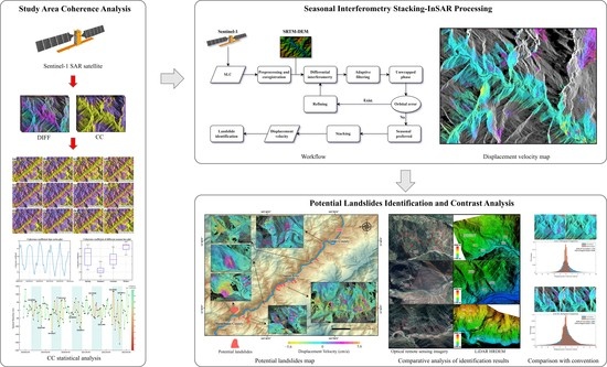
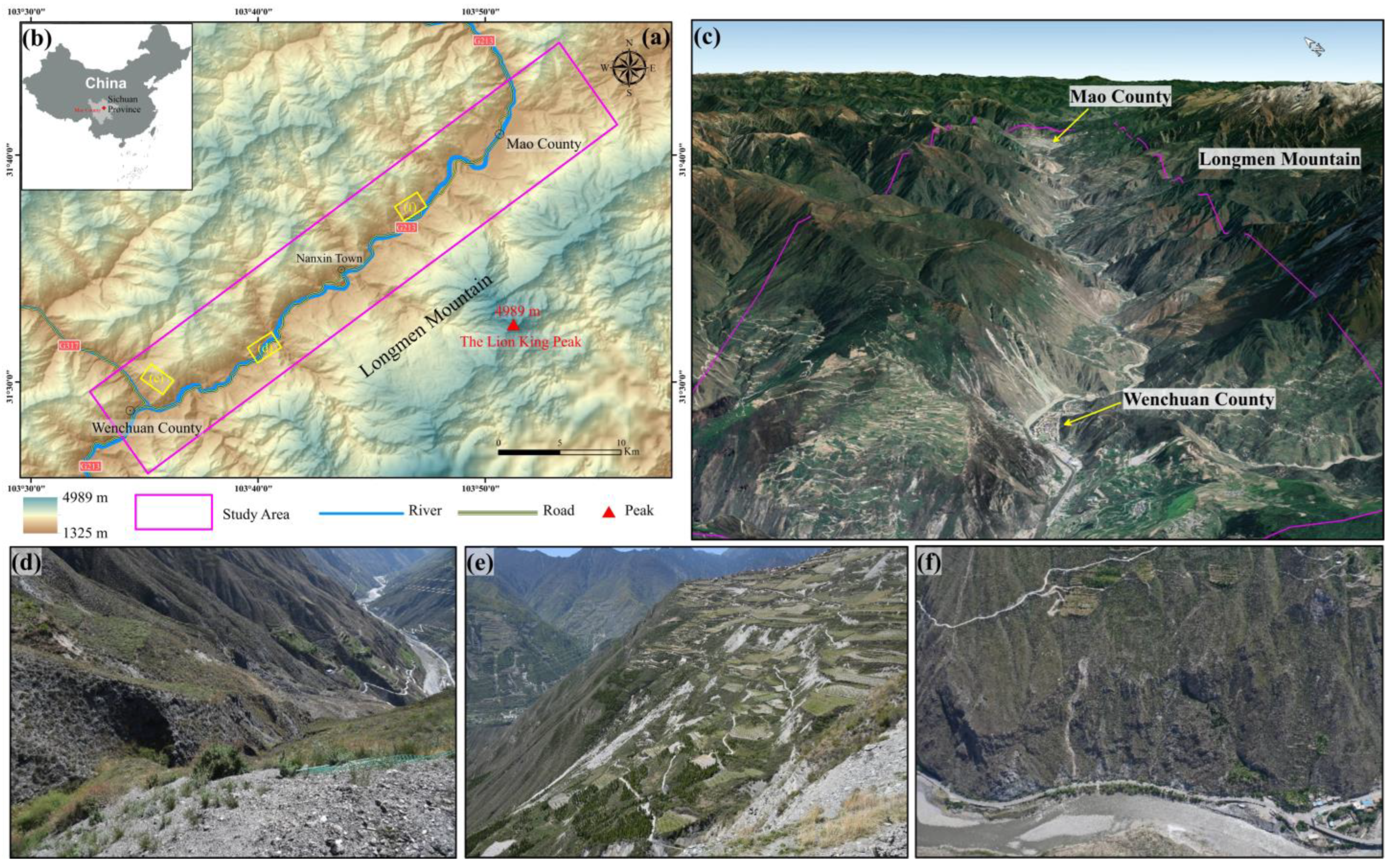
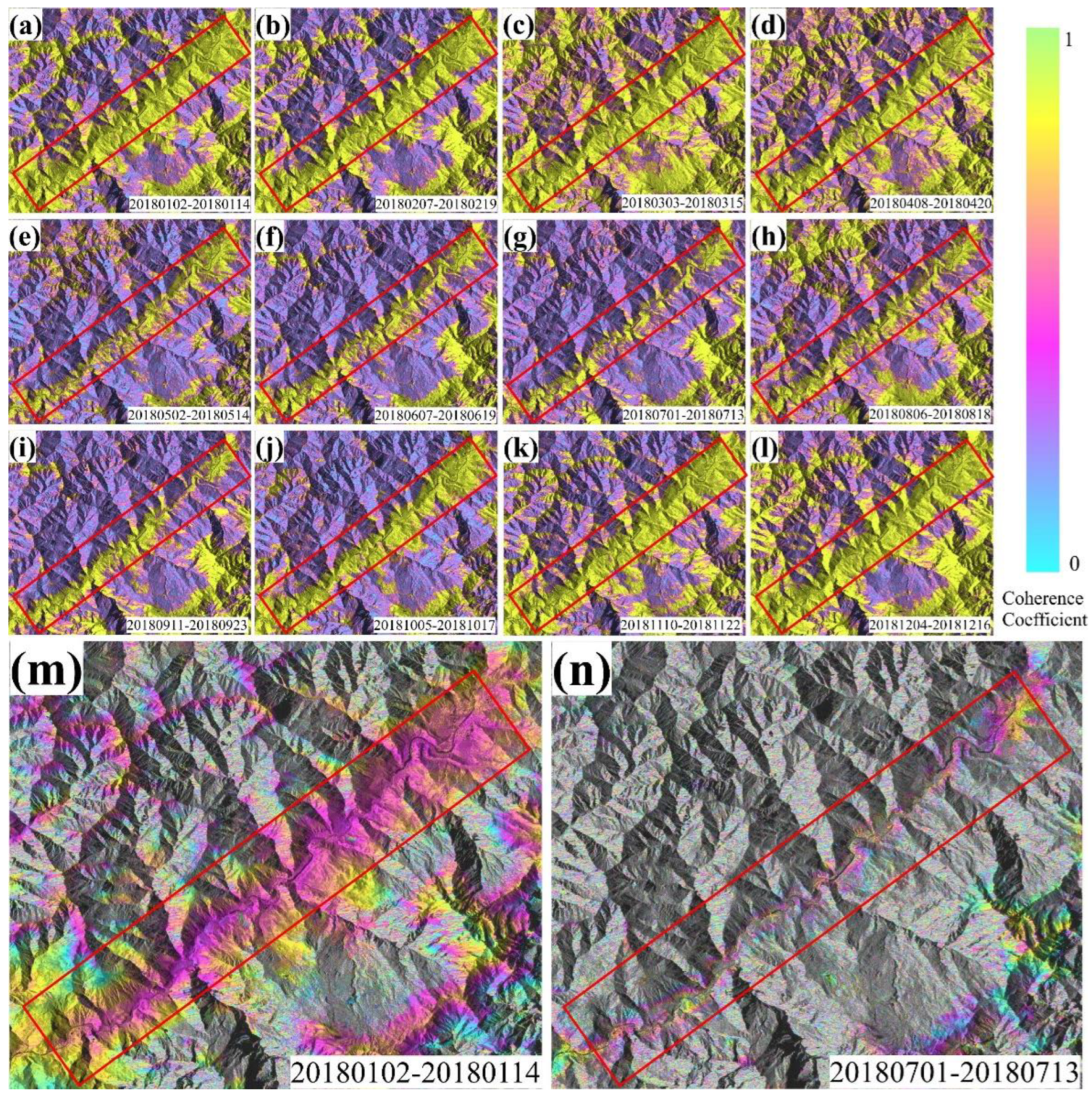
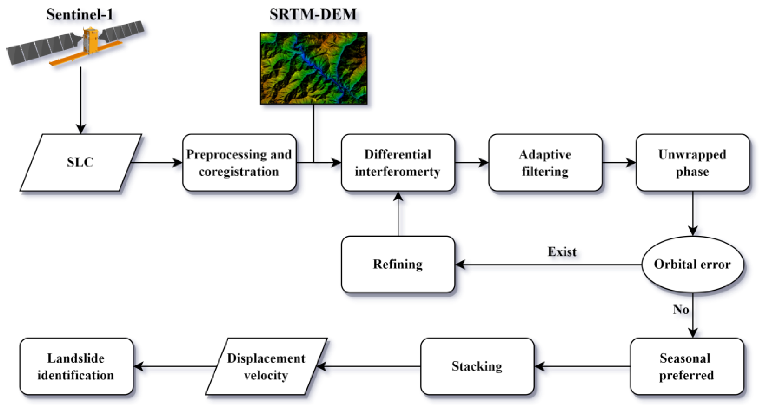
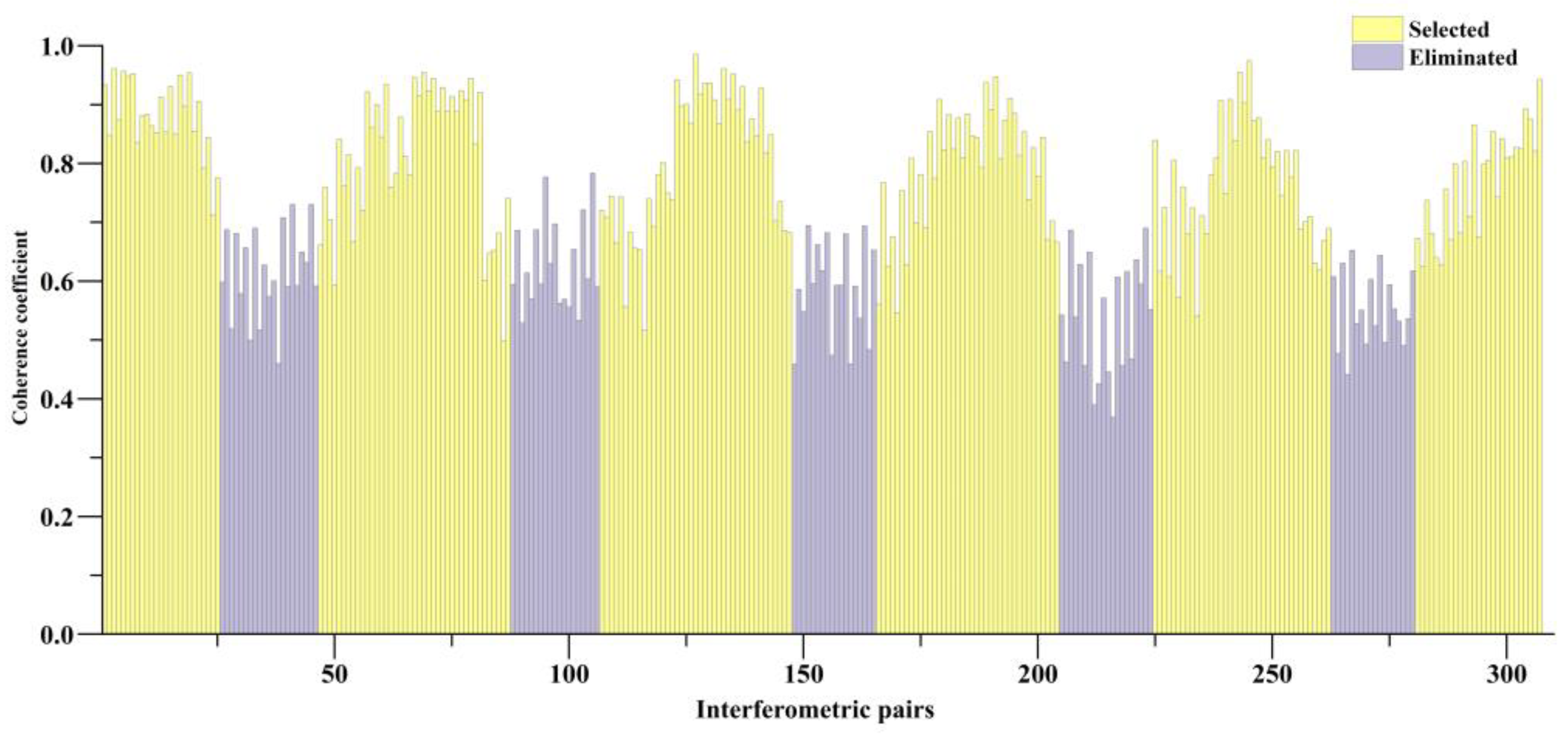
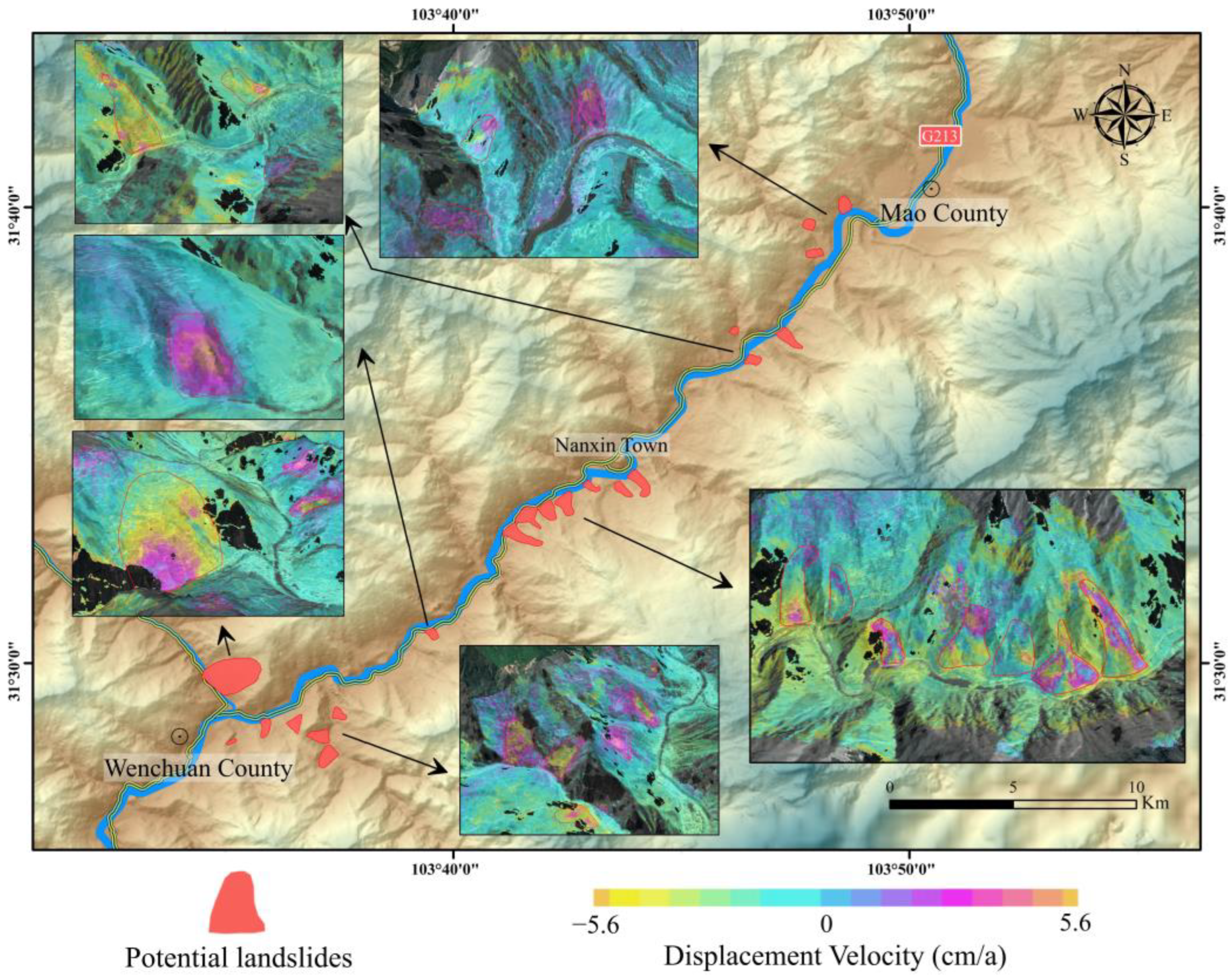
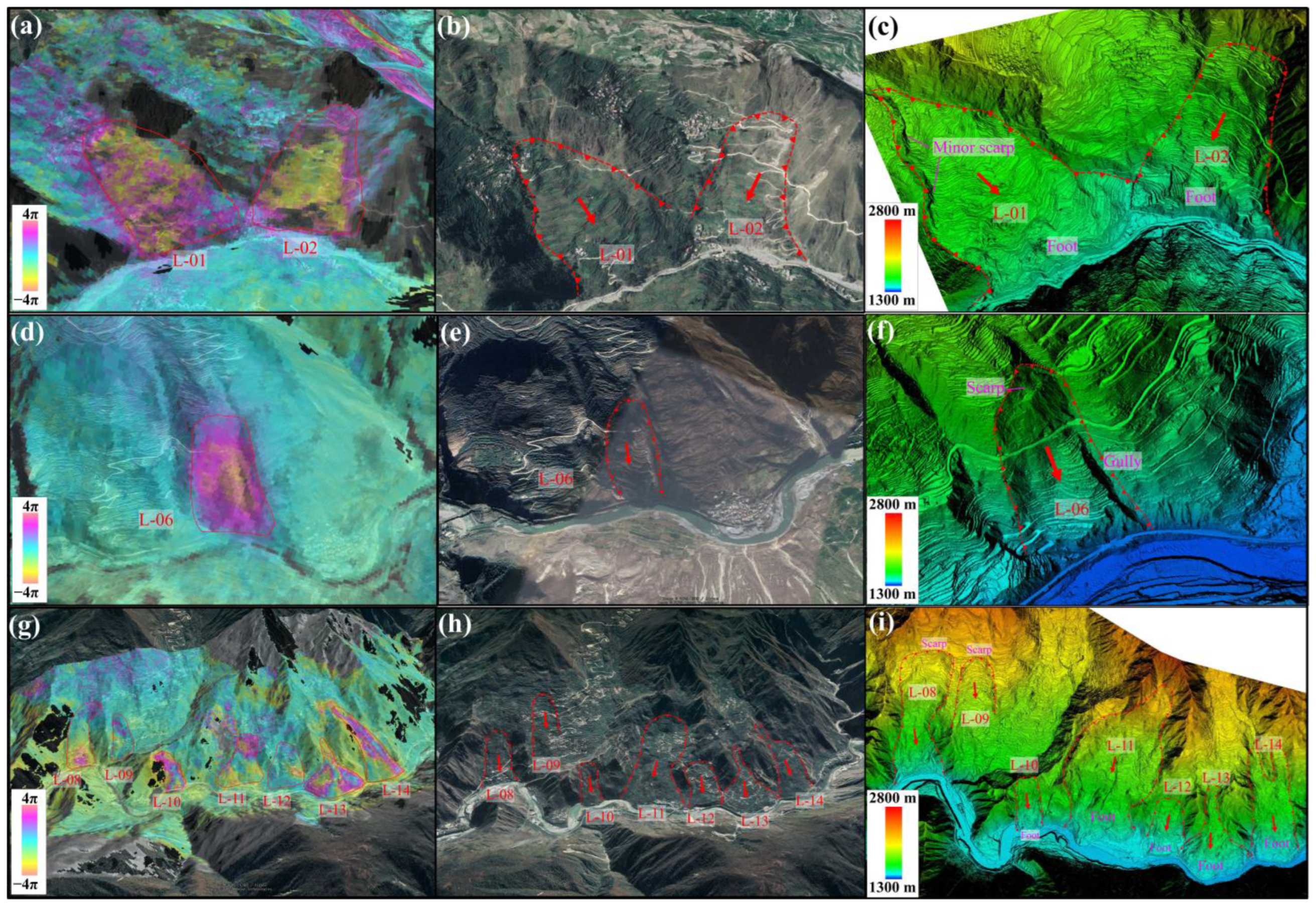
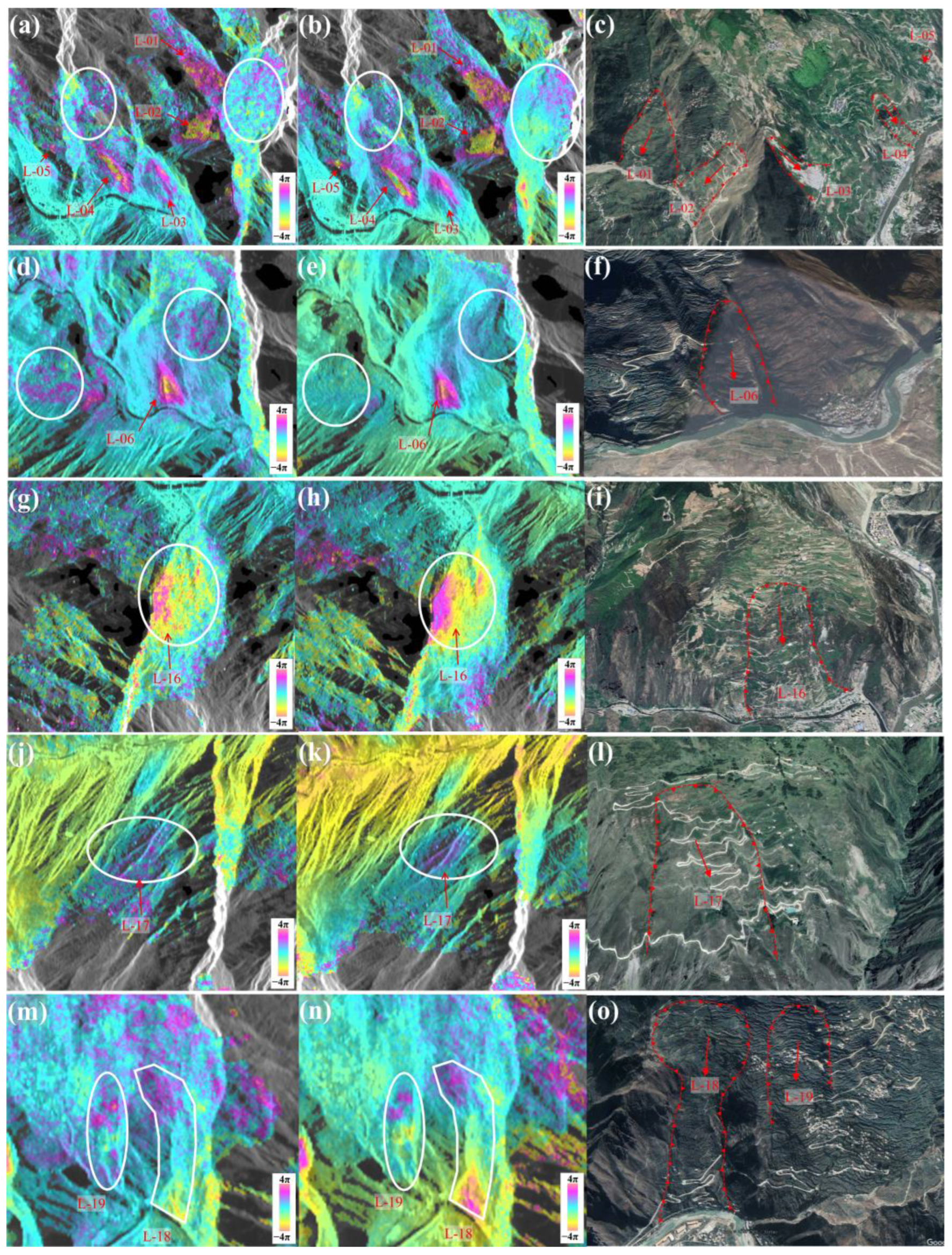
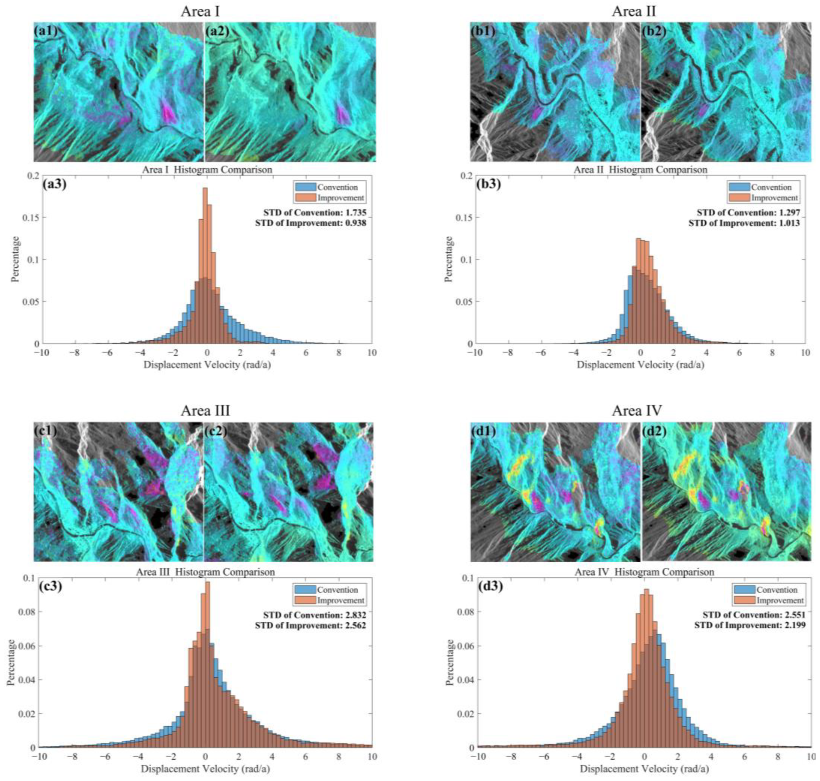
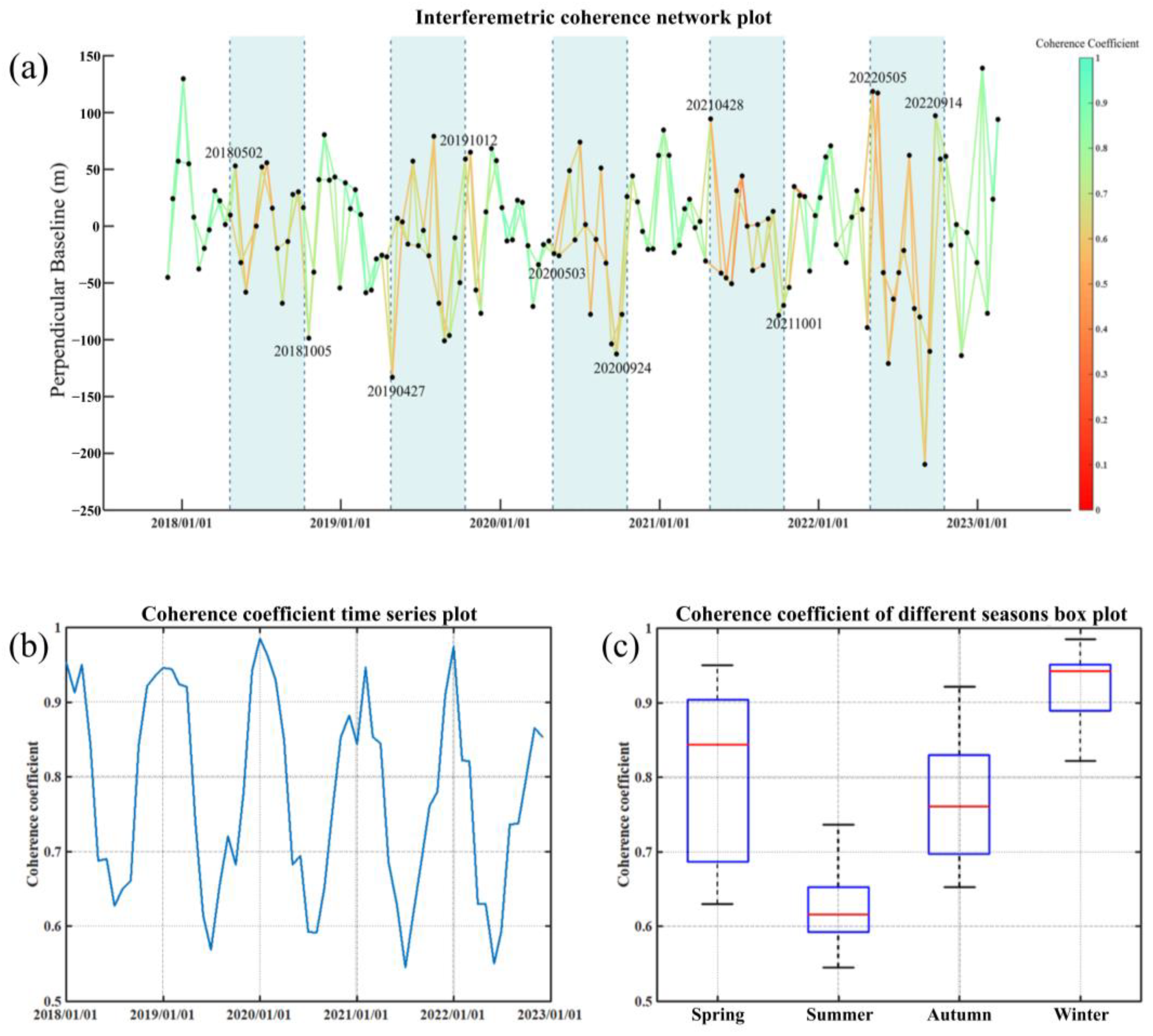
Landslides are a major concern in the mountainous regions of southwest China, leading to significant loss of life and property damage. Therefore, it is crucial to identify potential landslides for early warning and mitigation. stacking-InSAR, a technique used for landslide identification in a wide area, has been found to be faster than conventional time-series InSAR. However, the dense vegetation in southwest China mountains has an adverse impact on the coherence of stacking-InSAR, resulting in more noise and inaccuracies in landslide identification. To address this problem, this paper proposes an improved seasonal interferometry stacking-InSAR method. It uses Sentinel-1 satellite data from 2017 to 2022. The study area is the river valley section of the G213 road from Wenchuan County to Mao County. The study reveals the characteristics of seasonal decoherence in the steep mountainous region, and identifies a total of 21 potential landslides using the improved method. Additionally, optical satellite imagery and LiDAR data were used to assist in the identification of potential landslides. The results of the conventional stacking-InSAR method and the improved seasonal interferometry stacking-InSAR method are compared, showing that the latter is more effective in noise suppression caused by low coherence. Their standard deviations were reduced by 46%, 22%, 10%, and 14%, respectively, using the quantitative statistics for the four tested areas. The proposed method provides an efficient and effective approach for detecting potential landslides in the mountainous regions of southwest China. It can serve as a valuable technical reference for future landslide identification studies in this area.
Keywords: seasonal interferometry; stacking-InSAR; Sentinel-1; potential landslides; mountainous areas of southwest China seasonal interferometry; stacking-InSAR; Sentinel-1; potential landslides; mountainous areas of southwest China
Graphical Abstract