Article

Integrated Spatiotemporal Analysis of Vegetation Condition in a Complex Post-Mining Area: Lignite Mine Case Study

by
Jan Blachowski
1,*,
Aleksandra Dynowski
1,
Anna Buczyńska
1,
Steinar L. Ellefmo
2 and
Natalia Walerysiak
3
1
Faculty of Geoengineering, Mining and Geology, Department of Geodesy and Geoinformatics, Wroclaw University of Science and Technology, 50-421 Wrocław, Poland
2
Department of Geoscience and Petroleum, Norwegian University of Science and Technology, 7491 Trondheim, Norway
3
Faculty of Geoengineering, Mining and Geology, Wroclaw University of Science and Technology, 50-421 Wrocław, Poland
*
Author to whom correspondence should be addressed.
Remote Sens. 2023, 15(12), 3067; https://doi.org/10.3390/rs15123067
Submission received: 26 April 2023 / Revised: 9 June 2023 / Accepted: 10 June 2023 / Published: 12 June 2023

Abstract

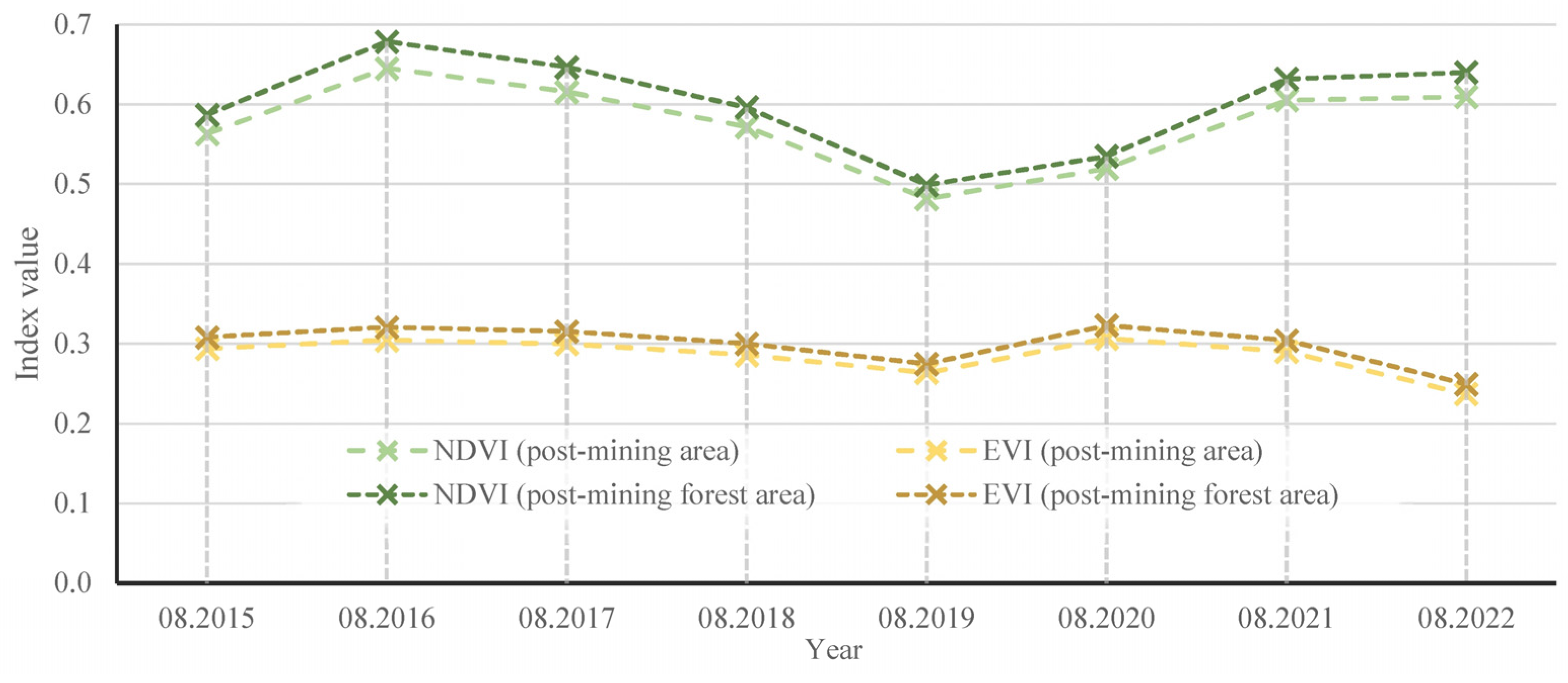
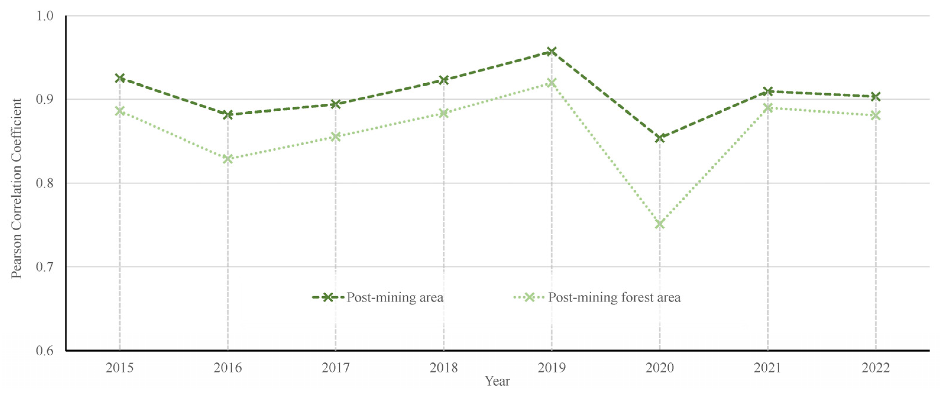
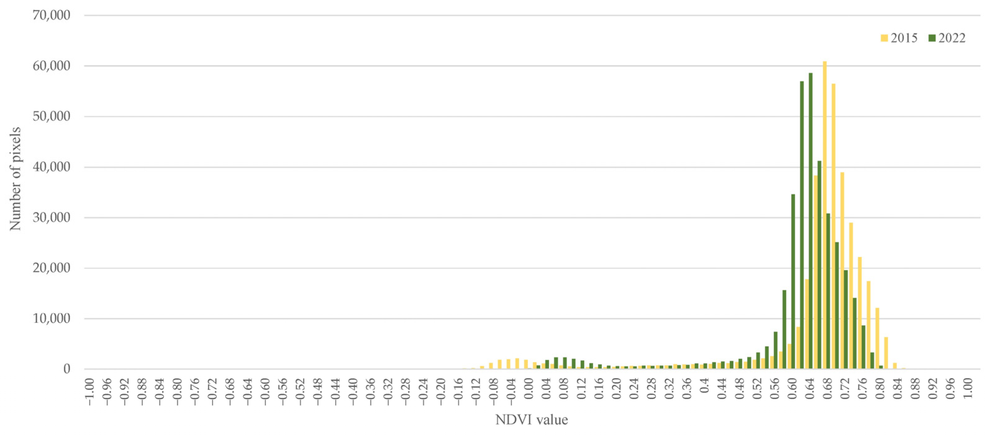
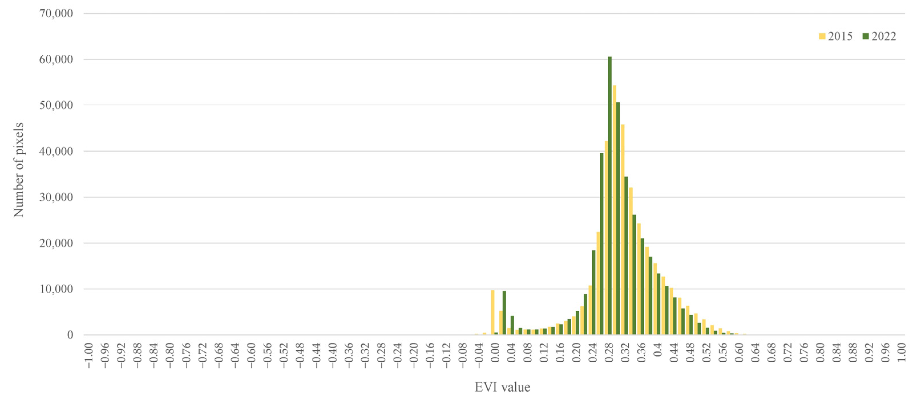
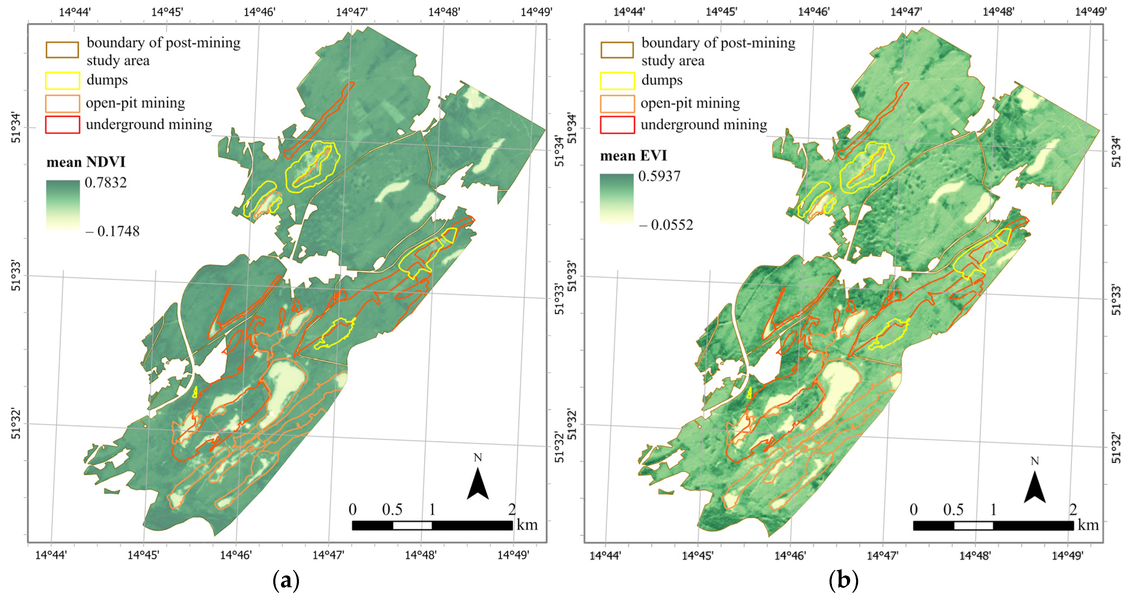
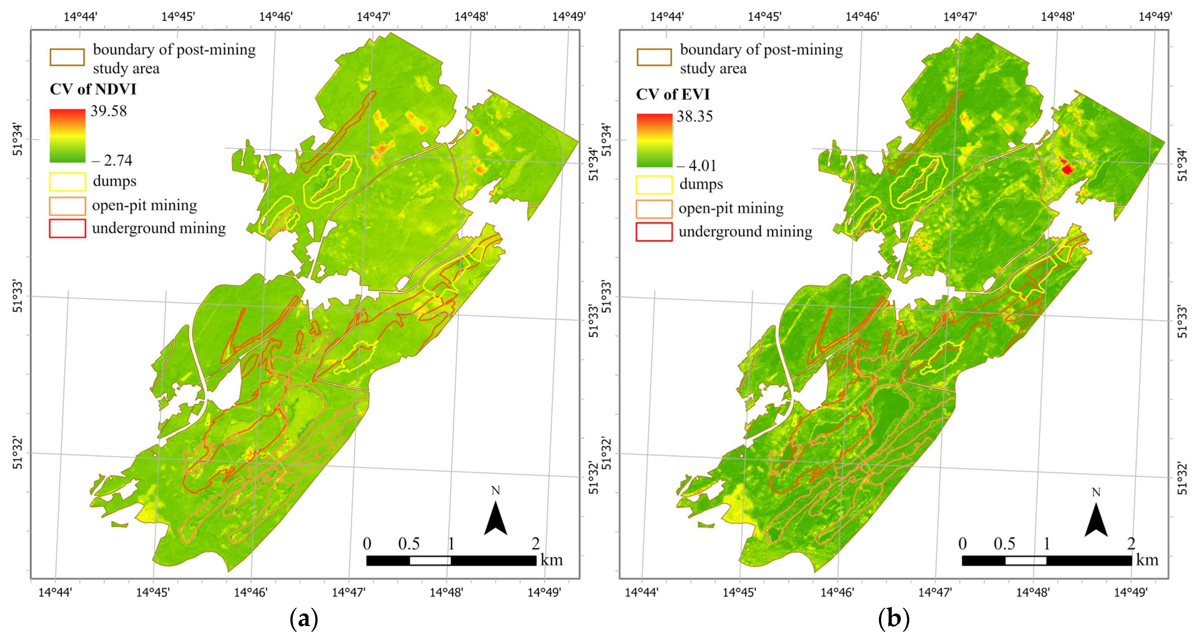
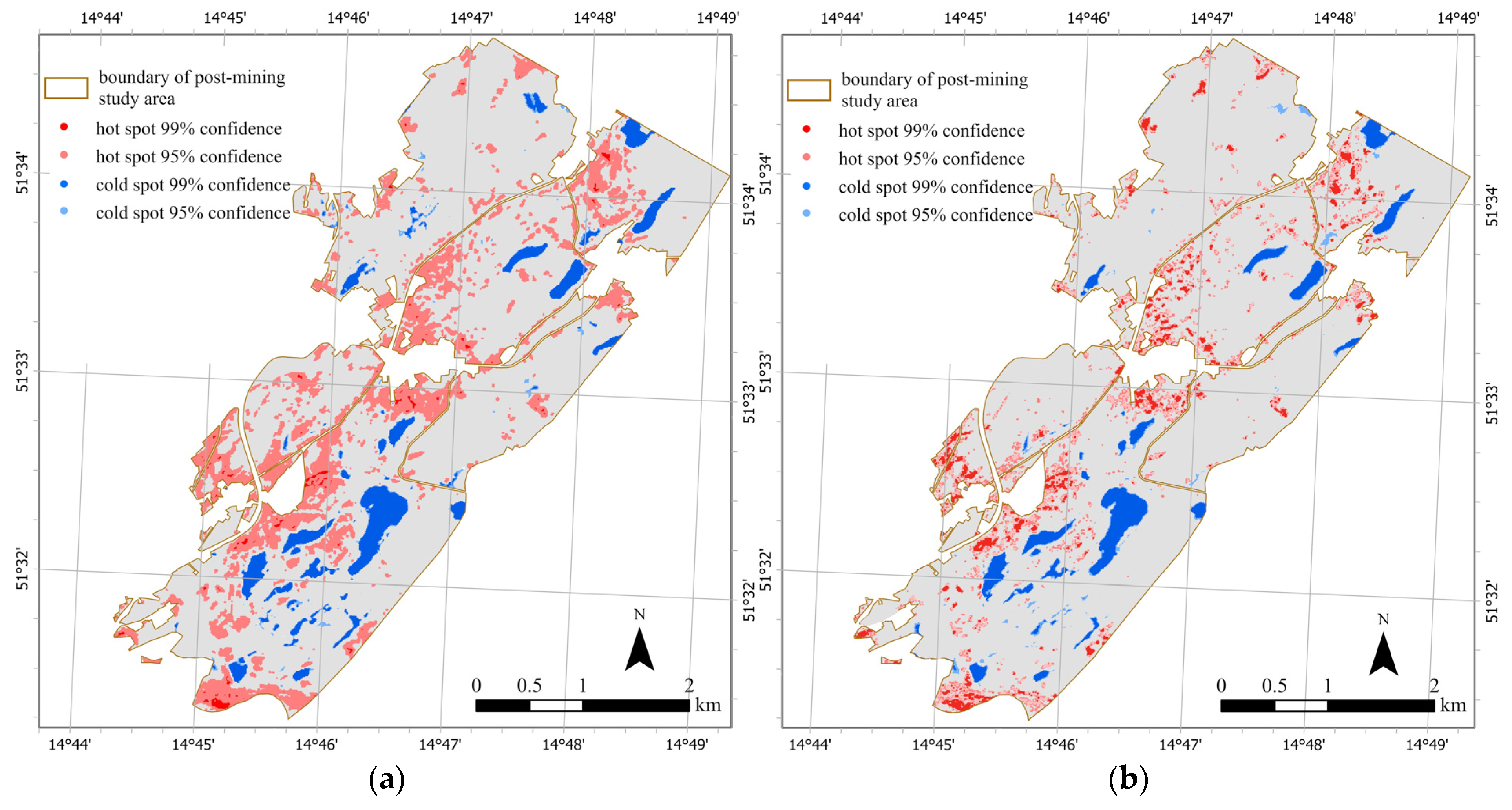
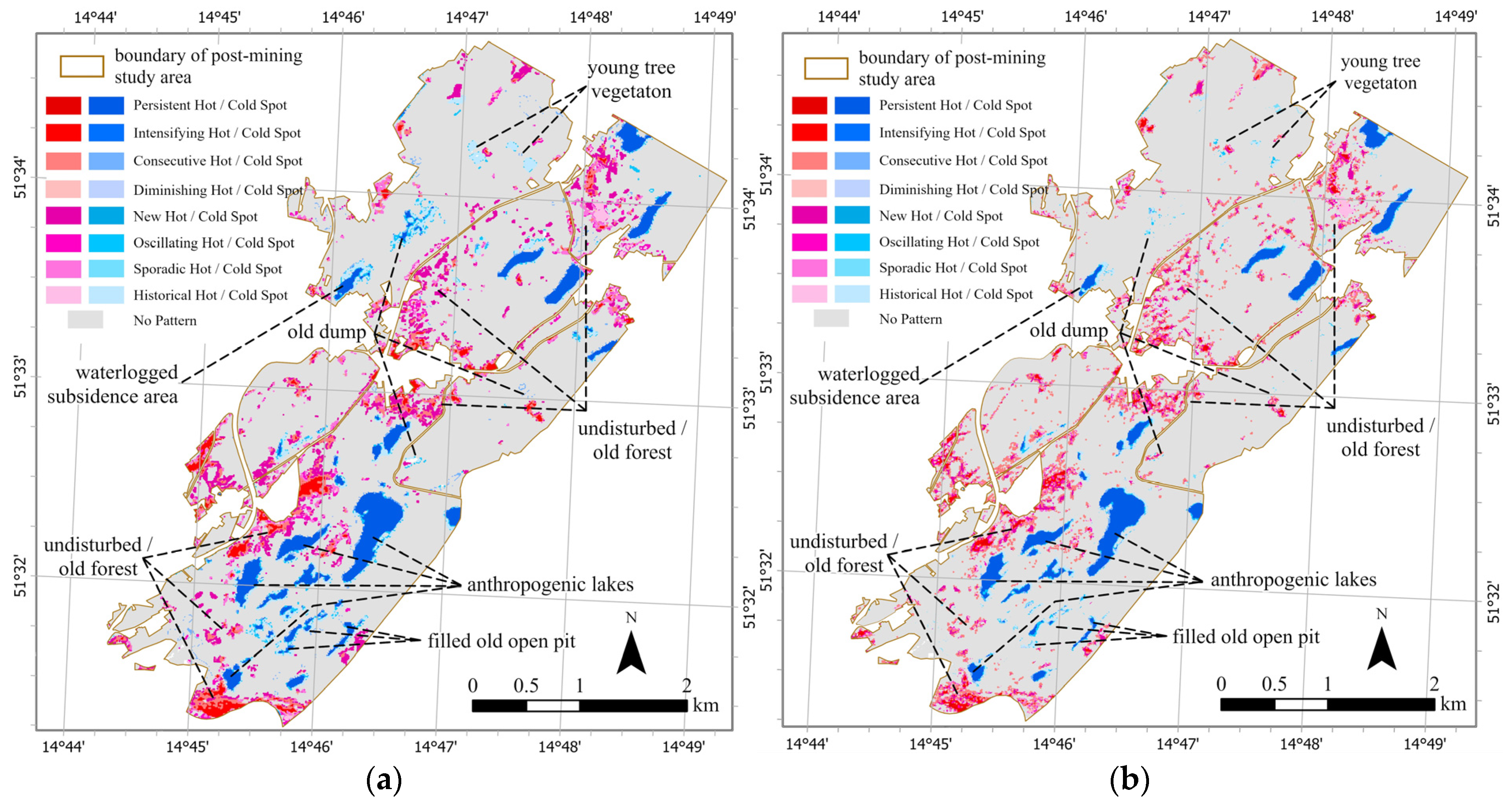
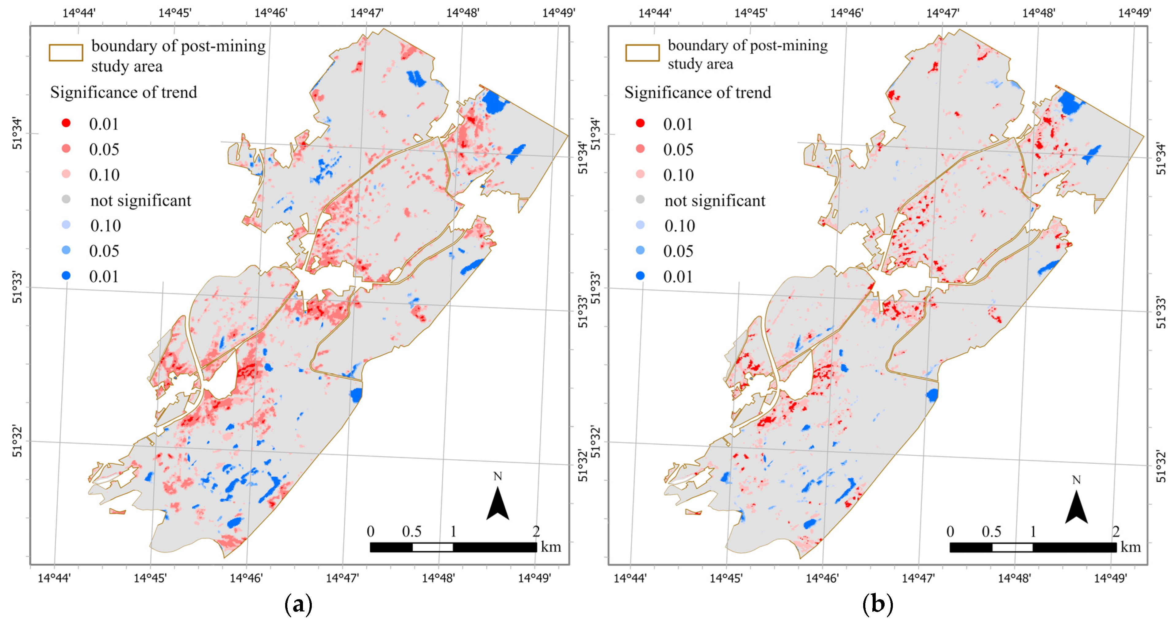
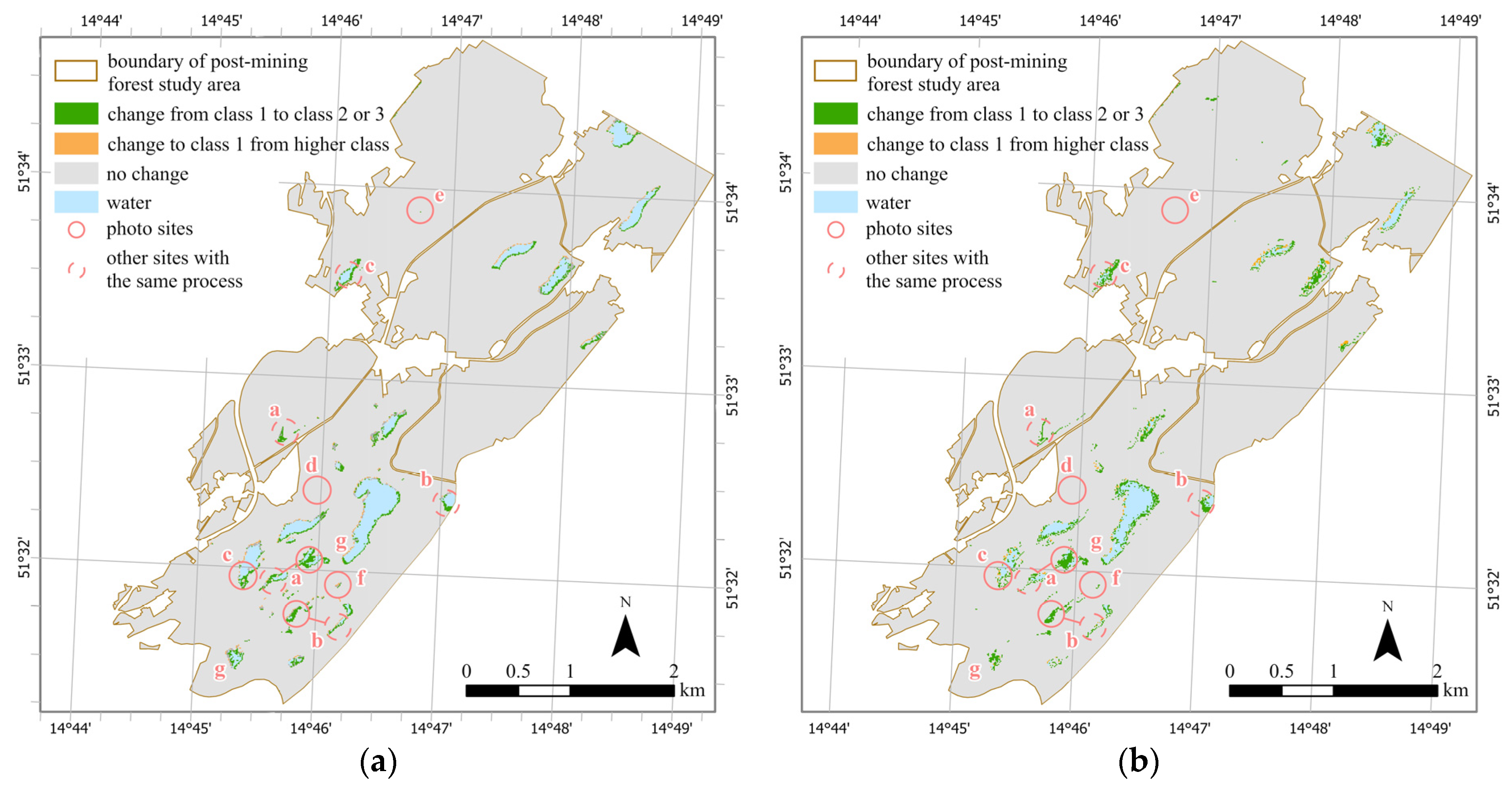
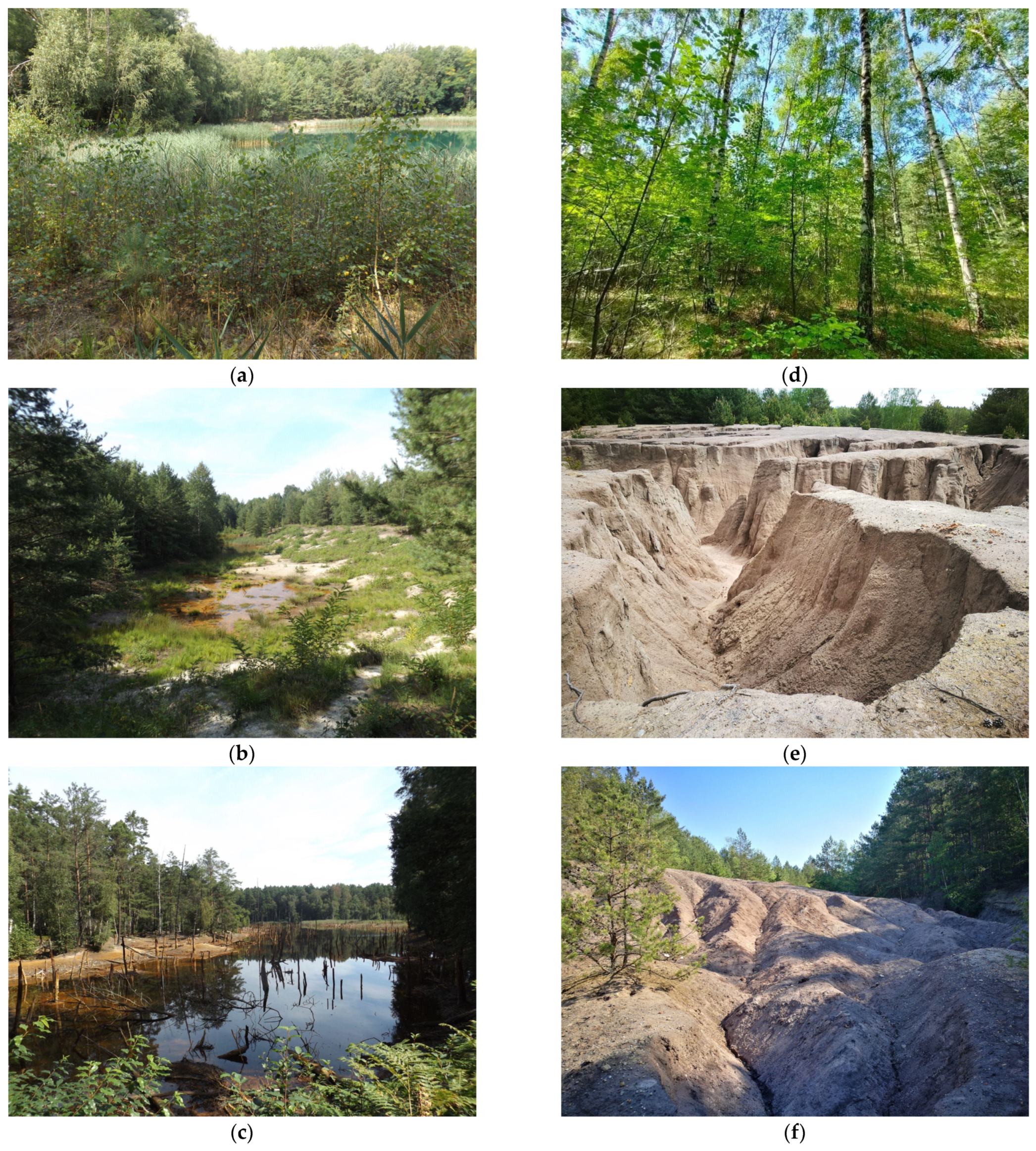
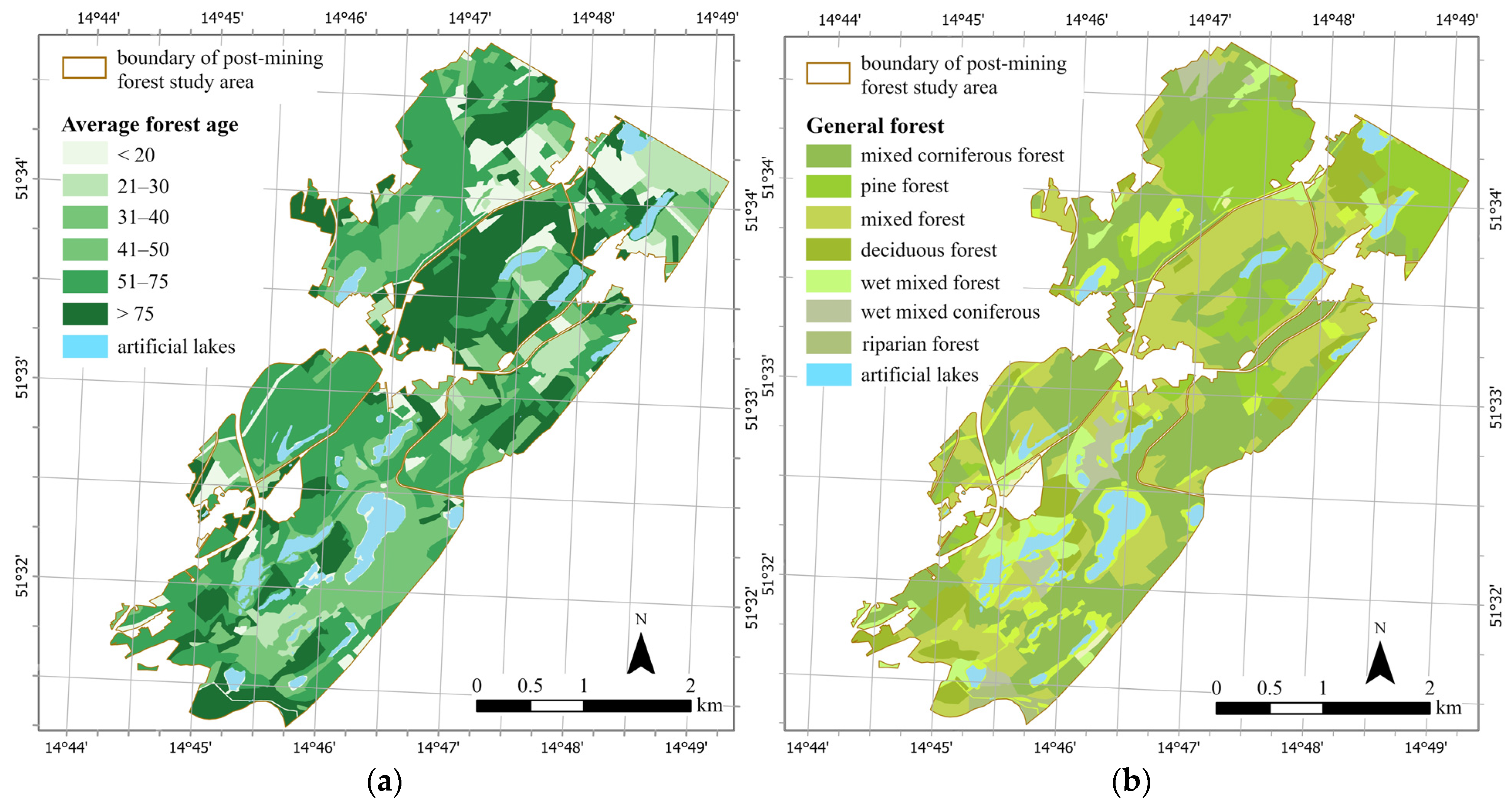
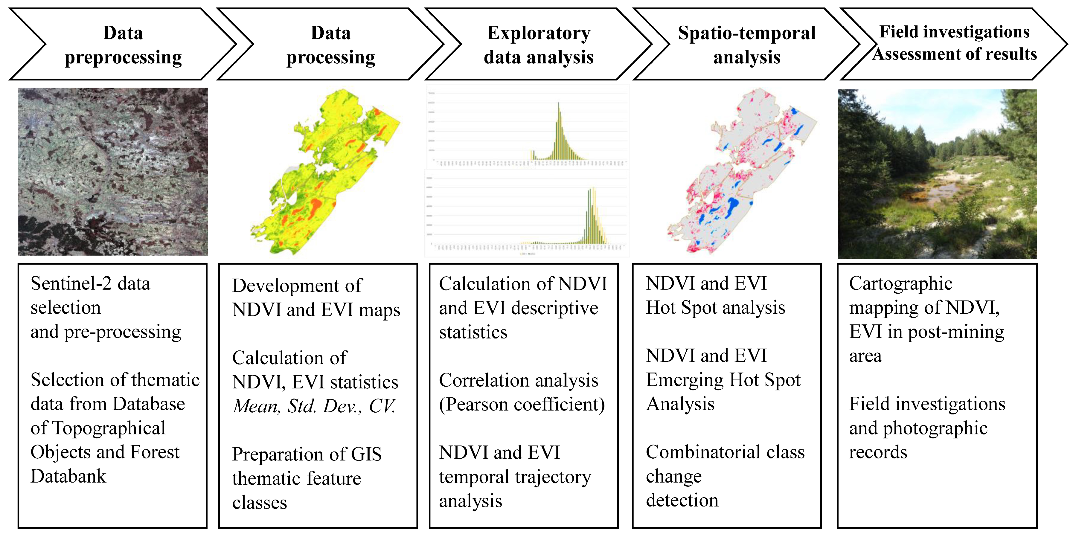
The motivation for this study arises from the need to monitor the condition of a rehabilitated post-mining areas even decades after the end of the recovery phase. This can be facilitated with satellite derived spectral vegetation indices and Geographic Information System (GIS) based spatiotemporal analysis. The study area described in this work is located in Western Poland and has unique characteristics, as it was subjected to the combined underground and open pit mining of lignite deposits that had been shaped by glaciotectonic processes. The mining ended in early 1970’ties and the area was subjected to reclamation procedures that ended in the 1980’ties. We used the Normalized Difference Vegetation Index (NDVI) and the Enhanced Vegetation Index (EVI) spectral indices derived from Sentinel-2 data for the 2015–2022. period. Then, we applied a combination of GIS-based map algebra statistics (local, zonal and combinatorial) and GI* spatial statistics (hot spot and temporal hot spot) for a complex analysis and assessment of the vegetation cover condition in a post-mining area thought to be in the rehabilitated phase. The mean values of NDVI and EVI for the post-mining study area range from 0.48 to 0.64 and 0.24 to 0.31 and are stable in the analyzed 8 year period. This indicates general good condition of the vegetation and post-recovery phase of the area of interest. However, the combination of spatiotemporal analysis allowed us to identify statistically significant clusters of higher and lower values of the vegetation indices and change of vegetation cover classes on 3% of the study area. These clusters signify the occurrence of local processes such as, the encroachment of aquatic vegetation in waterlogged subsidence basins, and growth of low vegetation in old pits filled with waste material, barren earth zones on external waste dumps, as well as present-day forest management activities. We have confirmed that significant vegetation changes related to former mining occur even five decades later. Furthermore, we identified clusters of the highest values that are associated with zones of older, healthy forest and deciduous tree species. The results confirmed applicability of Sentinel-2 derived vegetation indices for studies of post-mining environment and for the detection of local phenomena related to natural landscaping processes still taking place in the study area. The methodology adopted for this study consisting of a combination of GIS-based data mining methods can be used in combination or separately in other areas of interest, as well as aid their sustainable management.
Keywords: underground mining; open pit mining; glaciotectonic; remote sensing; Sentinel-2; GIS; spatial statistics; combinatorial change detection underground mining; open pit mining; glaciotectonic; remote sensing; Sentinel-2; GIS; spatial statistics; combinatorial change detection