Article

Integration of Satellite-Based Optical and Synthetic Aperture Radar Imagery to Estimate Winter Cover Crop Performance in Cereal Grasses

1
USDA—Agricultural Research Service, Sustainable Agricultural Systems Laboratory, 10300 Baltimore Avenue, Beltsville, MD 20705, USA
2
U.S. Geological Survey, Lower Mississippi-Gulf Water Science Center, Beltsville, MD 20705, USA
3
Department of Geographical Sciences, University of Maryland, College Park, MD 20742, USA
4
Department of Crop and Soil Sciences, North Carolina State University, Raleigh, NC 27695, USA
*
Author to whom correspondence should be addressed.
Remote Sens. 2022, 14(9), 2077; https://doi.org/10.3390/rs14092077
Submission received: 28 February 2022 / Revised: 16 April 2022 / Accepted: 20 April 2022 / Published: 26 April 2022

Abstract

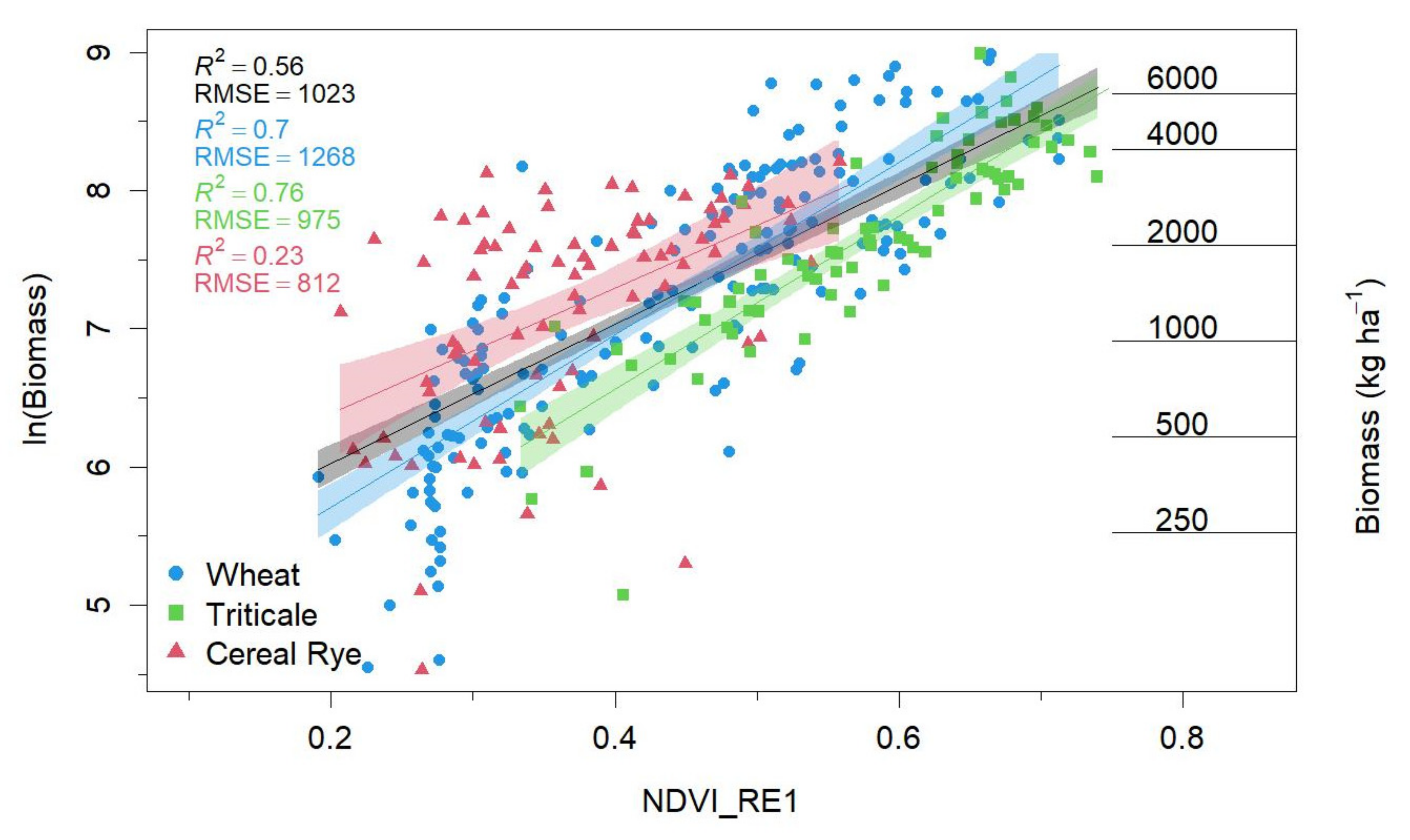
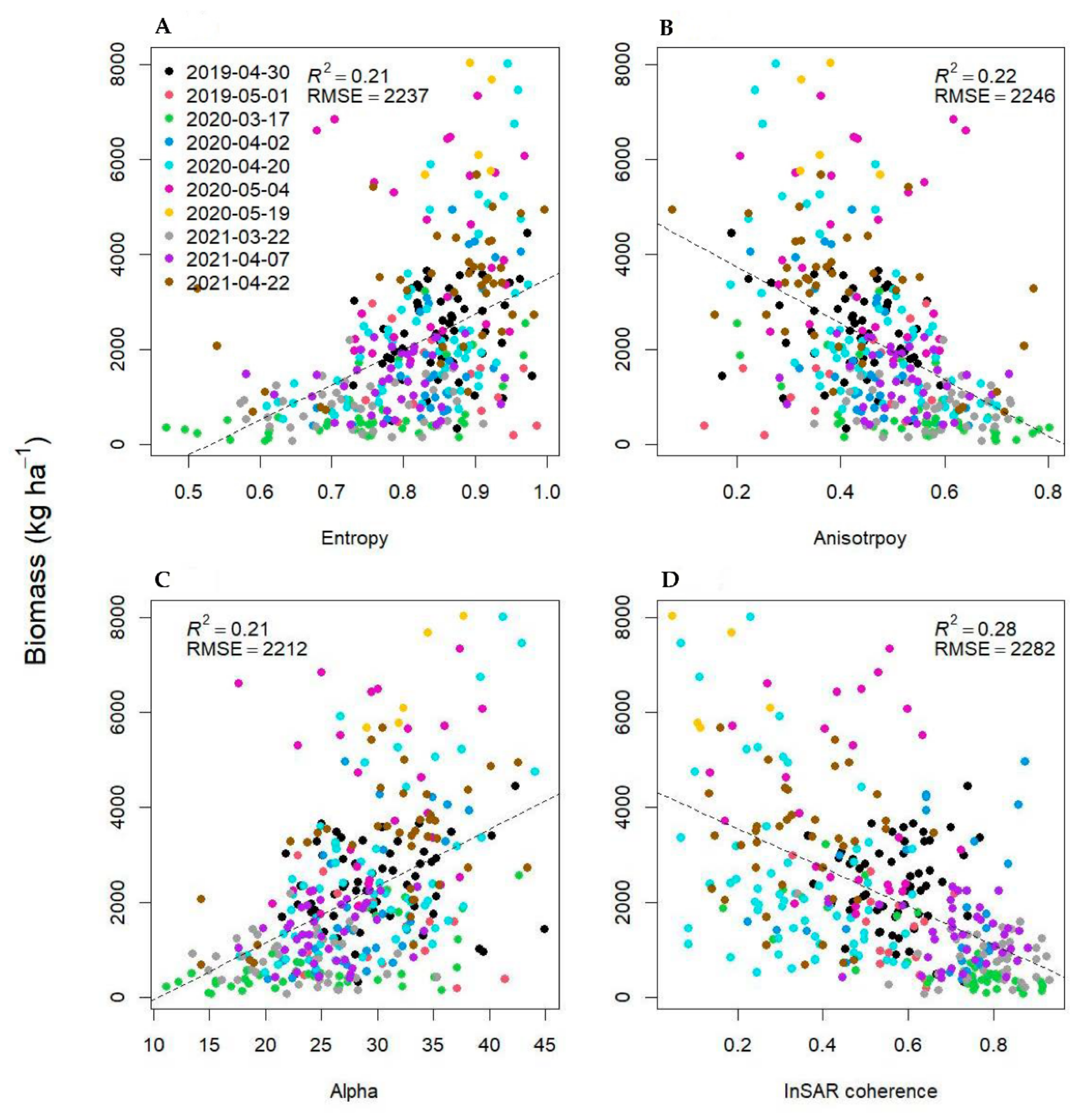
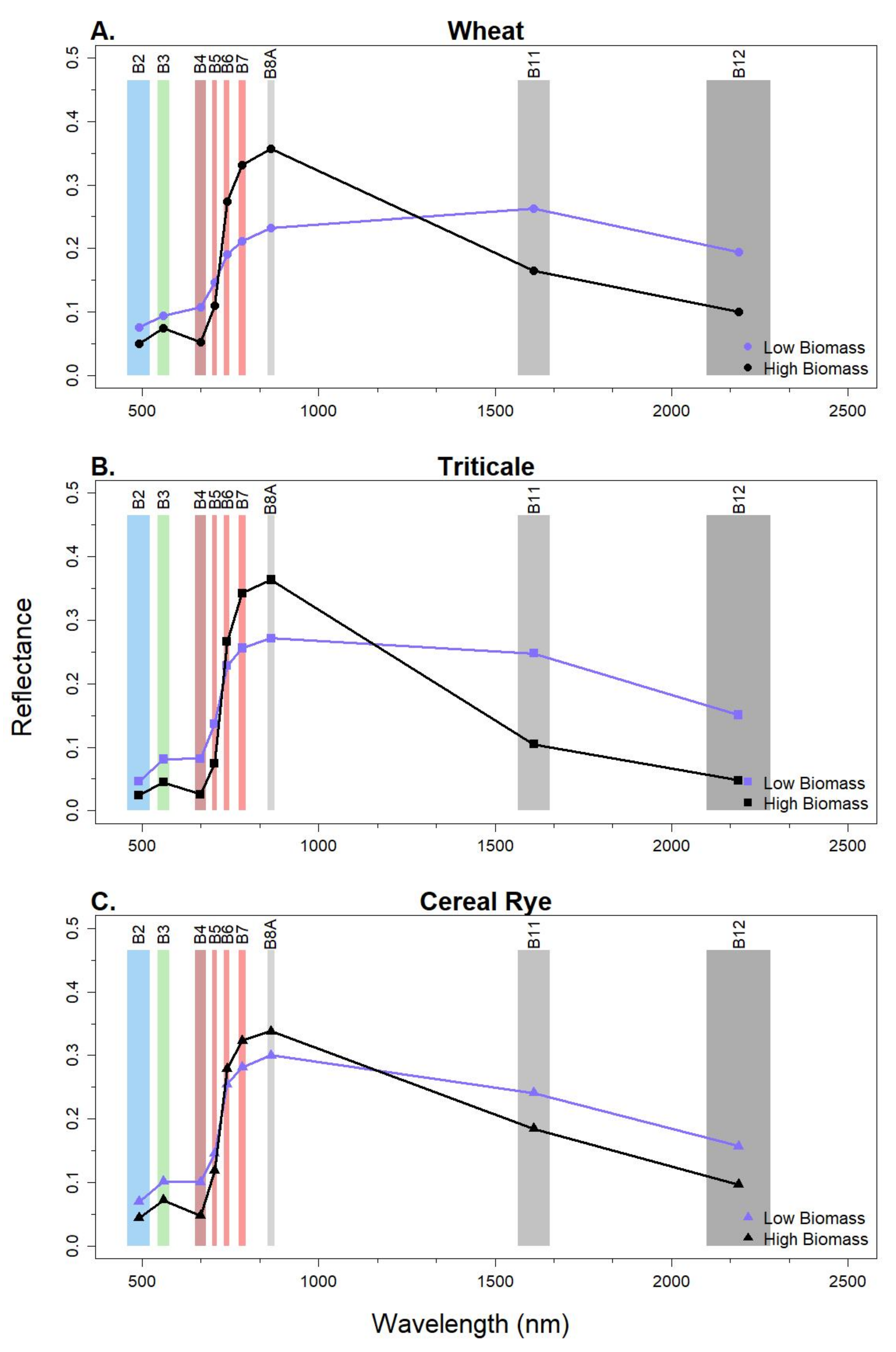
The magnitude of ecosystem services provided by winter cover crops is linked to their performance (i.e., biomass and associated nitrogen content, forage quality, and fractional ground cover), although few studies quantify these characteristics across the landscape. Remote sensing can produce landscape-level assessments of cover crop performance. However, commonly employed optical vegetation indices (VI) saturate, limiting their ability to measure high-biomass cover crops. Contemporary VIs that employ red-edge bands have been shown to be more robust to saturation issues. Additionally, synthetic aperture radar (SAR) data have been effective at estimating crop biophysical characteristics, although this has not been demonstrated on winter cover crops. We assessed the integration of optical (Sentinel-2) and SAR (Sentinel-1) imagery to estimate winter cover crops biomass across 27 fields over three winter–spring seasons (2018–2021) in Maryland. We used log-linear models to predict cover crop biomass as a function of 27 VIs and eight SAR metrics. Our results suggest that the integration of the normalized difference red-edge vegetation index (NDVI_RE1; employing Sentinel-2 bands 5 and 8A), combined with SAR interferometric (InSAR) coherence, best estimated the biomass of cereal grass cover crops. However, these results were season- and species-specific (R2 = 0.74, 0.81, and 0.34; RMSE = 1227, 793, and 776 kg ha−1, for wheat (Triticum aestivum L.), triticale (Triticale hexaploide L.), and cereal rye (Secale cereale), respectively, in spring (March–May)). Compared to the optical-only model, InSAR coherence improved biomass estimations by 4% in wheat, 5% in triticale, and by 11% in cereal rye. Both optical-only and optical-SAR biomass prediction models exhibited saturation occurring at ~1900 kg ha−1; thus, more work is needed to enable accurate biomass estimations past the point of saturation. To address this continued concern, future work could consider the use of weather and climate variables, machine learning models, the integration of proximal sensing and satellite observations, and/or the integration of process-based crop-soil simulation models and remote sensing observations.
Keywords: winter cover crops; biomass; optical synthetic aperture radar integration; remote sensing; winter cover crop performance winter cover crops; biomass; optical synthetic aperture radar integration; remote sensing; winter cover crop performance