Article

Automated Inventory of Broadleaf Tree Plantations with UAS Imagery
1
Department of Forestry and Natural Resources, Purdue University, 715 West State Street, West Lafayette, IN 47906, USA
2
School of Aviation Technology, Purdue University, 715 West State Street, West Lafayette, IN 47906, USA
*
Author to whom correspondence should be addressed.
Remote Sens. 2022, 14(8), 1931; https://doi.org/10.3390/rs14081931
Submission received: 7 March 2022 / Revised: 6 April 2022 / Accepted: 14 April 2022 / Published: 16 April 2022
(This article belongs to the Special Issue UAV Applications for Forest Management: Wood Volume, Biomass, Mapping)

Abstract

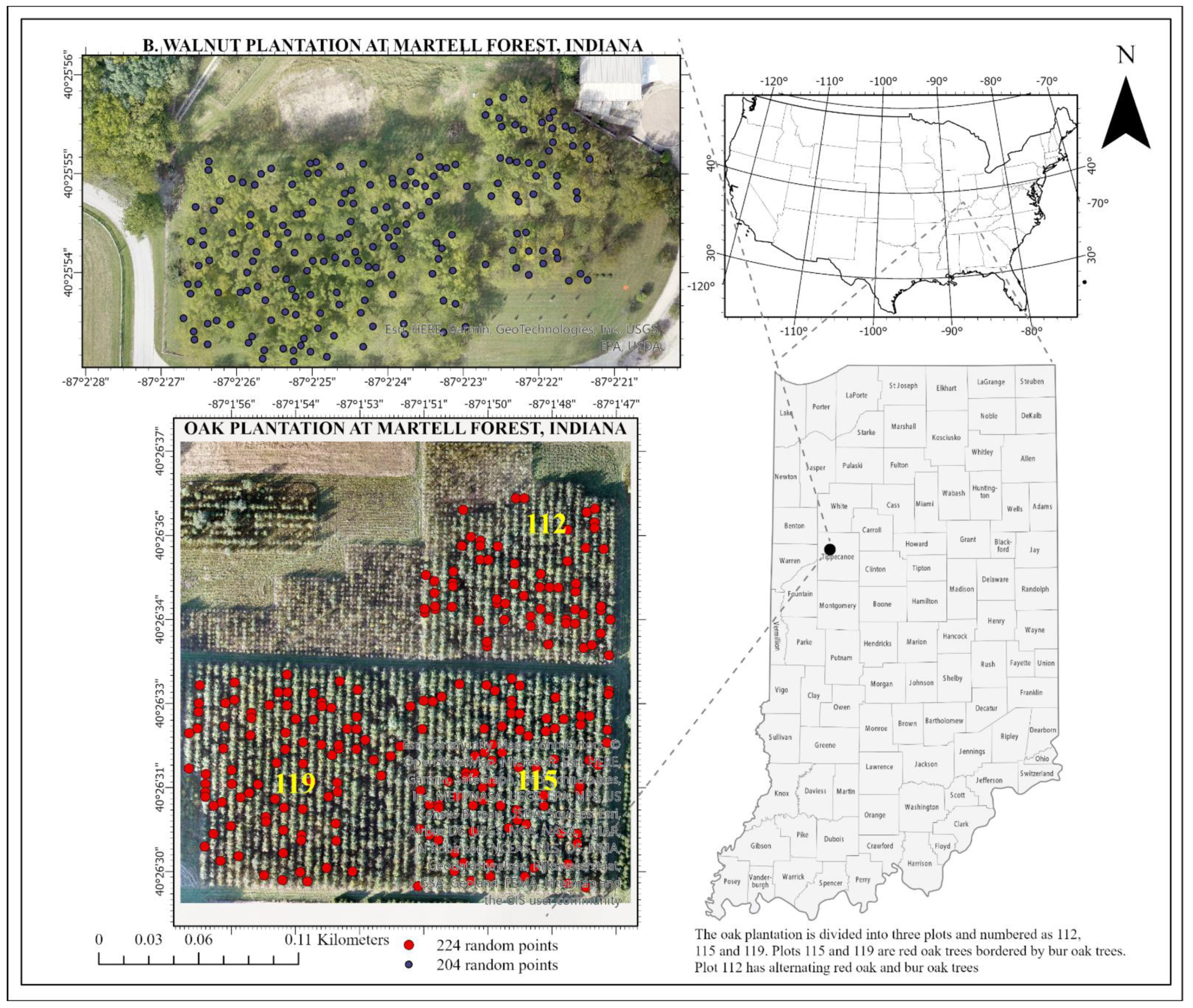
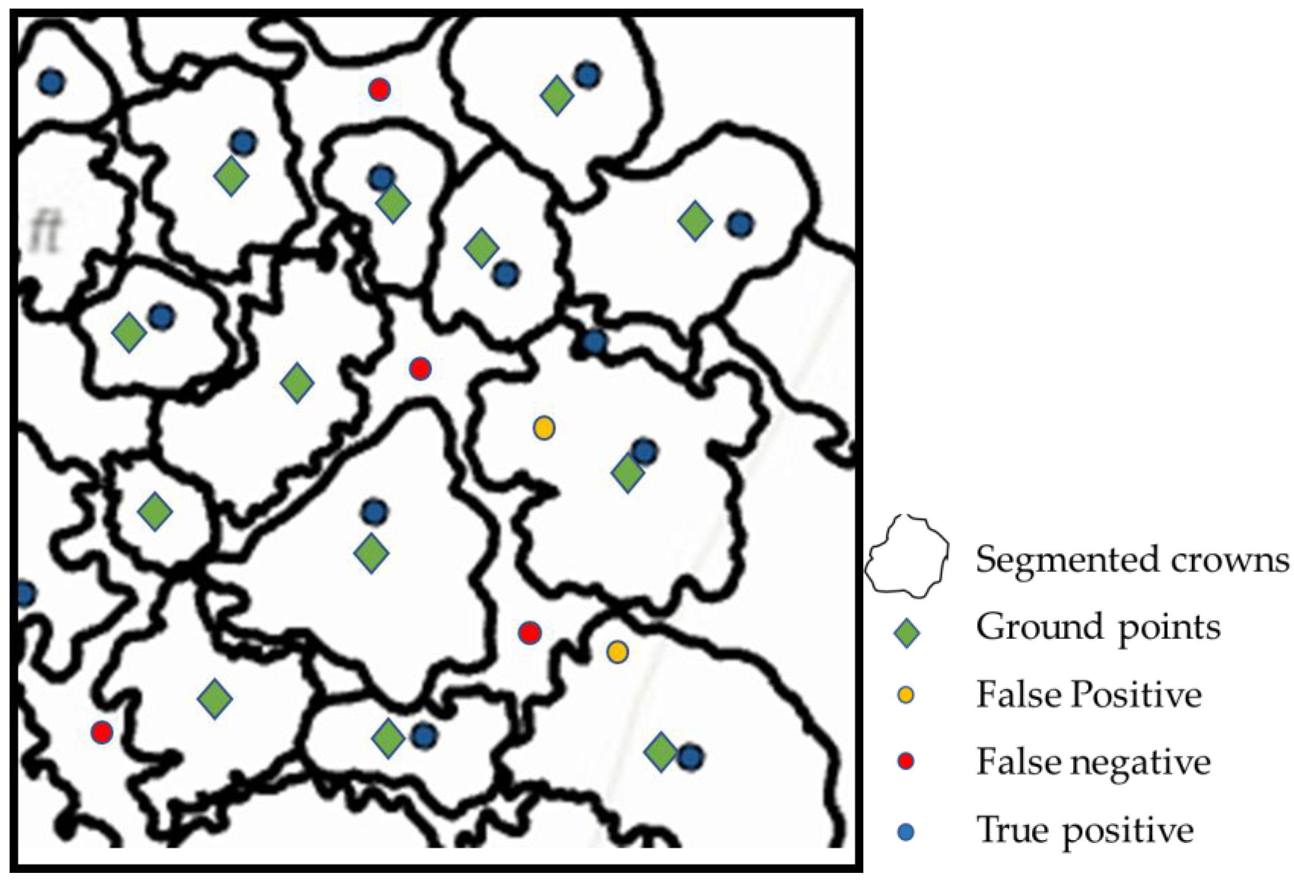
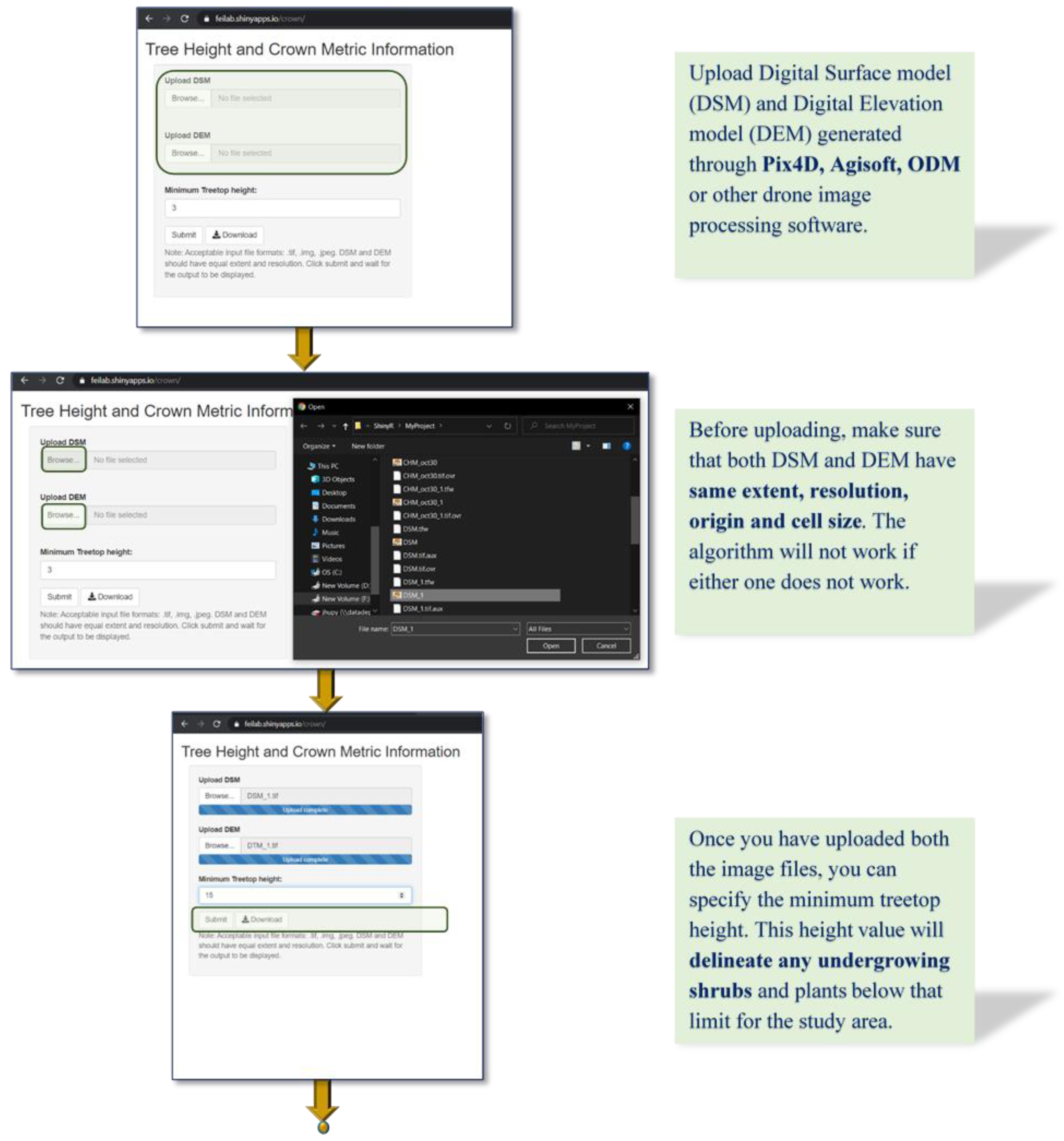
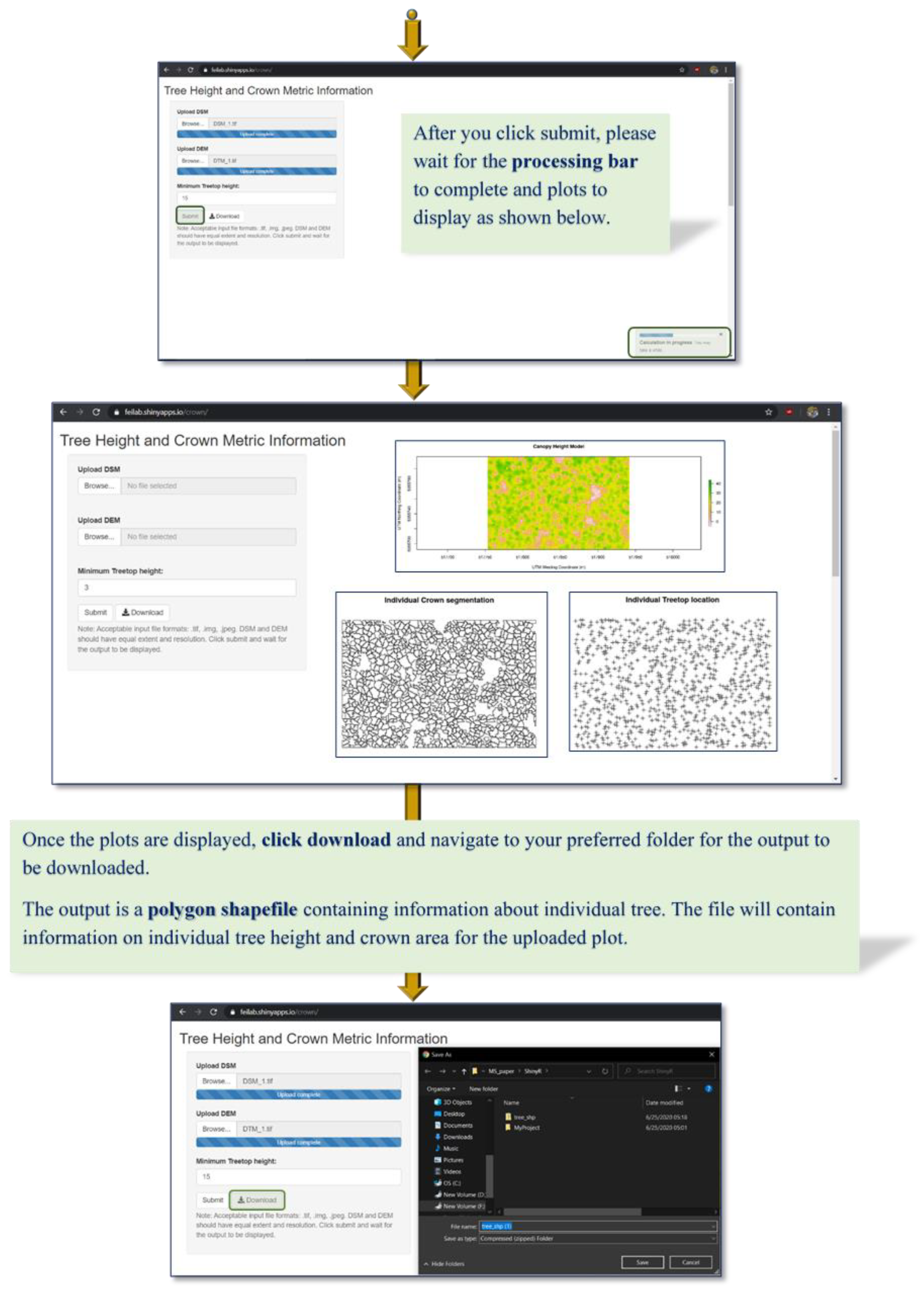
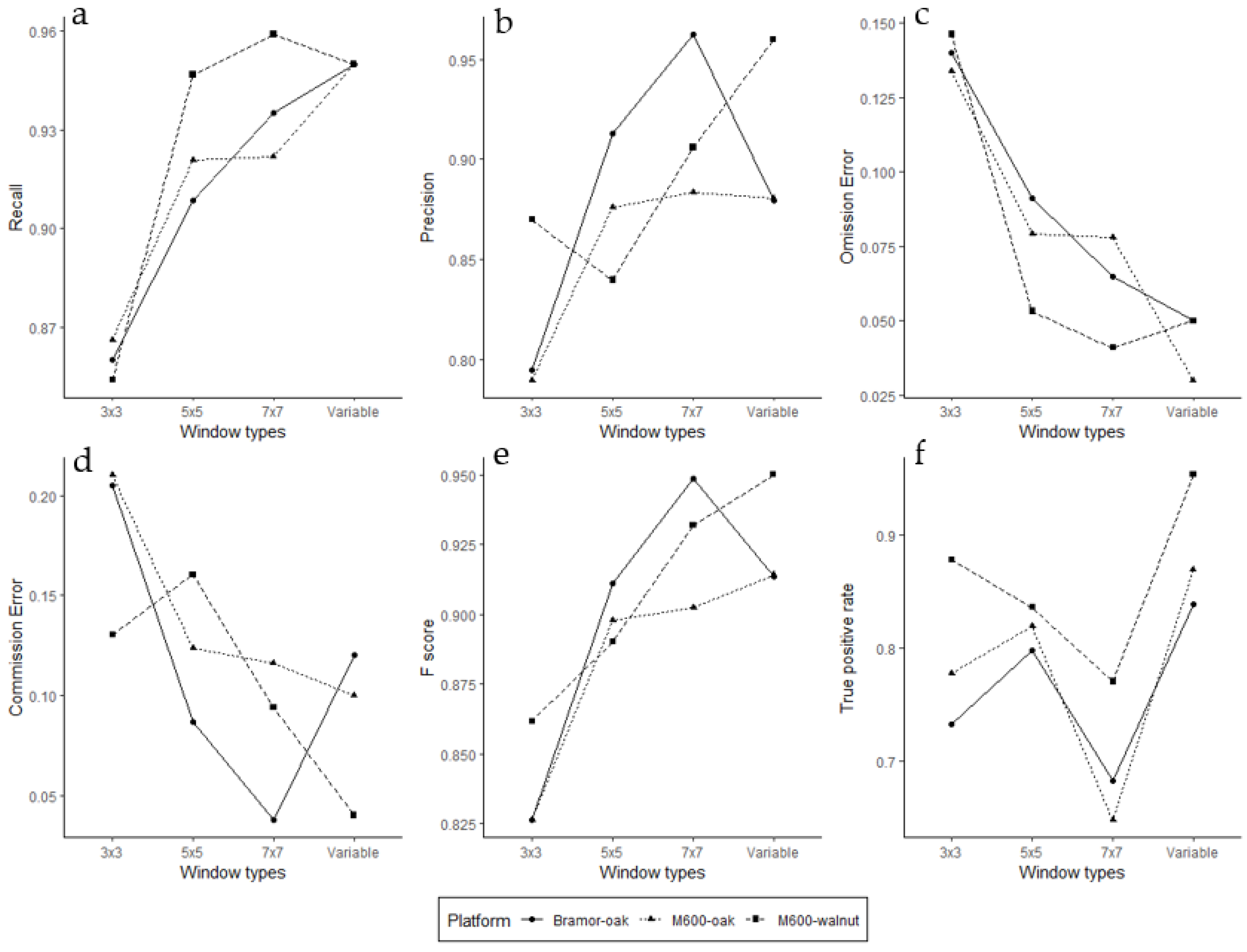
With the increased availability of unmanned aerial systems (UAS) imagery, digitalized forest inventory has gained prominence in recent years. This paper presents a methodology for automated measurement of tree height and crown area in two broadleaf tree plantations of different species and ages using two different UAS platforms. Using structure from motion (SfM), we generated canopy height models (CHMs) for each broadleaf plantation in Indiana, USA. From the CHMs, we calculated individual tree parameters automatically through an open-source web tool developed using the Shiny R package and assessed the accuracy against field measurements. Our analysis shows higher tree measurement accuracy with the datasets derived from multi-rotor platform (M600) than with the fixed wing platform (Bramor). The results show that our automated method could identify individual trees (F-score > 90%) and tree biometrics (root mean square error < 1.2 m for height and <1 m2 for the crown area) with reasonably good accuracy. Moreover, our automated tool can efficiently calculate tree-level biometric estimations for 4600 trees within 30 min based on a CHM from UAS-SfM derived images. This automated UAS imagery approach for tree-level forest measurements will be beneficial to landowners and forest managers by streamlining their broadleaf forest measurement and monitoring effort.
Keywords: tree-level inventory; broadleaf tree species; automated tree measurement; webtool; drone remote sensing; hardwood forest tree-level inventory; broadleaf tree species; automated tree measurement; webtool; drone remote sensing; hardwood forest