Article

Land Use Hotspots of the Two Largest Landlocked Countries: Kazakhstan and Mongolia
1
Center for Global Change and Earth Observations, Michigan State University, East Lansing, MI 48823, USA
2
Department of Geography, Environment & Spatial Sciences, Michigan State University, East Lansing, MI 48823, USA
3
Department of Biology and Department of Sustainability, University of South Dakota, Vermillion, SD 57069, USA
4
Institute of Geography, Mongolian Academy of Sciences, Ulaanbaatar 210620, Mongolia
*
Author to whom correspondence should be addressed.
Remote Sens. 2022, 14(8), 1805; https://doi.org/10.3390/rs14081805
Submission received: 23 February 2022 / Revised: 23 March 2022 / Accepted: 29 March 2022 / Published: 8 April 2022

Abstract

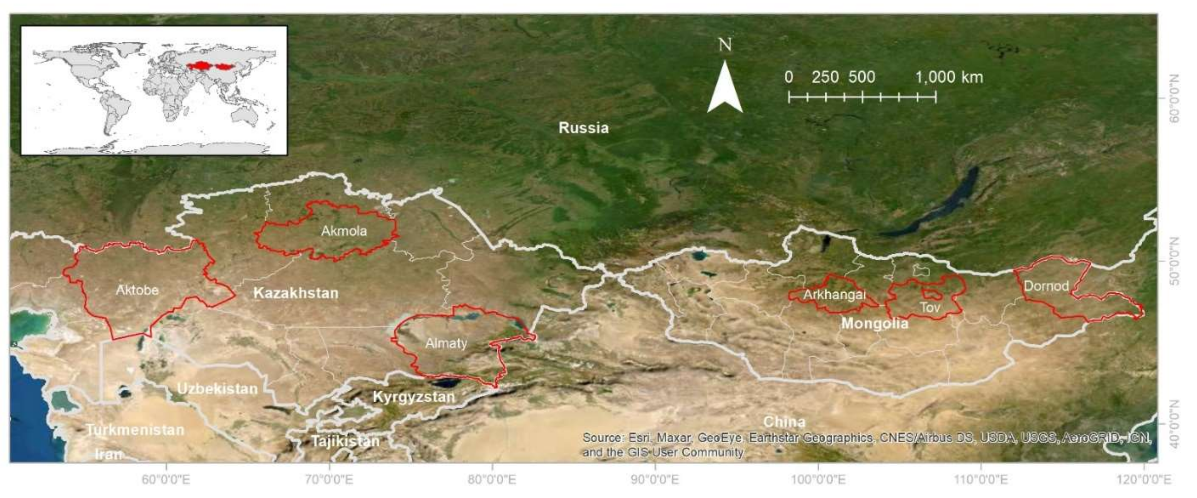

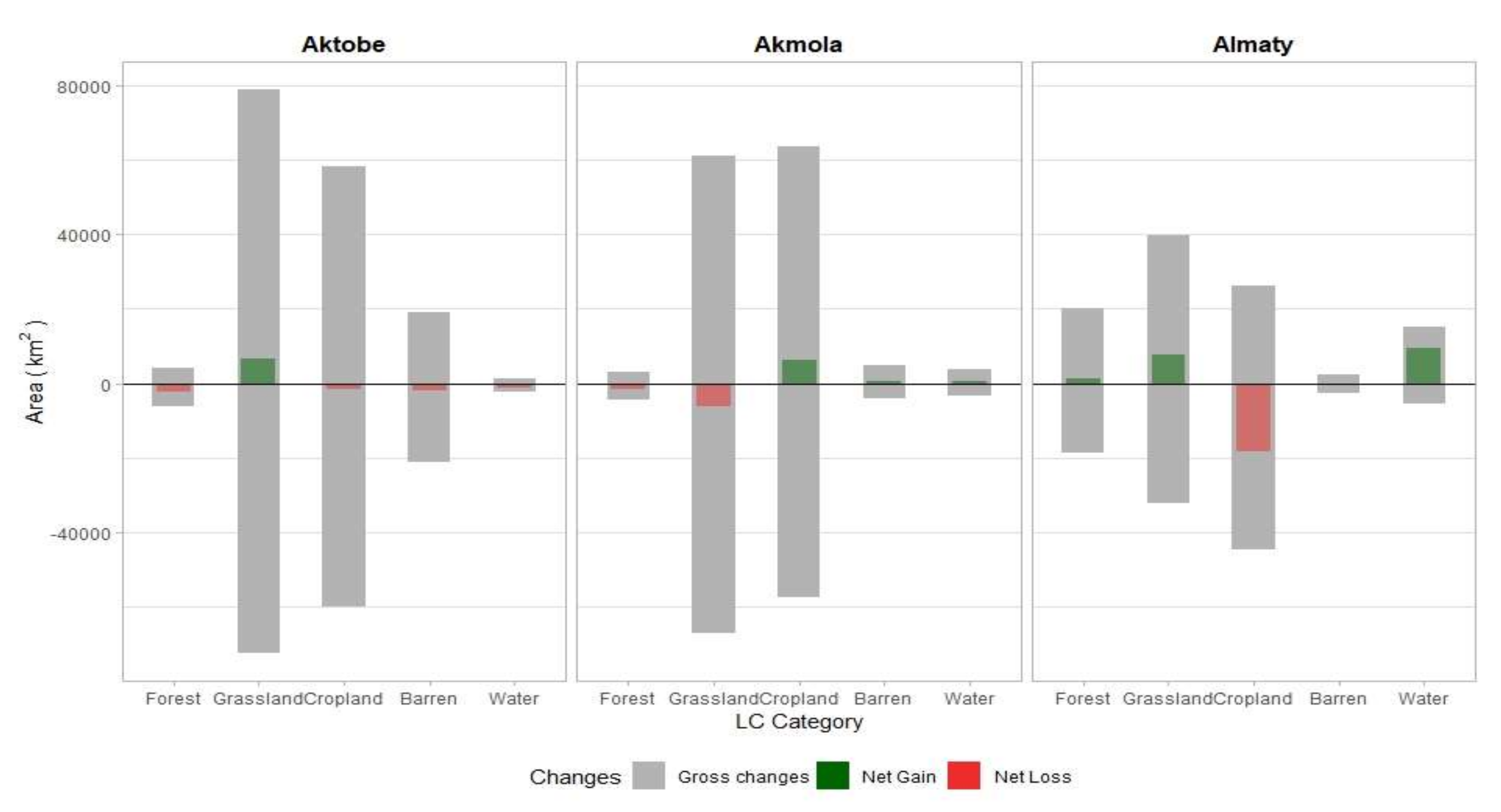
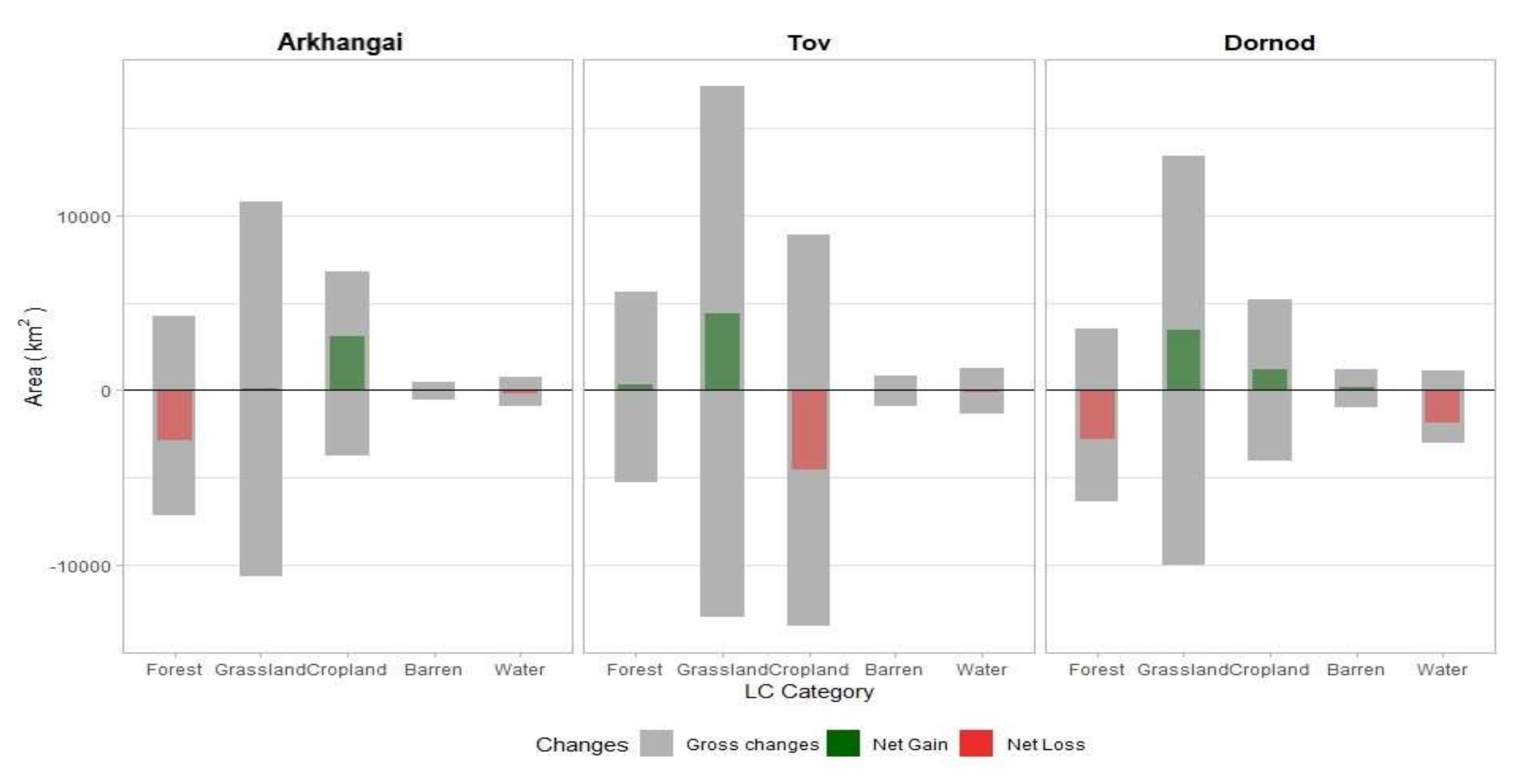
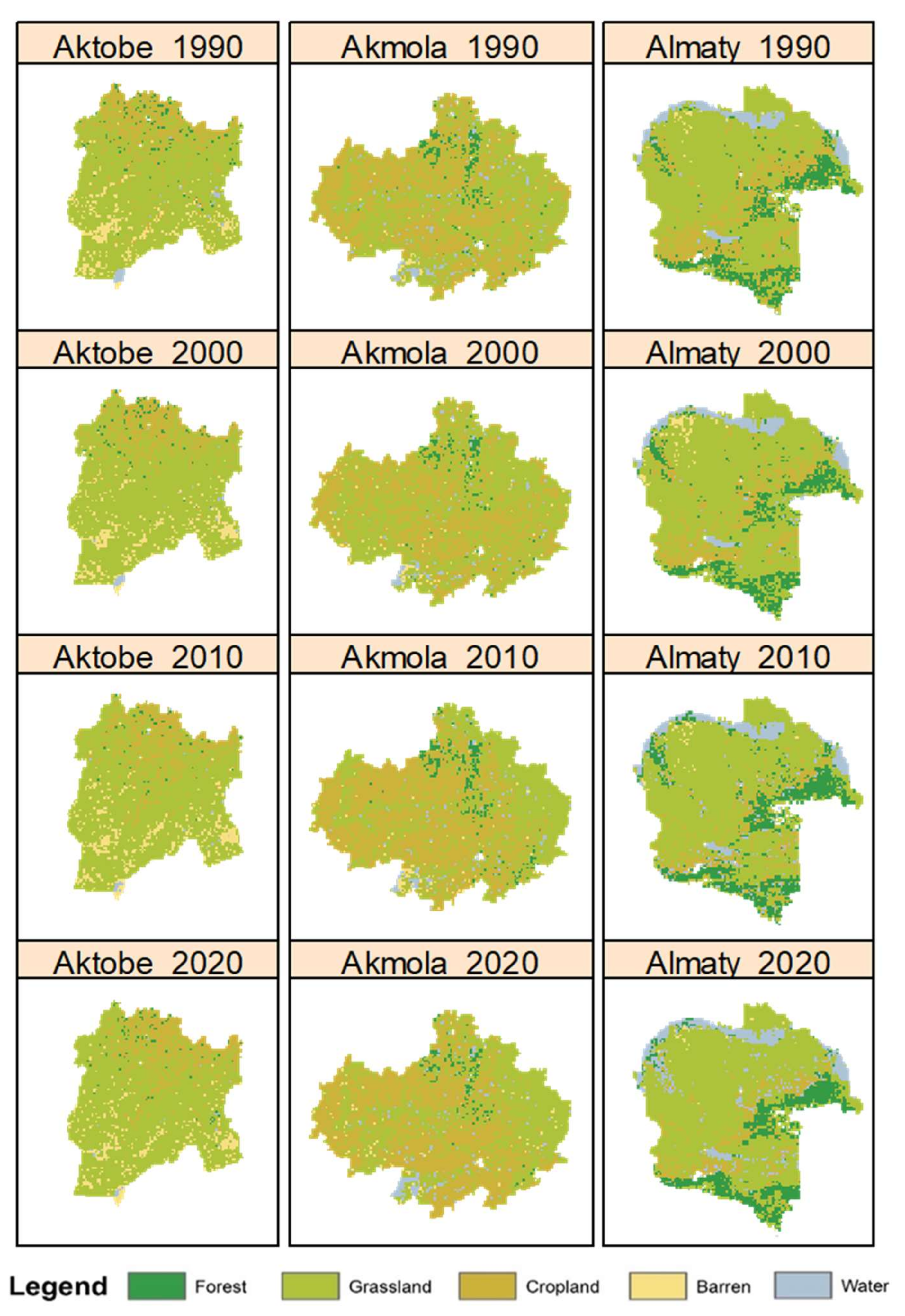
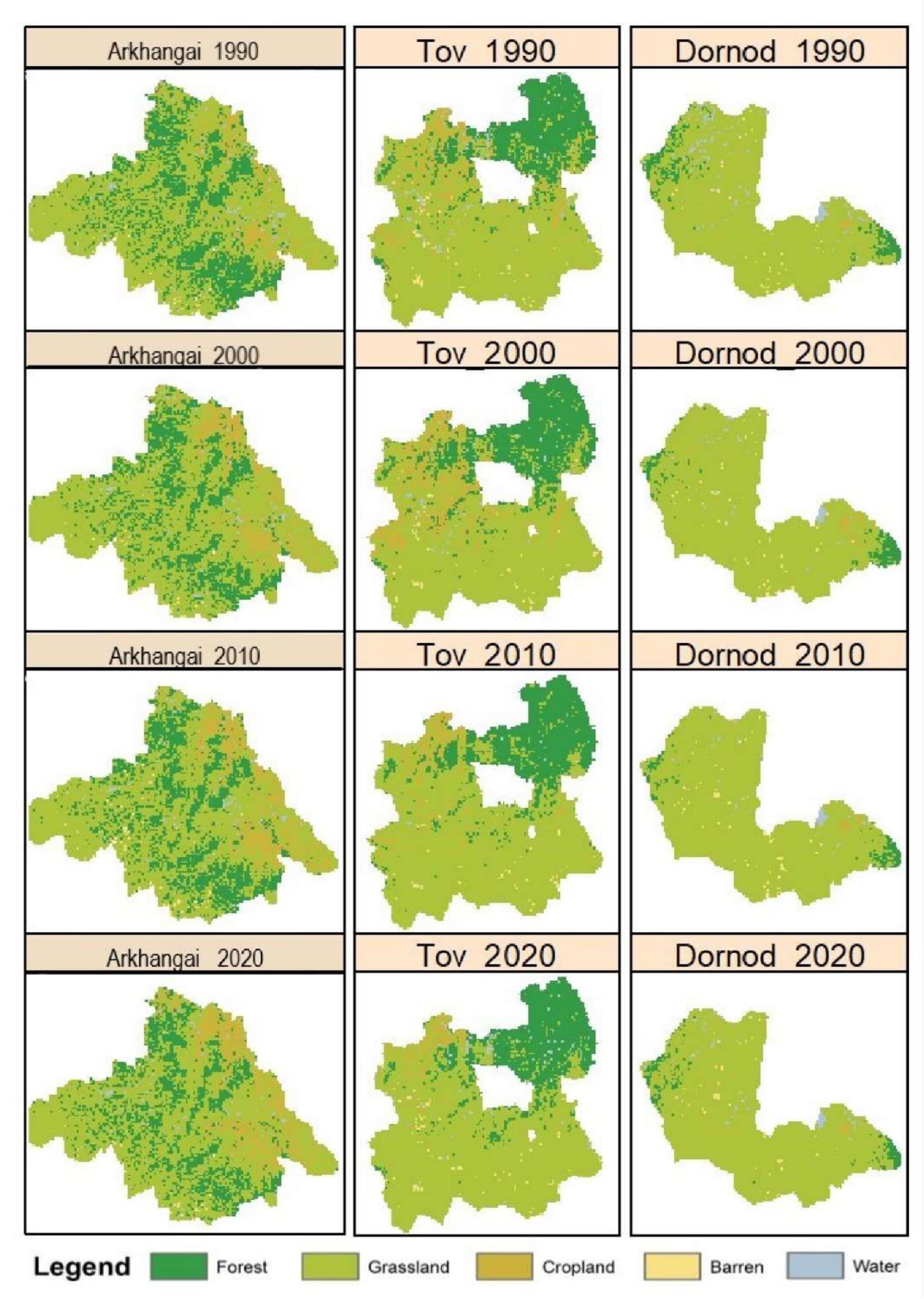
As the two largest landlocked countries, Kazakhstan and Mongolia have similar biophysical conditions and socioeconomic roots in the former Soviet Union. Our objective is to investigate the direction, extent, and spatial variation of land cover change at three administrative levels over three decades (1990–2020). We selected three provinces from each country (Aktobe, Akmola, and Almaty province in Kazakhstan, and Arkhangai, Tov, and Dornod in Mongolia) to classify the land cover into forest, grassland, cropland, barren, and water. Altogether, 6964 Landsat images were used in pixel-based classification method with random forest model for image processing. Six thousand training data points (300 training points × 5 classes × 4 periods) for each province were collected for classification and change detection. Land cover changes at decadal and over the entire study period for five land cover classes were quantified at the country, provincial, and county level. High classification accuracy indicates localized land cover classification have an edge over the latest global land cover product and reveal fine differences in landscape composition. The vast steppe landscapes in these two countries are dominated by grasslands of 91.5% for Dornod in Mongolia and 74.7% for Aktobe in Kazakhstan during the 30-year study period. The most common land cover conversion was grassland to cropland. The cyclic land cover conversions between grassland and cropland reflect the impacts of the Soviet Union’s largest reclamation campaign of the 20th century in Kazakhstan and the Atar-3 agriculture re-development in Mongolia. Kazakhstan experienced a higher rate of land cover change over a larger extent of land area than Mongolia. The spatial distribution of land use intensity indicates that land use hotspots are largely influenced by policy and its shifts. Future research based on these large-scale land use and land cover changes should be focused the corresponding ecosystem and society functions.
Keywords: LULCC; land cover classification; land use hotspots; landlocked country; Mongolia; Kazakhstan; Asia dryland; Google Earth Engine LULCC; land cover classification; land use hotspots; landlocked country; Mongolia; Kazakhstan; Asia dryland; Google Earth Engine