Article

Modern Dryland Source-to-Sink System Segments and Coupling Relationships from Digital Elevation Model Analysis: A Case Study from the Mongolian Altai


1
Key Laboratory of Tectonics and Petroleum Resources, China University of Geosciences, Wuhan 430074, China
2
School of Earth Resources, China University of Geosciences, Wuhan 430074, China
*
Author to whom correspondence should be addressed.
Remote Sens. 2022, 14(5), 1202; https://doi.org/10.3390/rs14051202
Submission received: 18 January 2022 / Revised: 26 February 2022 / Accepted: 27 February 2022 / Published: 28 February 2022
(This article belongs to the Special Issue Remote Sensing of Dryland River Systems)

Abstract

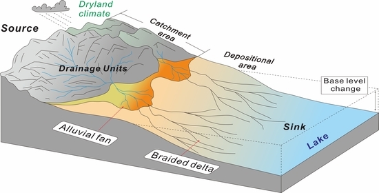
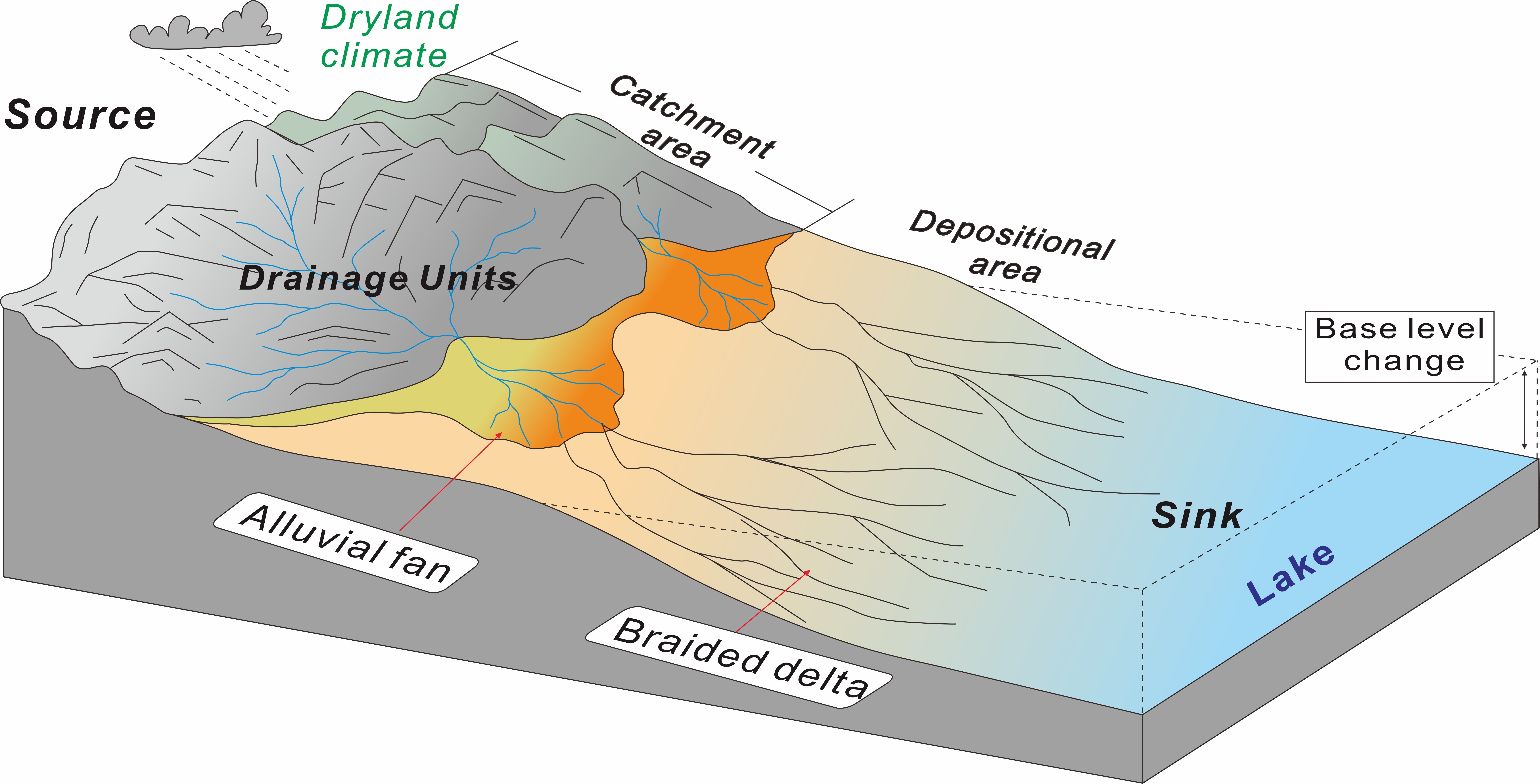
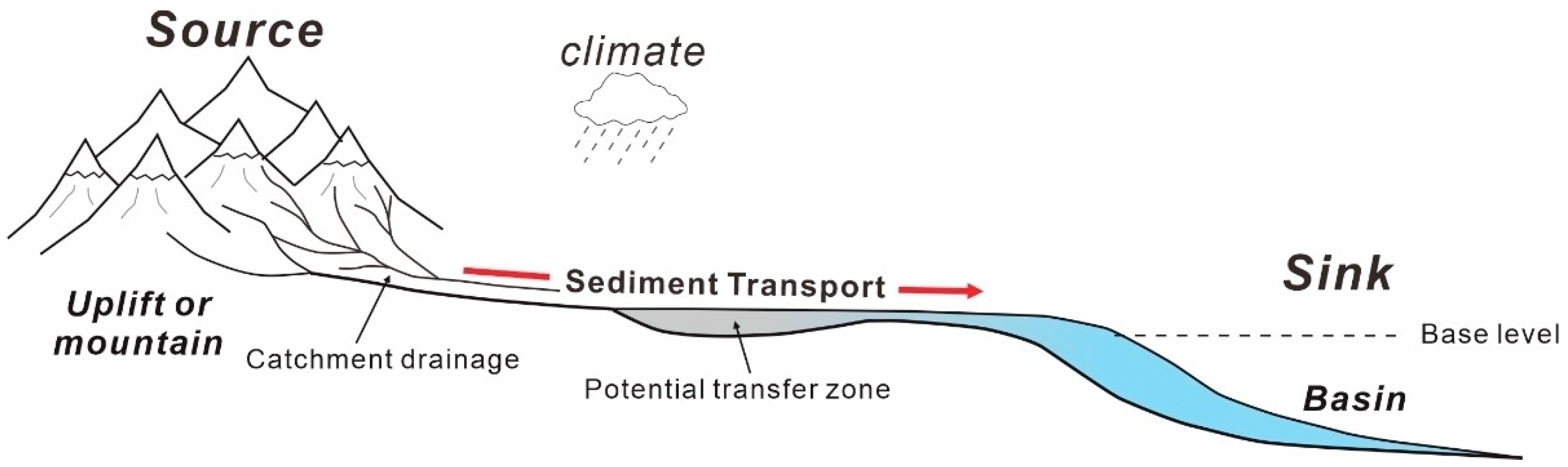
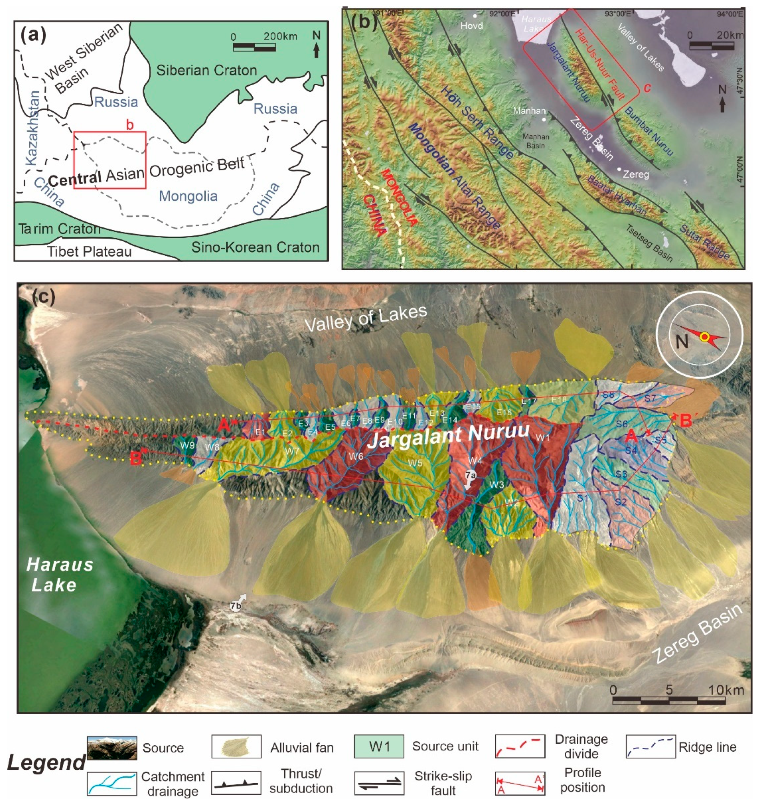
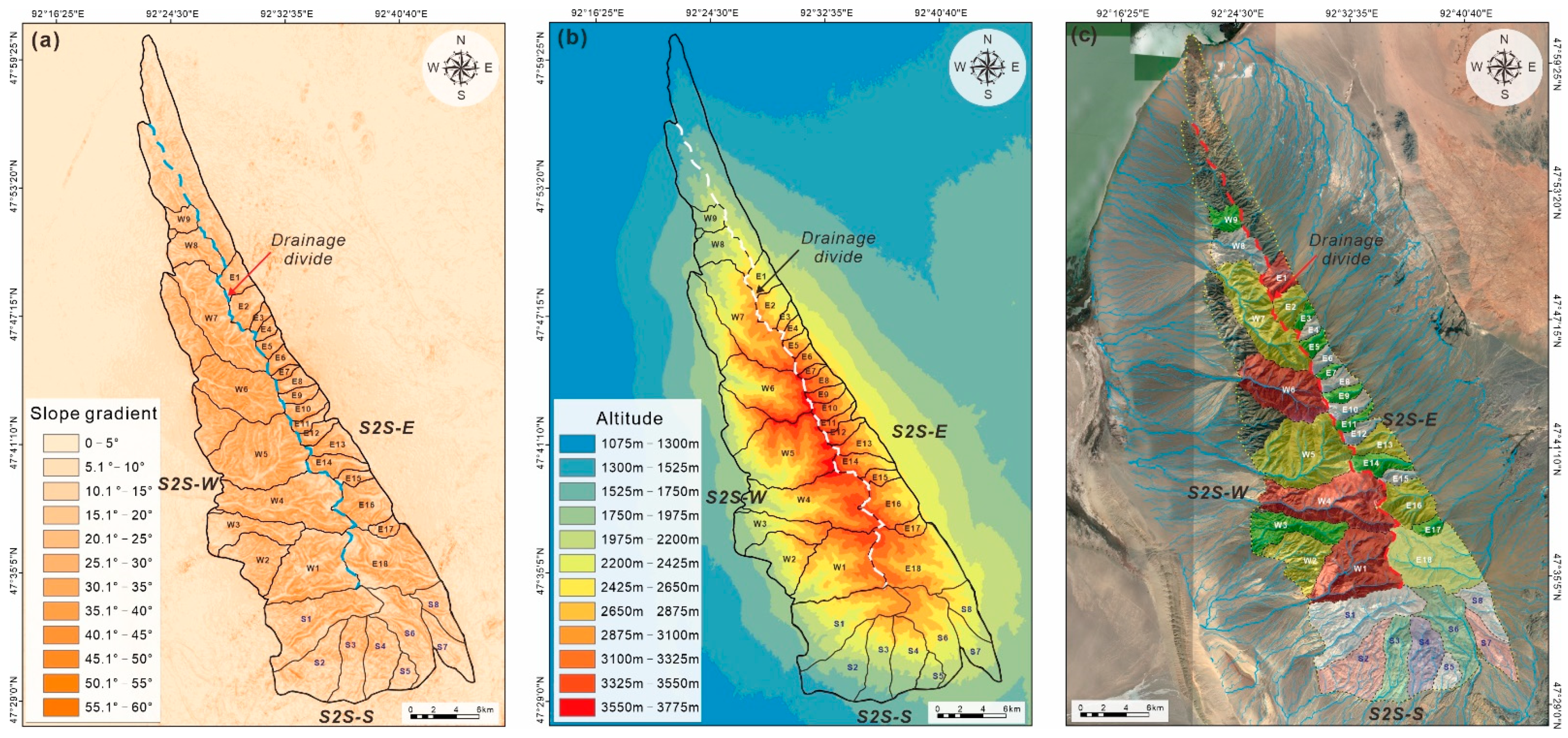
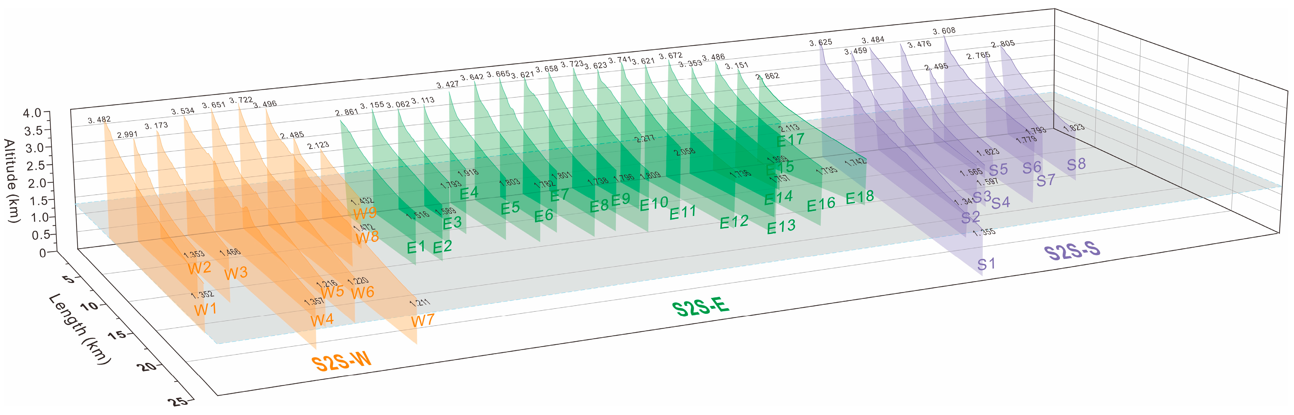
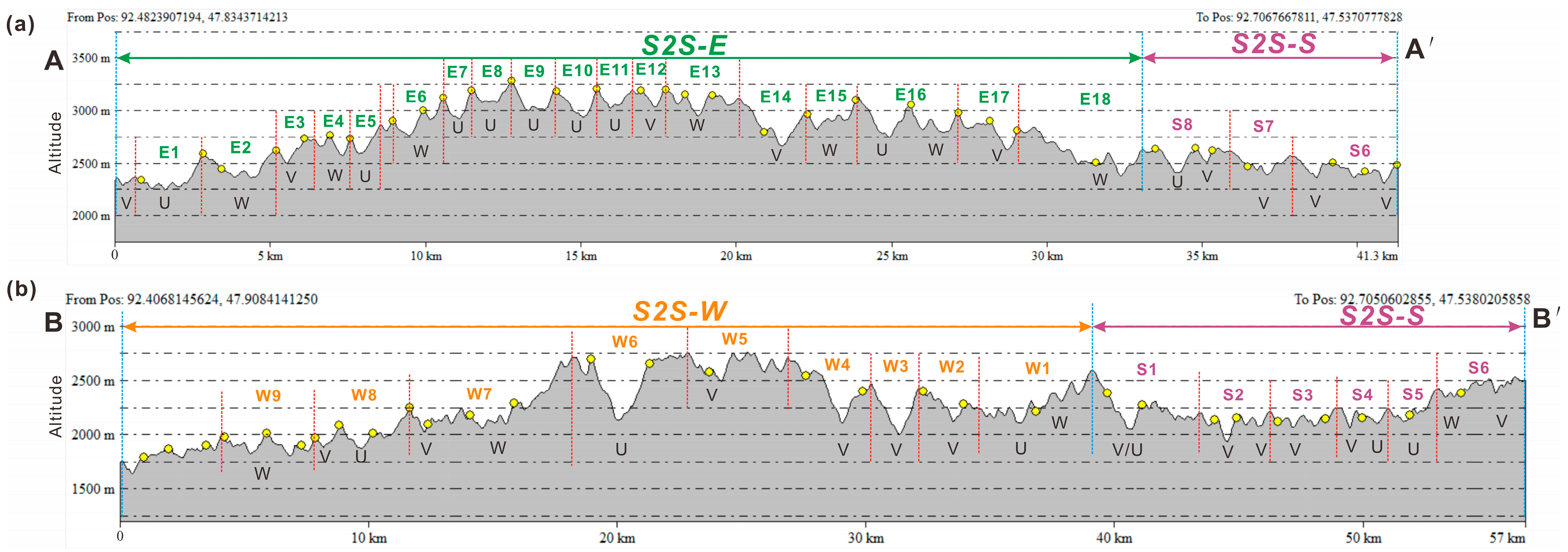
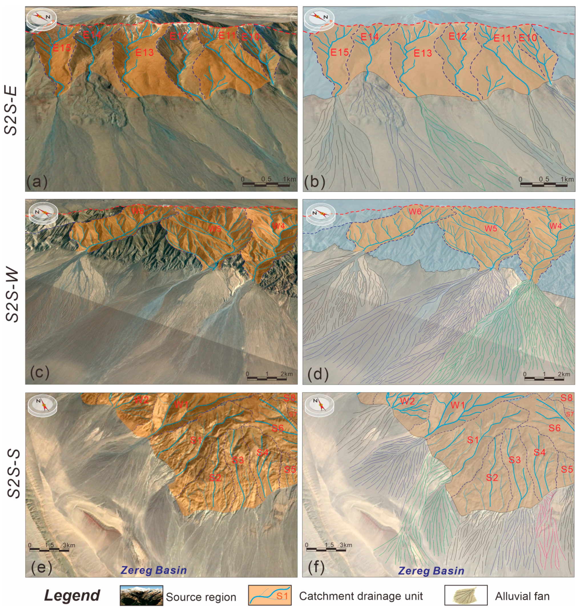
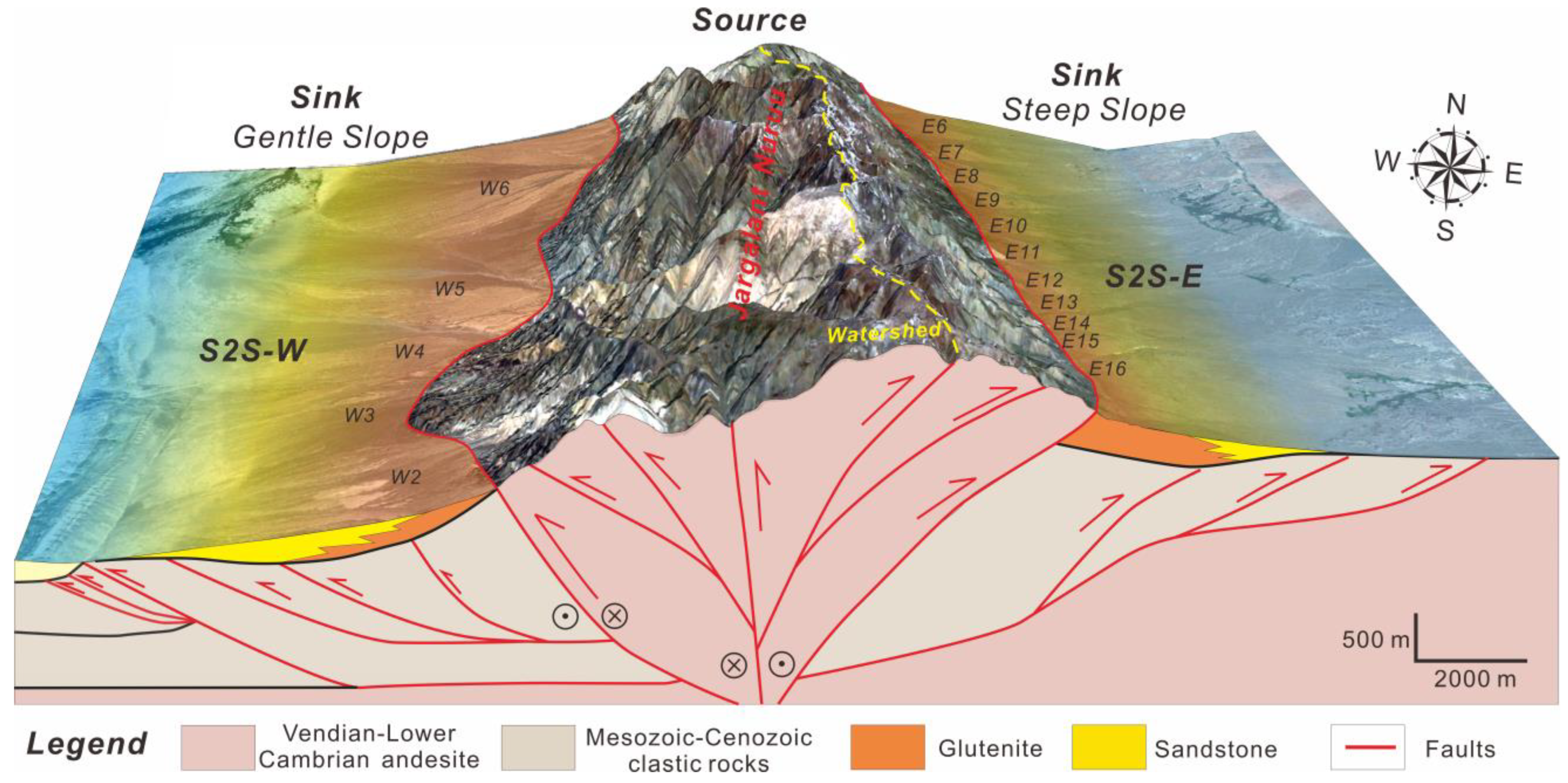
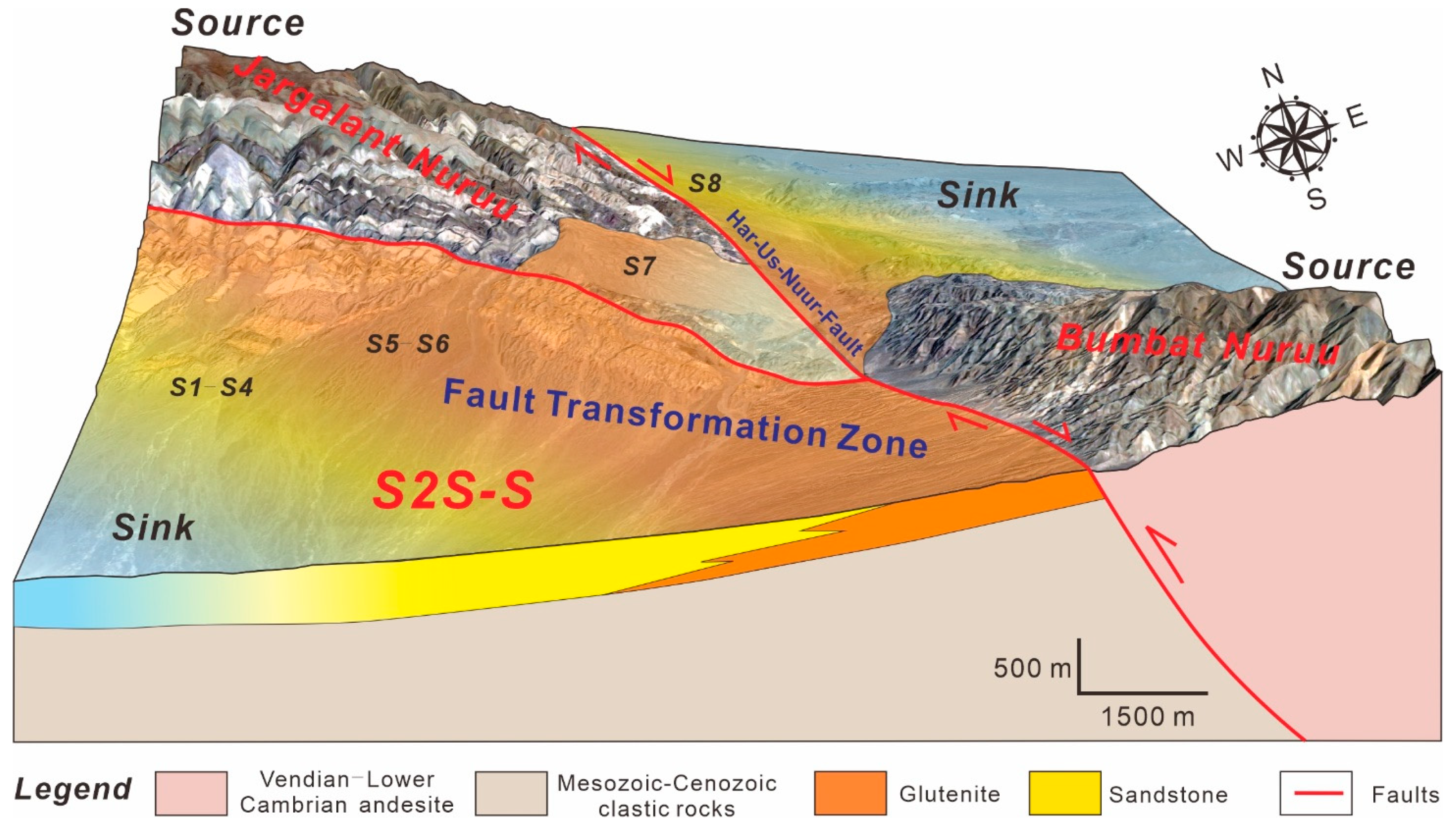
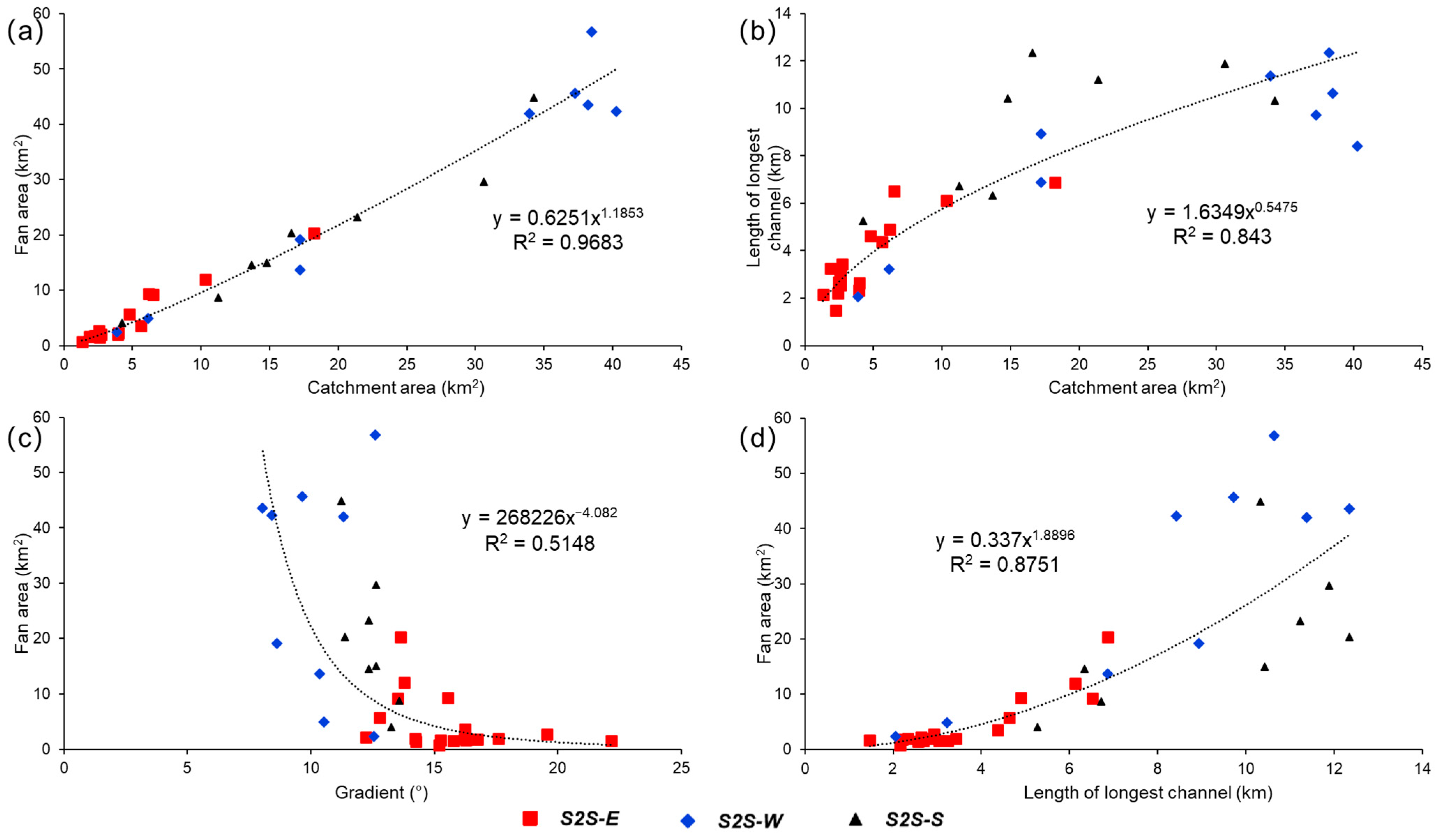
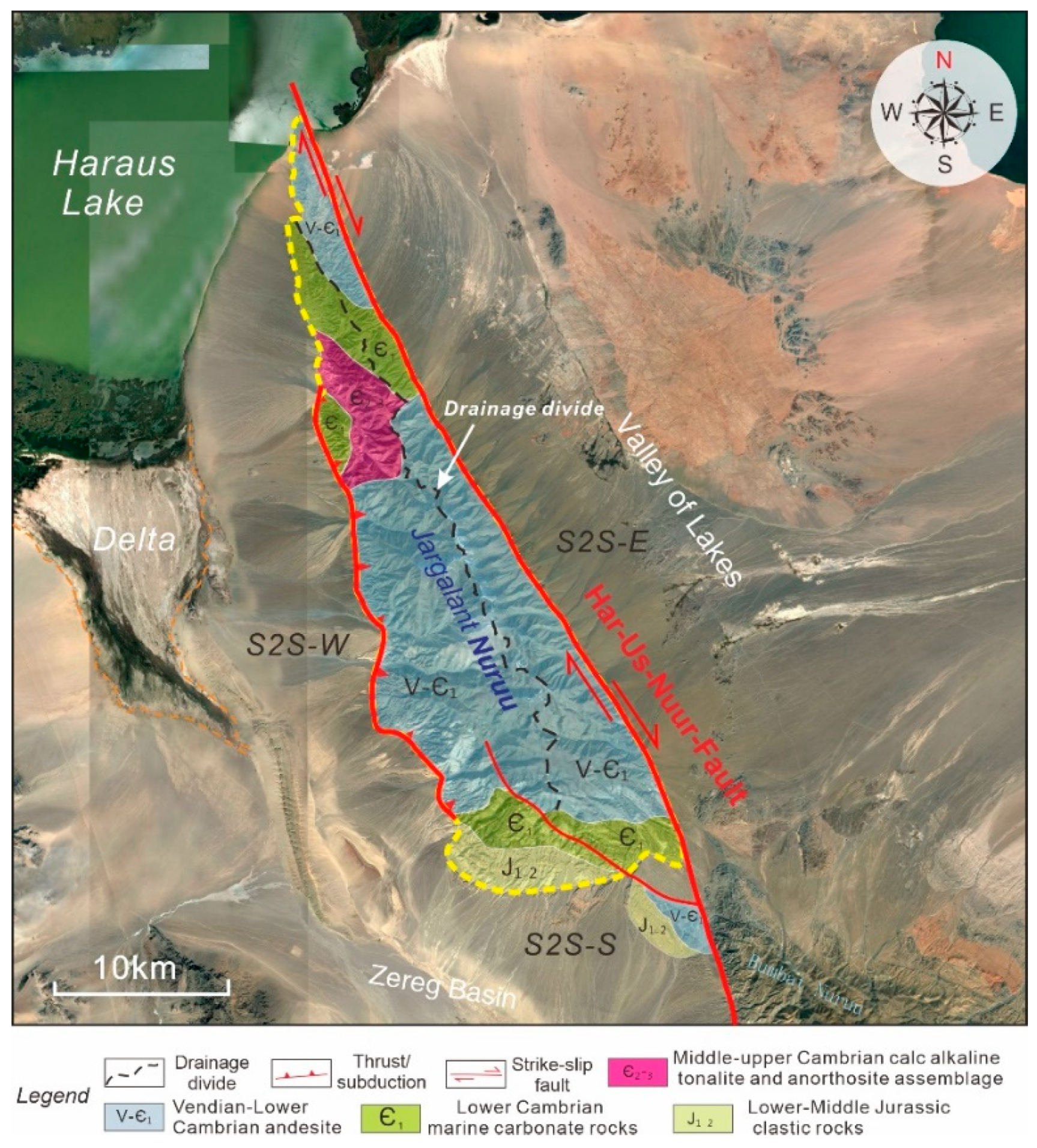
Source-to-sink (S2S) systems have represented a major area of research in recent years; however, few modern S2S system analyses have been applied to typical dryland uplifts/mountains. A modern lacustrine sedimentary system is widely developed in the Great Lakes Basin of western Mongolia, and the Jargalant Nuruu in the Mongolian Altai is a suitable natural laboratory for modern dryland S2S system analysis. In this study, the multi-order S2S system of the Jargalant Nuruu was applied based on a digital elevation model (DEM) and Google Earth database analysis. The Jargalant Nuruu system is subdivided into three second-order sub-S2S systems of the eastern, western, and southern parts (S2S-E, S2S-W, and S2S-S, respectively) and 35 third-order sub-S2S systems (E1–E18, W1–W9, and S1–S8) according to the slope gradients, altitude, and hydrographic net of the Jargalant Nuruu recognized by DEM data, integrated with the quantitative recognition of the topographic drainage divide and structural patterns of the uplift margin. The three second-order S2S systems correspond to three various S2S system coupling models. The S2S-E is characterized by a steep slope gradient system (average 15.61°) with small-scale dominantly alluvial fan deposits (average 4.56 km2). S2S-W is represented by a gentle slope gradient system (average 10.24°) with large-scale dominated fan-shaped lobes (average 30.04 km2). S2S-S, in contrast, is a transformation zone system with transitional features between the two former types. Four major potential controlling factors for the difference in sub-S2S systems are summarized here, including tectonic activity, bedrock properties in the source area, morphology from source to sink, and climatic conditions. The landforms, sedimentary characteristics, and their differences in these sub-S2S systems are the result of the comprehensive influence and control of these multiple factors. This case study could serve as a useful reference for characterizing the sedimentary features of a modern or even ancient S2S system in other regions.
Keywords: source-to-sink system; geomorphology; digital elevation model; Google Earth; catchment drainage; sediment transport; alluvial fan source-to-sink system; geomorphology; digital elevation model; Google Earth; catchment drainage; sediment transport; alluvial fan
Graphical Abstract