Article

Comparative Assessment of Pixel and Object-Based Approaches for Mapping of Olive Tree Crowns Based on UAV Multispectral Imagery


1
Department of Geography, University of Zadar, Trg kneza Višeslava 9, 23000 Zadar, Croatia
2
Faculty of Geodesy, University of Zagreb, Kačićeva 26, 10000 Zagreb, Croatia
3
Faculty of Technical Sciences, University of Novi Sad, Trg Dositej Obradović 6, 21000 Novi Sad, Serbia
*
Author to whom correspondence should be addressed.
Remote Sens. 2022, 14(3), 757; https://doi.org/10.3390/rs14030757
Submission received: 29 December 2021 / Revised: 2 February 2022 / Accepted: 4 February 2022 / Published: 6 February 2022

Abstract

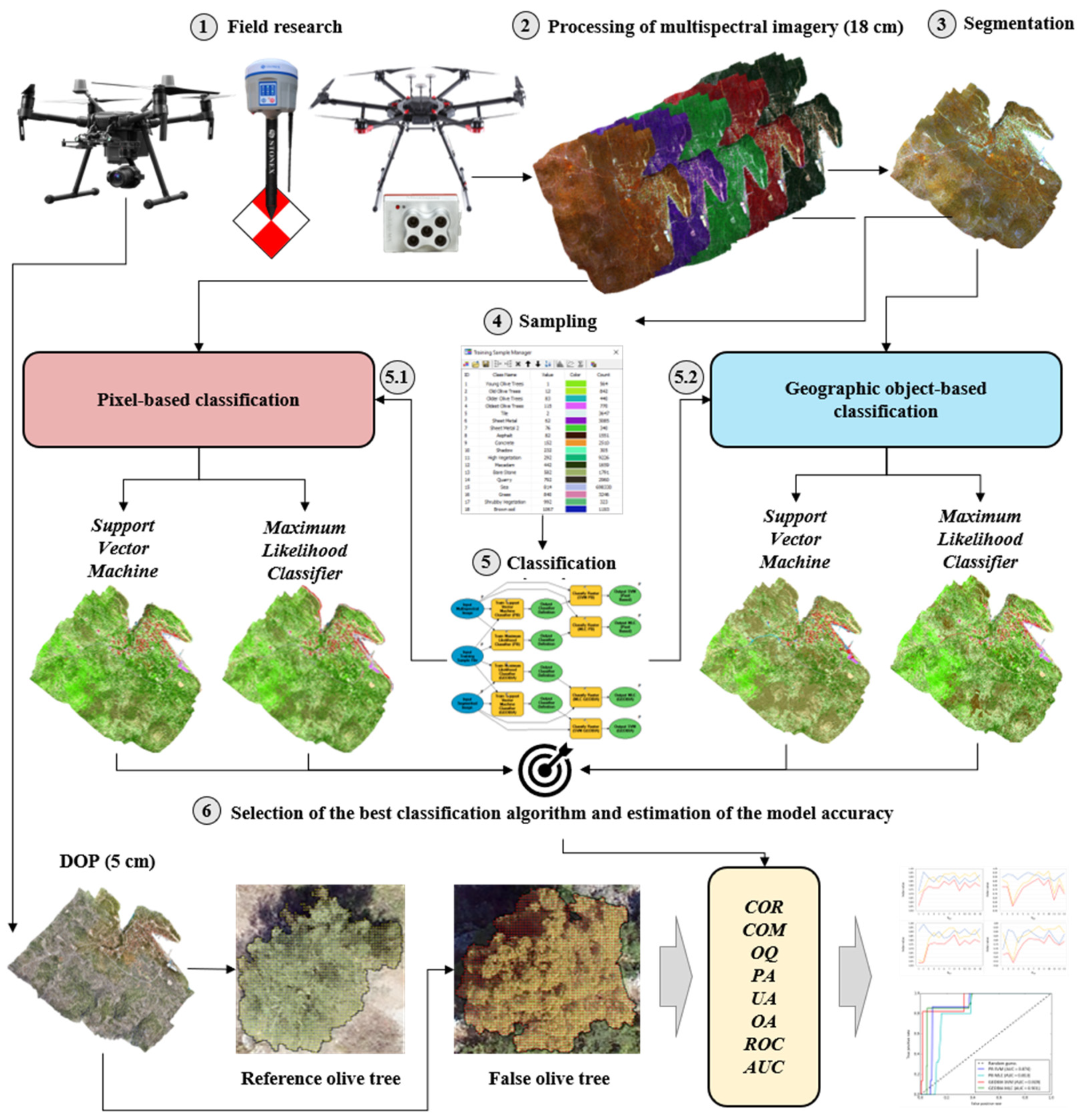
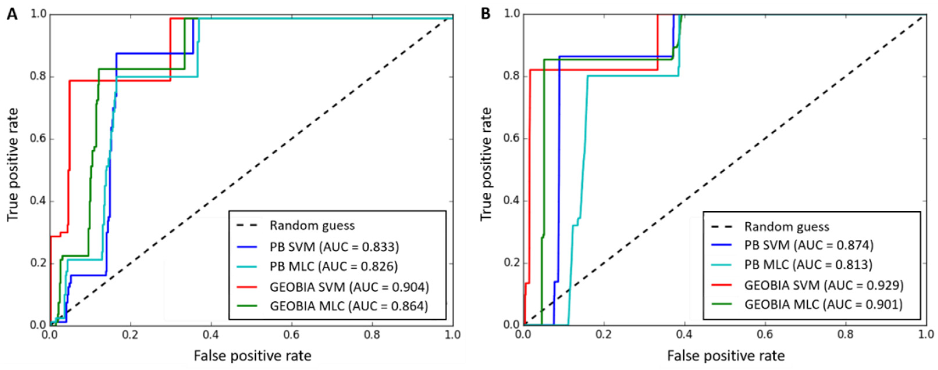
Pixel-based (PB) and geographic-object-based (GEOBIA) classification approaches allow the extraction of different objects from multispectral images (MS). The primary goal of this research was the analysis of UAV imagery applicability and accuracy assessment of MLC and SVM classification algorithms within PB and GEOBIA classification approaches. The secondary goal was to use different accuracy assessment metrics to determine which of the two tested classification algorithms (SVM and MLC) most reliably distinguishes olive tree crowns and which approach is more accurate (PB or GEOBIA). The third goal was to add false polygon samples for Correctness (COR), Completeness (COM) and Overall Quality (OQ) metrics and use them to calculate the Total Accuracy (TA). The methodology can be divided into six steps, from data acquisition to selection of the best classification algorithm after accuracy assessment. High-quality DOP (digital orthophoto) and UAVMS were generated. A new accuracy metric, called Total Accuracy (TA), combined both false and true positive polygon samples, thus providing a more comprehensive insight into the assessed classification accuracy. The SVM (GEOBIA) was the most reliable classification algorithm for extracting olive tree crowns from UAVMS imagery. The assessment carried out indicated that application of GEOBIA-SVM achieved a TACOR of 0.527, TACOM of 0.811, TAOQ of 0.745, Overall Accuracy (OA) of 0.926 or 0.980 and Area Under Curve (AUC) value of 0.904 or 0.929. The calculated accuracy metrics confirmed that the GEOBIA approach (SVM and MLC) achieved more accurate olive tree crown extraction than the PB approach (SVM and MLC) if applied to classifying VHR UAVMS imagery. The SVM classification algorithm extracted olive tree crowns more accurately than MLC in both approaches. However, the accuracy assessment has proven that PB classification algorithms can also achieve satisfactory accuracy.
Keywords: geographic object-based image analysis (GEOBIA); pixel-based approach; very-high-resolution imagery; segmentation; Sali; support vector machine; maximum likelihood; accuracy assessment geographic object-based image analysis (GEOBIA); pixel-based approach; very-high-resolution imagery; segmentation; Sali; support vector machine; maximum likelihood; accuracy assessment