Article

The Potential of UAV Imagery for the Detection of Rapid Permafrost Degradation: Assessing the Impacts on Critical Arctic Infrastructure


1
Permafrost Research Section, Alfred Wegener Institute Helmholtz Centre for Polar and Marine Research, Telegrafenberg A45, 14473 Potsdam, Germany
2
Geography Department, Humboldt-Universität zu Berlin, Unter den Linden 6, 10099 Berlin, Germany
3
Institute of Geosciences, University of Potsdam, Karl-Liebknecht-Str. 24-25, 14476 Potsdam, Germany
*
Author to whom correspondence should be addressed.
Remote Sens. 2022, 14(23), 6107; https://doi.org/10.3390/rs14236107
Submission received: 5 November 2022 / Revised: 25 November 2022 / Accepted: 29 November 2022 / Published: 2 December 2022
(This article belongs to the Special Issue Dynamic Disturbance Processes in Permafrost Regions)

Abstract

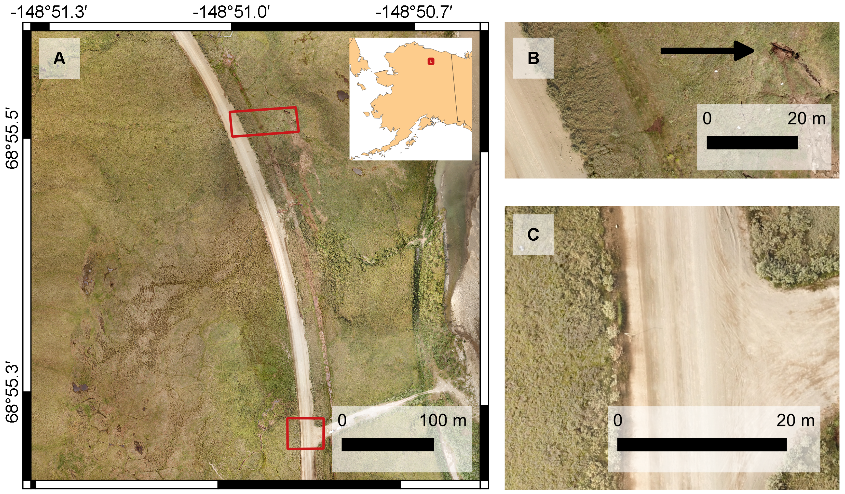
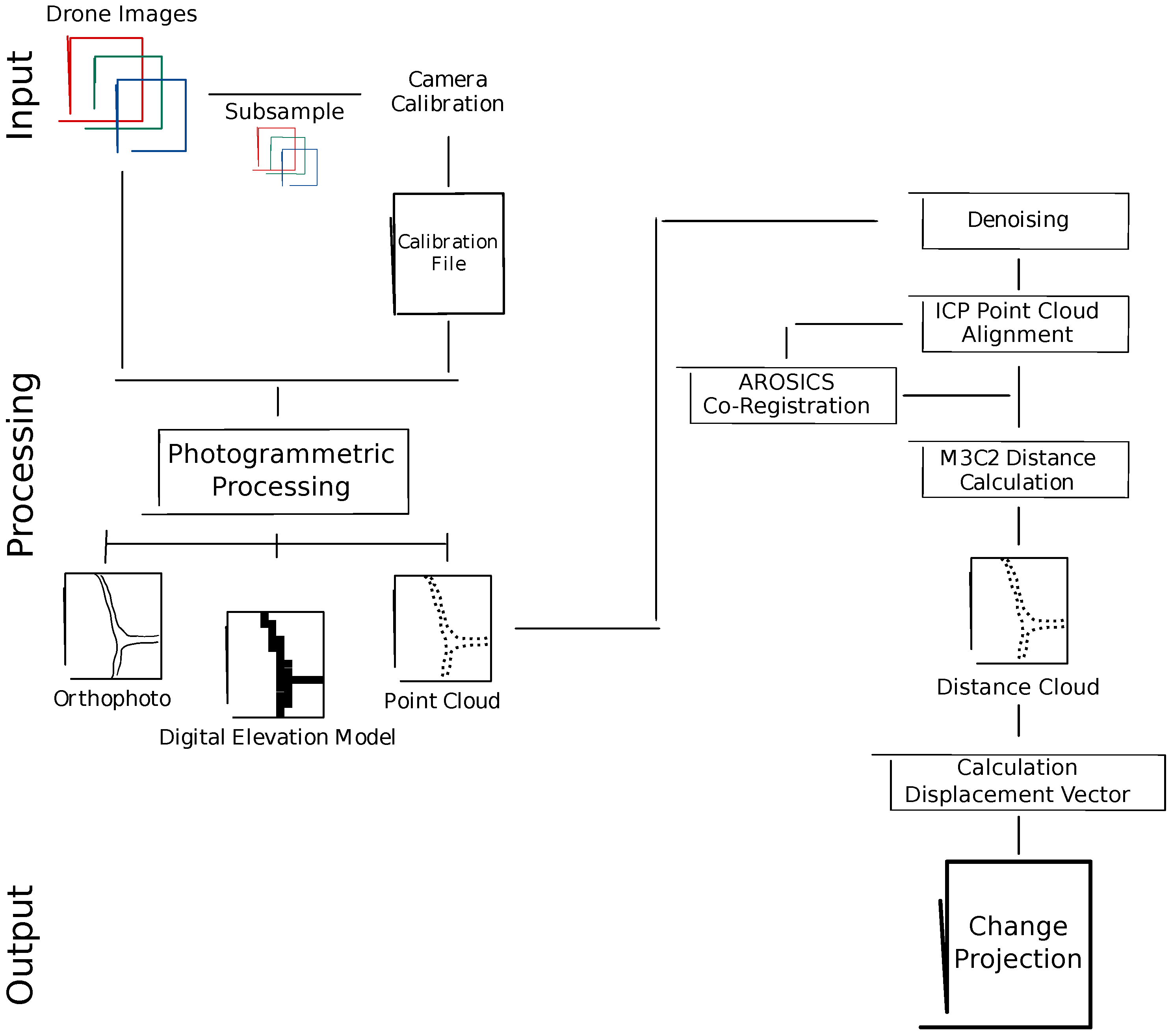
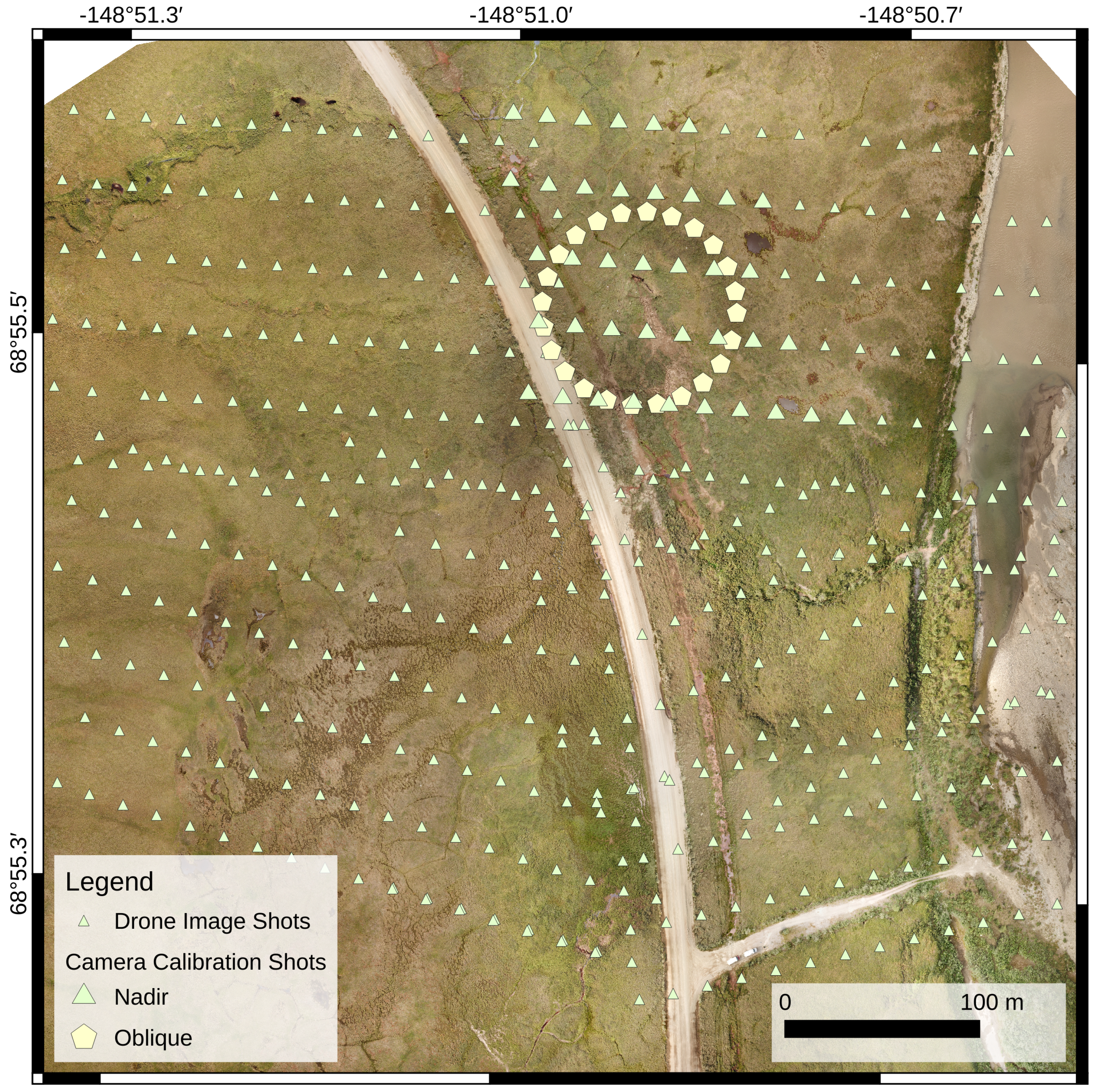
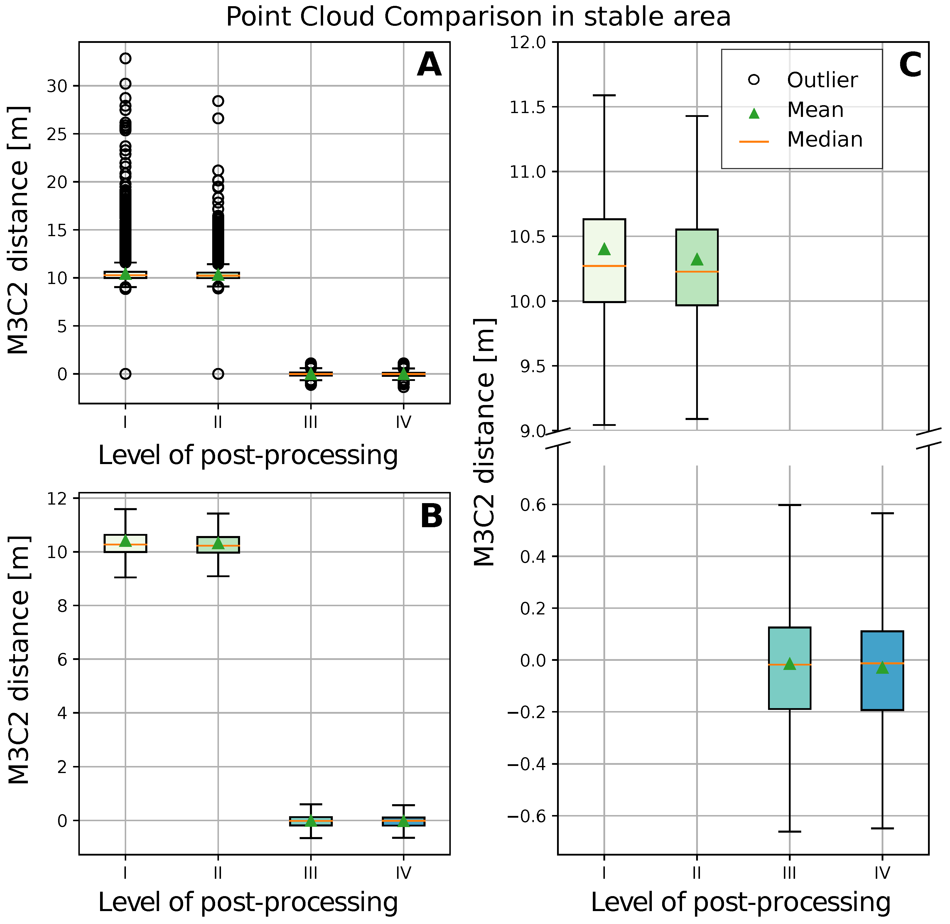
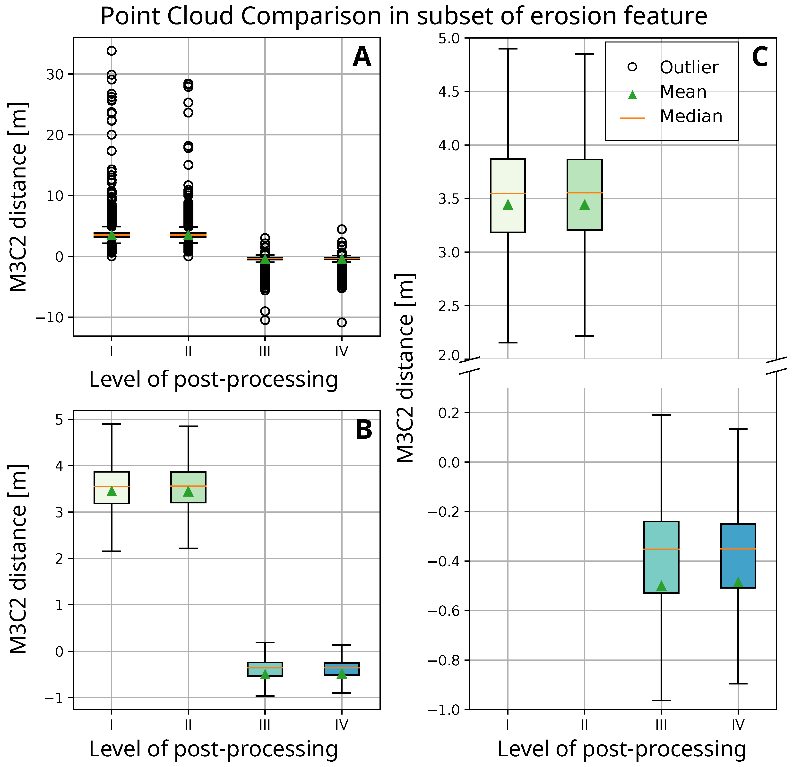
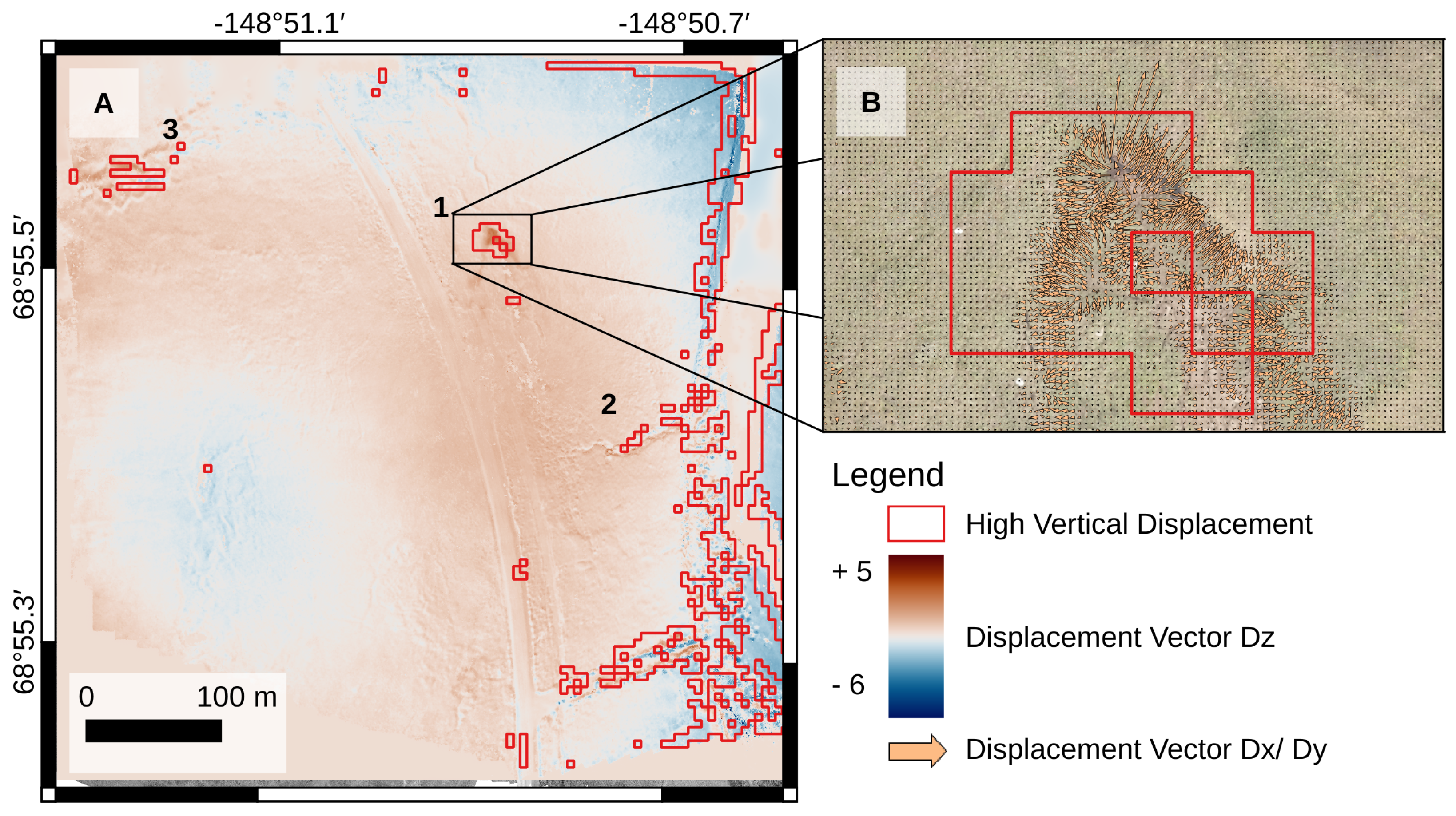
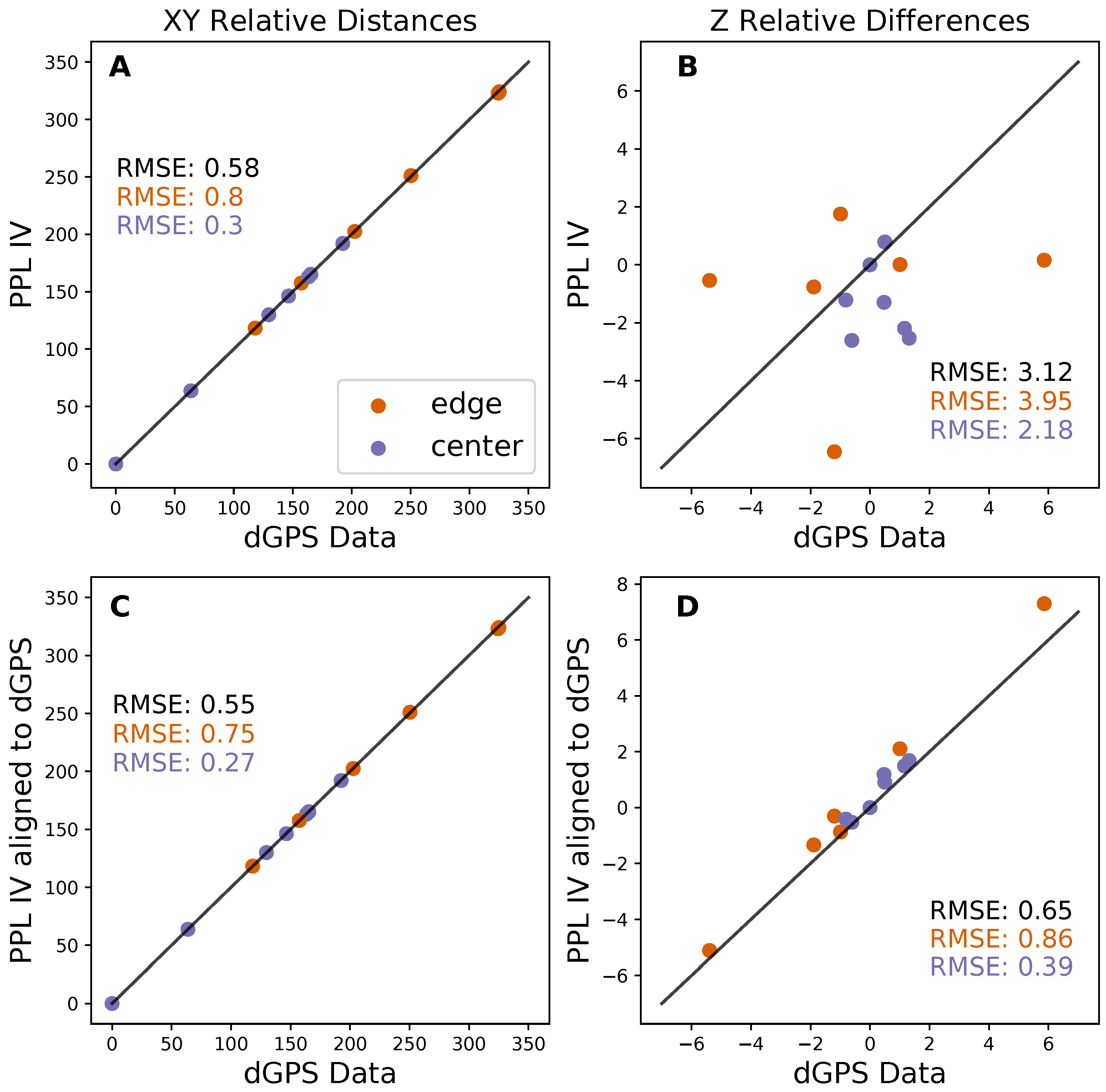
Ground subsidence and erosion processes caused by permafrost thaw pose a high risk to infrastructure in the Arctic. Climate warming is increasingly accelerating the thawing of permafrost, emphasizing the need for thorough monitoring to detect damages and hazards at an early stage. The use of unoccupied aerial vehicles (UAVs) allows a fast and uncomplicated analysis of sub-meter changes across larger areas compared to manual surveys in the field. In our study, we investigated the potential of photogrammetry products derived from imagery acquired with off-the-shelf UAVs in order to provide a low-cost assessment of the risks of permafrost degradation along critical infrastructure. We tested a minimal drone setup without ground control points to derive high-resolution 3D point clouds via structure from motion (SfM) at a site affected by thermal erosion along the Dalton Highway on the North Slope of Alaska. For the sub-meter change analysis, we used a multiscale point cloud comparison which we improved by applying (i) denoising filters and (ii) alignment procedures to correct for horizontal and vertical offsets. Our results show a successful reduction in outliers and a thorough correction of the horizontal and vertical point cloud offset by a factor of 6 and 10, respectively. In a defined point cloud subset of an erosion feature, we derive a median land surface displacement of 0.35 m from 2018 to 2019. Projecting the development of the erosion feature, we observe an expansion to NNE, following the ice-wedge polygon network. With a land surface displacement of 0.35 m and an alignment root mean square error of 0.99 m, we find our workflow is best suitable for detecting and quantifying rapid land surface changes. For a future improvement of the workflow, we recommend using alternate flight patterns and an enhancement of the point cloud comparison algorithm.
Keywords: permafrost degradation; consumer-grade unoccupied aerial vehicle; North Slope Alaska; land surface displacement; point cloud alignment; structure from motion; M3C2 permafrost degradation; consumer-grade unoccupied aerial vehicle; North Slope Alaska; land surface displacement; point cloud alignment; structure from motion; M3C2