Article

Mapping Area Changes of Glacial Lakes Using Stacks of Optical Satellite Images

by
Varvara Bazilova
1,2,* and
Andreas Kääb
1
1
Department of Geosciences, University of Oslo, P.O. Box 1047, 0316 Oslo, Norway
2
Department of Physical Geography, Utrecht University, P.O. Box 80115, 3508 TC Utrecht, The Netherlands
*
Author to whom correspondence should be addressed.
Remote Sens. 2022, 14(23), 5973; https://doi.org/10.3390/rs14235973
Submission received: 8 September 2022 / Revised: 19 November 2022 / Accepted: 22 November 2022 / Published: 25 November 2022
(This article belongs to the Special Issue Remote Sensing of the Cryosphere)

Abstract

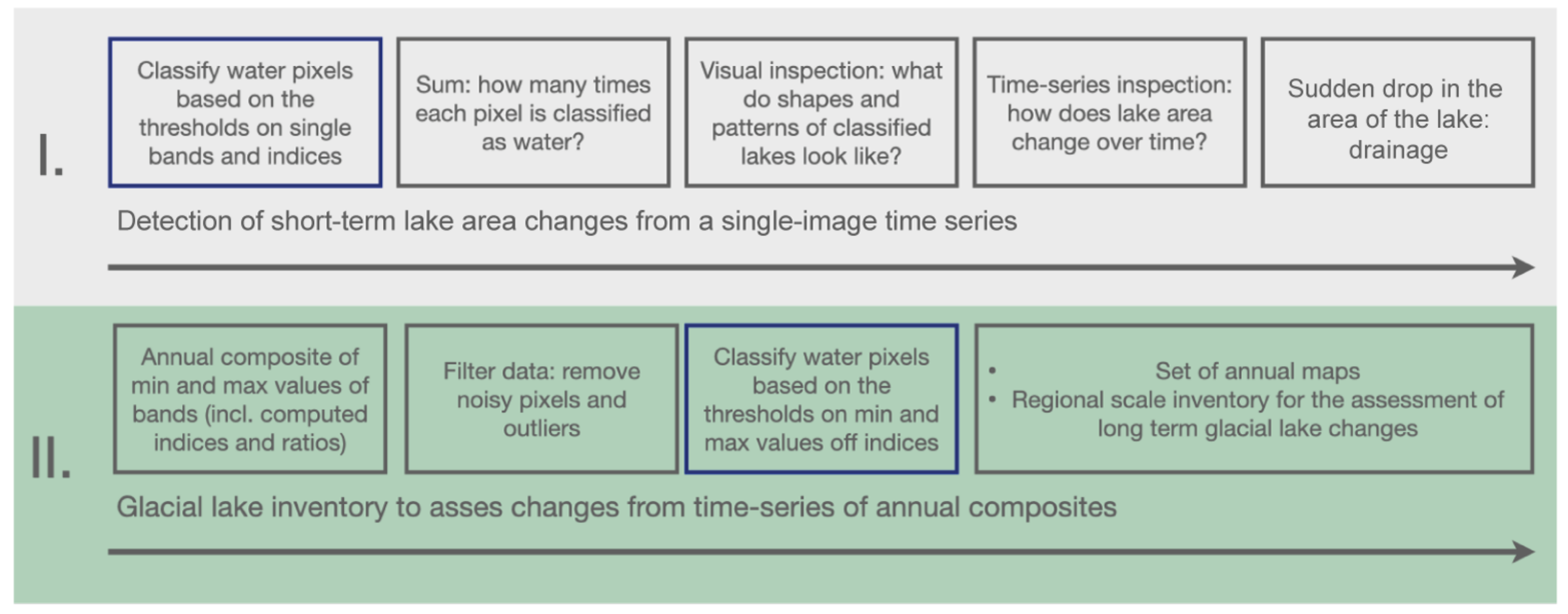
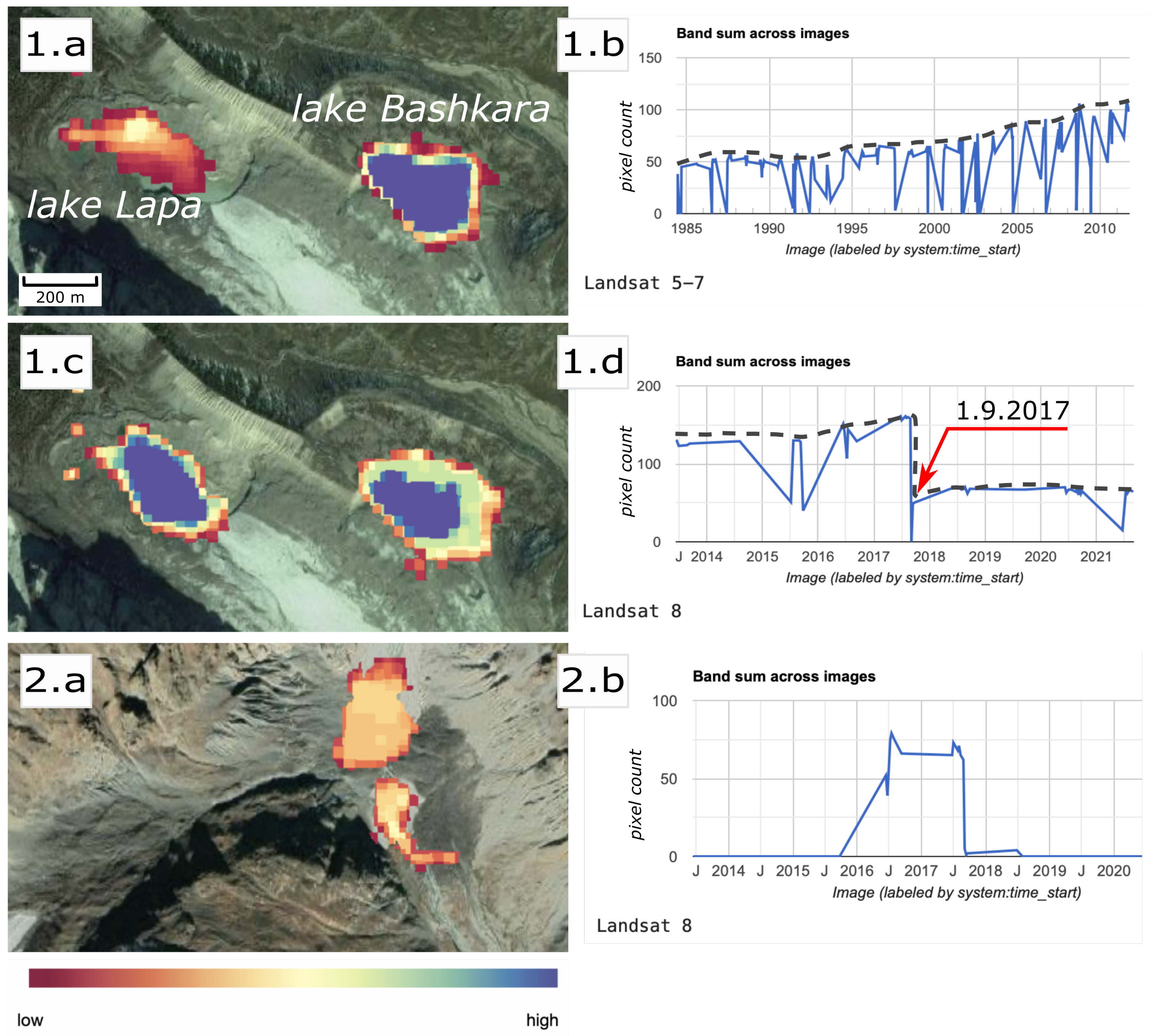
Glacial lakes are an important and dynamic component of terrestrial meltwater storage, responding to climate change and glacier retreat. Although there is evidence of rapid worldwide growth of glacial lakes, changes in frequency and magnitude of glacier lake outbursts under climatic changes are not yet understood. This study proposes and discusses a method framework for regional-scale mapping of glacial lakes and area change detection using large time-series of optical satellite images and the cloud processing tool Google Earth Engine in a semi-automatic way. The methods are presented for two temporal scales, from the 2-week Landsat revisit period to annual resolution. The proposed methods show how constructing an annual composite of pixel values such as minimum or maximum values can help to overcome typical problems associated with water mapping from optical satellite data such as clouds, or terrain and cloud shadows. For annual-resolution glacial lake mapping, our method set only involves two different band ratios based on multispectral satellite images. The study demonstrates how the proposed method framework can be applied to detect rapid lake area changes and to produce a complete regional-scale glacial lake inventory, using the Greater Caucasus as example.
Keywords: glacial lakes; glacial lake drainages; water body mapping; earth engine; multispectral images glacial lakes; glacial lake drainages; water body mapping; earth engine; multispectral images