Article

Wildfire Risk Assessment in Liangshan Prefecture, China Based on An Integration Machine Learning Algorithm


1
Faculty of Geosciences and Environmental Engineering, Southwest Jiaotong University, Chengdu 610031, China
2
State-Province Joint Engineering Laboratory of Spatial Information Technology of High-Speed Rail Safety, Southwest Jiaotong University, Chengdu 610031, China
*
Author to whom correspondence should be addressed.
Remote Sens. 2022, 14(18), 4592; https://doi.org/10.3390/rs14184592
Submission received: 16 August 2022 / Revised: 6 September 2022 / Accepted: 9 September 2022 / Published: 14 September 2022

Abstract

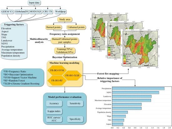
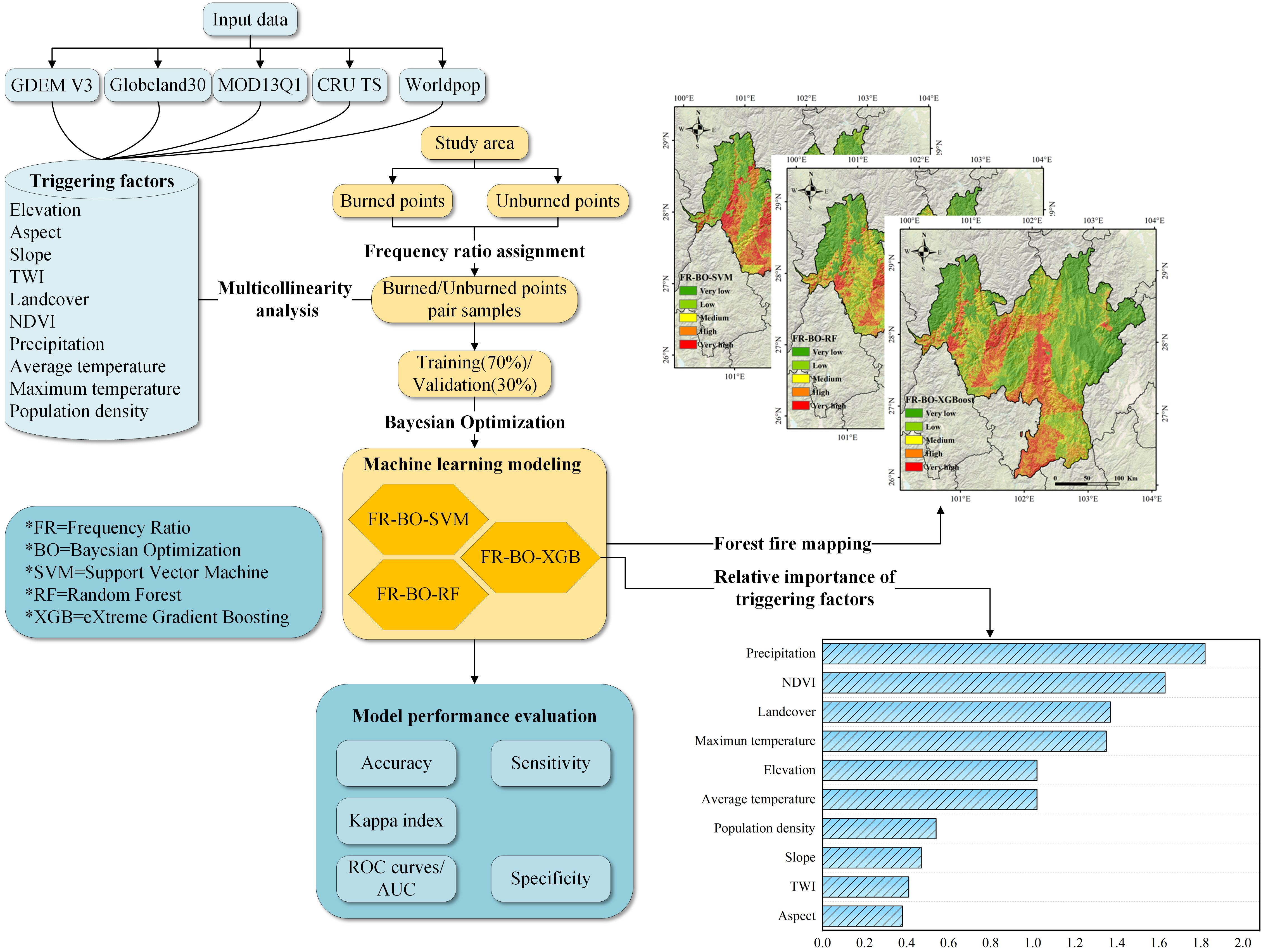
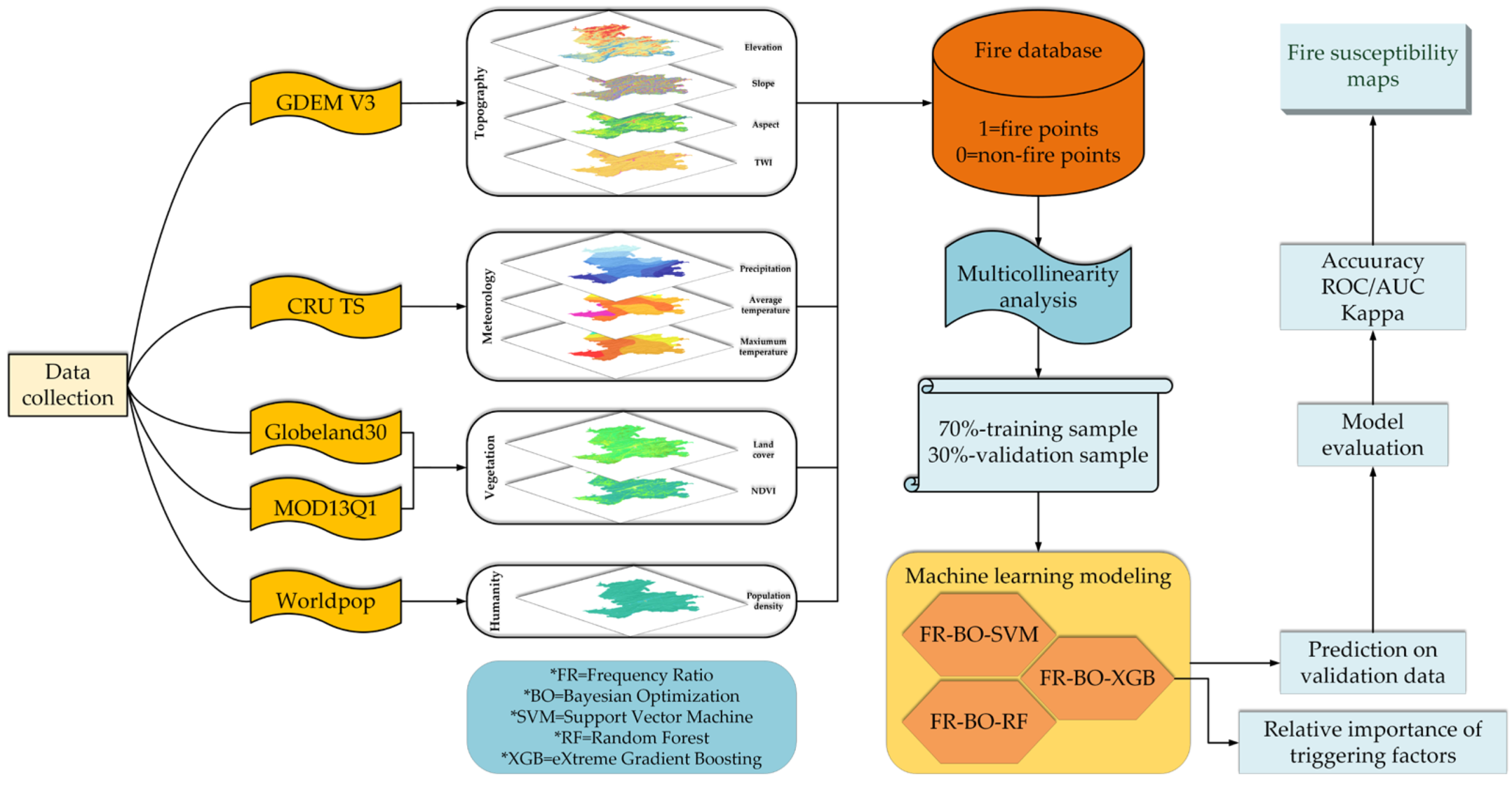
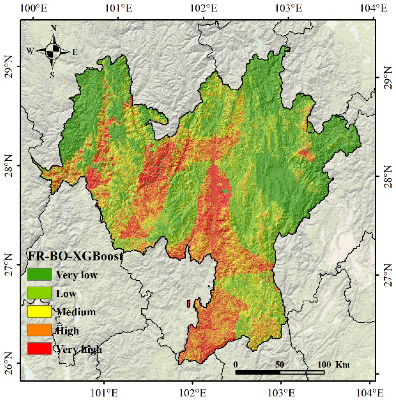
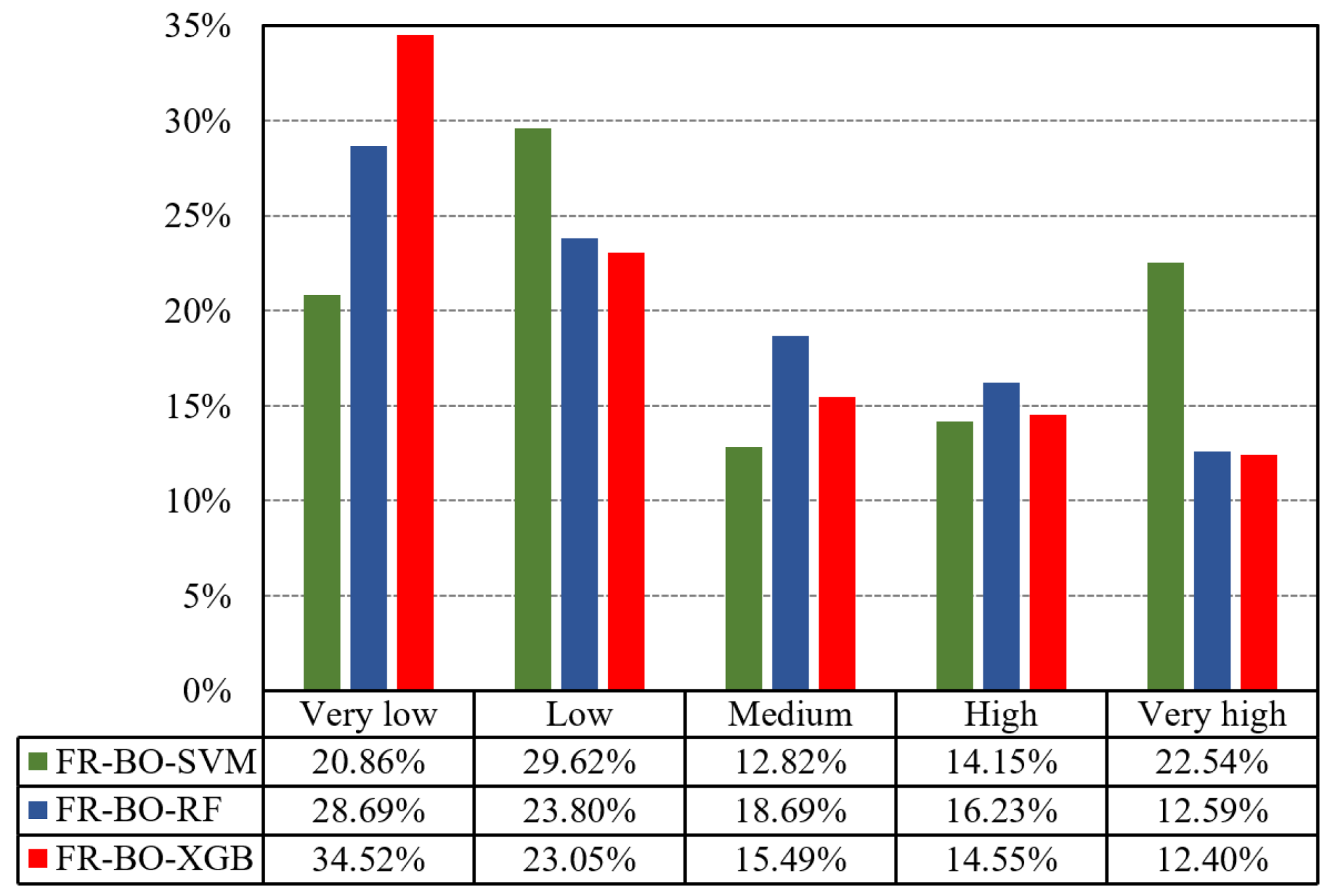
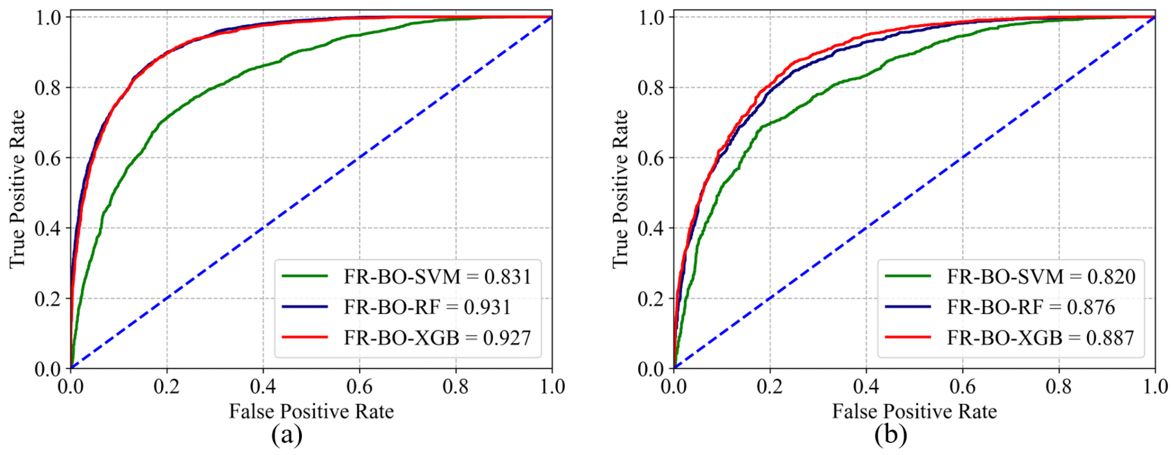
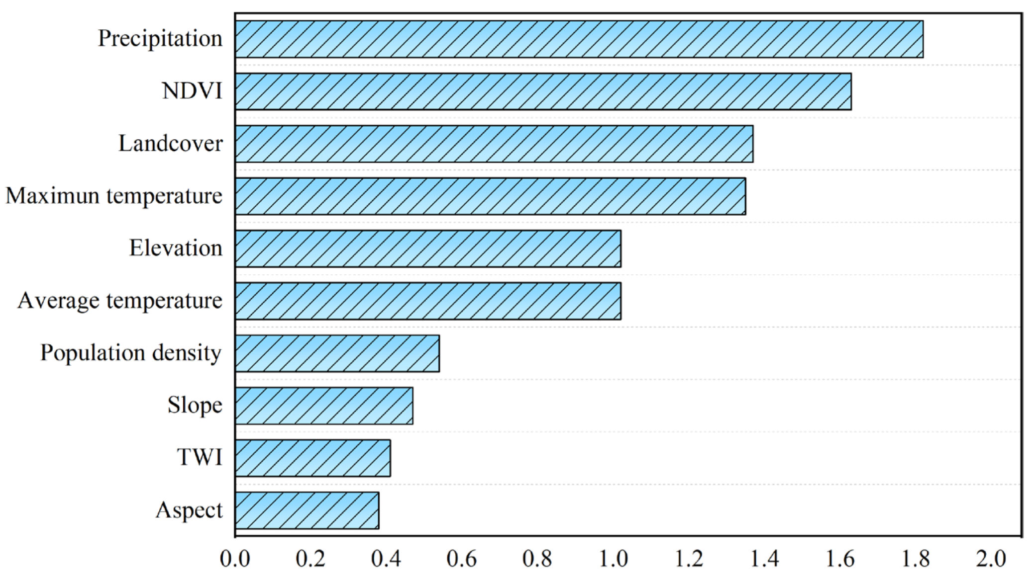
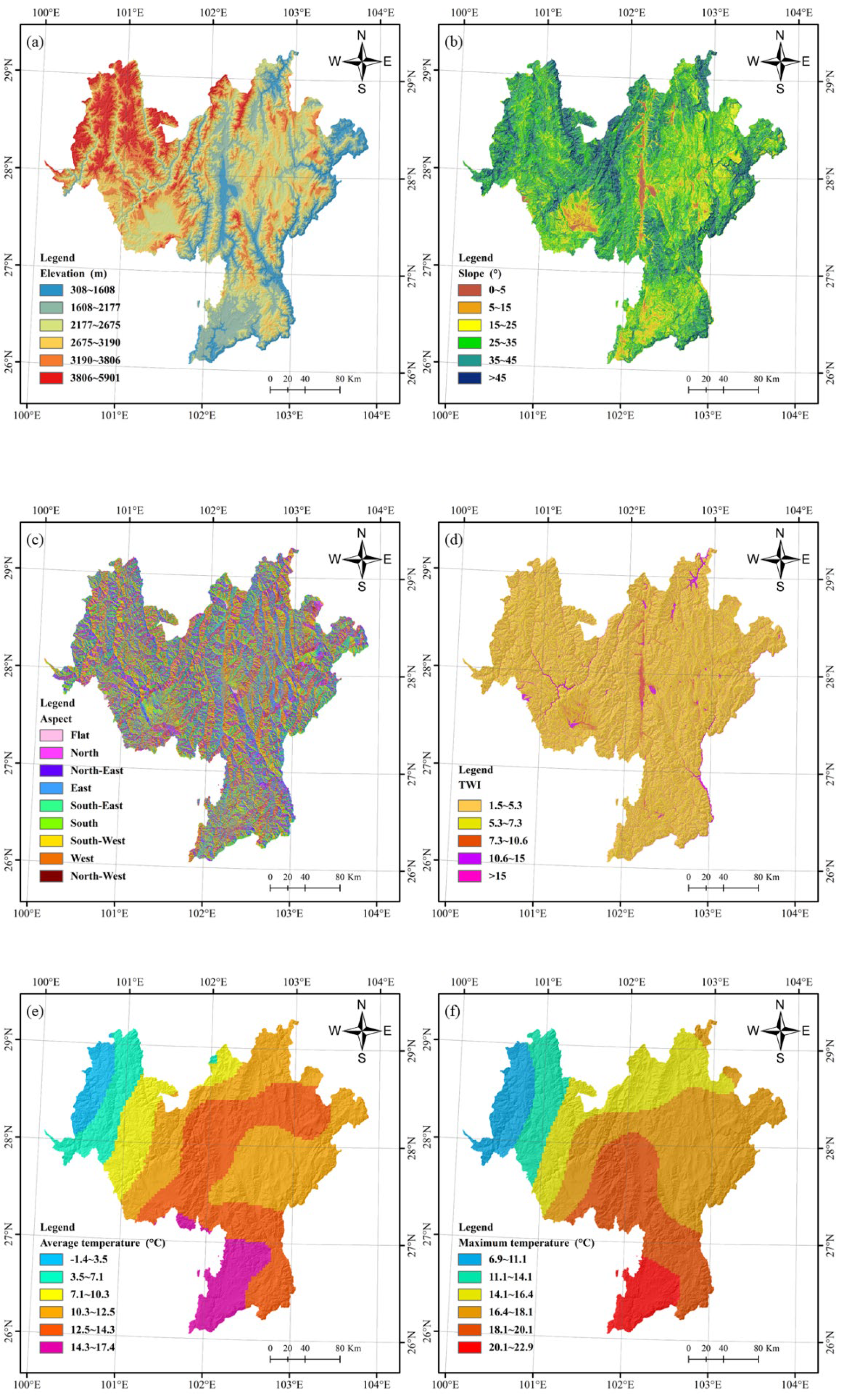
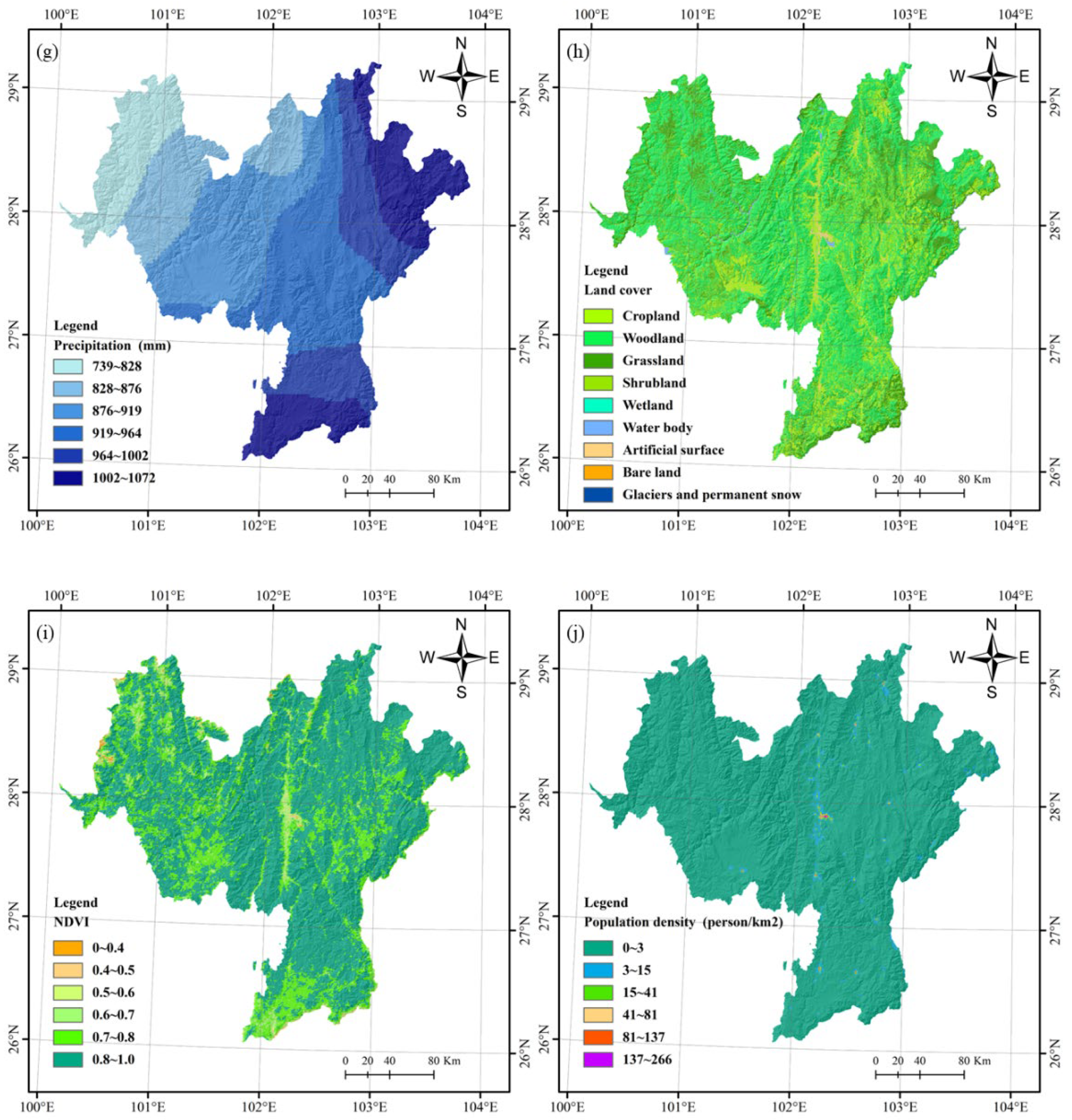
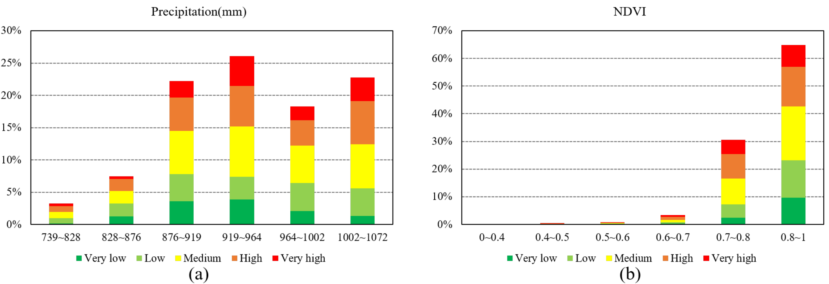
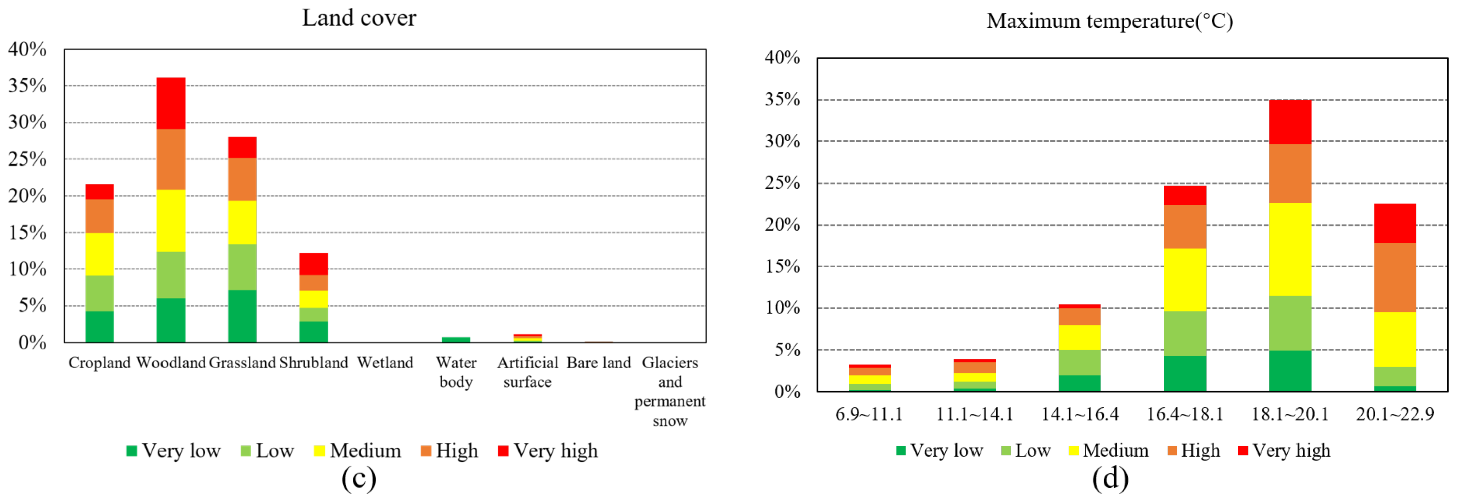
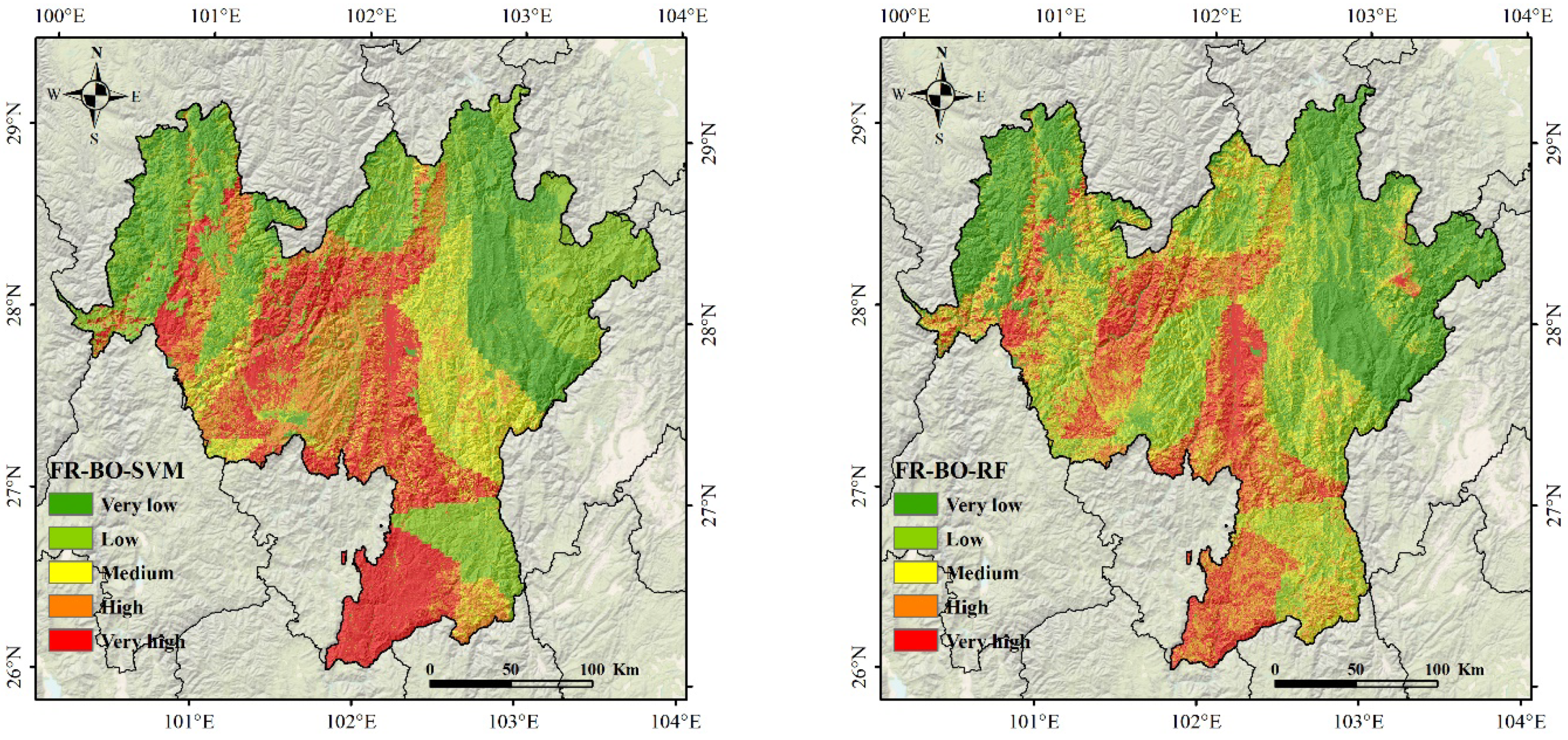
Previous wildfire risk assessments have problems such as subjectivity of weight allocation and the linearization of statistical models, resulting in generally low robustness and low generalization ability of fire risk assessment models. Therefore, in this paper, we explored the potential of integration machine learning algorithms to build wildfire risk assessment models. Based on analyzing fire data’s spatial and temporal distribution, we selected 10 triggering factors of topography, meteorology, vegetation, and human activities, using frequency ratio (FR) to provide uniform data representation of triggering factors. Next, we used the Bayesian optimization (BO) algorithm to perform hyperparametric optimization solutions for various machine learning models: support vector machine (SVM), random forest (RF), and extreme gradient boosting (XGBoost). Finally, we constructed an integration machine learning algorithm to acquire a fire risk grading map and the importance evaluation corresponding to each triggering factor. For validation purposes, we selected Liangshan Prefecture in Sichuan Province as the specific study area and obtained MCD64A1 burned area product to extract the extent of burned areas in Liangshan Prefecture from 2011 to 2020. The accuracy, kappa coefficient, and area under curve (AUC) were then applied to assess the predictive power and consistency of the fire risk classification maps. The experimental analysis showed that among the three models, FR-BO-XGBoost had the best performance in wildfire risk assessment in the Liangshan region (AUC = 0.887), followed by FR-BO-RF (AUC = 0.876) and FR-BO-SVM (AUC = 0.820). The feature importance result indicated that the study area’s most significant effects on wildfires were precipitation, NDVI, land cover, and maximum temperature. The proposed method avoided the subjective weighting and model linearization problems. Compared with the previous methods, it automatically acquired the importance of the triggering factors to the wildfire, which had certain advantages in wildfire risk assessment, and was worthy of further promotion.
Keywords: frequency ratio; MCD64A1; Bayesian optimization; support vector machine; random forest; extreme gradient boosting frequency ratio; MCD64A1; Bayesian optimization; support vector machine; random forest; extreme gradient boosting
Graphical Abstract