Article

Relative Sea-Level Rise Scenario for 2100 along the Coast of South Eastern Sicily (Italy) by InSAR Data, Satellite Images and High-Resolution Topography

by
Marco Anzidei
1,
Giovanni Scicchitano
2,
Giovanni Scardino
2,*,
Christian Bignami
1,
Cristiano Tolomei
1,
Antonio Vecchio
3,4,
Enrico Serpelloni
1,
Vincenzo De Santis
2,
Carmelo Monaco
5,6,7,
Maurilio Milella
8,
Arcangelo Piscitelli
8 and
Giuseppe Mastronuzzi
2
1
Istituto Nazionale di Geofisica e Vulcanologia, 00143 Roma, Italy
2
Dipartimento di Scienze della Terra e Geoambientali, Università degli Studi di Bari Aldo Moro, 70121 Bari, Italy
3
Radboud Radio Lab, Department of Astrophysics/IMAPP–Radboud University, P.O. Box 9010, 6500 GL Nijmegen, The Netherlands
4
LESIA, Observatoire de Paris, Université PSL, CNRS, Sorbonne Université, Univ. Paris Diderot, Sorbonne Paris Cité, 5 Place Jules Janssen, 92195 Meudon, France
5
Dipartimento di Scienze Biologiche, Geologiche e Ambientali, Università degli Studi di Catania, 95129 Catania, Italy
6
CRUST—Interuniversity Center for 3D Seismotectonics with Territorial Applications, 66100 Chieti, Italy
7
Istituto Nazionale di Geofisica e Vulcanologia, Osservatorio Etneo, 95125 Catania, Italy
8
Environmental Surveys S.r.l., Spin-Off Università degli Studi di Bari Aldo Moro, 74121 Taranto, Italy
*
Author to whom correspondence should be addressed.
Remote Sens. 2021, 13(6), 1108; https://doi.org/10.3390/rs13061108
Submission received: 25 January 2021 / Revised: 11 March 2021 / Accepted: 11 March 2021 / Published: 15 March 2021
(This article belongs to the Special Issue New Challenges in Sea Level Rise Observation)

Abstract

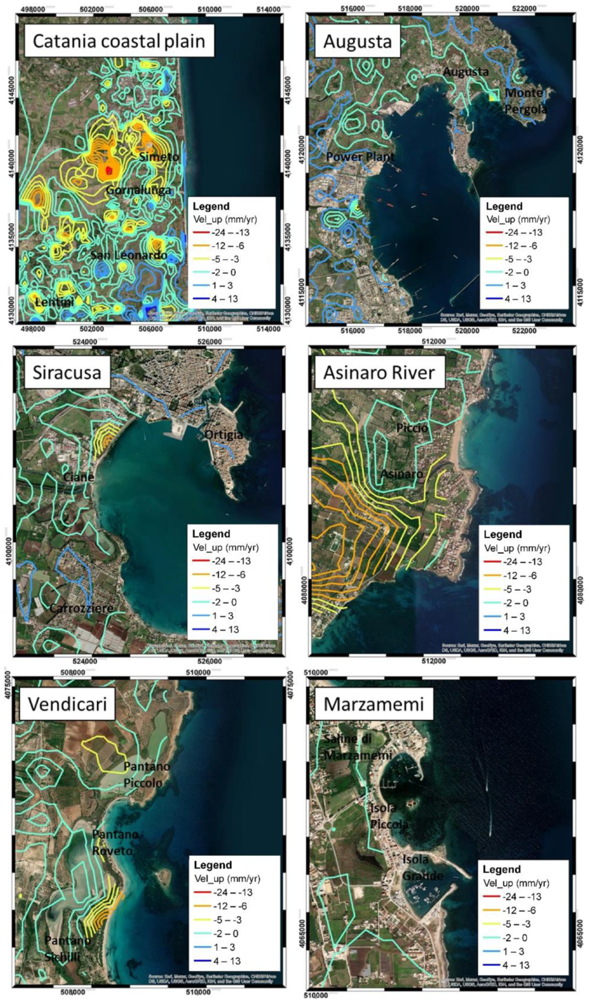
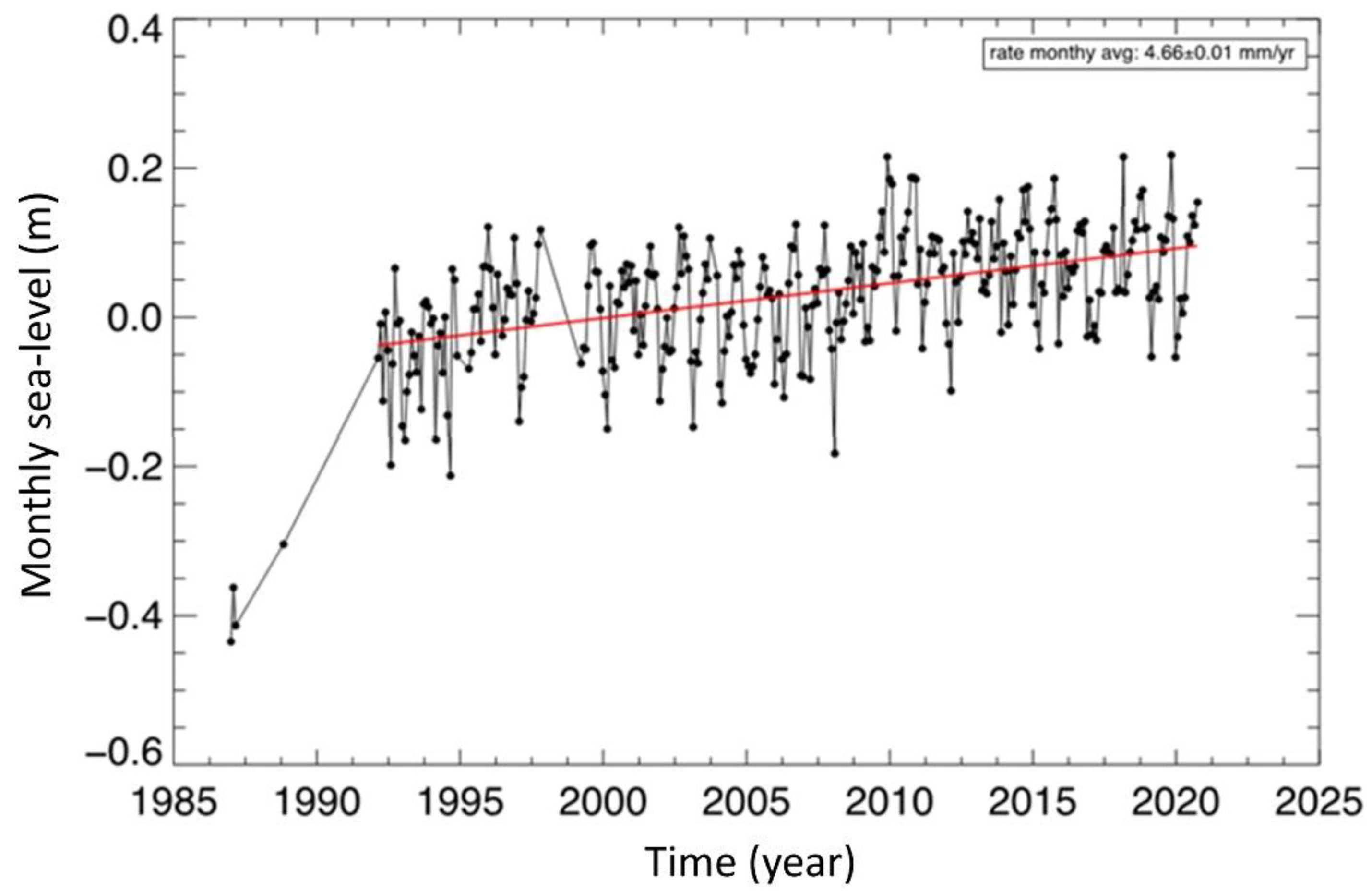
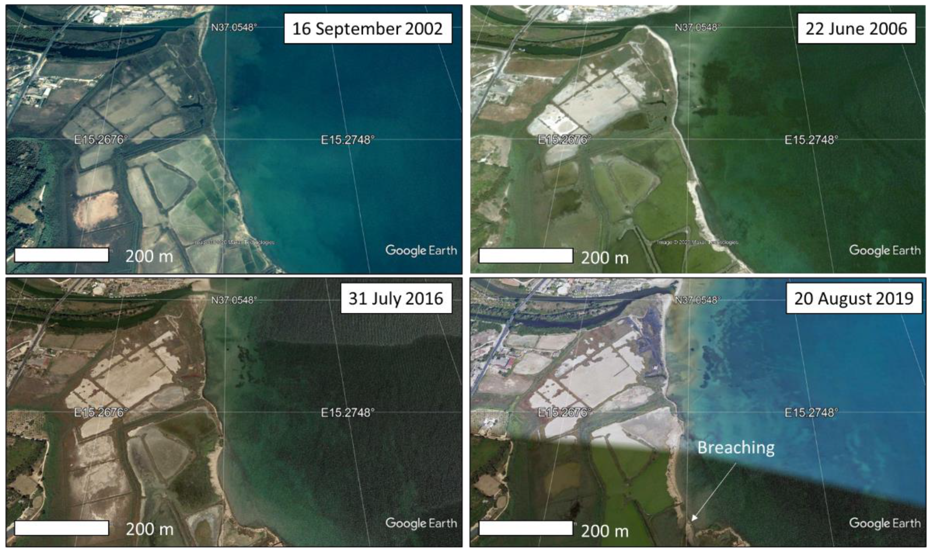
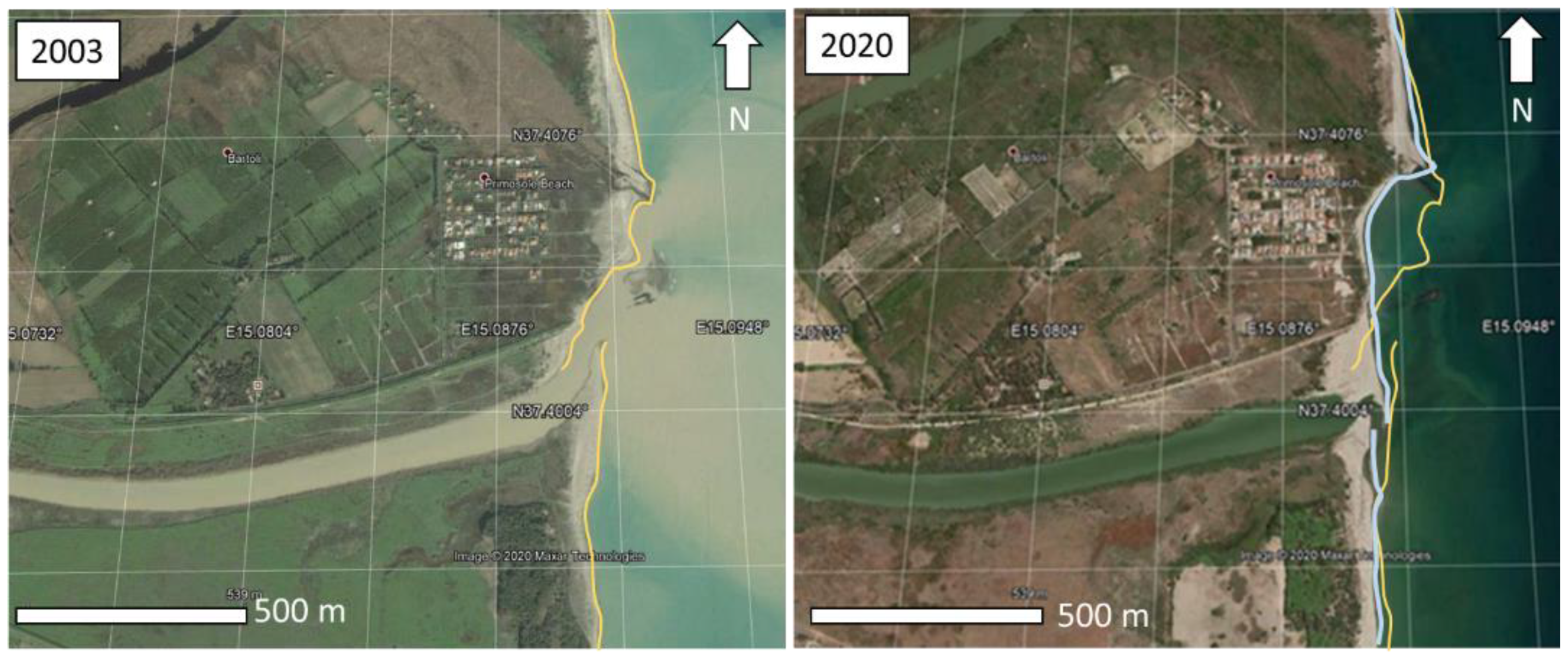
The global sea-level rise (SLR) projections for the next few decades are the basis for developing flooding maps that depict the expected hazard scenarios. However, the spatially variable land subsidence has generally not been considered in the current projections. In this study, we use geodetic data from global navigation satellite system (GNSS), synthetic aperture radar interferometric measurements (InSAR) and sea-level data from tidal stations to show the combined effects of land subsidence and SLR along the coast between Catania and Marzamemi, in south-eastern Sicily (southern Italy). This is one of the most active tectonic areas of the Mediterranean basin, which drives accelerated SLR, continuous coastal retreat and increasing effects of flooding and storms surges. We focus on six selected areas, which show valuable coastal infrastructures and natural reserves where the expected SLR in the next few years could be a potential cause of significant land flooding and morphological changes of the coastal strip. Through a multidisciplinary study, the multi-temporal flooding scenarios until 2100, have been estimated. Results are based on the spatially variable rates of vertical land movements (VLM), the topographic features of the area provided by airborne Light Detection And Ranging (LiDAR) data and the Intergovernmental Panel on Climate Change (IPCC) projections of SLR in the Representative Concentration Pathways RCP 2.6 and RCP 8.5 emission scenarios. In addition, from the analysis of the time series of optical satellite images, a coastal retreat up to 70 m has been observed at the Ciane river mouth (Siracusa) in the time span 2001–2019. Our results show a diffuse land subsidence locally exceeding 10 ± 2.5 mm/year in some areas, due to compacting artificial landfill, salt marshes and Holocene soft deposits. Given ongoing land subsidence, a high end of RSLR in the RCP 8.5 at 0.52 ± 0.05 m and 1.52 ± 0.13 m is expected for 2050 AD and 2100 AD, respectively, with an exposed area of about 9.7 km2 that will be vulnerable to inundation in the next 80 years.
Keywords: Sicily; sea-level rise; subsidence; flooding scenario 2100 A.D.; InSAR; GNSS; LiDAR Sicily; sea-level rise; subsidence; flooding scenario 2100 A.D.; InSAR; GNSS; LiDAR
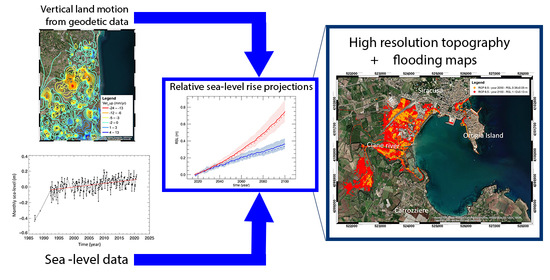
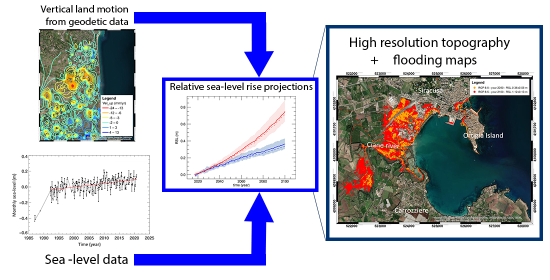
Graphical Abstract