Article

Spatiotemporal Monitoring of Soil CO2 Efflux in a Subtropical Forest during the Dry Season Based on Field Observations and Remote Sensing Imagery

1
Department of Physical Geography, Resources and Environment, School of Geography and Planning, Sun Yat-Sen University, Guangzhou 510275, China
2
Key Laboratory of Water Cycle and Related Land Surface Processes, Institute of Geographic Sciences and Natural Resources Research, Chinese Academy of Sciences, Beijing 100101, China
3
School of Geography and Tourism, Qufu Normal University, Rizhao 276825, China
4
Center of Land Research, Qufu Normal University, Rizhao 276825, China
5
State Key Laboratory of Desert and Oasis Ecology, Xinjiang Institute of Ecology and Geography, Chinese Academy of Sciences, Urumqi 830011, China
6
College of Geography and Tourism, Chongqing Normal University, Chongqing 401331, China
*
Author to whom correspondence should be addressed.
Remote Sens. 2021, 13(17), 3481; https://doi.org/10.3390/rs13173481
Submission received: 7 August 2021 / Revised: 28 August 2021 / Accepted: 30 August 2021 / Published: 2 September 2021

Abstract

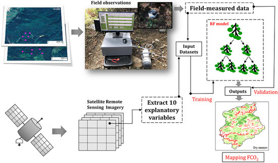
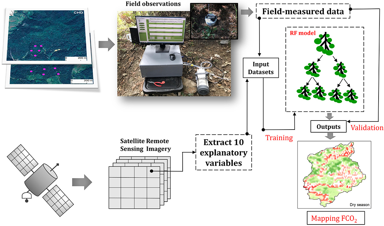
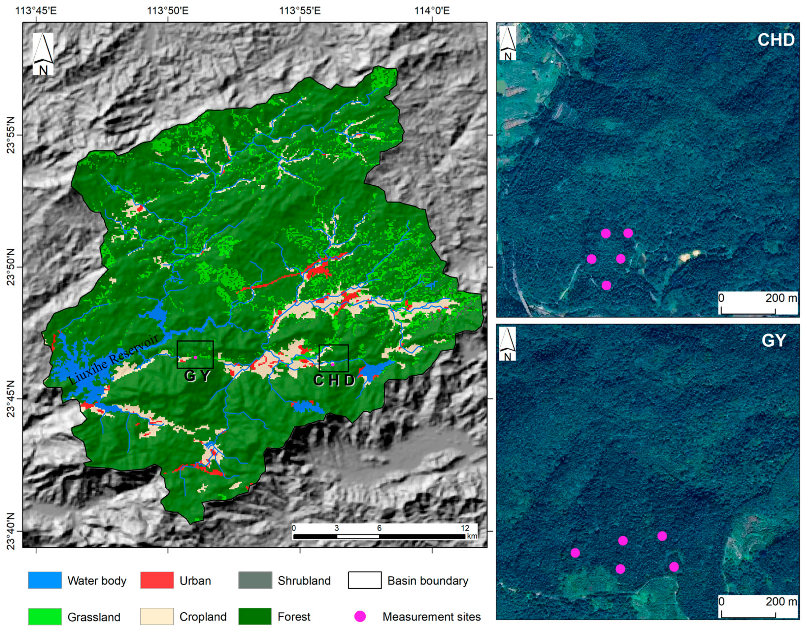
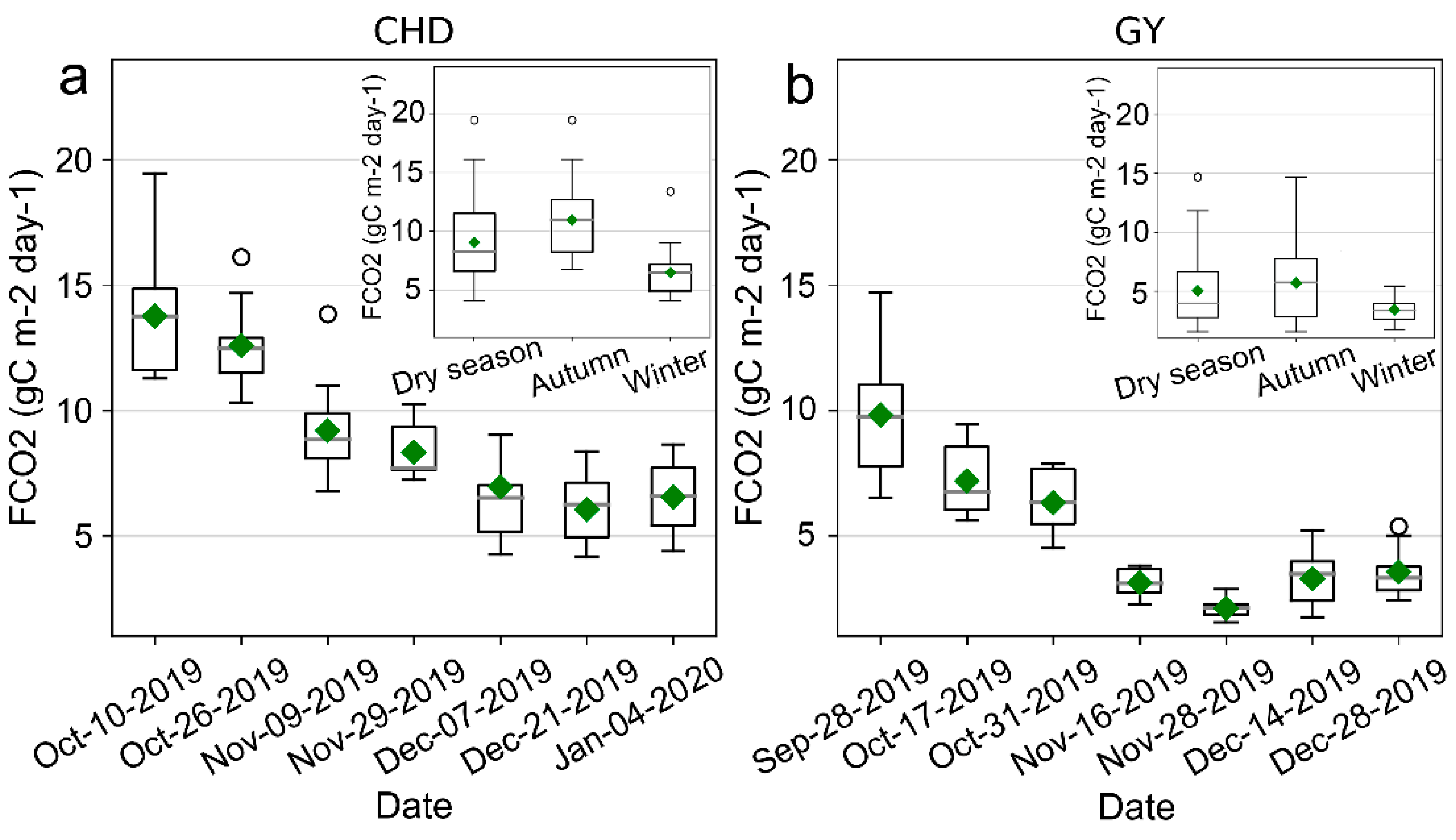
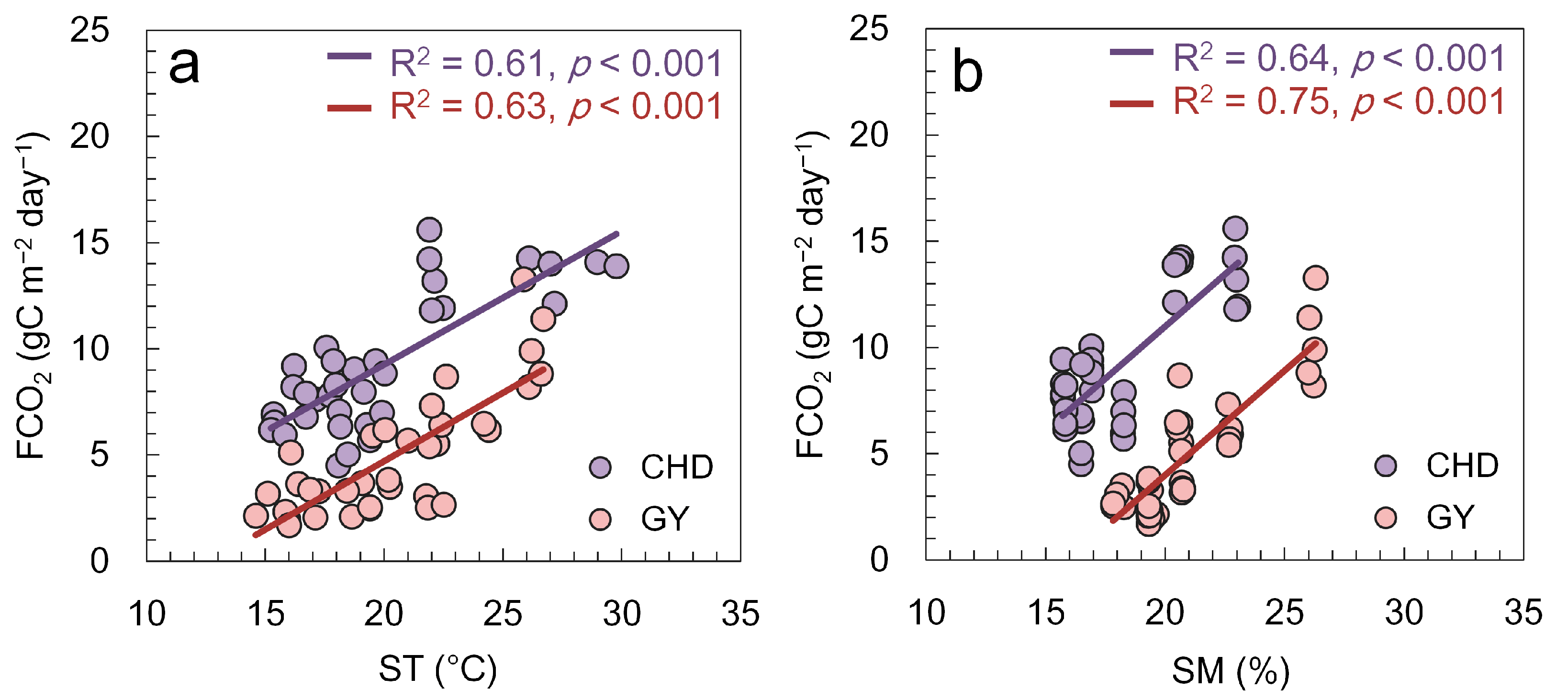
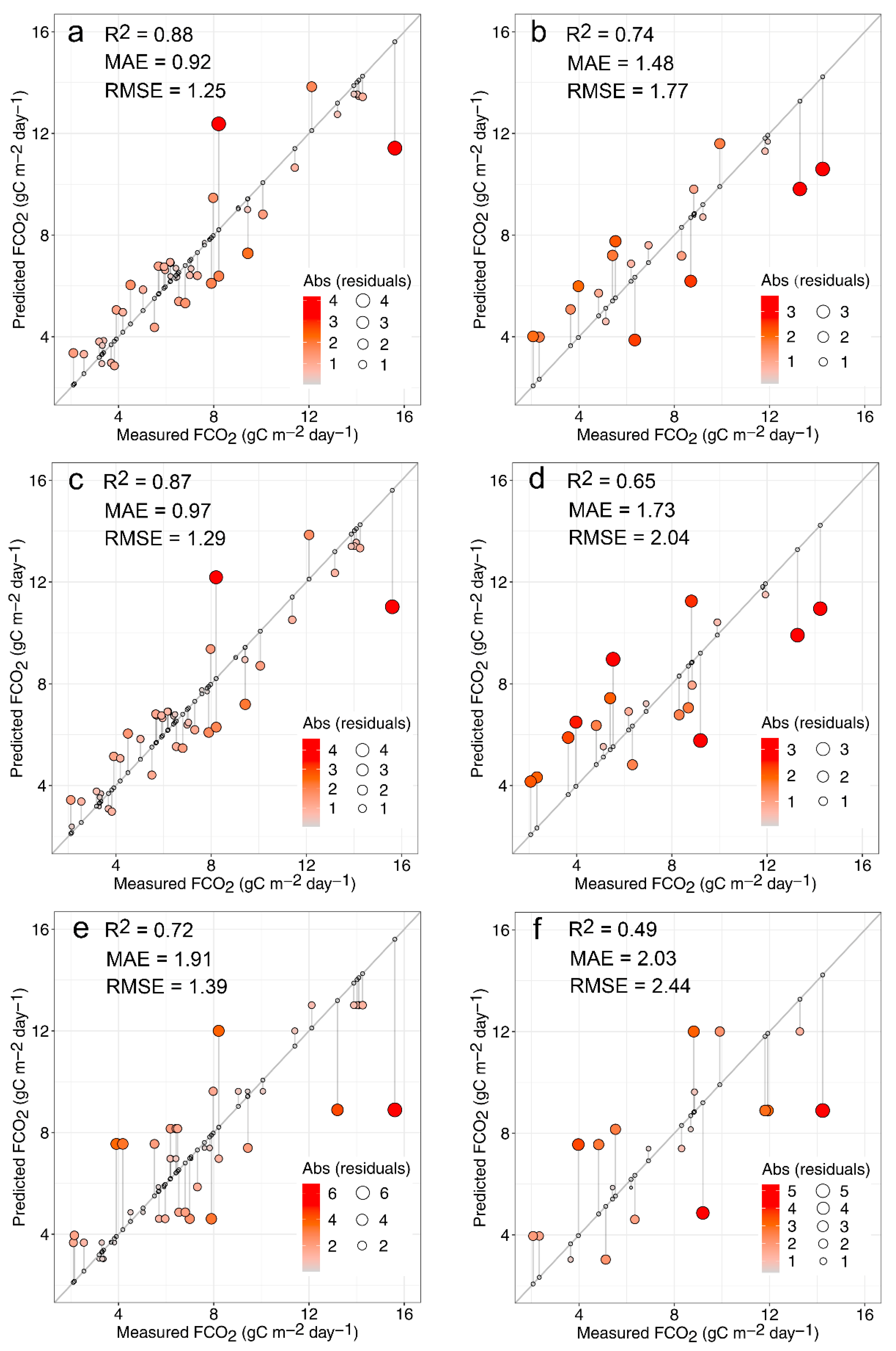
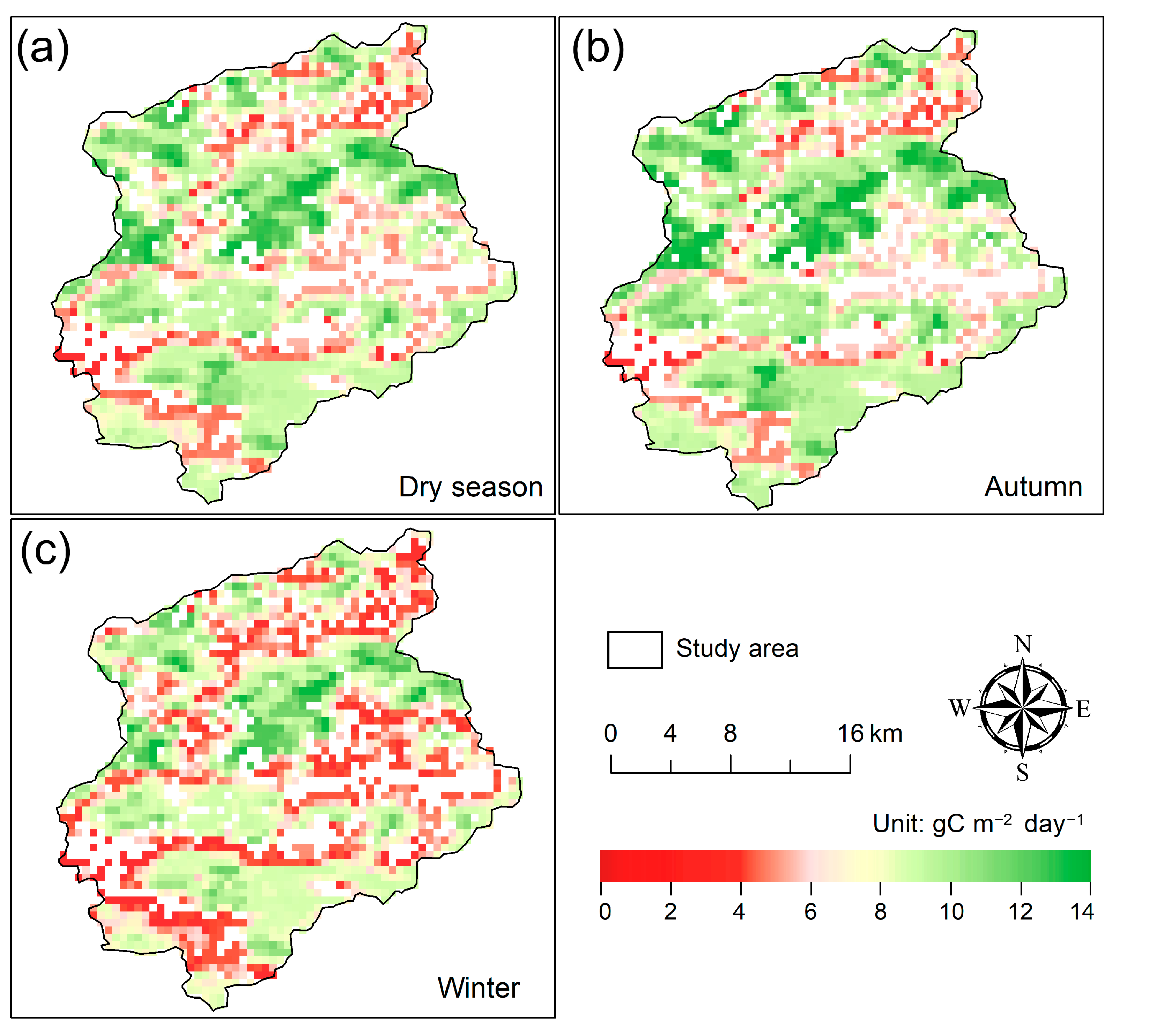
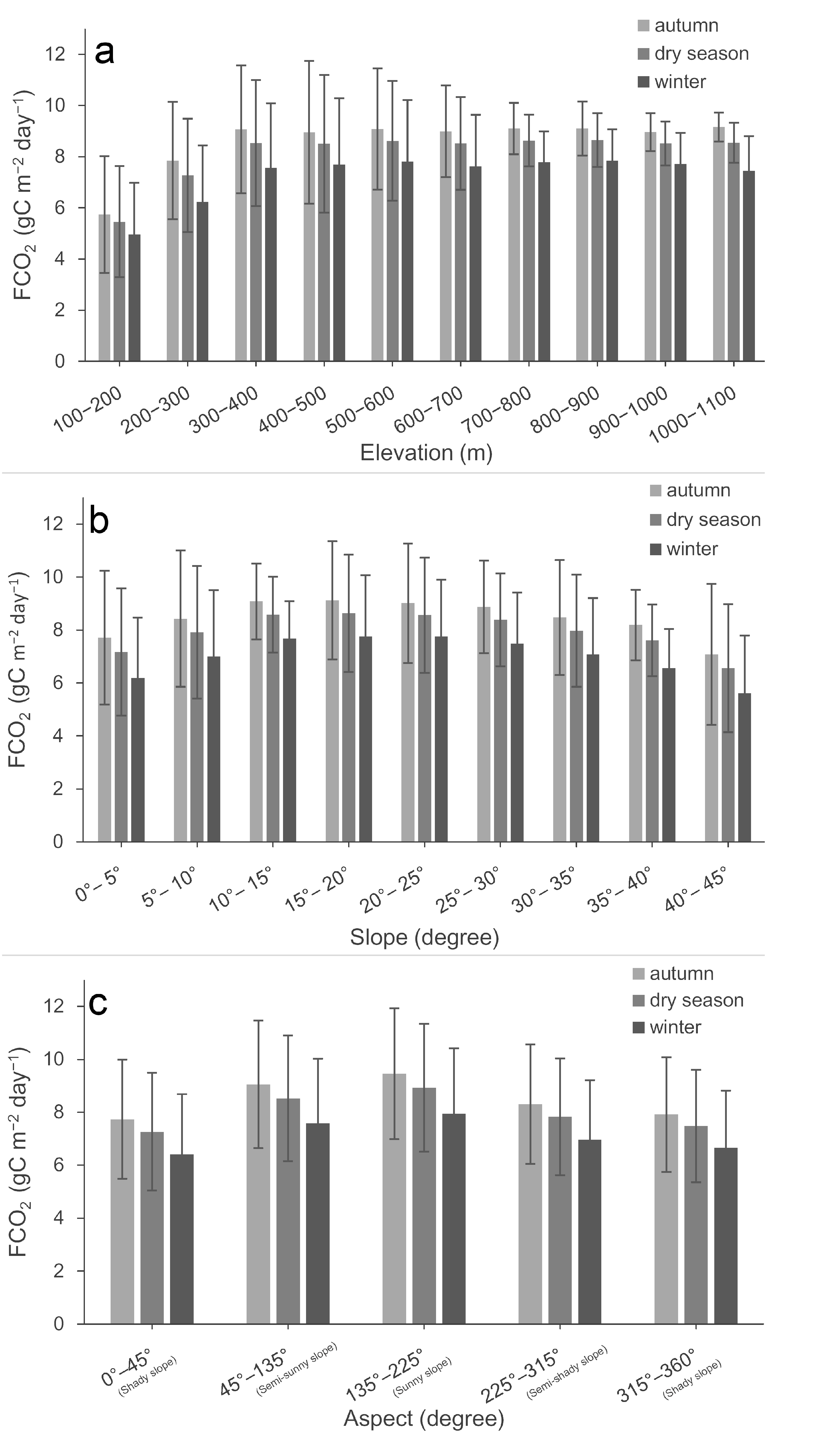
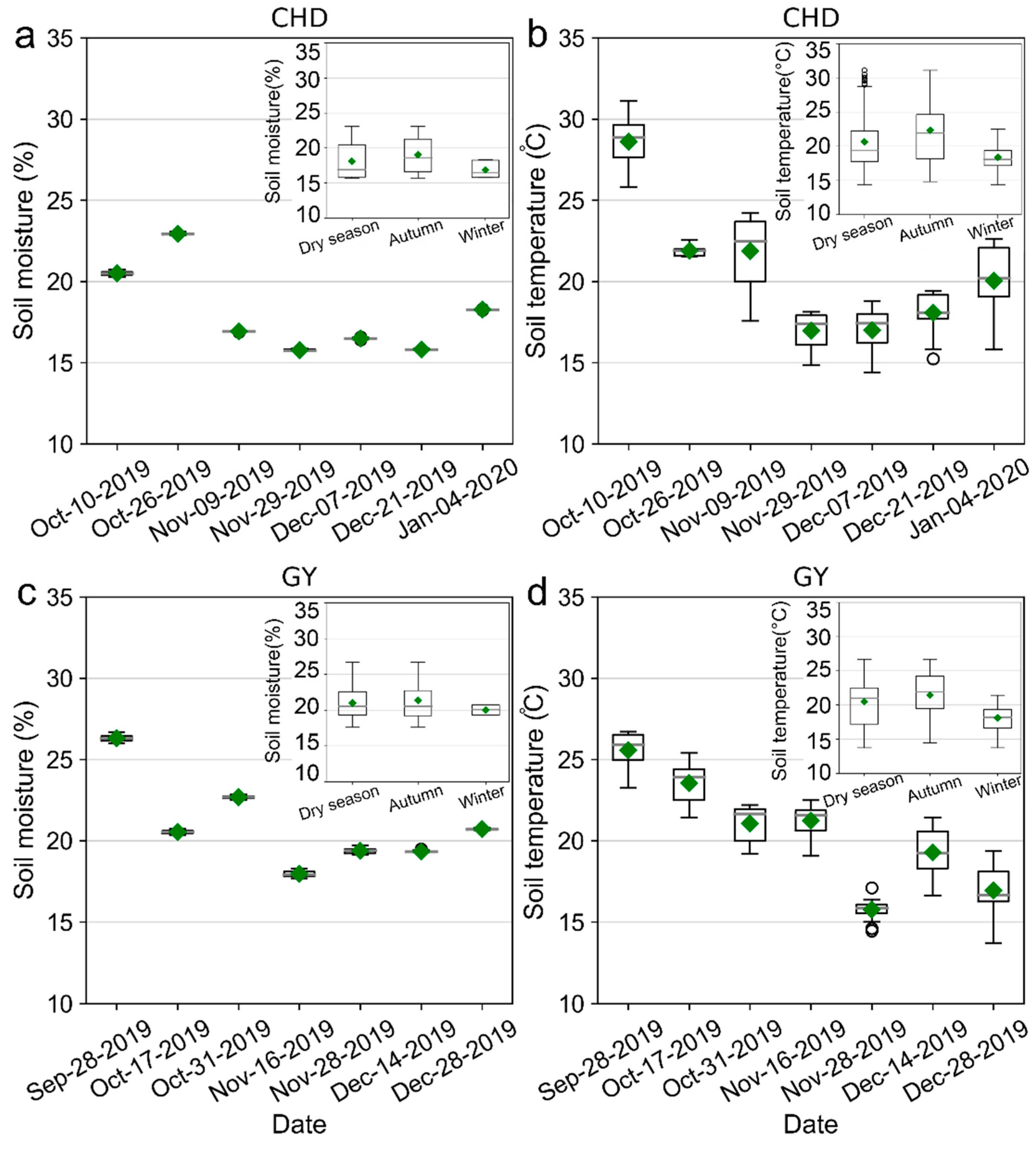
The CO2 efflux from forest soil (FCO2) is one of the largest components of the global carbon cycle. Accurate estimation of FCO2 can help us better understand the carbon cycle in forested areas and precisely predict future climate change. However, the scarcity of field-measured FCO2 data in the subtropical forested area greatly limits our understanding of FCO2 dynamics at regional and global scales. This study used an automatic cavity ring-down spectrophotometer (CRDS) analyzer to measure FCO2 in a typical subtropical forest of southern China in the dry season. We found that the measured FCO2 at two experimental areas experienced similar temporal trends in the dry season and reached the minima around December, whereas the mean FCO2 differed apparently across the two areas (9.05 vs. 5.03 g C m−2 day−1) during the dry season. Moreover, we found that both abiotic (soil temperature and moisture) and biotic (vegetation productivity) factors are significantly and positively correlated, respectively, with the FCO2 variation during the study period. Furthermore, a machine-learning random forest model (RF model) that incorporates remote sensing data is developed and used to predict the FCO2 pattern in the subtropical forest, and the topographic effects on spatiotemporal patterns of FCO2 were further investigated. The model evaluation indicated that the proposed model illustrated high prediction accuracy for the training and testing dataset. Based on the proposed model, the spatiotemporal patterns of FCO2 in the forested watershed that encloses the two monitoring sites were mapped. Results showed that the spatial distribution of FCO2 is obviously affected by topography: the high FCO2 values mainly occur in relatively high altitudinal areas, in slopes of 10–25°, and in sunny slopes. The results emphasized that future studies should consider topographical effects when simulating FCO2 in subtropical forests. Overall, our study unraveled the spatiotemporal variations of FCO2 and their driving factors in a subtropical forest of southern China in the dry season, and demonstrated that the proposed RF model in combination with remote sensing data can be a useful tool for predicting FCO2 in forested areas, particularly in subtropical and tropical forest ecosystems.
Keywords: forest soil CO2 flux; satellite remote sensing data; random forest algorithm; subtropical forest ecosystem forest soil CO2 flux; satellite remote sensing data; random forest algorithm; subtropical forest ecosystem
Graphical Abstract