Article

Assessment of the Spatial and Temporal Patterns of Cover Crops Using Remote Sensing
1
Department of Food, Agricultural and Biological Engineering, The Ohio State University, Columbus, OH 43210, USA
2
School of Environment and Natural Resources, The Ohio State University, Wooster, OH 44691, USA
3
Ohio State University Extension, The Ohio State University, Fremont, OH 43420, USA
*
Author to whom correspondence should be addressed.
Remote Sens. 2021, 13(14), 2689; https://doi.org/10.3390/rs13142689
Submission received: 1 June 2021 / Revised: 4 July 2021 / Accepted: 6 July 2021 / Published: 8 July 2021
(This article belongs to the Special Issue Remote Sensing and Vegetation Mapping)

Abstract

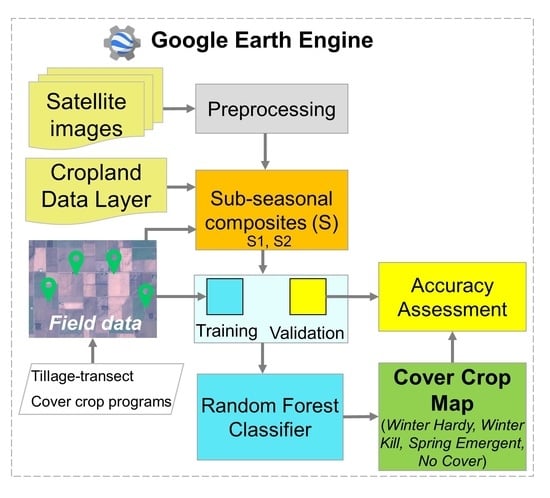
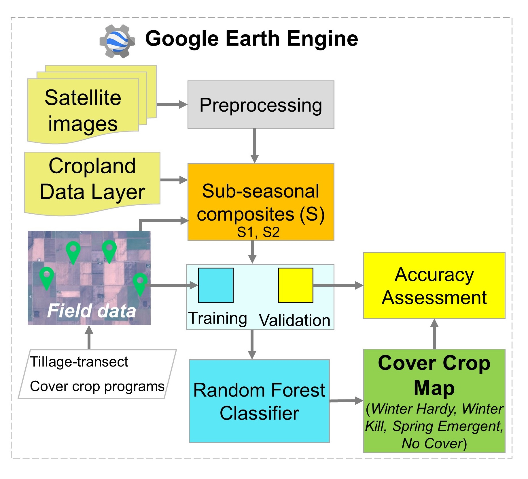
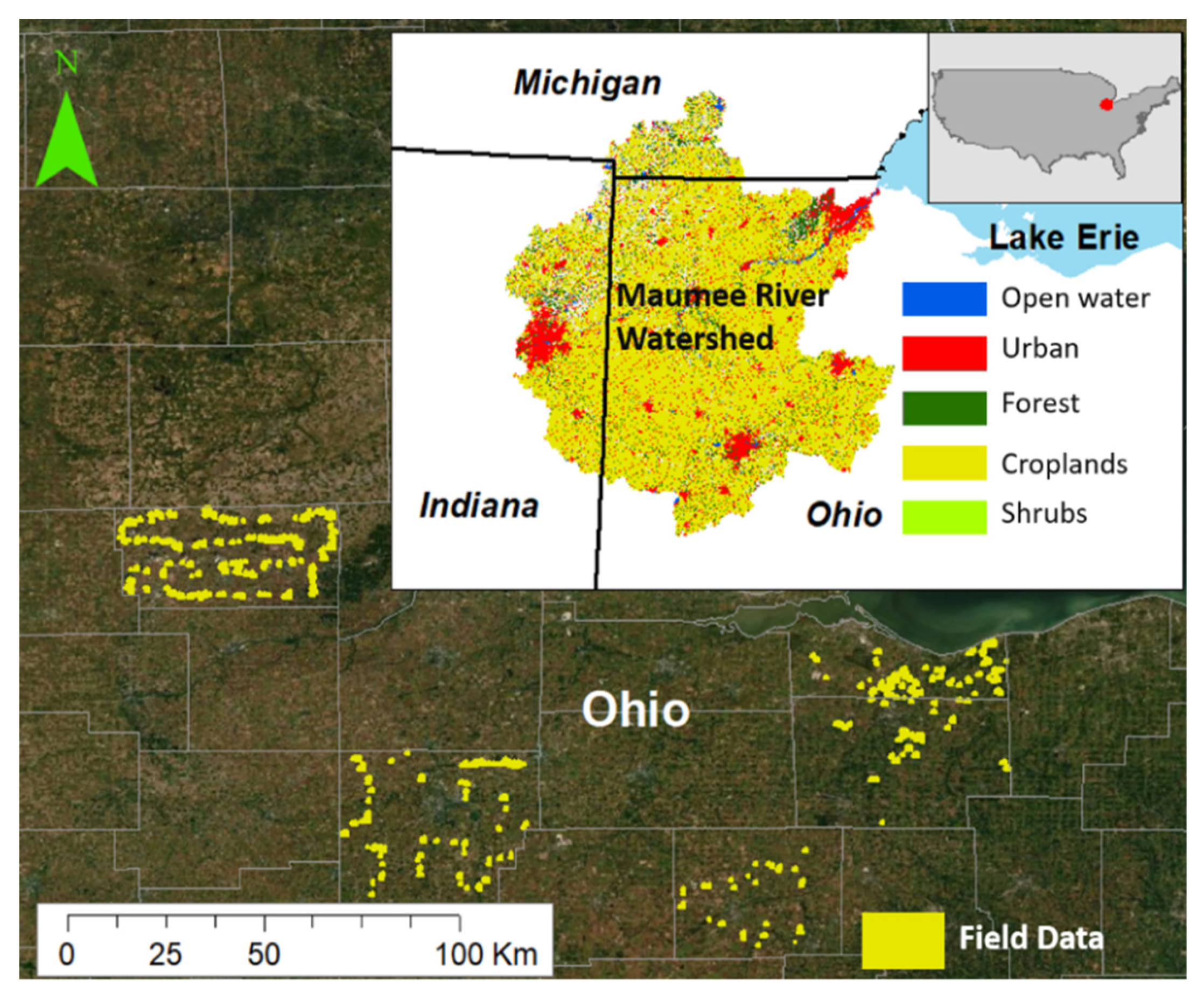
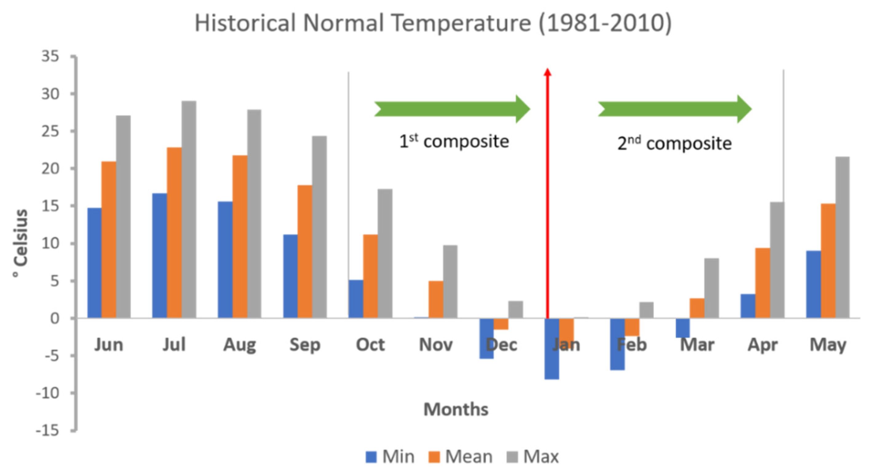
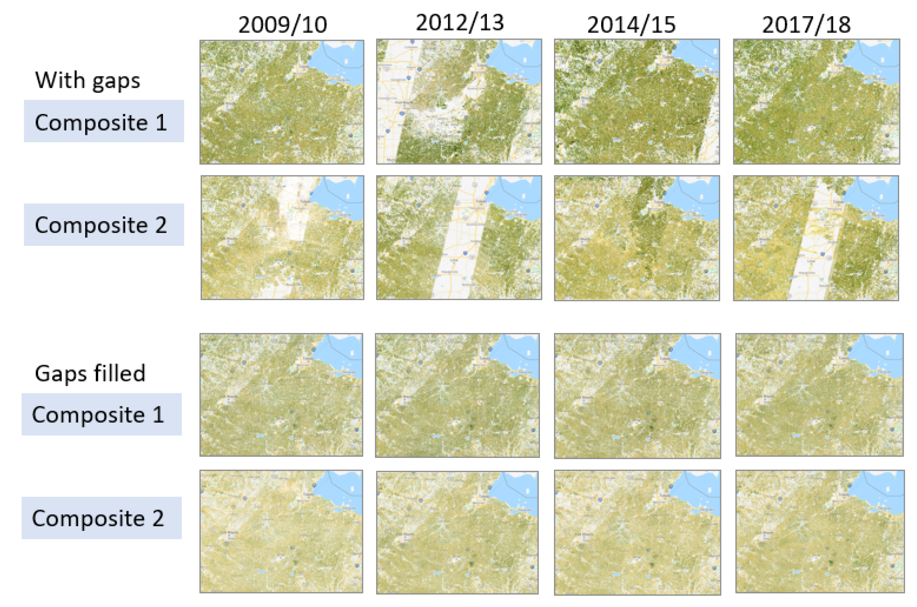
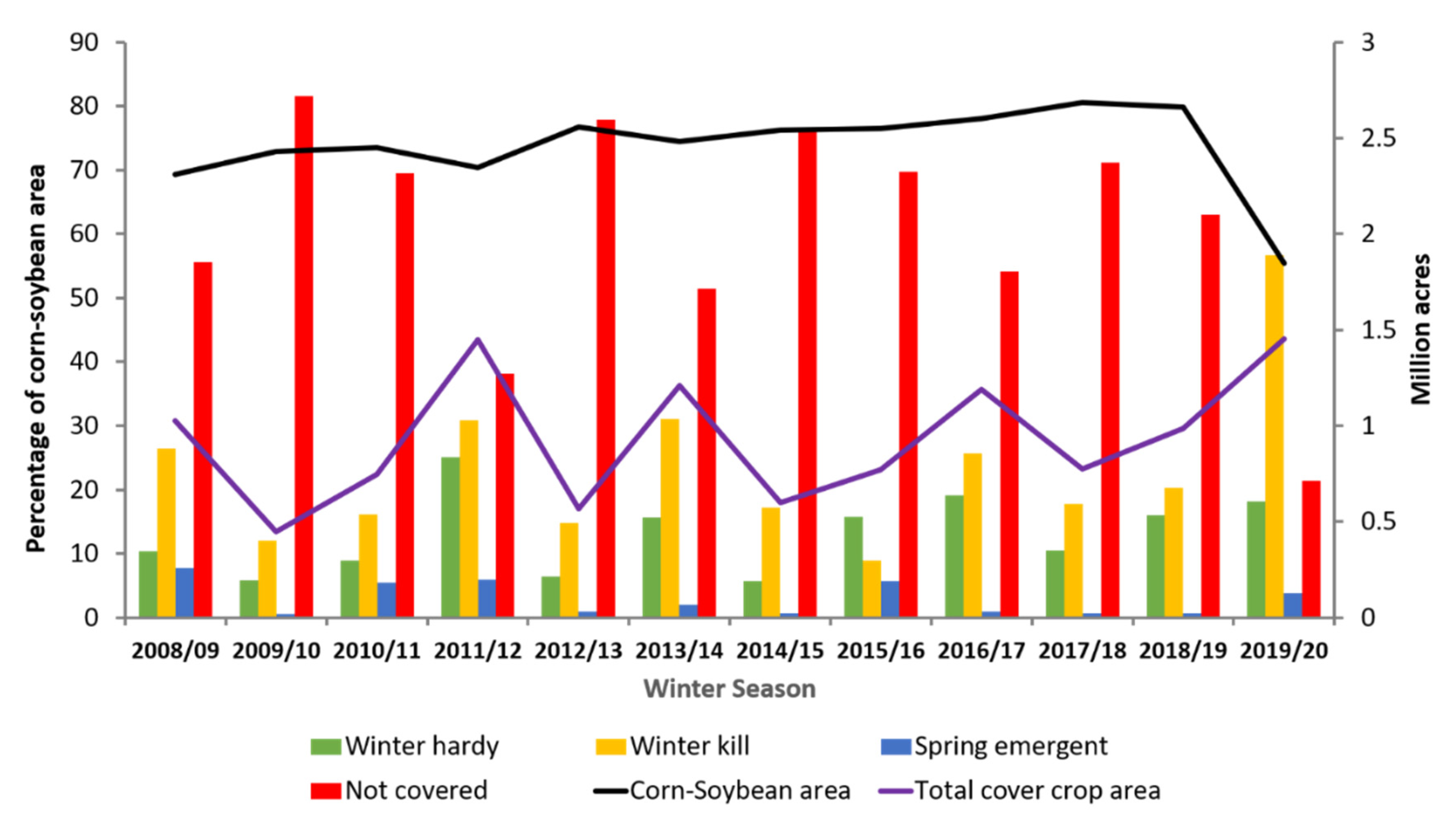
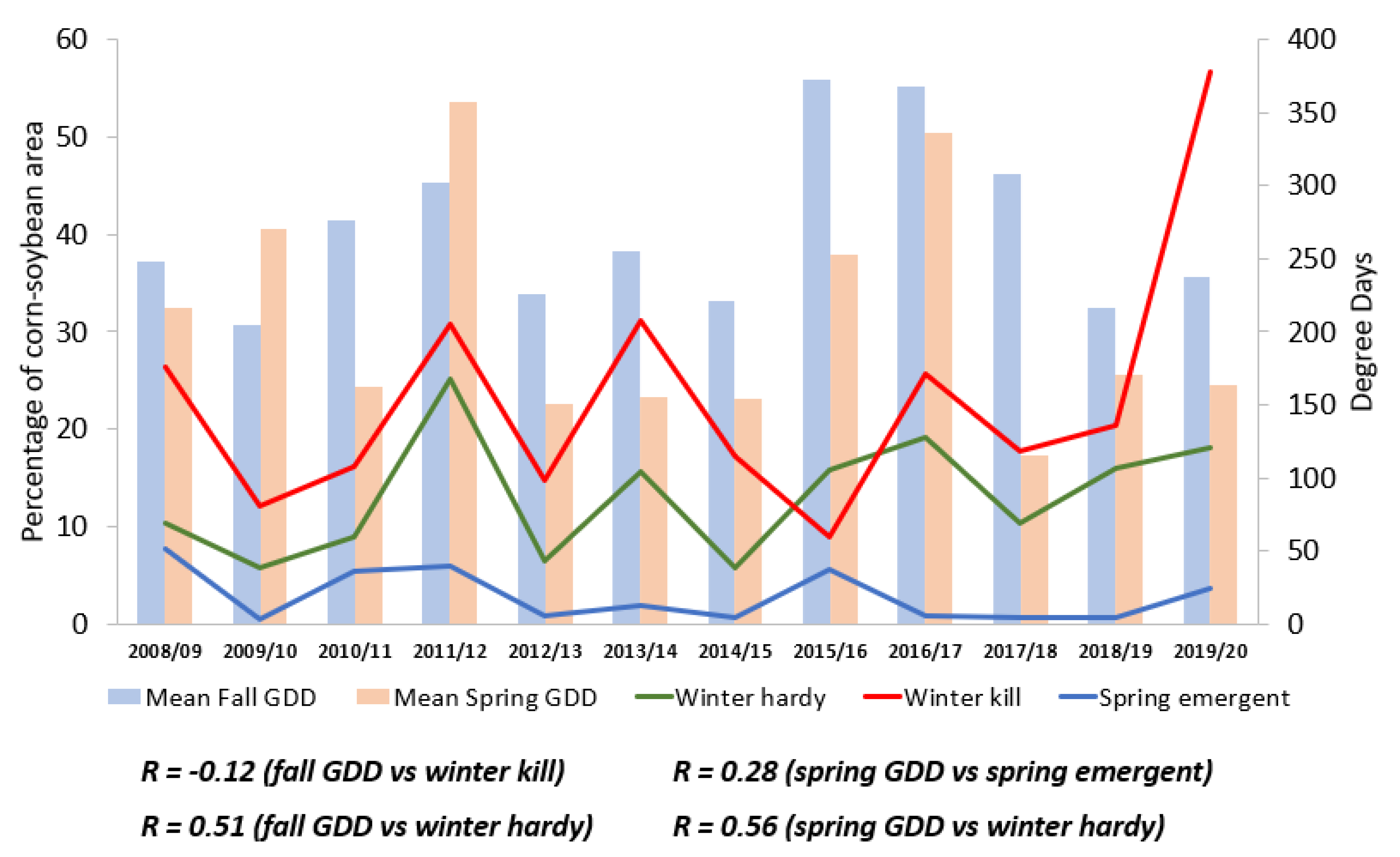
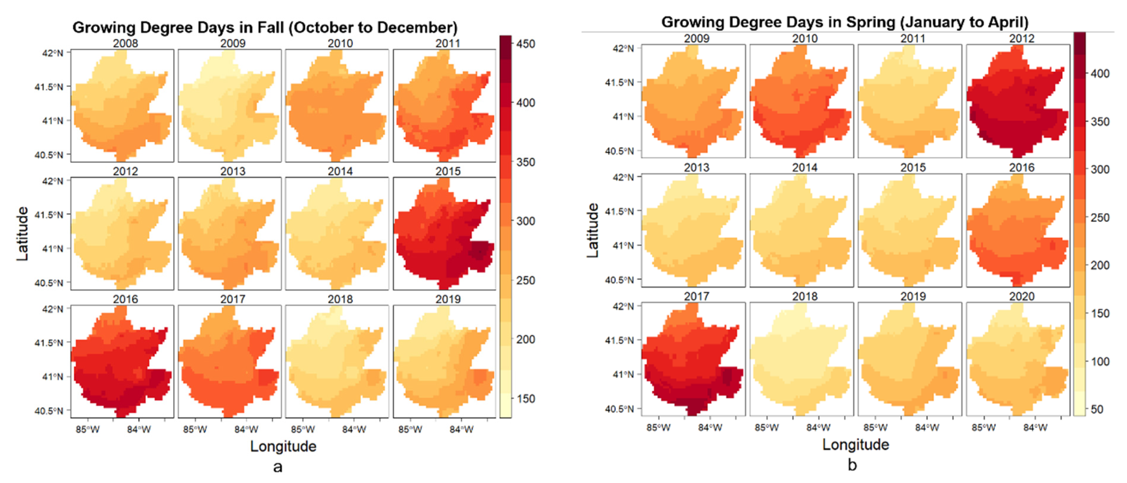
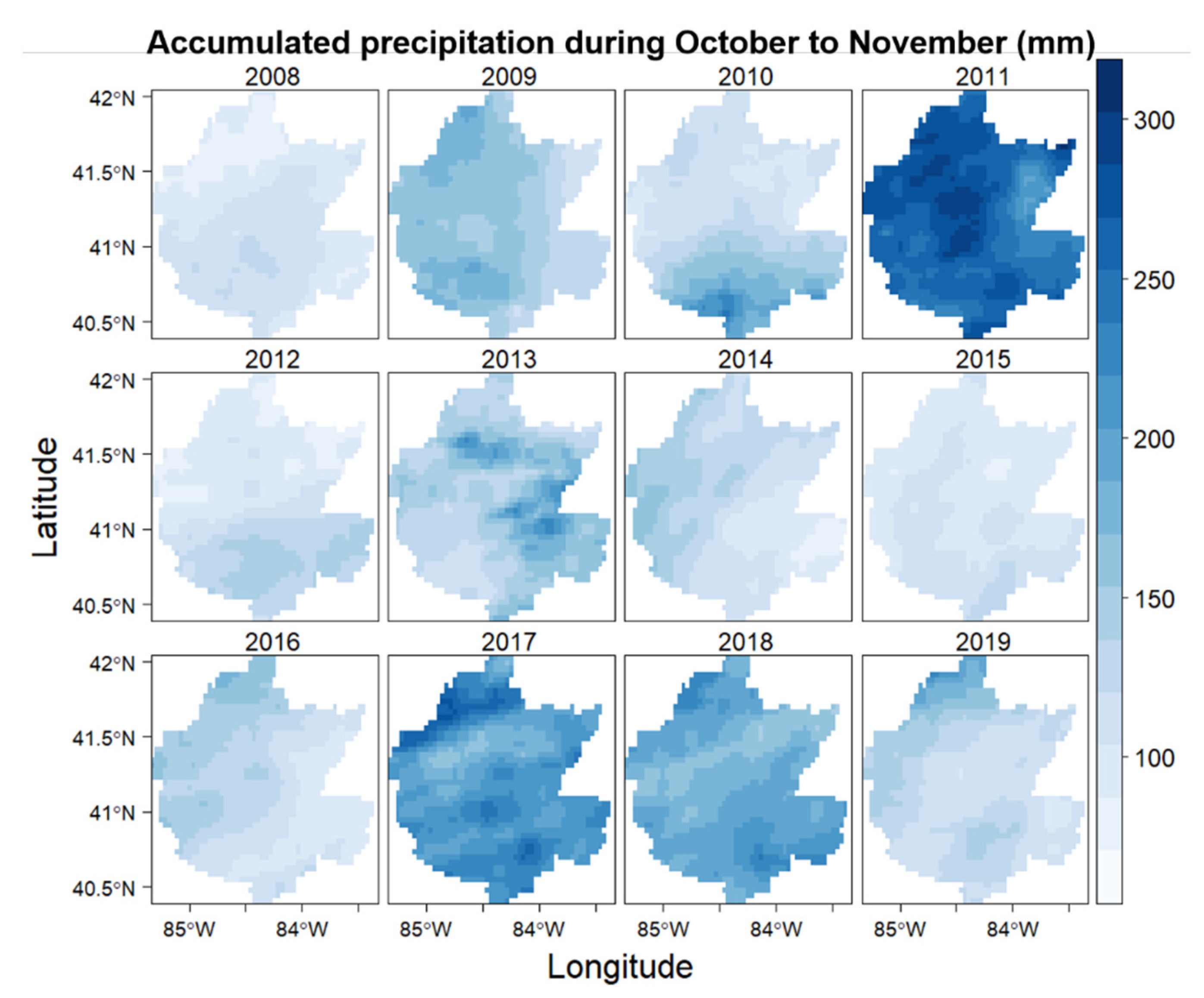
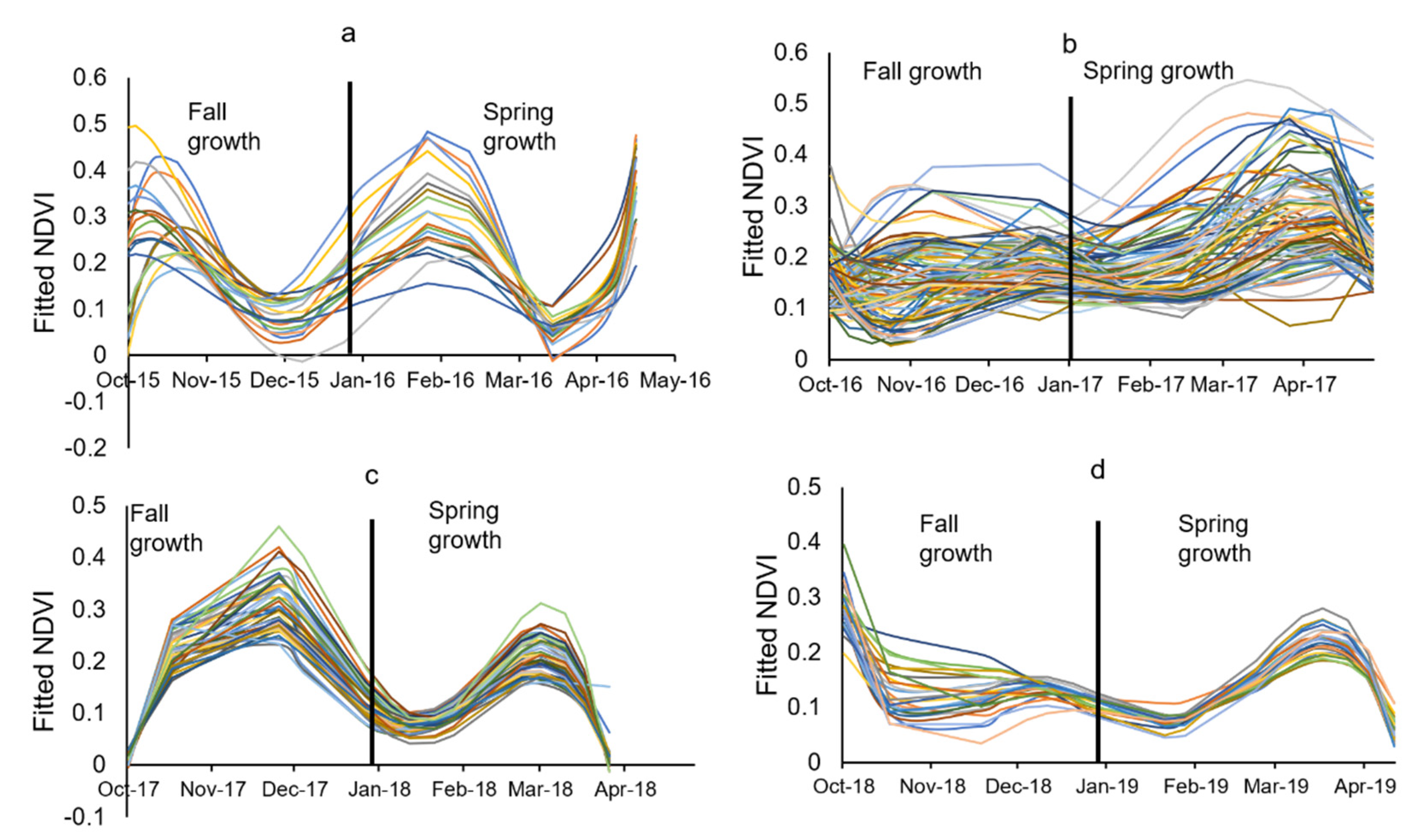
Cover cropping is a conservation practice that helps to alleviate soil health problems and reduce nutrient losses. Understanding the spatial variability in historic and current adoption of cover cropping practices and their impacts on soil, water, and nutrient dynamics at a landscape scale is an important step in determining and prioritizing areas in a watershed to effectively utilize this practice. However, such data are lacking. Our objective was to develop a spatial and temporal inventory of winter cover cropping practices in the Maumee River watershed using images collected by Landsat satellites (Landsat 5, 7 and 8) from 2008 to 2019 in Google Earth Engine (GEE) platform. Each year, satellite images collected during cover crop growing season (i.e., between October and April) were converted into two seasonal composites based on cover crop phenology. Using these composites, various image-based covariates were extracted for 628 ground-truth (field) data. By integrating ground-truth and image-based covariates, a cover crop classification model based on a random forest (RF) algorithm was developed, trained and validated in GEE platform. Our classification scheme differentiated four cover crop categories: Winter Hardy, Winter Kill, Spring Emergent, and No Cover. The overall classification accuracy was 75%, with a kappa coefficient of 0.63. The results showed that more than 50% of the corn-soybean areas in the Maumee River watershed were without winter crops during 2008–2019 period. It was found that 2019/2020 and 2009/2010 were the years with the largest and lowest cover crop areas, with 34% and 10% in the watershed, respectively. The total cover cropping area was then assessed in relation to fall precipitation and cumulative growing degree days (GDD). There was no apparent increasing trend in cover crop areas between 2008 and 2019, but the variability in cover crops areas was found to be related to higher accumulated GDD and fall precipitation. A detailed understanding of the spatial and temporal distribution of cover crops using GEE could help in promoting site-specific management practices to enhance their environmental benefits. This also has significance to policy makers and funding agencies as they could use the information to localize areas in need of interventions for supporting adoption of cover cropping practice.
Keywords: classification; cover crop; Google Earth Engine; machine learning; random forest; remote sensing; seasonal composites; western Lake Erie basin classification; cover crop; Google Earth Engine; machine learning; random forest; remote sensing; seasonal composites; western Lake Erie basin
Graphical Abstract