Article

New Inventories of Global Carbon Dioxide Emissions through Biomass Burning in 2001–2020
1
Center for Global Environmental Research, Earth System Division, National Institute for Environmental Studies, 16-1 Onogawa, Tsukuba, Ibaraki 305-8506, Japan
2
Research Faculty of Agriculture, Hokkaido University, Kita 9, Nishi 9, Kita-ku, Sapporo, Hokkaido 060-8589, Japan
*
Author to whom correspondence should be addressed.
Remote Sens. 2021, 13(10), 1914; https://doi.org/10.3390/rs13101914
Submission received: 12 March 2021 / Revised: 25 April 2021 / Accepted: 11 May 2021 / Published: 13 May 2021
(This article belongs to the Section Environmental Remote Sensing)

Abstract

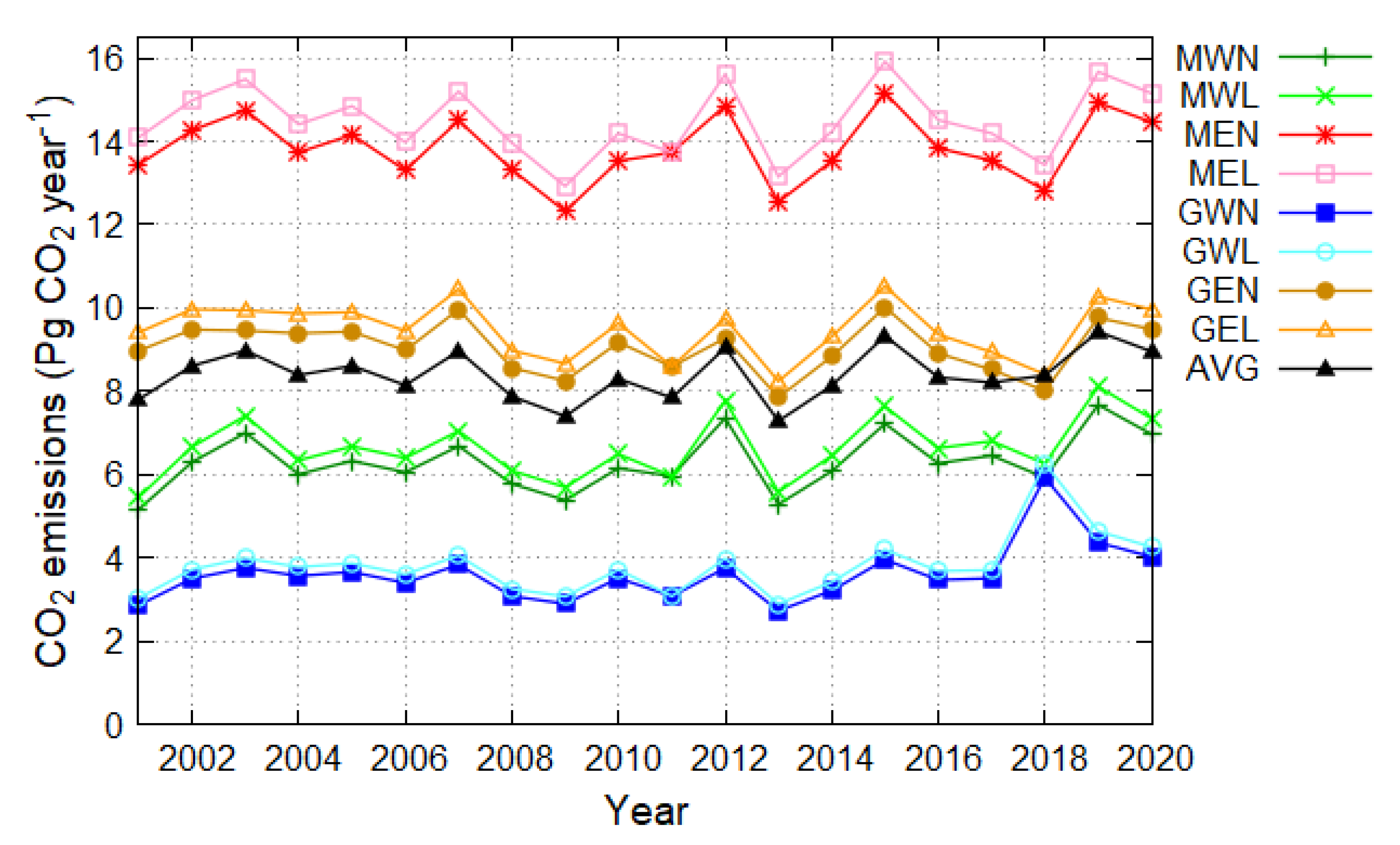
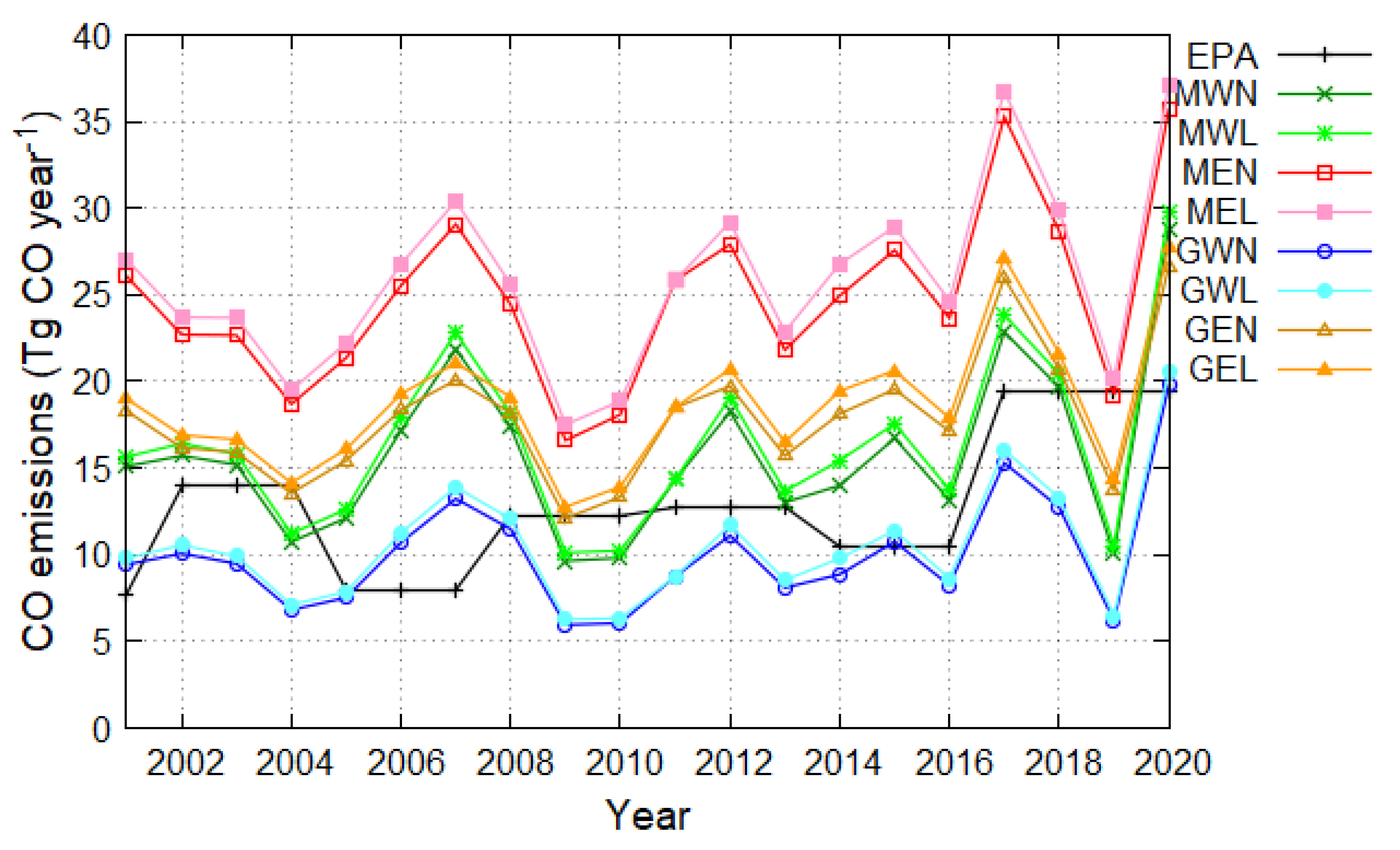
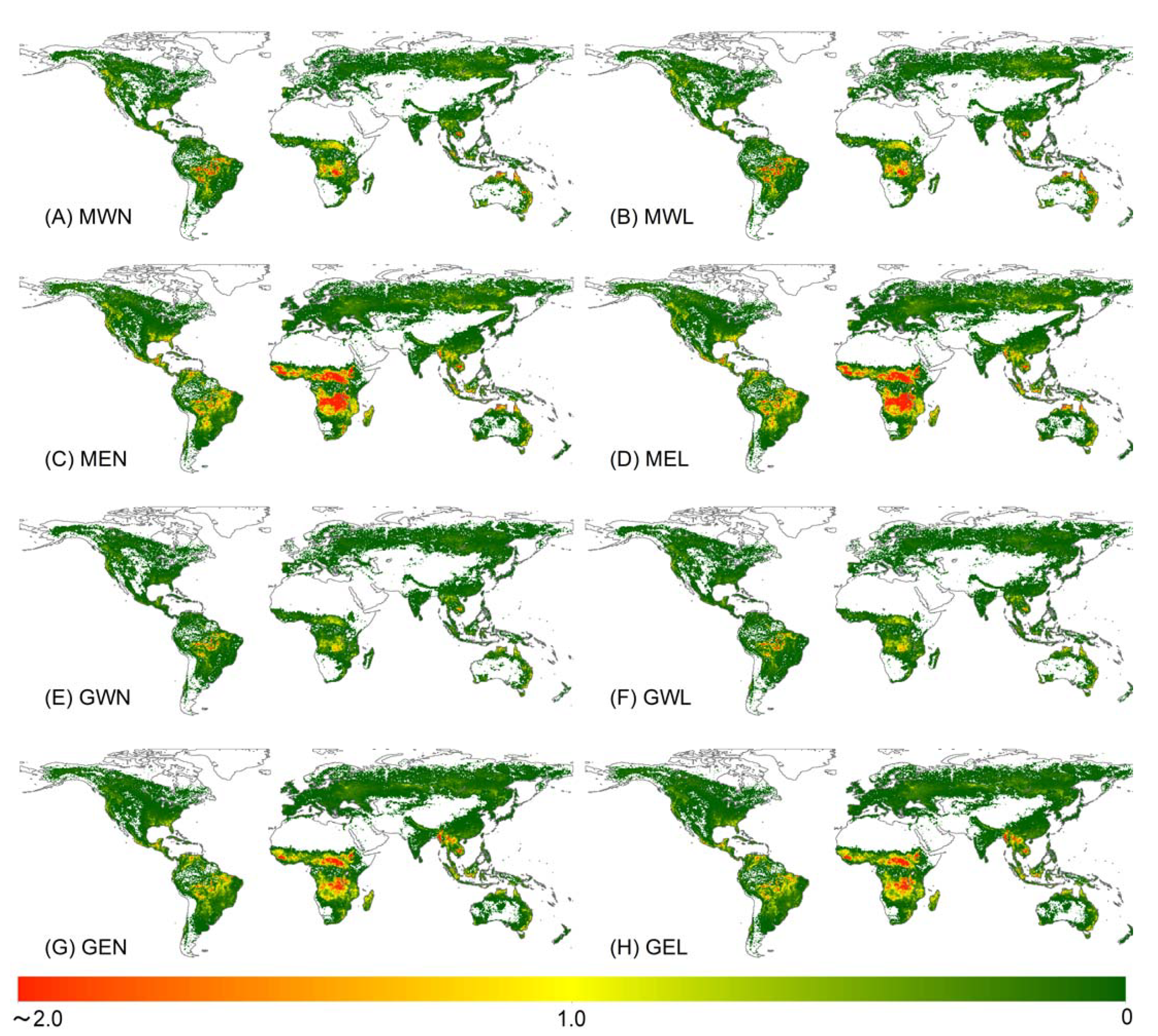
Recently, the effect of large-scale fires on the global environment has attracted attention. Satellite observation data are used for global estimation of fire CO2 emissions, and available data sources are increasing. Although several CO2 emission inventories have already been released, various remote sensing data were used to create the inventories depend on the studies. We created eight global CO2 emission inventories through fires from 2001 to 2020 by combining input data sources, compared them with previous studies, and evaluated the effect of input sources on CO2 emission estimation. CO2 emissions were estimated using a method that combines the biomass density change (by the repeated fires) with the general burned area approach. The average annual CO2 emissions of the created eight inventories were 8.40 ± 0.70 Pg CO2 year−1 (±1 standard deviation), and the minimum and maximum emissions were 3.60 ± 0.67 and 14.5 ± 0.83 Pg CO2 year−1, respectively, indicating high uncertainty. CO2 Emissions obtained from four previous inventories were within ±1 standard deviation in the eight inventories created in this study. Input datasets, especially biomass density, affected CO2 emission estimation. The global annual CO2 emissions from two biomass maps differed by 60% (Maximum). This study assesses the performance of climate and fire models by revealing the uncertainty of fire emission estimation from the input sources.
Keywords: CO2 emissions; biomass burning; fire map; land cover map; above-ground biomass map CO2 emissions; biomass burning; fire map; land cover map; above-ground biomass map