1. Introduction
Tourism is one of the world’s most vibrant and resilient economic sectors, and it provides a fundamental driving force for worldwide industrial development by generating jobs and attracting investment [
1]. International tourist arrivals reached 1.4 billion in 2023, generating revenues of approximately 1.6 trillion dollars and representing almost eleven percent of the global GDP [
2], according to the World Tourism Organization (UNWTO). Tourism not only has a large economic effect, but it is also an important promoter of people exchange and developing intercultural understanding, offering the chance to know diverse places, traditions, and historical stories [
3].
Tourism has emerged as an important engine of urban and regional development and innovation across the globe in recent decades. Strategic investments in transportation infrastructure, hospitality services, and information and communications technology have addressed changing tourist needs and improved residents’ quality of life in host communities [
4]. Alongside the expansion of this sector, technological development has significantly changed the interactions between visitors and destinations and how tourist services are delivered [
5].
The tourism industry has experienced an unprecedented technological shift, where innovations like virtual tours, mobile applications, intelligent destination management systems, augmented reality (AR), and virtual reality (VR) increasingly permeate how visitors interact with the places they visit [
6]. Digitized technologies have established updating frameworks for what a tourism practice can be, by facilitating the exploration of places from distance, planning in advance of visiting the place and boosted engagement at the destination [
7]. Virtual reality has appeared as an especially game-changing technology that provides the possibility of immersive experiences without traveling physically while also removing the barriers of distance, cost, mobility limitations and environment [
8].
Recent studies highlight the high potential of VR technologies for cultural heritage tourism. A complete methodology for digital exhibition of archeology was described in [
4], which showed how a 3D reconstruction can be used together with VR as an engaging promotional experience for cultural heritage. Likewise, a systematic review was performed with the purpose of identifying best practices and principles to formulate standards on 3D virtual reconstructions of cultural heritage in immersive VR through the conduction of a meta-analysis comprising 94 papers [
6]. These studies highlight the increasing acknowledgment of VR as an effective means of preserving and sharing cultural heritage.
Virtual tourism is a novel way for people to see cultural and historical places using virtual tours and other digital technologies, providing immersive, accessible and sustainable alternatives to physical travel [
9]. This model is of special interest for advocates at UNESCO World Heritage sites who are grappling with overtourism, physical deterioration, and how to balance preservation with public access [
10]. The effects of Environment Virtual tourism applications can help a wider audience to access these irreplaceable cultural assets, reducing physical impacts on fragile heritage structure [
11].
The combination of three-dimensional mapping technologies with VR tools creates new opportunities to create realistic, interactive virtual environments that simulate historical buildings [
12]. The authors in [
1] have presented a web-based virtual tour system based on Multiview 3D reconstruction techniques for archeological sites, which shows the feasibility of remotely exploring cultures heritage. A more recent example of gamified VR storytelling is [
2], which integrates 360° videos, 3D digitized artifacts, and virtual human agents into exploratory learning experiences for cultural tourism. Such developments demonstrate how virtual tourism has evolved from visual affordances to complex interactive experiences with multimodal participation.
Image-based modeling (IBM) is, at present, a well-known, low-cost and efficient process to acquire accurate 3D models of architectural heritage [
13]. IBM uses digital photography and computational algorithms to generate 3D shapes from a series of photographs taken from different angles, rather than taking the traditional surveying approach or relying on expensive laser scanning technology [
14]. These procedures are especially beneficial for recording complex architectural facades, ornamental details, and subjects such as urban environments where measurement approaches may not be feasible [
15].
The last few years have witnessed major developments in the fields of photogrammetry and computer vision, which have accordingly improved the accuracy, efficiency and accessibility of IBM methods. Consider the comprehensive scoping review of photogrammetry in cultural building heritage [
16] that captures how the intersection of photogrammetry with unmanned aerial vehicle (UAV) technology provides opportunities for the preservation and visualization of building heritage with unparalleled precision and efficiency. That work was further extended by using deep neural network architectures [
16,
17].to solve image segmentation and depth prediction problems together, allowing for the automatic reconstruction of 3D facades in a more reliable and less costly manner. Such advancements in technology are making high-definition 3D documentation accessible and affordable not only to larger institutions and researchers, but also to significantly smaller companies that want to complete more complex digitization projects related to our world heritage.
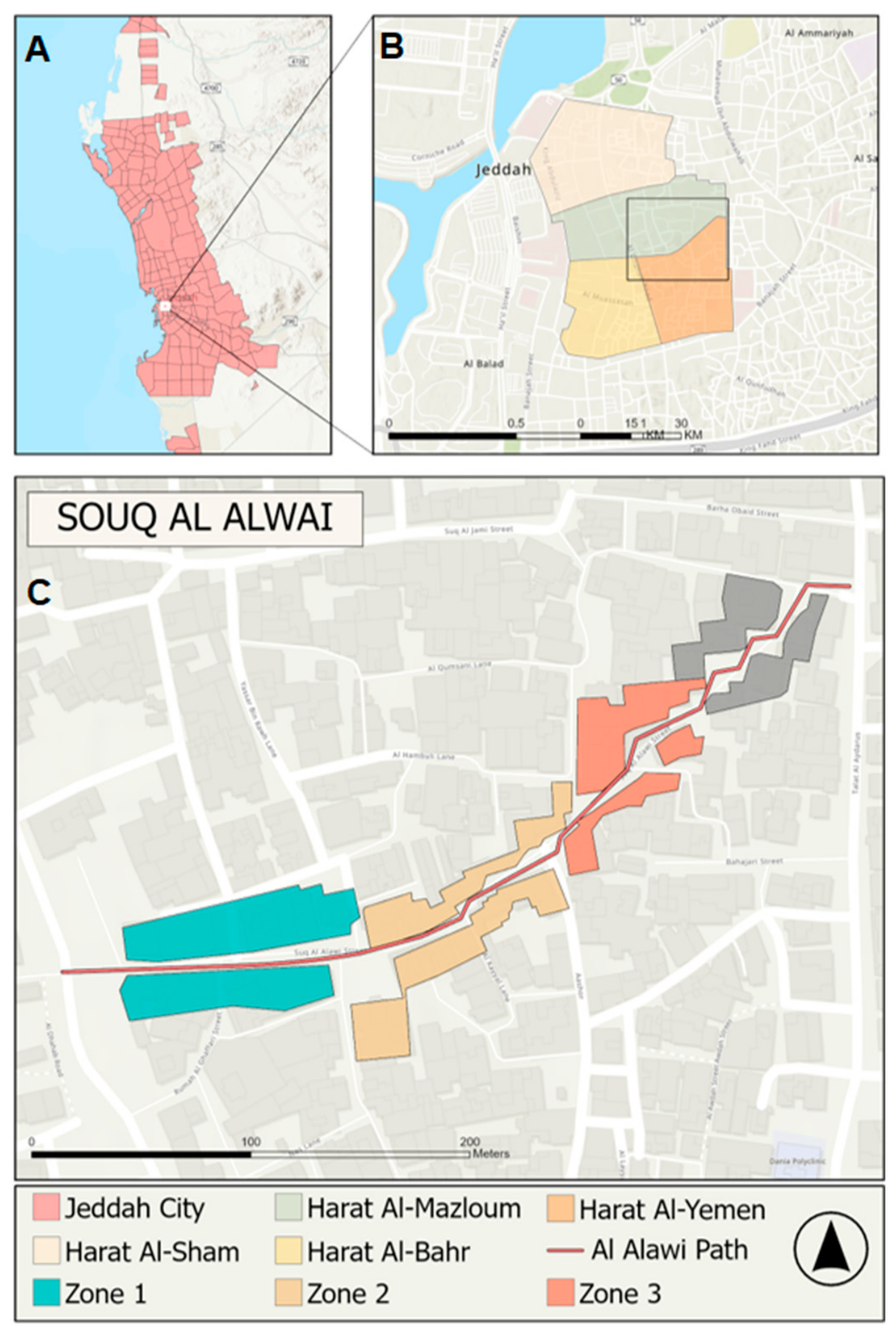
Souq Al-Alawi is in the historic Jeddah District (also known as Historic Jeddah, the Gate to Makkah), which was registered on the World Heritage List of UNESCO due to its remarkable universal value as a historical port city and exceptional architectural heritage [
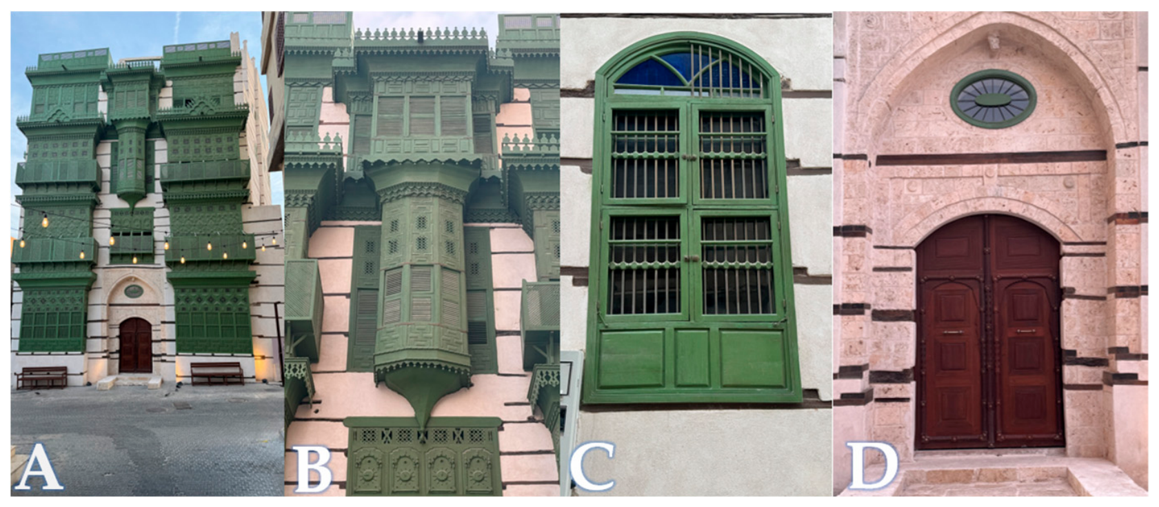
16]. The souq is also a primary example of Arabian market architecture, comprising typical coral stone buildings with elaborate wooden fronts (rawashin) and narrow pedestrian-only streets that reflect centuries of commerce and cultural exchange [
17].
Although Souq Al-Alawi is culturally significant, it suffers from many of the physical problems found in other historic urban centers, such as challenges with access for a range of visitor types, and insufficient interpretation and education resources [
18]. Earlier work [
11] showed the possibility of using an interactive virtual Building Information Modeling (BIM) to enhance virtual tourism in cultural heritage sites in Historic Jeddah, taking Zainal Historical House as a case study. Despite these advances, existing studies have primarily focused on individual components, such as 3D reconstruction, photogrammetry, BIM, or virtual reality applications, with limited attention to integrating these technologies into a unified virtual tourism platform for cultural heritage sites. Furthermore, few studies have demonstrated such an integrated workflow using image-based modeling, GIS data, and Unreal Engine to create an immersive virtual tourism experience for Historic Jeddah. This study addresses this gap by developing and demonstrating a comprehensive workflow for the digital documentation and virtual exploration of Souq Al-Alawi.
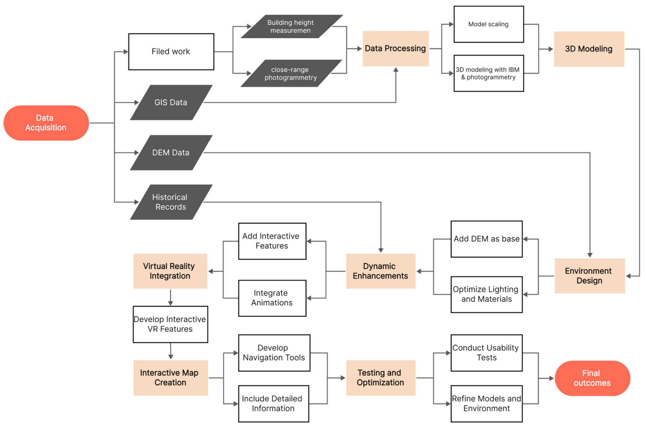
This study attempts to integrate 3D mapping, image-based modeling, GIS data integration and VR-based tourism through a virtual tourism platform (VTP) system for the Souq Al-Alawi. The specific objectives are as follows:
To create accurate 3D models of Souq Al-Alawi’s architectural facades using image-based modeling techniques.
To integrate GIS data and historical documentation to provide spatial and contextual information.
To develop an interactive VR environment using Unreal Engine that enables immersive exploration.
To address technical challenges related to facade distortion in narrow urban environments.
To demonstrate the potential of digital technologies for cultural heritage preservation and tourism enhancement.
The importance of this research highlights its role in sustainable management of cultural heritage, the digital tourism industry and protecting the architectural heritage of the Kingdom. Creating a virtual model of Souq Al-Alawi helps increase accessibility for international and local interests, enhances educational efforts, and serves as a digital repository to inform future preservation activities [
19,
20,
21,
22,
23].
Unlike previous studies that primarily focus on individual technologies, such as photogrammetry, GIS analysis, or virtual reality visualization, this study presents an integrated workflow that combines Structure-from-Motion Multi-View Stereo (SfM-MVS), Image-Based Modeling (IBM), GIS spatial analysis, and Unreal Engine-based virtual reality into a unified framework for cultural heritage documentation and virtual tourism. The proposed workflow enables accurate three-dimensional reconstruction, spatially referenced heritage analysis, and immersive virtual exploration within a single digital environment. Its application to the historic Souq Al-Alawi demonstrates a transferable methodology that can support heritage conservation, tourism planning, and digital preservation in other historic urban areas.
1.1. Literature Review
1.1.1. Virtual Reality in Cultural Heritage Tourism
Virtual reality has made a breakthrough in the field of cultural heritage preservation and tourism through immersive experiences that propose to go beyond access (physical access or cost barriers). The use of VR in cultural heritage scenarios has evolved from basic virtual representations to advanced multi-sensory settings that combine spatial movement, interactive environments, and storytelling content [
1,
2].
Recent studies have expanded virtual reality applications from visualization to interactive storytelling, education, and user engagement. While earlier studies mainly employed VR to visualize reconstructed heritage assets, more recent approaches have incorporated multimedia content, 360° videos, three-dimensional artifacts, and virtual human agents to enhance visitor interaction and educational experiences. These developments demonstrate a clear progression in immersive presentation; however, they continue to focus primarily on user interaction and content delivery, with comparatively less emphasis on integrating virtual reality with comprehensive heritage documentation, spatial information management, and end-to-end digital documentation workflows.
1.1.2. 3D Reconstruction and Modeling Techniques
While VR focuses on user interaction, three-dimensional reconstruction techniques provide the geometric foundation required for the accurate digital representation of heritage assets. These methods differ in terms of accuracy, processing requirements, and application scenarios. As such, state-of-the-art methods span from laser scanning and photogrammetry to image-based modeling [
4,
24] and procedural reconstruction.
Among existing reconstruction methods, photogrammetry has become the most widely adopted because it offers a practical balance between accuracy, cost, and operational flexibility for heritage documentation. A systematic scoping review of the application and innovations in photogrammetry of cultural building heritage [
25,
26] was undertaken, examining both data acquisition using a variety of UAV platforms and sensor payloads, and high-end processing in photogrammetry software. Previous studies consistently demonstrate that combining photogrammetry with UAV technologies improves documentation accuracy, efficiency, and accessibility for cultural heritage applications.
One such low-cost paradigm is image-based modeling for facade reconstruction. In [
24,
27], three types of methodologies for the 3D modeling of cultural objects in Bulgaria were compared: image-based modeling by non-metric cameras, spherical panoramic image-based representation, and geometric/photorealistic CAD drawing to a pyramid surface mesh model. The comparison showed that image-based modeling provides an efficient solution for virtual representation, whereas CAD-supported approaches are more suitable when higher geometric accuracy is required.
One of the key impacts is that multiple sources were integrated, which is essential in all heritage documentation. The role of advanced measurement and reality technologies in cultural heritage sustainability and tourism was explored [
12,
13,
14,
15,
16,
17,
18,
19,
20,
21,
22,
23,
24,
25,
26,
27,
28], emphasizing how laser scanning, close-range photogrammetry, and UAV photogrammetry can be combined with augmented reality (AR), virtual reality (VR), or mixed-reality (MR) applications. Thus, their research has shown that these methods of obtaining 3D images allow for virtual visits, which are cost- and time-saving compared to traditional documentation methods.
Overall, previous studies demonstrate that photogrammetry, UAV-based surveys, CAD-supported reconstruction, and image-based modeling each offer distinct advantages depending on the documentation objective. While several studies combine reconstruction with visualization technologies, their methodological emphasis generally remains on geometric reconstruction rather than the coordinated integration of reconstruction, spatial information management, and immersive visualization within a single workflow.
1.1.3. Virtual Tours and Interactive Visualization
Building upon 3D reconstruction, virtual tours transform digital models into interactive environments for education, interpretation, and tourism. Their effectiveness depends not only on visualization quality but also on navigation, information delivery, and user interaction. Effective virtual tours are mainly designed and implemented in user interface (UI) design, navigation mechanisms, information architecture and content integration [
7,
8].
Several virtual tour platforms [
3,
4,
5,
6,
7,
8,
9,
10,
11,
12,
13,
14,
15,
16,
17,
18,
19,
20,
21,
22,
23,
24,
25,
26,
27,
28,
29] integrate panoramic imagery, historical information, and multimedia content to support both heritage documentation and visitor interpretation. Their methodology combined 3D reconstruction for both documentation and conservation (using laser scanning to perform a full metric survey on some cases) with virtual reconstructions of the stages of history through historical research based on analysis of acquired data. This multi-layer perspective not only informs users about the contemporary aspect of a certain site but also acknowledges its historical layers in an engaging virtual experience.
An accessible digital platform was created for the Franciscan site of La Verna [
13] that merged both virtual tours with 3D models and educational material on Robbiane artworks. With its 3D digital documentation and high-quality panoramic imaging solutions, the platform aimed to provide remote yet immersive experiences that promote sustainable digital tourism while allowing public engagement and providing tools for heritage preservation, education, and accessibility. Multi-platform accessibility through compatibility with different communication systems and QR code access to the platform conveyed a message to reach multiple audience groups.
Virtual tours are delivered through several mechanisms; however, web-based platforms are proving to be one of the most effective solutions. An Integrated Framework for WebGIS Platform in Lightweight for Offering Cultural Tourism Information to Pattani Province, Thailand, was developed as a Web Map Service [
10]. The framework used geospatial databases, virtual tours, VR and 3D models based on open-source code for a low-cost high-performance system for local authorities and small organizations to manage their cultural heritage online. Collectively, these studies demonstrate a gradual evolution from panoramic virtual tours toward multimedia-rich and WebGIS-supported platforms. Although recent approaches incorporate multiple visualization components, their primary emphasis remains on user interaction, interface design, and information delivery, while the methodological integration between virtual tours, heritage documentation, spatial databases, and three-dimensional reconstruction is comparatively less developed.
1.1.4. GIS Integration and Spatial Data Management
Unlike virtual tour platforms that primarily support user interaction, GIS provides spatial analysis, geographic context, and data management capabilities for heritage documentation. GIS, 3D modeling, and VR technologies can all be combined to help in representing heritage sites within their geographical, historical, and cultural context [
10,
17].
An intuitive portal for visualizing cultural heritage objects combining spherical panoramas into various maps, GNSS data, and multimedia information was successfully demonstrated [
17]. It relied on recent rapid advancements in photogrammetry, remote sensing, laser scanning, and computer vision to provide spatial databases that serve both documentation and publicly held assets. The combination of accurate geospatial positioning and visual content allows users to understand the spatial relationships among heritage elements, supporting their documentation, management, and long-term preservation.
A Cross-European Cultural Routes Database was established using a web-based platform via extended reality tools to promote and manage European Cultural Routes [
30]. For their research, the authors used integrated rapid survey techniques combining UAVs and Simultaneous Localization and Mapping (SLAM) technologies for data acquisition at sites, allowing the generation of accurate 3D databases and models to form digital twins from multinational studies. As part of scan-to-BIM processes, photographic archives and census analysis developed suitable virtual representations of the space that could be accessed through extended reality tools; integrated GIS-VR approaches are promoted as scalable for heritage networks.
Combining GIS data with virtual tours improves navigation and information delivery. For visualizing and querying multi-resolution 3D models of a Maya archeological site in Copan, Honduras, we developed a web-based interactive tool called “QueryArch3D” [
31]. The platform allowed for interactive analyses of not just spatial architectural characteristics (such as architecture–landscape relationships and visibility studies) but also temporal ones, catering to scholars, students, and tourists alike. If structured spatial databases were of value due to their support for a wide range of user requirements and analytics, the semantic segmentation of geometric models and integration with attribute data from external sources, if not adding an additional level of complexity to the system, at least introduced it as yet another factor influencing how users might experience analysis. Existing studies consistently demonstrate the importance of GIS for heritage mapping, spatial databases, navigation, and geographic analysis. Nevertheless, GIS is frequently implemented as an independent spatial information component or visualization layer, with relatively limited methodological integration alongside photogrammetric reconstruction, image-based modeling, and immersive virtual reality environments.
1.1.5. Unreal Engine and Real-Time Rendering
After digital reconstruction and spatial data preparation, real-time rendering platforms such as Unreal Engine transform heritage datasets into immersive and interactive virtual environments. Besides the advanced rendering features, its visual scripting systems, and VR support, it works particularly well for creating virtual tourism apps [
8,
9].
A 3D modeling technique based on reality was applied [
27] to provide a digital memory and interpretation of historical changes in the Church of Santa Croce in Ravenna (Italy) using spatial–temporal navigation in an interactive 3D virtual environment. Their rigorous documentation process allows them to engage in academic research as well as social engagement, and the use of modern technology provides a direct demonstration of how digital tools can help with heritage preservation. The study identified interactive visualization through Unity or Unreal Engine platforms, which are noteworthy options given the potential offered by these engines for heritage applications.
Interactive technologies applied to cultural heritage were investigated [
28], including extensive historical background and high-accuracy 3D reconstruction for serious games and immersive VR applications. This case study on the reconstruction of the Forum of Augustus in Rome illustrated how Unreal Engine can facilitate gaming-adjacent, visually stunning reconstructions that teach as well as entertain. Validation ensured that the virtual reconstruction was performed in a scholarly manner while also offering rich user experiences [
30,
31,
32].
Many researchers have investigated the combination of photogrammetry with Unreal Engine. Metaverse assets and image-based photogrammetry techniques were implemented in the main facade that fronts Via del Grande as part of an Unreal Engine 5.0 game [
29,
33]. This project represents an example of how a game-like interactive experience has practical applications for cultural heritage preservation and engagement. Similarly, the shrine of Prophet Nahum was examined using image-based modeling and rendering (IBMR) technology with Unreal Engine software to address cultural heritage preservation issues in ancient buildings [
34]. Existing studies demonstrate the effectiveness of Unreal Engine for interactive visualization, real-time rendering, and immersive heritage presentation. However, most applications employ Unreal Engine as the final visualization environment following reconstruction, with comparatively less attention given to its methodological integration within the complete heritage documentation workflow from data acquisition through spatial analysis and digital reconstruction.
1.1.6. Challenges and Best Practices
There are still many challenges in the development of virtual tourism applications for cultural heritage, despite the progress. Technical challenges include photorealistic rendering and real-time performance, large data management of high-resolution 3D scans, geometric accuracy in complex architectural environments, and distortions owing to narrow spaces or difficult capture conditions [
3,
15].
Photogrammetric and UAV technologies for heritage preservation, and their technical, legal, and ethical challenges, were critically surveyed [
26]. The resulting scoping review outlined promising future research directions and best practices for heritage professionals, with a call for new standardized workflows, quality assurance protocols, and practical ethical guidelines to enhance digital heritage documentation. These considerations are critical for ensuring that virtual tourism initiatives remain integrity-driven and promote the values associated with cultural heritage.
A systematic review of 94 papers on virtual 3D reconstructions of cultural heritage in immersive VR was performed [
6], including a statistical analysis of heritage type, application features, VR experience characteristics, and assessment. The study presented insights into the best practices and future directions of research on virtual reconstruction via VR, highlighting the need for a user-centered design, validation of historical accuracy in reconstructions, and an evaluation of the educational value of virtual reconstructions. These best practices can guide the development of virtual tourism applications that are both technically sophisticated and educationally useful, but also easy to use.
Overall, previous studies demonstrate increasing integration among photogrammetry, three-dimensional reconstruction, GIS, virtual tours, and immersive visualization; however, this integration is typically limited to selected stages of the digital heritage process. Existing methodologies commonly emphasize either geometric reconstruction, spatial information management, or virtual visualization, with comparatively limited attention given to developing a unified workflow that systematically connects heritage documentation, image-based modeling, GIS integration, and immersive virtual environments. This methodological gap highlights the need for more comprehensive and reproducible digital heritage workflows. The present study addresses this need by developing and demonstrating an integrated workflow for the digital documentation and virtual tourism development of Souq Al-Alawi.
3. Results and Discussion
3.1. Reconstruction Outcomes
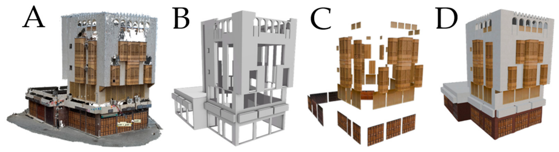
The field data collection and modeling results were extensive across the three study zones. A quantitative breakdown of models, IBM-generated portions, and the associated total walking distance is included in
Table 1. Moreover, the mobile capture methodology achieved low reprojection error values across all zones, indicating consistent photogrammetric processing performance, as shown in
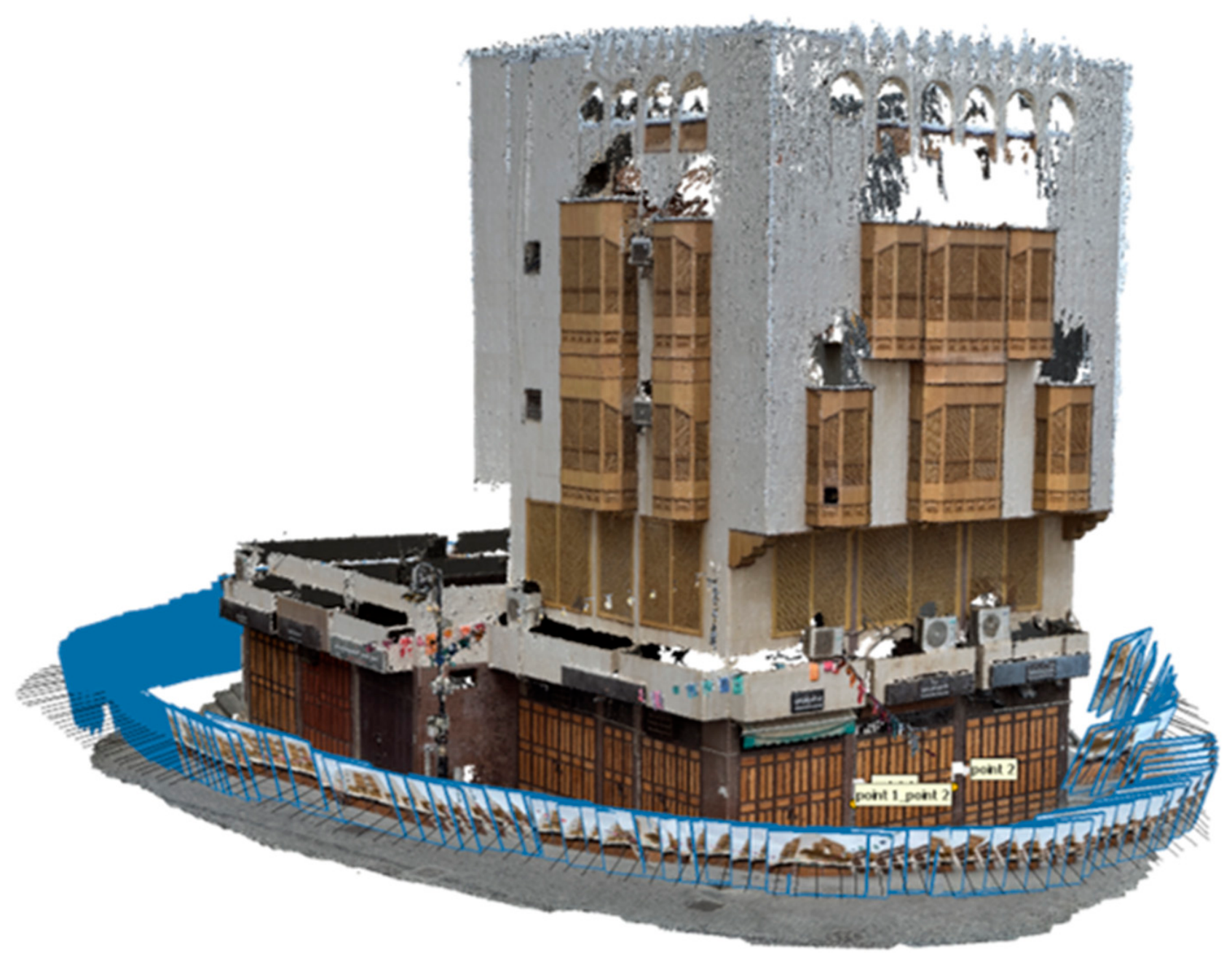
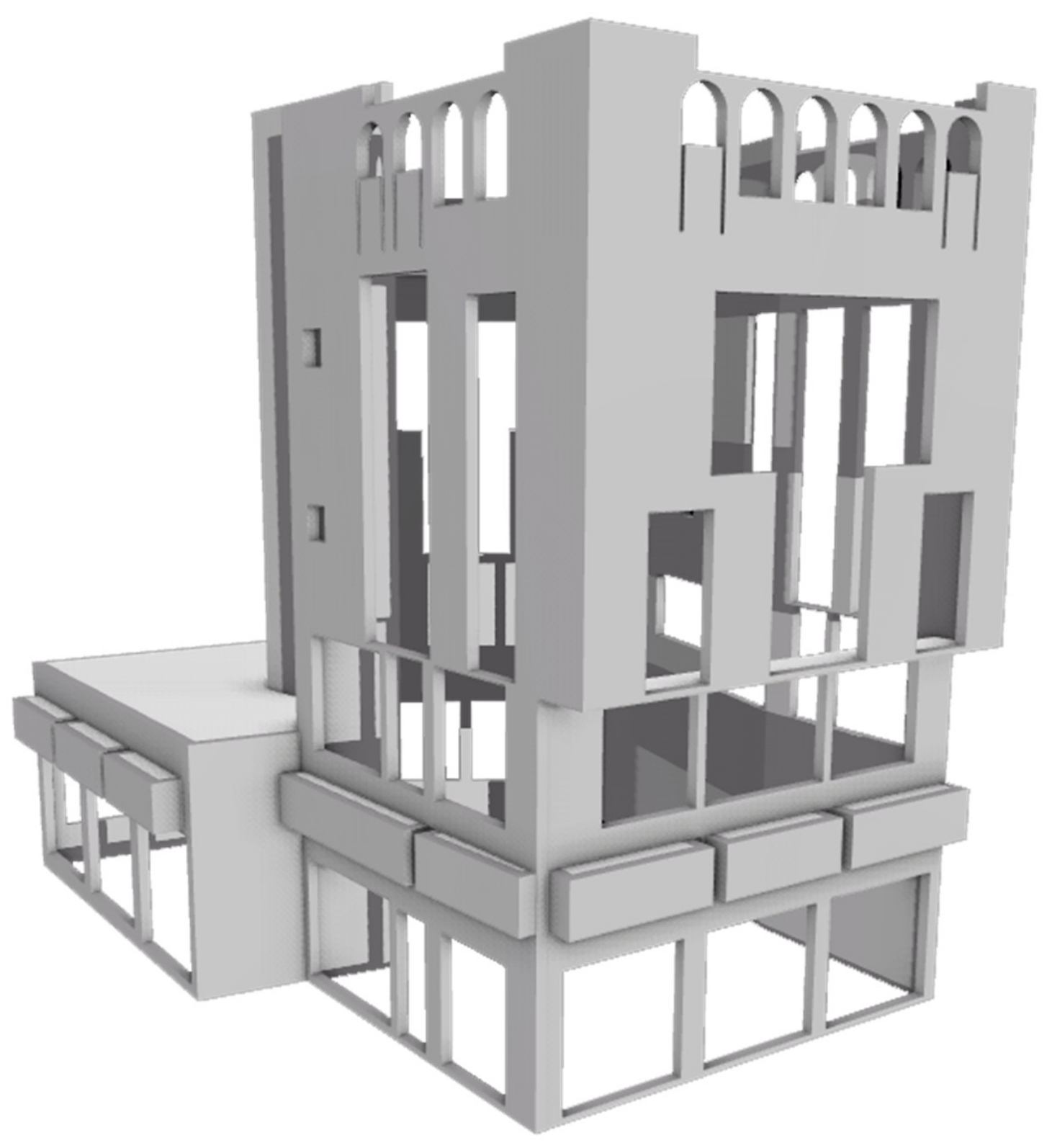
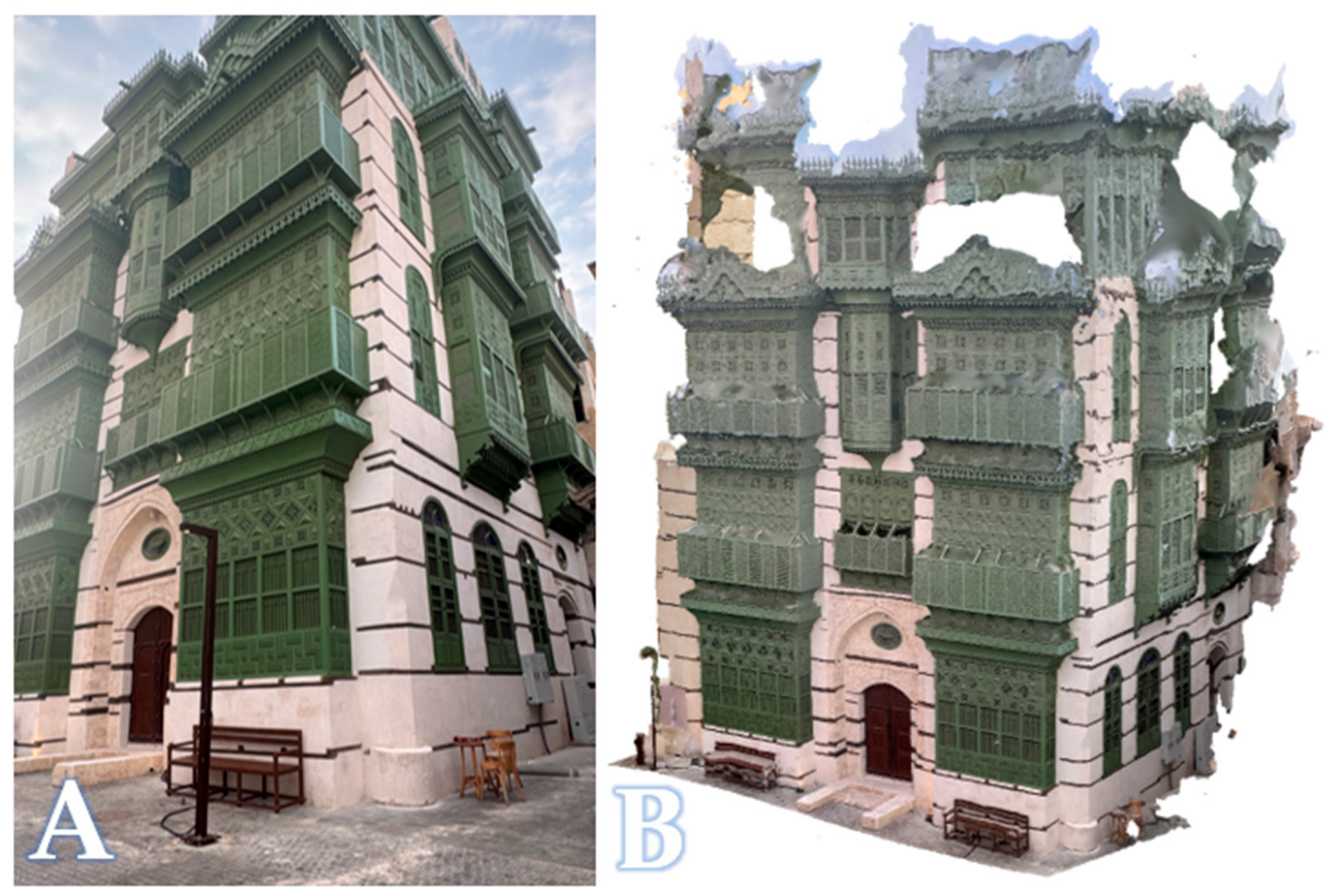
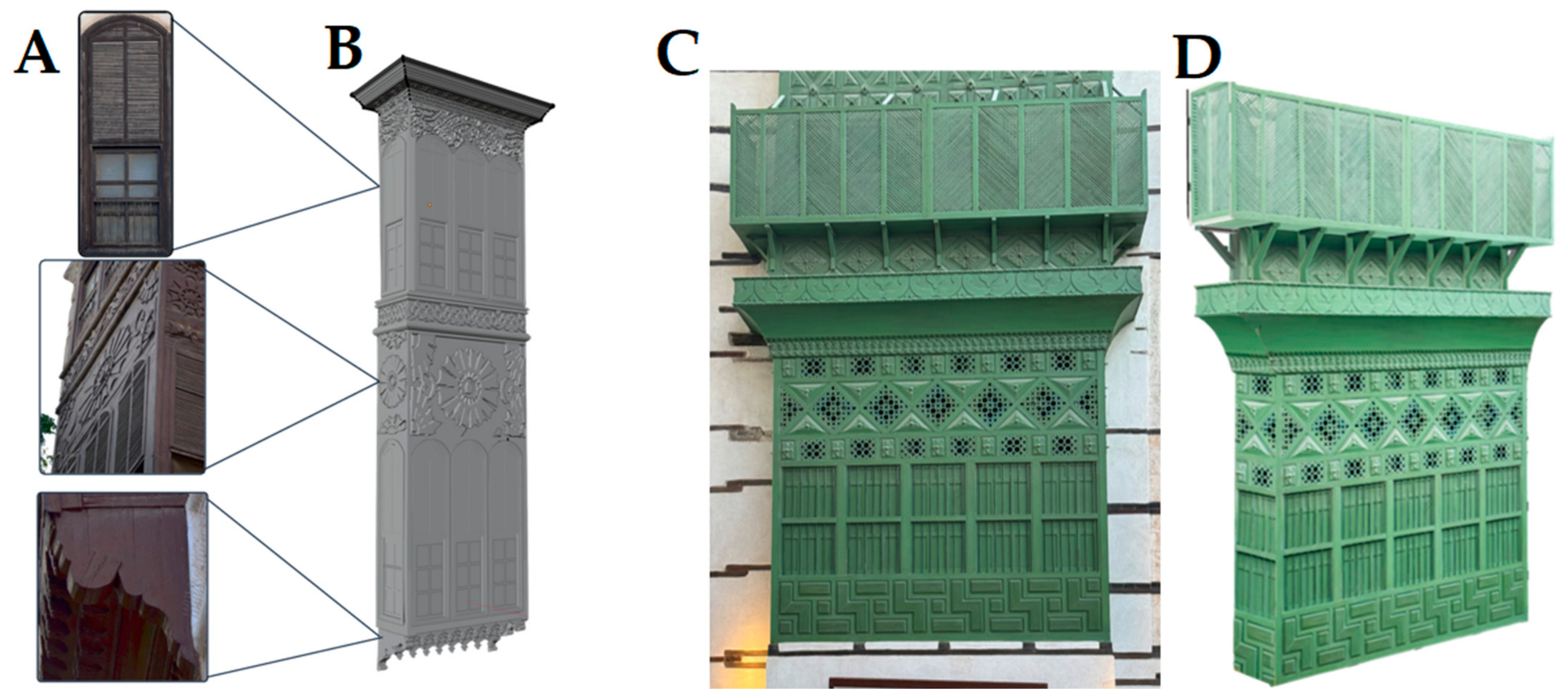
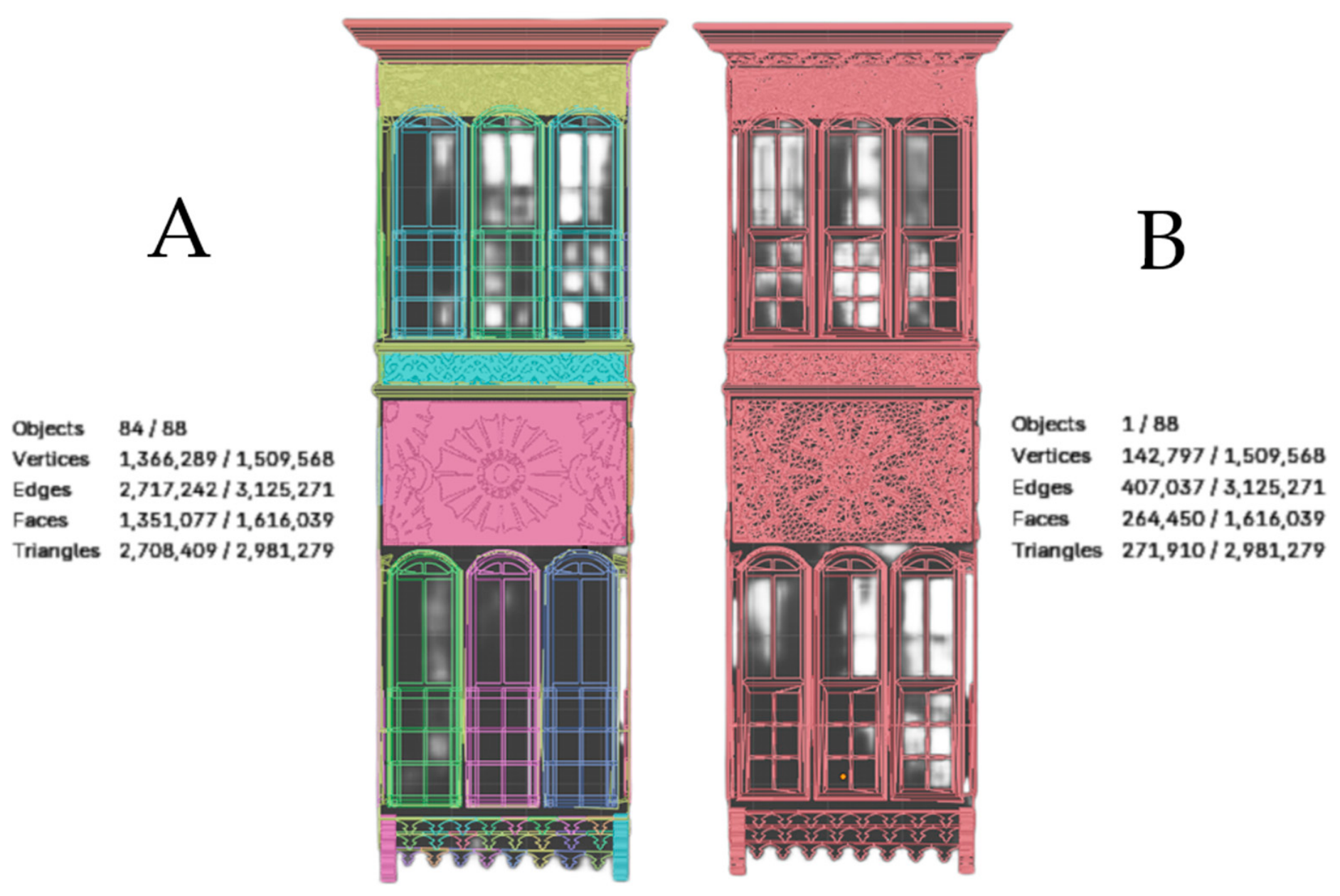
Table 2. The image-based modeling process produced detailed three-dimensional models of building facades within Souq Al-Alawi. The photogrammetric reconstruction generated thousands of dense point clouds (millions of points with a millimeter resolution) that represent the geometric complexity and architectural details typical of traditional Hijazi architecture. The mesh outputs provide detailed representations of coral stonework, wooden roshaan (lattice windows), ornamental details, and material textures that preserve the visual characteristics of the historic Souq.
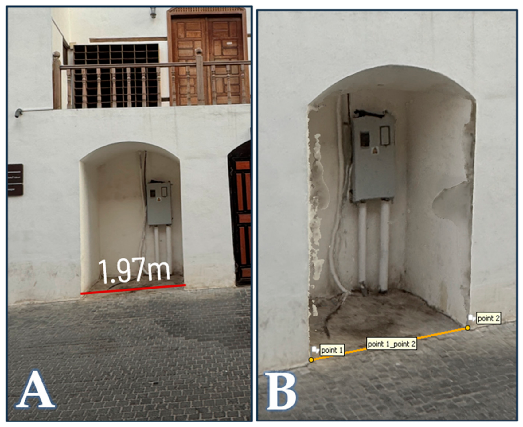
This quality highlights the potential of smartphone-based photogrammetry for heritage documentation [
26], as evidenced by previous studies on the accessibility and precision achievable with modern photogrammetric technologies. The iPhone 15 Pro Max’s state-of-the-art camera system, with systematic capture protocols and efficient processing algorithms, produced results equivalent to those of a professional-grade camera, lowering the technical and financial thresholds to quick and easy heritage digitization.
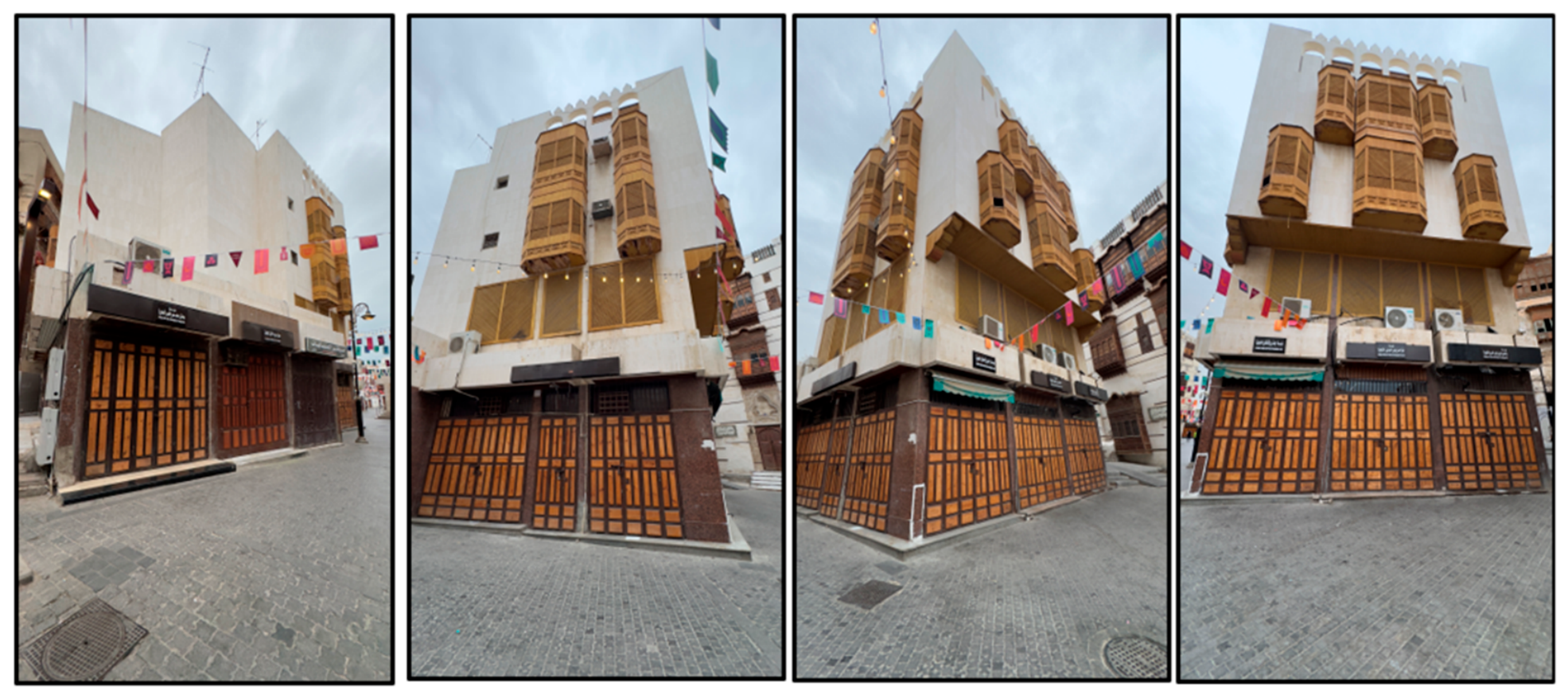
Fine-tuning the facade distortions due to narrow street widths was important to maintain geometric accuracy. The multi-frontal correction process, using careful capture techniques and photogrammetric calibration as well as post-processing procedures, successfully corrected the perspective distortions whilst ensuring vertical architectural elements remain aligned with respect to one another. Such systematic methods provide a reusable solution to comparable problems in dense urban spaces, and contribute to the literature on heritage documentation within spatially complex contexts [
3,
5].
3.2. Virtual Reality Environment
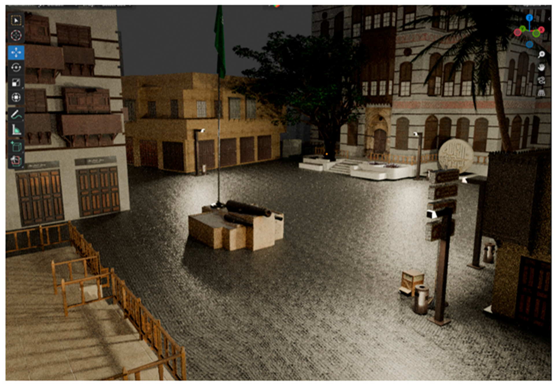
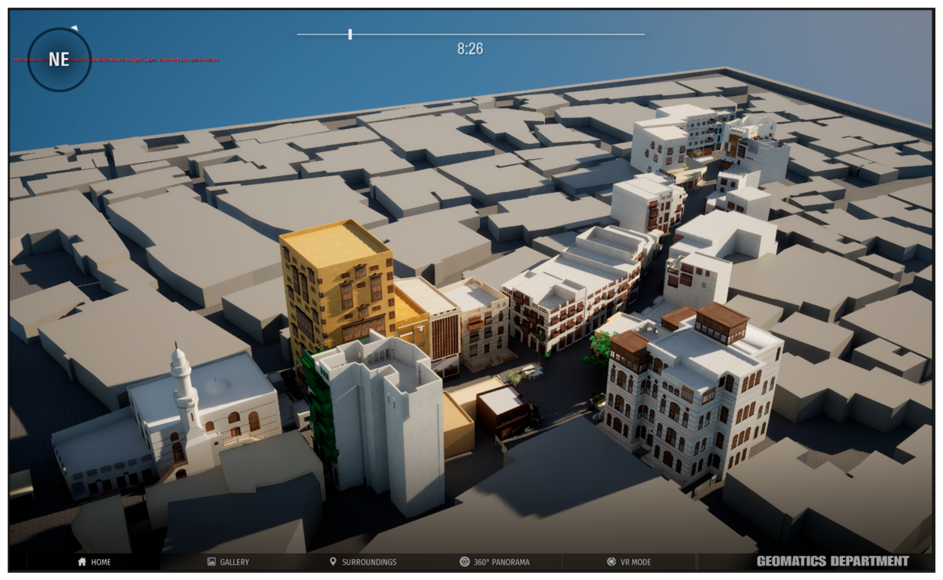
The immersive, interactive representation of Souq Al-Alawi was designed to simulate the spatial qualities, visual character, and atmospheric conditions of the physical site.
The navigation system is highly adaptable to various exploration patterns, from guided tours that emphasize specific architectural and historical highlights to free-roam discovery of the environment at the user’s leisure. This flexible nature appeals to learners taking a class, those taking part in casual virtual sightseeing, and both beginners and seasoned VR users. It is based on standard practice [
2] in building engaging, user-centered cultural heritage VR experiences.
Performance optimizations ensured a consistent frame rate of 90 frames per second throughout the virtual environment, making VR experiences comfortable and free from motion sickness or visual artifacts. Level-of-Detail systems work by reducing the geometric complexity of objects based on their distance from the viewer, so details always look nice while keeping the load low on distant objects. This optimization policy, based on state-of-the-art methodology in real-time rendering for heritage purposes [
7,
9], shows that integration into photorealistic VR environments is feasible without losing performance.
3.3. Interactive Features and Information Integration
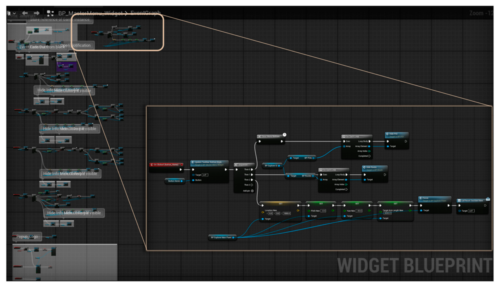
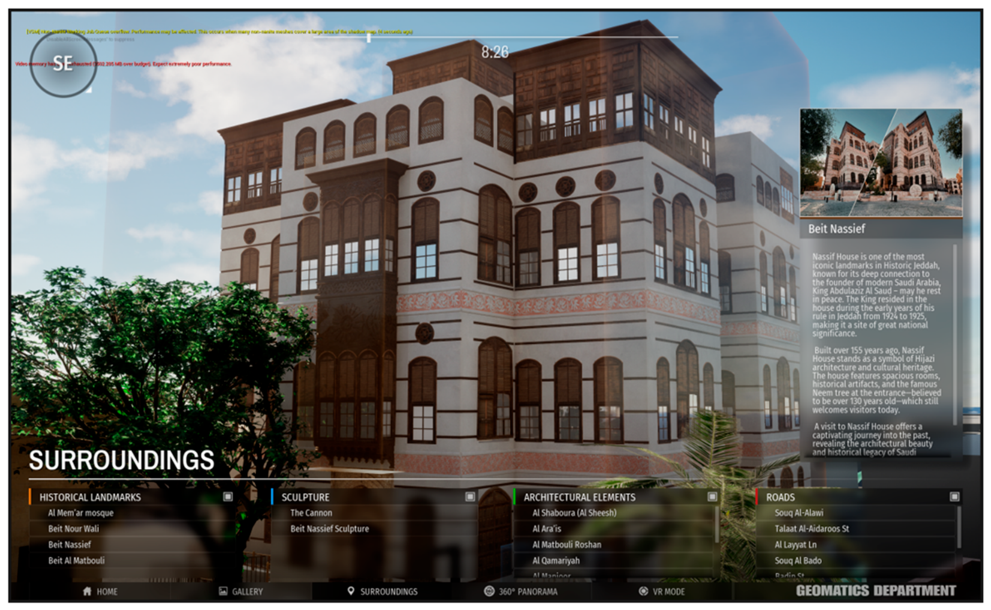
By including interactive hotspots, multimedia content, and contextual information to complement the highlights of each location, use cases enable a more educational virtual tourism platform. At key locations throughout the virtual reality experience, users can access historical photos, text descriptions of events, audio narration, and related information. The layered information architecture was designed to support multiple levels of information access, ranging from general visitor information to more detailed historical and architectural content. An illustrative instance of this digital storytelling implementation is shown in
Figure 18; when users arrive at locations of interest, they are presented with interactive information panels and relevant data that is contextually superimposed over the historical building.
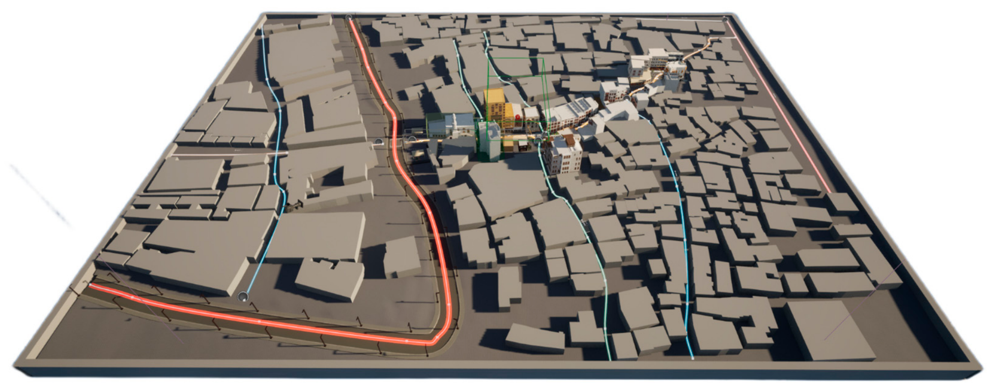
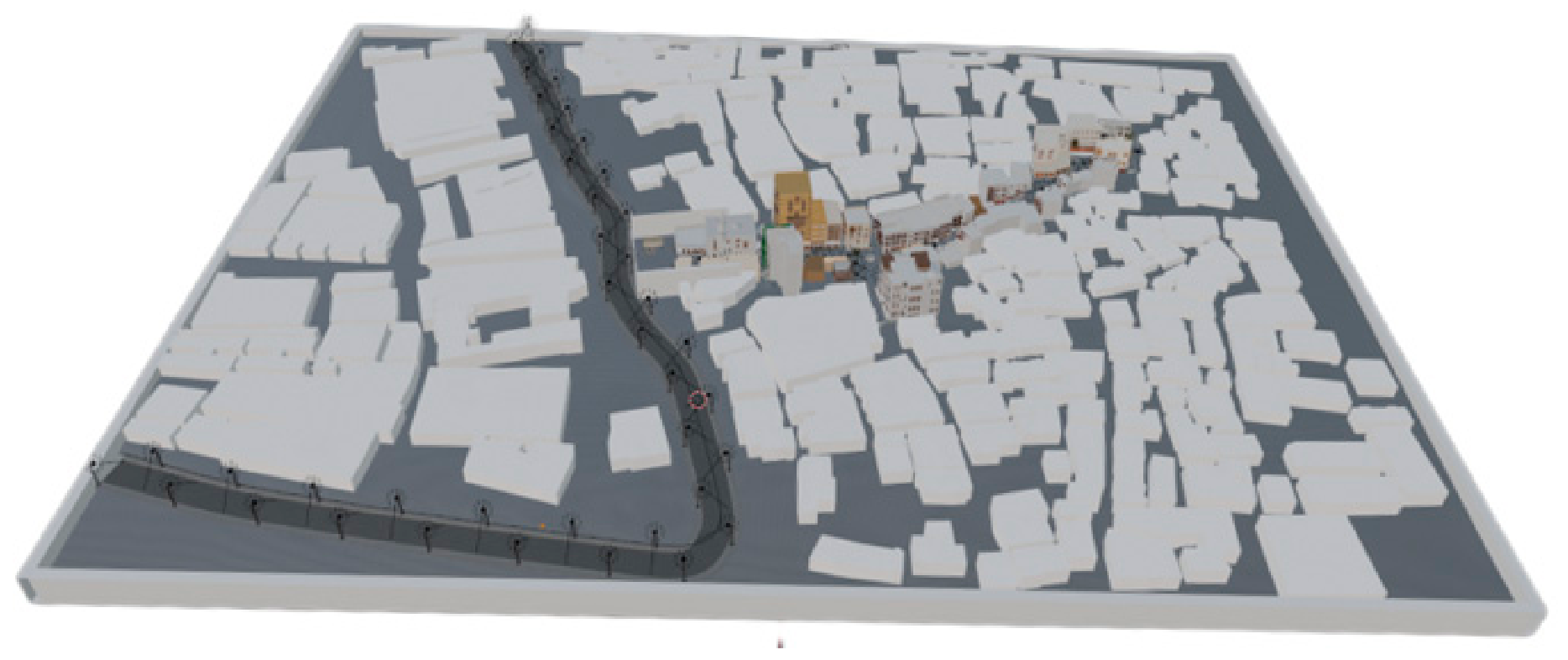
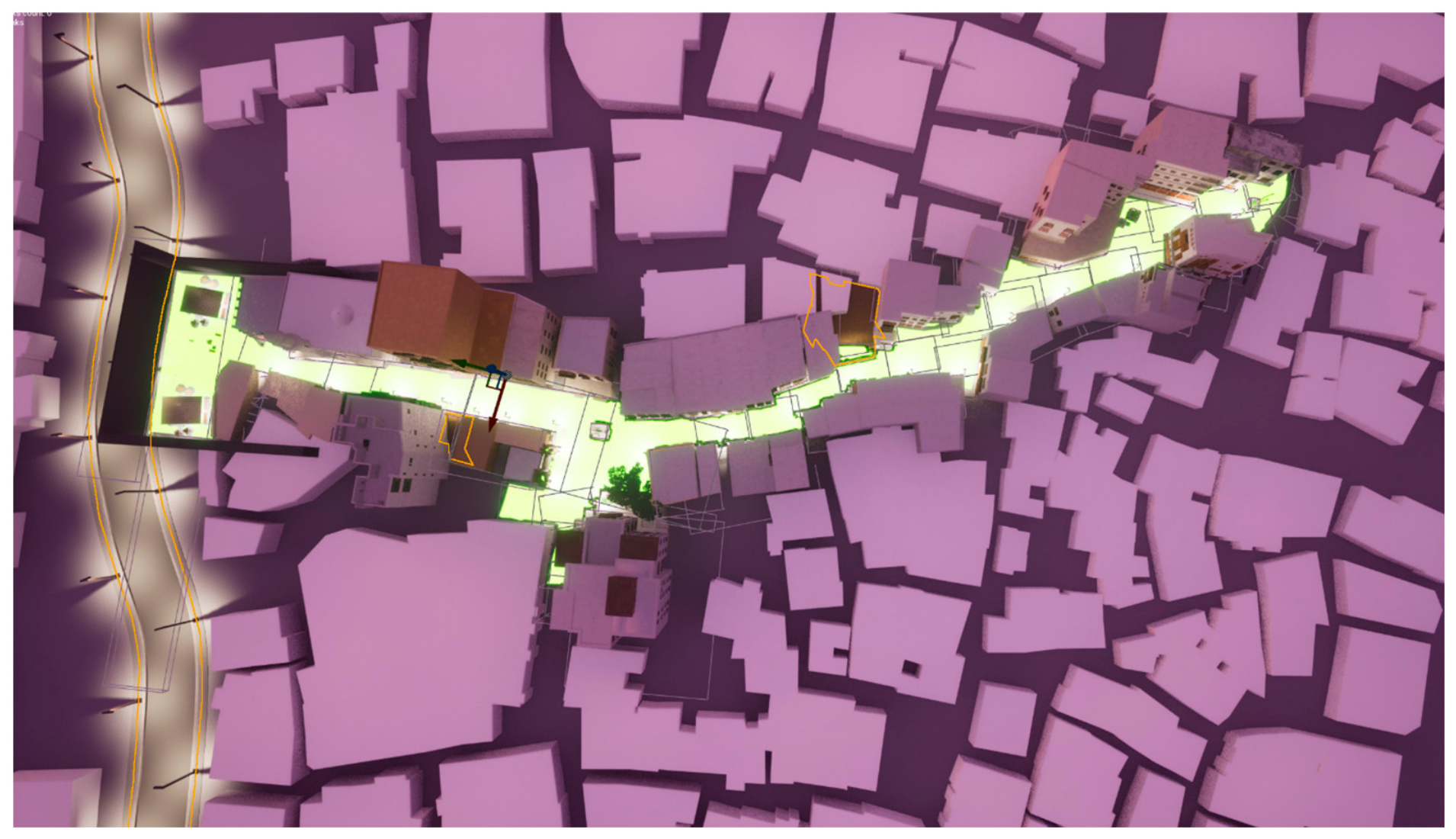
The GIS integration offers spatial context, helping users conceptualize Souq Al-Alawi’s place in the larger historic district of Jeddah. Most virtual environment designs need to take into account the common problem of users disoriented in a space void of familiar physical cues, but with a good mini map and wayfinding system backed by functionality, these concerns can be mitigated. This method is consistent with those previously proof-tested [
10,
31] for adding spatial data in virtual heritage.
The use of multimedia elements such as historical photos and an audio narration further enhances the quasi-trip, linking contemporary images of Souq Al-Alawi with its past and overall importance in Saudi Arabian culture. Drawing from well-established approaches [
3,
27], this temporal dimension allows users to appreciate the continuity and change in living heritage sites.
3.4. Accessibility and Inclusivity
The virtual tourism platform has the potential to improve the accessibility of Souq Al-Alawi to various audience groups that would otherwise have limited physical access. For international arrivals, the famed souq can be experienced at no expense and without the time commitment of international travel. Through improving accessibility in case of mobility limitations, users can visit the site virtually, overcoming physical barriers like uneven surfaces, stairs, and narrow passages, which could be challenging in a physical environment. Educational institutions may use the platform as a supplementary educational resource about Arabian architectural heritage, Islamic urbanism, and related fields without taking them on field trips.
These efforts to democratize access to tangible cultural heritage are in line with broader priorities for the preservation and education of cultural heritage, making sites around the world accessible to a global audience [
11,
18]. The platform enables preservation of a comprehensive digital representation of Souq Al-Alawi conditions today and serves as an evidence-based reference for knowledge regarding sustainable interventions while at the same time offering a basis for comparison to assess change over time [
6,
19].
3.5. Technical Challenges and Solutions
During the development of the virtual tourism platform, several technical challenges were encountered and addressed. The street aspect of Souq Al-Alawi, along with its narrow configuration, was challenging for photographic documentation, which necessitated preplanned placement of captured positions and methodical perspective distortion rectification. The rear solution consisted of optimal capture techniques, photogrammetric calibration, and post-processing adjustments, stressing the necessity of methodological rigor in documenting heritage [
3,
15].
The extensive datasets generated by high-resolution photogrammetry called for effective data management and optimization mechanisms. The photogrammetric processing yields point clouds and meshes with millions of points and polygons, respectively, so the output requires decimation and level-of-detail generation to allow real-time rendering in VR. The optimization combined geometric fidelity and performance considerations, ensuring that the virtual environment remained visually realistic while being amenable to rendering on consumer VR platforms [
7,
9].
To obtain homogeneous lighting and color for the different 3D models acquired under diverse natural illumination conditions, we used texture processing methods together with color correction. Souq Al-Alawi’s narrow streets lead to situations with complicated lighting patterns showing very different illumination levels between sunlit and shaded areas. The incorporation of texture blending algorithms and color normalization processes is required to ensure that all models not only look visually consistent, but also appear to have been rendered naturally in the environment within the game [
4,
13].
3.6. Comparison with Related Work
This study expands and extends previous work on virtual tourism and heritage digitization in different aspects. This project focuses on photorealistic visual representation based on image-based modeling as opposed to parametric BIM, and it contrasts with the interactive virtual approach to historic Jeddah that was developed previously [
11]. The BIM approaches are designed to facilitate architectural analysis and conservation planning but given that the photogrammetric approach used here is concerned with visual authenticity as well as immersive experience quality, it is ideal for potential virtual tourism applications.
The methodology used is consistent with the best practices reported in a recent systematic review [
6], such as the use of validated three-dimensional reconstruction techniques, integration of educational content and context, and user-centered design principles. This project illustrates the extent to which these best practices are realized in a specific heritage context, offering a relevant case study for virtual heritage projects in similar urban sites around the globe.
The combination of three different technologies, photogrammetry, GIS and VR, is in accordance with the complete methodology described in the literature [
3,
10], because good virtual heritage platforms need this synergistic coherence between complementary technologies. Such integration allows for a Virtual Tourism platform that functions simultaneously as an immersive experience, educational tool, spatial database and preservation record.
While the individual technologies employed in this study have been widely reported in previous research, their principal contribution lies in their systematic integration into a single operational workflow. The proposed framework bridges high-resolution photogrammetric reconstruction, GIS-based spatial analysis, and immersive VR visualization, enabling comprehensive documentation and interpretation of cultural heritage assets. This integrated approach extends beyond isolated applications by providing a reproducible methodology suitable for virtual tourism development and heritage management.
3.7. Implications for Cultural Heritage Preservation
The virtual tourism system presented here has important implications for cultural heritage preservation in Saudi Arabia and around the world. The project records Souq Al-Alawi in detail, contributing to the preservation of traditional Arabian architecture and urban morphology, which might be under threat due to urban development or environmental degradation, or simply natural aging processes [
18,
19].
Correct geometry design data can assist in decisions related to conservation planning through objective and authentic visual documentation and sufficient spatial context. They provide a baseline for conservation professionals to assess conditions, plan interventions, and continue monitoring changes over time. Using a combination of digital technologies for heritage management is consistent with previous approaches shown in the literature [
7,
12] to integrate documentation and conservation practices.
The virtual tourism platform developed in this study demonstrates potential applications in tourism promotion, academic research, professional training, and public heritage awareness. Researchers can examine aspects of architecture, spatial design, and urban elements without needing onsite access. Students can get a better understanding of a traditional Arabian architectural style through immersive virtual experiences. The general public can cultivate an appreciation for cultural heritage, potentially rallying support for preservation efforts [
15,
20].
3.8. Limitations and Future Directions
Several limitations of the current study need to be recognized. In particular, this study did not include user-based evaluations such as usability testing, sense of presence assessment, learning outcome measurement, or technology acceptance analysis because the primary objective was to develop and technically validate an integrated digital documentation and virtual tourism workflow rather than evaluate user responses, which requires separate experimental designs and participant-based investigations. Therefore, conclusions regarding educational effectiveness and user experience remain potential applications requiring future investigation. Although reprojection error was used to assess photogrammetric processing quality, independent geometric validation, including quantitative assessment of distortion correction using field measurements or angular deviation analysis, was beyond the scope of this study because the research focused on demonstrating the feasibility and integration of the proposed workflow rather than conducting a comprehensive surveying accuracy assessment. The photographic documentation was conducted during a single site visit under specific lighting and seasonal conditions. In addition, detailed image acquisition parameters, such as the number of images captured per façade, camera-to-subject distance, and camera height ranges, were not systematically recorded during fieldwork, which may limit the full reproducibility of the capture protocol. Future research should broaden the documentation to include a wider variety of seasons, time-of-day and weather properties in order to achieve an even more thorough representation of variation at any given place. The present-day virtual world is centered around visual and spatial representation; the integration of other sensory modalities (such as haptic feedback or olfactory elements that amp up immersion) could be added but are not fully integrated at this current time.
This project was intentionally limited to selected zones of Souq Al-Alawi to demonstrate and evaluate the proposed documentation workflow within representative sections of the historic urban environment. Expanding the documentation to the entire souq would have required substantially greater fieldwork, processing time, and computational resources, which were beyond the scope of the present study. Further developments could grow the virtual experience to include the entire souq and nearby parts of the Historic Jeddah area, establishing a truly complete virtual heritage district. Linking to other digital heritage initiatives in Jeddah could result in a virtual heritage network that links multiple sites and provides wider context for interpreting the city’s cultural heritage [
11,
17].
User evaluation studies using quantitative approaches (e.g., technology acceptance measures) and qualitative methods (e.g., interviews or focus groups) could further assess user experience, perceived usefulness, and behavioral intention across different user groups. User experience, learning outcomes and engagement patterns would allow for a systematic assessment that could help in iterative enhancements along with the understanding of effective virtual heritage design. Evaluation studies of this nature would be further augmentation to the nascent evidence base for virtual tourism as a heritage conservation and education solution, following existing methodologies for virtual reality assessments [
2,
6].
The future might offer new advances in VR hardware, rendering techniques and artificial intelligence to enable further improvements. Advancements such as real-time ray tracing, neural rendering and AI-driven content generation can also allow for better esthetics or new types of interaction. Integration with AI-based monitoring systems, such as those shown in recent studies, also allow the platform capabilities for heritage conservation to be expanded towards automated condition assessment and change detection [
32].
4. Conclusions
This research demonstrates the integration of 3D mapping, image-based modeling, GIS data, and virtual reality technology to develop an interactive virtual tourism platform for a selected section of Souq Al-Alawi (UNESCO World Heritage Site) in Jeddah, Saudi Arabia. The successful completion of the project achieved the following goals: obtain high-precision data related to traditional Arabian architecture, create an interactive VR environment, and find solutions for technical problems associated with heritage documentation in clustered urban areas.
The methodological approach in this work, using smartphone-based photogrammetry with systematic image capture protocols, photogrammetric processing and VR development in Unreal Engine, is a replicable methodology that could be applied in other virtual heritage projects developed in comparable contexts. This allows for direct, practical solutions to be obtained for the often-persistent problem of facade distortions resulting from narrow street configurations in historic urban documentation. The virtual tourism platform created in this study provides an interactive and immersive virtual environment that has the potential to support heritage education, public engagement, and cultural preservation. However, these potential benefits should be validated through future user-based evaluation studies.
This research demonstrates the potential of contemporary digital technologies to support virtual tourism, improve digital accessibility, and contribute to the documentation of cultural heritage within the scope of the present case study. This platform for virtual tourism allows different audiences, including international tourists, people with limited mobility, students, and researchers, to visit and learn about Souq Al-Alawi without the need to travel to Jeddah, Saudi Arabia. This sharing of access falls in line with the goals of UNESCO—for example, ensuring that important heritage sites around the world are accessible to audiences worldwide.
Photogrammetry, GIS, and VR work together as a digital heritage platform with different functions: providing immersive virtual tourism, educational uses, use as a spatial database, and use for the protection of documentation. This multi-faceted approach also extends the return from investment in digital heritage and supports varied stakeholder needs, including tourism promotion, conservation planning, and academic research.
Providing a case study with best practices for heritage digitization, VR development and information integration, this project adds to the body of knowledge in the emergent area of research represented by virtual heritage and digital tourism. The methodological approaches, technical solutions, and lessons learned from this case study can inform similar virtual heritage projects in Saudi Arabia and elsewhere, supporting the broader application of digital technologies for cultural heritage documentation and virtual tourism.
With the development of digital technology, there will be increasing opportunities for virtual tourism to share a space with physical tourism. It could help plan visits, provide virtual tours of museums afterwards as a memory aid, and provide an alternative to visitation for those unable to travel. Emerging technologies like artificial intelligence, neural rendering and extended reality will only enhance the quality and capabilities of virtual heritage experiences over the next decade, opening up new possibilities for cultural engagement and preservation.
The Souq Al-Alawi virtual tourism platform demonstrates the potential of digital technologies to support cultural heritage documentation and virtual tourism within the scope of this case study. The project embodies how technology can aid heritage preservation through a detailed digital record and improved accessibility, providing support for education and cultural appreciation while also catering to the changing trends of 21st-century tourism. This study supports the objectives of Saudi Arabia Vision 2030 by demonstrating the potential role of digital innovation in documenting and promoting cultural heritage through virtual tourism.