A Determination of Suitable Zones for Settlements Based on Multi-Criteria Analysis: A Case Study of Goranci (Bosnia and Herzegovina)
Abstract
1. Introduction
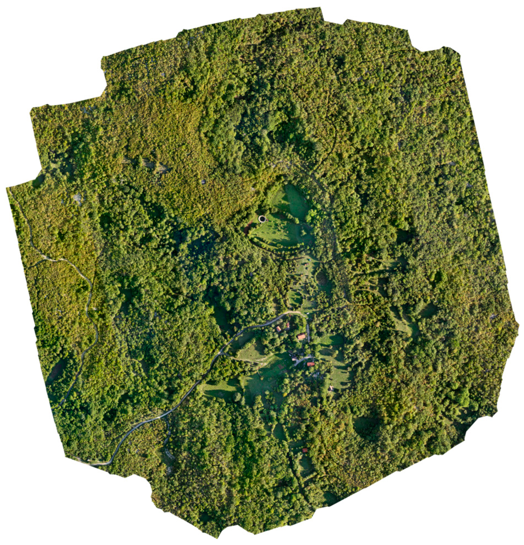
2. Study Area
2.1. Geological and Geomorphological Setting
2.2. Pedological and Hydrological Characteristics and Climate Conditions
2.3. Spatial Development Constraints
- Steep slopes (locally exceeding 25°), increasing construction costs and limiting accessibility.
- High variability in solar exposure due to complex relief.
- Poor levels of water availability caused by rapid infiltration and lack of permanent watercourses.
- Risk of soil erosion and terrain instability in areas with high slopes and shallow soil.
- Limited transportation infrastructure, with most roads being narrow, unpaved, and seasonally affected by weather conditions.
3. Materials and Methods
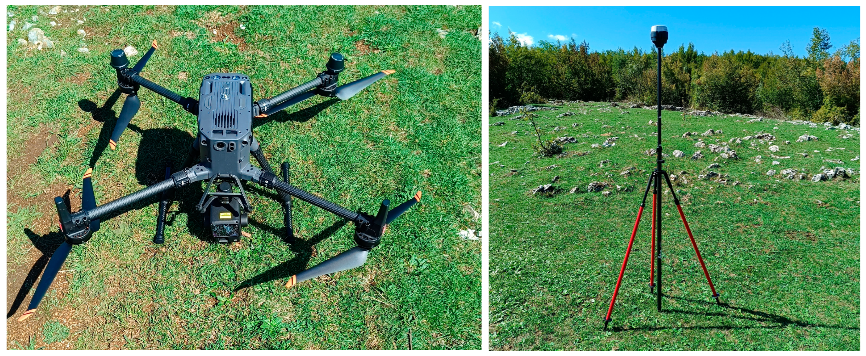
3.1. LiDAR Data Collection
- Digital Surface Model (DSM)—representing the top surface, including vegetation and built features.
- Digital Terrain Model (DTM)—representing the bare-earth surface derived through ground classification and interpolation using a TIN-based progressive densification algorithm.
3.2. Derivation of Morphometric and Environmental Parameters
4. Results and Discussions
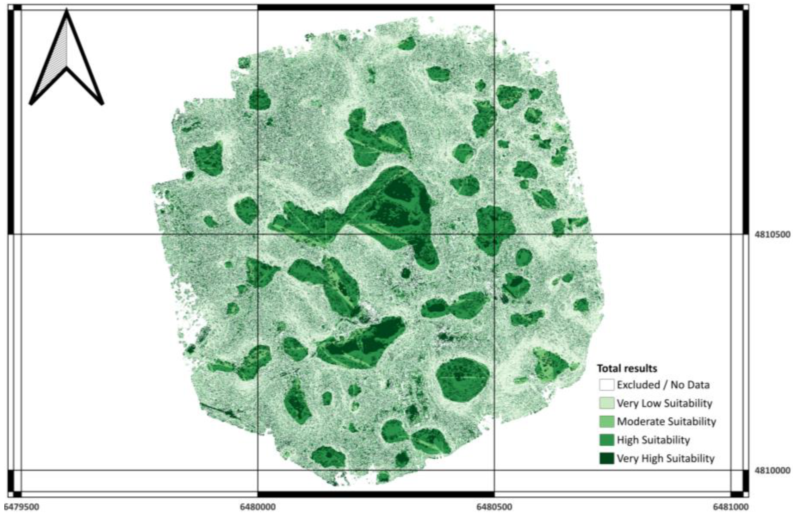
- Class 4 (very high suitability) zones are predominantly located on gently inclined karst plateaus and slightly elevated terraces characterized by slopes ≤ 15°, high solar insolation (PISR ≥ 1200 Wh/m2), and high sky openness (SVF ≥ 0.9). These conditions provide optimal microclimatic comfort and minimal earthwork for potential low-density residential development.
- Class 3 (high suitability) areas extend along transitional slopes and gently rolling terrain; although slightly more inclined, they remain structurally stable and well-drained.
- Classes 1–2 (low–moderate suitability) are associated with shaded northern slopes, localized depressions, and concave landforms with higher TWI values, reflecting temporary moisture retention and reduced solar exposure.
- Class 0 (excluded) coincides with deep dolines, steep escarpments, and hydrologically active channels identified through the LiDAR DTM.
- Data coverage and computational constraints
- Subjectivity in weight assessment
- Static representation of dynamic environments
- Absence of Socio-Economic and Infrastructure factors
5. Conclusions
Author Contributions
Funding
Institutional Review Board Statement
Informed Consent Statement
Data Availability Statement
Acknowledgments
Conflicts of Interest
Appendix A
| Criteria | Slope | PISR | TWI | TRI | LS | SVF | TPI | Weight |
|---|---|---|---|---|---|---|---|---|
| Slope | 1.00 | 1.25 | 1.67 | 2.50 | 2.50 | 2.50 | 5.00 | 0.263 |
| PISR | 0.80 | 1.00 | 1.33 | 2.00 | 2.00 | 2.00 | 4.00 | 0.211 |
| TWI | 0.60 | 0.75 | 1.00 | 1.50 | 1.50 | 1.50 | 3.00 | 0.158 |
| TRI | 0.40 | 0.50 | 0.67 | 1.00 | 1.00 | 1.00 | 2.00 | 0.105 |
| LS | 0.40 | 0.50 | 0.67 | 1.00 | 1.00 | 1.00 | 2.00 | 0.105 |
| SVF | 0.40 | 0.50 | 0.67 | 1.00 | 1.00 | 1.00 | 2.00 | 0.105 |
| TPI | 0.20 | 0.25 | 0.33 | 0.50 | 0.50 | 0.50 | 1.00 | 0.053 |
References
- Telbisz, T. Lidar-Based Morphometry of Conical Hills in Temperate Karst Areas in Slovenia. Remote Sens. 2021, 13, 2668. [Google Scholar] [CrossRef]
- Kim, J.; Hong, I. Evaluation of the Usability of UAV LiDAR for Analysis of Karst (Doline) Terrain Morphology. Sensors 2024, 24, 7062. [Google Scholar] [CrossRef]
- Telbisz, T.; Mari, L.; Székely, B. LiDAR-Based Morphometry of Dolines in Aggtelek Karst (Hungary) and Slovak Karst (Slovakia). Remote Sens. 2024, 16, 737. [Google Scholar] [CrossRef]
- Ko, S.-J.; Hong, S.; Kwak, T.-Y. Development of a UAV LiDAR-Based Framework for Consolidation Settlement Monitoring Through Spatial Analysis. J. Mar. Sci. Eng. 2025, 13, 1106. [Google Scholar] [CrossRef]
- Wei, G.; He, B.J.; Sun, P.; Liu, Y.; Li, R.; Ouyang, X.; Luo, K.; Li, S. Evolutionary Trends of Urban Expansion and Its Sustainable Development: Evidence from 80 Representative Cities in the Belt and Road Initiative Region. Cities 2023, 138, 104353. [Google Scholar] [CrossRef]
- Arabameri, A.; Rezaie, F.; Pal, S.C.; Cerda, A.; Saha, A.; Chakrabortty, R.; Lee, S. Modelling of Piping Collapses and Gully Headcut Landforms: Evaluating Topographic Variables from Different Types of DEM. Geosci. Front. 2021, 12, 101230. [Google Scholar] [CrossRef]
- Arabameri, A.; Pradhan, B.; Rezaei, K.; Yamani, M.; Pourghasemi, H.R.; Lombardo, L. Spatial Modelling of Gully Erosion Using Evidential Belief Function, Logistic Regression, and a New Ensemble of Evidential Belief Function–Logistic Regression Algorithm. Land. Degrad. Dev. 2018, 29, 4035–4049. [Google Scholar] [CrossRef]
- Chang, K.T.; Merghadi, A.; Yunus, A.P.; Pham, B.T.; Dou, J. Evaluating Scale Effects of Topographic Variables in Landslide Susceptibility Models Using GIS-Based Machine Learning Techniques. Sci. Rep. 2019, 9, 12296. [Google Scholar] [CrossRef]
- Chakrabortty, R.; Pal, S.C.; Chowdhuri, I.; Malik, S.; Das, B. Assessing the Importance of Static and Dynamic Causative Factors on Erosion Potentiality Using SWAT, EBF with Uncertainty and Plausibility, Logistic Regression and Novel Ensemble Model in a Sub-Tropical Environment. J. Indian Soc. Remote Sens. 2020, 48, 765–789. [Google Scholar] [CrossRef]
- Abdelkarim, A.; Al-Alola, S.S.; Alogayell, H.M.; Mohamed, S.A.; Alkadi, I.I.; Ismail, I.Y. Integration of GIS-Based Multicriteria Decision Analysis and Analytic Hierarchy Process to Assess Flood Hazard on the Al-Shamal Train Pathway in Al-Qurayyat Region, Kingdom of Saudi Arabia. Water 2020, 12, 1702. [Google Scholar] [CrossRef]
- Maxwell, A.E.; Shobe, C.M. Land-Surface Parameters for Spatial Predictive Mapping and Modeling. Earth Sci. Rev. 2022, 226, 103944. [Google Scholar] [CrossRef]
- Malczewski, J. GIS-based Multicriteria Decision Analysis: A Survey of the Literature. Int. J. Geogr. Inf. Sci. 2006, 20, 703–726. [Google Scholar] [CrossRef]
- Romano, G.; Dal Sasso, P.; Trisorio Liuzzi, G.; Gentile, F. Multi-Criteria Decision Analysis for Land Suitability Mapping in a Rural Area of Southern Italy. Land. Use Policy 2015, 48, 131–143. [Google Scholar] [CrossRef]
- Yalew, S.G.; van Griensven, A.; van der Zaag, P. AgriSuit: A Web-Based GIS-MCDA Framework for Agricultural Land Suitability Assessment. Comput. Electron. Agric. 2016, 128, 1–8. [Google Scholar] [CrossRef]
- Bonacci, O.; Željković, I.; Galić, A. Karst Rivers’ Particularity: An Example from Dinaric Karst (Croatia/Bosnia and Herzegovina). Environ. Earth Sci. 2013, 70, 963–974. [Google Scholar] [CrossRef]
- Bonacci, O. Karst Hydrogeology/Hydrology of Dinaric Chain and Isles. Environ. Earth Sci. 2015, 74, 37–55. [Google Scholar] [CrossRef]
- Kim, J.; Hong, I. Analysis of Doline Microtopography in Karst Mountainous Terrain Using UAV LiDAR: A Case Study of ‘Gulneomjae’ in Mungyeong City, South Korea. Sensors 2025, 25, 4350. [Google Scholar] [CrossRef]
- Čikić, S.; Čičić, S.; Avdagić, I.; Čičić, E. Geological Map of Bosnia and Herzegovina 1:300000. Available online: https://fzzg.gov.ba/file/gk300000-opt21/256 (accessed on 22 November 2024).
- Kobal, M.; Bertoncelj, I.; Pirotti, F.; Dakskobler, I.; Kutnar, L. Using Lidar Data to Analyse Sinkhole Characteristics Relevant for Understory Vegetation under Forest Cover—Case Study of a High Karst Area in the Dinaric Mountains. PLoS ONE 2015, 10, e0122070. [Google Scholar] [CrossRef]
- Federal Hydrometeorological Institute of Bosnia and Herzegovina. Climatological Analysis for the Year 2023; Federal Hydrometeorological Institute of Bosnia and Herzegovina: Sarajevo, Bosnia and Herzegovina, 2024. [Google Scholar]
- Dirksen, M.; Ronda, R.J.; Theeuwes, N.E.; Pagani, G.A. Sky View Factor Calculations and Its Application in Urban Heat Island Studies. Urban. Clim. 2019, 30, 100498. [Google Scholar] [CrossRef]
- Hodul, M.; Knudby, A.; Ho, H.C. Estimation of Continuous Urban Sky View Factor from Landsat Data Using Shadow Detection. Remote Sens. 2016, 8, 568. [Google Scholar] [CrossRef]
- Okoli, J.; Nahazanan, H.; Nahas, F.; Kalantar, B.; Shafri, H.Z.M.; Khuzaimah, Z. High-Resolution Lidar-Derived DEM for Landslide Susceptibility Assessment Using AHP and Fuzzy Logic in Serdang, Malaysia. Geosciences 2023, 13, 34. [Google Scholar] [CrossRef]
- Mahalingam, R.; Olsen, M.J.; O’Banion, M.S. Evaluation of Landslide Susceptibility Mapping Techniques Using Lidar-Derived Conditioning Factors (Oregon Case Study). Geomat. Nat. Hazards Risk 2016, 7, 1884–1907. [Google Scholar] [CrossRef]
- Everest, T.; Sungur, A.; Özcan, H. Determination of Agricultural Land Suitability with a Multiple-Criteria Decision-Making Method in Northwestern Turkey. Int. J. Environ. Sci. Technol. 2021, 18, 1073–1088. [Google Scholar] [CrossRef]
- Rahmati, O.; Pourghasemi, H.R.; Melesse, A.M. Application of GIS-Based Data Driven Random Forest and Maximum Entropy Models for Groundwater Potential Mapping: A Case Study at Mehran Region, Iran. Catena 2016, 137, 360–372. [Google Scholar] [CrossRef]
- Bathrellos, G.D.; Skilodimou, H.D.; Chousianitis, K.; Youssef, A.M.; Pradhan, B. Suitability Estimation for Urban Development Using Multi-Hazard Assessment Map. Sci. Total Environ. 2017, 575, 119–134. [Google Scholar] [CrossRef] [PubMed]
- Mosadeghi, R.; Warnken, J.; Tomlinson, R.; Mirfenderesk, H. Comparison of Fuzzy-AHP and AHP in a Spatial Multi-Criteria Decision Making Model for Urban Land-Use Planning. Comput. Environ. Urban. Syst. 2015, 49, 54–65. [Google Scholar] [CrossRef]
- Chen, Y.; Yu, J.; Khan, S. Spatial Sensitivity Analysis of Multi-Criteria Weights in GIS-Based Land Suitability Evaluation. Environ. Model. Softw. 2010, 25, 1582–1591. [Google Scholar] [CrossRef]
- Meng, F.; Liang, X.; Xiao, C.; Wang, G. Geothermal Resource Potential Assessment Utilizing GIS—Based Multi Criteria Decision Analysis Method. Geothermics 2021, 89, 101969. [Google Scholar] [CrossRef]
- Veronesi, F.; Schito, J.; Grassi, S.; Raubal, M. Automatic Selection of Weights for GIS-Based Multicriteria Decision Analysis: Site Selection of Transmission Towers as a Case Study. Appl. Geogr. 2017, 83, 78–85. [Google Scholar] [CrossRef]
- Morales, F.; de Vries, W.T. Establishment of Land Use Suitability Mapping Criteria Using Analytic Hierarchy Process (AHP) with Practitioners and Beneficiaries. Land 2021, 10, 235. [Google Scholar] [CrossRef]
- AbdelRahman, M.A.E.; Yossif, T.M.H.; Metwaly, M.M. Enhancing Land Suitability Assessment through Integration of AHP and GIS-Based for Efficient Agricultural Planning in Arid Regions. Sci. Rep. 2025, 15, 31370. [Google Scholar] [CrossRef] [PubMed]
- Saaty, T.L. Decision Making with the Analytic Hierarchy Process. Int. J. Serv. Sci. 2008, 1, 83. [Google Scholar] [CrossRef]
- Mugiyo, H.; Chimonyo, V.G.P.; Sibanda, M.; Kunz, R.; Masemola, C.R.; Modi, A.T.; Mabhaudhi, T. Evaluation of Land Suitability Methods with Reference to Neglected and Underutilised Crop Species: A Scoping Review. Land 2021, 10, 125. [Google Scholar] [CrossRef] [PubMed]

| Parameter | Description | SAGA Module | Relevance | Cross Reference |
|---|---|---|---|---|
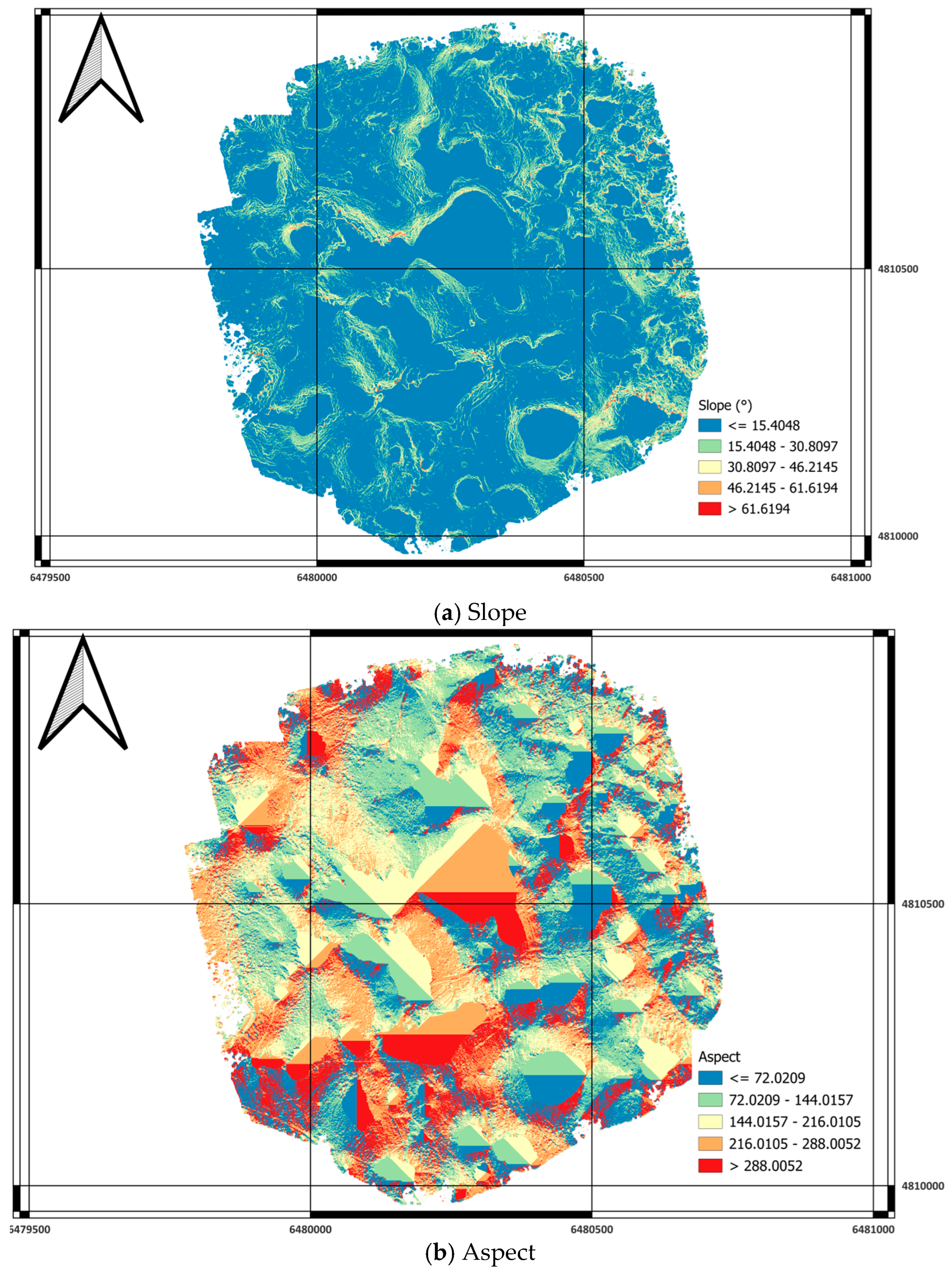
| Slope (°) | Angle of inclination derived from DTM | Slope, Aspect Curvature | Indicates construction feasibility and stability | Figure A1a,b |
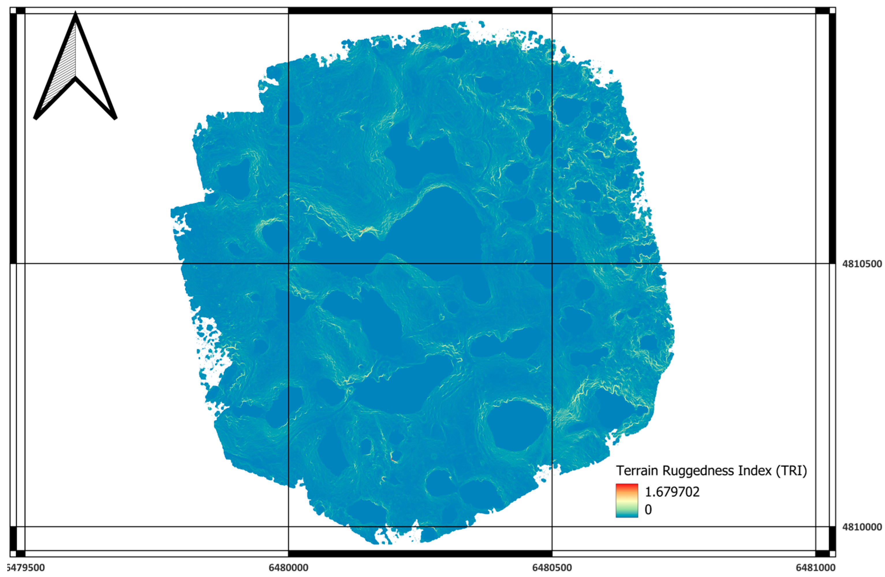
| TRI (Terrain Ruggedness Index) | Mean elevation difference between a cell and its neighbors | Terrain Ruggedness Index | Measures surface roughness; smoother terrain = higher suitability | Figure A2 |
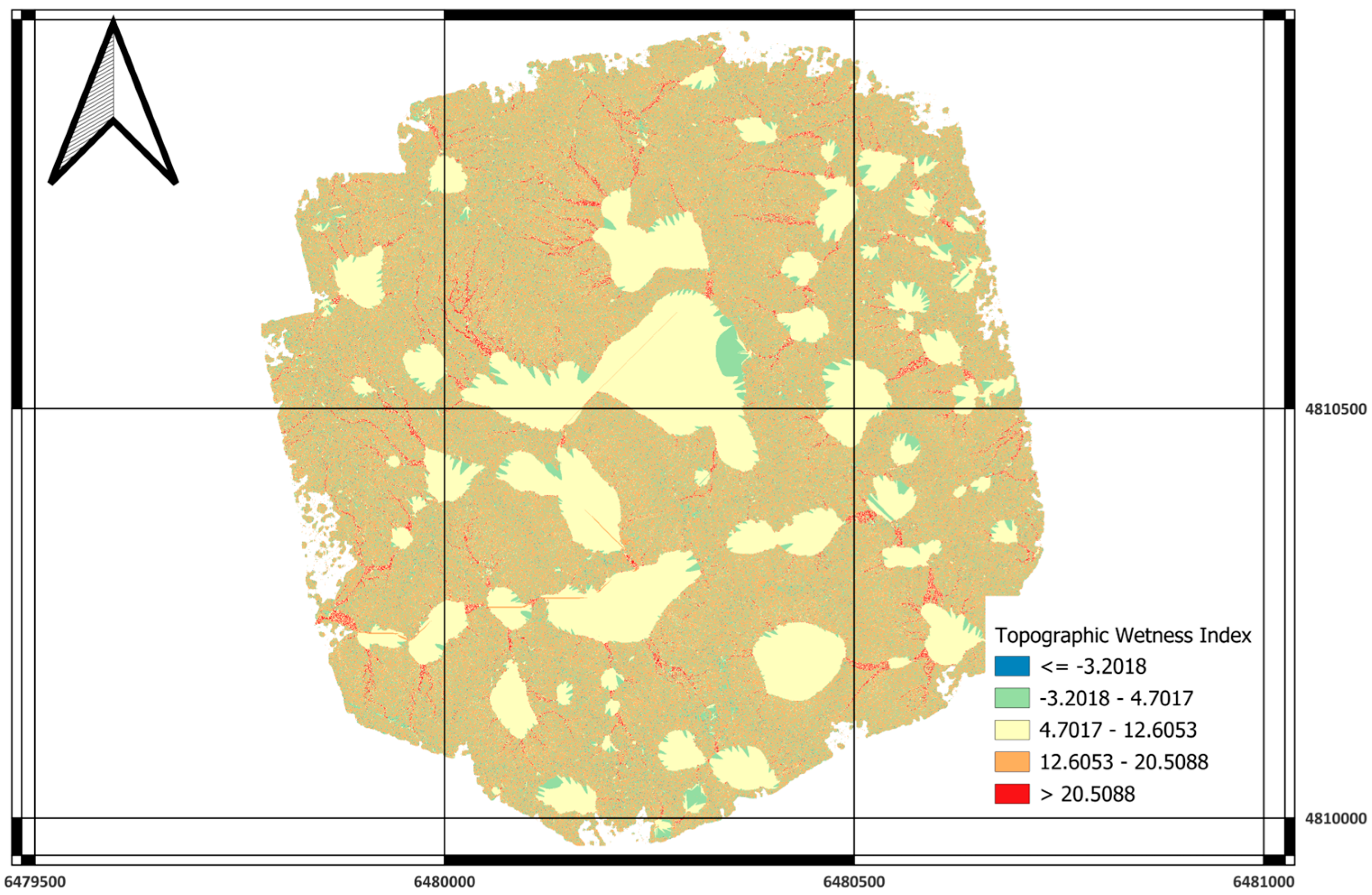
| TWI (Topographic Wetness Index) | ln (Ac/tan β), where Ac is the upslope contributing area | Topographic Wetness Index | Identifies potential moisture accumulation; drier = better | Figure A3 |
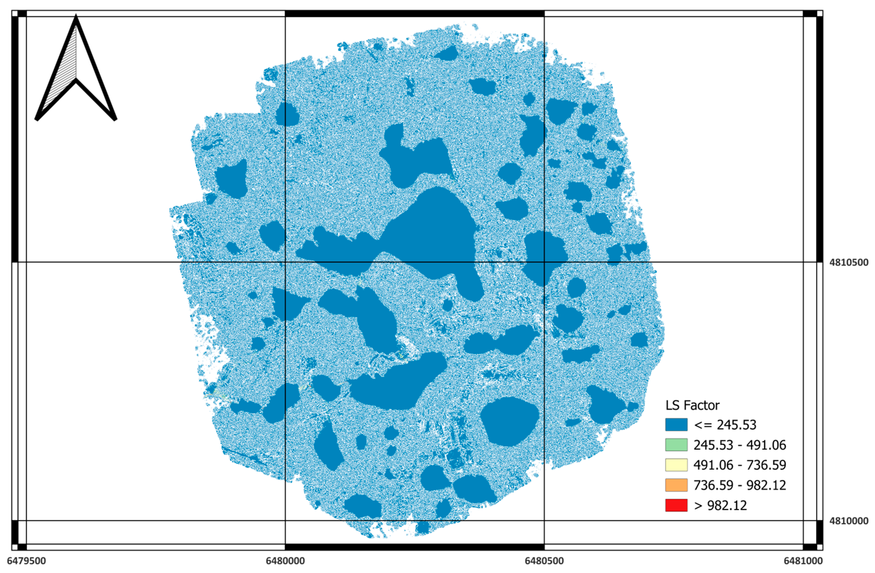
| LS Factor | Slope length–steepness factor from RUSLE | LS-Factor | Indicates erosion susceptibility; lower = better | Figure A4 |
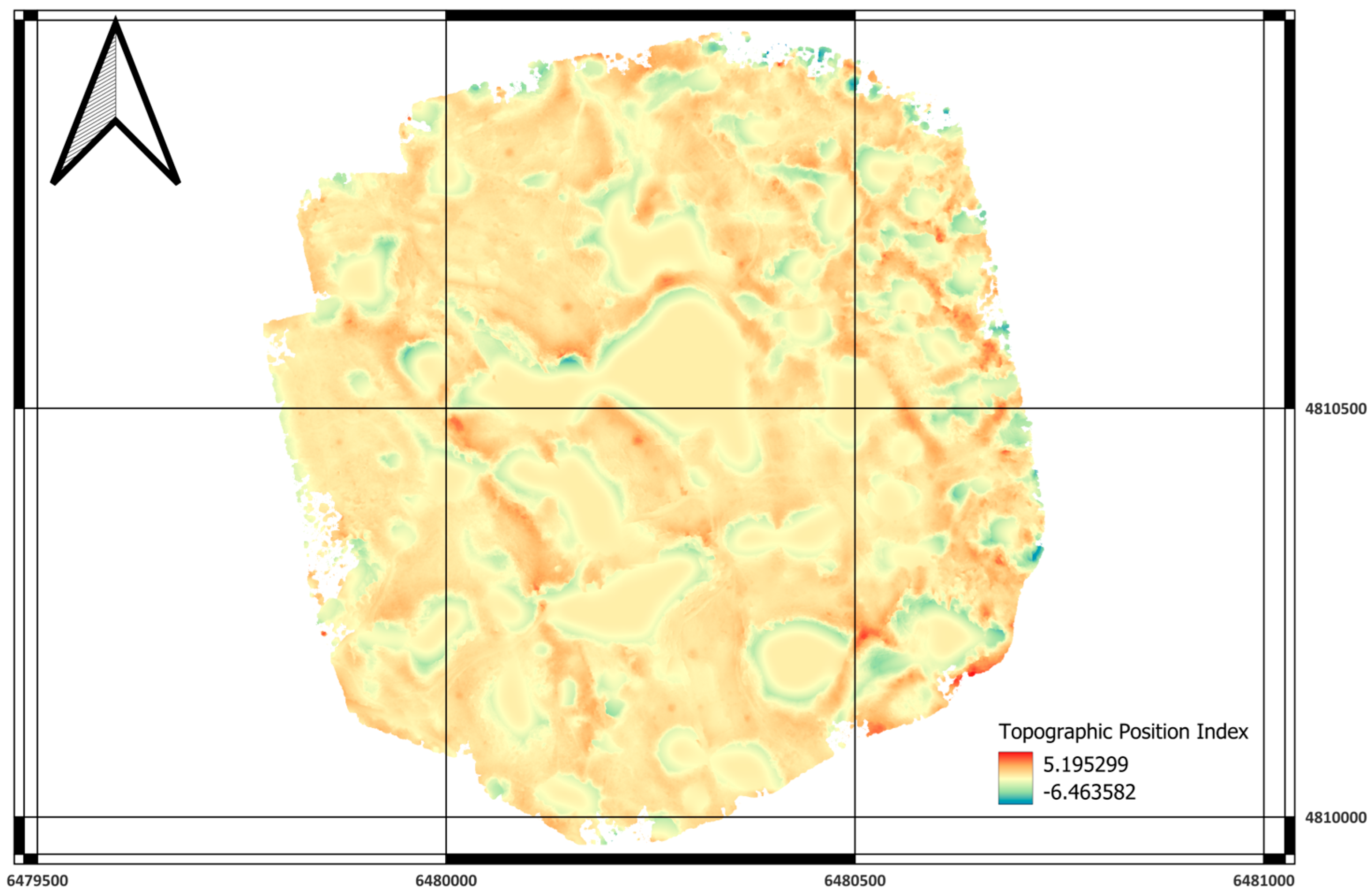
| TPI (Topographic Position Index) | Relative elevation compared to the surrounding terrain | Topographic Position Index | Distinguishes ridges, valleys, and mid-slopes | Figure A5 |
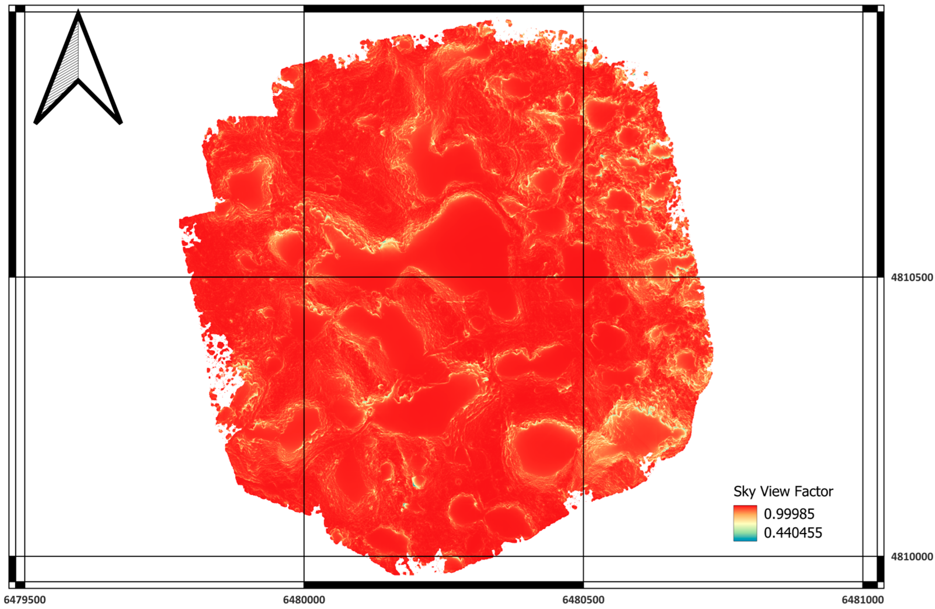
| SVF (Sky View Factor) | Portion of the visible sky hemisphere | Sky View Factor | Relates to openness, cold-air drainage, and microclimate | Figure A6 |
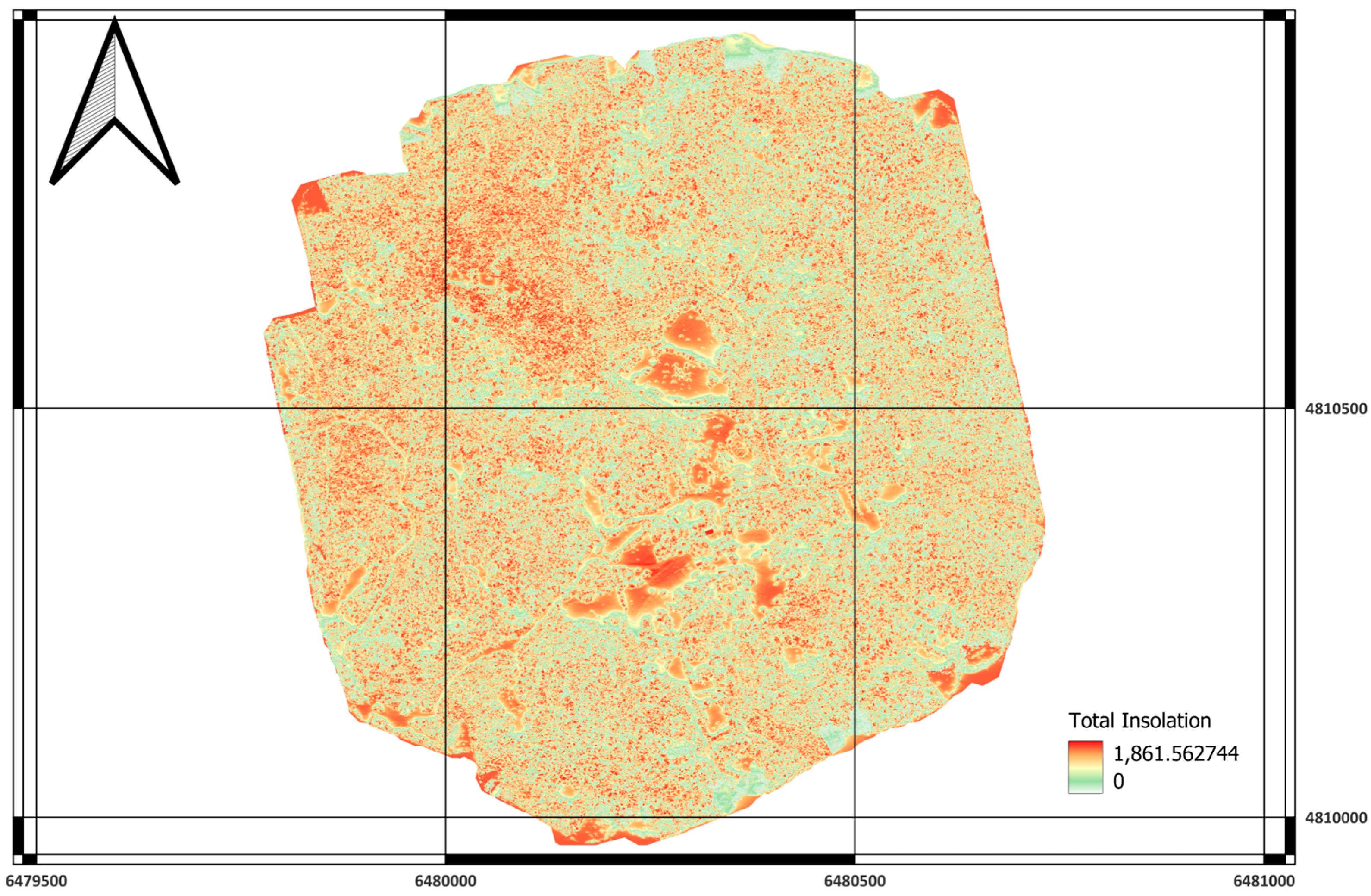
| PISR (Potential Incoming Solar Radiation) | Annual insolation energy (Wh/m2) | Potential Incoming Solar Radiation | Represents solar exposure; higher = better for living conditions | Figure A7 |
| Parameter | Optimal Condition | Non-Optimal | Suitability Logic |
|---|---|---|---|
| Slope (°) | ≤15° | >15° | More suitable is flatter terrain [23] |
| TRI | ≤0.30 | >0.30 | Low surface roughness favored [24] |
| TWI | ≤4.0 | >4.0 | Well-drained areas preferred [24] |
| LS Factor | ≤5 | >5 | Low erosion risk suitable [24,25] |
| TPI | −2 ≤ TPI ≤ 2 | outside range | Planar mid-slope surfaces optimal [25] |
| SVF | ≥0.9 | <0.9 | Open-sky terrain more comfortable [21] |
| PISR | ≥1200 | <1200 | High solar exposure beneficial |
| Parameter | Weight |
|---|---|
| Slope (°) | 0.2632 |
| TRI | 0.1053 |
| TWI | 0.1579 |
| LS Factor | 0.1053 |
| TPI | 0.0526 |
| SVF | 0.1053 |
| PISR | 0.2105 |
| Class | Description | Pixel Count | Area (m2) | Area (ha) | Share (%) |
|---|---|---|---|---|---|
| 0 | Excluded/No Data | 2,086,620 | 521,655 | 52.17 | 53.26 |
| 1 | Very Low Suitability | 236,391 | 59,098 | 5.91 | 6.04 |
| 2 | Moderate Suitability | 319,243 | 79,811 | 7.98 | 8.15 |
| 3 | High Suitability | 588,674 | 147,169 | 14.72 | 15.03 |
| 4 | Very High Suitability | 589,248 | 147,312 | 14.73 | 15.04 |
| Total | 979,045 | 97.9 | 100 | ||
Disclaimer/Publisher’s Note: The statements, opinions and data contained in all publications are solely those of the individual author(s) and contributor(s) and not of MDPI and/or the editor(s). MDPI and/or the editor(s) disclaim responsibility for any injury to people or property resulting from any ideas, methods, instructions or products referred to in the content. |
© 2025 by the authors. Licensee MDPI, Basel, Switzerland. This article is an open access article distributed under the terms and conditions of the Creative Commons Attribution (CC BY) license (https://creativecommons.org/licenses/by/4.0/).
Share and Cite
Kranjčić, N.; Šiško, D.; Đurin, B.; Cetl, V. A Determination of Suitable Zones for Settlements Based on Multi-Criteria Analysis: A Case Study of Goranci (Bosnia and Herzegovina). Sustainability 2025, 17, 10508. https://doi.org/10.3390/su172310508
Kranjčić N, Šiško D, Đurin B, Cetl V. A Determination of Suitable Zones for Settlements Based on Multi-Criteria Analysis: A Case Study of Goranci (Bosnia and Herzegovina). Sustainability. 2025; 17(23):10508. https://doi.org/10.3390/su172310508
Chicago/Turabian StyleKranjčić, Nikola, Darko Šiško, Bojan Đurin, and Vlado Cetl. 2025. "A Determination of Suitable Zones for Settlements Based on Multi-Criteria Analysis: A Case Study of Goranci (Bosnia and Herzegovina)" Sustainability 17, no. 23: 10508. https://doi.org/10.3390/su172310508
APA StyleKranjčić, N., Šiško, D., Đurin, B., & Cetl, V. (2025). A Determination of Suitable Zones for Settlements Based on Multi-Criteria Analysis: A Case Study of Goranci (Bosnia and Herzegovina). Sustainability, 17(23), 10508. https://doi.org/10.3390/su172310508


