1. Introduction
Cultural heritage houses in Iran stand as living testaments to the nation’s rich architectural legacy and deeply rooted social values. These historical dwellings, often centred around inner courtyards and adorned with intricate ornamentation, were designed not merely as shelters but as spatial narratives of Iranian lifestyles, privacy norms, and social structures [
1]. Ingrained in their architectural fabric are layers of cultural meaning that reflect gendered spatial divisions, hospitality practices, and environmental adaptations [
2,
3,
4]. Central elements such as pools, semi-open spaces, and finely crafted windows served as mediators between private and public realms, facilitating social interaction while preserving seclusion [
5,
6,
7]. The visual and physical arrangement of spaces in these houses responded to social hierarchies and climatic needs, offering valuable lessons for a harmonised built environment shaped by centuries of tradition [
8,
9]. In today’s rapidly urbanising contexts, such configurations present valuable models for integrating socio-cultural sensitivity into contemporary housing [
10]. Understanding these traditional spatial logics is crucial for rethinking modern design strategies that seek to balance openness, privacy, and social connectivity [
11].
Thus, examining the spatial characteristics of Iranian heritage houses provides an essential foundation for exploring their enduring relevance in contemporary architectural discourse. Crucially, this understanding is not merely academic; it is vital for informing sensitive and effective conservation and restoration interventions, ensuring that the intrinsic value and functional integrity of these unique structures are preserved for future generations. In doing so, this study contributes to ongoing debates on the sustainable design and assessment of heritage structures by demonstrating how traditional architectural elements act not only as aesthetic and environmental regulators but also as socio-spatial mediators that shape accessibility, privacy, and cultural resilience.
A key feature of Iranian cultural heritage houses lies in their hierarchical organisation of space, which carefully regulates socio-spatial accessibility in accordance with deeply ingrained cultural values [
12,
13]. The sequence from public to private areas, ranging from entrance zones to semi-private courtyards and fully private chambers, was designed to respect notions of modesty, gender roles, and social etiquette [
14]. This spatial hierarchy not only guided movement and interaction within the household but also reinforced family structures and collective identity [
15]. Understanding these inherited socio-cultural logics requires a methodological framework capable of decoding the relationship between spatial configuration and human behaviour [
16]. In this regard, analytical tools such as space syntax offer a scientific means of examining how visibility, permeability, and spatial connectivity influence patterns of use and social interaction [
17,
18]. By quantifying the integration and segregation of spaces, space syntax reveals how architectural layouts support or restrict access, visibility, and encounter [
19]. This approach enables a deeper appreciation of how traditional spatial arrangements were purposefully crafted to mediate social dynamics, offering critical insights for culturally informed architectural research [
20,
21]. Ultimately, the integration of spatial analysis with heritage studies paves the way for preserving intangible cultural values rooted in built form.
Despite the architectural richness of Iranian cultural heritage houses, one crucial yet underexplored aspect remains the functional role of window visual permeability in shaping socio-spatial experiences [
22]. A defining feature of these houses is the use of Orosi windows, intricately crafted wooden frames embedded with colourful stained glass, that not only served as visual focal points but also played a pragmatic role in regulating environmental conditions [
23]. Traditionally, these windows were designed to diffuse harsh sunlight, reduce indoor glare, and moderate temperature, thereby creating comfortable microclimates suited to Iran’s diverse climatic zones [
24]. While a considerable body of research has highlighted the environmental [
25,
26,
27], aesthetic [
28,
29,
30], and symbolic significance of such decorative windows [
31,
32,
33], much less attention has been paid to their contribution to visual connectivity within the spatial hierarchy of the house. In fact, these three dimensions, namely environmental, aesthetic, and symbolic, are not isolated, but operate hierarchically to mediate visual experience and social behaviour, as they collectively determine how space is experienced and perceived.
From a spatial–analytical perspective, the permeability of Orosi windows defines how visual fields overlap or separate interior and exterior zones, thereby regulating the degree of visibility and social interaction across domestic boundaries. By linking visual permeability to spatial configuration, the study addresses an overlooked dimension that connects design moderation and cultural symbolism to measurable socio-spatial accessibility. This interrelation between sight and privacy reveals how visual variables can actively structure socio-spatial accessibility, influencing the perception of openness, boundary, and intimacy within domestic settings [
34,
35,
36,
37,
38]. The degree of visual permeability, how much these windows allow users to perceive or be perceived by others, may profoundly influence feelings of openness, privacy, and social engagement. A deeper investigation into how these windows mediate visual access across different spatial zones is essential for understanding their functional impact on user behaviour and spatial interaction. Addressing this gap will offer a more holistic understanding of how traditional design elements contributed to socio-spatial coherence in heritage architecture. Such knowledge is particularly important for guiding future preservation efforts, ensuring that the unique socio-spatial functions of Orosi windows are respected and maintained during renovation or adaptive reuse.
This research aims to assess the impact of window visual permeability on socio-spatial accessibility in Iranian cultural heritage houses. To achieve this, the study adopts the space syntax methodology with a particular emphasis on VGA, applied in a more nuanced and context-sensitive manner than previous works. Unlike prior research that has primarily addressed the environmental or ornamental qualities of Orosi windows, this study operationalises their visual function through quantitative syntactical metrics, bridging cultural interpretation with measurable spatial data. While earlier studies often limited themselves to conventional syntactical assessments, this research employs a dual-phase analytical strategy: first, to examine the existing spatial conditions of heritage houses as they are, and second, to simulate a hypothetical scenario in which visual obstructions caused by traditional windows are removed. This comparative approach represents both a methodological and scalar advancement, as it quantifies the magnitude of change in spatial accessibility directly attributable to visual permeability, a dimension previously inferred but rarely measured. Accordingly, the study is guided by two central research questions: (1) What is the impact of such established windows on the visual permeability experienced by users? and (2) Does window visual permeability significantly affect socio-spatial accessibility for inhabitants in Iranian cultural heritage houses? By addressing these questions through a systematic quantitative framework, this paper extends the discussion of sustainable design and assessment in heritage contexts, offering an exemplary model for evaluating the socio-spatial consequences of traditional architectural features under conservation-oriented perspectives. The findings are expected to inform architects, conservationists, urban historians, and heritage policymakers by offering empirical evidence on how visual design elements contribute to the spatial logic and cultural integrity of traditional dwellings, thereby supporting more informed decision-making in the ongoing conservation and adaptive reuse of these invaluable cultural assets.
2. Materials and Methods
The methodology adopted in this study is inherently quantitative and grounded in the theoretical framework of Space Syntax, a well-known approach for examining the relationship between spatial configurations and socio-spatial interactions [
17,
18]. Space syntax provides a set of analytical tools that quantitatively assess spatial configuration, enabling the identification of patterns that influence movement, interaction, visibility, socio-spatial inclusivity, and perception in built environments [
39]. Given the hierarchical and culturally informed spatial organisation of Iranian heritage houses, this methodology is particularly well-suited for examining how architectural elements, such as windows, mediate socio-spatial accessibility and visual permeability.
In this study, two core analytical techniques of Space Syntax are employed: (1) Convex Space Analysis, to provide a foundational understanding of the topological relationships among the spaces in the selected heritage houses, and (2) VGA, to evaluate the visual fields and permeability of spaces with and without the presence of traditional windows using Depthmap 10.14.00b software [
40]. Ultimately, a comparative statistical analysis, using independent sample
t-tests, is subsequently conducted to assess the extent to which window visual permeability affects socio-spatial accessibility and user experience. In the following subsections, the detailed methodological approach employed is described.
2.1. Research Design Process
The integration of Convex and VGA offers a comprehensive multi-layered perspective on the spatial and visual dynamics of Iranian cultural heritage houses. While convex mapping captures the socio-spatial accessibility and movement potential of the house, VGA adds a perceptual dimension, reflecting how users experience and navigate spaces visually. Employing a dual-model approach not only allows for the quantification of visual permeability, but also provides insights into the cultural and functional roles of windows as mediators between public and private domains.
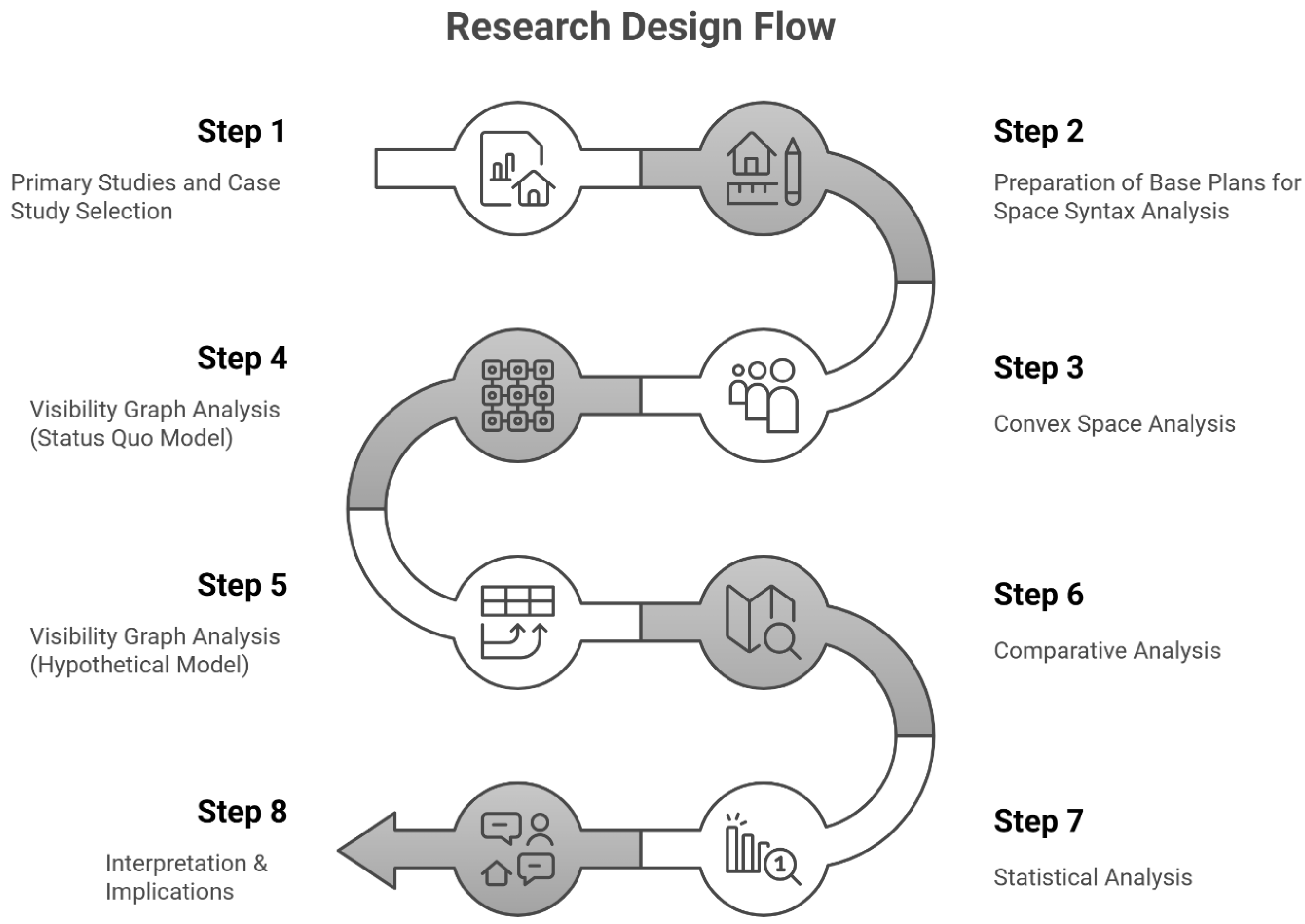
To structure this inquiry systematically, the research design was organised into a sequence of eight steps (
Figure 1). These begin with the documentation and preparation of case studies, followed by the construction of base maps. Subsequent stages apply configurational and visibility analyses, first through convex mapping and then through status quo and hypothetical VGA models. Comparative and statistical analyses are then employed to strengthen the validity of the results. Finally, the findings are interpreted to reveal their wider architectural and socio-cultural implications.
The combined use of space syntax and statistical testing also ensures that the study moves beyond qualitative interpretations, offering robust, data-driven conclusions that can inform architectural conservation, adaptive reuse, and contemporary design practices. The methodological research flow in this study is depicted in
Figure 1.
2.2. Convex Space Analysis in Space Syntax
Convex Space Analysis, as a foundational component of Space Syntax, is aimed at identifying the configurational properties of a spatial system by representing it as a set of convex spaces [
41]. A convex space is defined as a spatial unit in which all points within it are mutually visible, without any visual obstruction caused by walls, partitions, or other structural elements [
18]. The first step in conducting the analysis involves preparing accurate floor plans of the selected Iranian cultural heritage houses, which are digitised using architectural software of AutoCAD 2010 to ensure precise representation of spatial boundaries. These plans are then simplified to focus on the primary spatial elements—walls, doorways, courtyards, and transitional spaces—while non-essential decorative details are removed to create a clear spatial layout for analysis.
Once the base plan is prepared, the second step is to decompose the building layout into a series of convex polygons that collectively cover all navigable areas of the house. This is achieved by subdividing larger spaces, such as courtyards or halls, into smaller convex sets that maintain the principle of full intervisibility within each polygon. In cases where a space is non-convex, the decomposition follows the principle of using the fewest possible and fattest convex spaces to ensure accurate coverage of the entire accessible area [
18,
41,
42]. Each convex polygon is treated as a discrete spatial unit or “node” in the topological representation of the building. At this stage, careful consideration is given to the hierarchical organisation of spaces, such as the division between public and private areas, as these distinctions form a core part of the socio-spatial logic of Iranian houses.
The third step involves constructing a justified graph of the spatial configuration by connecting all convex nodes based on their adjacency and accessibility. This graph provides a topological model in which each node represents a convex space, and the links between nodes represent direct connections through doors or openings [
43,
44]. From this graph, key syntactic measures such as connectivity (the number of directly connected spaces), integration (the degree of spatial accessibility relative to the entire system), control (a measure of how much a space controls access to its immediate neighbours), and depth (the number of steps required to reach a space from a reference point) are calculated [
45]. These measures are essential for understanding how movement and visibility are organised within the spatial hierarchy of the houses. Convex analysis thus not only highlights the socio-spatial accessibility of heritage houses but also offers the foundation for exploring the influence of windows on visual fields [
43], which will be further elaborated through the VGA.
2.3. Visibility Graph Analysis in Space Syntax
VGA is a core technique within the Space Syntax framework that evaluates the visual properties of a spatial system by discretising space into a grid of observation points and analysing their inter-visibility [
46]. The fundamental premise of VGA is that spatial visibility strongly influences the way humans perceive, navigate, and interact within built environments, thereby shaping patterns of socio-spatial behaviour [
41]. In this study, VGA is employed to examine the visual permeability of windows in Iranian cultural heritage houses, assessing how these decorative openings mediate sightlines and influence the degree of visual connectivity across different spaces. The initial step involves preparing a precise digital floor plan of each case study house, which is then converted into a computational grid of observation points using Depthmap10 software. The grid resolution is carefully selected (typically between 60 cm per cell) to balance computational efficiency and analytical precision, ensuring that the visibility graph accurately reflects the real-world visual fields experienced by inhabitants. This resolution follows the human-scale convention commonly adopted in VGA studies, corresponding to the average shoulder width and perceptual radius of a standing observer [
45].
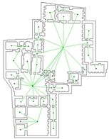
Following grid generation, the second step involves creating two distinct analytical models: a status quo model and a hypothetical model. The status quo model represents the existing condition of the heritage house, including the presence of windows and their semi-transparent stained glass, which partially filter visual fields. In contrast, the hypothetical model simulates a condition in which these windows are removed or treated as fully transparent, thereby allowing an unobstructed visual connection between interior and exterior spaces. This dual-model approach is designed to identify and quantify the influence of window visual permeability on the socio-spatial accessibility within the heritage houses. Key VGA metrics such as visual connectivity (the number of grid points visible from a given location), visual integration (how easily a point can be visually accessed within the overall layout), and visual control (which quantifies the ability to see and be seen) are computed for both models [
40,
46,
47,
48]. These measures enable a comparative analysis to determine whether and how the presence of such windows alters the visual and socio-spatial relationships within the house.
In the final step, the results from both VGA models are statistically evaluated to determine the significance of the observed differences. An independent sample t-test is employed to compare visual metrics between the status quo and hypothetical scenarios using SPSS 16. This statistical approach helps validate whether the presence of such windows introduces measurable changes in socio-spatial accessibility, as hypothesised in the research questions. The statistical analysis is particularly critical because it bridges the gap between spatial configuration data and socio-spatial implications, providing a quantitative basis for assessing the impact of visual permeability. Through combining space syntax techniques with statistical rigour, this study not only identifies localised variations in visual fields but also contributes to broader discussions about how architectural elements, such as window openings, influence visual permeability within traditional Iranian heritage houses.
2.4. Case Study Selection
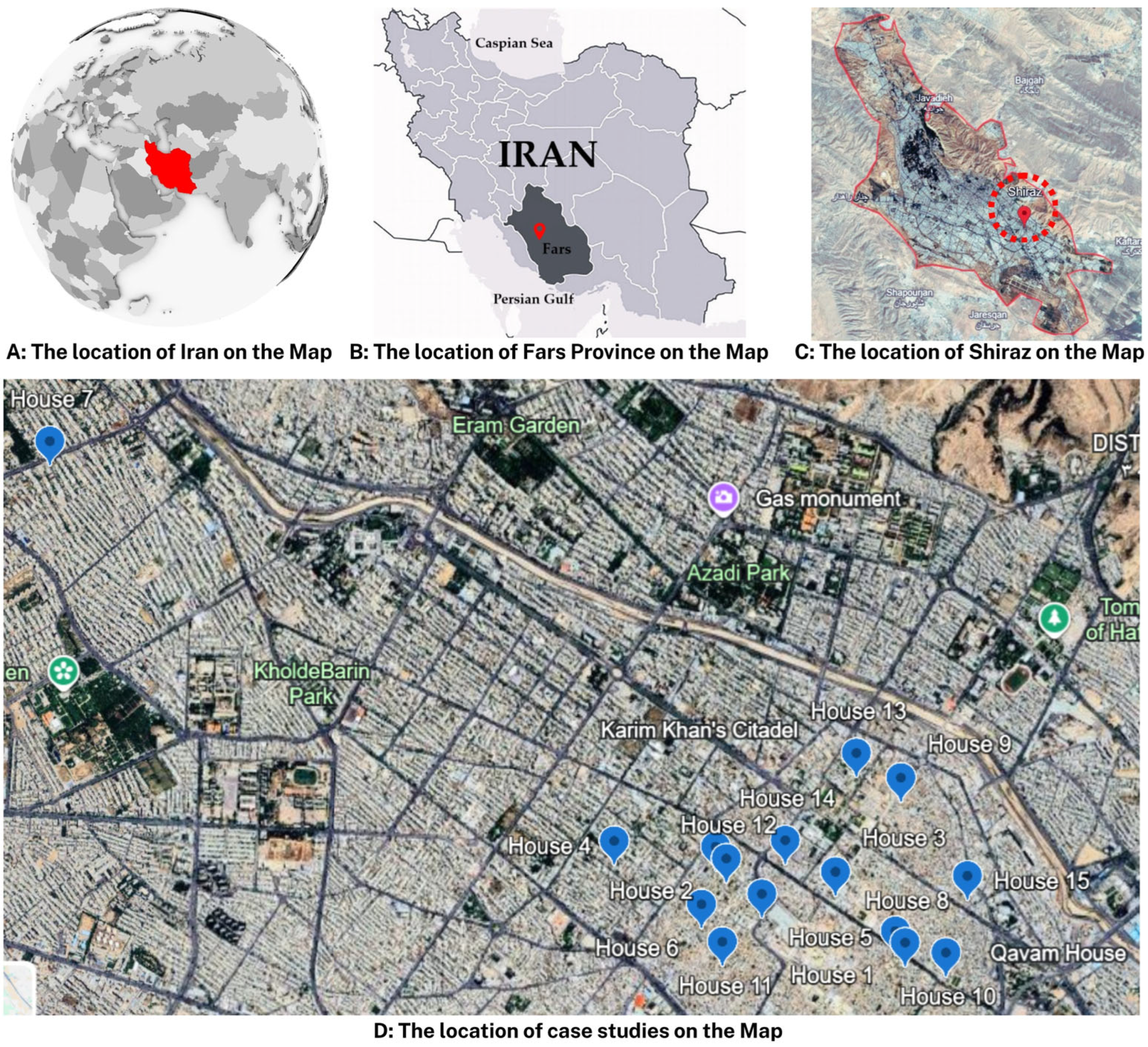
This research focuses on a systematic spatial analysis of fifteen historic cultural heritage houses located within the ancient urban fabric of Shiraz, Fars province, Iran (
Figure 2). These case studies, strategically dispersed across different sectors of the city’s historical core, are not merely architectural relics but active representations of Persian socio-spatial principles. Their layouts and spatial configurations reflect deeply rooted cultural norms, traditional family structures, and the subtle interplay between public and private realms, elements that are central to understanding the role of visual permeability in shaping socio-spatial accessibility. By studying these houses, the research aims to uncover how architectural features such as traditional windows mediate visibility, privacy, and accessibility, which is integral to the broader objectives of this study.
The selected houses, which include Nasir Al-Molk House, Meshkin-Fam Museum, Famouri House, Basirol-Saltaneh House, Manteghinejad House, Sa’adat House, Shafiee Ardakani House, Afsharian House, Atroush House, Zinat al-Muluk Ghavami House, Ardakani House, Haj Mahya House, Mohtashami House, Mansouri House, and Tohidi House, offer a diverse cross-section of architectural typologies and design approaches. Their inclusion ensures that the analysis captures a wide spectrum of spatial organisations, from single-courtyard residences to complex multi-courtyard layouts. This variety is essential for examining how different spatial arrangements influence the distribution of visual fields and socio-spatial accessibility across private, semi-private, and public zones within the houses.
The reason for choosing these particular houses is twofold. (1) Historical and cultural significance: These houses span key historical periods, particularly the Qajar dynasty (1789–1925) and the early Pahlavi period (1925–1941), both of which were critical in consolidating distinctive Persian housing typologies and the introduction of Orosi windows as mediators between interior and exterior spaces. (2) Representativeness of spatial and visual patterns: The selected houses, many of which are situated in the historic neighbourhood, exemplify the socio-spatial prototype of Shiraz’s traditional urban fabric, providing an ideal platform to investigate how architectural elements, such as windows, regulate visibility and interaction within domestic environments, an issue which is significantly lacking within the current literature of architectural science.
To ensure accuracy and reliability, comprehensive fieldwork was conducted, including detailed measurements, and plan verification of each property. These data were meticulously digitised and standardised to prepare precise base maps for the subsequent Space Syntax analysis. Collectively, the chosen houses present a robust dataset for exploring the research questions, particularly the impact of window visual permeability on socio-spatial accessibility. Their spatial diversity and cultural relevance make them exemplary samples for analysing the interface between architecture, visibility, and human interaction.
The geographical distribution of the case studies within Shiraz’s historic core is depicted in
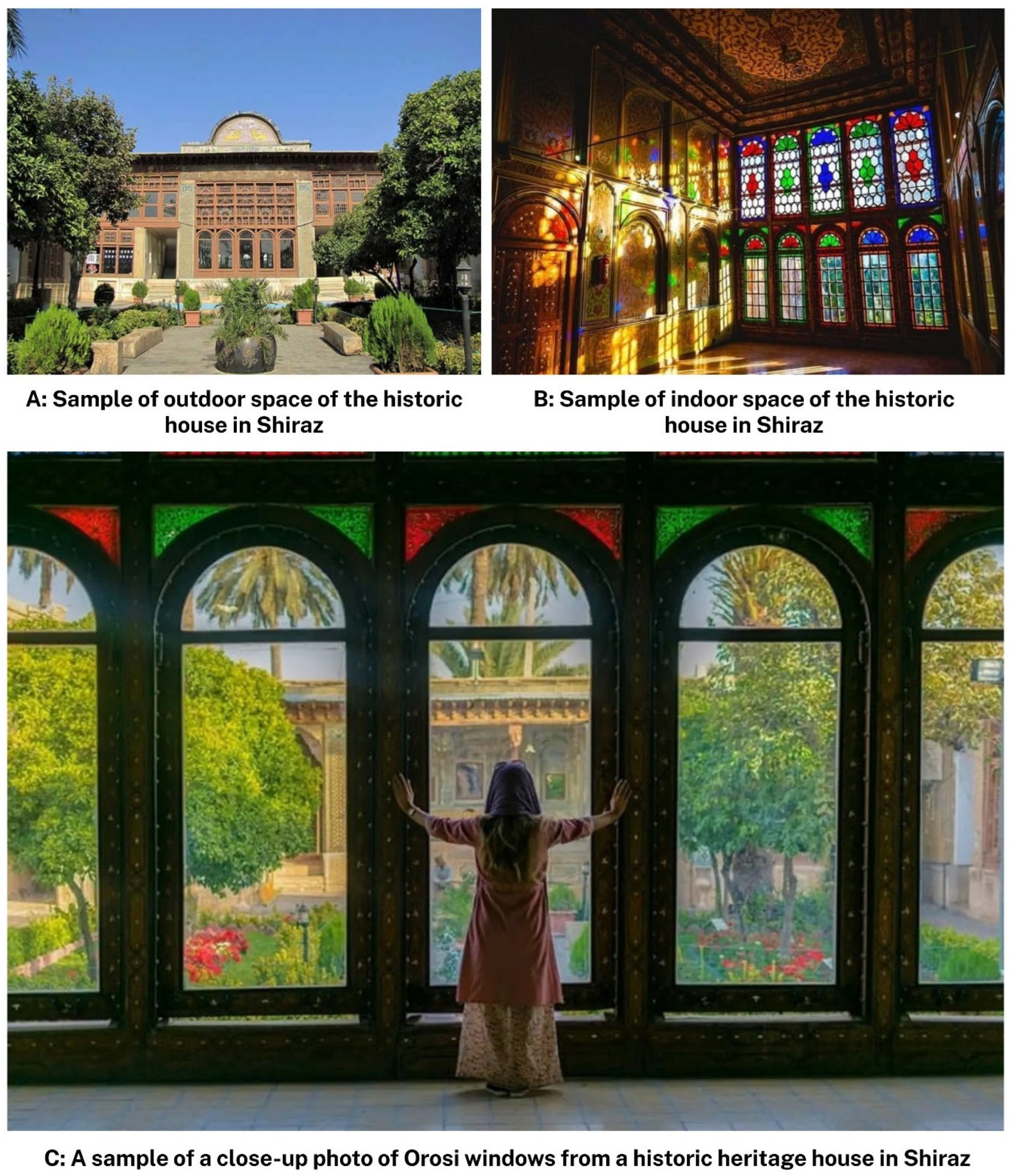
Figure 2. To further contextualise the architectural focus of this study,
Figure 3 presents an example of traditional Orosi windows. This visual evidence illustrates the stained-glass latticework and wooden frames that define Orosi typologies, highlighting their dual role as ornamental features and functional mediators of visibility and privacy.
Figure 3 specifically depicts one of the most outstanding examples among the selected case studies, namely the Zinat al-Muluk Ghavami House, showing both its interior and exterior views, as well as a close-up image of its intricately designed Orosi windows. Including this illustration at this stage enables the reader to better understand the material element under investigation before engaging with the methodological discussions of visual permeability and its analytical modelling.
To further clarify the dataset characteristics,
Figure 2 also serves as an illustration of the geographical distribution of the selected samples across Shiraz’s historic core. Although precise quantitative data on façade ratios or window-to-wall proportions were unavailable for all cases, typological consistency was ensured through qualitative verification during fieldwork and archival plan analysis. The selected houses span two major historical periods of Qajar (1789–1925) and early Pahlavi (1925–1941), and represent three dominant courtyard configurations: single, double, and multi-courtyard layouts, which collectively reflect the typological diversity of Shiraz’s residential heritage. Moreover, the spatial logic of openings was recorded through visual documentation, noting that courtyard-facing façades generally display higher window-to-wall ratios to promote daylight and controlled visibility, whereas street-facing façades maintain lower ratios to preserve privacy. This balance between internal openness and external seclusion typifies the socio-spatial logic explored throughout this research.
3. Results
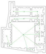
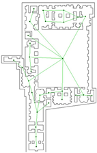
The Convex Space Analysis of the fifteen cultural heritage houses in Shiraz offers a detailed understanding of their socio-spatial configurations, illustrating the complex relationship between traditional domestic architecture and its embedded cultural logics (
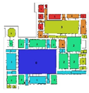
Table 1). The justified graphs generated for each house demonstrate clear hierarchical structuring of space, reflecting a consistent gradation from public entry areas toward increasingly private spaces. In most cases, the graphs adopt a deep tree-like structure, indicative of a strong segregation of spaces, particularly between semi-public courtyards and interior chambers. Houses such as Nasir al-Molk, Basirol-Saltaneh and Zinat al-Muluk Ghavami display highly branched spatial networks, reflecting their complex layouts and multiple functional zones, while simpler layouts, such as those in Atroush House, reveal shallower depth levels, emphasising their more compact and intimate design. These findings align with established Persian residential typologies that emphasise privacy, family cohesion, and gendered spatial organisation.
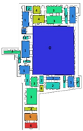
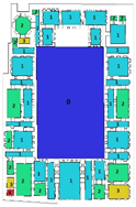
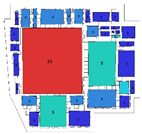
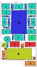
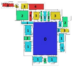
The connectivity analysis further highlights the substantial role of transitional spaces in organising circulation and interaction within these houses. In particular, courtyards emerge as the most connected nodes across all case studies, often registering the highest connectivity values (ranging between 7 and 10 direct links in larger houses). These spaces function as central hubs that mediate access between semi-private and private rooms, underscoring their dual role as social gathering areas and climatic regulators. Entry vestibules (hashti) and corridors, however, show significantly lower connectivity, typically 2–3 links, reinforcing their role as transitional buffers between the public street and the domestic interior. The colour-coded connectivity maps, ranging from warm hues for high connectivity to cooler tones for low connectivity, vividly illustrate this functional zoning, with warmer colours concentrated around courtyards and living rooms, and cooler colours occupying peripheral spaces, storage areas, and servant quarters.
Analysis of step depth further emphasises the spatial hierarchy inherent in these houses. The number of depth steps from the main entrance to the innermost private spaces ranges from 5 to 7 levels in the more elaborate Qajar-period residences, such as the Shafiee Ardakani, Sa’adat and Mansouri Houses, demonstrating a deliberate architectural strategy to reinforce privacy and security. Conversely, smaller houses like Afsharian and Atroush display 3 depth levels, indicative of simpler spatial layouts suited for more modest family structures. The visual representation of step depth maps reveals clear linear progressions toward the private domain, demonstrating how circulation pathways are choreographed to reflect social norms. This pronounced gradation between public and private spheres is a defining feature of Persian domestic architecture, reinforcing the socio-cultural emphasis on controlled access and privacy.
Finally, the integration analysis reveals a nuanced understanding of spatial accessibility within the studied houses. Integration values, normalised to allow for comparison, indicate that courtyards and main reception areas consistently emerge as the most integrated spaces, with values often exceeding 1.70, signifying their centrality to both movement and visibility. Secondary reception areas and transitional corridors typically occupy intermediate integration levels (0.70–1.70), while storage rooms, and service areas are highly segregated, with values falling below 0.70. This classification demonstrates the architectural logic of concentrating on social activities in highly integrated spaces, while reserving peripheral, low-integration areas for private or utilitarian functions. The integration maps, rendered with warm-to-cool colour gradients, reinforce this distinction visually, emphasising how architectural design intentionally shapes movement flows and visual accessibility. Collectively, these analyses underscore the sophistication of Iranian heritage houses, where spatial organisation, privacy norms, and environmental adaptation are harmoniously encoded into architectural configuration (
Table 1).
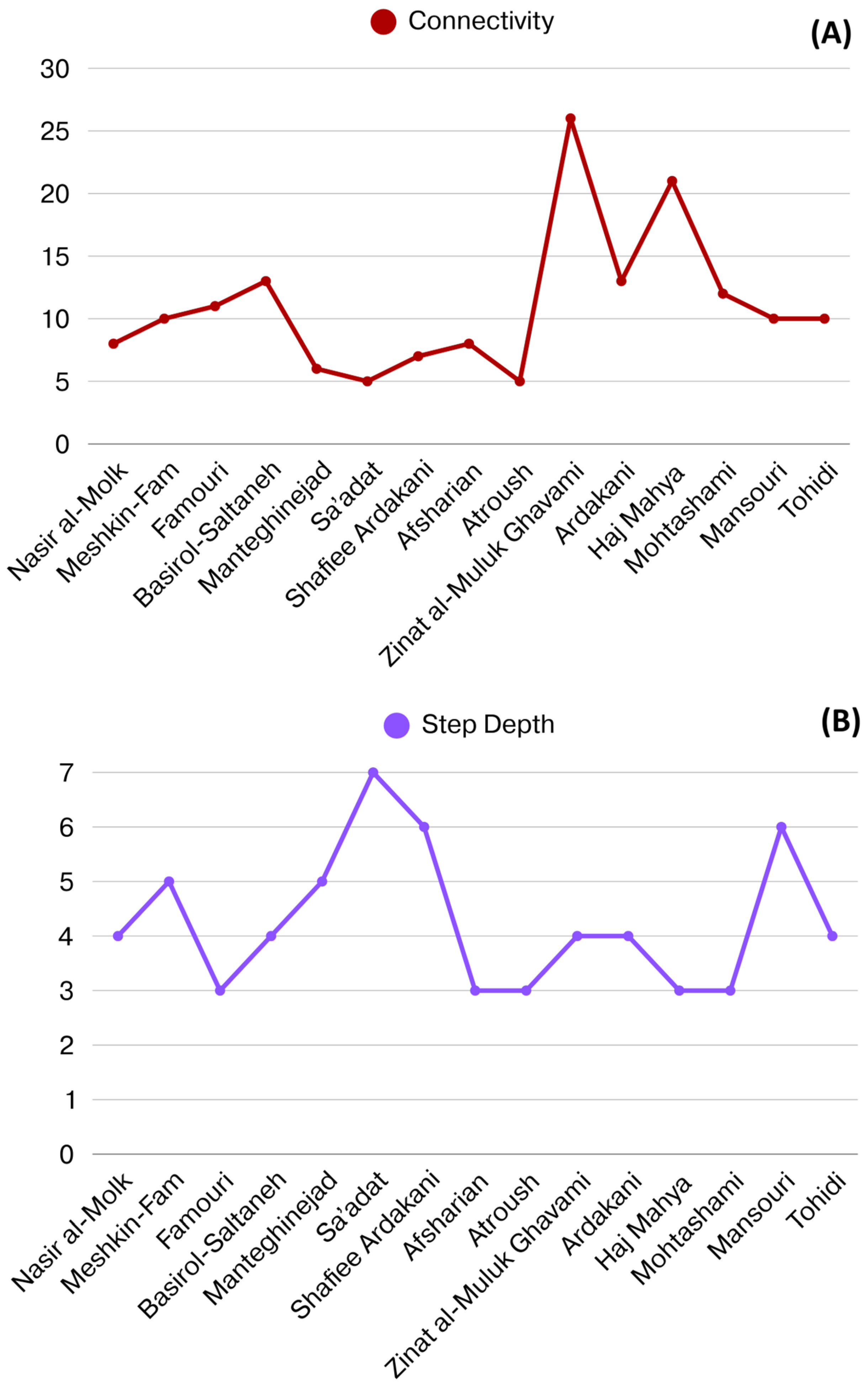
The comparative line charts in
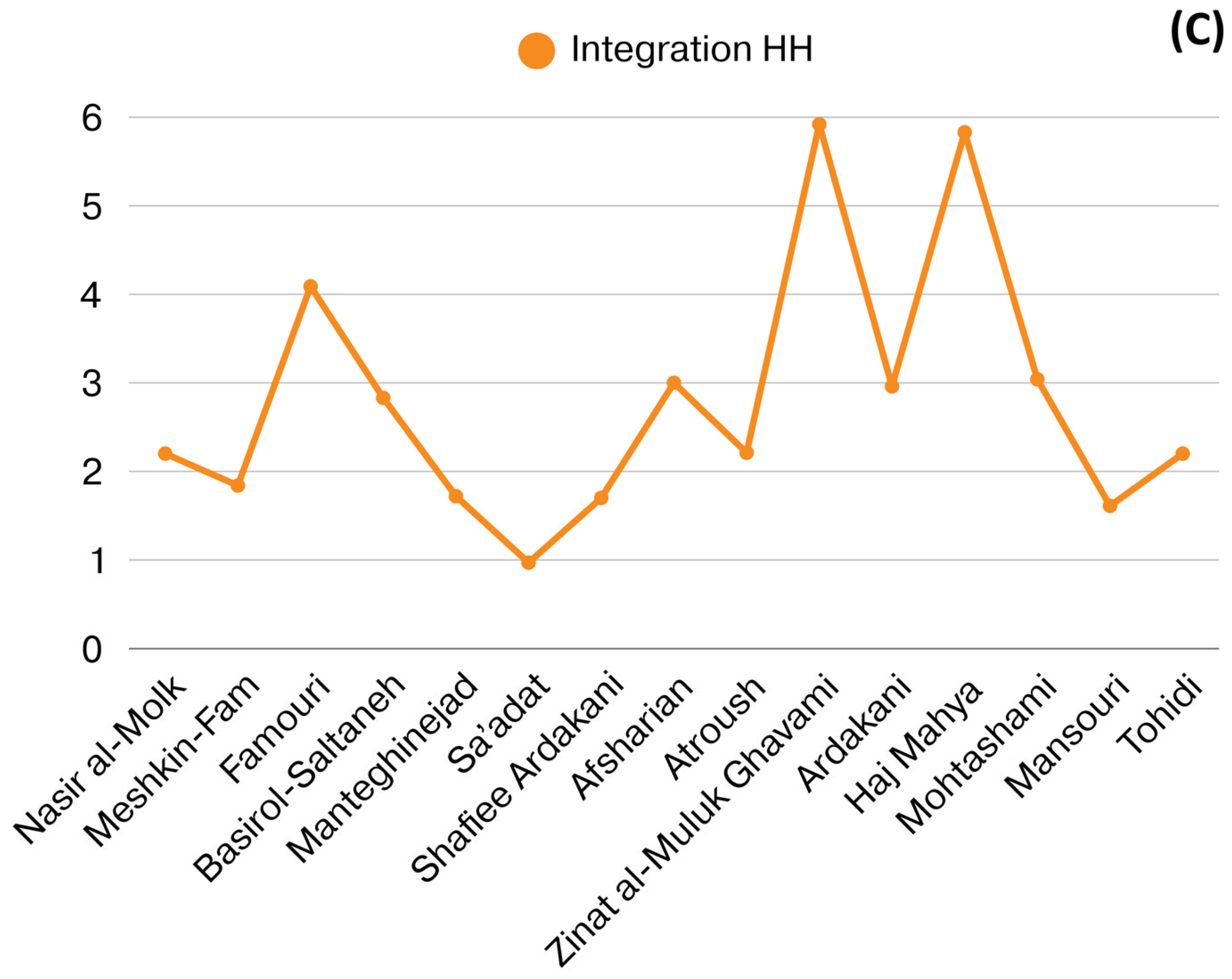
Figure 4 illustrate the highest recorded values of Connectivity (A), Step Depth (B), and Integration (C) for each of the fifteen case study houses, offering insight into the spatial hierarchies organised in their layouts. The connectivity chart shows that houses such as Zinat al-Muluk Ghavami, Haj Mahya, and Basirol-Saltaneh indicate significantly higher connectivity values, indicating a dense network of directly accessible spaces that reflect their large scale and socio-functional diversity. Conversely, houses like Sa’adat and Atroush demonstrate relatively low connectivity, reflecting more introverted layouts and stronger spatial segregation.
The step depth analysis emphasises the degree of spatial depth within the houses, with Sa’adat, Shafiee Ardakani and Mansouri reaching higher depth values, suggesting a clear hierarchical organisation of spaces and extended movement pathways. In contrast, Famouri, Afsharian, Atroush, Haj Mahya and Mohtashami present shallow depth, reinforcing their openness and ease of navigation. The integration chart highlights the overall accessibility and spatial centrality of each house, with Zinat al-Muluk Ghavami and Haj Mahya achieving the highest integration scores, positioning them as focal nodes for movement and social interaction. Lower integration scores in houses like Sa’adat and Mansouri align with their more fragmented spatial arrangements. Collectively, these charts confirm the architectural diversity among Shiraz’s heritage houses, showcasing how varying courtyard typologies, circulation systems, and spatial organisation shape socio-spatial accessibility dynamics (
Figure 4).
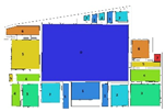
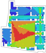
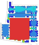
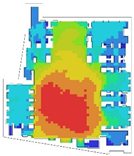
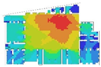
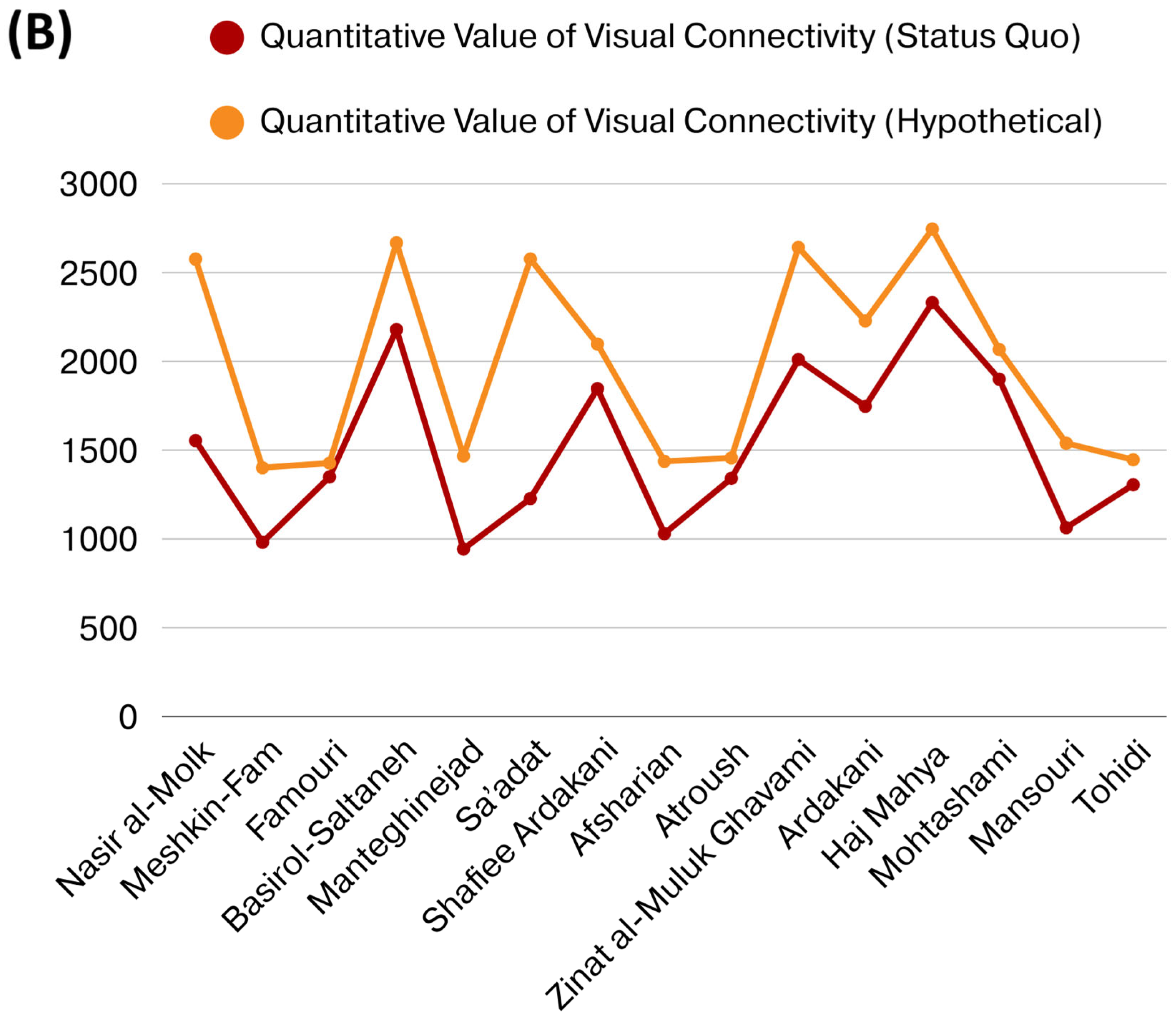
The results of the VGA provide important insights into how the visual permeability of Orosi windows influences socio-spatial accessibility in Iranian cultural heritage houses (
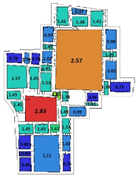
Table 2). In the status quo models, where windows are preserved in their original semi-transparent and patterned form, the values of visual integration and connectivity varied substantially across the fifteen houses. For example, the Mohtashami House demonstrated the highest level of visual integration (32.03), while the Haj Mahya House displayed the highest connectivity value (2331). These findings suggest that, even under their existing constraints, certain houses maintain strong visual fields that facilitate spatial awareness and opportunities for social interaction within their layouts. At the same time, lower values in houses such as Mansouri (integration 5.43) reveal the restrictive effects of limited permeability in more enclosed designs.
In contrast, the hypothetical models, where window barriers were virtually removed, revealed a marked increase in both visual integration and connectivity across nearly all case studies. The Mohtashami House, for instance, reached a notably higher integration value of 54.78, while Haj Mahya demonstrated an impressive rise in integration to 37.35 and connectivity to 2745. This consistent trend indicates that the removal of visual obstructions substantially expands sightlines, creating greater opportunities for surveillance, awareness, and interaction across spatial zones. The amplification of these values underscores the functional role of windows as critical mediators of visual permeability, balancing cultural demands for privacy with spatial needs for openness and accessibility.
To facilitate a clearer visual interpretation of spatial differences,
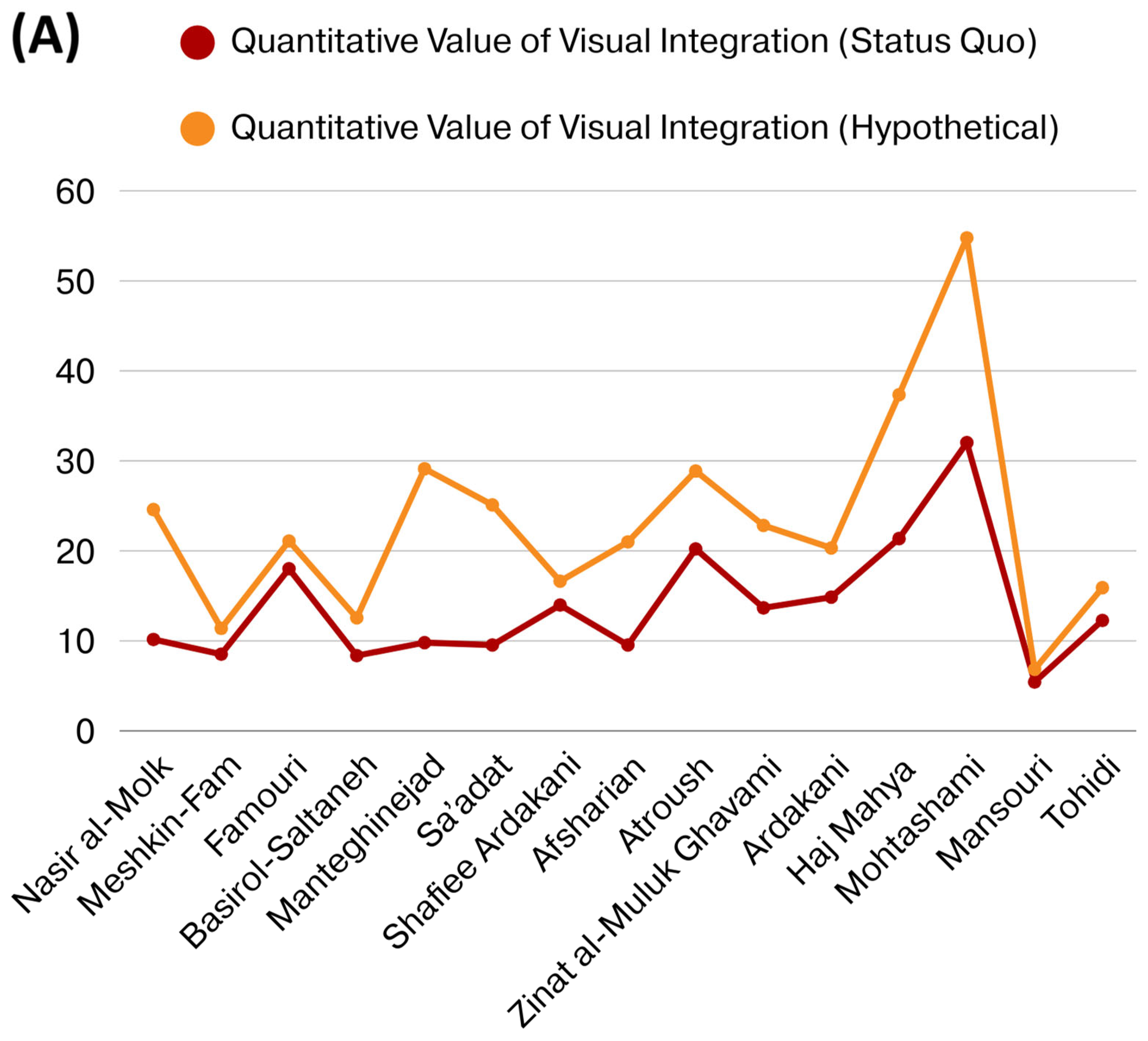
Table 2 incorporates a horizontal colour spectrum ranging from blue to red, representing the lowest to highest numerical values in the form of a heatmap. This visual legend enhances the qualitative readability of the VGA, illustrating how visual integration and connectivity vary across spatial configurations in both the status quo and hypothetical models. While this table emphasises the qualitative spatial distribution of visibility, the quantitative comparison of the highest numerical values for each case study is further illustrated in
Figure 5, where the results are presented through line charts to provide a more tangible comparison between models.
A peer-to-peer comparison between the two models (
Figure 5) clearly illustrates these differences. In almost every case, the hypothetical models recorded higher quantitative values than their status quo counterparts. The average increase in integration values ranged from modest increments (e.g., Meshkin-Fam rising from 8.52 to 11.39) to significant leaps (e.g., Manteghinejad from 9.81 to 29.13). Similarly, connectivity values rose across all houses, often by several hundred units. This comparative evidence highlights that traditional window arrangements, while aesthetically and environmentally beneficial, exert a constraining influence on visual connectivity that can reduce socio-spatial accessibility within the domestic environment.
Taken together, the VGA shows that window design in Iranian heritage houses operates as a double-edged instrument. On one hand, Orosi windows, in their current form, preserve privacy and regulate environmental comfort, thereby upholding cultural norms. On the other hand, their filtering effect limits the extent of visual fields, diminishing opportunities for integration between public and private domains. The simulated removal of these windows in the hypothetical models demonstrates the latent potential of these spaces for heightened connectivity and integration, which are suppressed in the status quo.
Overall, these findings provide empirical confirmation of the central role of window permeability in shaping visual accessibility and spatial interaction. The comparative analysis presented in
Figure 5 strengthens the argument that traditional design elements cannot be reduced to ornamental or environmental functions alone but must be understood as deeply rooted in the socio-spatial logic of Iranian domestic architecture. This evidence not only answers the study’s research questions but also highlights the importance of incorporating functional visibility considerations into heritage conservation and adaptive reuse practices.
The results of the independent sample
t-test suggest that the assumption of equal variances between the status quo and hypothetical models holds true for both visual integration and connectivity, as confirmed by Levene’s tests (
p = 0.209 for integration and
p = 0.187 for connectivity, both >0.05). This indicates that the variability between groups is homogeneous, allowing for a valid interpretation of the
t-test results under the equal variances assumption (
Table 3).
When comparing the mean values, the independent t-test revealed that the hypothetical models consistently yielded significantly higher integration and connectivity scores compared to the status quo models. For integration, the two-tailed significance value was p = 0.010, well below the 0.05 threshold, confirming a robust statistical difference. Similarly, connectivity differences were also significant, with a two-tailed significance of p = 0.007, indicating that the removal of window barriers had a measurable effect on visual fields. The 95% confidence intervals for both measures did not include zero, further supporting the conclusion that the observed differences were not due to chance. These results imply that the hypothetical removal of Orosi window obstructions significantly increased visual permeability in both integration and connectivity, providing strong statistical evidence that windows act as significant mediators of socio-spatial accessibility in Iranian cultural heritage houses.
4. Discussion
The results of the convex space analysis introduced critical notions regarding the socio-spatial organisation of Iranian cultural heritage houses, highlighting the extent to which spatial hierarchy governs movement, accessibility, and interaction. The justified graphs demonstrated that the majority of houses show profound and branched structures, reflecting a pronounced transition from public to private domains. High connectivity values in houses such as Zinat al-Muluk Ghavami, Haj Mahya, and Ardakani indicated dense networks of directly linked spaces that supported fluid circulation and social interaction. In contrast, houses such as Sa’adat and Atroush displayed reduced connectivity, consistent with more introverted layouts designed to protect privacy and limit movement between spatial zones. Integration analysis further clarified these dynamics, showing that central courtyards or transitional halls function as highly integrated spaces, reinforcing their role as social hubs within domestic life. These findings confirm the hypothesis that the spatial structure of heritage houses was deliberately configured to balance openness and seclusion, providing a socio-spatial framework that continues to inform contemporary interpretations of culturally responsive housing.
The results of the VGA expanded this picture by emphasising the importance of visual permeability in shaping socio-spatial experiences. In the status quo models, the integration and connectivity values confirmed that traditional Orosi windows act as partial barriers to vision, restricting sightlines and reinforcing privacy norms within the domestic hierarchy. For instance, while houses like Mohtashami and Haj Mahya retained relatively high levels of visual integration, others such as Mansouri and Basirol-Saltaneh revealed limited permeability, demonstrating the diversity of architectural responses to socio-cultural values. However, when shifting to the hypothetical models, where windows were treated as fully transparent, the results consistently demonstrated marked increases in both visual connectivity and integration across all cases. This indicates that the removal of visual obstacles greatly enhances spatial awareness and visual permeability, creating a stronger basis for social interaction and accessibility within the houses. These findings also highlight the broader principle that window elements can act as filters of different kinds, whether through stained glass, latticework, or additional blinds, each regulating solar gain, daylight quality, and visual control in distinct ways [
49,
50,
51]. In this sense, Orosi windows belong to a wider category of mediators that simultaneously manage environmental comfort and cultural expectations of privacy. The comparative outcomes, therefore, highlight the dual role of Orosi windows as both cultural artefacts that safeguard modesty and functional.
From this combined perspective, the comparative analysis of convex mapping, VGA models, and the statistical
t-tests offers a comprehensive understanding of how spatial and visual dynamics intersect in Iranian cultural heritage houses. While the raw results confirmed that visual permeability increased across all hypothetical models, the independent sample
t-tests indicated that these differences were statistically significant (integration:
p = 0.010; connectivity:
p = 0.007). This finding introduces an important concept: although Orosi windows demonstrably shape visibility and accessibility patterns, their overall quantitative effect on socio-spatial accessibility is statistically significant, confirming that the presence or absence of these window filters measurably alters integration and connectivity outcomes. In this sense, the results complement previous studies that highlighted the environmental and aesthetic effectiveness of Orosi windows [
7,
23,
25,
26,
52], by showing that their role in enhancing visual permeability extends beyond aesthetics or environmental comfort, exerting a tangible influence on socio-spatial accessibility. Rather than serving as marginal elements, these windows mediate between privacy and openness in measurable ways, offering a delicate balance that preserved modesty while maintaining a degree of connectedness within the domestic hierarchy. This interpretation underscores their function as socio-cultural regulators with statistically verifiable impacts on spatial experience, enriching our understanding of their enduring architectural value.
The findings of this study reverberate strongly with previous applications of Space Syntax to residential architecture, while also extending their scope to the role of window permeability. Similarly to Moqadam and Nubani [
53] and Hessari and Chegeni [
54,
55], our convex analysis highlighted how Iranian houses rely on hierarchical spatial organisation, with courtyards and transitional halls functioning as highly integrated nodes. These studies confirmed that courtyard typologies and layouts strongly influence intelligibility and accessibility, a trend equally observed in our sample where multi-courtyard houses, such as Zinat al-Muluk Ghavami and Basirol-Saltaneh, demonstrated higher connectivity and integration. However, our approach advances beyond conventional syntactical measures by incorporating VGA to explicitly address visual permeability as the original contribution of this research. While Xu et al. [
56] emphasised region-specific accessibility in Chinese houses, our results revealed how Orosi windows act as additional mediators of socio-spatial logic, subtly constraining or expanding visual fields depending on their configuration. Thus, while earlier studies underline the robustness of syntactical tools in capturing spatial logics, this research adds a critical visual layer, showing how architectural elements such as windows interact with configurational properties to influence socio-spatial accessibility.
In addition, our results align with broader cultural interpretations of privacy-accessibility trade-offs documented in Persian [
57,
58], Iraqi [
59,
60], Chinese [
61,
62], and cross-cultural contexts [
63]. Like Khalil et al. [
59], who showed how linear house morphologies favour privacy at the expense of accessibility, our VGA results demonstrated that Orosi windows restrict visibility, thereby safeguarding modesty but reducing spatial integration. Similarly, Ding and Ma’s [
64] distinction between “extroverted” and “introverted” spatial behaviours finds a parallel in our study, where the hypothetical removal of window obstacles produced more “extroverted” visibility patterns, while the status quo models reinforced introversion. The statistical analysis further confirmed that these visual effects were significant, indicating that the presence of Orosi windows systematically reduces integration and connectivity compared to fully transparent scenarios. This finding enriches the existing literature [
65,
66] by showing that while windows influence socio-spatial experience in measurable ways, their role is ultimately mediatory, reinforcing rather than overriding the broader hierarchical logic of traditional Iranian houses.
4.1. Implications for Policy and Planning
The findings of this study carry important implications for heritage policy and conservation planning, particularly regarding the preservation of Orosi windows as socio-cultural regulators rather than solely ornamental features. Current restoration practices often emphasise the aesthetic and environmental dimensions of these windows, valuing their craftsmanship and role in mediating light and temperature. However, this research highlights that their socio-spatial influence is statistically significant, demonstrating that these windows actively shape integration and connectivity within domestic environments. Policymakers should therefore adopt conservation frameworks that recognise this dual function. Instead of reducing restoration to material preservation, heritage authorities can encourage strategies that protect the intangible cultural values embedded in windows, especially their role in mediating social interaction, modesty, and visual fields. Such an approach could strengthen heritage policies by aligning architectural conservation with the socio-cultural functions that underpin spatial identity in Iranian housing traditions.
From a broader planning perspective, the study also offers lessons for contemporary housing development and urban design. The results suggest that elements such as windows can serve as mediators between openness and seclusion, suggesting critical solutions to ongoing debates around privacy, security, and accessibility in residential environments. While the VGA showed that the presence of Orosi windows significantly constrains visual permeability compared to fully transparent models, their mediatory function demonstrates how design layout may respect privacy without entirely excluding social connectedness. Architects and housing policymakers can draw from this principle when designing new residential typologies, particularly in contexts where cultural norms demand a balance between communal life and individual seclusion. Incorporating such lessons into planning guidelines would not only enhance the cultural sensitivity of housing projects but also persuade adaptive reuse practices where historic design principles inform contemporary challenges of density, social interaction, and sustainability.
4.2. Limitations and Directions for Future Studies
A key limitation of this study lies in its focus on a specific set of Iranian cultural heritage houses located in Shiraz, which constrains the generalisability of the findings. Although the fifteen case studies provide a robust dataset for exploring spatial and visual patterns, they represent only one regional expression of Persian domestic architecture. Cultural, geographical, and climatic variations across other Iranian cities, and more broadly across Muslim-majority contexts, may lead to different outcomes in terms of spatial hierarchy and the role of windows in mediating socio-spatial dynamics. Furthermore, the study relied exclusively on syntactical and quantitative methods, which, while powerful for identifying configurational patterns, cannot fully capture the lived experiences, emotional perceptions, or cultural meanings associated with these spaces. The absence of complementary qualitative data, such as ethnographic observation or oral histories, limits the ability to directly link quantitative findings to specific behavioural outcomes.
Another important methodological limitation concerns the use of a two-dimensional space syntax framework. In this research, spatial analysis was intentionally restricted to the topological and planimetric configuration of spaces to evaluate visual connectivity and accessibility within a consistent analytical framework. This approach aligns with established methodological standards in VGA studies, where 2D visibility analysis serves as a proxy for human perception at eye level. However, it does not account for the three-dimensional qualities of Orosi windows such as height, depth, color, or pattern that may influence perception and light diffusion. While these attributes fall outside the analytical scope of this study, their influence on spatial experience remains an important dimension for future exploration.
Future research should therefore aim to integrate multi-scalar and three-dimensional approaches, including 3D isovist analysis [
67,
68], photometric simulation [
69,
70], or digital photogrammetry [
71,
72], to examine how Orosi windows affect visibility, light distribution, and perceptual depth in vertical space. Combining these methods with the current two-dimensional syntactical framework would allow for a more comprehensive understanding of how window geometry, transparency, and ornamentation modulate the spatial experience within Iranian heritage houses.
Future studies should therefore expand in both geographical scope and methodological depth to address these limitations. Comparative research across multiple Iranian cities or even transnational contexts, such as Iraq, India, Southern Spain or Northern African countries, would help determine whether the patterns identified in Shiraz reflect broader cultural norms or more localised traditions. Moreover, combining space syntax analysis with qualitative approaches, such as semi-structured interviews, behavioural mapping, or participatory workshops, would enrich the understanding of how spatial configuration and window permeability intersect with cultural practices and social life. To further refine this line of inquiry, future research should also consider the role of additional visual and environmental filters, such as blinds, curtains, or awnings, which introduce layered forms of solar, light, and visual control. Investigating these mediators would allow for a more nuanced understanding of how different filtering strategies reinforce or counteract the socio-spatial logics observed in heritage houses. In addition, integrating temporal perspectives, for example, by examining seasonal or generational shifts in the use of heritage houses, could further illuminate the adaptability of traditional architectural forms under changing social pressures. Finally, future research should explore practical applications of these findings in contemporary housing design and adaptive reuse strategies, offering evidence-based guidelines for architects and conservationists seeking to balance heritage preservation with evolving urban needs.