Article

An Analysis of Implementation Constraints of Spatial Planning Tools for Disaster Risk Reduction in Mopani’s Informal Settlements, South Africa

by
Juliet Akola
* and
Mvuyana Bongekile Yvonne Charlotte
Public Administration and Economics Department, Faculty of Management Sciences, Mangosuthu University of Technology, 4026 511 Griffiths Mxenge Highway, Durban 4031, South Africa
*
Author to whom correspondence should be addressed.
Sustainability 2025, 17(13), 6075; https://doi.org/10.3390/su17136075
Submission received: 3 May 2025 / Revised: 2 June 2025 / Accepted: 8 June 2025 / Published: 2 July 2025

Abstract

Urbanization is rapidly transforming cities, especially in the Global South, with Sub-Saharan Africa expected to see the fastest growth in the next 30 years. In South Africa’s Mopani District, this urban expansion has led to the growth of informal settlements, increasing disaster risks related to water, health, and fire. This study focuses on Giyani Local Municipality, examining disaster risks in its informal settlements and the factors influencing the implementation of spatial planning tools. Using a SWOT analysis combined with the Analytical Hierarchy Process (AHP), the study found that while the municipality has strong land use and disaster management policies, poor enforcement, lack of integration, and weak governance limit their effectiveness. Opportunities for improvement include securing grants from the National Government and Disaster Management Centre to support disaster risk reduction (DRR) initiatives. However, challenges such as land shortages and ecological degradation threaten sustainable planning. The findings provide important insights for policymakers, urban planners, and disaster management professionals. The SWOT-AHP approach helps in prioritizing resource allocation, identifying risk trends, and focusing on key areas for mitigation. Overall, the study supports efforts to enhance resilience and promote sustainable urban development in informal settlements through better spatial planning.

1. Introduction

Urbanization is one of the global trends that has continued to shape the future of urban areas, including in the Global South [1]. Over the next 30 years, a significant portion of the global population will be concentrated in urban areas, with the majority of this growth occurring in less developed regions like South and South Eastern Asia and Sub-Saharan Africa [2,3]. In South Africa, including in Mopani District, urbanization is largely unplanned, contributing to the rapid expansion of informal settlements that are deeply exposed to disaster risks related to water, health and fire [4]. Informal settlements in Mopani District are at the frontline of these risks, highlighting the urgent need for effective spatial planning tools to reduce disaster risks since spatial planning aims at creating liveable, efficient, accessible and safe environments. Such approaches directly support the Sustainable Development Goal (SDG) target 11.1, which calls for ensuring access for all to adequate, safe, and affordable housing and basic services and upgrading slums [5]. However, the implementation of these tools is faced by constraints [6].
Spatial planning tools include plans that are considered corporate documents owned by all sectors of government as methods used by public sectors worldwide to influence the distribution of people and activities in spaces of various scales [7]. This suggests that there is a variety of implementable spatial planning tools available to each country for disaster risk reduction in informal settlements. However, the implementation of these tools depends on the legal framework, decision-making process, policy statements, spatial strategies, land use regulation, development management, environmental assessment, economic instruments, evidence and monitoring, payment for spatial planning, supervision, and probity of spatial planning activities [8]. Comprehensively, spatial planning tools that could be used for disaster risk reduction in informal settlements include land use planning regulations, land use schemes, zoning, subdivision, building codes, and standards [8]. All these tools aim at reducing the effects of hazards, exposure and vulnerability through exercising a regulatory and developmental function [9,10,11] and form part of responsive developmental initiatives that build local resilience to possible disaster risks [12]. However, studies such as those of the South African Development Agency [13] show that the implementation of these tools in informal settlements is usually faced with constraints. Therefore, this study’s central aim was to analyze the constraints of implementing spatial planning tools for disaster risk reduction in informal settlements in Mopani District, South Africa.
Informal settlements are residential areas where inhabitants often lack secure land tenure, live in substandard or makeshift structures such as shacks or informal dwellings, and have limited access to essential services, including water, sanitation, waste management, and electricity [3,14,15]. These settlements frequently arise in hazardous or environmentally sensitive locations such as wetlands, low-lying areas, hilltops, and forests, increasing residents’ exposure to disaster risks related fires, water, and health [16]. A study by [17] reports similar situations of informal settlements across selected cities in Sierra Leone, Ghana, Uganda, Somalia, Tanzania, Malawi, and Zimbabwe. Addressing these challenges is central to achieving Sustainable Development Goal (SDG) 11, particularly target 11.1, which calls for inclusive, safe, resilient, and sustainable urban development [18]. They are also closely linked to SDG 1 (poverty eradication), SDG 3 (health and well-being), and SDG 6 (clean water and sanitation) [18]. Implementing spatial planning tools for disaster risk reduction, including hazard mapping, land use planning, zoning regulations, and building regulation, can significantly mitigate health-, fire-, and water-related risks while guiding safer upgrading and enhancing urban resilience [9,14]. However, in many developing countries, such interventions are limited due to challenges associated with rapid and unregulated urbanization [16]. Globally, informal settlements house around one billion people, representing approximately one-seventh of the world’s population and one-third of the urban population [19]. With projections indicating that 66 percent of the global population will reside in urban areas by 2050 [20], the proliferation of informal settlements is likely to persist amid growing shortages of affordable housing [21].
This continued growth increases the vulnerability of communities to both natural disasters such as floods, extreme weather conditions and wild fires, and human-induced disasters such as diseases due to poor waste management [22,23]. In South Africa, for instance, informal settlements in Cape Town [24], KwaZulu Natal [25] and Giyani Local Municipality, Mopani District, and Limpopo Province exemplify this reality, where inadequate land use planning, unregulated construction, and poor access to basic services further compound disaster risks [4]. To address these vulnerabilities, the use of spatial planning tools such as geospatial technologies, risk-sensitive planning, and land use zoning is critical for fostering sustainable and resilient urban development [26]. In response to the rapid proliferation of informal settlements and the increasing vulnerability to urban disaster risks in South Africa, the Spatial Planning and Land Use Management Act (SPLUMA) No. 16 of 2013 was enacted as a comprehensive legislative framework for spatial planning and land use management. This act consolidates and replaces various fragmented land legislations, establishing an integrated and uniform approach to land development and spatial governance across all spheres of government [14]. SPLUMA explicitly recognizes the importance for inclusive spatial transformation, particularly as it pertains to informal settlements. Under Chapter 2, Section 7(a), subsections (ii), (iii), and (v), the act advances the principle of spatial justice. It mandates that spatial development frameworks and policies must (1) promote the inclusion of historically marginalized groups and regions, such as informal settlements, former homeland areas, and underdeveloped peri-urban zones; (2) incorporate spatial planning instruments, including land use schemes, that facilitate equitable access to land and services for disadvantaged communities; (3) establish land use management systems that are comprehensive, flexible, and responsive to the specific governance needs of informal and marginalized areas; and (4) support land development processes that provide secure tenure and facilitate the incremental upgrading of informal settlements. Furthermore, Chapter 4, Part A, Section 12(1) (h) of the act reinforces the role of all spheres of government at national, provincial, and municipal levels in developing spatial development frameworks that explicitly integrate previously disadvantaged areas. This includes areas under traditional leadership, rural communities, informal settlements, slums, and land owned by state entities. These frameworks must aim to align these areas with broader spatial, economic, social, and environmental development objectives, thereby supporting their integration into the formal urban fabric and transforming informal settlements into sustainable human settlements.
Despite the well-documented benefits of spatial planning tools for disaster risk reduction, their implementation remains constrained by several factors. For instance, [27] found that the implementation of the Disaster Safe Education Unit (SPAB) programme in the disaster-prone area of Mount Merapi in Sleman, Yogyakarta, Indonesia, was hindered by legal, funding, and human resource limitations. Similarly, in Tanzania, Nuhu, Munuo and Mngumi [5] reports that the regularization of informal settlements faced challenges due to governance issues. In Zimbabwe, a study by [28] identified land issues as a constraint to the implementation of spatial planning tools for DRR. Evidence from [29] indicates that strong institutional frameworks, especially those built on public–private and community partnerships, can significantly enhance disaster risk reduction efforts in informal settlements. The study presents several successful case examples, including the Mukuru settlement in Kenya, one of the largest informal settlements in the country, along with community-driven initiatives in Mahila Milan (India), Thailand, and Pakistan. This therefore means that where there are no such frameworks, partnerships, or community initiatives, it becomes difficult to implement spatial planning tools for such informal spaces.
In South Africa, although the government has adopted the Spatial Planning and Land Use Management Act (SPLUMA) to guide the transformation of informal settlements, the effective implementation of spatial planning tools, particularly in rural Municipalities such as Giyani Local Municipality, remains limited due to persistent structural and institutional constraints [16]. These include limited financial resources, inadequate technical expertise, weak policy enforcement, and social resistance [19]. Additionally, external threats such as climate change and rapid population growth further complicate the adoption process of sustainable spatial planning tools for DRR [20].
Moreover, existing research on the application of spatial planning tools for disaster risk reduction has largely focused on broad policy frameworks or urban contexts, often overlooking the unique constraints faced by rural municipalities. While some studies acknowledge these constraints [5,29], few have systematically prioritized them or employed structured decision-making tools to inform planning interventions, especially in Mopani District [4]. This gap not only weakens disaster resilience in informal settlements but also impedes sustainable urban development efforts in Mopani District. Addressing these challenges requires a comprehensive analysis to develop targeted strategies for enhancing the application of spatial planning tools in disaster risk reduction.
This study aimed to examine the nature of disaster risks in informal settlements within Giyani Local Municipality, Mopani District. It sought to identify the internal and external factors influencing the implementation of spatial planning tools for disaster risk reduction. Furthermore, the study applied the Analytical Hierarchy Process (AHP) to prioritize these factors, offering actionable recommendations to improve spatial planning and disaster risk reduction efforts in the district.
To achieve this, the study integrated SWOT analysis and AHP, providing a structured framework for evaluating the constraints to implementing spatial planning tools [30]. The SWOT analysis categorized the internal and external factors affecting implementation, while AHP prioritized these factors to support informed decision making [31], which can be attainable through leveraging on strength and opportunities in Mopani District.
The SWOT-AHP framework integrates theories from strategic management, multi-criteria decision making (MCDM), systems thinking, and participatory planning [32,33]. SWOT analysis originates from strategic management theory, focusing on identifying internal and external factors influencing decisions but lacks prioritization capabilities [34]. AHP complements this by applying MCDM theory, enabling structured pairwise comparisons that produce quantitative rankings, thereby enhancing decision objectivity [35]. This combined framework aligns with systems theory, which views informal settlements as complex adaptive systems requiring holistic analysis of social, institutional, and environmental interactions [36]. Furthermore, SWOT-AHP supports participatory planning by incorporating stakeholder perspectives in prioritizing constraints, reflecting the need for inclusive decision making in disaster risk reduction [33]. These theoretical foundations make SWOT-AHP suitable for analyzing spatial planning challenges in Giyani’s informal settlements.
After the introduction, this paper presents a description of the study area and a brief overview of the research methods employed in the study. It then explores the existing disaster risks and conducts a SWOT analysis of the key factors affecting the application of spatial planning tools for disaster risk reduction. Finally, the paper offers recommendations for implementing spatial planning tools to minimize disaster risks in informal settlements within Giyani Local Municipality, Limpopo Province, South Africa.

2. Description of the Study Area

Spatially, the study was conducted within the Greater Giyani Local Municipality, one of the five local municipalities comprising the Mopani District Municipality in Limpopo Province, South Africa, as illustrated in Figure 1 [37]. The Mopani District is recognized as a region susceptible to disaster risks, including droughts and floods [26], thereby determining the choice for the study area, particularly Giyani Municipality.
The spatial scope of this study was confined to four informal settlements namely; Matshamahikani, Dumpsite, Hluephekani, and Ma Two Rooms which are located within the Greater Giyani Local Municipality, located in Limpopo’s Mopani District [16]. The municipality spans approximately 4172 square kilometres and comprise 30 wards and 93 villages under 10 traditional authority areas [38]. It lies about 185 km from Polokwane, 100 km from Thohoyandou, and 550 km from Tshwane, with the town of Giyani serving as the administrative, economic, and service hub. Giyani hosts the highest concentration of population, employment opportunities, commercial activity, and recreational facilities [37].
According to the 2022 census, Greater Giyani has a population of 316,841, a notable increase from 242,986 in 2011 [39]. This growth has raised the population density from 58.2 to 75.9 persons per square kilometre. Within the study area, approximately 70,537 households were recorded, highlighting the significant spatial and service demands placed on the municipality [39]. The combination of rapid population growth, limited planning enforcement, and socio-economic inequality has contributed to the proliferation of informal settlements. These demographic and spatial dynamics are central to understanding the municipality’s spatial planning challenges and its vulnerability to disaster risks, particularly in underserved and unregulated areas where infrastructure development lags behind settlement expansion.

3. Materials and Methods

A mixed approach, both qualitative and quantitative, was employed in this study [40]. The research focused on a case study of the Greater Giyani Local Municipality, located within the Mopani District Municipality in Limpopo Province, South Africa. Informal settlements in Greater Giyani are particularly vulnerable to disaster risks due to the lack of effective implementation of spatial planning tools for disaster risk reduction [16].
The SWOT framework was developed based on expert knowledge and insights drawn from the Greater Giyani Integrated Development Plan (IDP) 2022/2023, which reflects community-identified needs and priorities. Primary data collection involved administering a pairwise comparison questionnaire and conducting unstructured interviews with 30 purposively selected experts, as detailed in Table 1. This sample size was considered adequate for the purpose of pairwise comparisons, which, according to [32], require matched pairs for effective analysis.
The Analytic Hierarchy Process (AHP) was then used to prioritize the SWOT factors, relying exclusively on the domain experts’ evaluations. While this expert-led approach ensures methodological rigour, it excludes direct community participation in the weighting process. Furthermore, the analysis is context-specific, grounded in the institutional and spatial dynamics unique to Greater Giyani, and thus constrained by its local scale.

3.1. Conducting a SWOT Analysis

The SWOT analysis, shown in Figure 2, was performed after a field visit to Giyani Local Municipality and conducting a literature review of the Integrated Development Plan Report for 2022/2023 [41]. This aided in the identification of the strengths, weaknesses, opportunities, and threats of Giyani Local Municipality in relation to the implementation of spatial planning tools for disaster risk reduction [42]. Strengths entail internal factors that give Giyani Municipality an advantage in implementing spatial planning tools for reducing disaster risks [43]. Weaknesses are internal negative factors that may hinder the Municipality from implementing spatial planning tools for disaster risk reduction in informal settlements [44]. Opportunities involve external factors that the Municipality could exploit to its advantage [20]. In addition, threats are external factors that represent limitations that could cause difficulties in the implementation of spatial planning tools for disaster risk reduction in informal settlements in Giyani Local Municipality [45].

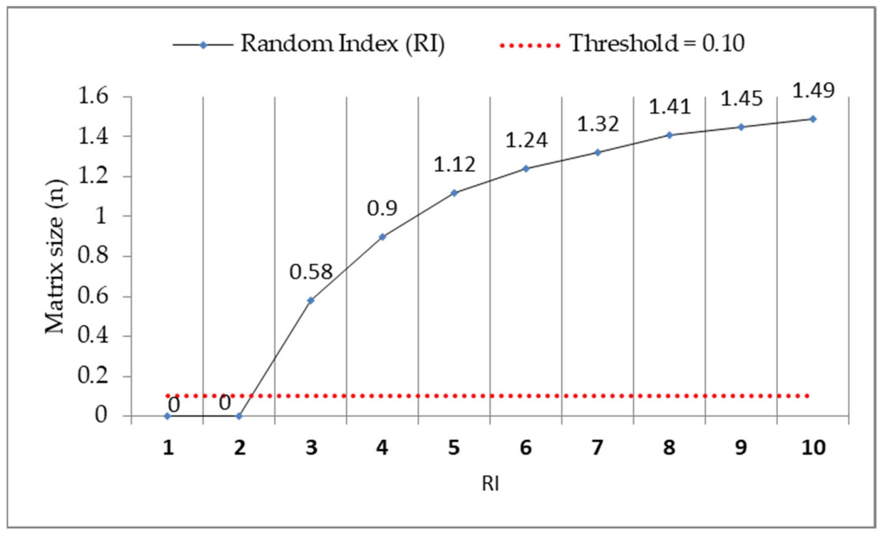
3.2. Development of the SWOT—AHP Analysis

AHP analysis enhances traditional SWOT analysis by introducing a structured, quantitative approach to decision making [46]. While SWOT identifies strengths, weaknesses, opportunities, and threats, it lacks a systematic method for prioritization [47]. This implies that by integrating the Analytical Hierarchy Process (AHP), decision-makers, based on their expertise, can subjectively assign weights and objectively rank factors through pairwise comparisons, thereby improving consistency and reducing subjectivity [48]. This approach supports multi-criteria decision making, ensures expert involvement, and enables data-driven strategic planning. Ultimately, SWOT-AHP provides a more rigorous framework for evaluating complex scenarios and making well-informed decisions [49].
The factors used to develop the Giyani Local Municipality SWOT-AHP analysis were drawn from the Integrated Development Plans of the Municipality [41] and analyzed by experts through a pairwise comparison or prioritization questionnaire. The prioritization mechanism was performed by assigning a number from a comparison scale (Table 2) developed by Saaty [33] to represent the relative importance of the criteria.
The AHP model was used in this study because it has widely been used in solving many decision-making problems [43,47,49,50,51,52]. In AHP, multiple pairwise comparisons were based on a standardized comparison scale, as shown in Table 2. The responses of each respondent were analyzed using Expert choice pro 11.5 to calculate the weighting vectors or priorities and the consistency ratios (CR) of each main criteria and sub criteria. The pairwise comparison matrices obtained from the respondents were combined using the geometric mean approach at each hierarchy level to obtain the corresponding consensus pairwise comparison matrices. Each of these matrices where then translated into the corresponding largest eigenvalue problem and solved to find the normalized and unique priority weights for each criterion.
Considering X = {X j | j = 1, 2, … n} as a set of criteria, the pairwise comparison on n criteria was summarized in an (n x n) evaluation matrix A, in which every element ij (i, j = 1, 2, …, n) was the quotient of weights of the criteria, as shown in equation (Equation (1)) below;
A = ( a i j ) n x n = a 11 a 12 . a 1 n a 21 a 22 . a 2 n . . . a 1 n a n 2 . a n n
The last step involved each matrix being normalized and finding the relative weights that were given by the right eigenvector, with (w) corresponding to the largest eigenvalue (λmax), as follows:
A w   = λ m a x · W
When the pairwise comparisons were completely consistent, the matrix A had a rank of 1 and λ m a x   = n. In this case, weights were obtained by normalizing any of the rows or columns of A [50]. The quality of the output of the AHP is linked to the consistency of the pairwise comparison judgments. The consistency is defined by the relationship between the entries of A: aij x ajk = aik. The consistency index was calculated using the formula below
C I = λ m a x 1 n 1
The consistency ratio (CR) was then calculated using Expert choice pro 11.5 to determine whether the evaluations were sufficiently consistent. This uses the formula below
C R = C I R I
where CI is the consistency index and RI is the random index as set by Saaty [33], as shown in Figure 3. The acceptable upper limit for CR is 0.1. If the final consistency ratio is >0.1, the evaluation procedure has to be repeated to improve consistency. A CR ratio < 0.1, according to [53] indicates that the experts selected in the study are experienced and knowledgeable in the area being evaluated and their judgments are consistent.
Figure 4 shows the SWOT matrix hierarchical structure adopted for analyzing the implementation constraints of spatial planning tools for disaster risk reduction in informal settlements of Giyani Local Municipality in Mopani District.
The following section presents the weighted prioritization of SWOT-AHP factors and interprets their implications for disaster risk reduction in Giyani Local Municipality.

4. Results and Discussion

The results of the SWOT-AHP analysis provide valuable insights into spatial planning priorities in Greater Giyani Local Municipality. However, it is important to contextualize these findings by acknowledging certain methodological limitations. Although the SWOT factors were drawn from the Greater Giyani Integrated Development Plan (IDP), which includes community consultation, the AHP prioritization phase was conducted solely with experts, including informal settlement and traditional leaders. Consequently, the results primarily reflect institutional and professional perspectives rather than the lived experiences of informal settlement residents. While the involvement of local leaders offered some level of community representation, this indirect participation falls short of capturing the broader community’s experiential knowledge.
Furthermore, the study’s geographic focus on Greater Giyani limits the generalisability of its findings to other municipalities, which may face different local dynamics, except in cases where similar contextual conditions exist. To enhance the inclusiveness and policy relevance of future research, the SWOT-AHP framework should be applied across multiple localities and incorporate direct community participation in the weighting process, ensuring a more balanced integration of expert judgement and grassroots insight.

4.1. The Nature of Disaster Risks in Informal Settlements in Giyani Local Municipality

Greater Giyani Local Municipality, Mopani District, has four informal settlements namely, Ma-Two Rooms, Dumpsite, Matshamahikani and Hluphekani, and these are located in disaster-prone areas such as wetlands, dumpsites, low-lying areas, and hilly and forested areas. In addition, these informal settlements do not have infrastructure such as piped water, proper toilets, waste management, sewerage, storm and surface drainage systems, paved all-weather access roads, proper electricity grid, or proper housing and street lighting, as indicated in Figure 5. Lack of such facilities expose residents to water-, health-, and fire-related risks.
Informal settlements within Giyani Local Municipality are characterized by substandard housing structures that expose residents to extreme weather conditions, including severe cold and heat waves. These settlements often rely on illegal electricity connections, which pose significant fire hazards. Additionally, the absence of adequate sewer and drainage systems increases the risk of disease outbreaks and heightens vulnerability to flooding. Notably, areas such as Dumpsite and Matshamahikani are situated adjacent to forested land, creating an environment conducive for mosquitoes to breed and, consequently, increasing the risk of malaria outbreaks. All the stated risks in these informal settlements indicate absence of formal planning [54].
Given these risks, the implementation of spatial planning tools is imperative to enhance the liveability of these informal settlements [11]. However, the effective application of such tools in Giyani Local Municipality is constrained by a range of institutional weaknesses and external threats [44]. Nevertheless, these constraints can be mitigated by leveraging the municipality’s strengths and opportunities, thereby fostering sustainable and resilient urban development.

4.2. Giyani Local Municipality SWOT Factors Identification

The internal and external factors that influence the implementation of spatial planning tools for disaster risk reduction (DRR) in informal settlements of Greater Giyani Local Municipality in Mopani District are summarized in Table 3. A total of 14 internal factors and 12 external factors where identified.

4.3. The SWOT—AHP Prioritization

The Analytical Hierarchy Process (AHP) was integrated with the SWOT matrix to improve decision-making. Initially, experts conducted a pairwise comparison of the SWOT elements using Saaty’s [33] 1–9 scale (Figure 3). The results of the significance or priority of each SWOT element and weights are as follows; Strengths (32.5%), Weaknesses (14.4%), Opportunities (44.7%), and Threats (8.5%) (Table A1). This suggests that the strategic focus, based on expert judgement using SWOT-AHP, leans heavily toward leveraging internal strengths (32.5%) and capitalizing on external opportunities (44.7%), together making up over 77% of the total priority weight. These results are consistent with many studies that have found that experts prioritize strengths and opportunities as most important to achieve strategic goals [31,50,54]. This suggests that experts perceive the availability of opportunities and the strength in the Municipality are highly significant in implementing spatial planning tools for disaster risk reduction. The question remains as to why Giyani’s informal settlements are still exposed to disaster risks related to fire, water and health. The continued exposure of Giyani’s informal settlements to fire, water, and health risks may partly stem from weaknesses (14.4%) and threats (8.5%) faced by the Municipality. These internal and external factors may hinder effective mitigation of disaster risks in these informal settlements.
Subsequently, each SWOT category was independently assessed and ranked by a team of experts through pairwise comparisons of the factors within each category, as shown in Table A2, Table A3, Table A4 and Table A5 (Appendix A). These assessments produced the overall priority scores of SWOT factors for Giyani Local Municipality, presented in Table 4. Table 4 shows that all strategy groups achieved consistency ratios below 0.1, confirming the reliability of the expert judgments and the methodological soundness of the AHP results [48].

4.3.1. Top Weaknesses of Giyani Local Municipality

From the weakness group, lack of integrated processes (W7, 0.022), weak institutional governance systems (W5, 0.019), and lack of implementation of council resolutions (W8, 0.022) emerged as the primary weaknesses in the SWOT-AHP analysis for Giyani Local Municipality. These interconnected institutional deficiencies significantly undermine the implementation of spatial planning tools for disaster risk reduction [7]. Weak governance structures reduce accountability and decision-making efficiency, while the absence of integrated processes exacerbates fragmentation across departments such as the Disaster Management Centre, and urban planning and law enforcement departments. Furthermore, the failure to implement council resolutions reflects a systemic breakdown in translating policy directives into actionable programmes. Together, these weaknesses create a cycle of disjointed planning, resource misallocation, and persistent exposure of informal settlements to disaster risks. A study by [55] identified weak governance and fragmented planning as barriers to effective disaster risk management, particularly in developing countries. Similarly, Nikolić et al., [56] found that a poor institutional capacity in municipalities across Serbia leads to disproportionate vulnerability in informal settlements. In a related study by [23], the authors confirmed that fragmented institutional structures limit adaptive capacity in informal settlements. Weak institutional governance has been identified as a key driver in the proliferation of informal settlements in both Tanzania [57] and Ethiopia [58]. However, evidence from [29] suggests that strong institutional frameworks, particularly those involving public–private/community partnerships, can yield positive outcomes in addressing disaster risks in informal settlements. The study highlights several successful examples, including Mukuru, one of the largest informal settlements in Kenya, as well as initiatives in Mahila Milan (India), Thailand, and Pakistan.
Furthermore, Mntambo and Adebayo [59] highlighted the critical role of governance in policy implementation and DRR in South Africa’s informal settlements. This contention aligns with vulnerability theory, which emphasizes the state’s central responsibility for mitigating risk by ensuring equitable access to key societal institutions by the community [60]. These studies emphasize that the persistence of these weaknesses in Giyani Local Municipality may limit community resilience and reinforce patterns of vulnerability, particularly in settlements exposed to fire, water, and health hazards. Addressing these barriers is essential for strengthening coordinated, proactive, and sustainable disaster risk reduction strategies.

4.3.2. Top Threats of Giyani Local Municipality

Unavailability of land for development (T6, 0.020) and ecological degradation (T4, 0.015) were identified as highly rated external threats in the SWOT-AHP analysis for Giyani Local Municipality. These factors pose significant challenges to the effective implementation of spatial planning tools for disaster risk reduction (DRR). The unavailability of land for development limits the municipality’s capacity to expand housing and infrastructure for reducing disaster risks in informal settlements [4]. Additionally, ecological degradation exacerbates the vulnerability of communities to natural hazards such as floods, soil erosion, drought and outbreak of disease such as cholera. This aligns with the findings of [61], which highlighted land scarcity as a critical constraint to urban planning and disaster risk reduction in informal settlements. Evidence by [62] from Namibia highlights that limited land availability hampers efforts to improve informal settlements. A comparable situation is reported in Harare, Zimbabwe, where [28] attributes land shortages to the dominance of so-called “land barons,” whose control over vast tracts of land renders government acquisition efforts financially burdensome. Similarly, in South Africa, the White Paper of 2025 on Human Settlements [63] acknowledges that land shortages present a major obstacle to informal settlement upgrading, primarily due to the high costs associated with land acquisition.
Similarly, Belle, Collins and Jordaan [64] noted that ecological degradation, particularly in urban environments and environmentally sensitive areas, undermines the sustainability of disaster risk reduction efforts by reducing the natural buffers that mitigate hazards. In South Africa, wetlands, forests and flood plains have been cleared for residential purpose and hence destroy the ecological systems, as explained in the state of African cities report [65]. Protecting such areas through spatial planning has been hampered by human activities, hence presenting increased water and health disaster risks due to inappropriate establishment of settlements in disaster prone areas. These threats in Giyani reflect broader challenges faced by informal settlements across South Africa, where land access and environmental degradation limit resilience. Addressing these threats requires coordinated land use planning and integrated ecological restoration efforts to enhance the resilience of communities to disaster risks.

4.3.3. Top Strengths of the Giyani Local Municipality

Findings from the strengths group indicate that Giyani Local Municipality’s primary assets lie in the existence of key land use management policies, notably the Spatial Development Framework (SDF), the Land Use Scheme (LUS), and supportive by-laws (S1, 0.085), alongside Disaster Management Policies (S2, 0.085). These institutional frameworks establish a formal foundation for spatial planning and disaster risk reduction (DRR) initiatives. Their presence suggests a degree of policy preparedness, which, if effectively operationalized, could promote more resilient and sustainable settlement development. Under the Spatial Planning and Land Use Management Act (SPLUMA) of 2013, such policies are mandatory to ensure coherent, uniform, and legally enforceable spatial planning across all municipalities in South Africa [66]. Accordingly, they serve as critical guiding instruments for regulating informal settlement growth and advancing DRR strategies. Nevertheless, as noted by the World Bank Group [67], the mere existence of such policies does not guarantee effective outcomes; challenges in implementation persist across many developing countries, often resulting in unregulated urban expansion and heightened disaster risks.

4.3.4. Top Opportunities of Giyani Local Municipality

Findings from the opportunities group indicate that factors O3 (0.102) and O6 (0.112) were identified by experts as the most significant opportunities. These relate to the availability of grants from the National Government and the presence of the Disaster Management Centre within the region, respectively. Such financial and institutional support mechanisms are recognized as critical enablers for the implementation of spatial planning tools aimed at disaster risk reduction (DRR) in informal settlements. International development agencies, including the Asian Development Bank [68], similarly emphasize the pivotal role of financial instruments and institutional frameworks in enhancing the capacity of municipalities to advance DRR initiatives and promote sustainable urban development.

4.4. Limitations and Future Research Directions

This study investigates spatial planning implementation constraints for disaster risk reduction in informal settlements within the Greater Giyani Local Municipality, using an expert-led SWOT-AHP analysis grounded in the local Integrated Development Plan (IDP). It identifies institutional and planning weaknesses as key vulnerabilities. However, several limitations must be acknowledged. First, the reliance on a relatively small sample of 30 experts may affect the robustness and representativeness of the findings. Second, the exclusion of community participation, though represented by their leaders, limits the inclusiveness and contextual relevance of the analysis. Third, the study’s localized focus restricts the generalisability of its conclusions to broader contexts.
Additionally, while the SWOT-AHP method provides a systematic framework for prioritizing planning constraints, it is inherently dependent on subjective expert judgments and pairwise comparisons. This subjectivity may introduce bias and affect the consistency of results, particularly when expert perspectives vary significantly. Future research should aim to triangulate SWOT-AHP findings with participatory and empirical data, expand the study scope to include multiple municipalities, and integrate community voices to support more inclusive, robust, and generalizable resilience strategies.

5. Conclusions

This study employed the SWOT-AHP framework to analyze the critical factors influencing the implementation of spatial planning tools for disaster risk reduction (DRR) in the informal settlements of Giyani Local Municipality, South Africa. The findings demonstrate that the municipality possesses significant institutional and financial capacity to implement DRR strategies effectively, as evidenced by the high priority given to internal strengths (32.5%) and external opportunities (44.7%). Specifically, the presence of formal spatial planning instruments such as the Spatial Development Framework (SDF), Land Use Scheme (LUS), and Disaster Management Policies, each with significant priority weights (S1 and S2 at 0.085), provides a strong institutional basis for planning. Likewise, the availability of grants from the national government (O3 = 0.102) and the existence of a Disaster Management Centre within the region (O6 = 0.112) highlight a supportive external environment conducive to resilience-building initiatives. Despite this potential, the analysis reveals persistent challenges that undermine implementation. The most pressing internal weaknesses include the lack of an integrated planning process (W7 = 0.022), weak institutional governance (W5 = 0.019), and poor enforcement of council resolutions (W8 = 0.022). These governance-related constraints suggest that while policy frameworks are present, their practical application remains limited. Furthermore, external threats such as land scarcity (T6 = 0.020) and ecological degradation (T4 = 0.015) represent ongoing environmental risks that compound the vulnerabilities faced by informal settlements. Overall, the study concludes that although Giyani Local Municipality possesses both the tools and opportunities for effective DRR, their impact is undermined by institutional inefficiencies and unsustainable land use practices. Addressing these limitations through a more integrated and coordinated governance approach is essential for enhancing resilience in vulnerable communities.

6. Recommendations

In light of the findings, several recommendations emerge for strengthening the implementation of DRR-oriented spatial planning in Giyani. First, improving the enforcement of existing policies is essential. While the municipality has adopted key frameworks such as the SDF and LUS, their practical implementation is hampered by limited capacity and weak coordination across departments. Establishing clear implementation protocols, backed by monitoring and evaluation mechanisms, would enable greater accountability and policy follow-through. Additionally, capacity-building initiatives targeting municipal officials and planners can strengthen institutional coordination and align departmental mandates with DRR goals. Second, the municipality should take full advantage of available institutional and financial resources. The presence of national government grants and a regional Disaster Management Centre presents an opportunity to fund and operationalise resilience-oriented projects. A dedicated municipal unit tasked with coordinating project development, funding applications, and inter-agency partnerships would improve the ability to translate policy into action. Third, integrated and participatory planning should be prioritized to ensure that DRR interventions are contextually appropriate and inclusive. Creating formal platforms for collaboration among government agencies, private stakeholders, and community representatives can foster trust and align development priorities with local needs. Moreover, addressing land availability challenges requires a long-term strategic approach. This includes the identification and reservation of low-risk zones for urban expansion, alongside measures to prevent the occupation of ecologically sensitive or hazard-prone areas. Alternative housing solutions such as in situ upgrading and guided resettlement should be explored to reduce exposure to risk. Lastly, to address land degradation, environmental protection must be placed at the core of spatial planning. The municipality should enforce conservation-based zoning regulations and invest in green infrastructure such as sustainable urban drainage systems. These actions would contribute to the restoration of degraded ecosystems and enhance overall resilience to climate-induced hazards.

7. Policy Implication

This study highlights the urgent need to move beyond policy formulation toward effective implementation. While Giyani Local Municipality has adopted key spatial planning instruments—such as the Spatial Development Framework (SDF), Land Use Scheme (LUS), and Disaster Management Framework—limited institutional capacity and weak enforcement continue to undermine their effectiveness. Strengthening interdepartmental coordination and accountability is essential for translating these frameworks into practical outcomes. Disaster risk reduction must also be fully integrated into routine spatial planning. This includes aligning DRR objectives with zoning regulations, infrastructure planning, and land use controls, particularly in informal settlements. Addressing land scarcity and ecological degradation through improved land governance and the protection of sensitive areas such as wetlands and floodplains is critical for long-term resilience. Finally, a coordinated approach across all spheres of government—supported by national funding mechanisms and technical assistance—is necessary. institutionalizing participatory planning processes will ensure that DRR efforts are inclusive, locally informed, and responsive to the vulnerabilities of at-risk communities.

Author Contributions

Conceptualization, J.A.; methodology, J.A.; software, J.A.; validation, M.B.Y.C.; formal analysis, J.A.; investigation, J.A.; resources, M.B.Y.C.; data curation, J.A.; writing—original draft preparation, J.A.; writing—review and editing, M.B.Y.C.; visualization, J.A.; supervision, M.B.Y.C.; project administration, J.A.; funding acquisition, M.B.Y.C. All authors have read and agreed to the published version of the manuscript.

Funding

The University of Venda under the Capacity Development Grant, grant number 6959, funded this research and Mangosuthu University of Technology funded the APC.

Institutional Review Board Statement

This study was conducted in accordance with the ethical guidelines of the University of Venda and was approved by the Ethics Committee (Project NOSES/20/ERM/10/1111) on 11 November 2020.

Informed Consent Statement

All participants provided informed consent prior to their involvement in the study.

Data Availability Statement

The data presented in this study are available upon confirmed request from the corresponding author.

Acknowledgments

The authors would like to acknowledge the support of those who directly or indirectly contributed to the success of this study.

Conflicts of Interest

The authors declare no conflicts of interest.

Abbreviations

The following abbreviations are used in this manuscript:
DRRDisaster Risk Reduction
SDFSpatial Development Framework
SPLUMASpatial Planning Land Use Management Act

Appendix A

Table A1. Pairwise comparison of SWOT elements.
SWOT GroupsSWOTImportance Degrees
Strength (S)1.003.001.003.000.325
Weakness (W)0.331.000.202.000.144
Opportunities (O)1.005.001.004.000.447
Threats (T)0.330.500.251.000.085
CR = 0.071
Table A2. Pairwise comparison of the strength of Giyani.
StrengthS1S2S3S4S5Importance Degrees
S1—Land use management policies (SDF, LUS, By-laws)1.001.002.003.001.000.26
S2—Disaster management policies1.001.002.003.001.000.26
S3—Waste management facilities0.500.501.003.001.000.20
S4—Tourism0.330.330.331.000.500.08
S5—Skilled personnel1.001.001.002.001.000.20
CR = 0.0302
Table A3. Pairwise comparison of the weakness of Giyani.
WeaknessesW1W2W3W4W5W6W7W8W9Importance Degrees
W1—Lack of implementation of land use management policies and by-laws1.001.001.001.001.000.500.501.001.000.097
W2—Lack of engagement with the review processes of policies0.501.001.000.331.000.501.000.330.330.064
W3—Out-dated data that misinforms planning1.001.001.000.501.001.000.331.001.000.084
W4—Lack of capacity in land use management1.003.002.001.000.501.001.001.001.000.123
W5—Weak institutional governance systems1.001.001.002.001.002.001.001.002.000.129
W6—Lack of insured infrastructure2.002.001.001.000.501.000.500.501.000.102
W7—Lack of integrated processes2.001.003.001.001.002.001.001.002.000.150
W8—Lack of implementation of council resolutions1.003.001.001.001.002.001.001.003.000.150
W9—Poor maintenance of infrastructure1.003.001.001.000.501.000.500.331.000.100
CR = 0.0541
Table A4. Pairwise comparison of the opportunities of Giyani.
OpportunitiesO1O2O3O4O5O6Importance Degrees
O1—Tourism as revenue base1.002.000.331.000.500.330.108
O2—Waste recycling that results in creating jobs0.501.000.330.500.330.330.063
O3—Grants from the national government3.003.001.002.001.001.000.229
O4—Proximity to Kruger national park1.002.002.001.000.500.330.142
O5—Awareness creation platforms2.003.001.002.001.001.000.208
O6—National Disaster Management Centre3.003.001.003.001.001.000.250
CR = 0.090
Table A5. Pairwise comparison of the threats of Giyani.
ThreatsT1T2T3T4T5T6T7Importance
Degrees
T1—Lack of specialized skills to ensure legislative compliance1.003.000.500.501.000.501.000.129
T2—Legal cases against the municipality0.331.001.000.331.000.330.500.077
T3—Non-functionality of Disaster Management Centre2.001.001.001.000.500.330.500.109
T4—Ecological degradation2.003.001.001.001.001.001.000.171
T5—Weak relationship with Tribal Authority1.001.002.001.001.000.501.000.129
T6—Unavailability of land for development2.003.003.001.002.001.002.000.240
T7—Scarcity of water1.002.002.001.001.000.501.000.146
CR = 0.0525

References

  1. Madubula, N.; van Eeden, E. An analysis of the vulnerability of informal and formal households to disaster risks in the Rand West City region. Jamba J. Disaster Risk Stud. 2023, 16, a1589. [Google Scholar] [CrossRef] [PubMed]
  2. Visagie, J.; Turok, I. Getting urban density to work in informal settlements in Africa. Environ. Urban. 2020, 32, 351–370. [Google Scholar] [CrossRef]
  3. Cai, Y.S.; Mustapha, A. Editorial: Environmental health in informal settlements: Current progress, challenges and perspectives. Front. Public Health 2023, 11, 547–558. [Google Scholar] [CrossRef] [PubMed]
  4. Akola, J.; Chakwizira, J.; Ingwani, E.; Bikam, P. An AHP-TOWS Analysis of Options for Promoting Disaster Risk Reduction Infrastructure in Informal Settlements of Greater Giyani Local Municipality, South Africa. Sustainability 2023, 15, 267. [Google Scholar] [CrossRef]
  5. Nuhu, S.; Munuo, N.; Mngumi, L. Governance challenges of regularisation of informal settlements in peri-urban Tanzania: Perspectives from local stakeholders. Int. J. Urban Sustain. Dev. 2023, 15, 35–47. [Google Scholar] [CrossRef]
  6. Nzazi, E. Unraveling the Urban Landscape: Assessing the Influence of Informal Settlements on Spatial Planning in Lusaka, Zambia. OALib 2025, 12, e12879. [Google Scholar] [CrossRef]
  7. United Nations Economic Commission for Europe(UNECE). Spatial Planning: Key Instrument for Development and Effective Governance with Special Reference to Countries in Transition; United Nations Publication: New York, NY, USA; Geneva, Switzerland, 2008; pp. 1–46. [Google Scholar]
  8. South Africa. Spatial Planning and Land-Use Management; MDPI AG: Basel, Switzerland, 2013. [Google Scholar]
  9. Satterthwaite, D.; Sverdlik, A. Assessing Health Risks in Informal Settlements in Sub-Saharan African Cities; Breifing No.10; Urban Africa Risk Knowledge: Holborn, UK, 2018; Volume 96. [Google Scholar]
  10. UN-Habitat. Planning Sustainable Cities Un-Habitat Practices and Perspectives; UN-Habitat: Nairobi, Kenya, 2010. [Google Scholar]
  11. Dodman, D.; Archer, D.; Mayr, M.; Engindeniz, E. Pro-Poor Climate Action in Informal Settlements; UN-Habitat: Nairobi, Kenya, 2018; Volume 46, pp. 1–60. [Google Scholar]
  12. United Nations Office for Disaster Risk Reduction (UNISDR). UNISDR’s Support for the New Partnership for Africa’s Development (NEPAD); May 2015–April 2016; United Nations Office for Disaster Risk Reduction: Addis Ababa, Ethiopia, 2016. [Google Scholar]
  13. Tong, X.; Feng, Y. How current and future urban patterns respond to urban planning? An integrated cellular automata modelling approach. Cities 2019, 92, 247–260. [Google Scholar] [CrossRef]
  14. South African Cities Network (SACN). SPLUMA as a Tool for Spatial Transformation; South African Cities Network: Johannesburg, South Africa, 2017; Volume 27. [Google Scholar]
  15. Fisher, T.; Singh, K. Geospatial Analysis of Informal Settlement Development in Cape Town. S. Afr. J. Geomat. 2023, 12, 206–220. [Google Scholar] [CrossRef]
  16. Akola, J.; Chakwizira, J.; Ingwani, E.; Bikam, P. Awareness Level of Spatial Planning Tools for Disaster Risk Reduction in Informal Settlements in Mopani District, South Africa. Sustainability 2023, 15, 5380. [Google Scholar] [CrossRef]
  17. Ouma, S.; Cocco Beltrame, D.; Mitlin, D.; Chitekwe-Biti, B. Informal Settlements: Domain Report Informal Settlements: Domain Report Diana Mitlin; African Cities Research Consortium: Manchester, UK, 2024. [Google Scholar]
  18. United Nation. The Sustainable Development Goals Report 2017; United Nation: Washington, DC, USA, 2017. [Google Scholar]
  19. Mejía-dugand, S.; Croese, S.; Reddy, S.A. SDG Implementation at the Local Level: Lessons From Responses to the Coronavirus Crisis in Three Cities in the Global South. Front. Sustain. Cities 2020, 2, 598516. [Google Scholar] [CrossRef]
  20. Eliades, F.; Doula, M.K.; Papamichael, I.; Vardopoulos, I.; Voukkali, I.; Zorpas, A.A. Carving out a Niche in the Sustainability Confluence for Environmental Education Centers in Cyprus and Greece. Sustainability 2022, 14, 8368. [Google Scholar] [CrossRef]
  21. Agyabeng, A.N.; Peprah, A.A.; Mensah, J.K.; Mensah, E.A. Informal settlement and urban development discourse in the Global South: Evidence from Ghana. Nor. Geogr. Tidsskr. 2022, 76, 242–253. [Google Scholar] [CrossRef]
  22. Matimolane, S.; Strydom, S.; Mathivha, F.I.; Chikoore, H. Evaluating the spatiotemporal patterns of drought characteristics in a semi-arid region of Limpopo Province, South Africa. Environ. Monit. Assess. 2024, 196, 1062. [Google Scholar] [CrossRef] [PubMed]
  23. Ndabezitha, K.E.; Mubangizi, B.C.; John, S.F. Adaptive capacity to reduce disaster risks in informal settlements. Jamba J. Disaster Risk Stud. 2024, 16, a1488. [Google Scholar] [CrossRef]
  24. Cinnamon, J.; Noth, T. Spatiotemporal development of informal settlements in Cape Town, 2000 to 2020: An open data approach. Habitat Int. 2023, 133, 102753. [Google Scholar] [CrossRef]
  25. Parikh, P.; Bisaga, I.; Loggia, C.; Georgiadou, M.C.; Ojo-Aromokudu, J. Barriers and opportunities for participatory environmental upgrading: Case study of Havelock informal settlement, Durban. City Environ. Interact. 2020, 5, 100041. [Google Scholar] [CrossRef]
  26. Nembilwi, N.; Chikoore, H.; Kori, E.; Munyai, R.B.; Manyanya, T.C. The occurrence of drought in Mopani district municipality, South Africa: Impacts, vulnerability and adaptation. Climate 2021, 9, 61. [Google Scholar] [CrossRef]
  27. Wardhani, P.I.; Musiyam, M.; Wibowo, Y.A.; Rahmadana, A.D.W.; Utami, S.; Maulana, E. Evaluation of disaster safe education unit programme implementation in Mt. Merapi using the pressure state response approach. Jamba J. Disaster Risk Stud. 2024, 16, a1769. [Google Scholar] [CrossRef]
  28. Matamanda, A.R. Battling the informal settlement challenge through sustainable city framework: Experiences and lessons from Harare, Zimbabwe. Dev. S. Afr. 2020, 37, 217–231. [Google Scholar] [CrossRef]
  29. Satterthwaite, D.; Archer, D.; Colenbrander, S.; Dodman, D.; Hardoy, J.; Mitlin, D.; Patel, S. Building Resilience to Climate Change in Informal Settlements. One Earth 2020, 2, 143–156. [Google Scholar] [CrossRef]
  30. Abdel-Basset, M.; Mohamed, M.; Smarandache, F. An extension of neutrosophic AHP-SWOT analysis for strategic planning and decision-making. Symmetry 2018, 10, 116. [Google Scholar] [CrossRef]
  31. Ben Ali, M.; Rauch, E. Sustainable Mobility Transition: A SWOT-AHP Analysis of the Case Study of Italy. Sustainability 2024, 16, 4861. [Google Scholar] [CrossRef]
  32. Atkinson, C.L. Informal Settlements: A New Understanding for Governance and Vulnerability Study. Urban Sci. 2024, 8, 158. [Google Scholar] [CrossRef]
  33. Baek, J. A Study on Consumer-Centric Health Information Provision Strategy Using SWOT-AHP-Focusing on the National Health Information Portal. Health Care Anal. 2025. [Google Scholar] [CrossRef]
  34. Cardozo, F.A.C.; Campos, H.J.S.; Petter, C.O.; Ambrós, W.M. Application of Monte Carlo Analytic Hierarchy Process (MAHP) in Underground Mining Access Selection. Mining 2023, 3, 773–785. [Google Scholar] [CrossRef]
  35. Wang, H.C. Consolidating Informal Settlements Through Upgrading? The Temporary Implications of In-Situ Electrification from Thembelihle in Johannesburg, South Africa. J. Asian Afr. Stud. 2024, 59, 425–442. [Google Scholar] [CrossRef]
  36. Greater Giyani Municipality. Greater Giyani Municipality Integrated Development Plan 2019/2020; Greater Giyani Municipality: Giyani, South Africa, 2020. [Google Scholar]
  37. Municipalities of South Africa. Municipalities of South Africa: Greater Giyani Local Municipality. Greater Giyani Local Municiplity (MDB Code: LIM331). Available online: https://municipalities.co.za/locals/view/128/greater-giyani (accessed on 26 May 2025).
  38. Greater Giyani Municipality. Greater Giyani Municipality Annual Report 2023–24; Greater Giyani Municipality: Giyani, South Africa, 2023. [Google Scholar]
  39. Kothari, C.R.; Garg, G. Research Methodology: Methods and Techniques, 3rd ed.; New Age International Publishers: New Delhi, India, 2014; ISBN 978-81-224-3623-5. [Google Scholar]
  40. Greater Giyani Municipality. Intergrated Development Plan Report 2022/2023; Greater Giyani Municipality: Giyani, South Africa, 2022. [Google Scholar]
  41. Emet, G.; Merba, T. SWOT Analysis: A Theoretical Review. J. Int. Soc. Res. 2017, 10, 6–11. [Google Scholar] [CrossRef]
  42. Dyson, R.G. Strategic development and SWOT analysis at the University of Warwick. Eur. J. Oper. Res. 2004, 152, 631–640. [Google Scholar] [CrossRef]
  43. Görener, A.; Toker, K.; Uluçay, K. Application of Combined SWOT and AHP: A Case Study for a Manufacturing Firm. Procedia—Soc. Behav. Sci. 2012, 58, 1525–1534. [Google Scholar] [CrossRef]
  44. Rizzo, A.S.; Kim, J.G. A SWOT Analysis of the Field of Virtual Reality Rehabilitation. Mass. Inst. Technol. 2005, 14, 119–146. [Google Scholar] [CrossRef]
  45. Gago, D.; Mendes, P.; Murta, P.; Cabrita, N.; Teixeira, M.R. Stakeholders’ Perceptions of New Digital Energy Management Platform in Municipality of Loulé, Southern Portugal: A SWOT-AHP Analysis. Sustainability 2022, 14, 1445. [Google Scholar] [CrossRef]
  46. Omid, M. Strategic planning and urban development by using the SWOT analysis. The case of Urmia city. Rom. Rev. Reg. Stud. 2014, X, 47–54. [Google Scholar]
  47. Odu, G.O. Weighting methods for multi-criteria decision making technique. J. Appl. Sci. Environ. Manag. 2019, 23, 1449–1457. [Google Scholar] [CrossRef]
  48. Yang, J.; Ogunkah, I.C.B. A Multi-Criteria Decision Support System for the Selection of Low-Cost Green Building Materials and Components. J. Build. Constr. Plan. Res. 2013, 1, 89–130. [Google Scholar] [CrossRef]
  49. Wickramasinghe, V.S.K.; Takano, S.E.I. Application of Combined SWOT and Analytic Hierarchy Process (AHP) for Tourism Revival Strategic Marketing Planning. J. East. Asia Soc. Transp. Stud. 2010, 8, 954–969. [Google Scholar]
  50. Nikolić, D.; Spasić, J.; Živković, Ž.; Djordjević, P.; Mihajlović, I.; Kangas, J. SWOT—AHP model for prioritization of strategies of the resort Stara Planina. Serbian J. Manag. 2015, 10, 141–150. [Google Scholar] [CrossRef]
  51. Datta, K. Application of SWOT-TOWS Matrix and Analytical Hierarchy Process (AHP) in the Formulation of Geoconservation and Geotourism Development Strategies for Mama Bhagne Pahar: An Important Geomorphosite in West Bengal, India. Geoheritage 2020, 12, 45. [Google Scholar] [CrossRef]
  52. El Menshawy, A.; Aly, S.S.; Salman, A.M. Sustainable upgrading of informal settlements in the developing world, case study: Ezzbet Abd El Meniem Riyadh, Alexandria, Egypt. Procedia Eng. 2011, 21, 168–177. [Google Scholar] [CrossRef]
  53. Pinfold, N. Community Mapping in Informal Settlements for Better Housing and Service Delivery, Cape Town, South Africa; INSPIRE-Geospatial World Forum: Lisbon, Portugal, 2015; Volume 0. [Google Scholar]
  54. Nguyen, T.; Truong, C. Integral SWOT-AHP-TOWS Model for Strategic Agricultural Development in the Context of Drought: A Case study in Ninth Thuan, Vietnam. Int. J. Anal. Hierarchy Process 2022, 14, 1–30. [Google Scholar] [CrossRef]
  55. Watson, V. ‘The planned city sweeps the poor away…’: Urban planning and 21st century urbanisation. Prog. Plann. 2009, 72, 151–193. [Google Scholar] [CrossRef]
  56. Nikolić, D.S.; Pantić, M.D.; Jokić, V.T. Urban and Spatial Planning: Pragmatic Considerations for Plan Implementation Improvements (A Case Study of the City of Bor). SAGE Open 2021, 11, 1–14. [Google Scholar] [CrossRef]
  57. Kitosi, P.; Mwipopo, D.; Murro, G.; Kimilo, A.; Kapinga, M. The nature of land conflicts in informal settlements: Experience from regularization projects: The case of Dar es Salam, Tanzania. Afr. J. L. Policy Geospatial Sci. 2024, 7, 555–567. [Google Scholar] [CrossRef]
  58. Bayuma, T.B.; Abebe, B.G. Heliyon An investigation of the factors underlying informal settlement growth: The case of Burayu City, Ethiopia. Heliyon 2024, 10, e39443. [Google Scholar] [CrossRef] [PubMed]
  59. Mntambo, S.; ADEBAYO, P. Disaster Management in South Africa’S Informal Settlements: Policy, Practice and Covid-19 Implications. J. Incl. Cities Built Environ. 2022, 2, 87–100. [Google Scholar] [CrossRef]
  60. Fineman, M.A. The Vulnerable Subject: Anchoring Equality in the Human Condition. Yale J. Law Fem. 2008, 20, 1–23. [Google Scholar]
  61. Hallegatte, S.; Vogt-Schilb, A.; Rozenberg, J.; Bangalore, M.; Beaudet, C. From Poverty to Disaster and Back: A Review of the Literature. Econ. Disasters Clim. Change 2020, 4, 223–247. [Google Scholar] [CrossRef]
  62. Muzanima, J.; Shipandeni, M.N.T.; Togarepi, C.; Shivolo-Useb, S.; Jona, C.N.; Petrus, N.P. Constraints and coping strategies of urban agriculture households in Namibia’s informal settlements during COVID-19. Urban Agric. Reg. Food Syst. 2024, 9, e70006. [Google Scholar] [CrossRef]
  63. South Africa. White Paper for Human Settlement; Department of Human Settlements: Pretoria, South Africa, 2025; pp. 1–234. [Google Scholar]
  64. Belle, J.A.; Collins, N.; Jordaan, A. Managing wetlands for disaster risk reduction: A case study of the eastern Free State, South Africa. Jamba J. Disaster Risk Stud. 2018, 10, a400. [Google Scholar] [CrossRef]
  65. Laros, M. The State of African Cities 2014: Re-Imagining Sustainable Urban Transitions, 3rd ed.; United Nations Human Settlements Programme (UN-Habitat): Nairobi, Kenya, 2014. [Google Scholar]
  66. South Africa, Department of Rural Development and Land Reform. Spatial Planning and Land Use Management Act 16 of 2013; Rural Development and Land Reform: Pretoria, South Africa, 2013; pp. 1–72. [Google Scholar]
  67. Acharya, G.D. Including the Excluded: Marginalised Poor Communities and Development Practices in Rural Nepal; University of Queensland: Brisbane, Australia, 2018. [Google Scholar]
  68. ADB. Enabling Inclusive Cities: Tool Kit for Inclusive Urban Development; Asian Development Bank: Mandaluyong, Philippines, 2017. [Google Scholar]
Figure 1. Location of the study area. Source: authors (2022).
Sustainability 17 06075 g001
Figure 2. SWOT analysis framework. Source: authors (2023).
Sustainability 17 06075 g002
Figure 3. Random Index (RI) vs. Matrix size (n). Source: authors 2025.
Sustainability 17 06075 g003
Figure 4. SWOT matrix hierarchical structure. Source: authors (2023).
Sustainability 17 06075 g004
Figure 5. Disaster risks in Giyani Local Municipality informal settlements. Source: adopted from Akola et al. [4].
Sustainability 17 06075 g005
Table 1. Expert profiles.
Number of ExpertsExpert GroupsArea of Expertise
6Municipal officialsMunicipal infrastructure
1Municipal officialsEnvironment management
2Ward councillorsManagement of informal settlements
1Spatial planningLand use schemes
2Disaster management officialsDisaster risk management
3Local economic development and housingHousing and informal settlements
2Traditional leadersLand matters and traditional affairs
8Informal settlement leadersCommunity leadership
5Police officialsMaintenance of law and order
Source: Authors (2023).
Table 2. Pairwise comparison scale.
ImportanceExplanation
1Two criteria contribute equally to the objective
3Experience and judgement slightly favour one over another
5Experience and judgement strongly favour one over another
7Criterion is strongly favoured, and its dominance is demonstrated in practice
9The importance of one over another affirmed in the highest possible order
2, 4, 6, 8Used to represent a compromise between the priorities listed above
Source: Adopted from Akola et al. [4].
Table 3. Giyani Local Municipality SWOT factors.
Internal Factors
StrengthWeaknesses
S1—Land use management policies in place (SDF, LUMS, By-laws)
S2—Environmental framework (disaster management policies, integrated waste management plan)
S3—Waste management facilities
S4—Tourism
S5—Sports facilities in rural communities
W1—Lack of implementation of land use management policies and by-laws
W2—Lack of engagement with the review processes of policies (lack of ownership)
W3—Out-dated data that misinforms planning
W4—Lack of capacity in land use management
W5—Lack of institutional governance systems
W6—Lack of insured infrastructure
W7—Lack of integrated processes
W8—Lack of implementation of council resolutions
W9—Poor maintenance of infrastructure
External Factors
OpportunitiesThreats
O1—Tourism
O2—Waste recycling that results in creating jobs
O3—A healthy society due to the availability of sports facilities
O4—Poverty: government investment directed to Giyani
O5—Proximity to Kruger national park
T1—Lack of critical/specialized skills to ensure legislative compliance and has a negative impact on the development of infrastructure
T2—Legal cases against the municipality due to loss of infrastructure and human lives due to disasters and accidents occurrence, since the infrastructure is not insured and in the bad state
T3—Non-functionality of the Disaster Management Centre
T4—Ecological degradation
T5—Relationship with Tribal Authority (development not addressing the vision)
T6—Unavailability of land for development
T7—Scarcity of water, sewerage, and storm drainage infrastructure.
Table 4. Overall Priority Scores of SWOT Factors for Giyani Local Municipality.
SWOT GroupGroup PrioritySWOT FactorImportance DegreesOverall Priority Degree
Strengths
CR = 0.0302
0.325S1—Land use management policies (SDF, LUS, By-laws)0.2620.085
S2—Disaster management policies0.2620.085
S3—Waste management facilities0.1970.064
S4—Tourism0.0820.027
S5—Skilled personnel0.1970.064
Weaknesses
CR = 0.0541
0.144W1—Lack of implementation of land use management policies and by-laws0.0970.014
W2—Lack of engagement with the review processes of policies0.0640.009
W3—Out-dated data that misinforms planning0.0840.012
W4—Lack of capacity in land use management0.1230.018
W5—Weak institutional governance systems0.1290.019
W6—Lack of insured infrastructure0.1020.015
W7—Lack of integrated processes0.1500.022
W8—Lack of implementation of council resolutions0.1500.022
W9—Poor maintenance of infrastructure0.1000.014
Opportunities
CR = 0.090
0.447O1—Tourism as revenue base0.1080.048
O2—Waste recycling that results in creating jobs0.0630.028
O3—Grants from the national government0.2290.102
O4—Proximity to Kruger national park0.1420.064
O5—Awareness creation platforms0.2080.093
O6—National Disaster management centre0.2500.112
Threats
CR = 0.0525
0.085T1—Lack of specialized skills to ensure legislative compliance0.1290.011
T2—Legal cases against the municipality0.0770.007
T3—Non-functionality of Disaster Management Centre0.1090.009
T4—Ecological degradation0.1710.015
T5—Weak relationship with Tribal Authority0.1290.011
T6—Unavailability of land for development0.2400.020
T7—Scarcity of water0.1460.012
Disclaimer/Publisher’s Note: The statements, opinions and data contained in all publications are solely those of the individual author(s) and contributor(s) and not of MDPI and/or the editor(s). MDPI and/or the editor(s) disclaim responsibility for any injury to people or property resulting from any ideas, methods, instructions or products referred to in the content.

