Exploring the Preferences of Iranian Geotourists: Case Study of Shadows Canyon and Canyon of Jinns
Abstract
1. Introduction
2. Study Area
3. Methodology
4. Results and Discussion
5. Conclusions
Author Contributions
Funding
Institutional Review Board Statement
Informed Consent Statement
Data Availability Statement
Conflicts of Interest
References
- Božić, S.; Tomić, N. Canyons and gorges as potential geotourism destinations in Serbia: Comparative analysis from two perspectives—general geotourists’ and pure geotourists’. Open Geosci. 2015, 7, 531–546. [Google Scholar] [CrossRef]
- Ranney, W.; Glotfelty, M. Journey to the Grand Canyon: A geologic and hydrologic excursion across Arizona’s magnificent heartland. In Geologic Excursions in Southwestern North America; Geological Society America: Boulder, CO, USA, 2019. [Google Scholar]
- Pellitero, R.; González-Amuchastegui, M.J.; Ruiz-Flaño, P.; Cañadas, E.S. Geodiversity and Geomorphosite Assessment Applied to a Natural Protected Area: The Ebro and Rudron Gorges Natural Park (Spain). Geoheritage 2010, 3, 163–174. [Google Scholar] [CrossRef]
- Cocean, G.; Cocean, P. An Assessment Gorges for Purposes Identifying Geomorphosites Geotourism Value in the Apuseni Mountains (Romania). Geoheritage 2016, 9, 71–81. [Google Scholar] [CrossRef]
- Began, M.; Višnić, T.; Djokić, M.; Vasiljevic, D.A. Interpretation Possibilites Geoheritage in Southeastern Serbia—Gorge and Canyon Study. Geoheritage 2016, 9, 237–249. [Google Scholar] [CrossRef]
- Telbisz, T.; Stergiou, C.L.; Mindszenty, A.; Chatzipetros, A. Karst features and related social processes in the region the Vikos Gorge and Tymphi Mountain (Northern Pindos National Park, Greece). Acta Carsologica 2019, 48, 29–42. [Google Scholar] [CrossRef]
- Khodadadi, M. A new dawn? The Iran nuclear deal and the future the Iranian tourism industry. Tour. Manag. Perspect. 2016, 18, 6–9. [Google Scholar] [CrossRef]
- O’Gorman, K.D.; McLellan, L.; Baum, T. Tourism in Iran: Central control and indigeneity. In Tourism and Indigenous Peoples; Elsevier BV: Amsterdam, The Netherlands, 2007; pp. 251–264. [Google Scholar]
- Gray, M. Geodiversity: Valuing and Conserving Abiotic Nature; John Wiley & Sons: Chichester, UK, 2004. [Google Scholar]
- Gray, M. Geodiversity: The origin and evolution a paradigm. In the History Geoconservation. Geological Society; Burek, C.V., Prosser, C.D., Eds.; Special Publications: London, UK, 2008; Volume 300, pp. 31–36. [Google Scholar]
- Pourahmad, A.; Hosseini, A.; Pourahmad, A.; Zoghi, M.; Sadat, M. Tourist Value Assessment Geotourism and Environmental Capabilities in Qeshm Island, Iran. Geoheritage 2018, 10, 687–706. [Google Scholar] [CrossRef]
- Bahaee, M.; Pisani, M.J.; Shavakh, F. Residents’ Attitudes toward International Tourism: A Case Iran. J. Tour. Recreat. 2014, 1, 1–14. [Google Scholar] [CrossRef]
- Amrikazemi, A. Introducing Geotourism in Iran. In Proceedings of the 10th International Ecotourism Conference, Cairns, Australia, 21–25 October 2002. [Google Scholar]
- Amrikazemi, A. Atlas the Qeshm Geotourism, a Look at the Geological Features the Qeshm Island; Geological Survey Iran: Tehran, Iran, 2004. [Google Scholar]
- Tomić, N.; Božić, S. A modified geosite assessment model (MGAM) and its application on the Lazar Canyon area (Serbia). Int. J. Environ. Res. 2014, 8, 1041–1052. [Google Scholar]
- Tičar, J.; Tomić, N.; Breg Valjavec, M.; Zorn, M.; Marković, S.B.; Gavrilov, M.B. Speleotourism in Slovenia: Balancing between mass tourism and geoheritage protection. Open Geosci. 2018, 10, 344–357. [Google Scholar] [CrossRef]
- Ghazi, J.M.; Ólafsdóttir, R.; Tongkul, F.; Ghazi, J.M. Geological Features for Geotourism in the Western Part Sahand Volcano, NW Iran. Geoheritage 2012, 5, 23–34. [Google Scholar] [CrossRef]
- Ghorbani, M. A Summary Geology Iran. In Springer Geology; Springer Science and Business Media LLC: Berlin/Heidelberg, Germany, 2012; pp. 45–64. [Google Scholar]
- Fookes, P.; Knill, J. The application engineering geology in the regional development northern and central Iran. Eng. Geol. 1969, 3, 81–120. [Google Scholar] [CrossRef]
- Nasab, H.V.; Clark, G.A.; Torkamandi, S. Late Pleistocene dispersal corridors across the Iranian Plateau: A case study from Mirak, a Middle Paleolithic site on the northern edge the Iranian Central desert (Dasht-e Kavir). Quat. Int. 2013, 300, 267–281. [Google Scholar] [CrossRef]
- Mohseni, H.; Hamed, M.; Behbahani, R.; Moeeni, M. Geochemistry siliciclastic sediments the Semnan Province and NE Isfahan Province (Iran), implication for provenance. Geopersia 2017, 7, 55–69. [Google Scholar] [CrossRef]
- Yahya, S.V.; Zamaniyan, E. Geotourism Potentials Jenni, Sardar and Tafto Canyons (Case Study: Tabas County). In Proceedings of the International Geosciences Congress, Tehran, Iran, 22–24 February 2016. [Google Scholar]
- Ruban, D.A. Geotourism—A geographical review the literature. Tour. Manag. Perspect. 2015, 15, 1–15. [Google Scholar] [CrossRef]
- Dowling, R.; Newsome, D. Geotourism: Definition, Characteristics and International Perspectives. In Handbook Geotourism; Edward Elgar Publishing: Cheltenham, UK, 2018; Chapter 1; pp. 1–22. [Google Scholar]
- Ólafsdóttir, R.; Tverijonaite, E. Geotourism: A Systematic Literature Review. Geoscience 2018, 8, 234. [Google Scholar] [CrossRef]
- Wang, L.; Tian, M.; Wen, X.; Zhao, L.; Song, J.; Sun, M.; Wang, H.; Lan, Y.; Sun, M. Geoconservation and geotourism in Arxan-Chaihe Volcano Area, Inner Mongolia, China. Quat. Int. 2014, 349, 384–391. [Google Scholar] [CrossRef]
- Štrba, Ľ. Analysis Criteria Affecting Geo-site Visits by General Public: A Case Slovak (Geo)Tourists. Geoheritage 2019, 11, 291–300. [Google Scholar] [CrossRef]
- Pralong, J.P. A method for assessing the tourist potential and use geomorphological sites. Géomorphologie Relief Process. Environ. 2005, 3, 189–196. [Google Scholar] [CrossRef]
- Tomić, N. The potential Lazar Canyon (Serbia) as a geotourism destination: Inventory and evaluation. Geogr. Pannonica 2011, 15, 103–112. [Google Scholar] [CrossRef]
- Reynard, E.; Fontana, G.; Kozlik, L.; Scapozza, C. A method for assessing “scientific” and “additional values” geomorphosites. Geogr. Helv. 2007, 62, 148–158. [Google Scholar] [CrossRef]
- Brilha, J.B. Inventory and Quantitative Assessment Geosites and Geodiversity Sites: A Review. Geoheritage 2016, 8, 119–134. [Google Scholar] [CrossRef]
- Fassoulas, C.; Mouriki, D.; Dimitriou, P.D.; Iliopoulos, G. Quantitative Assessment Geotopes as an Effective Tool for Geoheritage Management. Geoheritage 2012, 4, 177–193. [Google Scholar] [CrossRef]
- Różycka, M.; Migoń, P. Visitors’ background as a factor in geosite evaluation. The case Cenozoic volcanic sites in the Pogórze Kaczawskie region, SW Poland. Geotourism Geoturystyka 2014, 34, 3–18. [Google Scholar] [CrossRef]
- Różycka, M.; Migoń, P. Customer-Oriented Evaluation Geoheritage on the Example Volcanic Geosites in the West Sudetes, SW Poland. Geoheritage 2018, 10, 23–37. [Google Scholar] [CrossRef]
- Kubalíková, L.; Kirchner, K. Geosite and geomorphosite assessment as a tool for geoconservation and geotourism purposes: A case study from Vizovickávrchovina Highland (eastern part the Czech Republic). Geoheritage 2016, 8, 5–14. [Google Scholar] [CrossRef]
- Rybár, P. Assessment attractiveness (value) geotouristic objects. Acta Geoturistica 2010, 1, 13–21. [Google Scholar]
- Štrba, Ľ. Identification and evaluation geosites along existing tourist trail as a primary step geotourism development: Case study from the Spiš region (Slovakia). Geoj. Tour. Geosites 2015, 16, 126–140. [Google Scholar]
- Štrba, Ľ.; Rybár, P.; Baláž, B.; Molokáč, M.; Hvizdák, L.; Kršák, B.; Lukáč, M.; Muchová, L.; Tometzová, D.; Ferenčíková, J. Geosite assessments: Comparison methods and results. Curr. Issues Tour. 2015, 18, 496–510. [Google Scholar] [CrossRef]
- Pál, M.; Albert, G. Comparison geotourism assessment models: And experiment in Bakony–Balaton UNSECO Global Geopark, Hungary. Acta Geoturistica 2018, 9, 1–13. [Google Scholar] [CrossRef]
- Serrano, E.; González-Trueba, J.J. Assessment geomorphosites in natural protected areas: The Picos de Europa National Park (Spain). Géomorphologie Relief Process. Environ. 2005, 3, 197–208. [Google Scholar] [CrossRef]
- Bruschi, V.M.; Cendrero, A. Geosite evaluation. Can we measure intangible values? IL Quat. 2005, 18, 293–306. [Google Scholar]
- Coratza, P.; Giusti, C. Methodological proposal for the assessment the scientific quality geomorphosites. IL Quat. 2005, 18, 307–313. [Google Scholar]
- Erhartič, B. Geomorphosite assessment. Acta Geogr. Slov. 2010, 50, 295–319. [Google Scholar] [CrossRef]
- Hose, T.A. Geotourism—Selling the Earth to Europe. In Engineering Geology and the Environment; Marinos, P.G., Koukis, G.C., Tsiambaos, G.C., Stournaras, G.C., Eds.; AA Balkema: Rotterdam, The Netherlands, 1997; pp. 2955–2960. [Google Scholar]
- Pereira, P.; Alves, M.I.C. Geomorphosite assessment in Montesinho Natural Park (Portugal). Geogr. Helv. 2007, 62, 159–168. [Google Scholar] [CrossRef]
- Reynard, E. Scientific research and tourist promotion geomorphological heritage. Geogr. Fis. Din. Quat. 2008, 31, 225–230. [Google Scholar]
- Zouros, N.C. Geomorphosite assessment and management in protected areas Greece Case study the Lesvos island—coastal geomorphosites. Geogr. Helv. 2007, 62, 169–180. [Google Scholar] [CrossRef]
- Antić, A.; Tomić, N. Geoheritage and geotourism potential the Homolje area (eastern Serbia). Acta Geoturistica 2017, 8, 67–78. [Google Scholar] [CrossRef][Green Version]
- Boškov, J.; Kotrla, S.; Jovanović, M.; Tomić, N.; Lukić, T.; Rvović, I. Application the preliminary geosite assessment model (GAM): The case the Bela Crkva municipality (Vojvodina, North Serbia). Geogr. Pannonica 2015, 19, 146–152. [Google Scholar] [CrossRef]
- Božić, S.; Tomić, N.; Pavić, D. Canyons as potential geotourism attractions Serbia—comparative analysis Lazar and Uvac canyons by using M-GAM model. Acta Geoturistica 2014, 5, 18–30. [Google Scholar]
- Bratić, M.; Marjanović, M.; Radivojević, A.R.; Pavlovic, M. M-GAM method in function tourism potential assessment: Case study the Sokobanja basin in eastern Serbia. Open Geosci. 2020, 12, 1468–1485. [Google Scholar] [CrossRef]
- Tomić, N.; Marković, S.B.; Korać, M.; Mrđić, N.; Hose, T.A.; Vasiljević, D.A.; Jovičić, M.; Gavrilov, M.B. Exposing mammoths: From loess research discovery to public palaeontological park. Quat. Int. 2015, 372, 142–150. [Google Scholar] [CrossRef]
- Tomić, N.; Antić, A.; Marković, S.B.; Đorđević, T.; Zorn, M.; Breg Valjavec, M. Exploring the potential for speleotourism development in eastern Serbia. Geoheritage 2019, 11, 359–369. [Google Scholar] [CrossRef]
- Vukoičić, D.; Milosavljević, S.; Valjarević, A.; Nikolić, M.; Srećković-Batoćanin, D. The evaluation geosites in the territory National park ‘Kopaonik’ (Serbia). Open Geosci. 2018, 10, 618–633. [Google Scholar] [CrossRef]
- Antić, A.; Tomić, N.; Marković, S.B. Karst geoheritage and geotourism potential in the Pek River lower basin (eastern Serbia). Geogr. Pannonica 2019, 23, 32–46. [Google Scholar] [CrossRef]
- Antić, A.; Tomić, N. Assessing the speleotourism potential together with archaeological and palaeontological heritage in Risovača Cave (Central Serbia). Acta Geoturistica 2019, 10, 1–11. [Google Scholar]
- Vuković, S.; Antić, A. Speleological approach for geotourism development in Zlatibor county (west Serbia). Turizam 2019, 23, 53–68. [Google Scholar] [CrossRef]
- Tomić, N.; Marković, S.B.; Antić, A.; Tešić, D. Exploring the potential for geotourism development in the Danube Region Serbia. Int. J. Geoheritage Parks 2020, 8, 123–139. [Google Scholar] [CrossRef]
- Antić, A.; Tomić, N.; Marković, S.B. Karst-based geotourism in Eastern Carpathian Serbia: Exploration and evaluation natural stone bridges. Geoconservation Res. 2020, 3, 62–80. [Google Scholar]
- Antić, A.; Tomić, N.; Đorđević, T.; Radulović, M.; Đević, I. Speleological objects becoming showcaves: Evidence from the Valjevo karst area in Western Serbia. Geoheritage 2020, 12, 1–12. [Google Scholar] [CrossRef]
- Jonić, V. Comparative analysis Devil’s town and Bryce canyon geosites by applying the modified geosite assessment model (M-GAM). Researches Review the Department Geography. Tour. Hotel Manag. 2018, 47, 113–125. [Google Scholar]
- Božić, S.; Tomić, N. Developing the Cultural Route Evaluation Model (CREM) and its application on the Trail Roman Emperors, Serbia. Tour. Manag. Perspect. 2016, 17, 26–35. [Google Scholar] [CrossRef]
- Tomić, N.; Košić, K. Developing the Spa Assessment Model (SAM) and its application on the Kopaonik-Jastrebac spa zone (Serbia). Tour. Manag. Perspect. 2020, 36, 100753. [Google Scholar] [CrossRef]
- Nowaczek, A.; Smale, B. Exploring the predisposition travellers to qualify as ecotourists: The Ecotourist Predisposition Scale. J. Ecotourism 2010, 9, 45–61. [Google Scholar] [CrossRef]
- Ruhanen, L. The prominence eco in ecotourism experiences: An analysis post-purchase online reviews. J. Hosp. Tour. Manag. 2019, 39, 110–116. [Google Scholar] [CrossRef]
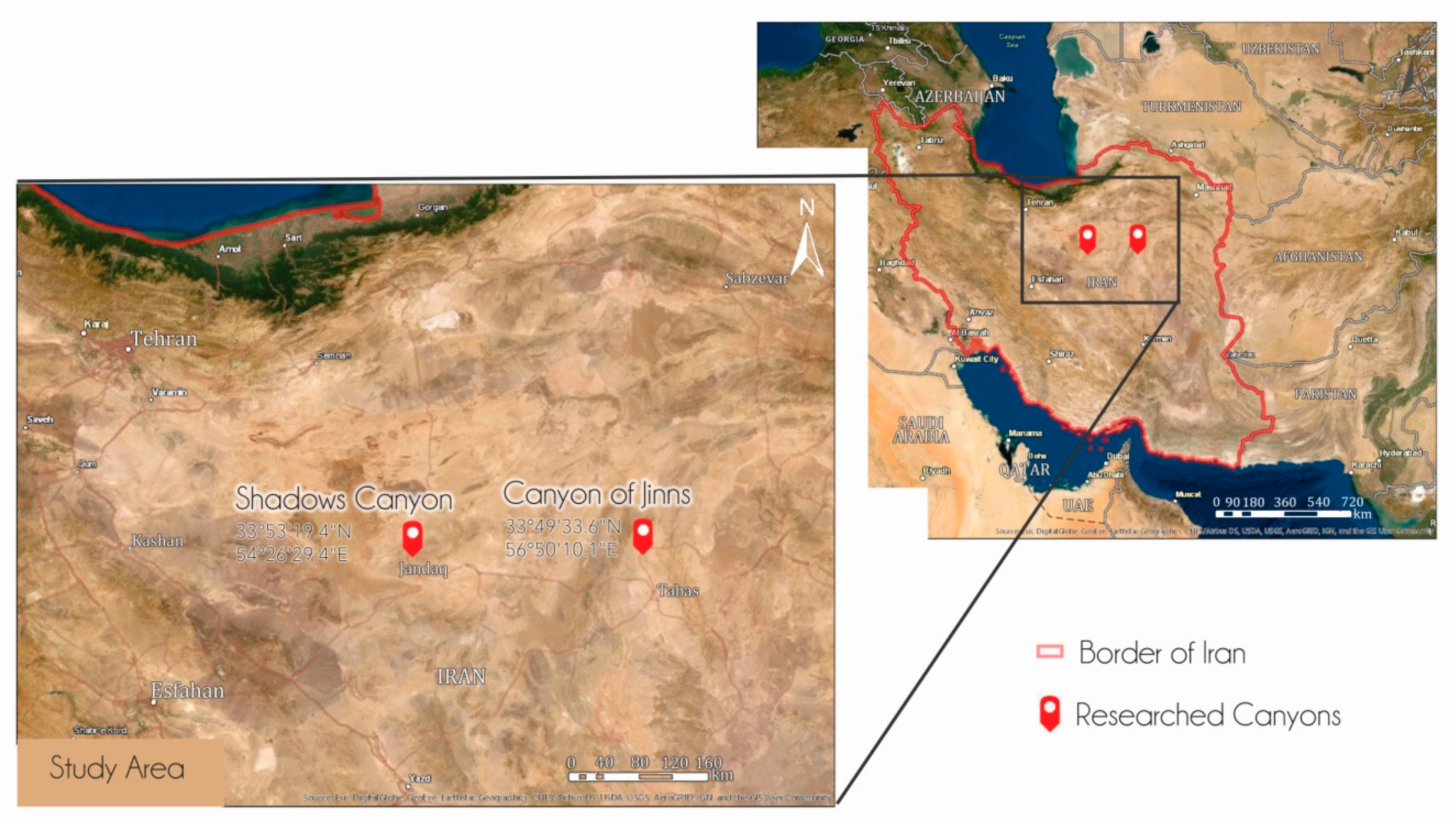
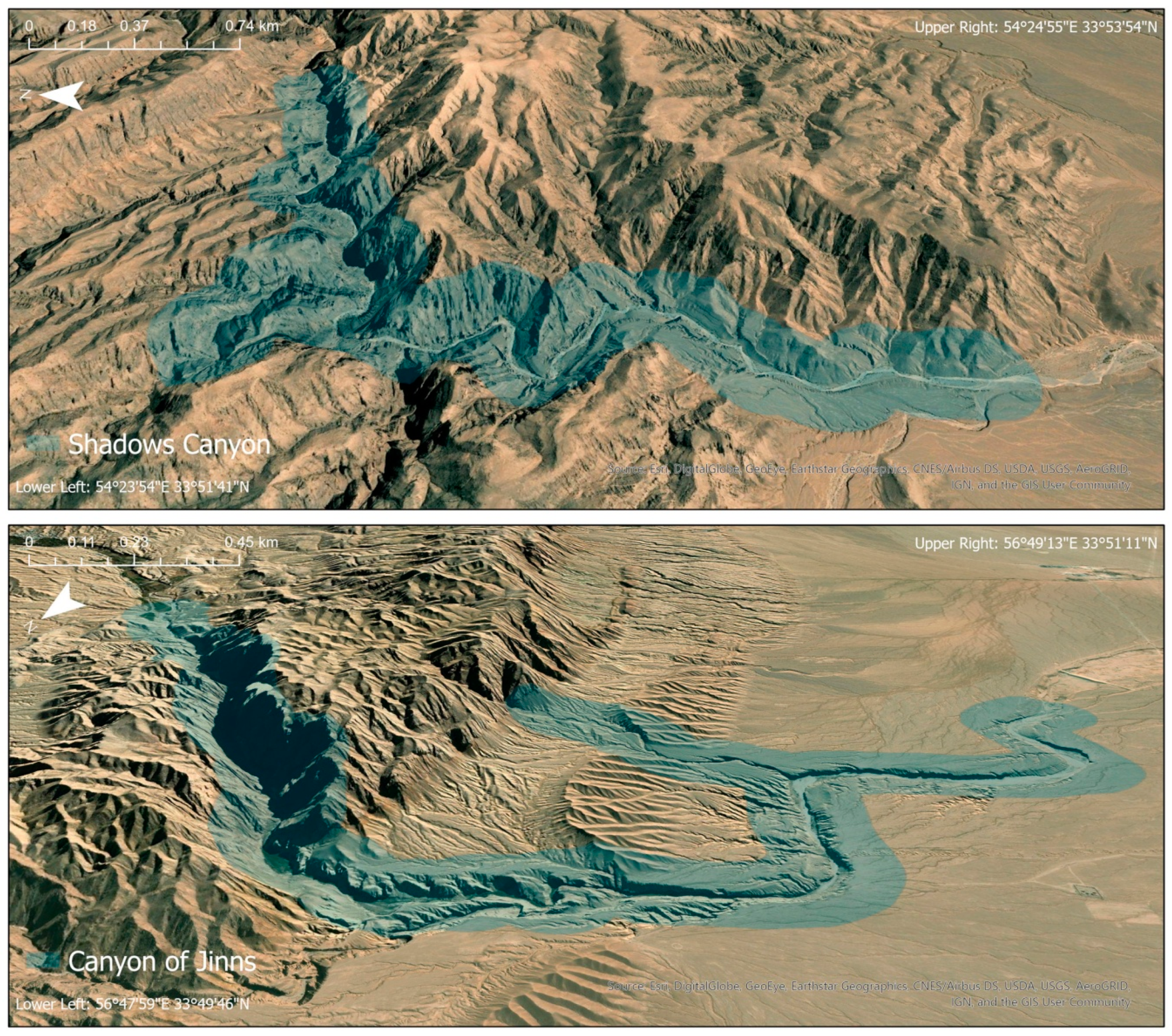
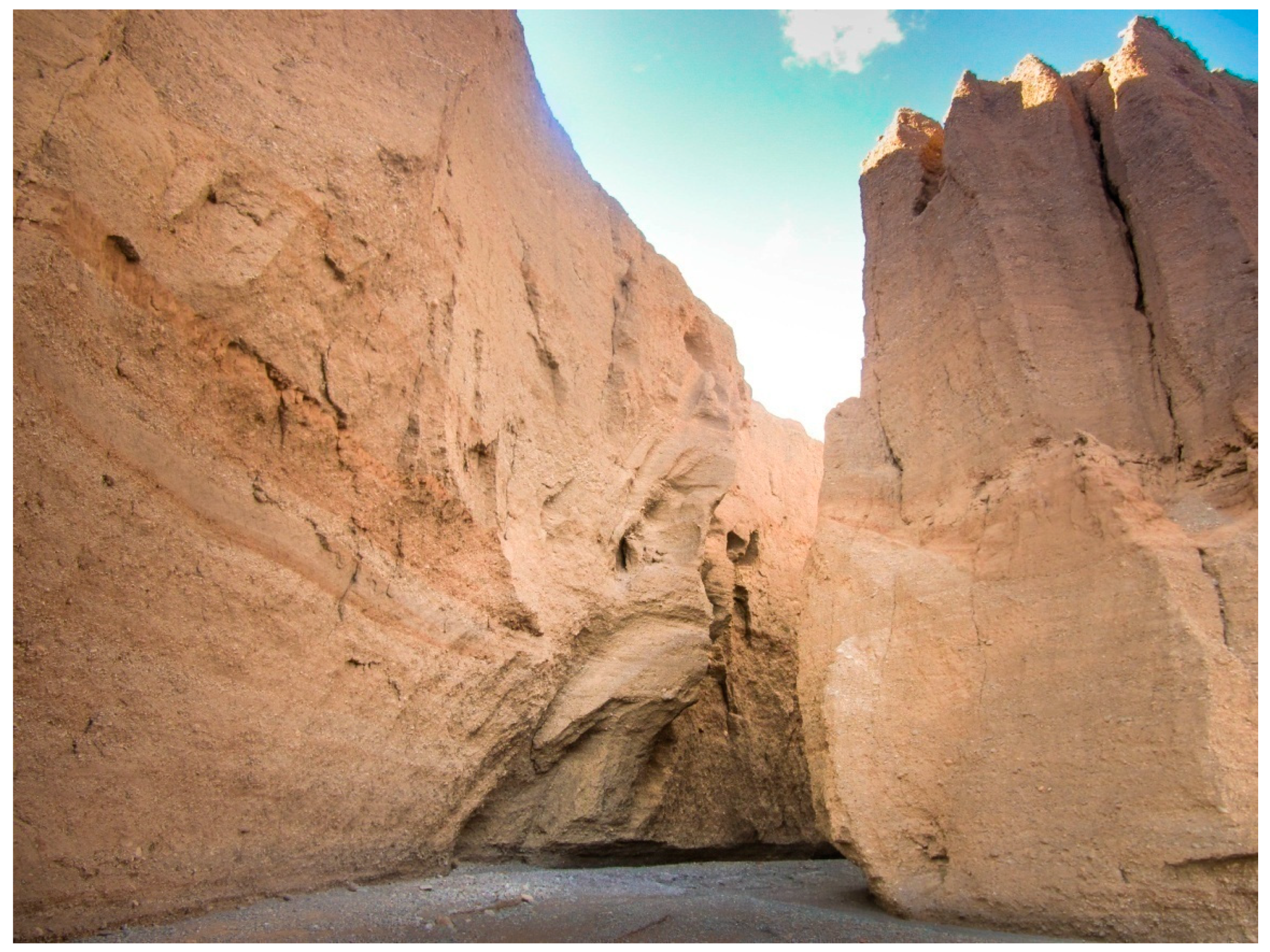
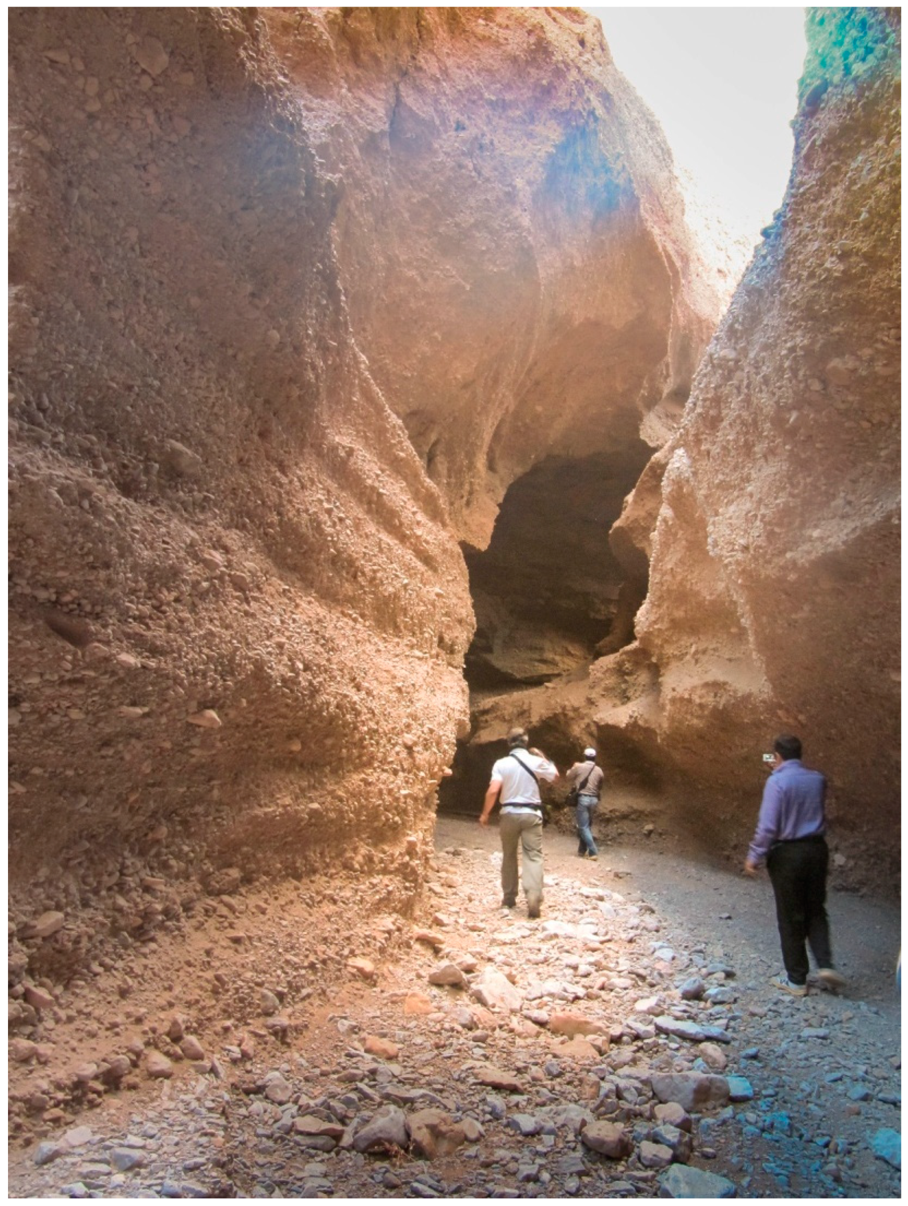
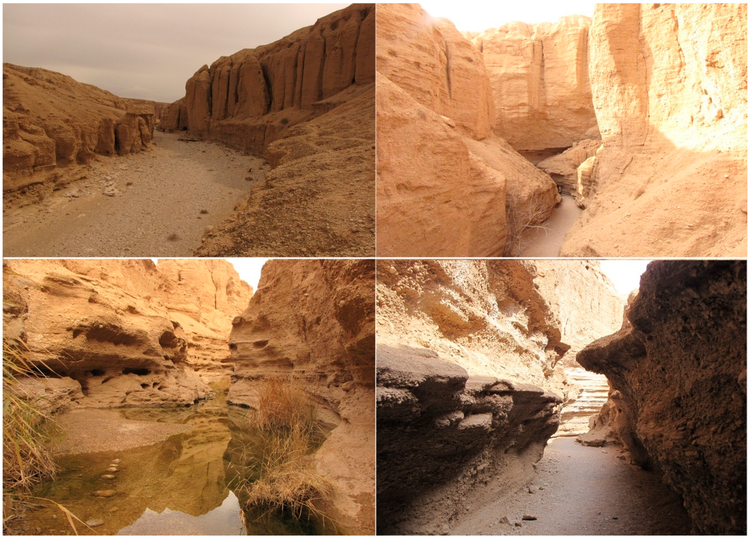
| Indicators/Subindicators | Description | ||||
|---|---|---|---|---|---|
| Main Values (MV) | |||||
| Scientific/Educational Value (VSE) | |||||
| 1. Rarity | Number of closest identical sites | ||||
| 2. Representativeness | Didactic and exemplary characteristics of the site due to its own quality and general configuration | ||||
| 3. Knowledge of geoscientific issues | Number of written papers in acknowledged journals, theses, presentations, and other publications | ||||
| 4. Level of interpretation | Level of interpretive possibilities for geological and geomorphologic processes, phenomena, and shapes and level of scientific knowledge | ||||
| Scenic/Aesthetic (VSA) | |||||
| 5. Viewpoints | Number of viewpoints accessible by a pedestrian pathway. Each must present a particular angle of view and be situated less than 1 km from the site | ||||
| 6. Surface | Whole surface of the site. Each site is considered in quantitative relation to other sites | ||||
| 7. Surrounding landscape and nature | Panoramic view quality, presence of water and vegetation, absence of human-induced deterioration, vicinity of urban area, etc. | ||||
| 8. Environmental fitting of sites | Level of contrast to the nature, contrast of colors, appearance of shapes, etc. | ||||
| Protection (VPr) | |||||
| 9. Current condition | Current state of geosite | ||||
| 10. Protection level | Protection by local or regional groups, national government, international organizations, etc. | ||||
| 11. Vulnerability | Vulnerability level of geosite | ||||
| 12. Suitable number of visitors | Proposed number of visitors on the site at the same time, according to surface area, vulnerability, and current state of geosite | ||||
| Additional Values (AV) | |||||
| Functional values (VFn) | |||||
| 13. Accessibility | Possibilities of approaching to the site | ||||
| 14. Additional natural values | Number of additional natural values in the radius of 5 km (geosites also included) | ||||
| 15. Additional anthropogenic values | Number of additional anthropogenic values in the radius of 5 km | ||||
| 16. Vicinity of emissive centers | Closeness of emissive centers | ||||
| 17. Vicinity of important road network | Closeness of important road networks in the radius of 20 km | ||||
| 18. Additional functional values | Parking lots, gas stations, mechanics, etc. | ||||
| Touristic values (VTr) | |||||
| 19. Promotion | Level and number of promotional resources | ||||
| 20. Organized visits | Annual number of organized visits to the geosite | ||||
| 21. Vicinity of visitors centers | Closeness of visitor center to the geosite | ||||
| 22. Interpretative panels | Interpretative characteristics of text and graphics, material quality, size, fitting to surroundings, etc. | ||||
| 23. Number of visitors | Annual number of visitors | ||||
| 24. Tourism infrastructure | Level of additional infrastructure for tourist (pedestrian pathways, resting places, garbage cans, toilets, etc.) | ||||
| 25. Tour guide service | If it exists, expertise level, knowledge of foreign language(s), interpretative skills, etc. | ||||
| 26. Hostelry service | Hostelry service close to geosite | ||||
| 27. Restaurant service | Restaurant service close to geosite | ||||
| Scores (0.00–1.00) | |||||
| 0.00 | 0.25 | 0.50 | 0.75 | 1.00 | |
| 1. | Common | Regional | National | International | The only occurence |
| 2. | None | Low | Moderate | High | Utmost |
| 3. | None | Local publications | Regional publications | National publications | International publications |
| 4. | None | Moderate level of processes but hard to explain to non-experts | Good example of processes but hard to explain to non-experts | Moderate level of processes but easy to explain to common visitor | Good example of processes and easy to explain to common visitor |
| 5. | None | 1 | 2 to 3 | 4 to 6 | More than 6 |
| 6. | Small | - | Medium | - | Large |
| 7. | - | Low | Medium | High | Utmost |
| 8. | Unfitting | - | Neutral | - | Fitting |
| 9. | Totally damaged (as a result of human activities) | Highly damaged (as a result of natural processes) | Medium damaged (with essential geomorphologic features preserved) | Slightly damaged | No damage |
| 10. | None | Local | Regional | National | International |
| 11. | Irreversible (with possibility of total loss) | High (could be easily damaged) | Medium (could be damaged by natural processes or human activities) | Low (could be damaged only by human activities) | None |
| 12. | 0 | 0 to 10 | 10 to 20 | 20 to 50 | More than 50 |
| 13. | Inaccessible | Low (on foot with special equipment and expert guide tours) | Medium (by bicycle and other means of man-powered transport) | High (by car) | Utmost (by bus) |
| 14. | None | 1 | 2 to 3 | 4 to 6 | More than 6 |
| 15. | None | 1 | 2 to 3 | 4 to 6 | More than 6 |
| 16. | More than 100 km | 100 to 50 km | 50 to 25 km | 25 to 5 km | Less than 5 km |
| 17. | None | Local | Regional | National | International |
| 18. | None | Low | Medium | High | Utmost |
| 19. | None | Local | Regional | National | International |
| 20. | None | Less than 12 per year | 12 to 24 per year | 24 to 48 per year | More than 48 per year |
| 21. | More than 50 km | 50 to 20 km | 20 to 5 km | 5 to 1 km | Less than 1 km |
| 22. | None | Low quality | Medium quality | High quality | Utmost quality |
| 23. | None | Low (less than 5000) | Medium (5001 to 10,000) | High (10,001 to 100,000) | Utmost (more than 100,000) |
| 24. | None | Low | Medium | High | Utmost |
| 25. | None | Low | Medium | High | Utmost |
| 26. | More than 50 km | 25–50 km | 10–25 km | 5–10 km | Less than 5 km |
| 27. | More than 25 km | 10–25 km | 10–5 km | 1–5 km | Less than 1 km |
| Gender | |
| Male | 61.7% |
| Female | 38.3% |
| Average age | 34.3 |
| Education level | |
| Secondary school | 8.5% |
| Faculty (Bachelor degree) | 49% |
| Faculty (Master degree) | 31% |
| Faculty (Ph.D.) | 11.5% |
| Main Indicators/Subindicators | Values Given by Experts | Im | Total | ||
|---|---|---|---|---|---|
| I Scientific/Educational Values (VSE) | GS1 | GS2 | GS1 | GS2 | |
| 1. Rarity (SIMV1) | 0.5 | 0.5 | 0.93 | 0.46 | 0.46 |
| 2. Representativeness (SIMV2) | 0.75 | 0.75 | 0.75 | 0.56 | 0.56 |
| 3. Knowledge on geoscientific issues (SIMV3) | 0.0 | 0.75 | 0.81 | 0.0 | 0.60 |
| 4. Level of interpretation (SIMV4) | 1.0 | 1.0 | 0.84 | 0.84 | 0.84 |
| II Scenic/Aesthetic Values (VSA) | |||||
| 5. Viewpoints (each must present a particular angle of view and be situated less than 1 km from the site) (SIMV5) | 0.75 | 0.75 | 0.93 | 0.70 | 0.70 |
| 6. Surface (each considered in quantitative relation to other) (SIMV6) | 0.5 | 0.75 | 0.74 | 0.37 | 0.55 |
| 7. Surrounding landscape and nature (SIMV7) | 0.5 | 1.0 | 0.91 | 0.45 | 0.91 |
| 8. Environmental fitting of sites (SIMV8) | 1.0 | 1.0 | 0.79 | 0.79 | 0.79 |
| III Protection (VPr) | |||||
| 9. Current condition (SIMV9) | 1.0 | 0.75 | 0.90 | 0.90 | 0.67 |
| 10. Protection level (SIMV10) | 0.5 | 0.5 | 0.71 | 0.35 | 0.35 |
| 11. Vulnerability (SIMV11) | 0.75 | 0.5 | 0.74 | 0.55 | 0.37 |
| 12. Suitable number of visitors (SIMV12) | 0.75 | 1.0 | 0.70 | 0.52 | 0.70 |
| I Functional Values (VFn) | |||||
| 13. Accessibility (SIAV1) | 0.75 | 0.75 | 0.67 | 0.50 | 0.50 |
| 14. Additional natural values (SIAV2) | 0.75 | 0.50 | 0.54 | 0.40 | 0.27 |
| 15. Additional anthropogenic values (SIAV3) | 0.25 | 0.50 | 0.61 | 0.15 | 0.30 |
| 16. Vicinity of emissive centers (SIAV4) | 0.0 | 0.50 | 0.61 | 0.0 | 0.30 |
| 17. Vicinity of important road network (SIAV5) | 0.75 | 0.75 | 0.82 | 0.61 | 0.61 |
| 18. Additional functional values (SIAV6) | 0.50 | 0.50 | 0.73 | 0.36 | 0.36 |
| II Touristic Values (VTr) | |||||
| 19. Promotion (SIAV7) | 0.0 | 0.5 | 0.63 | 0.0 | 0.31 |
| 20. Annual number of organized visits (SIAV8) | 0.25 | 0.5 | 0.62 | 0.15 | 0.31 |
| 21. Vicinity of visitors center (SIAV9) | 0.25 | 0.25 | 0.57 | 0.14 | 0.14 |
| 22. Interpretative panels (characteristics of text and graphics, material quality, size, fitting to surroundings, etc.) (SIAV10) | 0.25 | 0.5 | 0.54 | 0.13 | 0.27 |
| 23. Annual number of visitors (SIAV11) | 0.25 | 0.75 | 0.65 | 0.17 | 0.49 |
| 24. Tourism infrastructure (pedestrian pathways, resting places, garbage cans, toilets, wellsprings, etc.) (SIAV12) | 0.25 | 0.25 | 0.85 | 0.21 | 0.21 |
| 25. Tour guide service (expertise level, knowledge of foreign language(s), interpretative skills, etc.) (SIAV13) | 0.25 | 0.25 | 0.46 | 0.11 | 0.11 |
| 26. Hostelry service (SIAV14) | 0.75 | 0.25 | 0.48 | 0.36 | 0.12 |
| 27. Restaurant service (SIAV15) | 0.5 | 0.25 | 0.47 | 0.23 | 0.11 |
| Geosite Label | Main Values | Additional Values | Field | ||
|---|---|---|---|---|---|
| VSE + VSA + VPr | ∑ | VFn + VTr | ∑ | ||
| Shadows Canyon—GS1 | 1.86 + 2.31 + 2.32 | 6.49 | 2.02 + 1.50 | 3.52 | Z21 |
| Canyon of Jinns—GS2 | 2.46 + 2.95 + 2.09 | 7.50 | 2.34 + 2.07 | 4.41 | Z21 |
| Main Indicators/Subindicators | Im (Iran) | Im (Serbia) | Im (Slovenia) |
|---|---|---|---|
| I Scientific/Educational Values (VSE) | |||
| 1. Rarity (SIMV1) | 0.93 * | 0.89 * | 0.78 |
| 2. Representativeness (SIMV2) | 0.75 | 0.79 | 0.77 |
| 3. Knowledge on geoscientific issues (SIMV3) | 0.81 | 0.45 | 0.77 |
| 4. Level of interpretation (SIMV4) | 0.84 * | 0.85 * | 0.94 * |
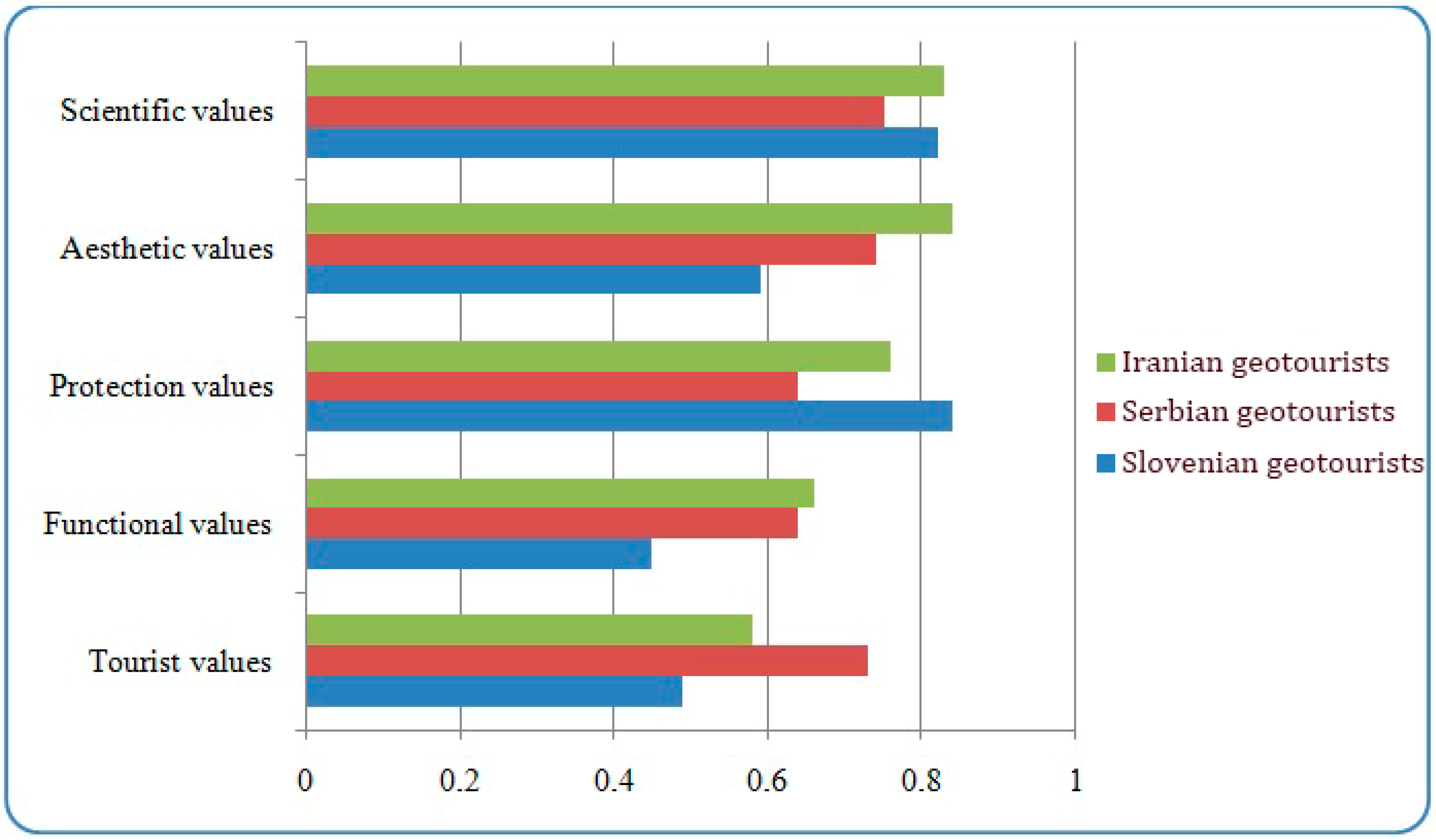
| Average Im Value | 0.83 | 0.75 | 0.82 |
| II Scenic/Aesthetic Values (VSA) | |||
| 5. Viewpoints (each must present a particular angle of view and be situated less than 1 km from the site) (SIMV5) | 0.93 * | 0.79 | 0.78 |
| 6. Surface (each considered in quantitative relation to other) (SIMV6) | 0.74 | 0.54 | 0.40 |
| 7. Surrounding landscape and nature (SIMV7) | 0.91 * | 0.95 * | 0.65 |
| 8. Environmental fitting of sites (SIMV8) | 0.79 | 0.68 | 0.55 |
| Average Im Value | 0.84 | 0.74 | 0.59 |
| III Protection (VPr) | |||
| 9. Current condition (SIMV9) | 0.90 * | 0.83 | 0.87 * |
| 10. Protection level (SIMV10) | 0.71 | 0.76 | 0.81 |
| 11. Vulnerability (SIMV11) | 0.74 | 0.58 | 0.82 |
| 12. Suitable number of visitors (SIMV12) | 0.70 | 0.42 | 0.89 * |
| Average Im Value | 0.76 | 0.64 | 0.84 |
| I Functional Values (VFn) | |||
| 13. Accessibility (SIAV1) | 0.67 | 0.75 | 0.64 |
| 14. Additional natural values (SIAV2) | 0.54 | 0.71 | 0.47 |
| 15. Additional anthropogenic values (SIAV3) | 0.61 | 0.70 | 0.43 |
| 16. Vicinity of emissive centers (SIAV4) | 0.61 | 0.48 | 0.28 |
| 17. Vicinity of important road network (SIAV5) | 0.82 | 0.62 | 0.53 |
| 18. Additional functional values (SIAV6) | 0.73 | 0.59 | 0.35 |
| Average Im Value | 0.66 | 0.64 | 0.45 |
| II Touristic Values (VTr) | |||
| 19. Promotion (SIAV7) | 0.63 | 0.85 * | 0.52 |
| 20. Annual number of organized visits (SIAV8) | 0.62 | 0.56 | 0.59 |
| 21. Vicinity of visitors center (SIAV9) | 0.57 | 0.87 * | 0.53 |
| 22. Interpretative panels (characteristics of text and graphics, material quality, size, fitting to surroundings, etc.) (SIAV10) | 0.54 | 0.81 | 0.69 |
| 23. Annual number of visitors (SIAV11) | 0.65 | 0.43 | 0.31 |
| 24. Tourism infrastructure (pedestrian pathways, resting places, garbage cans, toilets, wellsprings, etc.) (SIAV12) | 0.85 * | 0.73 | 0.50 |
| 25. Tour guide service (expertise level, knowledge of foreign language(s), interpretative skills, etc.) (SIAV13) | 0.46 | 0.87 * | 0.70 |
| 26. Hostelry service (SIAV14) | 0.48 | 0.73 | 0.20 |
| 27. Restaurant service (SIAV15) | 0.47 | 0.78 | 0.41 |
| Average Im Value | 0.58 | 0.73 | 0.49 |
Publisher’s Note: MDPI stays neutral with regard to jurisdictional claims in published maps and institutional affiliations. |
© 2021 by the authors. Licensee MDPI, Basel, Switzerland. This article is an open access article distributed under the terms and conditions of the Creative Commons Attribution (CC BY) license (http://creativecommons.org/licenses/by/4.0/).
Share and Cite
Tomić, N.; Sepehriannasab, B.; Marković, S.B.; Hao, Q.; Lobo, H.A.S. Exploring the Preferences of Iranian Geotourists: Case Study of Shadows Canyon and Canyon of Jinns. Sustainability 2021, 13, 798. https://doi.org/10.3390/su13020798
Tomić N, Sepehriannasab B, Marković SB, Hao Q, Lobo HAS. Exploring the Preferences of Iranian Geotourists: Case Study of Shadows Canyon and Canyon of Jinns. Sustainability. 2021; 13(2):798. https://doi.org/10.3390/su13020798
Chicago/Turabian StyleTomić, Nemanja, Babak Sepehriannasab, Slobodan B. Marković, Qingzhen Hao, and Heros Augusto Santos Lobo. 2021. "Exploring the Preferences of Iranian Geotourists: Case Study of Shadows Canyon and Canyon of Jinns" Sustainability 13, no. 2: 798. https://doi.org/10.3390/su13020798
APA StyleTomić, N., Sepehriannasab, B., Marković, S. B., Hao, Q., & Lobo, H. A. S. (2021). Exploring the Preferences of Iranian Geotourists: Case Study of Shadows Canyon and Canyon of Jinns. Sustainability, 13(2), 798. https://doi.org/10.3390/su13020798


