Article

Synergy of Active and Passive Remote Sensing Data for Effective Mapping of Oil Palm Plantation in Malaysia

by
Nazarin Ezzaty Mohd Najib
1,
Kasturi Devi Kanniah
1,*,
Arthur P. Cracknell
2 and
Le Yu
3
1
Faculty of Built Environment and Surveying, Universiti Teknologi Malaysia, UTM Skudai 81310, Malaysia
2
Division of Electronic Engineering and Physics, University of Dundee, Nethergate, Dundee DDI 4HN, UK
3
Department of Earth System Science, Tsinghua University, Beijing 100084, China
*
Author to whom correspondence should be addressed.
Forests 2020, 11(8), 858; https://doi.org/10.3390/f11080858
Submission received: 19 June 2020 / Revised: 7 July 2020 / Accepted: 24 July 2020 / Published: 6 August 2020

Abstract

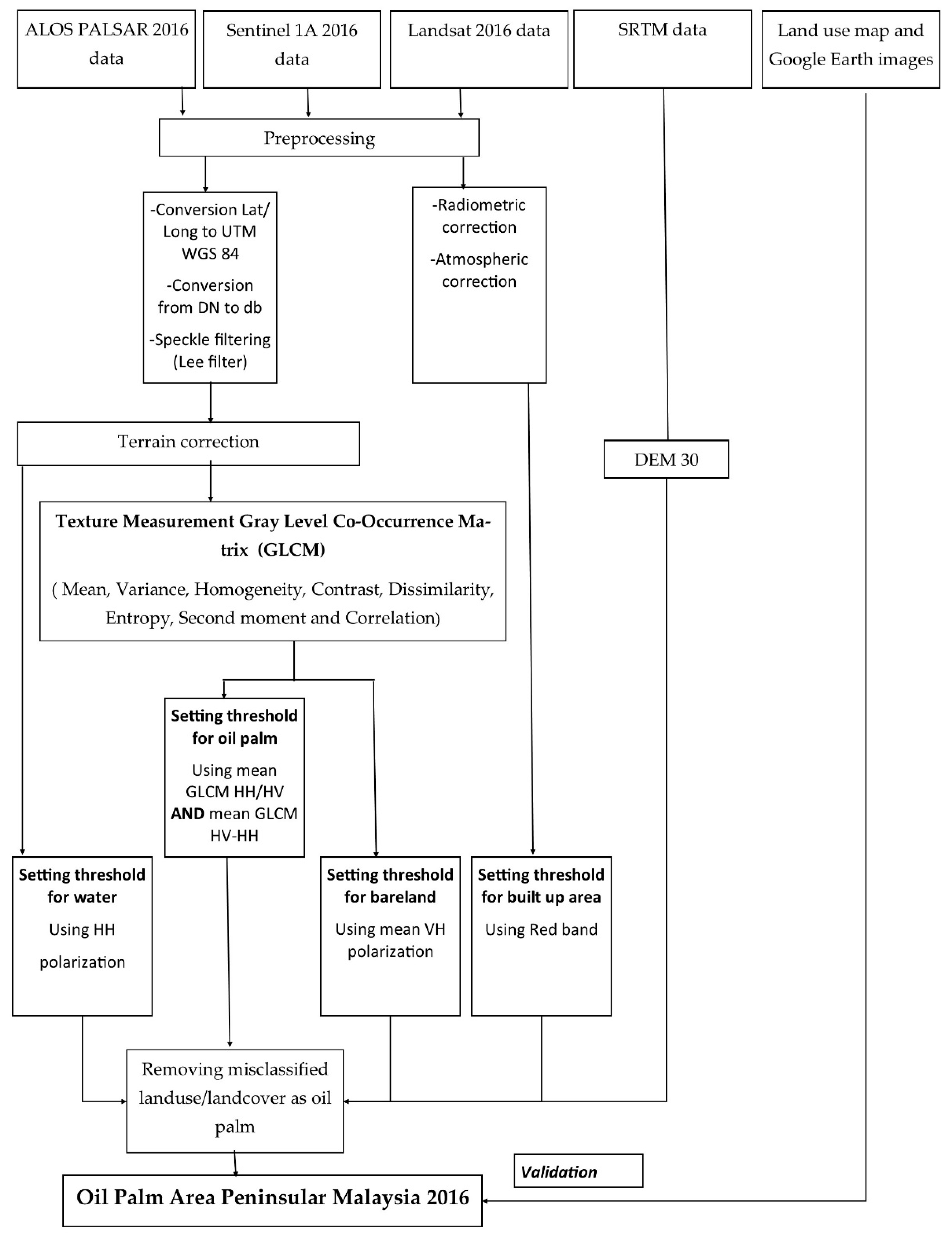
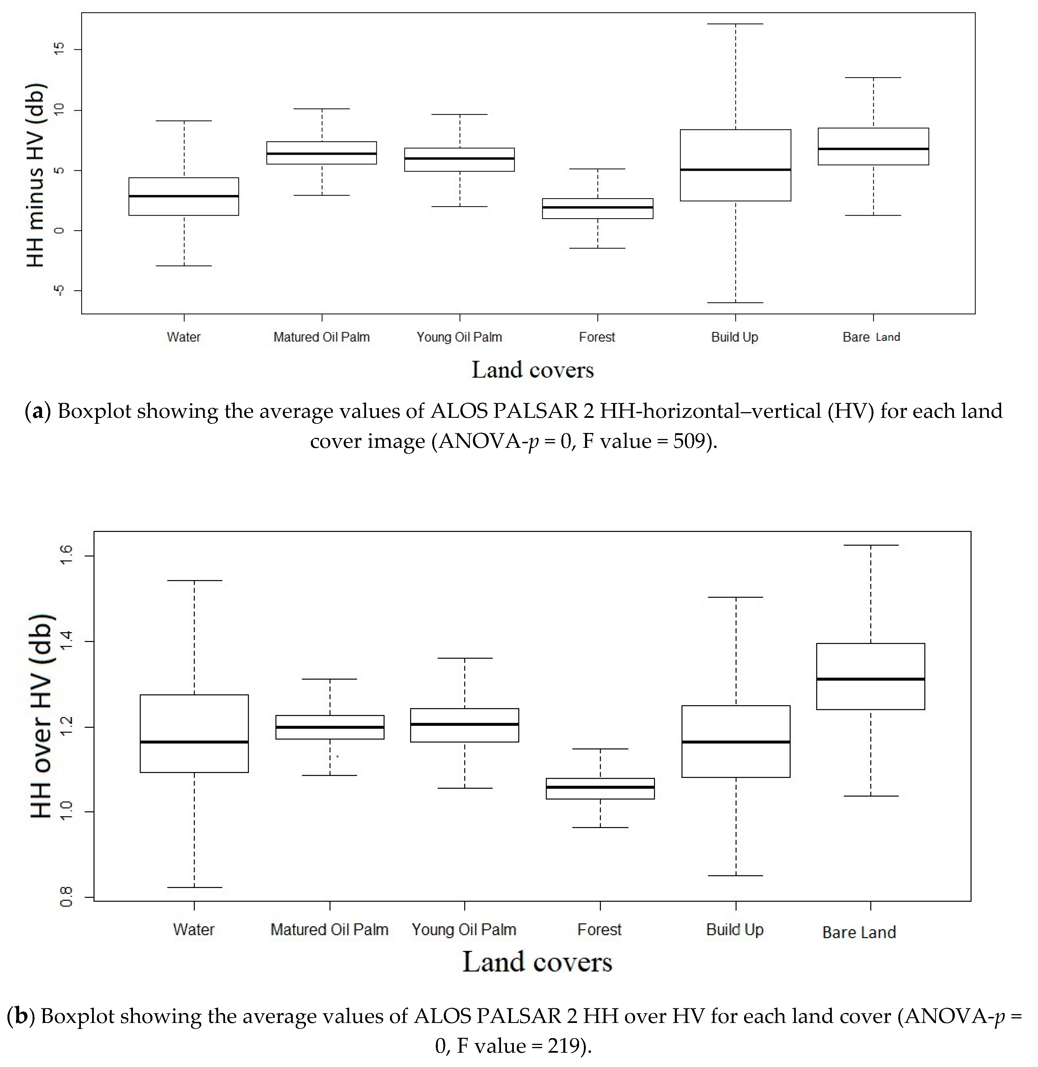
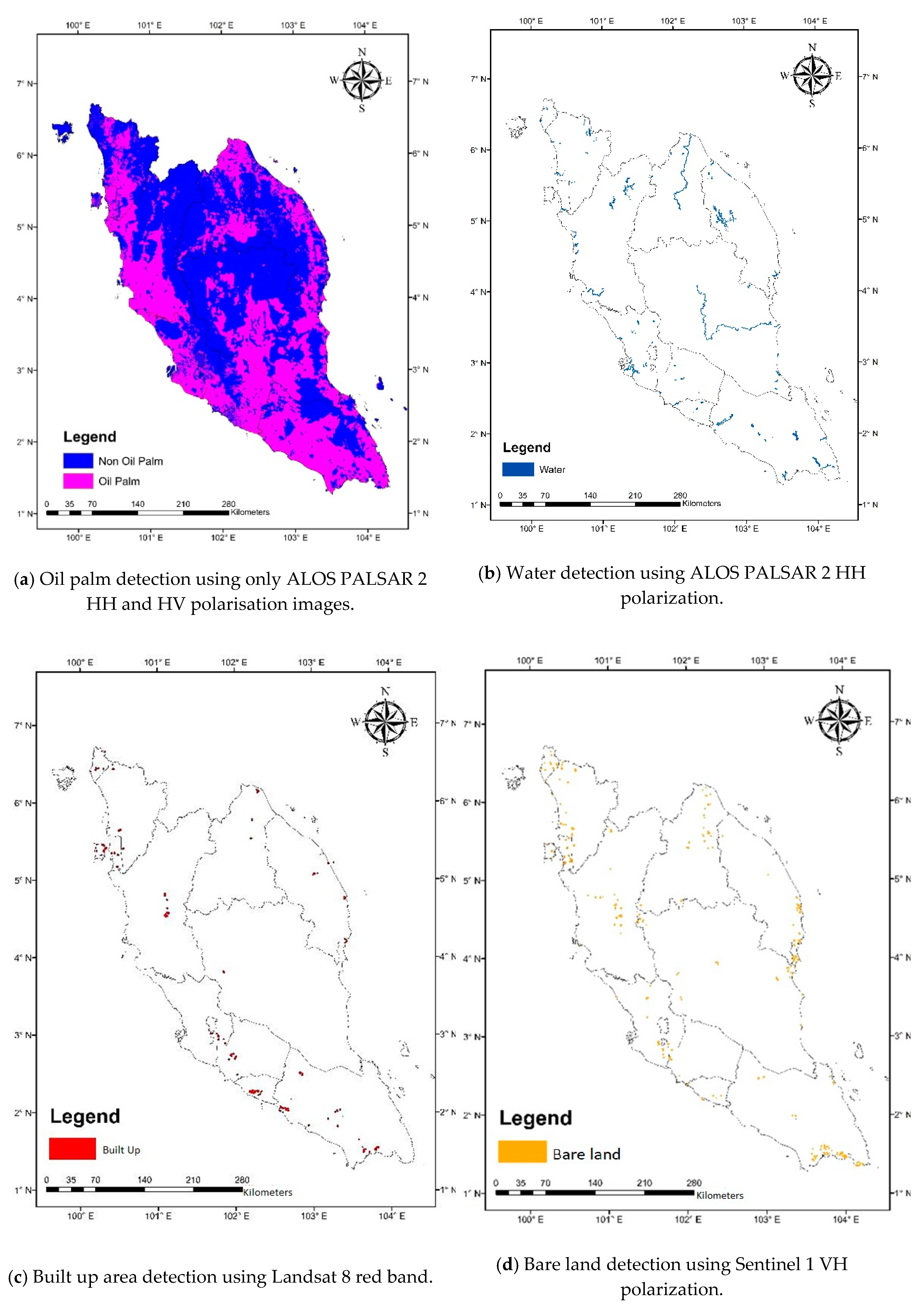
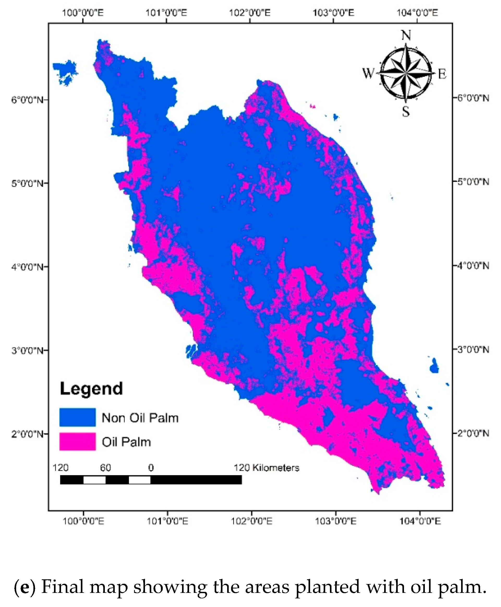
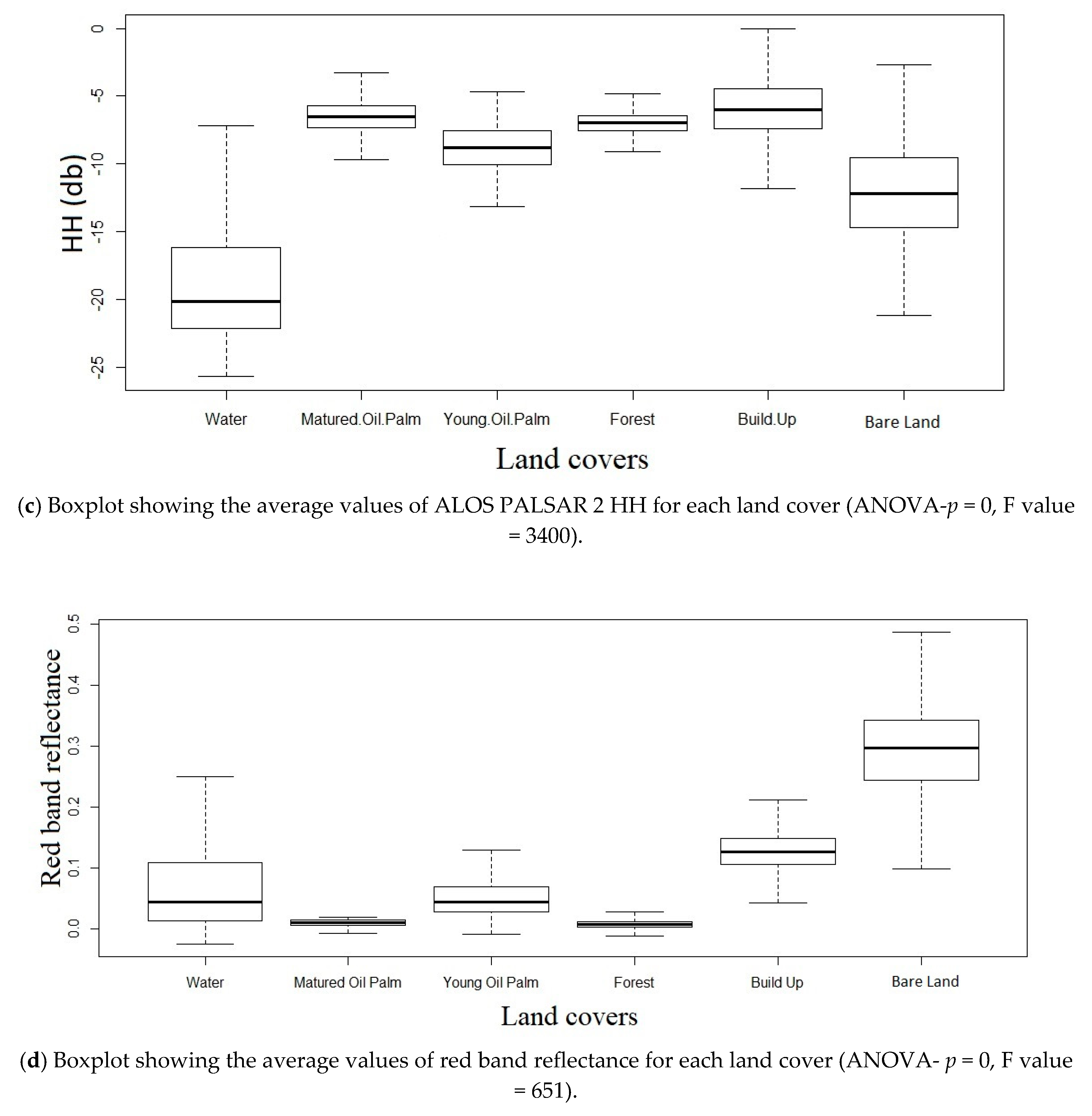
Oil palm is recognized as a golden crop, as it produces the highest oil yield among oil seed crops. Malaysia is the world’s second largest producer of palm oil; 16% of its land is planted with oil palm. To cope with the ever-increasing global demand on edible oil, additional areas of oil palm are forecast to increase globally by 12 to 19 Mha by 2050. Multisensor remote sensing plays an important role in providing relevant, timely, and accurate information that can be developed into a plantation monitoring system to optimize production and sustainability. The aim of this study was to simultaneously exploit the synthetic aperture radar ALOS PALSAR 2, a form of microwave remote sensing, in combination with visible (red) data from Landsat Thematic Mapper to obtain a holistic view of a plantation. A manipulation of the horizontal–horizontal (HH) and horizontal–vertical (HV) polarizations of ALOS PALSAR data detected oil palm trees and water bodies, while the red spectra L-band from Landsat data (optical) could effectively identify built up areas and vertical–horizontal (VH) polarization from Sentinel C-band data detected bare land. These techniques produced an oil palm area classification with overall accuracies of 98.36% and 0.78 kappa coefficient for Peninsular Malaysia. The total oil palm area in Peninsular Malaysia was estimated to be about 3.48% higher than the value reported by the Malaysian Palm Oil Board. The over estimation may be due the MPOB’s statistics that do not include unregistered small holder oil palm plantations. In this study, we were able to discriminate most of the rubber areas.
Keywords: mapping; oil palm; ALOS PALSAR 2; Sentinel; Landsat; Malaysia mapping; oil palm; ALOS PALSAR 2; Sentinel; Landsat; Malaysia