Article

Detecting Harvest Events in Plantation Forest Using Sentinel-1 and -2 Data via Google Earth Engine


1
Department of Geography, University of the Free State, Phuthaditjhaba 9869, South Africa
2
School of Agricultural, Earth and Environmental Sciences, University of KwaZulu-Natal, Westville Campus, Durban 4000, South Africa
3
Department of Geography and Environmental Studies, University of Zululand, KwaDlangezwa 3886, South Africa
*
Author to whom correspondence should be addressed.
Forests 2020, 11(12), 1283; https://doi.org/10.3390/f11121283
Submission received: 17 August 2020 / Revised: 25 November 2020 / Accepted: 26 November 2020 / Published: 29 November 2020

Abstract

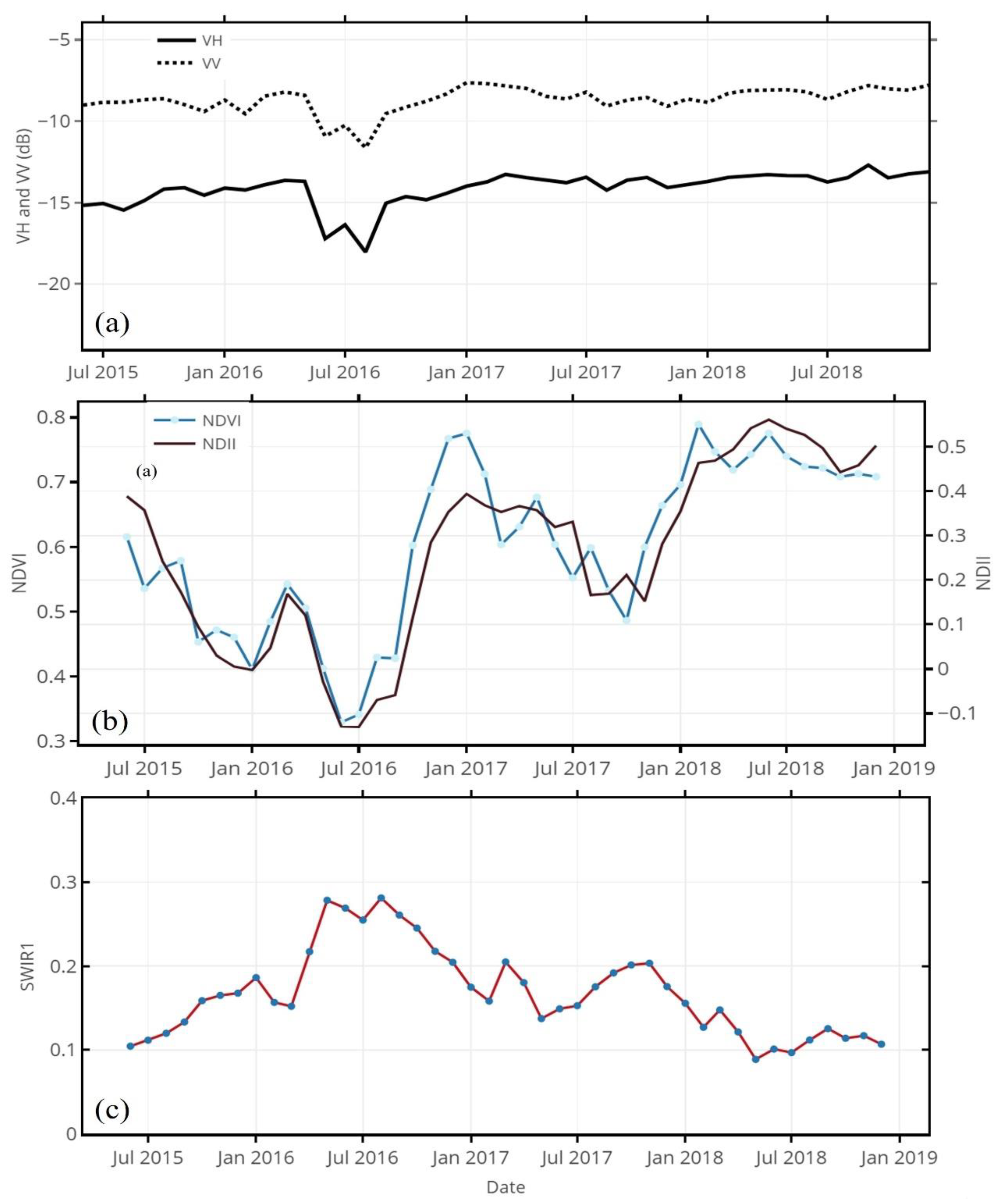
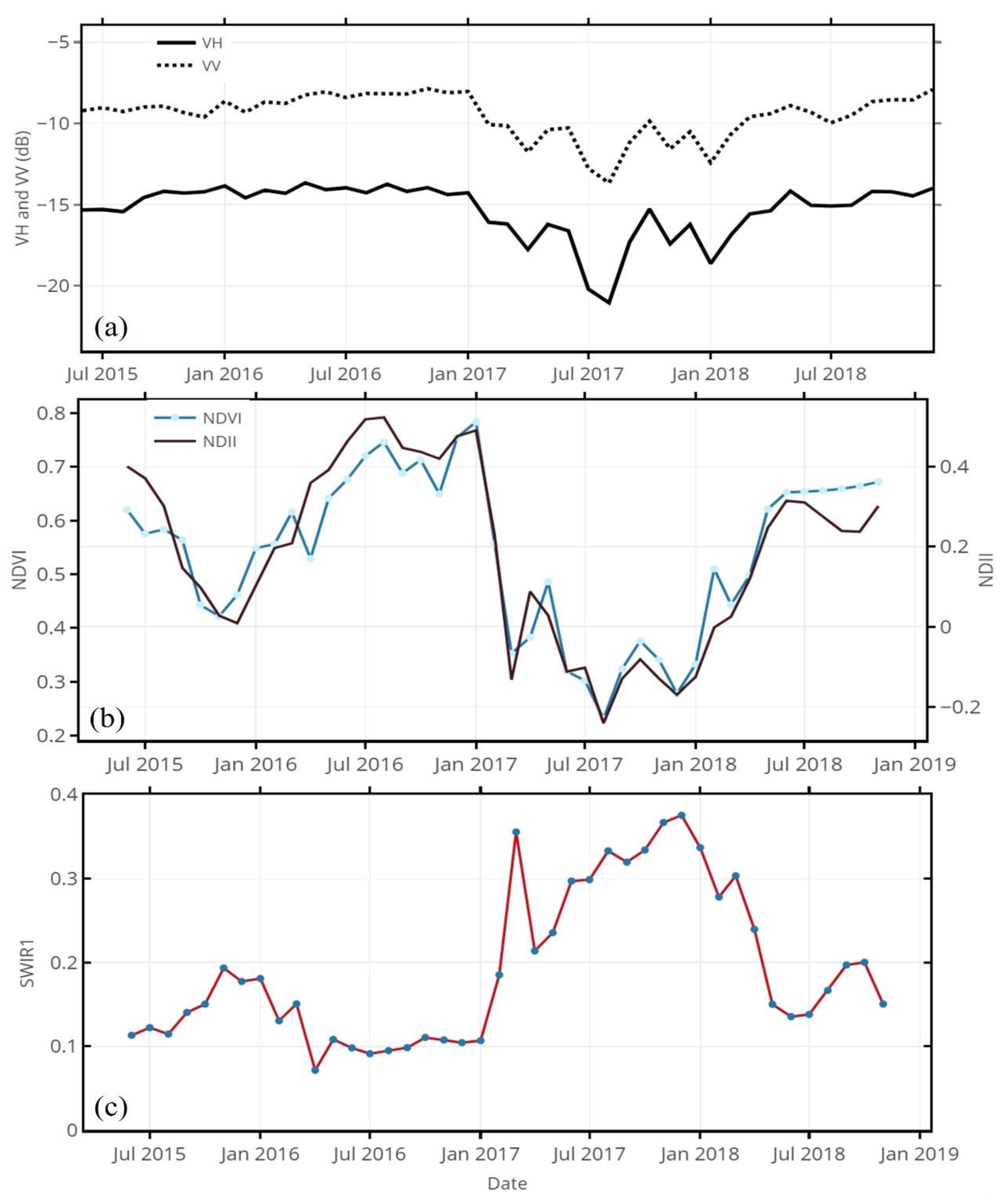
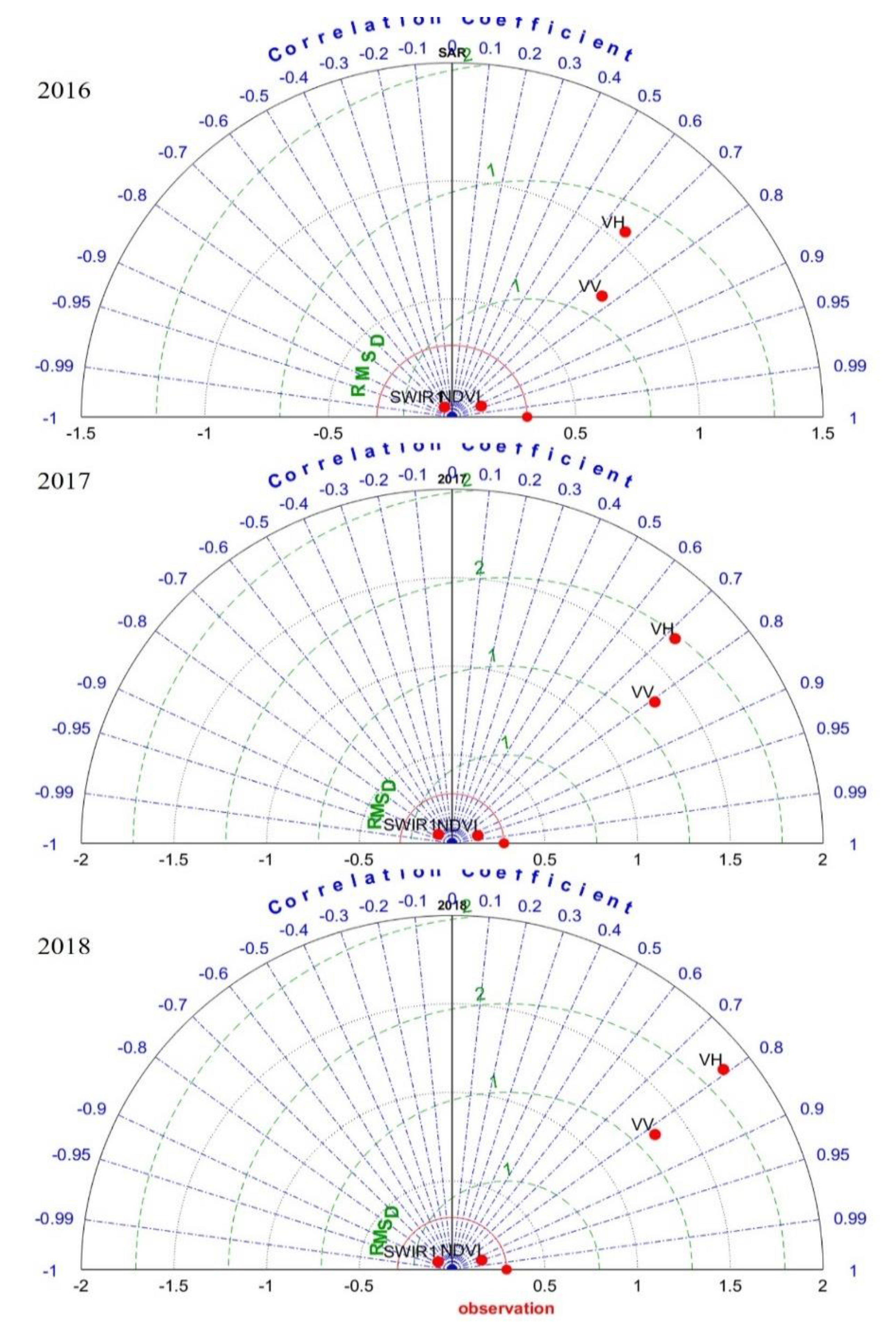
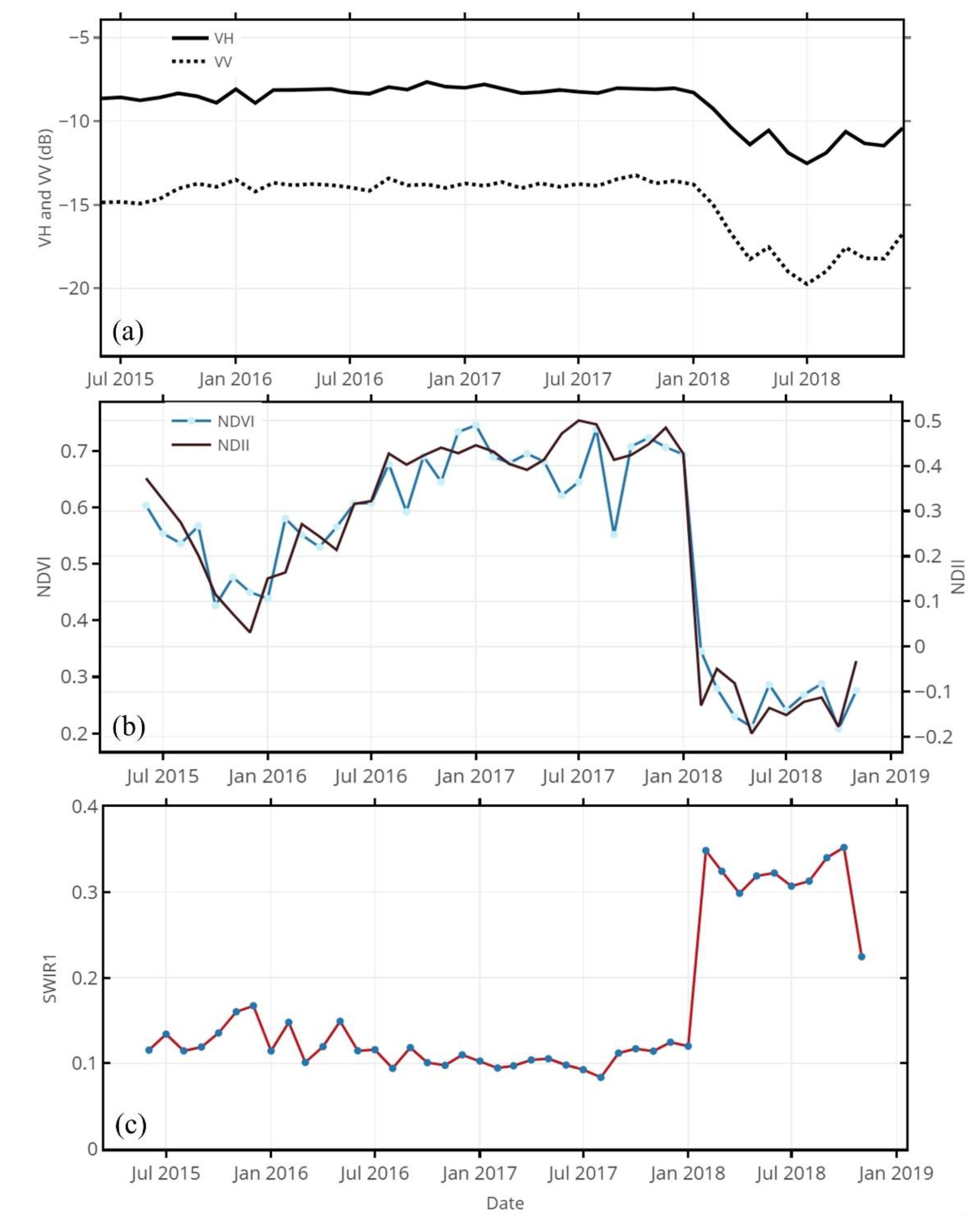
South Africa is reported to experience timber shortages as a result of growing timber demands and pulp production, coupled with the government’s reluctance to grant new forestry permits. Rampant timber theft in the country makes these circumstances worse. The emergence of cloud-based platforms, such as Google Earth Engine (GEE), has greatly improved the accessibility and usability of high spatial and temporal Sentinel-1 and -2 data, especially in data-poor countries that lack high-performance computing systems for forest monitoring. Here, we demonstrate the potential of these resources for forest harvest detection. The results showed that Sentinel-1 data are efficient in detecting clear-cut events; both VH and VV backscatter signals decline sharply in accordance with clear-cutting and increase again when forest biomass increases. When correlated with highly responsive NDII, the VH and VV signals reached the best accuracies of 0.79 and 0.83, whereas the SWIR1 achieved –0.91. A Random Forest (RF) algorithm based on Sentinel-2 data also achieved over 90% accuracies for classifying harvested and forested areas. Overall, our study presents a cost-effective method for mapping clear-cut events in an economically important forestry area of South Africa while using GEE resources.
Keywords: forest; Sentinel-1; Sentinel-2; harvest; RF classification; remote sensing; Google Earth Engine forest; Sentinel-1; Sentinel-2; harvest; RF classification; remote sensing; Google Earth Engine