
Identification of Soil Erosion-Based Degraded Land Areas by Employing a Geographic Information System—A Case Study of Pakistan for 1990–2020

 ,
, 
 , and
, and 
Abstract
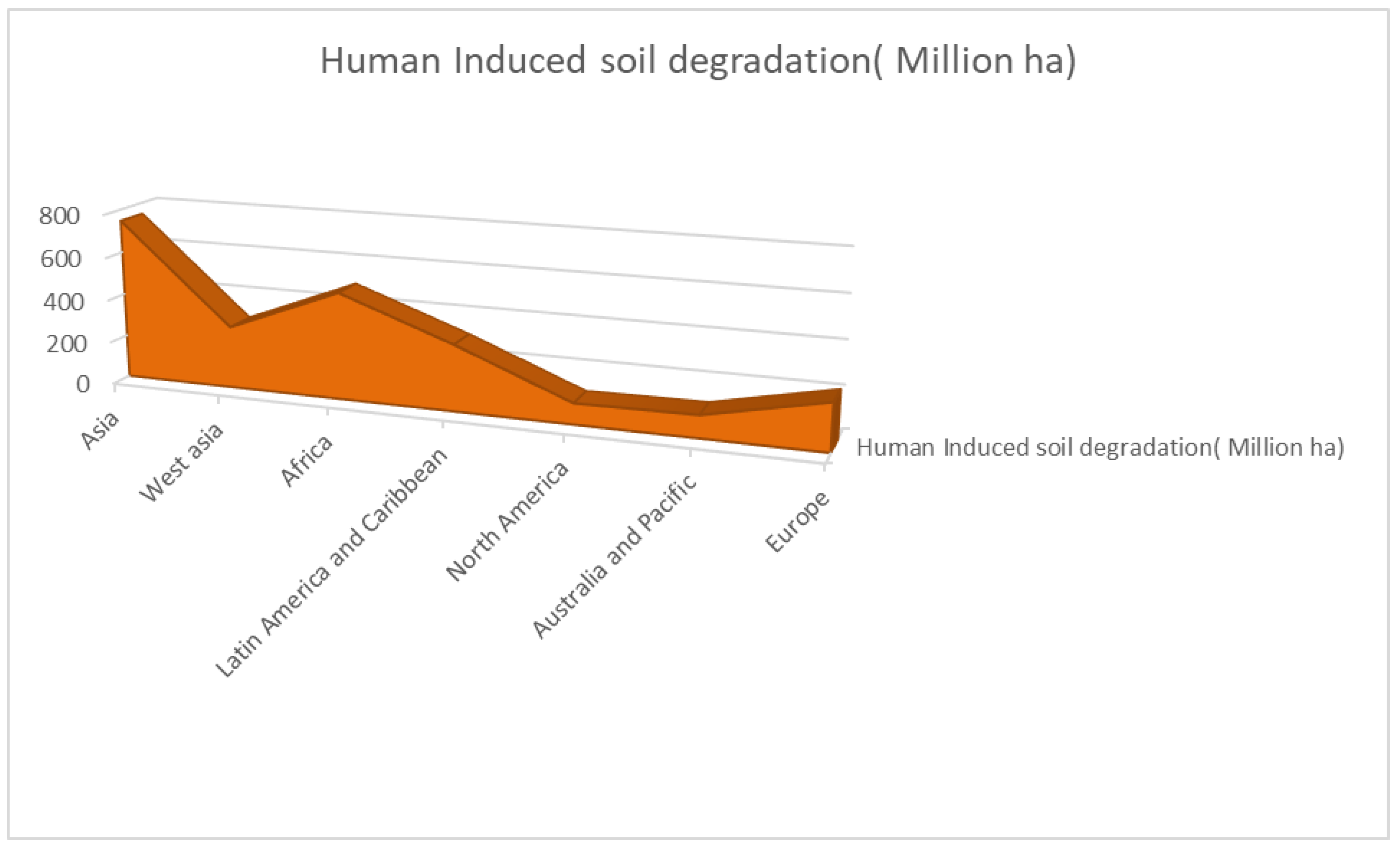
1. Introduction
2. Materials and Methods
2.1. Study Area Description
- Zone A lies between 34° N and 38° N and lies in the north of Pakistan.
- Zone B lies between 31° N and 34° N and consists of sub-mountains with a mild-cold climate.
- Zone C lies between 27° N and 32° N and between 64° E and 70° E.
- Zone D consists of almost plain region and is the driest and hottest of all the zones.
- Zone E is the biggest zone among all zones and extends into Sindh and Balochistan (Figure 3).
2.2. Data Acquisition
2.3. Data Processing
2.3.1. Preparation of Spatial Datasets
2.3.2. Analytical Hierarchal Process (AHP)
- i.
- The preparation of thematic layers.
- ii.
- Weight determination by using a pairwise comparison matrix based on experts’ opinions.
- iii.
- A standardization of criteria
- iv.
- Overlay of all thematic layers to generate the final map.
Preparation of Thematic Layers
Weight Determination
Standardization of Criteria
Weight Overlay of Thematic Layers
3. Results
4. Discussion
5. Conclusions
Author Contributions
Funding
Conflicts of Interest
References
- Xie, H.; Zhang, Y.; Wu, Z.; Lv, T. A Bibliometric Analysis on Land Degradation: Current Status, Development, and Future Directions. Land 2020, 9, 28. [Google Scholar] [CrossRef]
- Sun, T.; Feng, Z.; Yang, Y.; Lin, Y.; Wu, Y. Research on land resource carrying capacity: Progress and prospects. J. Resour. Ecol. 2018, 9, 331–340. [Google Scholar] [CrossRef]
- Bai, Z.-G.; Dent, D.L.; Olsson, L.; Schaepman, M.E. Proxy global assessment of land degradation. Soil Use Manag. 2008, 24, 223–234. [Google Scholar] [CrossRef]
- UN Climate Change Conference Doha 2012 Cop26-CMP8. Doha 26 November–6 December 2012. Available online: https://climate.ec.europa.eu/news-your-voice/events/doha-climate-change-conference-cop-18cmp-8-2012-11-26_en (accessed on 9 December 2012).
- Teklu, T. Environment stress and increased vulnerability to impoverishment in rural Ethiopia: Case studies evidence. Int. J. Afr. Dev. 2014, 1, 5. [Google Scholar]
- UNCCD. United Nations Convention to Combat Desertification. 1994. Available online: https://www.unccd.int/convention/about-convention (accessed on 8 October 2020).
- Halbac-Cotoara-Zamfir, R.; Smiraglia, D.; Quaranta, G.; Salvia, R.; Salvati, L.; Giménez-Morera, A. Land Degradation and Mitigation Policies in the Mediterranean Region: A Brief Commentary. Sustainability 2020, 12, 8313. [Google Scholar] [CrossRef]
- Jiang, L.; Jiapaer, G.; Bao, A.; Kurban, A.; Guo, H.; Zheng, G.; Maeyer, P. Monitoring the long-term desertification process and assessing the relative roles of its drivers in Central Asia. Ecol. Indic. 2019, 104, 195–208. [Google Scholar] [CrossRef]
- Nachtergaele, F.; Petri, M.; Biancalani, R.; Van Lynden, G.; Van Velthuizen, H. Global Land Degradation Information System (GLADIS), Beta Version, An Information Database for Land Degradation Assessment at Global Level, Land Degradation Assessment in Dry Lands Technical (Report, No. 17); FAO: Rome, Italy, 2010. [Google Scholar]
- Low, P.S. Economic and Social Impacts of Desertification, Land Degradation and Drought, White Paper I. UNCCD 2nd Scientific Conference, Prepared with the Contributions of an International Group of Scientists. Available online: https://profiles.uonbi.ac.ke/jmariara/files/unccd_white_paper_1.pdf (accessed on 16 September 2016).
- Gibbs, H.K.; Salmon, J.M. Mapping the world’s degraded lands. Appl. Geogr. 2015, 57, 12–21. [Google Scholar] [CrossRef]
- Zia, H.S.; Arshad, M. Land Degradation in Pakistan: A Serious Threat to Environments and Economic Sustainability. 2006. Available online: https://www.researchgate.net/publication/263617360 (accessed on 8 October 2020).
- Food and Agricultural Organization. SOLAW Report 3. Water-Scarcity@fao.org. 2021. Available online: https://www.fao.org/3/cb7654en/online/cb7654en.html (accessed on 9 December 2012).
- Bridges, E.M.; Oldeman, L.R. Global Assessment of Human-Induced Soil Degradation (GLASOD). Arid Soil Res. Rehabil. 2010, 13, 319–325. [Google Scholar] [CrossRef]
- Maqsoom, A.; Aslam, B.; Hassan, U.; Kazmi, Z.A.; Sodangi, M.; Tufail, R.F.; Farooq, D. Geospatial Assessment of Soil Erosion Intensity and Sediment Yield Using the Revised Universal Soil Loss Equation (RUSLE) Model. ISPRS Int. J. Geo-Inf. 2020, 9, 356. [Google Scholar] [CrossRef]
- Chuenchum, P.; Xu, M.; Tang, W. Estimation of Soil Erosion and Sediment Yield in the Lancang–Mekong River Using the Modified Revised Universal Soil Loss Equation and GIS Techniques. Water 2019, 12, 135. [Google Scholar] [CrossRef]
- Tadesse, L.; Suryabhagavan, K.V.; Sridhar, G.; Legesse, G. Land use and land cover changes and Soil erosion in Yezat Watershed, North Western Ethiopia. Int. Soil Water Conserv. Res. 2017, 5, 85–94. [Google Scholar] [CrossRef]
- Farhan, Y.; Anaba, O. A remote sensing and GIS approach for prioritization of Wadi Shueib Mini-Watersheds (Central Jordan) based on morphometric and Soil erosion susceptibility analysis. J. Geogr. Inf. Syst. 2016, 8, 1–19. [Google Scholar] [CrossRef]
- Mohamed, A.E.; Rahman, A.; Natarajan, A.; Hegde, R.; Prakash, S.S. Assessment of land degradation using comprehensive geostatistical approach and remote sensing data in GIS-model builder. Egypt. J. Remote Sens. Space Sci. 2018, 22, 323–334. [Google Scholar] [CrossRef]
- Raina, P.; Joshi, D.C.; Kolarkar, A.S. Mapping of soil degradation by using remote sensing on alluvial plain, Rajathan, India. Arid Land Res. Manag. 1993, 7, 145–161. [Google Scholar] [CrossRef]
- Qasim, M.; Khalid, S.; Shams, D.F. Spatiotemporal Variations and Trends in Minimum and Maximum Temperatures of Pakistan. J. Appl. Environ. Biol. Sci. 2014, 4, 85–93. [Google Scholar]
- Al-Mashreki, M.H.; Akhir, J.B.M.; Abd Rahim, S.; Desa, K.; Rahman, Z.A. Remote sensing and GIS application for assessment of land suitability potential for agriculture in the IBB governorate, the Republic of Yemen. Pak. J. Biol. Sci. 2010, 13, 1116–1128. [Google Scholar] [CrossRef][Green Version]
- Harris, I.; Jones, P.D.; Osborn, T.J.; Lister, D. HCRU TS3.22: Climatic Research Unit (CRU) Time-Series (TS) Version 3.22 of High-Resolution Gridded Data of Month-by-month Variation in Climate (January 1901–December 2013); NCAS British Atmospheric Data Centre: Oxford, UK, 2014. [Google Scholar]
- Castrignano, A.; Giugliarini, L.; Risaliti, R.; Martinelli, N. Study of spatial relationships among soil physico-chemical properties of a field in central Italy using multivariate geostatistics. Geoderma 2000, 97, 39–60. [Google Scholar] [CrossRef]
- Hassan, I.; Javed, M.A.; Luqman, M.; Ahmad, S.R. Weighted Overlay Based Land Suitability Analysis of Agriculture Land in Azad Jammu and Kashmir Using GIS and AHP. Pak. J. Agric. Sci. 2020, 57, 1509–1519. [Google Scholar] [CrossRef]
- García, M.; Contreras, S.; Domingo, F.; Puigdefábregas, J. Mapping Land Degradation Risk: Potential of the Non-Evaporative Fraction Using Aster and MODIS Data; Estacio Experimental de Zonas Raids (CSIC): Almeria, Spain, 2009. [Google Scholar]
- Hengl, T.; de Jesus, J.M.; MacMillan, R.A.; Batjes, N.H.; Heuvelink, G.B.M.; Ribeiro, E.; Samuel-Rosa, A.; Kempen, B.; Leenaars, J.G.B.; Walsh, M.G.; et al. SoilGrids1km—Global soil information based on automated mapping. PLoS ONE 2014, 9, e105992. [Google Scholar] [CrossRef]
- Feizizadeh, B.; Jankowski, P.; Blaschke, T. A GIS based spatially-explicit sensitivity and uncertainty analysis approach for multi-criteria decision analysis. Comput. Geosci. 2014, 64, 81–95. [Google Scholar] [CrossRef]
- Islam, A.; Ali, S.M.; Afzaal, M.; Iqbal, S.; Zaidi, S.N.F. Landfill sites selection through analytical hierarchy process for twin cities of Islamabad and Rawalpindi, Pakistan. Environ. Earth Sci. 2018, 77, 72. [Google Scholar] [CrossRef]
- Dars, G.H. Climate Change Impacts on Precipitation Extremes over the Columbia River Basin Based on Downscaled CMIP5 Climate Scenarios. Master’s Thesis, Portland State University PDX Scholar, Portland, OR, USA, 2013. [Google Scholar] [CrossRef]
- Dahan, R.; Bouglala, M.; Mrabet, R.; Laamari, A.; Balaghi, R.; Lajouad, L. A Review of Available Knowledge on Land Degradation in Morocco; ICARDA, Ed.; OASIS Country, Report 2, Project: Conservation Agriculture Morocco; International Center for Agricultural Research in the Dry Area: Rabat, Morocco, 2012; ISBN 92-9127-265-5. [Google Scholar]
- Mishra, P.K.; Rai, A.; Abdelrahman, K.; Rai, S.C.; Tiwari, A. Land Degradation, Overland Flow, Soil Erosion, and Nutrient Loss in the Eastern Himalayas, India. Land 2022, 11, 179. [Google Scholar] [CrossRef]
- Narayana, V. Downstream Impacts of Soil Conservation In The Himalayan Region. Mt. Res. Dev. 1987, 7, 287. [Google Scholar] [CrossRef]
- Khan, M.A.; Ahmed, M.; Hashmi, S. Review of Available Knowledge on Land Degradation in Pakistan; OASIS Country Report 3; ICARDA: Rabat, Morocco, 2012. [Google Scholar]
- Varghese, N.; Singh, N.P. Linkages between land use changes, desertification and human development in the Thar Desert Region of India. Land Use Policy 2016, 51, 18–25. [Google Scholar] [CrossRef]
- Birkenholtz, T. Irrigated landscapes, produced scarcity, and adaptive social institutions in Rajasthan, India. Ann. Assoc. Am. Geogr. 2009, 99, 118–137. [Google Scholar] [CrossRef]
- Webb, N.P.; A Marshall, N.; Stringer, L.C.; Reed, M.S.; Chappell, A.; Herrick, J.E. Land degradation and climate change: Building climate resilience in agriculture. Front. Ecol. Environ. 2017, 15, 450–459. [Google Scholar] [CrossRef]
- Pimentel, D. Soil Erosion and The Threat to Food Security and The Environment. Ecosys. Health 2000, 6, 221–226. [Google Scholar] [CrossRef]
- Tesfahunegn, G.; Ayuk, E.; Adiku, S. Farmers’ Perception On Soil Erosion In Ghana: Implication For Developing Sustainable Soil Management Strategy. PLoS ONE 2021, 16, e0242444. [Google Scholar] [CrossRef]
- Stringer, L.C.; Harris, A. Land degradation in Dolj county, southern Romania: Environmental changes, impacts and responses. Land Degrad. Dev. 2014, 25, 17–28. [Google Scholar] [CrossRef]
- United Nations Framework Convention on Climate Change. Slow Onset Events. 2012. Available online: http://unfccc.int/resource/docs/2012/tp/07.pdf (accessed on 9 December 2012).


| Countries | Degraded Area (km2) |
|---|---|
| Australia | 1,994,268 |
| Brazil | 1,881,702 |
| Canada | 1,985,085 |
| China | 2,193,697 |
| Indonesia | 1,028,042 |
| Russia | 2,082,060 |
| USA | 1,983,866 |
| Zaire (Democratic Republic of Congo) | 1,346,914 |
| World | 35,058,104 |
| Data | Data Source |
|---|---|
| Precipitation | Climatic Research Unit (CRU) |
| Temperature | Climatic Research Unit (CRU) |
| Soil pH | International Soil references and information Centre (ISRIC), landforms.org |
| Soil texture | International Soil references and information Centre (ISRIC), landforms.org |
| Soil water content | INTERNATIONAL SOIL REFERENCES AND INFORMATION CENTRE (ISRIC), LANDFORMS.ORG |
| Soil Bulk Density | INTERNATIONAL SOIL REFERENCES AND INFORMATION CENTRE (ISRIC), LANDFORMS.ORG |
| LULC Map | PROBA V (100 m Spatial Resolution) |
| Aspect | SRTM DEM |
| Elevation | SRTM DEM |
| Slope | SRTM DEM |
| Water Bodies/Water Channels | Open Street Map (https://www.openstreetmap.org) accessed on 1 June 2020. |
| Elevation | Slope | Aspect | Land use Landcover | Temperature | Precipitation | Drainage Density | Soil Texture | Soil Bulk Density | Soil Water Content | Soil pH | Sum | CV | |
|---|---|---|---|---|---|---|---|---|---|---|---|---|---|
| Elevation | 0.2777 | 0.4076 | 0.4467 | 0.4335 | 0.3907 | 0.3317 | 0.2653 | 0.2658 | 0.1860 | 0.1501 | 0.1320 | 3.2870 | 11.8356 |
| Slope | 0.1389 | 0.1489 | 0.2978 | 0.3251 | 0.3125 | 0.2764 | 0.2274 | 0.2325 | 0.1628 | 0.1313 | 0.1174 | 2.3710 | 11.6347 |
| Aspect | 0.0926 | 0.0542 | 0.1489 | 0.2168 | 0.2344 | 0.2211 | 0.1895 | 0.1993 | 0.1395 | 0.1125 | 0.1027 | 1.7115 | 11.4953 |
| Land use Landcover | 0.0694 | 0.0260 | 0.0744 | 0.1084 | 0.1563 | 0.1658 | 0.1516 | 0.1661 | 0.1163 | 0.0938 | 0.0880 | 1.2162 | 11.2218 |
| Temperature | 0.0555 | 0.0138 | 0.0496 | 0.0542 | 0.0781 | 0.1106 | 0.1137 | 0.1329 | 0.0930 | 0.0750 | 0.0734 | 0.8499 | 10.8774 |
| Precipitation | 0.0463 | 0.0076 | 0.0372 | 0.0361 | 0.0391 | 0.0553 | 0.0758 | 0.0997 | 0.0698 | 0.0563 | 0.0587 | 0.5817 | 10.5233 |
| Drainage Density | 0.0397 | 0.0055 | 0.0298 | 0.0271 | 0.0260 | 0.0276 | 0.0379 | 0.0664 | 0.0465 | 0.0375 | 0.0440 | 0.3881 | 10.2400 |
| Soil Texture | 0.0347 | 0.0033 | 0.0248 | 0.0217 | 0.0195 | 0.0184 | 0.0190 | 0.0332 | 0.0465 | 0.0563 | 0.0440 | 0.3214 | 9.6764 |
| Soil Bulk Density | 0.0309 | 0.0023 | 0.0213 | 0.0181 | 0.0156 | 0.0138 | 0.0126 | 0.0166 | 0.0233 | 0.0375 | 0.0293 | 0.2213 | 9.5190 |
| Soil Water Content | 0.0361 | 0.0016 | 0.0186 | 0.0155 | 0.0130 | 0.0111 | 0.0095 | 0.0111 | 0.0116 | 0.0188 | 0.0293 | 0.1762 | 9.3932 |
| Soil pH | 0.0305 | 0.1300 | 0.0165 | 0.0135 | 0.0112 | 0.0092 | 0.0076 | 0.0083 | 0.0116 | 0.0094 | 0.0147 | 0.2626 | 17.8966 |
| Pairwise Comparison Matrix | |||||||||||||
| CI = Lambda-n/n-1 | 0.3012 | 10 | 0.0301209 | ||||||||||
| 11.3012-11/11-1 | |||||||||||||
| CI = 0.041695 | 0.030121 | ||||||||||||
| CR = CI/RI | |||||||||||||
| CR = 0.041695/1.51 | 0.019948 | ||||||||||||
Publisher’s Note: MDPI stays neutral with regard to jurisdictional claims in published maps and institutional affiliations. |
© 2022 by the authors. Licensee MDPI, Basel, Switzerland. This article is an open access article distributed under the terms and conditions of the Creative Commons Attribution (CC BY) license (https://creativecommons.org/licenses/by/4.0/).
Share and Cite
Ulain, Q.; Ali, S.M.; Shah, A.A.; Iqbal, K.M.J.; Ullah, W.; Tariq, M.A.U.R. Identification of Soil Erosion-Based Degraded Land Areas by Employing a Geographic Information System—A Case Study of Pakistan for 1990–2020. Sustainability 2022, 14, 11888. https://doi.org/10.3390/su141911888
Ulain Q, Ali SM, Shah AA, Iqbal KMJ, Ullah W, Tariq MAUR. Identification of Soil Erosion-Based Degraded Land Areas by Employing a Geographic Information System—A Case Study of Pakistan for 1990–2020. Sustainability. 2022; 14(19):11888. https://doi.org/10.3390/su141911888
Chicago/Turabian StyleUlain, Qurrat, Syeda Maria Ali, Ashfaq Ahmad Shah, Kanwar Muhammad Javed Iqbal, Wahid Ullah, and Muhammad Atiq Ur Rehman Tariq. 2022. "Identification of Soil Erosion-Based Degraded Land Areas by Employing a Geographic Information System—A Case Study of Pakistan for 1990–2020" Sustainability 14, no. 19: 11888. https://doi.org/10.3390/su141911888
APA StyleUlain, Q., Ali, S. M., Shah, A. A., Iqbal, K. M. J., Ullah, W., & Tariq, M. A. U. R. (2022). Identification of Soil Erosion-Based Degraded Land Areas by Employing a Geographic Information System—A Case Study of Pakistan for 1990–2020. Sustainability, 14(19), 11888. https://doi.org/10.3390/su141911888