Article

Forest Density Detection Using a Set of Remotely Sensed Vegetation Indices, Texture Parameters, and Spatial Clustering Metrics


Department of Aerospace Science and Technology, National Kapodistrian University of Athens, 15784 Athens, Greece
*
Author to whom correspondence should be addressed.
Geomatics 2026, 6(2), 33; https://doi.org/10.3390/geomatics6020033

Submission received: 10 February 2026 / Revised: 24 March 2026 / Accepted: 25 March 2026 / Published: 27 March 2026

Abstract

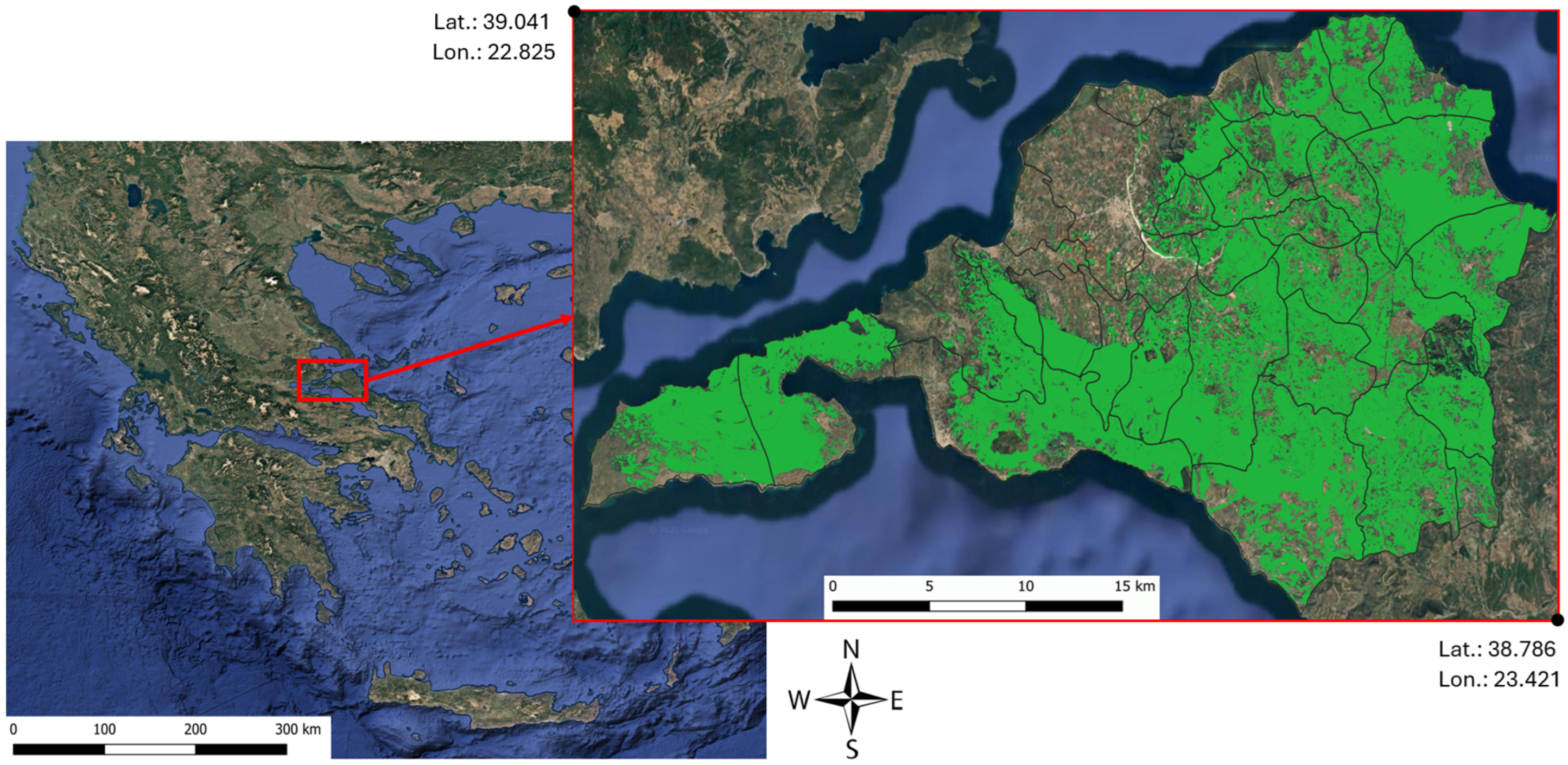
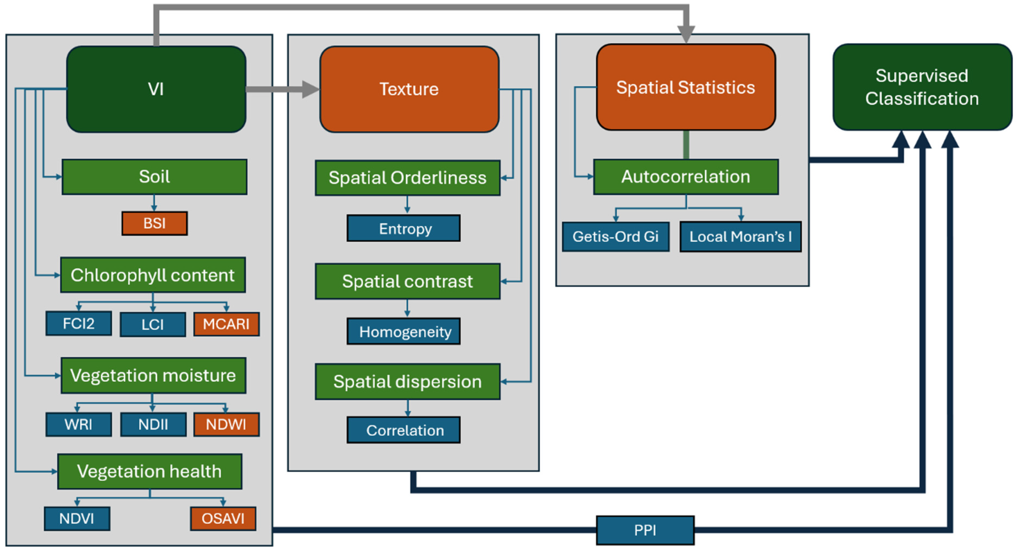
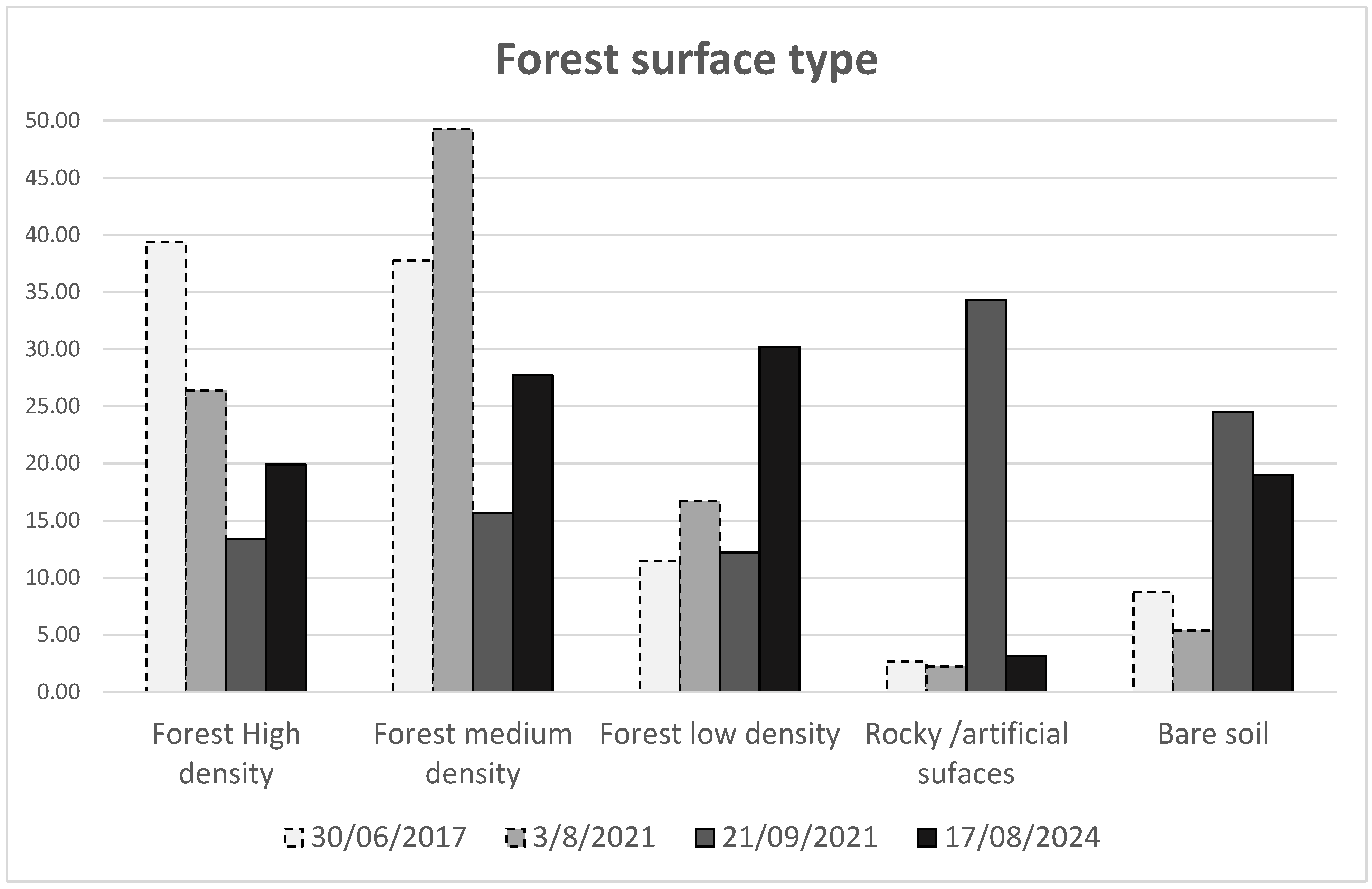
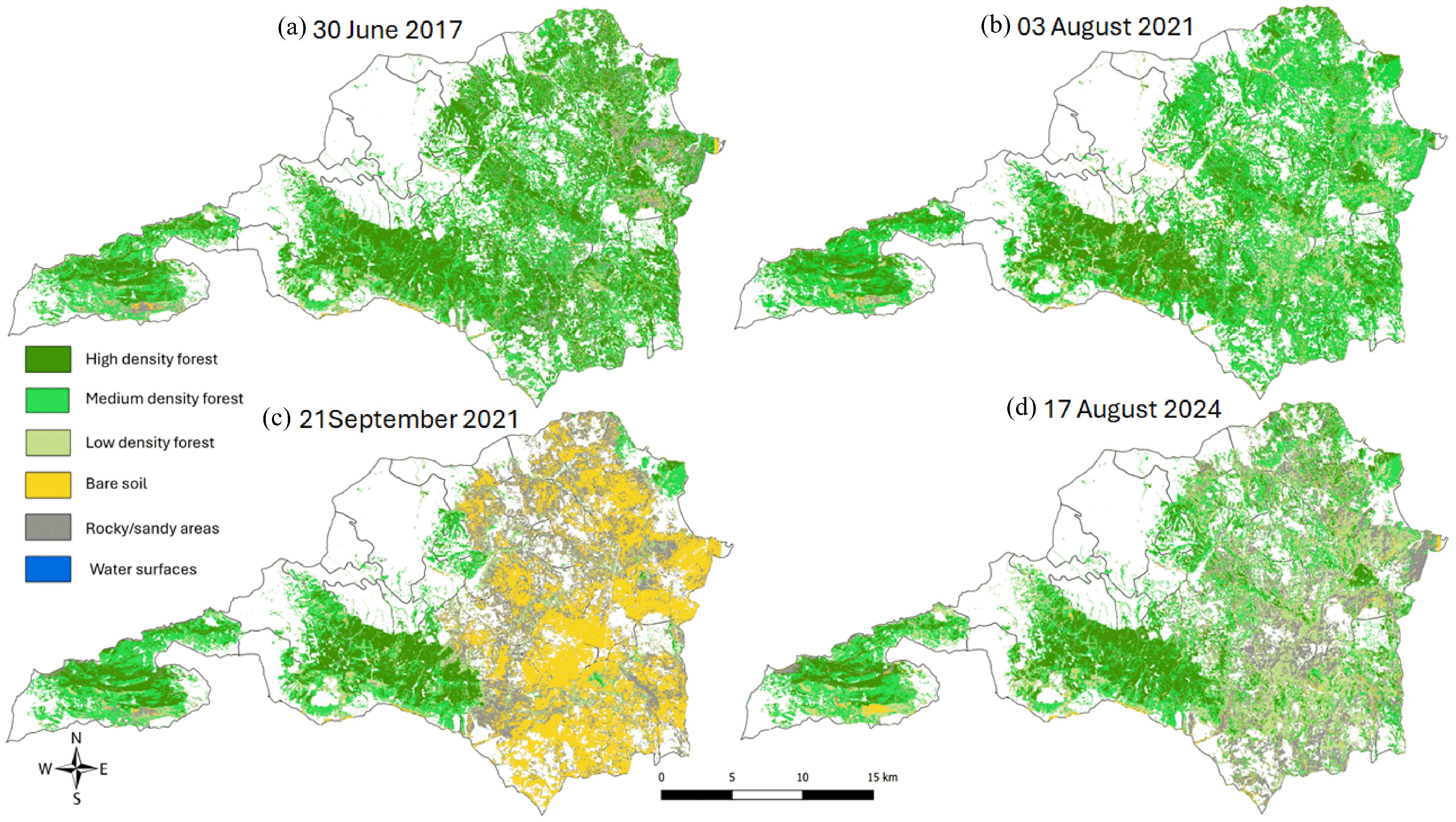
Monitoring forest density is essential for understanding ecosystem health, wildfire risk, and post-disturbance recovery. This study proposes a robust methodology to extract forest density classes exclusively using Sentinel-2 multispectral imagery combined with vegetation indices (VIs), textural parameters, and spatial clustering metrics. The approach was applied to the northern part of Euboea Island, Greece, as a pilot area severely affected by a wildfire in August 2021. Four cloud-free Sentinel-2 images (2017–2024) were selected to capture pre- and post-fire conditions. A set of nine VIs—representing vegetation vigor, chlorophyll content, soil exposure, and canopy moisture—were calculated and statistically assessed for independence. To enhance classification accuracy, texture measures (homogeneity, correlation, and entropy) and spatial autocorrelation metrics (Moran’s I, Getis-Ord Gi) were derived for selected VIs. Supervised classification was performed using the Maximum Likelihood algorithm, yielding overall accuracies up to 89.4% and kappa coefficients above 0.85 when combining VIs with texture and spatial metrics. Results revealed a dramatic 49.3% reduction in forest cover immediately after the wildfire, with partial recovery (to 77.9% of pre-fire levels) three years later, mainly as a low-density forest. Approximately 12.1% of forest cover failed to regenerate, indicating potential long-term ecosystem degradation. The proposed approach provides a computationally efficient, high-accuracy alternative to data-fusion methods involving (Light Detection and Ranging) LiDAR or (Synthetic Aperture Radar) SAR datasets, making it suitable for operational forest monitoring and fire-risk management.
Keywords: forest density; Sentinel-2 satellite; remote sensing; pixel purity index; spatial changes forest density; Sentinel-2 satellite; remote sensing; pixel purity index; spatial changes