Article

Deformation Laws of Coal Mining-Affected Slopes in Loess Gully Area

1
Shaanxi 185 Coal Field Geology Co., Ltd., Yulin 719053, China
2
College of Geology and Environment, Xi’an University of Science and Technology, Xi’an 710054, China
3
Shaanxi Nuclear Industry Engineering Survey Institute Co., Ltd., Xi’an 710043, China
*
Author to whom correspondence should be addressed.
GeoHazards 2026, 7(3), 89; https://doi.org/10.3390/geohazards7030089

Submission received: 10 June 2026 / Revised: 10 July 2026 / Accepted: 14 July 2026 / Published: 20 July 2026

Abstract

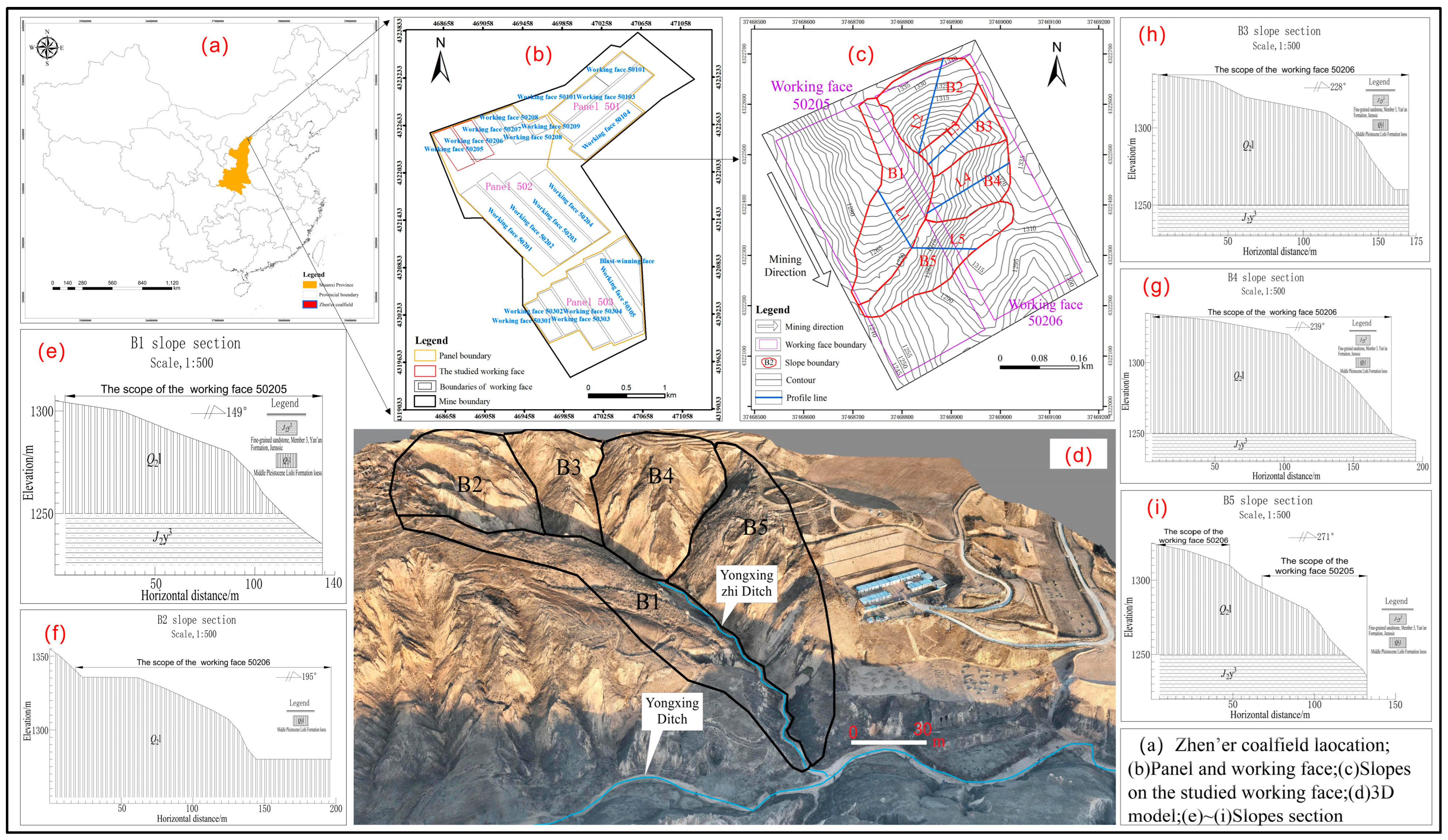
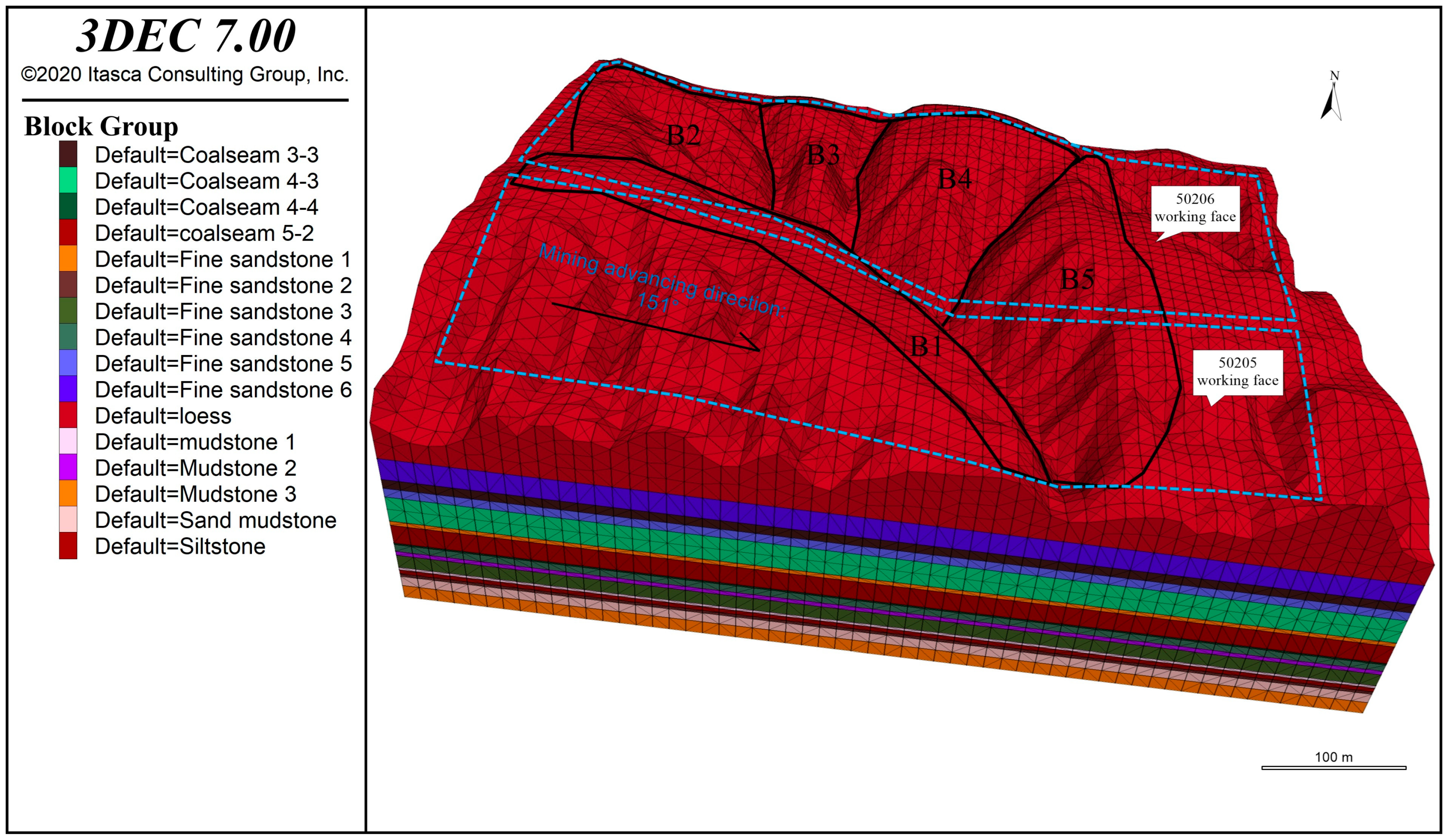
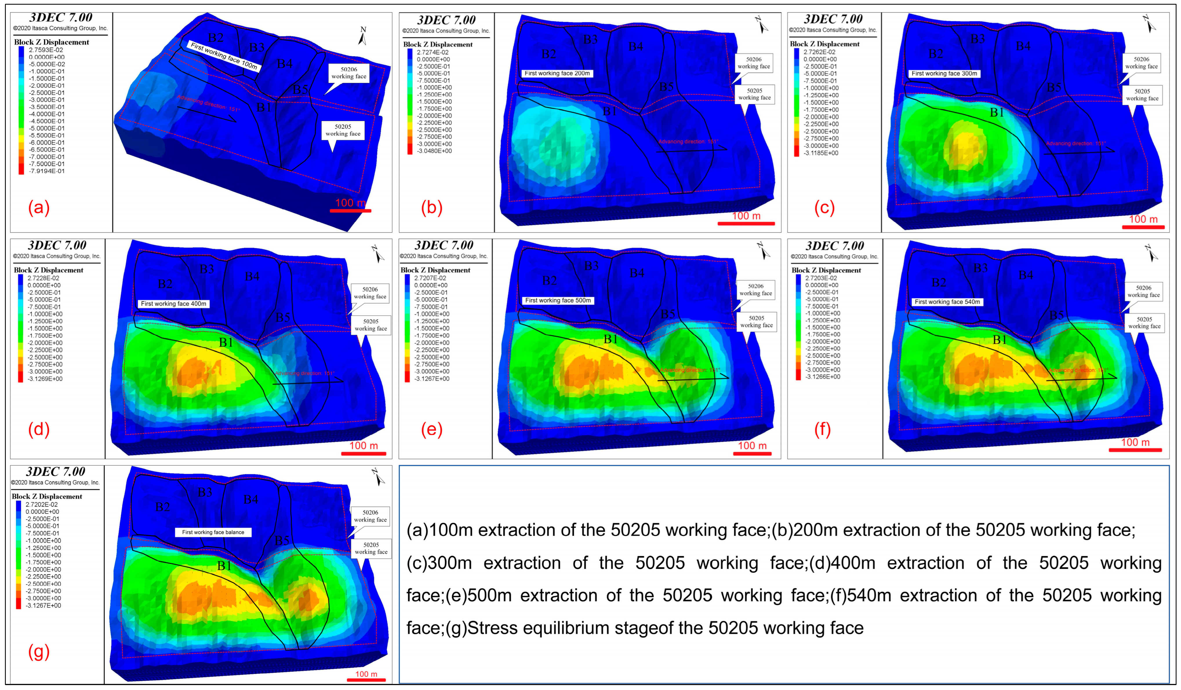
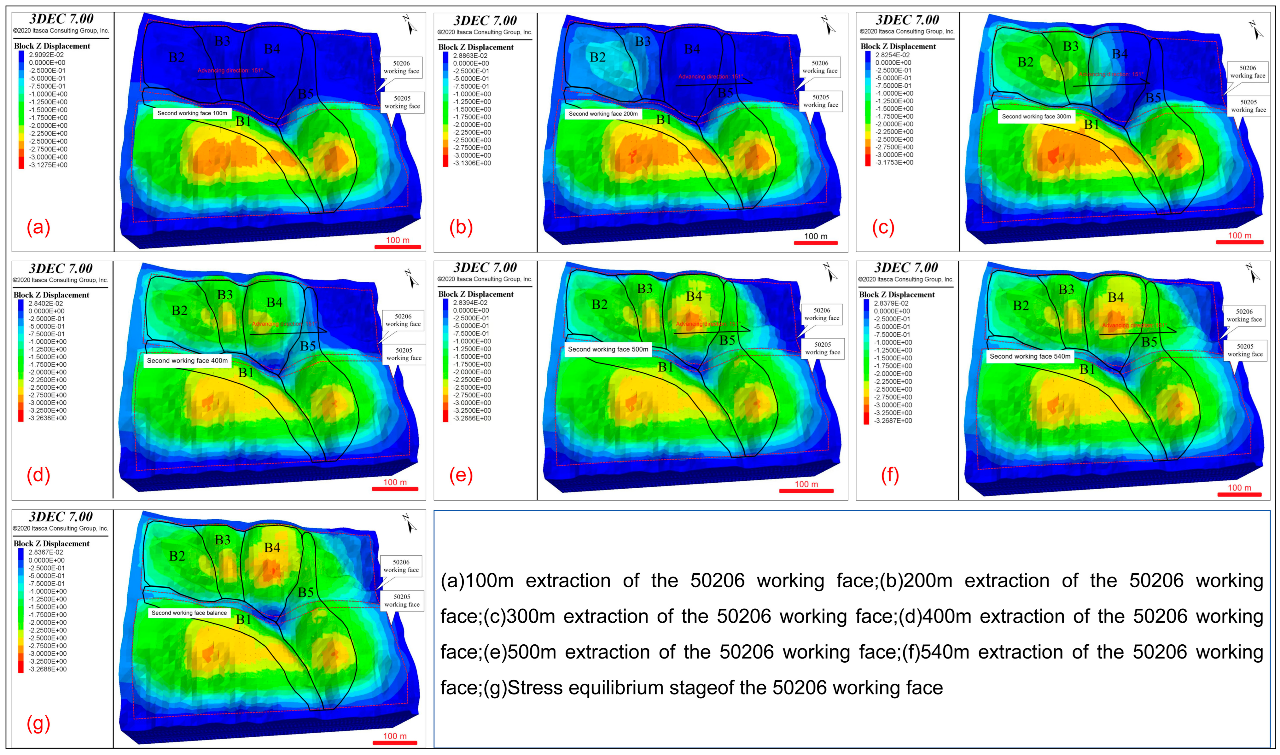
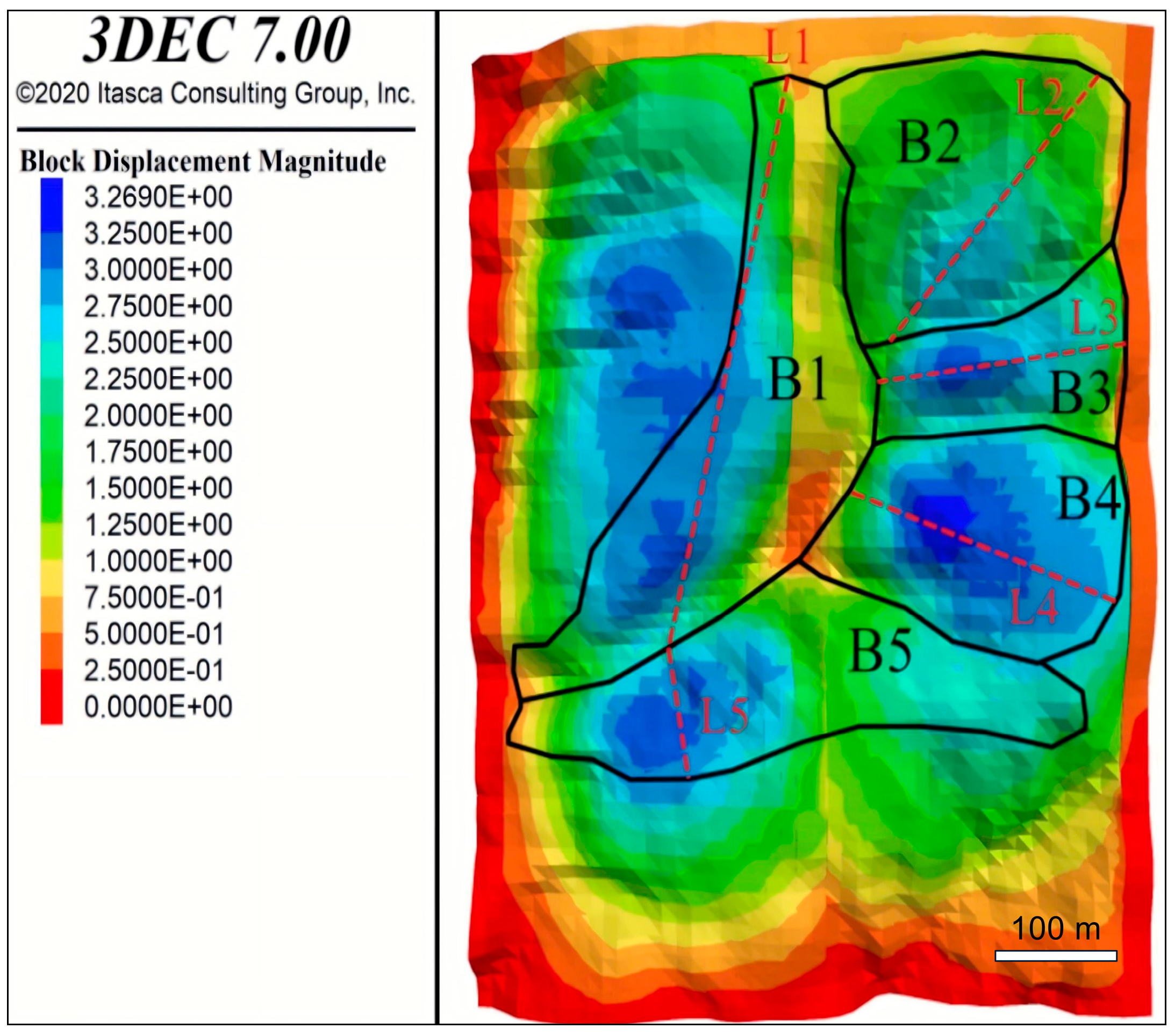
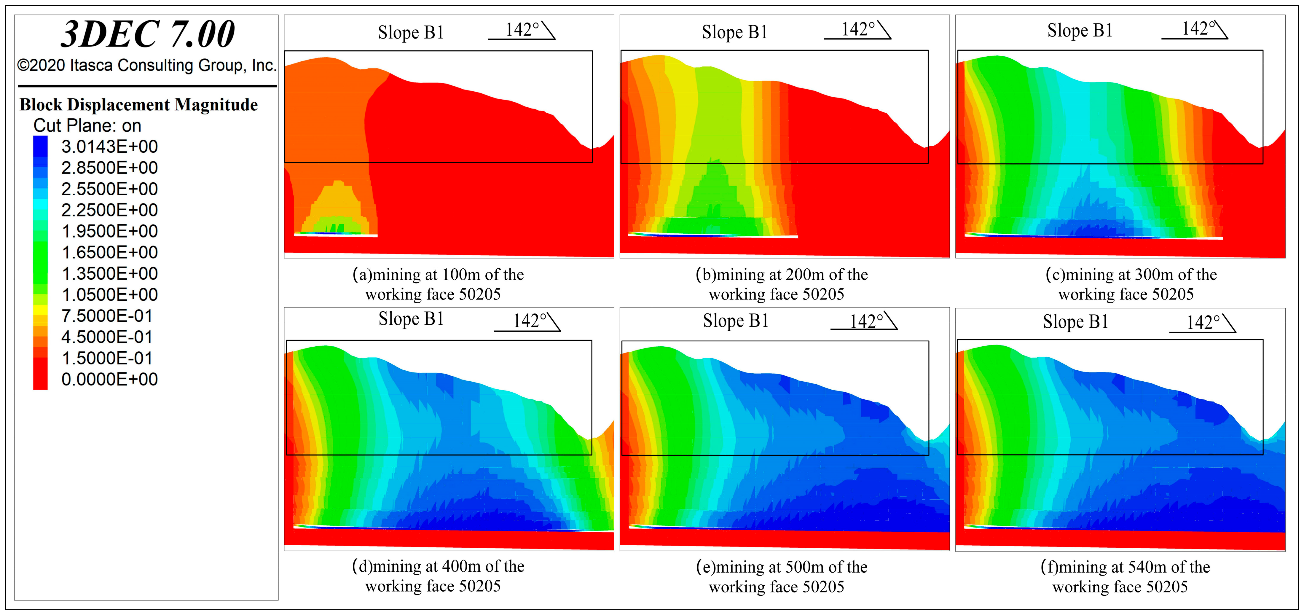
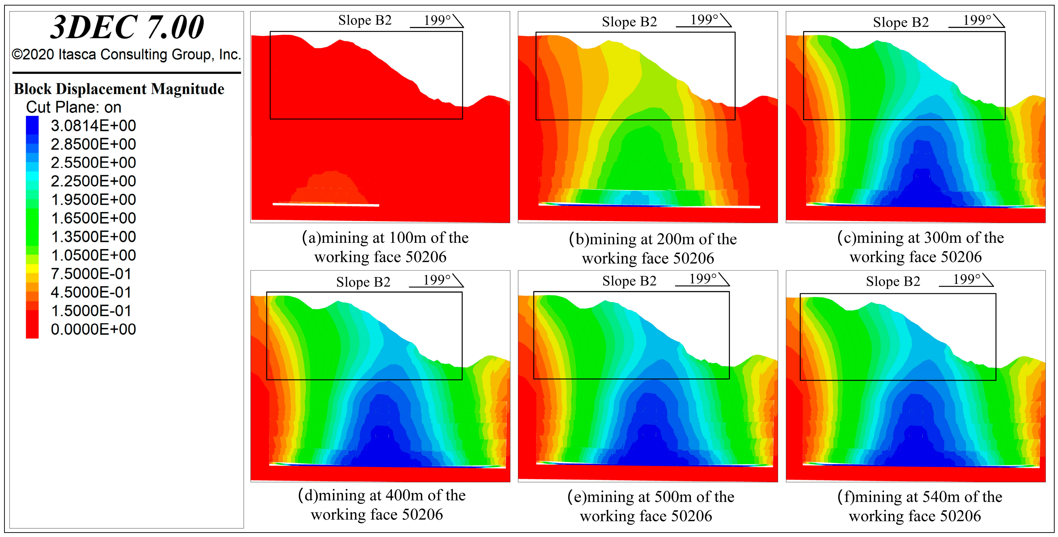
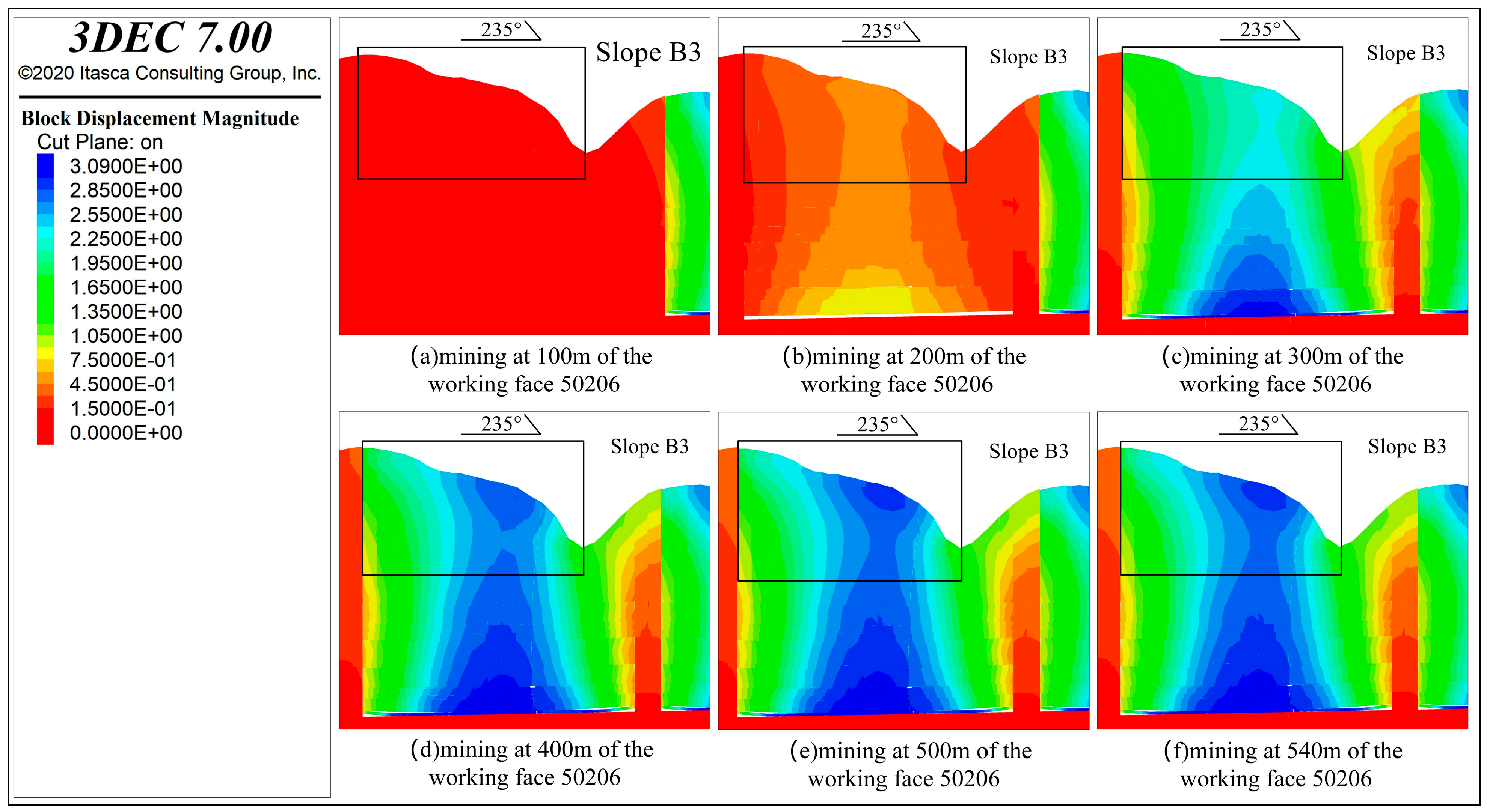
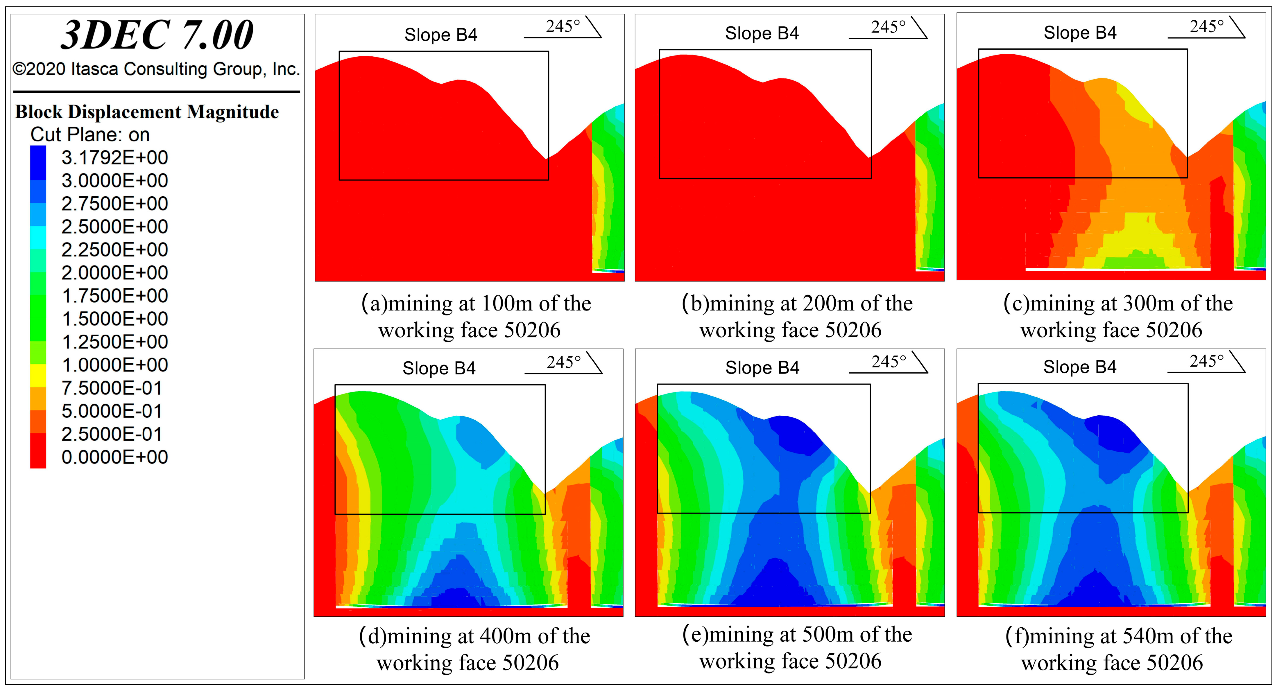
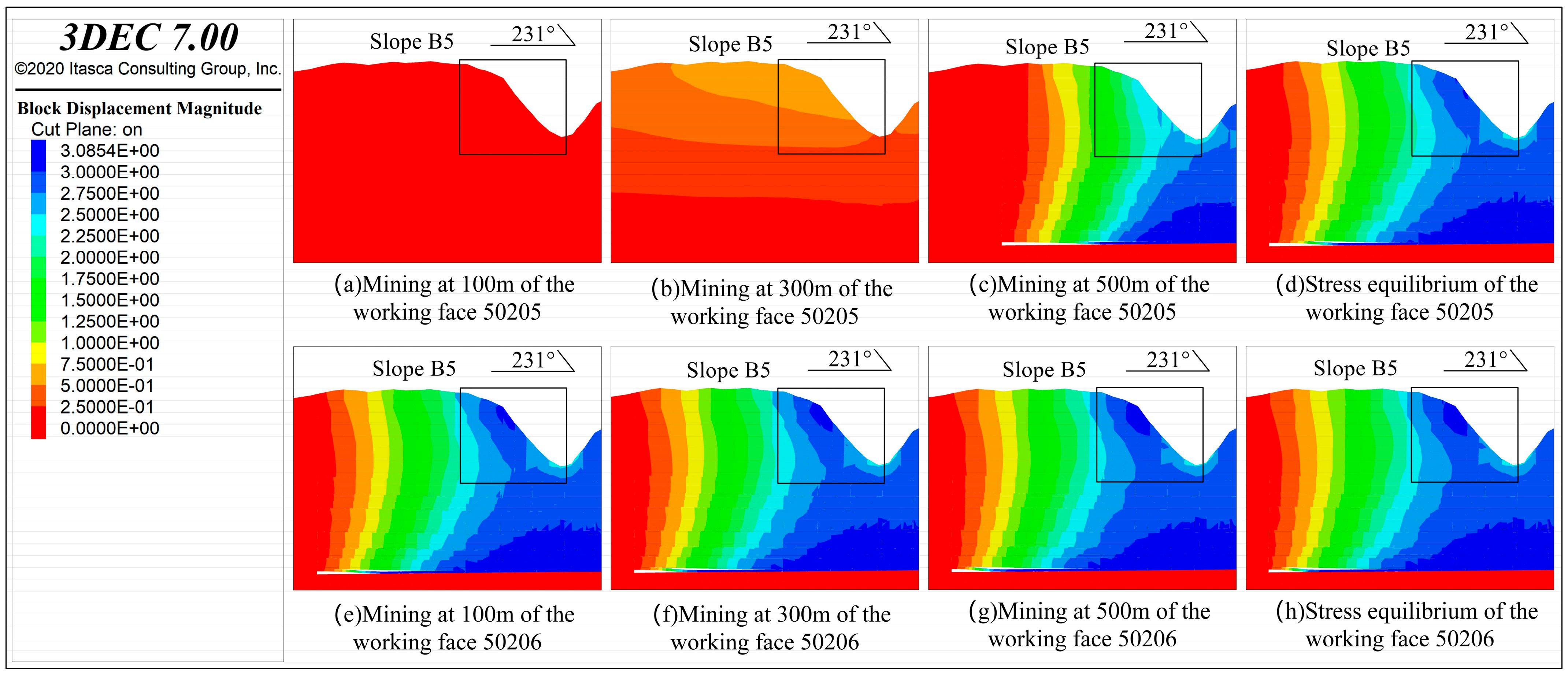
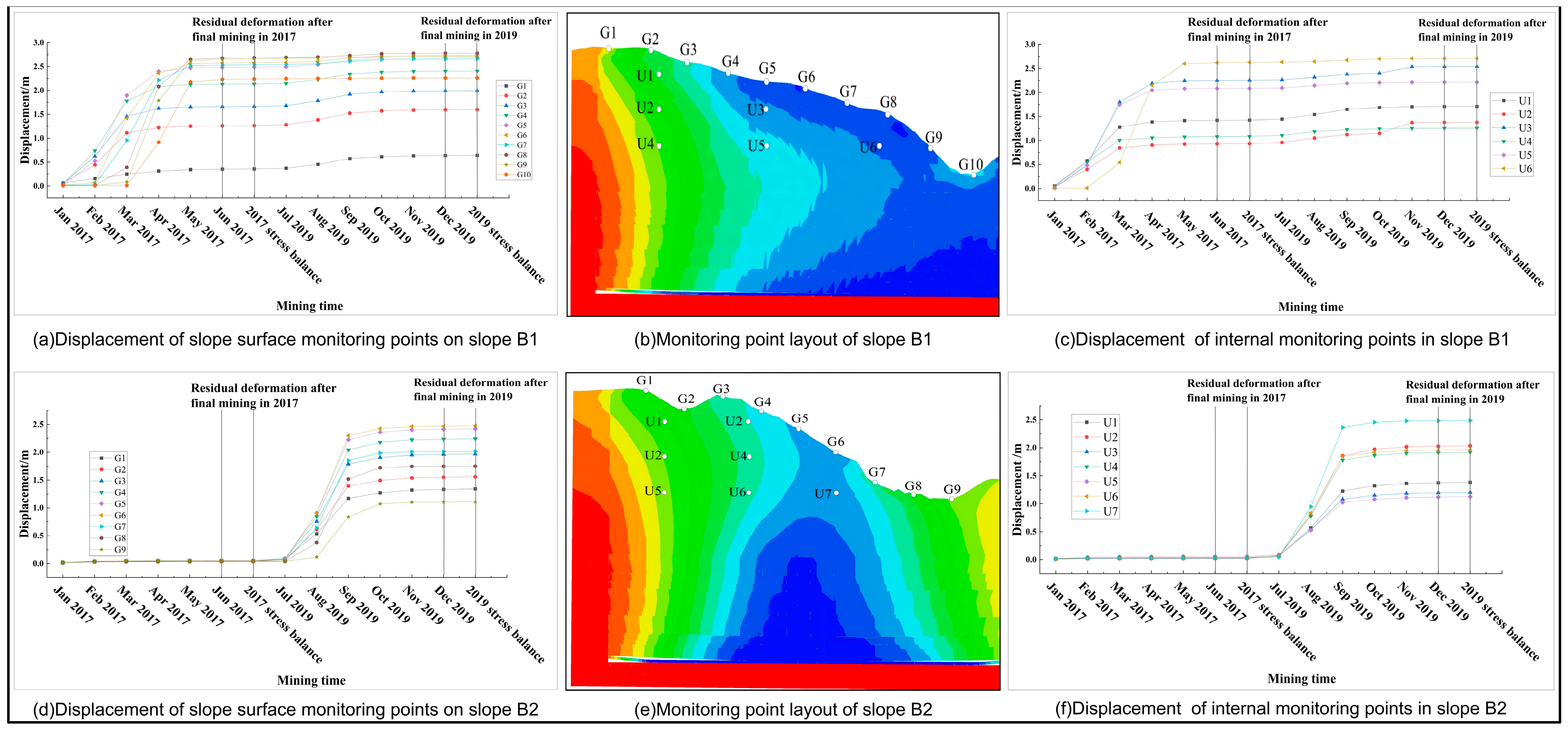
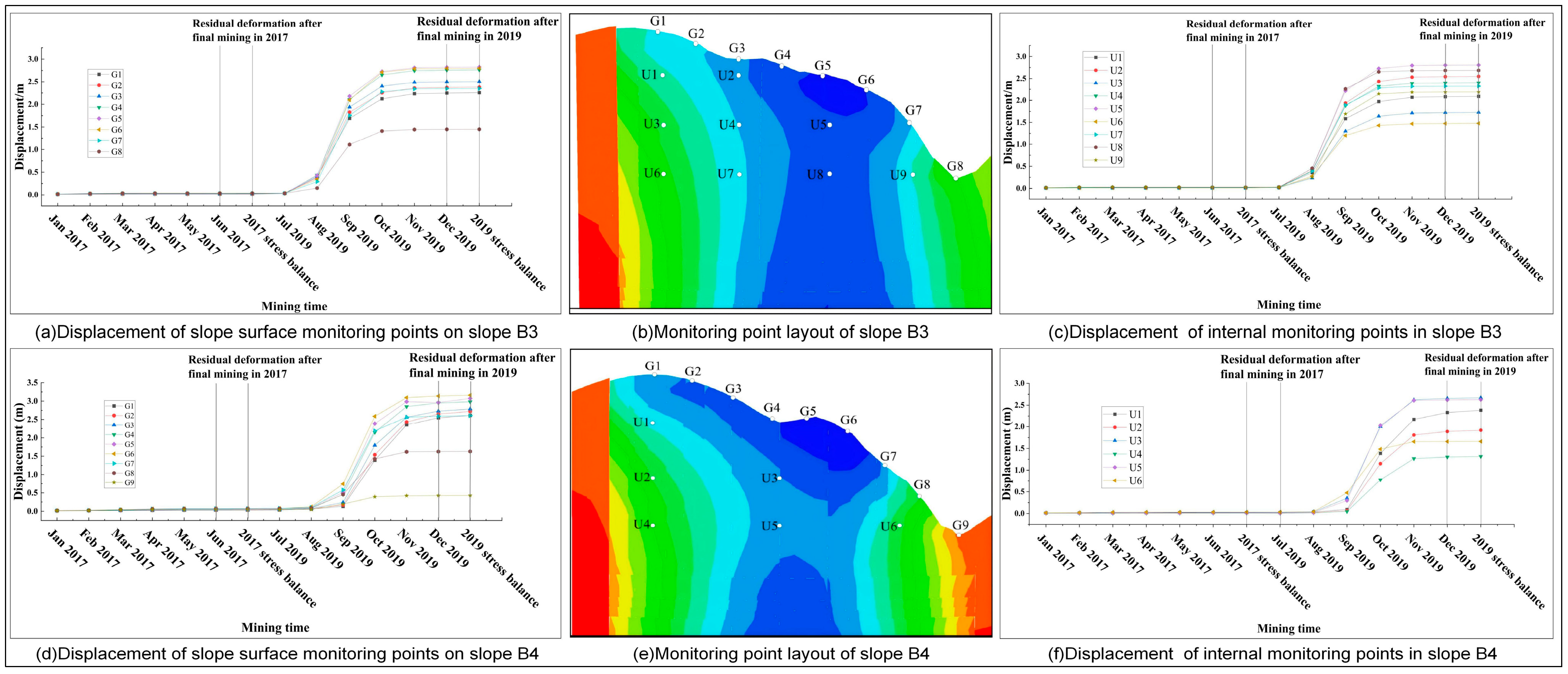
The loess gully region is characterized by complex terrain with crisscrossing gullies, where coal mining can readily induce surface subsidence and slope deformation. Such deformation often leads to geological hazards and ecological issues, including collapses, landslides, soil erosion, vegetation dry up, and land degradation. Therefore, understanding the deformation behavior of mining-induced slopes is essential for the restoration and management of mine geological environments. This study focuses on five slopes within working faces 50205 and 50206 of the Zhen’er Coal Mine in Fugu County. Using a combination of 3DEC numerical simulations and orthophoto-based fracture identification, we systematically investigated mining-induced slope deformation under the complex topographic conditions of the loess gully region. The goal is to answer three key questions: where mining-induced slope deformation primarily occurs, how it evolves over time, and what the main controlling factors are. Spatially, the primary deformation zones and their propagation paths vary significantly among the five slopes. The largest deformation occurs in the slope body directly above the main section of the working face, gradually decreasing toward the edges of the working face. Temporally, mining-induced slope deformation exhibits a time lag, meaning that surface responses lag behind underground mining activities and continue to develop even after the working face is fully extracted. In the loess gully region, slope deformation induced by mining is controlled not only by mining activities but also by topographic factors such as slope shape, aspect, gradient, and height. The spatiotemporal evolution of deformation becomes even more complex for slopes that span multiple working faces. These findings provide a scientific basis for monitoring mining-induced slope deformation and preventing geological disasters in the loess gully region, while also offering practical guidance for safe mining operations and hazard control in similar settings.
Keywords: mining-affected slopes; loess gully region; deformation; spatiotemporal evolution law; Zhen’er coal mine mining-affected slopes; loess gully region; deformation; spatiotemporal evolution law; Zhen’er coal mine