
Article

Global Near-Real-Time Burned Area Mapping Using Sentinel-2 and VIIRS Active Fires
1
COMPLUTIG, 28801 Alcalá de Henares, Spain
2
Indra Espacio, 28108 Alcobendas, Spain
3
Department of Geography, King’s College London, London WC2R 2LS, UK
4
Photonics Engineering Group, Universidad de Cantabria, 39005 Santander, Spain
5
Earth Observation, Climate and Optical Group, National Physical Laboratory, Teddington TW11 0LW, UK
6
HYGEOS, Euratechnologies, 59000 Lille, France
7
School of Geography, Geology and the Environment, University of Leicester, Leicester LE1 7RH, UK
*
Author to whom correspondence should be addressed.
Fire 2026, 9(5), 195; https://doi.org/10.3390/fire9050195
Submission received: 5 March 2026 / Revised: 20 April 2026 / Accepted: 25 April 2026 / Published: 7 May 2026
(This article belongs to the Section Fire Science Models, Remote Sensing, and Data)

Abstract

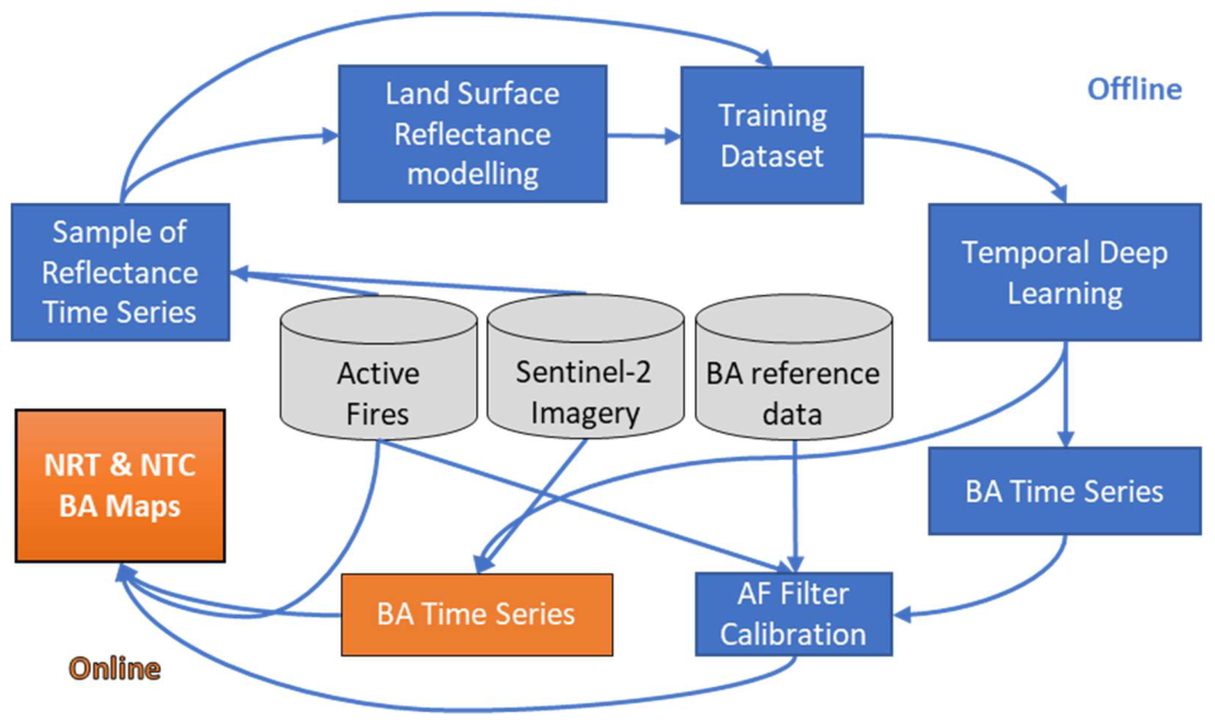
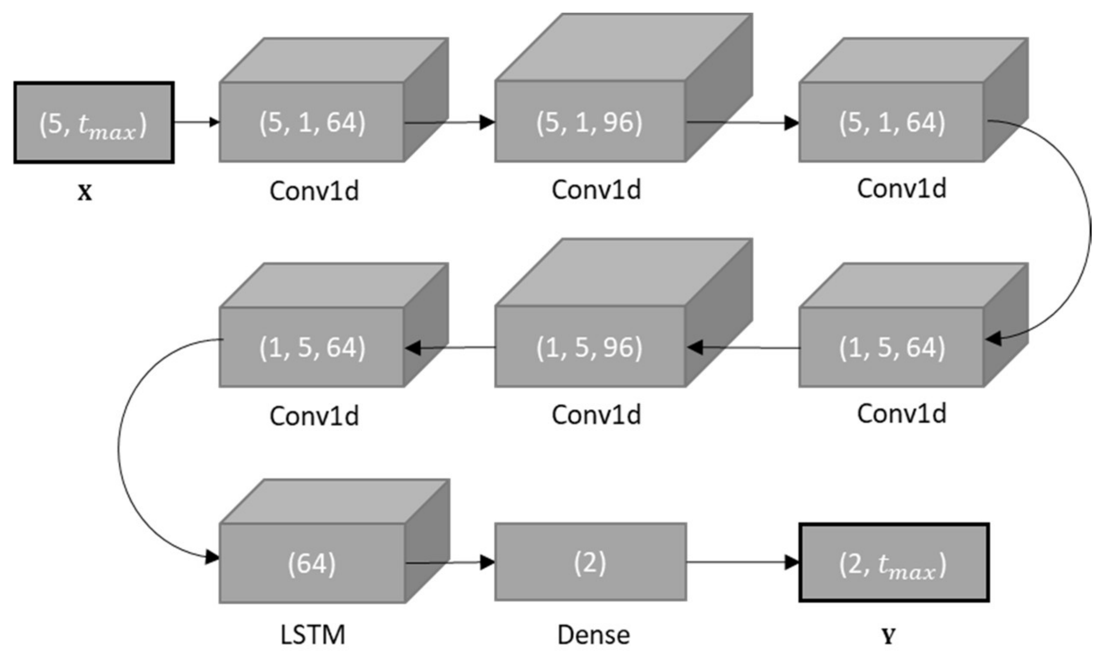
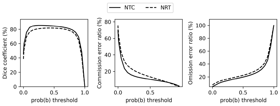
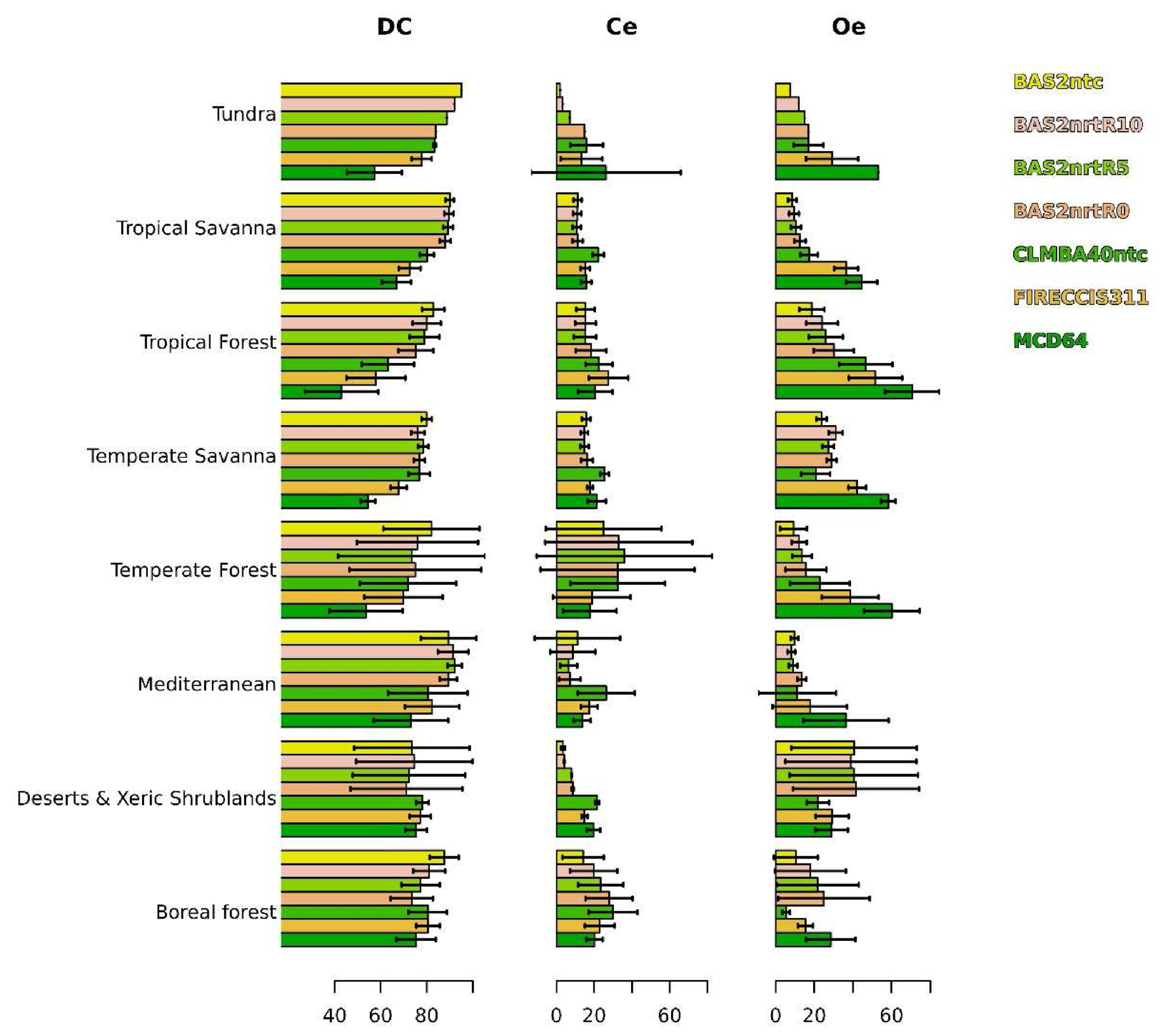
Despite the well-known strong influence of spatial resolution on the quality of burned area mapping and the need for timely environmental information, global wildfire monitoring services are commonly based on coarse spatial resolution (300–500 m) reflectance imagery and deliver products months or years after the present date. The paper presents, for the first time, an algorithm that provides highly accurate near-real-time medium spatial resolution burned area, from 20 m Sentinel-2 imagery. The paper exploits a pioneering sensor-independent potential of a mapping method, based on land surface reflectance modelling and machine learning, originally optimised for Sentinel-3 imagery. The mapping method uses predictions of time series of burned area from a neural network, which are combined with the spatio-temporal density of active fire detections. The mapping method was calibrated and validated using reference datasets for the years 2020 and 2019, respectively. The novelty of this method lies in its high accuracy and multi-latency flexibility: it achieves a Dice coefficient (DC) of 82.7% with zero-day latency, already surpassing the 81.8% accuracy of current state-of-the-art non-time critical methods. As reflectance data availability increases, accuracy scales to DC 84.7% and 85.4% with 5 and 10 days of latency, respectively, and to DC 87.2% for monthly composites with 45 days of latency.
Keywords: near-real-time; monitoring; burned area; wildfire; terrestrial globe; Sentinel-2; VIIRS near-real-time; monitoring; burned area; wildfire; terrestrial globe; Sentinel-2; VIIRS