Article

Highway Accident Hotspot Identification Based on the Fusion of Remote Sensing Imagery and Traffic Flow Information

1
Institute of Intelligent Transportation Systems, College of Civil Engineering and Architecture, Zhejiang University, Hangzhou 310058, China
2
Shandong Hi-speed Group Co., Ltd., Jinan 250098, China
*
Author to whom correspondence should be addressed.
Big Data Cogn. Comput. 2025, 9(11), 283; https://doi.org/10.3390/bdcc9110283
Submission received: 29 September 2025 / Revised: 2 November 2025 / Accepted: 7 November 2025 / Published: 10 November 2025
(This article belongs to the Special Issue Application of Artificial Intelligence in Traffic Management)

Abstract

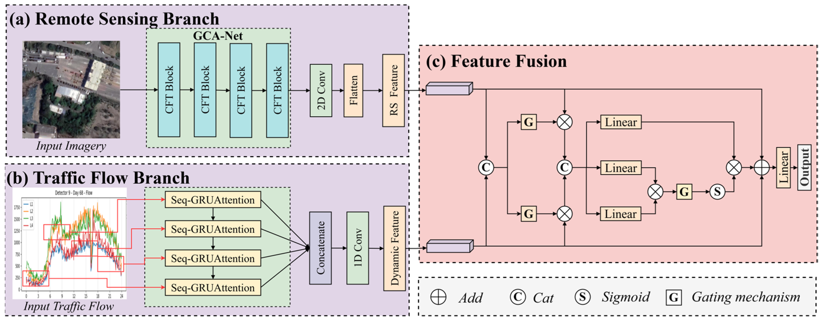
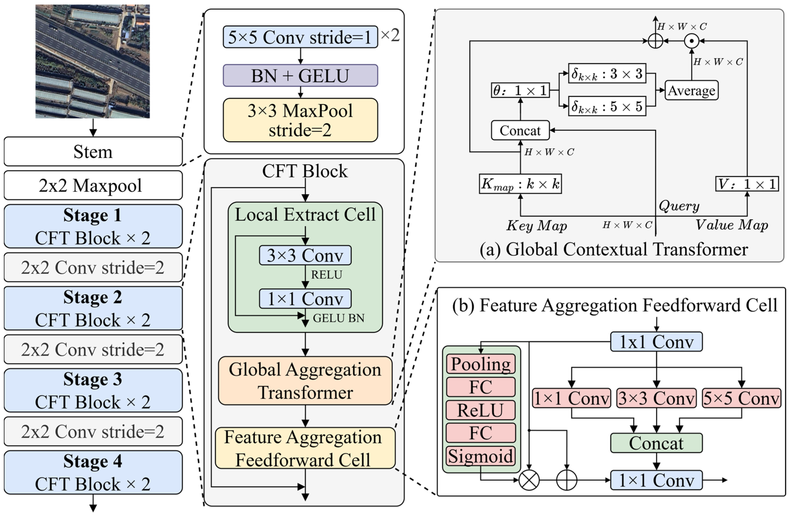
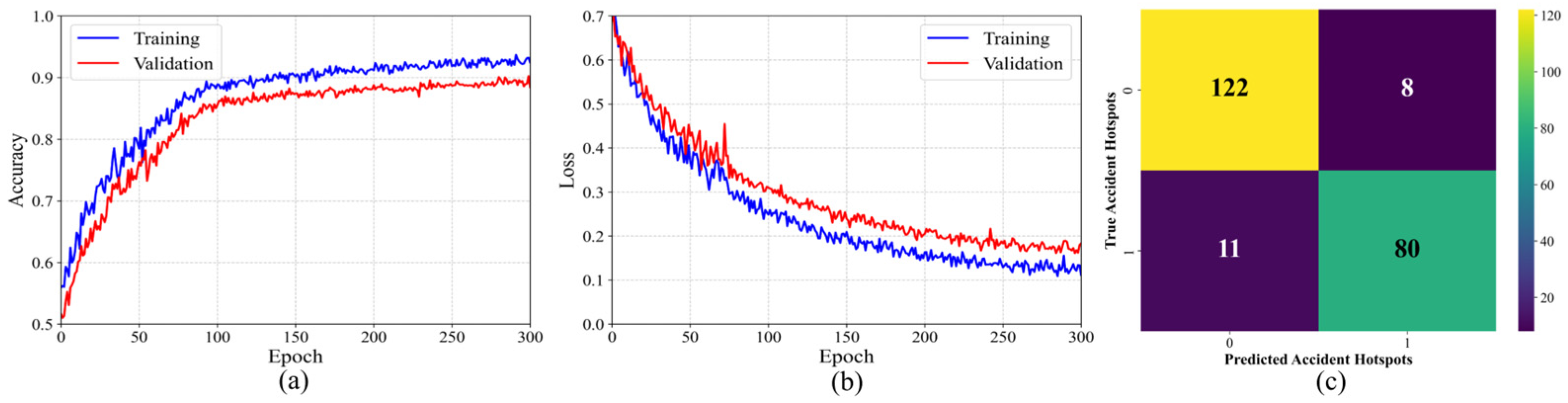
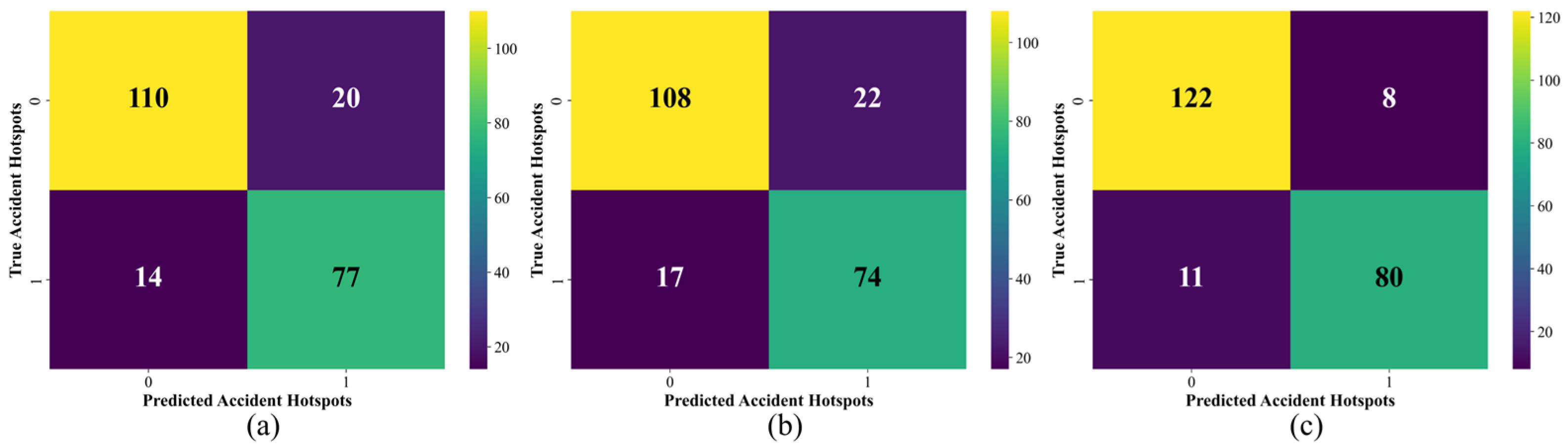
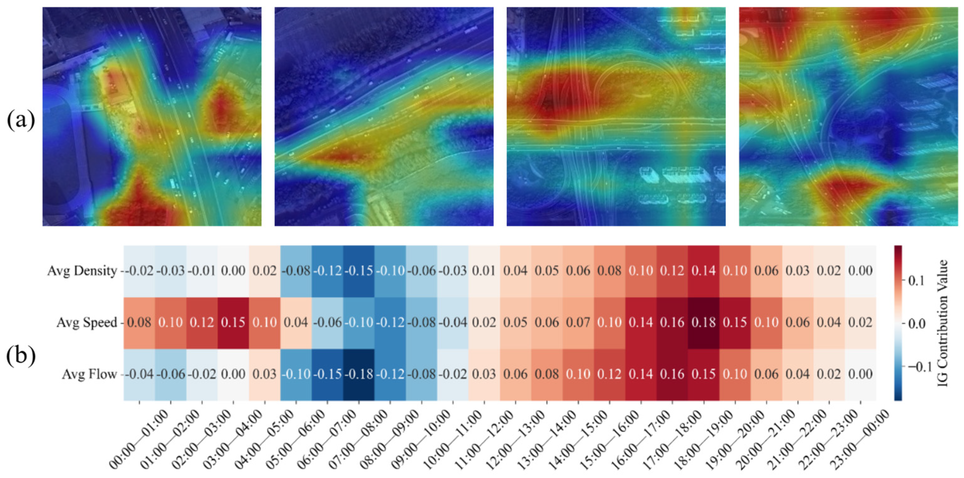
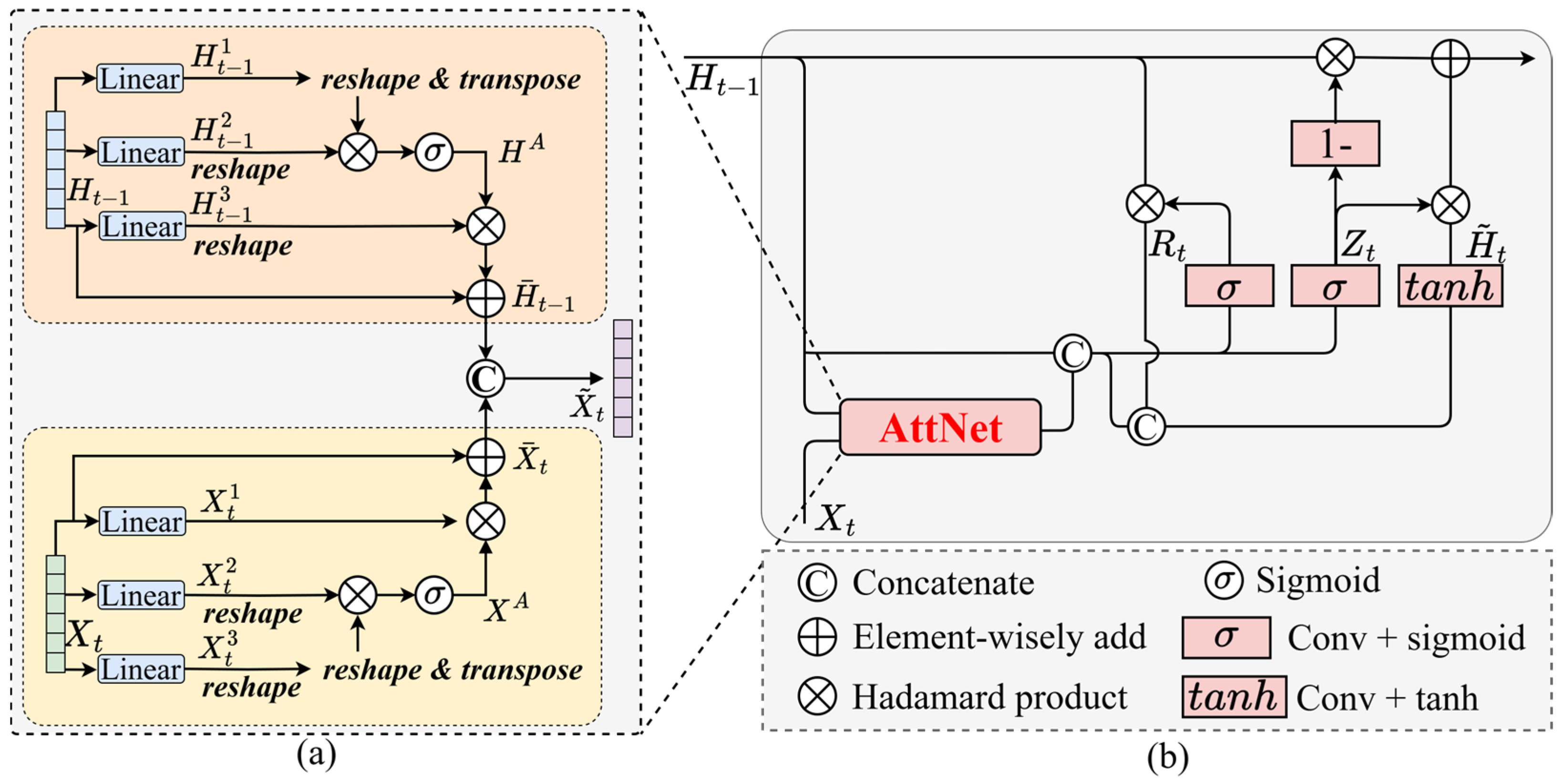
Traffic safety is a critical issue in highway operation management, where accurate identification of accident hotspots enables proactive risk prevention and facility optimization. Traditional methods relying on historical statistics often fail to capture macro-level environmental patterns and micro-level dynamic variations. To address this challenge, we propose a Dual-Branch Feature Adaptive Gated Fusion Network (DFAGF-Net) that integrates satellite remote sensing imagery with traffic flow time-series data. The framework consists of three components: the Global Contextual Aggregation Network (GCA-Net) for capturing macro spatial layouts from remote sensing imagery, a Sequential Gated Recurrent Unit Attention Network (Seq-GRUAttNet) for modeling dynamic traffic flow with temporal attention, and a Hybrid Feature Adaptive Module (HFA-Module) for adaptive cross-modal feature fusion. Experimental results demonstrate that the DFAGF-Net achieves superior performance in accident hotspot recognition. Specifically, GCA-Net achieves an accuracy of 84.59% on satellite imagery, while Seq-GRUAttNet achieves an accuracy of 82.51% on traffic flow data. With the incorporation of the HFA-Module, the overall performance is further improved, reaching an accuracy of 90.21% and an F1-score of 0.92, which is significantly better than traditional concatenation or additive fusion methods. Ablation studies confirm the effectiveness of each component, while comparisons with state-of-the-art models demonstrate superior classification accuracy and generalization. Furthermore, model interpretability analysis reveals that curved highway alignments, roadside greenery, and varying traffic conditions across time are major contributors to accident hotspot formation. By accurately locating high-risk segments, DFAGF-Net provides valuable decision support for proactive traffic safety management and targeted infrastructure optimization.
Keywords: accident hotspot; traffic safety; remote sensing; deep learning; multimodal fusion accident hotspot; traffic safety; remote sensing; deep learning; multimodal fusion