Article

Citizens and Scientific Perceptions of Ecosystem Services—Assessing Local Controversies over Climate Mitigation Efforts in Drained Wetlands

1
Department of People and Technology, Roskilde University, University Road 1, 4000 Roskilde, Denmark
2
Department of Technology and Innovation, University of Southern Denmark, Campusvej 55, 5230 Odense, Denmark
3
Department of Communication and Arts, Roskilde University, 4000 Roskilde, Denmark
4
Department of Science and Environment, Roskilde University, 4000 Roskilde, Denmark
5
Department of Biology, University of Southern Denmark, Campusvej 55, 5230 Odense, Denmark
*
Author to whom correspondence should be addressed.
Climate 2025, 13(6), 112; https://doi.org/10.3390/cli13060112
Submission received: 28 March 2025 / Revised: 16 May 2025 / Accepted: 20 May 2025 / Published: 29 May 2025
(This article belongs to the Section Climate and Environment)

Abstract

:
Draining wetland landscapes accelerates climate change, and multilateral support is therefore needed to speed up the transition to new land uses. This paper examines perceptions of ecosystem services (ES) in wetland areas in scientific and civic assessments. The case study area is Denmark’s largest drained wetland system, which is notable for its carbon sequestration potential. The area’s transformation efforts involving public participation offer a unique chance to examine differences between scientific and civic perceptions of ES. This exceptional case is ideal for revealing contextual differences, trade-offs, and controversies between scientific and civic perceptions of ES. Millennium ES Assessment and CICES are used as a conceptual framework for understanding and mapping human–nature interactions in a nature park. However, these systems are, in practice, not sufficiently developed to identify how citizens understand and value ES in real life. Therefore, we analyse perceptions using interviews, collaborative mapping, and media analysis. We compare these to scientific ES mappings based on local data, literature reviews, and fieldwork. The paper concludes that (1) scientific ES asymmetries are important; (2) environmental blind spots in scientific ES are due to its approach to knowledge collection; (3) citizens’ blind spots are due to their everyday life focus and tabooing the issue of local climate mitigation; and (4) science-based ES assessments and accounts are disconnected from local ES controversies. We argue that identifying ES controversies through various scientific methods may improve climate mitigation and restoration efforts if community planning becomes involved.

1. Introduction

Internationally, the restoration of peatland and wetlands is recognised as important for mitigating climate change [1,2]. Globally, wetlands cover a total area of 12.1 million km2 and account for 40.6% of the total value of global ecosystem services (ES) [3,4,5,6]. The Intergovernmental Panel on Climate Change (IPCC) describes the importance of wetlands to climate change [7,8], biodiversity degradation, and the function of wetland carbon sinks [9]. The scientific information from ES mapping and assessment may inform national and international policy frameworks (e.g., Common Agricultural Policy, EU-CAP Biodiversity Strategy) [10,11]. Yet, local responses in rural areas very often do not resonate with the national and international transformation agendas informed by ES. EU and national governmental frameworks [11,12] recognise the need for the transfer of ES services in drained wetlands towards climate mitigation and in lowlands to mitigate the worst effects of global environmental change [13]. However, local communities may oppose such efforts, and they may even exacerbate conflicts between and among local stakeholders and citizens when confronted with potential interventions [14,15]. Accordingly, no ES assessment in local areas unfolds in a socio-political vacuum, and as global warming accelerates [7], local responses and decision processes concerning climate mitigation are becoming more urgent [16]. Thus, there is a need for local authorities and land managers to orient themselves to lay–expert differences and let ES assessment become a tool for this, but there is a knowledge gap. Our research aim is therefore to gain a deeper understanding of the characteristics and context for the differences in expert and lay approaches to the same natural area’s ES in order to achieve improved trade-offs. We intend to contribute to this by comparing the use of scientific ES assessments with a sample of local citizens’ assessments from diverse sources in a specific area. Inspired by actor–network theory (ANT) [17,18], we pursue controversies in the case area of Danish lowland using scientific ES assessments and assessments from a diverse set of sources related to citizens and stakeholders.
A typical way of handling controversies in the ES assessments of experts vs. citizens is to address the need to translate scientific knowledge from experts to citizens and stakeholders. Financial valuation using monetary accounting is a main approach to handle this. While cost and benefits can be important in the practical planning of the use of ES assessments for prioritising [5,19,20], this approach reveals little about citizens’ understanding of ES and especially local responses to restoring ES functions [15,21]. However, the inclusion of citizens’ and stakeholders’ responses to wetland transformation is increasingly important to gain access to local ES transformation functions and to legitimise commitment among politicians. Citizens and local stakeholders may even block participatory planning in defence of property rights, etc. [22], and the process thus becomes too slow to tackle the urgency of climate and biodiversity action. Natural area managers and public planners are accordingly obliged to cope with the fact and dilemma that local citizens’ and stakeholders’ perceptions often diverge internally and from scientific assessments of the problem focus and the importance of a set of ES functions. As mentioned, this relates to valuating taken-for-granted ES based on very long timespans but also politically controversial aspects of ES irreversible thresholds, as well as nature’s complex and often invisible contributions to citizens in our everyday life [23,24,25].
Thus, novel balanced methodologies to examine ES through participatory mapping have been developed to handle this discrepancy [26,27,28]. Manoeuvring towards the right form of methods in ES participation (e.g., Natura 2000 implementation) also implies avoiding dominance by the economically strong stakeholders and institutions with vested interests, as their opinions are typically given more weight than those of average citizens [23,29]. To compensate for representativity bias, overcome participatory blocking of changes, and tackle climate urgency, a broad spectrum of participatory planning approaches has been developed to better understand and handle citizen ES valuations [20,27] and integrate them into local climate governance [30].
By way of illustration, Lopes and Videira [9] use workshops and participatory approaches in modelling system dynamics to conceptualise ES feedback processes. This enables them to develop a causal loop diagram to inform policies on climate regulation. Richards and Tuncer [29] and Zhang et al. [31], among others, have examined participatory photo sharing through social media to understand user preferences in order to estimate the monetary value of recreational ES for potential land use transformation. However, this is based on an understanding of citizens’ perceptions and assessments of the landscape and nature as fully accessible through ask–respond situations in uncommon settings. In contrast, Dou et al. [32] and Jaligot et al. [33] took a more real-life approach, studying the influence of completed ecological restoration on residents’ perception of cultural ecosystem services (CES). They found that by converting cultivated land into grassland and forests in a Chinese ecological restoration project, the landscape’s change influenced citizen perceptions negatively. Thus, Dou et al. [32] show how cultivated land ranks higher than forests and grasslands to citizens in the area and that agricultural land has greater CES value than grassland and forests because local traditions are bound to agricultural landscapes. Similarly, local stakeholders’ monetary valuations may diverge from scientific accounts, as Car and Milstein [34] identify environmental blind spots among citizens in a coastal high marsh and former mangrove, underscoring the relevance of the actors’ ES values and the network they inhabit. Environmental blindness is related to inattentional blindness, they argue, and describes when individuals or groups fail to value (in monetary or other terms) environmental entities, dynamics, or processes they are faced with. Also, plant blindness varies across different stakeholders and arises when individuals do not acknowledge, know, or pay attention to plants in their own environment [35].
For a more suitable contribution to scientific ES mapping, we search for more comprehensive ways to access citizens’ real-life ES perceptions, estimations, appreciations, and understandings by uncovering many life circumstances embedded in their ecosystem environments to be assessed [26,35]. However, little research has been published on citizens’ understanding of ES and wetland restoration [16,34,36] and the gap between scientific and citizens’ understandings of ES for wetland transformation [2,6,33]. For an exception, see Burdon et al. [26] or Krasny et al. [19]. As Brian [35] and Chambers et al. [23] note, collaborative methods risk preserving the interests of those in control. Hence, we argue for a combination of scientific and civic ES mapping to generate a more holistic understanding of which ES and functions and perceptions thereof may conflict with one another). The present paper therefore aims to contribute to the literature and reduce this deficiency by enhancing understanding of the expert–lay differences in assessing nature’s ES and achieving a more balanced position under real-life conditions [26,28,31,37]. We aim to identify different ways of achieving citizens’ ES assessments under late historical conditions that may be more fruitful for understanding how expert–lay ES assessments might be merged. In continuation of the described spectrum of participatory planning approaches and real-life evaluations (comprehensive, multifaceted, and context-related analysis), we have chosen to use a multi-method approach to identify local citizens’ and stakeholders’ understandings of and attitudes towards wetland ES and the transformation involved. We do so by adopting a case story approach to examining scientific and civic ES assessments in a drained wetland in Åmosen Nature Park (NPÅ) over a historically short period. NPÅ covers the largest bog, peatland, and former wetlands on the Island of Zealand, Denmark. The area contains significant soil carbon and a former Ramsar nature reserve [4,6,38,39,40,41]. Previous restoration efforts have shown the importance of stakeholders’ ES controversies as a reason why previous ecological and wetland restoration projects failed. In such cases, ANT theory suggests following controversies in order to gain a deeper understanding of what is at stake and which types of networks are involved [17,42].
In the problem area of the differences between scientific and civic local ES assessment, we raise the following research questions. Do ES controversies exist between scientific and civic ES assessments of drained wetlands under pressure for transformation? How does a multiplicity approach to citizens and stakeholders contribute to ES trade-offs and mappings?

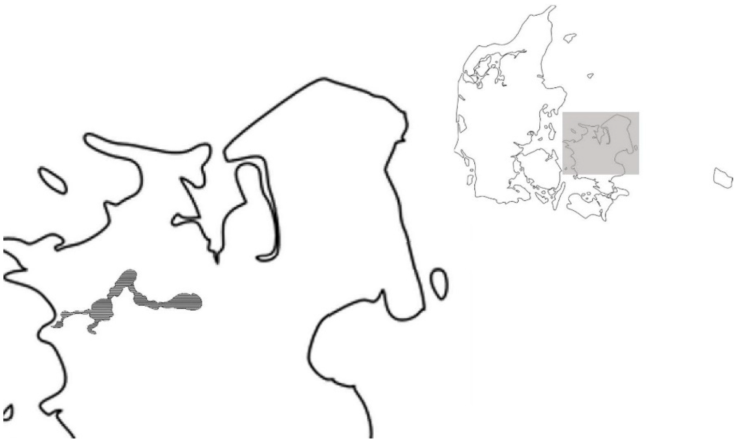
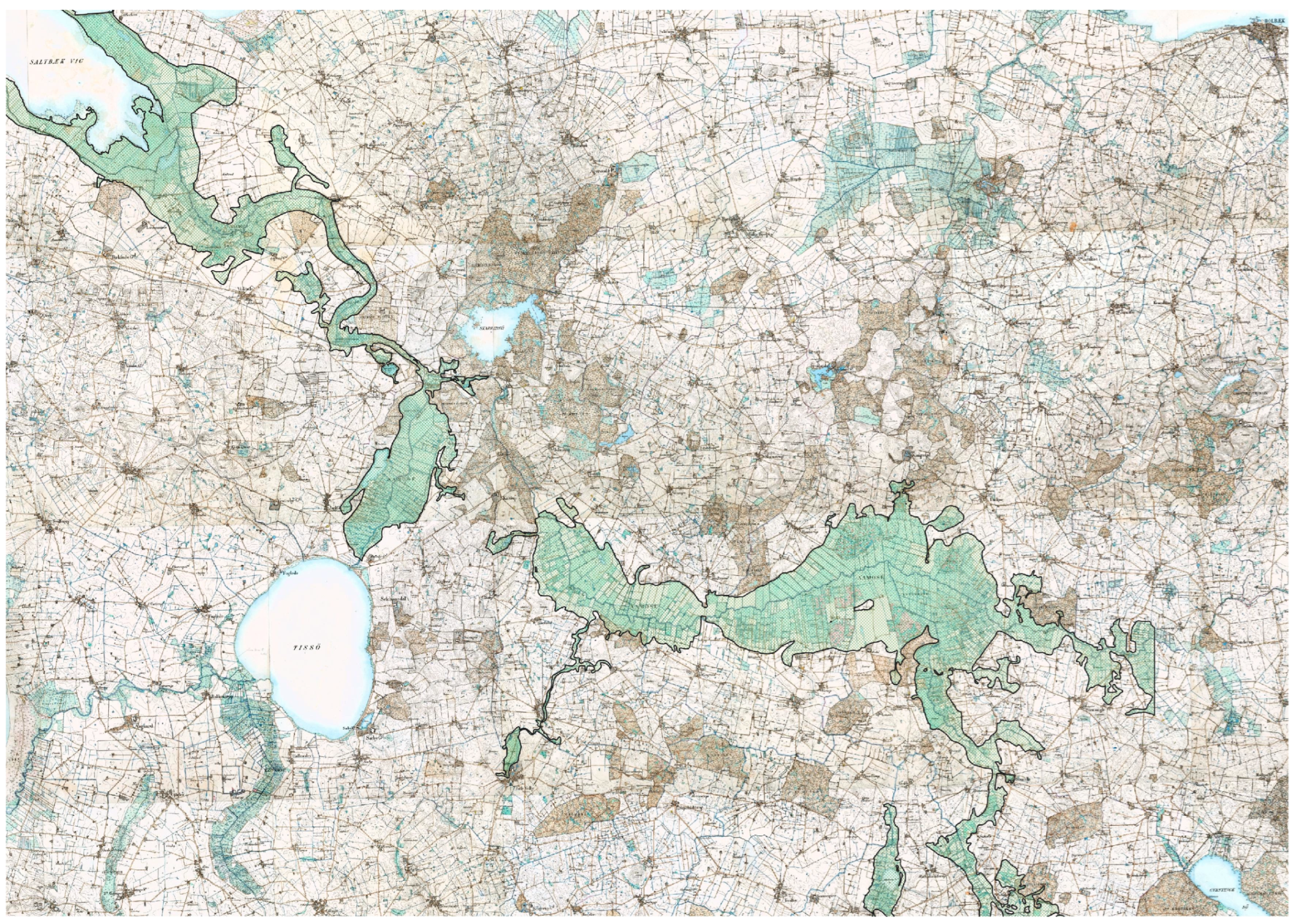
2. Case Area Description, Planning History, and ES Assessments

The Åmose basin consists of Lille (Small) Åmose (LÅ) and Store (Big) Åmose (SÅ), wetlands of 6 km2 and 30 km2, respectively (Figure 1). Located in a Weichselian glacial valley in western Zealand, it is part of Denmark’s biggest wetland system and the largest drained water system [43,44,45]. Two streams, one from SÅ and one from lake Skarresø, merge into the Halleby stream just before LÅ, funnelling the precipitation of the 524 km2 watershed through the kettle lake, Tissø, before entering the ocean, the Great Belt [38]. Both SÅ and LÅ have been drained over time since 1800, with the most extensive drainage taking place in the 1930s and ending in the 1960s [39,41,46]. As part of the drainage, the Halleby stream was straightened to its current state somewhere between 1808 and 1842 and is still maintained in this state. Both SÅ and LÅ are, however, normally waterlogged from late autumn to early summer, and both consist of raised bog peat, which in some areas is partly decomposed due to the drainage [45,47]. NPÅ has 2802 ha (hectares) of carbon-rich soil (+12% carbon), the third largest of such areas in Denmark. While no accurate emission estimates exist, Cowi Consultancy [45,48,49] found that Store Åmose emits 23 147 tonnes of CO2e/year in a 1413 ha site with carbon-rich soils and 18,702 tonnes of CO2e/year in another 1181 ha site. The entire system consists of 8000 ha of lowlands with varied carbon content. In comparison, the entire country has 300,000 ha of carbon-rich soils (+6% carbon) that emit 76 mega tonnes of CO2e/year [50,51]. Low-lying areas and wetlands contribute half of the agricultural sector’s land use emissions in Denmark [50,51]. Figure 2 illustrates the water system of the nature park, the lowlands, and the carbon-rich soils. The plotted area marks the previous lowlands, including peat, marsh, razed fen, bog, and wetlands. The NPÅ area is now primarily used for non-extensive agriculture, such as hay and cattle grazing, and parts of the area have been used for agriculture for more than 6000 years [39,41,46].
Until the middle of the 19th century, bogs, peat, and wetlands occupied 20–25% of the land. Today they cover less than 1–3% [53,54,55]. In the late 1990s, the NPÅ area gained growing political attention in terms of nature and culture restoration projects, being the largest drained wetland and peatland in Denmark [56,57,58,59,60,61,62,63]. Reports from consultancies and national nature conservation agencies pinpointed the need to restore the wetland, especially in order to preserve some of the best archaeological artefacts from the Stone Age in northern Europe [47,53]. Furthermore, the Danish Forest and Nature Agency established two initiatives in 1999 and 2006 on wetland restoration simultaneously with initiatives to transform the area into a national park [45,48,49]. However, uncertain public participation, confusion due to the divergent aims of the two national initiatives, and unclear stakeholder involvement characterised the process. This created uncertainty among the approximately 1900 landowners who found themselves marginalized and with little representation in the planning process [54]. As many landowners had major concerns about the nature restoration initiative and confused it with the national park initiative, they formed a lobbying group, the Association for the Conservation of Nature in Eastern NPÅ, which mobilised protests by national and local politicians. Eventually, the wetland restoration project fell apart, and the government could not obtain a majority in Parliament [15,22].
Nevertheless, restoration policies and climate mitigation agendas are growing at the national and international level (e.g., the EU Biodiversity Strategy). Similarly to Norway, which has banned further cultivation of peatlands to protect critical carbon sinks [16], the Danish Government has approved a DKK 600 million (EUR 80 million) bill (2020–2022) to restore low-lying areas, such as Åmosen, with more than 6% organic matter, to mitigate CO2 and methane emissions [45,49]. As national governments set carbon reduction targets and the EU Common Agricultural Policy (CAP) is likely to regulate agriculture further, it might also encourage compensation models and restoration projects in the Åmose wetland system [55], whereby local responses to such plans will once again become urgent to citizens living in areas with climate mitigation potential.

3. Analytical Approach, Methods, and Data

From the ANT approach, we derive our conceptual and methodological frameworks to study practised ES assessment as the primary core of focus above socio-natural dichotomies [42,56,64]. Traditional divisions between natural and social science encapsulate controversies and blind spots in knowledge production as a result [42,64,65]. Instead, we want to trace networks within ES practices, which, according to ANT, means following relations and/or controversies between all types of actants, both human and non-human [42]. To trace a network means to choose which actant is the prime mover, meaning that the actant is chosen as the initiator worth investigating [66]. In this specific context, the prime movers are ES [42,66]. To follow relations and controversies between all types of actants influencing ES in Åmosen requires the involvement of a variety of methods and datasets to identify the complexity and variation of relations. The aim of the ANT approach is to work beyond the understanding of ES as a mode of regulation and its traditional understanding of nature and culture as separate fields and issues [66] and see ES as bridging natural and social sciences, as well as civic and professional understandings.
The Millennium Ecosystem Assessment [57] is a commonly used scientific assessment approach that defines ES as all of the benefits that scientists may identify for a given ecosystem provision to people or society. Thus, we draw upon the Millennium ES Assessment as a conceptual framework for understanding and mapping human–nature interactions in NPÅ seen from a scientific perspective. However, while recognising cultural services, the ES Millennium mapping system was in practice not developed to identify how citizens understand and value ES in real life. Hence, Millennium ES studies [57] may fail to identify eventual differences and controversies between scientific and civic mapping, as well as between stakeholder groups. Therefore, we must involve other methods to follow our analytical strategy, which is to study if, where, and what controversies are displayed to diverse stakeholders and citizens and compare this to the diverse scientific ES assessments [42,66].
Our case study approach forms the framework for tracing networks and controversies in the civic and scientific ES assessments. Our multiple methods approach consists of four procedures: (1) a literature review of Åmosen wetland ES studies and political–regulatory interventions covering a timespan of around 100 years, (2) individual, group, and focus group interviews in 2020–23, (3) collaborative mapping in 2022–2023, and (4) a media analysis covering the period of 2005–2020. For the scientific literature review of ES mapping in the area, information from scientific, peer-reviewed journals, consultancy reports, and reports from relevant authorities were considered. Furthermore, the scientific–societal section of the review focuses on identifying nature-oriented planning, regulation, and politics related to the Åmosen wetland over the past 100 years. The three other datasets constitute the citizen mapping. We understand the methods to be supportive when each one reveals similar or controversial knowledge and additive insofar as each method adds knowledge to a genuine picture of ES perceived by multiple stakeholders, i.e., scientific-based vs. civil-society-based ES [21,23]. This comparative analysis is used to understand disparities between expert and citizen perspectives. This framework captures how various stakeholders interpret and value ES, revealing potentially significant asymmetries.
NPÅ ES assessments were identified and mapped in each of the three areas from the EU Common International Classification of Ecosystem Services (CICES) database (v. 4.1) for ES mapping and assessment [3,58,59] the provisioning services, regulating and maintenance services, and cultural services, which are further described and discussed in Section 4.1 and Tables 3 and 4. For an overview of the ES in wetlands and peatlands in general, see Bonn et al. [20] and Joosten et al. [60]. All datasets were subject to thematic analysis according to the CICES section level and then mapped to the group level based on a simple binary approach (present/not present) considering the abundance of the various ES when structuring the data. The binary approach allowed us to compare the science-based ES with the civil-society-based ES and to identify possible gaps and controversies, which will be analysed in more detail. The combination of comparative and thematic analyses aims to deepen our understanding of gaps and controversies between scientific and citizen assessments.

3.1. Scientific ES Mapping—Review

To systematically identify and analyse ES in NPÅ, we conducted a comprehensive literature review. This review encompassed six peer-reviewed articles and 21 reports sourced from various entities, including consultancies, the Danish Ministry of the Environment, local authorities, and academic institutions, all specifically relevant to the study area. Although the reports from authorities and consultancies are classified as non-scientific, we have organised their content according to established international literature standards. The data have been categorised using a binary approach and further supplemented with relevant international peer-reviewed literature addressing specific ES functions.
Our findings about ES identified in NPÅ were further supported by discussions in the peer-reviewed literature beyond NPÅ, which also highlighted potential missing services. We would claim that NPÅ exhibits the same biogeochemical characteristics and functions commonly found in drained wetlands.

3.2. Citizen ES Mapping—Collaborative Mapping

A total of 186 citizens participated in 11 workshops with 5–10 people per session (2019–2022) in the nature park administration offices and at public nature park events. At the workshops, citizens mapped their own or others’ local stories from places in the nature park, joined focus group interviews/discussions on their relationships to the NPÅ area, and expressed their wishes for the future [15,22]. These stories were given numbers and plotted on maps, and the citizens’ area affiliation and wishes for the future were transcribed and ordered. In total, participants’ ES data consist of 159 lifeworld stories. The workshops were based on semi-structured interview guidelines for questions and discussions. The collaborative mapping method covered different angles of ecological change, including struggles over resources, (in)justice, local meaning and nature aspirations, and what the citizens considered needed to be sustained and preserved in the area. The respondents were asked to place figures on one or more of six detailed maps of the nature park and write their experiences of specific places [15]. In this way, the collaborative mapping, but also the media analysis and the interviews, were not framed beforehand by established scientific CIRCES projects; instead, we sought to explore the actors’ perspectives and approaches to land use themes that later could be translated into the ES framework.

3.3. Civic ES Mapping—Media Content Analysis

The media content analysis was initiated by a search for articles from local newspapers published and delivered in the upland municipalities of NPÅ. The search involved the word Åmose and was conducted in the media archive Infomedia. The search included 13 local newspapers from January 2005 to October 2020, and 428 articles mentioning Åmose were found (Table 1). The newspapers varied greatly in the number of mentions of Åmose, with 2 articles in Lejre Lokalavis compared to 189 articles in Nordvestnyt. Articles mentioning Åmose cover editorial material, news, letters from readers, and posts from various NGOs announcing meetings, hikes, and presentations related to the Åmose area. The dataset was sampled, read, and structured through short abstracts of each article, and the material was subsequently searched to locate any ES. ES statements were found in all 428 articles.

3.4. Civic ES Mapping—Individual Stakeholder Interviews

The data consist of 15 on-site, in-depth qualitative interviews with local stakeholders (2019–2022). All interviews were recorded. The data also include short interviews from landowner trips in June 2022 and June 2023, each of which had approximately 35 landowners from the area. The landowner trips were public and had no selection criteria. The events were advertised by the nature park on social media and in the local newspapers. The 15 interviewees were actors with a direct association to the nature park (Table 2).
Based on a primary mapping of public, semi-public, and voluntary organisations, interviewees were selected based upon inputs from the nature park organisation, business directories, and internet searches identifying them as core participants in the NPÅ network. The initial mapping was followed by snowball sampling of additional actors mentioned as relevant by the interviewees (Table 2 lists all interviewees). The interview themes concerned three questions: their perception of the area, attractions visited, and their nature experience. The questions opened up a discussion about which natural landscapes and cultural heritage sites the interviewees regarded as needing to be sustained and what needed to be developed and how the actors saw their own interests being realised in relation to this context.

4. Analysis and Discussion

The Åmosen area is a highly intensified agricultural landscape where both the climate profile and vegetation systems have changed significantly over the past century. These changes are perceived differently by scientists and local citizens in their assessments of ES in the region. The following section provides a detailed discussion of these scientific and civic perspectives.

4.1. Scientific Mapping of Ecosystem Services in Åmosen

The scientific literature review of studies related to NPÅ identified seven ES corresponding to three CICES categories: provisioning, regulation and maintenance, and cultural services (see Table 3 and Table 4). The following section describes each of these seven ES in detail, including comparisons between the potential services provided by natural or drained wetlands and those characteristic of the Åmosen area.

4.1.1. Provisioning Services

ES of natural wetlands produce an array of vegetation, animals, and resources [60,61]. The provisioning services identified for Åmosen during drainage are primarily related to agricultural use, such as feed and water for grazing livestock (terrestrial plants and animals for food and water for agricultural use). Even though drainage affects the groundwater level and water quality negatively, the area still provides “water for human consumption”. Several households in the area have a private well. Prior to drainage, plant fibres were cut and used as thatch for local roofs, and peat mining provided fuel (biomass-based energy). Especially during and after the Second World War, the peat digging industry provided fuel for the whole region. Both practices were reduced following drainage and are now non-existent [38,45,48,49]. Overall, resource provisioning, as well as wild animal and vegetation systems, have been severely impacted by drainage, resulting in reduced biodiversity.

4.1.2. Regulation and Maintenance Services

Regulation and Maintenance ES (RMES) in wetlands are essential for sustaining key ecosystem functions by regulating various ecological processes, some of which have global significance [62]. For example, natural wetlands contribute to water quality improvement by regulating the biophysical and physicochemical environment [57]. However, in Åmosen, those functions have been diminished due to extensive drainage.
An important RMES of natural wetlands is climate regulation [5,7,60]. Natural wetlands sequester carbon in their soil and, therefore, their function as carbon sinks plays an increasingly significant role in mitigating climate change [63]. NPÅ has 2802 ha of carbon-rich soil (+12% carbon), the third largest such area in Denmark [8,51,62,67]. Whether wetlands function as a source or a sink depends on a range of interacting factors, including soil physical conditions, microbial processes, and vegetation characteristics [25,37,60].
Another RMES is the ability of natural wetlands to remove nutrients, such as nitrogen and, to some degree, phosphorous, from agricultural and runoff water. This is especially relevant for inland wetlands like the Åmose area [68,69], where this may protect groundwater quality and reduce the risk of eutrophication further downstream [55,70]. This service is non-existent when a wetland is drained like Åmosen is.
In terms of water RMES functions, Lake Tissø, the largest lake in the area, supported a different vegetation system prior to the drainage interventions [39,40] and was known to have rootstock plants [40]. This is no longer the case in the oxic conditions following the drainage of Åmose, where the lake has high nutrient loads and has suffered from severe eutrophication, preventing fishing [47,68]. Furthermore, another ES absent during drainage of NPÅ is the ecosystem’s “water flow regulation” ES, which not only supports groundwater recharge and discharge but also further helps flood abatement by storing and slowing the flow of floodwaters and thereby reducing the height of flood peaks and the risk of flooding downstream [70]. Given climate change impacts on the region, including prolonged and severe summer droughts and increased instances of heavy precipitation and winter flooding, this water flow regulation service would be especially beneficial for Åmosen and its surrounding areas. However, we have identified “water flow regulation” as an ES during drainage but with contrary use, as it is the removal of water that makes the area fit for agriculture [45,48,49].
The final RMES is the regulation of the biotic environment, which is “Lifecycle maintenance, habitat and gene pool protection” ES [57]. The high biodiversity in wetlands with rich flora and fauna [20,44,60] supports high plant productivity and animal diversity. Loss of biodiversity has been reported in the Åmosen area during the drainage period [44,45,46,48,49]. Prior to 1970, biodiversity was not a focus point for the area, yet we have identified it as an ES, as there were small patches distributed throughout the area. In the 1990s, biodiversity became a focus point, and potential nature restoration projects and several national screenings identified the cost-effectiveness of restoring the area to the biodiversity conditions prior to drainage [44,45,47,48,49].

4.1.3. Cultural Services

Cultural ES (CES) of wetlands in general deliver important non-material benefits, such as aesthetic, cultural, spiritual, and educational values, and they provide invaluable opportunities for recreation [43,44]. Wetlands are valued for their spiritual and inspirational significance as well as aesthetic appreciation of their natural features [53]. With regard to historical legacy, conservation biology, and biodiversity, wetlands can provide important value for education [13,14]. In cultural ES in the context of NPÅ, there was identification of links between the use of ecosystems and their physical or experiential application. A review of the extant literature on the subject indicates the presence of some of the most well-preserved archaeological artefacts from the Mesolithic Stone Age (12,800–3900 BC) in northern Europe [46,53]. Recreation as an ES and tourist practices were scarcely identified in the literature [15,22]; even in 2006, there were no major outdoor activities reported in the area, and access to Åmose was generally considered rather limited [45,49,71].

4.2. Citizen Mapping of Ecosystem Services in Åmosen

Collaborative mapping across multiple interests suggests that citizens primarily have an awareness of CES and the changes involved and, secondly, the cultivation of the wetland. CES mainly focuses on leisure and recreation, excursions, and nature experiences. As far as wildlife and biodiversity are concerned, it covers two aspects of location-dependent experiences. First, there are stories representing former nature experiences and the disappearance of animal and plant life. By way of illustration, an elderly farmer told stories about the disappearance of the white stork, normally seen when cycling to school as a child. Another farmer reported the danger of playing in the wetland as a child. “There were snakes everywhere, and we had bare legs”. Thus, stories report the disappearance of regulation and maintenance services, including biotic life, habitats, and gene pools. However, some stories also report wildlife newcomers, such as sea eagles, and changes in vegetation (gathering of heathers, withering away of heather).
Another aspect of wildlife and biodiversity relates to animal- and plant-related CES rather than provisioning or regulation services. This tendency of representing nature as an experiential use of ecosystems is primarily related to the highly appreciated landscape. This is the case when participants explain recreational services and that they moved to Åmose due to the natural scenery, the silence, and the dark sky. Most notable are detailed stories about the value of riding a horse in the dimming sunset, watching rabbits, eagles, or deer pay attention to you, and other recreational experiences. According to the collaborative mapping, emotional experiences of nature dominate, along with a sensuous relationship and care for nature and animal life, not as provisioning or regulation services but as non-extractive recreation, trails, sites to visit, access, etc. [15,22].
The CES also come into play in participants’ lifeworld histories of living in the bog area. CES, we find, relate to former provisioning services, e.g., the history of former gravel digging, especially peat digging (stories of families and children working in the bog); cultural heritage, history, and archaeology found in the bog (history of churches, estates, etc.); agricultural and working life (hay grazing or working around a local industry, such as sugar manufacturing); and the gradual disappearance of prevalent myths and spiritual aspects of the bog (the myth of a healing stream and of elves and fairies) [22].
The collaborative mapping does not identify RMES, such as water flow regulation, atmospheric regulation, or protection of habitats. Furthermore, provisioning services, such as nutrition, water supply, or biobased energy, are not reported, and only biomass-based energy as cultural heritage remains, as well as previous peat digging, other work, etc. The collaborative mapping only to a limited degree identifies ES controversies, like the case of streetlights disturbing the environment, whereas possible wetland transformation was a topic avoided by the participants. Thus, provisioning services (e.g., water supply, climate adaptation, nutrition, or wetland carbon sink functions, including services and regulation of the biophysical environment) are not reported in collaborative mapping, and we therefore identify significant ES asymmetries between the civic and scientific mapping. This oversight may stem from a lack of awareness or understanding of these services among the local population, highlighting a gap in environmental education, cultural contexts, and engagement.

4.3. Media Analysis of Ecosystem Services

The media analysis covers 428 news and media texts. The analysis shows that ES are mentioned primarily in advertisements for several types of leisure or educational trips and excursions to the nature park and the former wetland. These recreational ES advertisements are arranged by different local NGOs and local branches of national NGOs, especially the Danish Society for Nature Conservation. Even though there is a considerable amount of this publicity, which presents aspects of different ES (cultural, historical, and natural life), we identify significant ES asymmetries, as provisioning ES and RMES are barely reported. In continuation of what we call ES asymmetries represented in the public media, media texts mainly contain controversies related to accessibility to specific ES, especially between local outdoor living enthusiasts and landowners. These controversies are numerous and categorised in Table 3.
Table 3. Ecosystem service (ES) controversies/trade-offs identified through the media analysis.
Recreationvs.Cultivation
Nature conservation/restorationvs.Recreation
Nature conservation/restorationvs.Property right/cultivation
Block policy and/or party politics (about nature restoration, wetting, tourism, cultural heritage, etc.)vs.Collective understanding and agreement
Nature parkvs.Landowners
Accessibility of naturevs.Landowners/cultivation
Accessibility of naturevs.Nature
Biomass cropsvs.Cancellation of agricultural land/nature restoration
National politicsvs.Local politics
Experiencesvs.Raw material
Naturevs.Pig production
Citizen involvementvs.Top–down planning
Commercial purposesvs.Environment/nature
Lack of purification of watercoursesvs.Landowners
Purification of watercoursesvs.Recreational fishers
Municipalityvs.The Watercourses Act
Reersø as isolated from the natural areavs.Reersø as part of the larger natural area
Nurtured naturevs.Nature
The media analysis of ES controversies reveals how intermingled all of these issues are and that many of the controversies are not only binary but tripartite or multipartite. By way of illustration, farmers accused the municipality of Sorø of not having purified and maintained parts of the Åmose creek properly (ES water flow regulation). Having started to purify it, the municipality found itself accused of damaging biodiversity and fish spawning grounds (ES regulation of the biotic environment). Fishing stakeholders then launched legal action because they found that leisure activities were destroyed, as the former wetland did not live up to the Watercourses Act. Provisioning, maintenance, and recreational ES were mutually contradictory. These diverse interests revealed the multiplicity of perceptions of ES and show how the more traditional scientific understanding and development of ES benefits by being supplemented by the involvement of civil society’s many positions, as represented here in the media analysis, which revealed the conflictual characteristics of ES.
The overrepresentation of CES shows how the multi-scalar nature of provisioning services is unevenly distributed, many of which are ignored in local contexts. Conversely, experts may prioritise scientific assessments that emphasise quantifiable benefits, such as monetary valuations of ecosystem services, which do not resonate with citizens’ lived experiences or their qualitative perceptions of the environment. By way of illustration, provisioning climate services is particularly relevant to wetlands, yet it is little represented in local media climate debates. Unlike the growing amount of space devoted to climate disputes in the national media, climate and wetland conflicts are barely represented in local media despite the areas’ carbon sink potential. When climate change is represented, it is by local politicians who debate green agendas, not citizens or landowners, and no mention is made of wetland transformations and carbon stock. The media analysis thus suggests asymmetries in scientific vs. citizens’ ES and natural vs. social ES; thus, a wetland carbon reality gap exists in relation to ES representation in the local media. This difference in focus can lead to a disconnect between scientific recommendations and community acceptance, potentially hindering effective wetland restoration initiatives. For example, while experts might advocate for certain restoration techniques based on ecological data, citizens may resist these measures if they perceive them as threatening their property rights or local traditions.

4.4. Individual Stakeholder Interviews and Mapping of Ecosystem Services

Stakeholder positions on ES are co-dependent on varied uses of the area, stakeholders’ economic and other interests, values, culture, practical influences, etc. Also, in the interviews, many ES functions were not reported (primarily provisioning services), and thus we find asymmetrical ES, which supports the asymmetry between citizens and experts supported by the media analysis and collaborative mapping. While CES are overrepresented (see Table 4), there are also variations between interviews and the media analysis (identification of ES) and the ways in which asymmetrical ES translate into ES controversies.
Table 4. Various ES perceived from different parts.
SectionDivisionGroupMedia AnalysisCitizen Map and StakeholdersDrained
(Present)
ProvisioningNutritionTerrestrial plants and animals for foodX X
Water supplyWater for human consumption X
Water for agricultural use X
EnergyBiomass-based energyXX
Regulation and MaintenanceRegulation of waterWater flow regulation X §
Regulation of physico-chemical environmentAtmospheric regulationX
Regulation of biotic environmentLifecycle maintenance; habitat and gene pool protectionX X *
CulturalPhysical or experiential use of ecosystemsNon-extractive recreationXXX #
Information and knowledgeXXX
Intellectual representations of ecosystemsSpiritual and symbolic X
ES identified 647
These assigned ES are debatable. § Drainage of water that makes the area fit for agriculture; thus, it could be viewed as an ES even though it is not what is intended. * There are small patches with valuable nature, but fouling threatened these. # In 2006, there were no major outdoor activities in the area, and access to Åmosen was generally considered rather limited [48,71]. The binary mapping of the identified ecosystem services (ES) in NPÅ in relation to the media analysis, the citizen map, and the scientific literature review gives focus to the period when Åmose was drained (1970–2022).
The most prevalent ES controversies concern accessibility to land among stakeholders from NGOs, outdoor living associations, and protection of recreational natural sites, contrary to hunting interests and wildlife protection. Thus, many landowners find they protect habitat ES:
“We have many unique flowers and rare orchids, and birds in Åmosen. Once I had tourists in my garden, and they saw nothing and simply trod on rare plants. We protect the flowers and the unique landscape best by keeping the tourists away”
(Interview 13)
Many of these controversies represent classical clashes of interest due to property rights. Thus, ES and CES are translated into local conflicts, such as those between landowners that protect their land with little accessibility versus local citizens, NGOs, and tourist entrepreneurs arguing for access to nature. Moreover, ES controversies are networked, as landowners become actants who claim to protect and preserve nature by restricting access to their land (e.g., ES habitat to protect the otter). At the same time, the stakeholder group fights against wetland transformation in their claim to protect rare plants and landscapes, which presumably protects the existing ES habitat instead of reestablishing a new one (regulation of the biotic environment). In contrast, many NGOs, nature associations, and outdoor living groups argue that access to natural sites raises the value of recreational and experiential ES. Both parties argue that they preserve, protect, and/or restore different ES (see Table 5).
As far as provisioning services are concerned, controversies represented in interviews differ from the collaborative mapping and the media analysis. Where we identified a carbon reality gap in the media analysis and collaborative mapping, knowledge on wetland climate regulation is well-represented in interviews. One group of agroforestry stakeholders reports that water flow regulation needs further drainage to produce terrestrial plants and animals for food. Yet, landowners also report the existence of industrial interest in higher water levels to secure the robustness of water for industrial consumption. The industrial symbiosis in Kalundborg is in need of further water supply (ES water supply), even to the extent that wetland transformation through wetting is conducted to support further industrial expansion, as several landowners claim. This, however, would lower ES nutrition and food production and become a real concern for their farm production. According to several interviewees, the controversy regarding water flow regulation and wetland climate regulation is so disputed that the topic is taboo locally (Douglas, 1979). Thus, when asking landowners about previous attempts at wetland transformation for climate mitigation, rewilding, or biodiversity and/or possible future wetland transformations, such as through flooding, they refuse to answer, answer in one sentence, or avoid answering. Wetland ES and climate regulation are not talked about in public, and the interviewed participants respond with explanations of local conflicts. Thus, ES wetland water regulation and the ES carbon sink potential of wetland transformation are well-known by all participants, but the carbon reality gap still prevails. This is to such an extent that we find that wetland climate mitigation through, e.g., wetting, and potential climate regulation services become tabooed, and the ES controversy thus represents institutionalised environmental blindness.
This type of blindness that eco-anthropologist Mary Douglas famously studied differs from that described by Carr and Milstein [34], as we identify blindness relating to ES controversies due to taboos among local stakeholders, not lack of ES knowledge. The finding applies to Schultz et al.’s [37] identification of a concept reality gap in UNESCO biosphere reserves. Yet, we suggest that the concept of asymmetrical ES better captures the difference between scientific and citizen ES mapping and call for similar studies to examine asymmetrical ES in different contexts and their potential overlapping features.

5. Conclusions

This study identifies significant variation between scientific ES mapping and a new type of citizen ES mapping in a former wetland, approaching a comprehensive, multifaceted, and as close to real-life analysis as possible. The results from tracing controversies in the case area using four procedures demonstrate a disparity between ES identified by experts and the ES we identify through a mixture of approaches by citizens. Here, we claim to have identified important asymmetries in ES assessments, which refers to an uneven way of handling, interpreting, and framing knowledge. Obviously, this occurs between scientists and citizens, but it also relates to civic positions in society between citizens and stakeholders and historical circumstances.
ES controversies exist primarily over CES and the utilisation of recreational ES, including hunting, accessibility, and trails. The most notable provisioning ES controversy is, however, wetland climate regulation. In contrast to ES identified by experts on wetland climate regulation, citizen ES mapping suggests little public representation of wetland transformation despite the area’s carbon sequestration potential. Thus, the media analysis and collaborative mapping reveal an absence of climate-related ES functions and carbon sink potential. Based on this finding, we conclude that a carbon reality gap exists between the scientific and citizen ES assessments. We furthermore identify the topic of climate mitigation in the wetland area as being avoided in public debate. Thus, we have identified a local taboo on ES controversies regarding wetland climate regulation. This finding differs from the environmental blindness related to inattentional blindness found by Dou et al. [32], as a taboo is a deliberate type of blindness. Scientific blind spots related to cultural valuation and sensemaking among citizens are also a problem.
Breaking the silence on climate mitigation discussions is essential for promoting open dialogue about sensitive issues and improving our collective understanding of the role of ecosystems in climate regulation. Identifying ES controversies with a plurality of scientific methods, we argue, may improve climate mitigation and restoration efforts if community planning and climate mitigation planning have synergic frameworks as an aim. It will help to identify local transition pathways for multilateral wetland and nature restoration.
Future research should examine aspects of climate change and ES functions in relation to continued investigations of ES controversies and ES asymmetries. Local interests are diverse among landowners, tourism entrepreneurs, agriculture, forestry, and hunting, and more knowledge about ES asymmetries and tabooed ES controversies, e.g., about wetland climate regulation, will be necessary in the debate and decisions over what needs to be preserved or restored. Consequently, we call for similar studies to examine asymmetrical ES in different contexts, their potential controversies and overlapping features, and environmental blindness and taboos.

Author Contributions

Conceptualization, T.S.G. and J.H.; methodology, P.A. and G.L.; software, S.D.H.; validation, G.B., K.S., H.H.-N. and S.L.; formal analysis, T.S.G., J.H., P.A. and G.L.; investigation, G.L., K.S. and S.D.H.; resources, S.D.H.; data curation, G.L.; writing—original draft preparation, T.S.G., G.L. and P.A.; writing—review and editing, J.H. and T.S.G.; visualization, G.L.; supervision, H.H.-N.; project administration, G.L.; funding acquisition, T.S.G. All authors have read and agreed to the published version of the manuscript.

Funding

This research was funded by Nordea Foundation grant number [02-2018-1386] and the APC was funded by [02-2018-1386].

Data Availability Statement

Apart from confidential interviews, data will be shared upon request.

Conflicts of Interest

The authors declare no conflict of interest.

References

  1. Ricaurte, L.F.; Olaya-Rodríguez, M.H.; Cepeda-Valencia, J.; Lara, D.; Arroyave-Suárez, J.; Max Finlayson, C.; Palomo, I. Future Impacts of Drivers of Change on Wetland Ecosystem Services in Colombia. Glob. Environ. Change 2017, 44, 158–169. [Google Scholar] [CrossRef]
  2. Xu, H.; Zhao, G.; Fagerholm, N.; Primdahl, J.; Plieninger, T. Participatory Mapping of Cultural Ecosystem Services for Landscape Corridor Planning: A Case Study of the Silk Roads Corridor in Zhangye, China. J. Environ. Manag. 2020, 264, 110458. [Google Scholar] [CrossRef]
  3. Costanza, R.; De Groot, R.; Sutton, P.; Van Der Ploeg, S.; Anderson, S.J.; Kubiszewski, I.; Farber, S.; Turner, R.K. Changes in the Global Value of Ecosystem Services. Glob. Environ. Change 2014, 26, 152–158. [Google Scholar] [CrossRef]
  4. Rattan, R.; Sharma, B.; Kumar, R.; Saigal, V.; Shukla, S. Ramsar Convention: History, Structure, Operations, and Relevance. In Wetlands Conservation; Wiley: Hoboken, NJ, USA, 2021; pp. 17–39. ISBN 978-1-119-69268-3. [Google Scholar]
  5. Nahlik, A.M.; Fennessy, M.S. Carbon Storage in US Wetlands. Nat. Commun. 2016, 7, 13835. [Google Scholar] [CrossRef]
  6. Xu, X.; Jiang, B.; Tan, Y.; Costanza, R.; Yang, G. Lake-Wetland Ecosystem Services Modeling and Valuation: Progress, Gaps and Future Directions. Ecosyst. Serv. 2018, 33, 19–28. [Google Scholar] [CrossRef]
  7. Intergovernmental Panel On Climate Change (IPCC). Climate Change 2021—The Physical Science Basis: Working Group I Contribution to the Sixth Assessment Report of the Intergovernmental Panel on Climate Change, 1st ed.; Cambridge University Press: Cambridge, UK, 2023; ISBN 978-1-009-15789-6. [Google Scholar]
  8. Intergovernmental Panel On Climate Change (IPCC). 2013 Supplement to the 2006 IPCC Guidelines for National Greenhouse Gas Inventories: Wetlands: Methodological Guidance on Lands with Wet and Drained Soils, and Constructed Wetlands for Wastewater Treatment; IPCC, Intergovernmental Panel on Climate Change: Geneva, Switzerland, 2014; ISBN 978-92-9169-139-5. [Google Scholar]
  9. Lopes, R.; Videira, N. Conceptualizing Stakeholders’ Perceptions of Ecosystem Services: A Participatory Systems Mapping Approach. Environ. Clim. Technol. 2015, 16, 36–53. [Google Scholar] [CrossRef]
  10. European Commission. Directorate General for Environment: EU Biodiversity Strategy for 2030: Bringing Nature Back into Our Live; Publications Office: Luxembourg, 2021. [Google Scholar]
  11. European Commission. The EU’s Common Agricultural Policy (CAP): Ensuring the EU’s Development and Agricultural Policies Evolve Together; Publications Office: Luxembourg, 2015; ISBN 978-92-79-38235-2. [Google Scholar]
  12. Hermoso, V.; Carvalho, S.B.; Giakoumi, S.; Goldsborough, D.; Katsanevakis, S.; Leontiou, S.; Markantonatou, V.; Rumes, B.; Vogiatzakis, I.N.; Yates, K.L. The EU Biodiversity Strategy for 2030: Opportunities and Challenges on the Path towards Biodiversity Recovery. Environ. Sci. Policy 2022, 127, 263–271. [Google Scholar] [CrossRef]
  13. Bouwma, I.; Schleyer, C.; Primmer, E.; Winkler, K.J.; Berry, P.; Young, J.; Carmen, E.; Špulerová, J.; Bezák, P.; Preda, E.; et al. Adoption of the Ecosystem Services Concept in EU Policies. Ecosyst. Serv. 2018, 29, 213–222. [Google Scholar] [CrossRef]
  14. Comín, F.A. Ecological Restoration and Ecosystem Services. In Encyclopedia of the UN Sustainable Development Goals; Springer International Publishing: Cham, Switzerland, 2021; pp. 244–252. ISBN 978-3-319-95980-1. [Google Scholar]
  15. Grindsted, T.S.; Holm, J.; Sørensen, F.; Nielsen, T.T.; Byrnak-Storm, N.; Jensen, J.F. Conflicting Landscapes—Integrating Sustainable Tourism in Nature Park Developments. Geogr. Ann. Ser. B Hum. Geogr. 2024, 106, 460–479. [Google Scholar] [CrossRef]
  16. Farstad, F.M.; Hermansen, E.A.T.; Grasbekk, B.S.; Brudevoll, K.; Van Oort, B. Explaining Radical Policy Change: Norwegian Climate Policy and the Ban on Cultivating Peatlands. Glob. Environ. Change 2022, 74, 102517. [Google Scholar] [CrossRef]
  17. Callon, M.; Lascoumes, P.; Barthe, Y.; Burchell, G. Acting in an Uncertain World: An Essay on Technical Democracy; Inside Technology; First MIT Press paperback edition; MIT Press: Cambridge, MA, USA; London, UK, 2011; ISBN 978-0-262-51596-2. [Google Scholar]
  18. Latour, B. En ny Sociologi for et Nyt Samfund: Introduktion til Aktør-Netværk-Teori; Akademisk Forlag: København, Denmark, 2008; ISBN 978-87-500-3964-8. [Google Scholar]
  19. Krasny, M.E.; Russ, A.; Tidball, K.G.; Elmqvist, T. Civic Ecology Practices: Participatory Approaches to Generating and Measuring Ecosystem Services in Cities. Ecosyst. Serv. 2014, 7, 177–186. [Google Scholar] [CrossRef]
  20. Bonn, A.; Allott, T.; Evans, M.; Joosten, H.; Stoneman, R. Peatland Restoration and Ecosystem Services: Science, Policy and Practice, 1st ed.; Cambridge University Press: Cambridge, UK, 2016; ISBN 978-1-107-02518-9. [Google Scholar]
  21. Schröter, M.; Kraemer, R.; Mantel, M.; Kabisch, N.; Hecker, S.; Richter, A.; Neumeier, V.; Bonn, A. Citizen Science for Assessing Ecosystem Services: Status, Challenges and Opportunities. Ecosyst. Serv. 2017, 28, 80–94. [Google Scholar] [CrossRef]
  22. Holm, J.; Cold-Ravnkilde, S.; Grindsted, T.S. Borgernes Stemme: Udfordringer Og Ønsker Til Fremtidens Naturpark; Roskilde Universitet: Roskilde, Denmark, 2020. [Google Scholar]
  23. Chambers, J.M.; Wyborn, C.; Klenk, N.L.; Ryan, M.; Serban, A.; Bennett, N.J.; Brennan, R.; Charli-Joseph, L.; Fernández-Giménez, M.E.; Galvin, K.A.; et al. Co-Productive Agility and Four Collaborative Pathways to Sustainability Transformations. Glob. Environ. Change 2022, 72, 102422. [Google Scholar] [CrossRef]
  24. Díaz, S.; Pascual, U.; Stenseke, M.; Martín-López, B.; Watson, R.T.; Molnár, Z.; Hill, R.; Chan, K.M.A.; Baste, I.A.; Brauman, K.A.; et al. Assessing Nature’s Contributions to People. Science 2018, 359, 270–272. [Google Scholar] [CrossRef] [PubMed]
  25. Smart, L.S.; Vukomanovic, J.; Sills, E.O.; Sanchez, G. Cultural Ecosystem Services Caught in a ‘Coastal Squeeze’ between Sea Level Rise and Urban Expansion. Glob. Environ. Change 2021, 66, 102209. [Google Scholar] [CrossRef]
  26. Burdon, D.; Potts, T.; McKinley, E.; Lew, S.; Shilland, R.; Gormley, K.; Thomson, S.; Forster, R. Expanding the Role of Participatory Mapping to Assess Ecosystem Service Provision in Local Coastal Environments. Ecosyst. Serv. 2019, 39, 101009. [Google Scholar] [CrossRef]
  27. Brink, E.; Aalders, T.; Ádám, D.; Feller, R.; Henselek, Y.; Hoffmann, A.; Ibe, K.; Matthey-Doret, A.; Meyer, M.; Negrut, N.L.; et al. Cascades of Green: A Review of Ecosystem-Based Adaptation in Urban Areas. Glob. Environ. Change 2016, 36, 111–123. [Google Scholar] [CrossRef]
  28. Cortinovis, C.; Geneletti, D. Mapping and Assessing Ecosystem Services to Support Urban Planning: A Case Study on Brownfield Regeneration in Trento, Italy. One Ecosyst. 2018, 3, e25477. [Google Scholar] [CrossRef]
  29. Blondet, M.; De Koning, J.; Borrass, L.; Ferranti, F.; Geitzenauer, M.; Weiss, G.; Turnhout, E.; Winkel, G. Participation in the Implementation of Natura 2000: A Comparative Study of Six EU Member States. Land Use Policy 2017, 66, 346–355. [Google Scholar] [CrossRef]
  30. Agger, A.; Tortzen, A. ‘Co-Production on the inside’—Public Professionals Negotiating Interaction between Municipal Actors and Local Citizens. Local Gov. Stud. 2023, 49, 801–820. [Google Scholar] [CrossRef]
  31. Zhang, H.; Huang, R.; Zhang, Y.; Buhalis, D. Cultural Ecosystem Services Evaluation Using Geolocated Social Media Data: A Review. Tour. Geogr. 2022, 24, 646–668. [Google Scholar] [CrossRef]
  32. Dou, Y.; Zhen, L.; Yu, X.; Bakker, M.; Carsjens, G.-J.; Xue, Z. Assessing the Influences of Ecological Restoration on Perceptions of Cultural Ecosystem Services by Residents of Agricultural Landscapes of Western China. Sci. Total Environ. 2019, 646, 685–695. [Google Scholar] [CrossRef] [PubMed]
  33. Jaligot, R.; Hasler, S.; Chenal, J. National Assessment of Cultural Ecosystem Services: Participatory Mapping in Switzerland. Ambio 2019, 48, 1219–1233. [Google Scholar] [CrossRef]
  34. Carr, J.; Milstein, T. “See Nothing but Beauty”: The Shared Work of Making Anthropogenic Destruction Invisible to the Human Eye. Geoforum 2021, 122, 183–192. [Google Scholar] [CrossRef]
  35. Perreault, T.; Bridge, G.; McCarthy, J. The Routledge Handbook of Political Ecology; Routledge: London, UK, 2015; ISBN 978-1-315-75928-9. [Google Scholar]
  36. Ghermandi, A. Integrating Social Media Analysis and Revealed Preference Methods to Value the Recreation Services of Ecologically Engineered Wetlands. Ecosyst. Serv. 2018, 31, 351–357. [Google Scholar] [CrossRef]
  37. Schultz, L.; West, S.; Bourke, A.J.; d’Armengol, L.; Torrents, P.; Hardardottir, H.; Jansson, A.; Roldán, A.M. Learning to Live with Social-Ecological Complexity: An Interpretive Analysis of Learning in 11 UNESCO Biosphere Reserves. Glob. Environ. Change 2018, 50, 75–87. [Google Scholar] [CrossRef]
  38. Christensen, B.; Simonsen, M.Ø. Naturgenopretning af Lille Åmose by Naturpark Åmosen; Issuu: Kalundborg, Denmark, 2009. (In Danish) [Google Scholar]
  39. Noe-Nygaard, N.; Abildstrup, C.H.; Albrechtsen, T.; Gotfredsen, A.B. Palæobiologiske, sedimentologiske og geokemiske undersøgelser af Sen Weichsel og Holocæne aflejringer i Store Åmose, Danmark. Geol. Tidsskr. 1998, 2, 1–65. [Google Scholar]
  40. Pedersen, O.; Baastrup-Spohr, L.; Madsen-Østerbye, M.; Kristensen, E.; Kragh, T.; Andersen, M.R.; Andersen, F.Ø.; Sand-Jensen, K. Lobeliesøer—Trusler Og Restaurering; University of Southern Denmark: Odense, Denmark, 2016. [Google Scholar]
  41. Noe-Nygaard, N.; Ulfeldt Hede, M. Tissø, Lille Åmose og Store Åmoses Dræningssystem Gennem 18.000 år; Københavns Universitet: Copenhagen, Denmark, 2004. [Google Scholar]
  42. Latour, B. En Ny Sociologi for et Nyt Samfund [Translated from Reassembling the Social (2007)], 1st ed.; Akademisk Forlag: Copenhagen, Denmark, 2008; ISBN -13: 9788750039648. [Google Scholar]
  43. Fischer, A.; Pedersen, L.; Matthiesen, H.; Jensen, P. Kulturarv i Naturpark Åmosen-Tissø (Cultural Heritage of Nature Park Aamose-Tissoe). Kalundborg Museum, National Museum of Denmark: Kalundborg, Denmark, 2005. [Google Scholar]
  44. Fischer, A.; Christiansen, H.G.; Müller, J.; Pedersen, E.; Ovesen, C.H.; Olsen, E.V.; Clausen, C. Naturtilstand i Lille og Store Åmose i Kalundborg, Holbæk og Sorø Kommuner; Danish Society for Nature Conservation: Kalundborg, Denmark, 2022. [Google Scholar]
  45. COWI. Teknisk Sammenfatning af Skitseprojekt for Østlige Store Åmose; Skov-og Naturstyrelsen og Kulturarvsstyrelsen: Copenhagen, Denmark, 2006. (In Danish) [Google Scholar]
  46. Aaby, B.; Noe-Nygaard, N. Åmosens Historie fra Fortid til Nutid; Copenhagen University: København, Denmark, 2020; Available online: https://naturstyrelsen.dk/media/nst/Attachments/%C3%85mosenshistoriefrafortidtilnutid.pdf (accessed on 6 January 2023). (In Danish)
  47. Lundhede, T.; Hasler, B.; Bille, T. Værdisætning Af Naturgenopretning Og Bevarelse i Store Åmose I Vestsjælland; Aarhus University: Aarhus, Denmark, 2005. [Google Scholar]
  48. COWI. Visualisering af Skitseprojekt: Åmosen—Fra Fortid til Fremtid, Udarbejdet af COWI for Skov- og Naturstyrelsen. 2006. Available online: http://www.aamose.dk/kilder/cowi.pdf (accessed on 6 January 2023). (In Danish).
  49. COWI. Visioner for Østlige Del Af Store Åmose. 2006. Available online: http://www.aamose.dk/kilder/cowi2.pdf (accessed on 6 January 2023). (In Danish).
  50. Gyldenkærne, S.; Greve, M. Teknisk Rapport—For Bestemmelse Af Drivhusgasudledning Ved Udtagning/Ekstensivering Af Land-Brugsjorder På Kulstofholdige Lavbundsjorde; Aarhus University: Aarhus, Denmark, 2015. [Google Scholar]
  51. Rosing, S.; Gram, K.; Færgeman, T. Organiske Lavbundsjorder—Natur-, Miljø- Og Klimagevinster. 2013. Available online: https://concito.dk/udgivelser/organiske-lavbundsjorder-natur-miljo-klimagevinster (accessed on 24 April 2023). (In Danish).
  52. Dataforsyningen. 2025. Available online: https://dataforsyningen.dk/asset/PDF/signaturforklaringer/hoeje_maalebordsblade_signatur.pdf (accessed on 12 March 2025).
  53. Lundhede, T.; Bille, T.; Hasler, B. Exploring Preferences and Non-Use Values for Hidden Archaeological Artefacts: A Case from Denmark. Int. J. Cult. Policy 2013, 19, 501–530. [Google Scholar] [CrossRef]
  54. Ministry of the Environment. Hvidsbog over Høringssvar Og Ministerbesvarelser Vedr. Skitseprojektering Af Naturgenopretningsprojekt I Den Østlige Del Af Åmosen; Ministry of the Environment: Copenhagen, Denmark, 2006. [Google Scholar]
  55. Maes, J.; Hauck, J.; Paracchini, M.L.; Ratamäki, O.; Hutchins, M.; Termansen, M.; Furman, E.; Pérez-Soba, M.; Braat, L.; Bidoglio, G. Mainstreaming Ecosystem Services into EU Policy. Curr. Opin. Environ. Sustain. 2013, 5, 128–134. [Google Scholar] [CrossRef]
  56. Lorimer, J. Multinatural Geographies for the Anthropocene. Prog. Hum. Geogr. 2012, 36, 593–612. [Google Scholar] [CrossRef]
  57. World Resources Institute Millennium Ecosystem Assessment. Ecosystems and Human Well-Being: Wetlands and Water Synthesis. 2005. Available online: https://www.millenniumassessment.org/documents/document.358.aspx.pdf (accessed on 17 August 2023).
  58. European Environmental Agency. Common International Classification of Ecosystem Services (CICES), Programme on Natural Systems and Vulnerability, Copenhagen. 2022. Available online: https://cices.eu/ (accessed on 17 August 2023).
  59. Costanza, R.; De Groot, R.; Braat, L.; Kubiszewski, I.; Fioramonti, L.; Sutton, P.; Farber, S.; Grasso, M. Twenty Years of Ecosystem Services: How Far Have We Come and How Far Do We Still Need to Go? Ecosyst. Serv. 2017, 28, 1–16. [Google Scholar] [CrossRef]
  60. Joosten, H.; Tapio-Biström, M.-L.; Tol, S. (Eds.) Peatlands—Guidance for Climate Change Mitigation through Conservation, Rehabilitation and Sustainable Use. In Mitigation of Climate Change in Agriculture Series, 2nd ed.; FAO: Rome, Italy, 2012; ISBN 978-92-5-107302-5. [Google Scholar]
  61. Jones, H.P.; Jones, P.C.; Barbier, E.B.; Blackburn, R.C.; Rey Benayas, J.M.; Holl, K.D.; McCrackin, M.; Meli, P.; Montoya, D.; Mateos, D.M. Restoration and Repair of Earth’s Damaged Ecosystems. Proc. R. Soc. B Biol. Sci. 2018, 285, 20172577. [Google Scholar] [CrossRef] [PubMed]
  62. Greeson, P.E.; Clark, J.R.; Clark, J.E. Wetland Functions and Values: The State of Our Understanding; Technical Publication Series; American Water Resources Association: Herndon, VA, USA, 1979. [Google Scholar]
  63. Krauss, K.; Zhu, Z.; Stagg, C. Managing Wetlands to Improve Carbon Sequestration. Eos 2021, 102. [Google Scholar] [CrossRef]
  64. Latour, B.; Latour, B. We Have Never Been Modern; 3. print; Harvard University Press: Cambridge, MA, USA, 1994; ISBN 978-0-674-94839-6. [Google Scholar]
  65. Grindsted, T.S. Geoscience and Sustainability—In between Keywords and Buzzwords. Geoforum 2018, 91, 57–60. [Google Scholar] [CrossRef]
  66. Callon, M. Some Elements of a Sociology of Translation: Domestication of the Scallops and the Fishermen of St Brieuc Bay. Sociol. Rev. 1984, 32, 196–233. [Google Scholar] [CrossRef]
  67. Klimarådet—The Danish Council on Climate Change. Kulstofholdige Lavbundsjorde (Carbon Rich Peat Soils). 2020. Available online: https://klimaraadet.dk/en/analyser/kulstofrige-lavbundsjorder (accessed on 11 June 2023).
  68. Nielsen, B. Giver Mindre Kvælstof Renere Vand i Søer Og Fjorde? 2011. Available online: https://vand-og-jord.dk/wp-content/uploads/2021/04/vj211-kvaelstof-67.pdf (accessed on 24 April 2023). (In Danish).
  69. Tanner, C.C.; Sukias, J.P.S. Multiyear Nutrient Removal Performance of Three Constructed Wetlands Intercepting Tile Drain Flows from Grazed Pastures. J. Environ. Qual. 2011, 40, 620–633. [Google Scholar] [CrossRef] [PubMed]
  70. Hey, D.L.; Philippi, N.S. Flood Reduction through Wetland Restoration: The Upper Mississippi River Basin as a Case History. Restor. Ecol. 1995, 3, 4–17. [Google Scholar] [CrossRef]
  71. Sørensen, F.; Grindsted, T.S. Sustainability Approaches and Nature Tourism Development. Ann. Tour. Res. 2021, 91, 103307. [Google Scholar] [CrossRef]
Figure 1. Nature Park Åmosen is located one hour’s drive from Copenhagen between the Holbæk, Kalundborg, and Sorø Municipalities. The scale is 1:100,000, and the map covers the northern and western parts of the Island of Zealand.
Climate 13 00112 g001
Figure 2. Former wetlands and lowlands of Åmosen. The areas in green represent former lowlands, wetlands, and bogs. These areas were drained between the 1800s and 1960s. The map (Høje Målebordsplade), Danish Topographic Maps (DTK), is 1:20,000, and it was drawn between 1862 and 1899 by the Geodetic Institute. At the time, Danish maps traditionally did not have a legend, and thus the legend is represented via the map [52]. See https://dataforsyningen.dk/asset/PDF/signaturforklaringer/hoeje_maalebordsblade_signatur.pdf (assessed on 24 April 2025).
Climate 13 00112 g002
Table 1. List of media and number of articles (per year).
Newspaper/Year 2005200620072008200920102011201220132014201520162017201820192020
Lejre Lokalavis-------------2--
Søndagsavisen---------1-212--
Midtsjællands Folkeblad-----4--1----11-
By og Land-------1112331--
Ugeavisen Kalundborg Kommune-----468--------
Holbæk Amts Venstreblad-----84---------
Kalundborg Nyt-----13433-4-111
Kalundborg Folkeblad-----133---------
Jyderup Posten------14-321264-
Ugebladet Vestsjælland-----22222365611
Sjællandske4218-32----------
Sorø Avis--424336412233142
Nordvestnyt------816820322219302212
Table 2. Interviewees in the case study (recording numbers).
Interview Recording #Interviewees’ Professions
1Municipal planner, municipal project leader in tourism development
2Business Association, public/private partnership project leader in nature-based tourism
3Landlord/landowner, private farmer (agriculture and forestry), incl. accommodation
4NGO representative, Danish Nature Association
5NGO representative, manager of a group of volunteers at the nature park
6NGO representative, board member of Åmosen and of the Danish Outdoor Council
7Tourism Association, manager of a local visit organisation
8Landlord/landowner, manager of a one-person nature activities tourism business
9Landlord/landowner, with family-run farm accommodation
10Landlord/landowner, manager of a one-person B&B business
11Landlord/landowner, private farmer (agriculture and forestry)
12NGO representative, manager of a sports NGO
13Municipal Planner, municipal project leader in tourism development
14Municipal Planner, museum manager
15Business Association, foreman of a local business association
Table 5. Examples of the local ES controversies between citizens and stakeholders.
ES IssueClaims from CitizensCounter Claim from Stakeholders (Landowners and Farmers)
Regulating and maintaining: water flow regulationWetting the wetlands will benefit all in the area and naturePreservation and conservation of specific nature areas in the bog are needed from wetting and other human change
Cultural: non-extractive use: access to recreation and natureThe magnificence of nature is common property—landowners want it for themselves, but we locals can help look after the areaThe particularly wild and species-rich nature in the area is due to the limited access for people
Cultural: non-extractive use: access to recreation: horse ridingRiders are the only ones who can get close to game, and they just rasp the trailsRiders destroy hunting and trails and frighten game and birds
Cultural: non-extractive use: experience economyToday, there are far too few who use nature—there is plenty of room for more, and tourism can create local businessBuses full of hordes of tourists will destroy the peace; tourism can also create new sources of income, but only for the few
Cultural: non-extractive use: access to recreation: sailingPlenty of space and options for sailing on lakes and creeksSailors throw litter, disturb wildlife, and destroy crops
Cultural: non-extractive use: agricultural remainsPreserve cultural remains in the bogPreservation and conservation of specific nature areas in the bog are needed from wetting and other human change
Disclaimer/Publisher’s Note: The statements, opinions and data contained in all publications are solely those of the individual author(s) and contributor(s) and not of MDPI and/or the editor(s). MDPI and/or the editor(s) disclaim responsibility for any injury to people or property resulting from any ideas, methods, instructions or products referred to in the content.

