Article

Quantifying Spatial Complexity and Signage Distribution in Large-Scale Hospital Wayfinding: A Space Syntax Analysis of a Medical Center


by
Keunhye Lee
,
Taebean Lim
,
Kilho Lee
and
Chong-Ku Park
*
Department of Interior Architecture, Gachon University, Seongnam-si 13120, Republic of Korea
*
Author to whom correspondence should be addressed.
ISPRS Int. J. Geo-Inf. 2026, 15(9), 399; https://doi.org/10.3390/ijgi15090399
Submission received: 29 June 2026 / Revised: 16 August 2026 / Accepted: 26 August 2026 / Published: 2 September 2026

Abstract

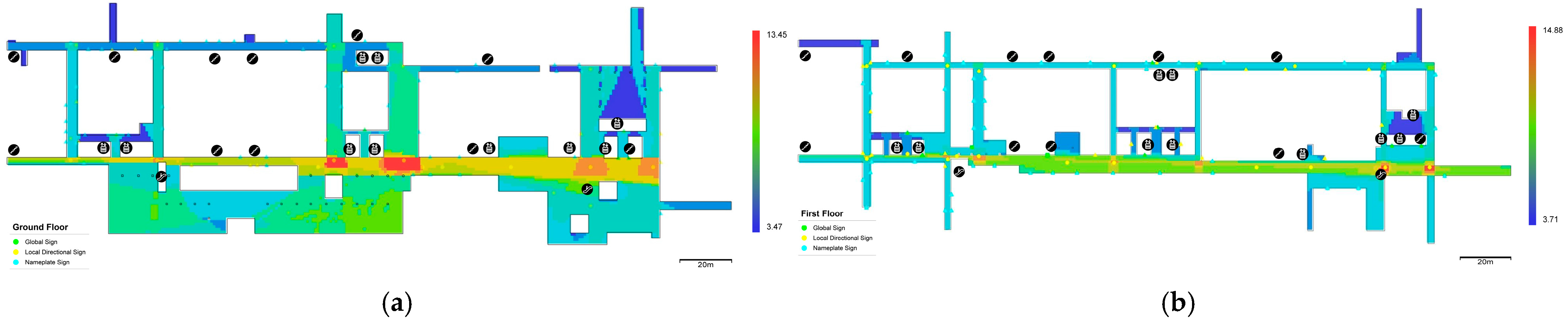
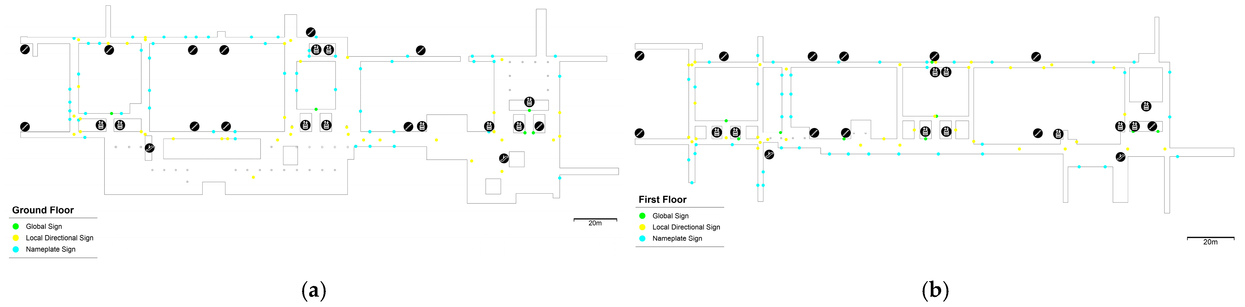
Wayfinding difficulty in large-scale hospitals constitutes a form of healthcare accessibility barrier, affecting patient experience, appointment adherence, and operational efficiency—particularly for elderly, first-time, and cognitively burdened users. This study examines the relationship between spatial configuration and signage distribution as a spatial diagnostic framework for evaluating healthcare navigability, using the outpatient department of Asan Medical Center (AMC), one of the largest tertiary hospitals in Republic of Korea, as a critical case. Using a non-intrusive analytical framework grounded in GIScience and spatial analysis, the study combines axial analysis, Visibility Graph Analysis (VGA), and a georeferenced inventory of 194 wayfinding signs to evaluate the degree of correspondence between movement structure, visual accessibility, and informational support across two outpatient floors. The results show that the outpatient circulation system is organized around a dominant southern horizontal corridor that functions as the principal configurational and visual spine. Existing signage is spatially concentrated along this corridor and at several major nodal intersections; however, no significant monotonic relationship was found between axial integration and signage count on either floor. Instead, the Ground floor showed a significant U-shaped distribution across integration groups, with denser signage in both highly integrated and peripheral segments than in intermediate-integration segments, while the First floor showed a comparatively even distribution. Together with the VGA and georeferenced signage analyses, these results reveal a differentiated spatial relationship that cannot be explained by a simple reinforcement model alone. These findings demonstrate the importance of evaluating how informational support is distributed across spatially differentiated environments, with implications for healthcare accessibility planning and evidence-based hospital design.
Keywords: wayfinding; space syntax; hospital design; spatial complexity; signage systems; visibility graph analysis; healthcare accessibility; GIScience; spatial analysis; Korean hospitals wayfinding; space syntax; hospital design; spatial complexity; signage systems; visibility graph analysis; healthcare accessibility; GIScience; spatial analysis; Korean hospitals