Article

Investigating Flood Impact on Crop Production under a Comprehensive and Spatially Explicit Risk Evaluation Framework
1
College of Urban and Environmental Sciences, Peking University, No.5 Yiheyuan Road, Haidian District, Beijing 100871, China
2
Handan Hydrology and Water Resources Survey Bureau of Hebei Province, Handan 056001, China
3
School of Architecture, Building and Civil Engineering, Loughborough University, Loughborough LE11 3TU, UK
*
Author to whom correspondence should be addressed.
Agriculture 2022, 12(4), 484; https://doi.org/10.3390/agriculture12040484

Submission received: 25 January 2022 / Revised: 27 March 2022 / Accepted: 29 March 2022 / Published: 30 March 2022

Abstract

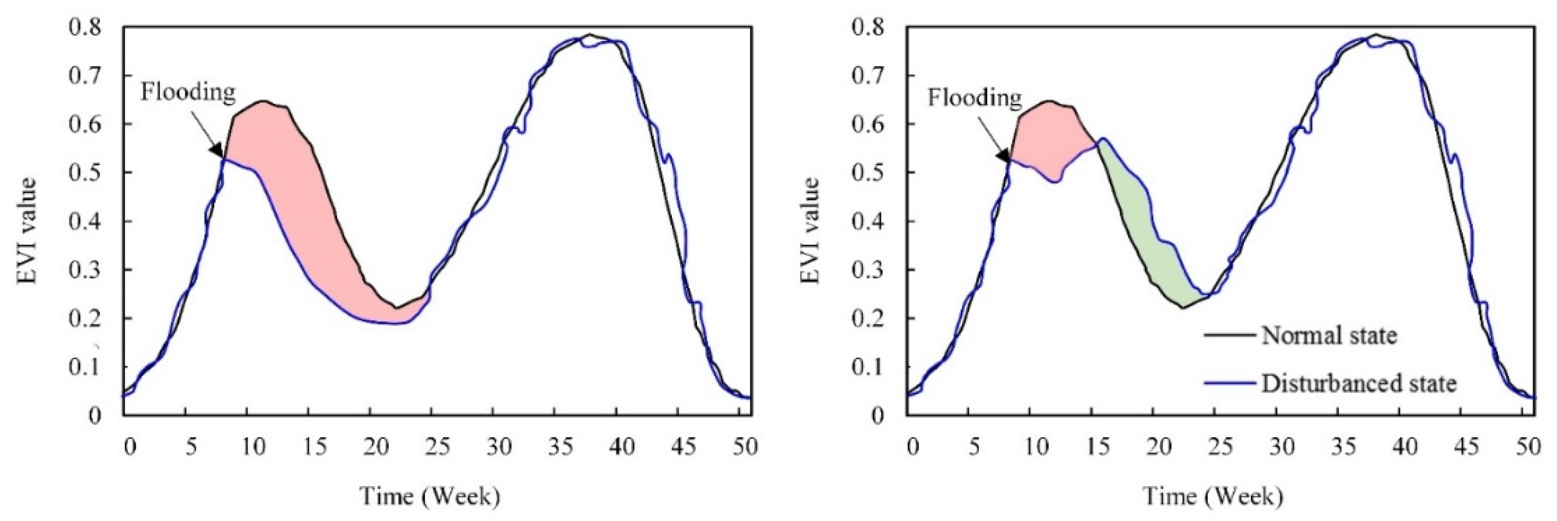
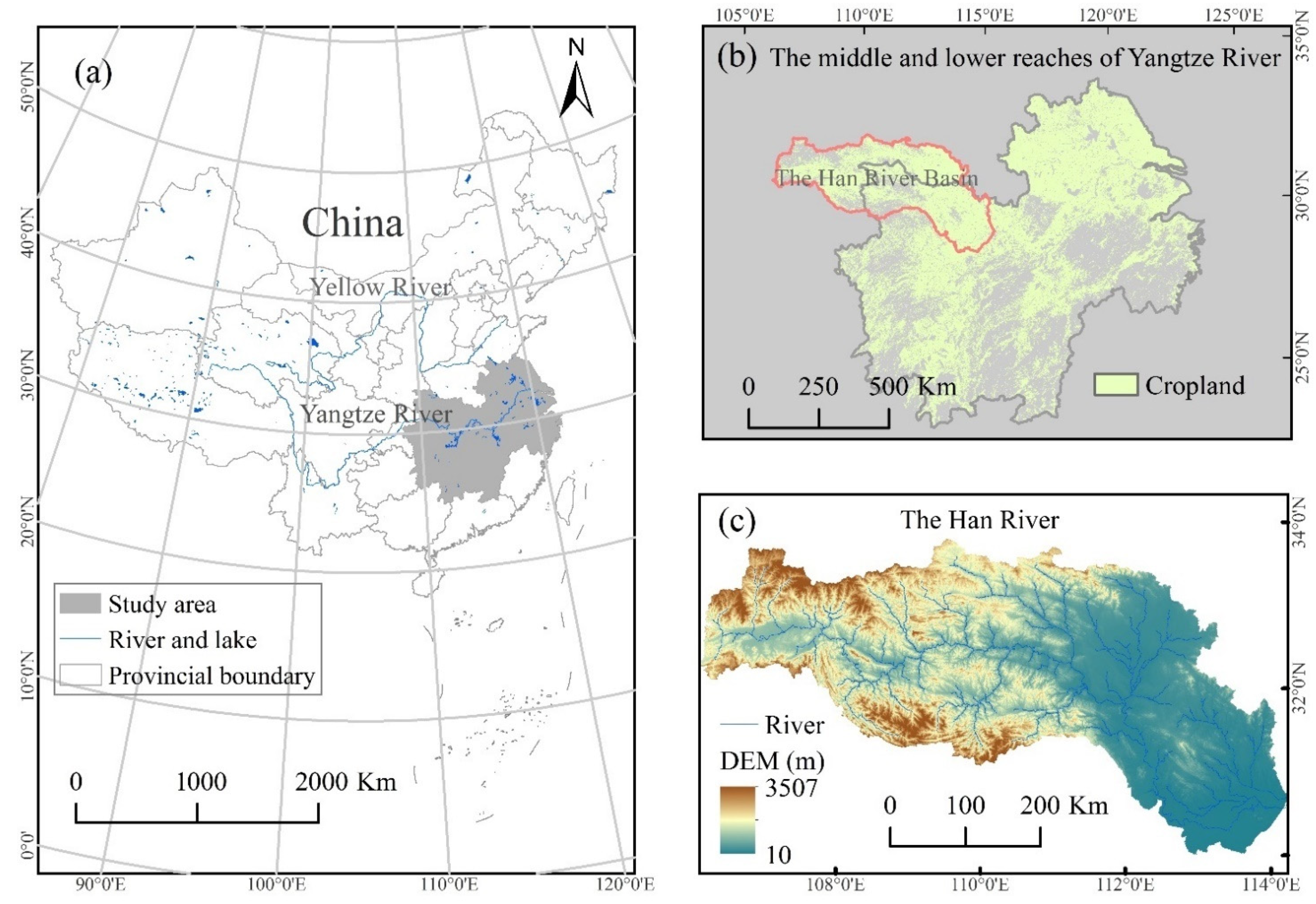
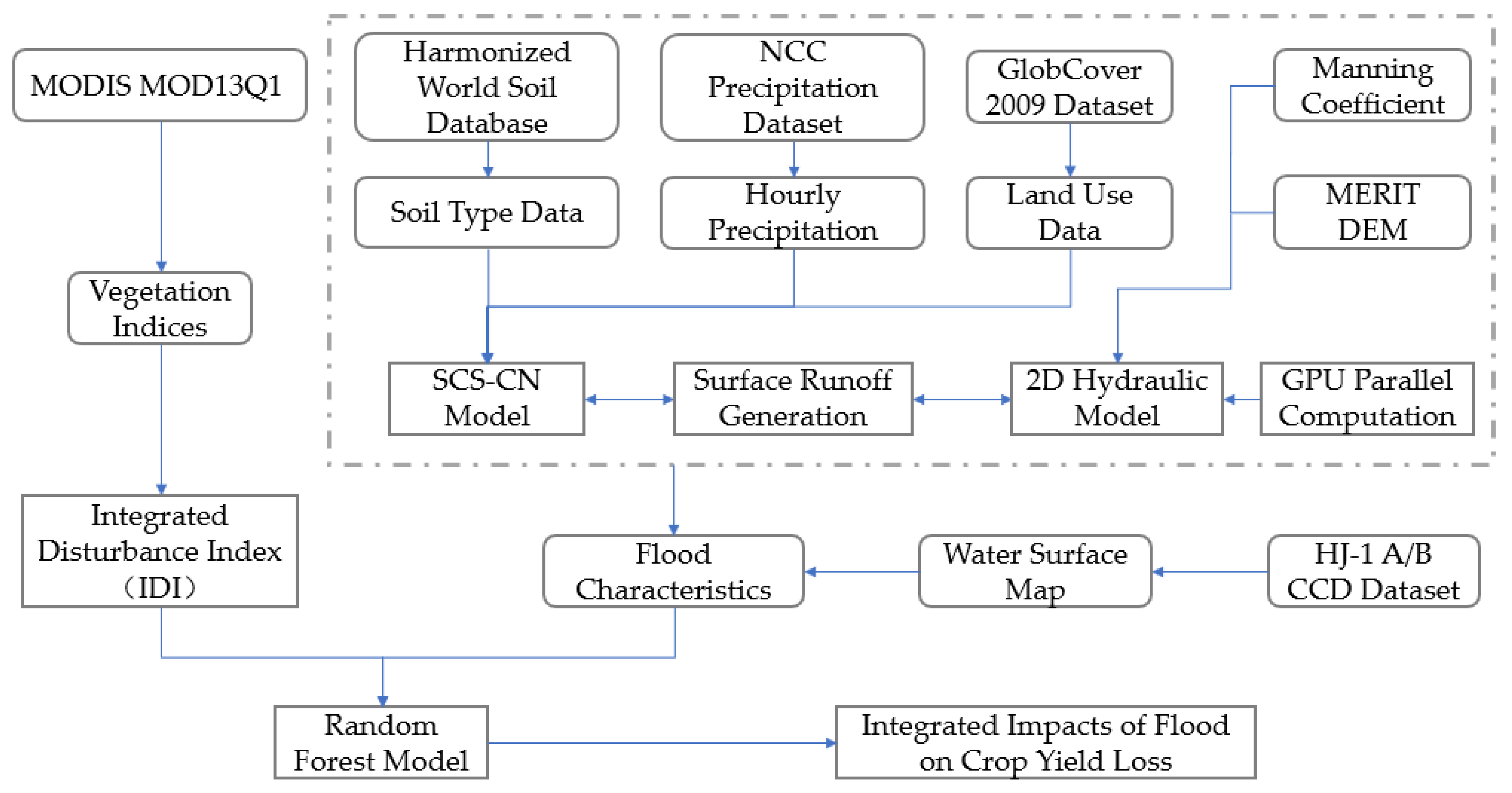
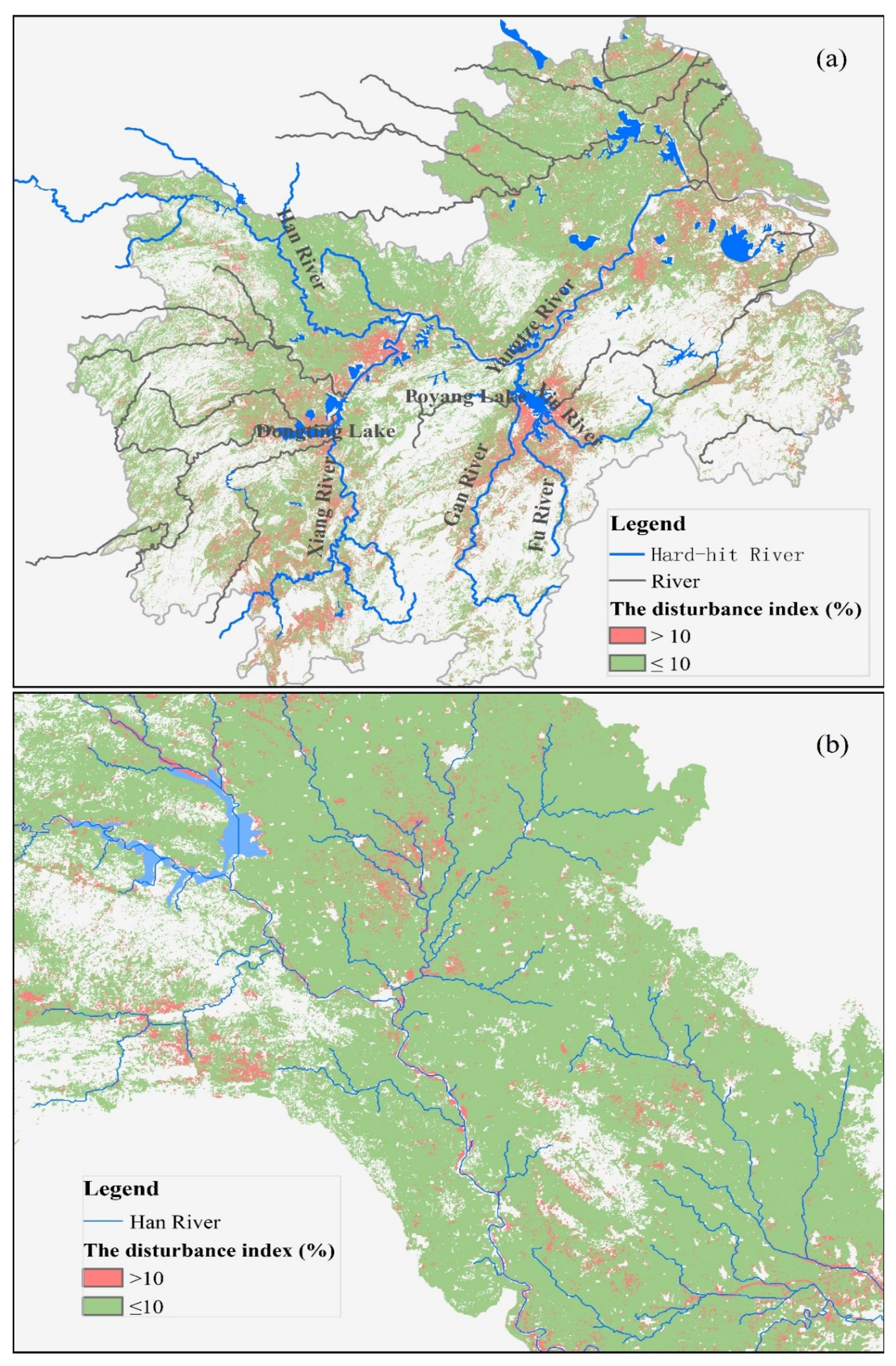
Due to the projected increased frequency of occurrence of extreme flood events, it is becoming increasingly important to pay attention to agricultural flood management. The middle and lower reaches of the Yangtze River Basin (MLYRB), as one of the most important agricultural areas in the world, frequently suffer from the ravages of long-duration extreme flood events. Comprehensive flood risk evaluation can provide important support for effective management strategies by focusing on the combination of flood hazard and the consequences of flooding in areas exposed to the inundation. Previous satellite-based flood disturbance detection methods intended for use in single-cropping agricultural systems cannot be applied to the MLYRB with multi-cropping practices and long-duration flood events. Additionally, comprehensive agricultural flood risk evaluations traditionally neglect the characteristics of the impact of flooding with strong spatial and temporal variability. Thus, in this research, an integrated disturbance index (IDI) was developed to detect the impact of flood disturbance on crop growth, aiming to acquire a map of crop damage condition for a multi-cropping agricultural system with long-duration flood events that is spatially explicit and has a sufficiently high spatial resolution. A coupled hydrological and 2D hydraulic model parallelized using the GPU approach was employed to simulate flood flows, aiming at deriving sufficient meaningful detail at the local scale in terms of flood inundation patterns and processes over the whole natural watershed. Additionally, a spatial map of the combined effects of flood hazard and the consequences of flooding was used to investigate the relationship between flood characteristics and associated loss extent with the random forest model. The comprehensive evaluation framework was applied for the 2010 flood event in the MLYRB. The evaluation results indicate that the detection results based on IDI are consistent with the governmental statistics, the most hard-hit areas in related reports, and the spatial characteristics of river floods. The coupled hydrological–hydraulic model offers a clear picture of the flood characteristics over the whole basin, while simultaneously ensuring a sufficiently high spatial resolution. Our findings show that flood duration is the most important predictor in predicting crop damage extent.
Keywords: flooding; crop production; disturbance detection index; two-dimensional hydraulic model; spatial characteristics flooding; crop production; disturbance detection index; two-dimensional hydraulic model; spatial characteristics