Article

Research on the Jiamusi Area’s Shallow Groundwater Recharge Using Remote Sensing and the SWAT Model

1
School of Hydraulic and Electric Power, Heilongjiang University, Harbin 150080, China
2
Institute of Groundwater Cold Region, Heilongjiang University, Harbin 150080, China
3
International Joint Laboratory of Hydrology and Hydraulic Engineering in Cold Regions of Heilongjiang Province, Harbin 150080, China
*
Author to whom correspondence should be addressed.
Appl. Sci. 2024, 14(16), 7220; https://doi.org/10.3390/app14167220
Submission received: 8 July 2024 / Revised: 18 July 2024 / Accepted: 13 August 2024 / Published: 16 August 2024
(This article belongs to the Special Issue Sustainable Environment and Water Resource Management)

Abstract

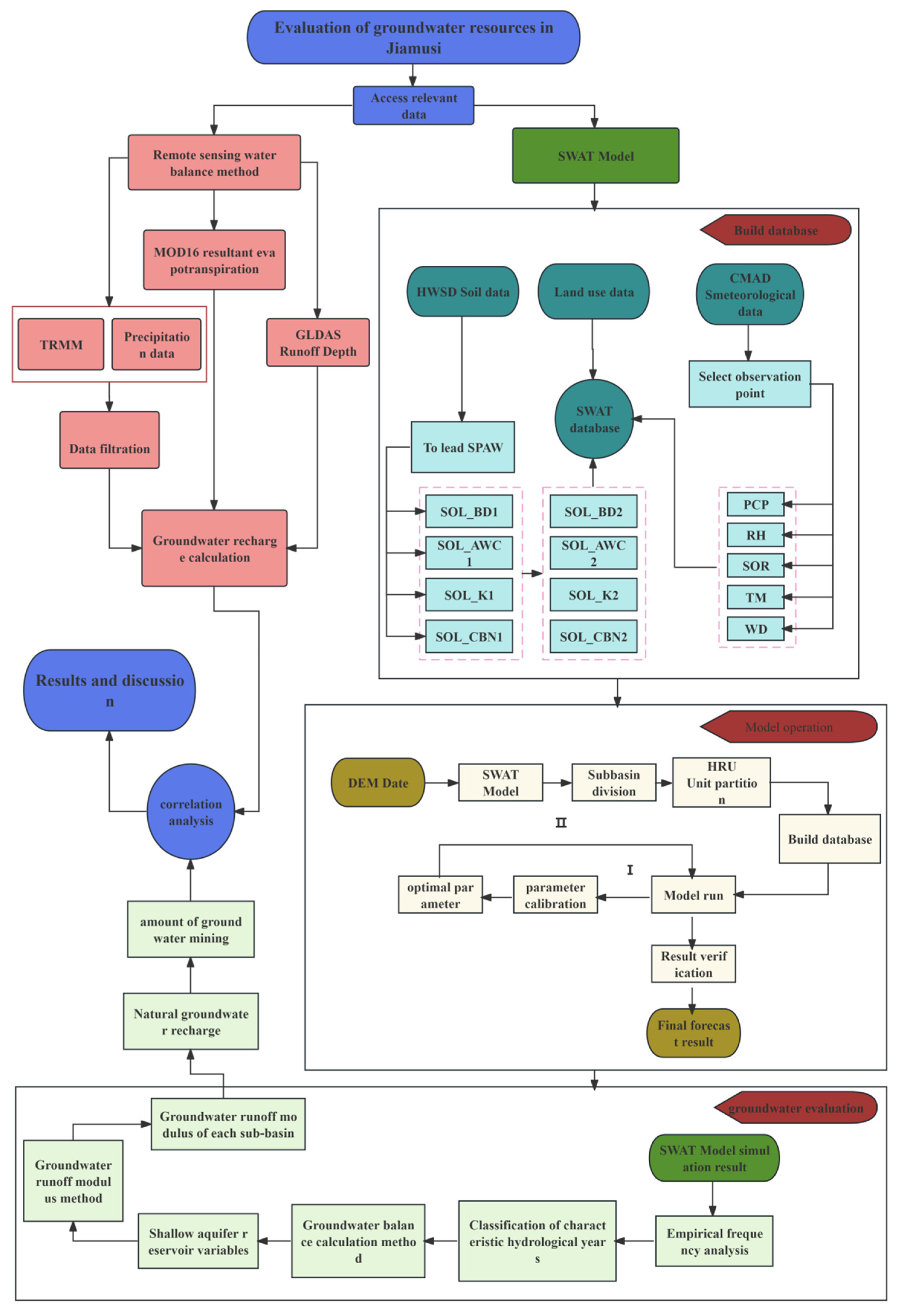
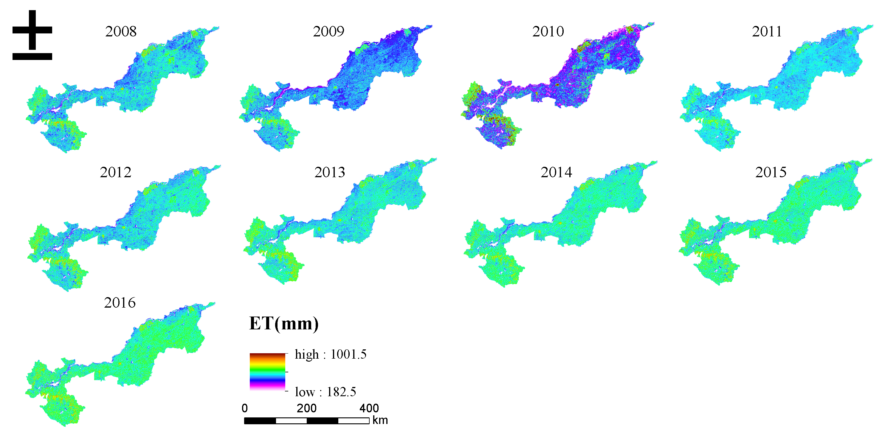
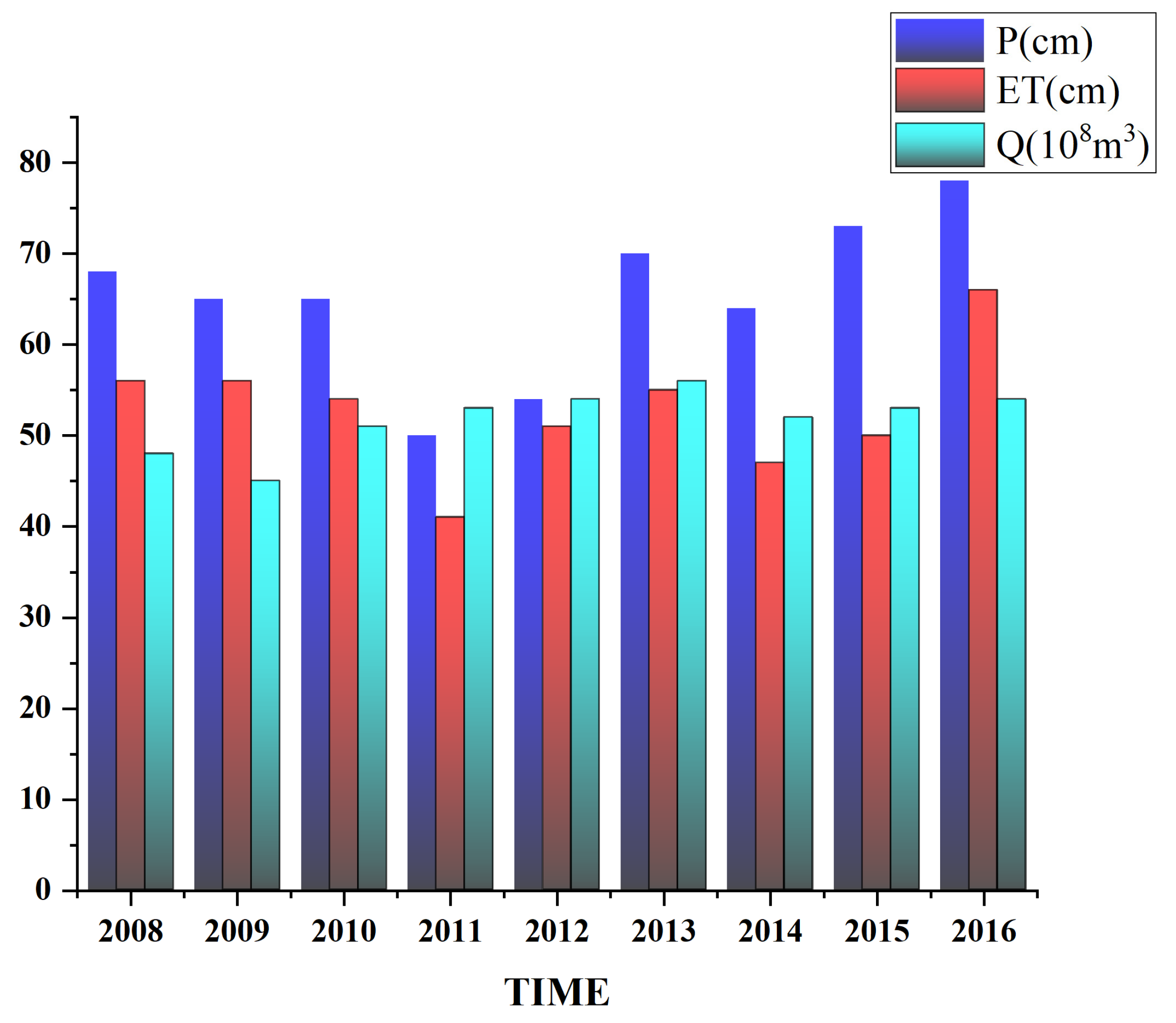
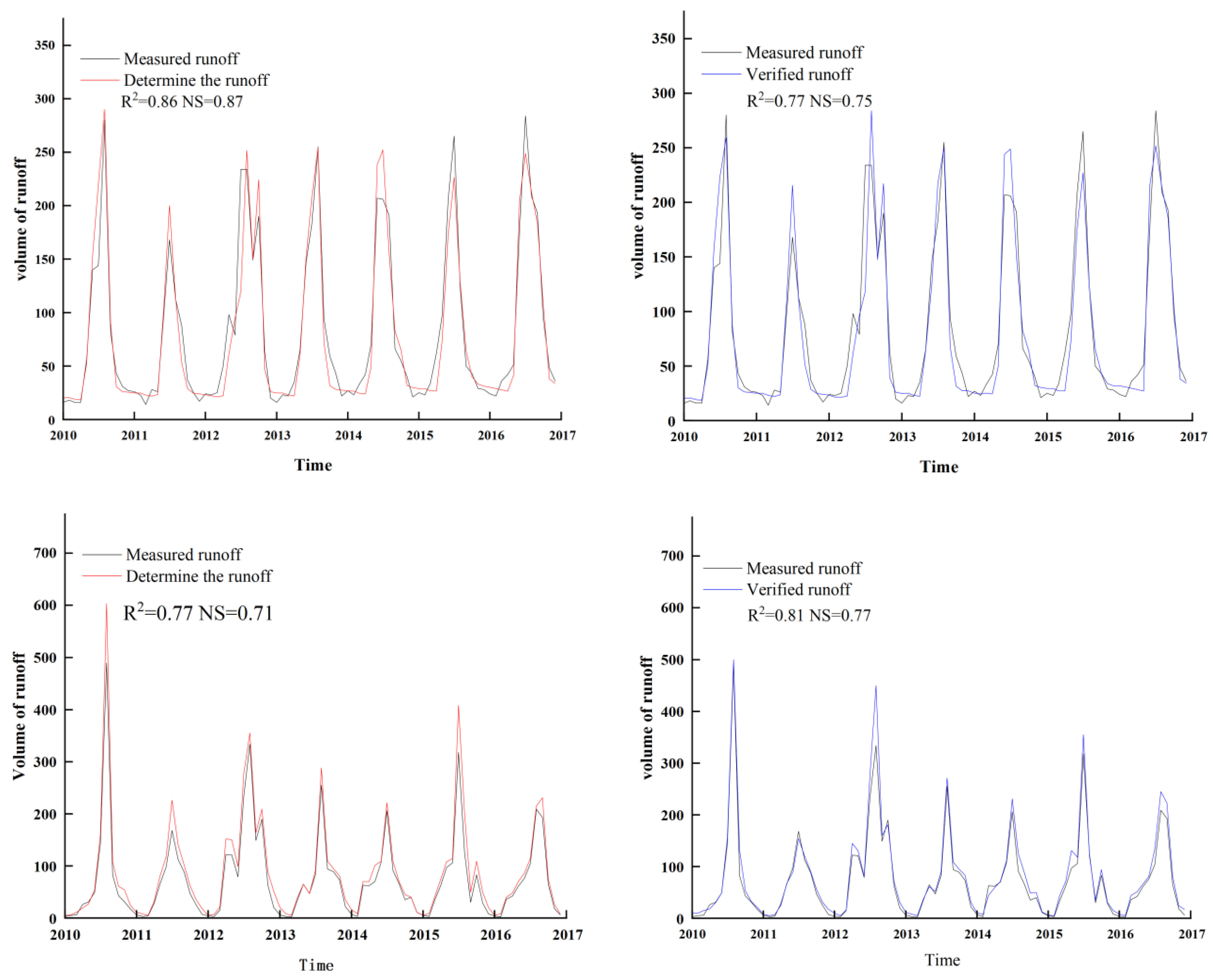
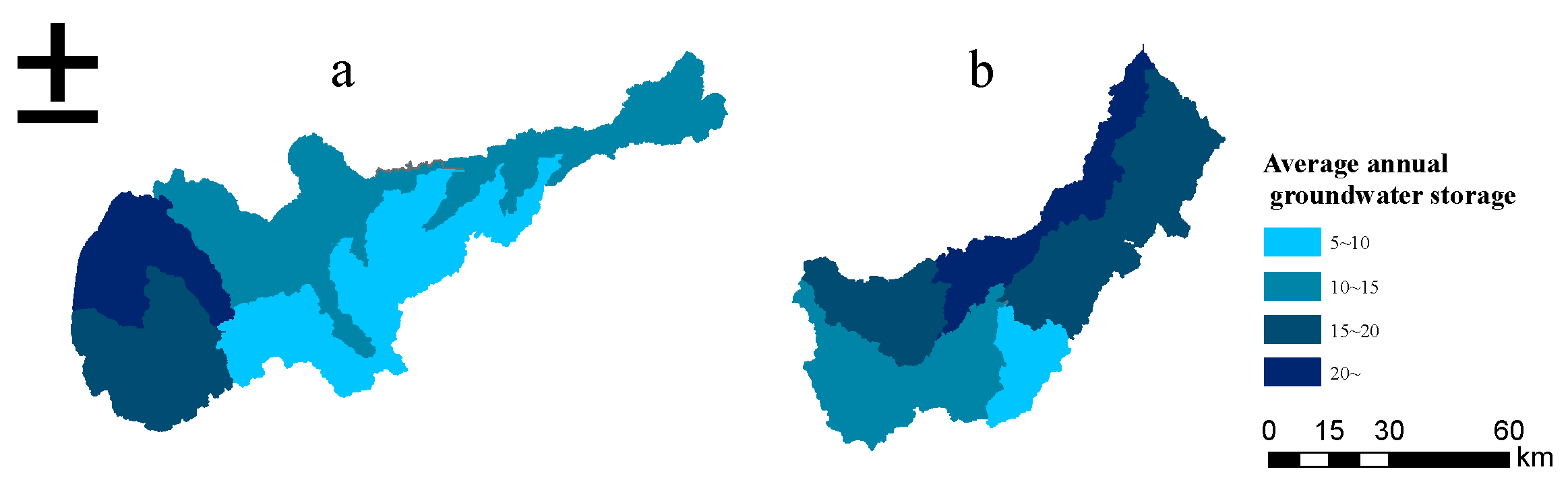
Jiamusi is situated in Heilongjiang Province, China, in the center of the Sanjiang Plain. The 1980s’ overplanting of paddy fields resulted in a decrease in groundwater levels, scarcity of groundwater resources, and frequent earth collapses. Examining and safeguarding the groundwater resources in this region has emerged as a crucial subject. In light of this, this paper uses the remote sensing water balance method and the SWAT distributed hydrological model to calculate groundwater resources in the Jiamusi area. It also conducts scientific experiments by examining various factors, including rainfall, the degree of water supply, soil type, and land use. The measured monthly runoff of Jiamusi City’s Tongjiang and Fuyuan City’s hydrology stations was utilized to establish the model parameters for the SWAT model. A preliminary assessment of the distribution features of shallow groundwater in the Jiamusi area is conducted using the two methodologies mentioned above, and the following results are reached: (1) Tongjiang Hydrological Station and Fuyuan Hydrological Station both had good runoff modeling results, with R2 and NS values of 0.81, 0.77, and 0.77, 0.75, respectively. (2) The SWAT model works well for assessing groundwater resources. Between 2010 and 2016 (two preheating years), Jiamusi’s average groundwater recharge was 61.03 × 10⁸ m3, with a recoverable amount of 27.4 × 10⁸ m3. (3) Based on the remote sensing water balancing approach, the average exploitable quantity of groundwater recharge in the Jiamusi area between 2008 and 2016 is 23.94 × 10⁸ m3, while the average recharge in the area is 53.2 × 10⁸ m3. (4) The Jiamusi metropolitan area is the core of the groundwater phreatic reservoir water reserves, which progressively decline in both the northeast and southeast directions. It falls to the southwest as Fuyuan City’s center. The Songhua River’s main stream area near Tongjiang City has the least volume of water reserves in the phreatic layer, and the area’s groundwater reserves converge to the southeast and northwest, where surface water makes up the majority of the water resources.
Keywords: groundwater recharge; groundwater resource assessment; runoff simulation; Sanjiang Plain; SWAT model; remote sensing groundwater recharge; groundwater resource assessment; runoff simulation; Sanjiang Plain; SWAT model; remote sensing