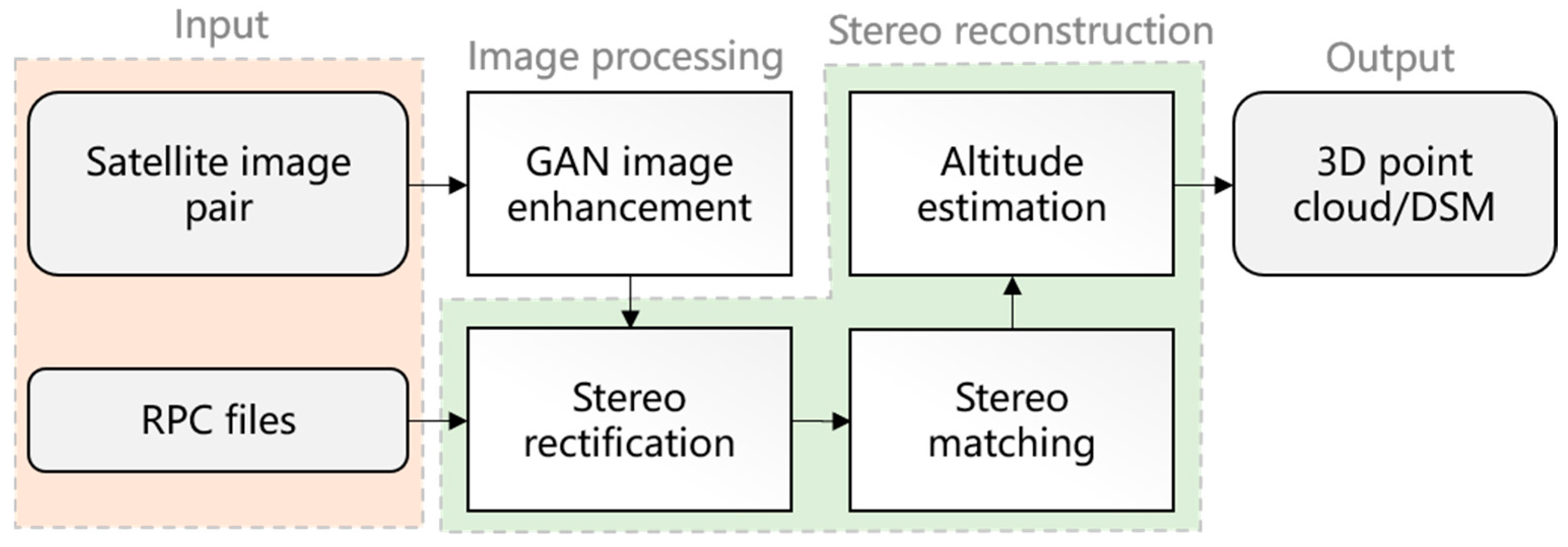
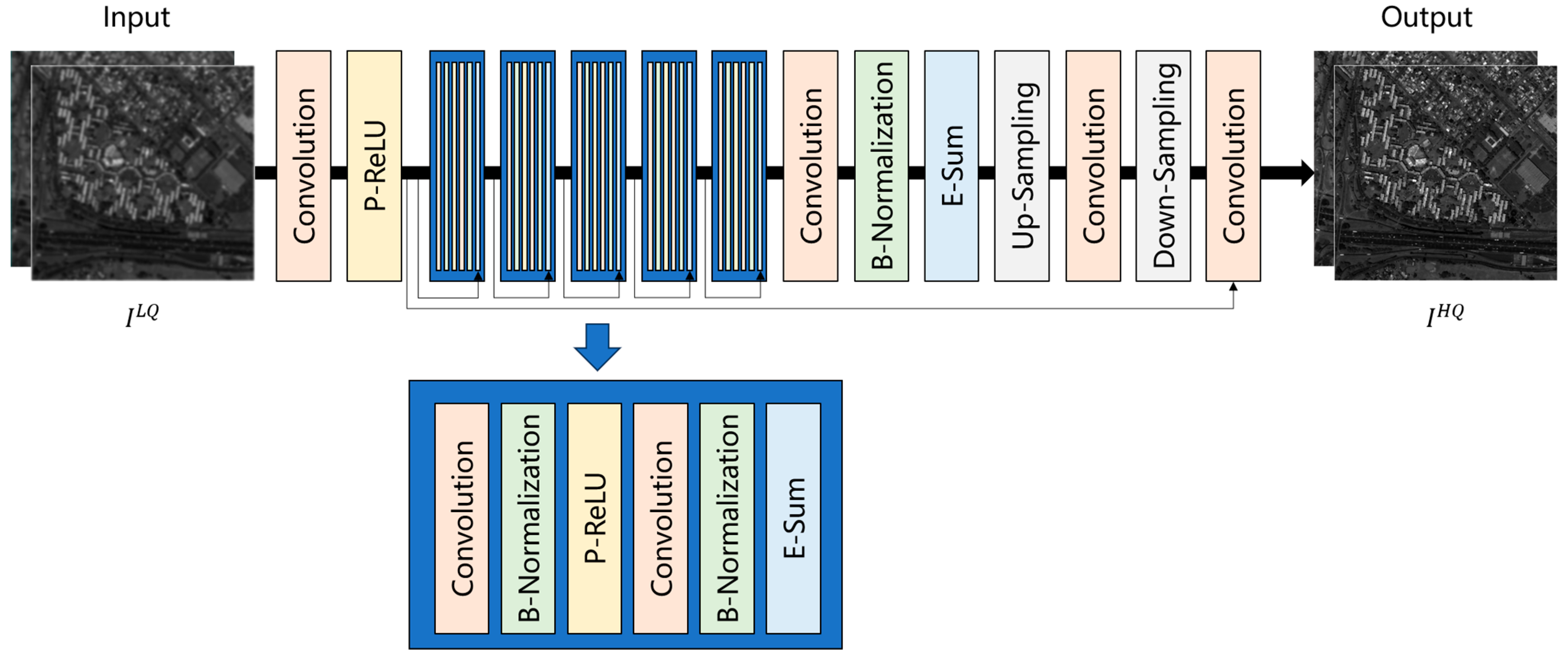
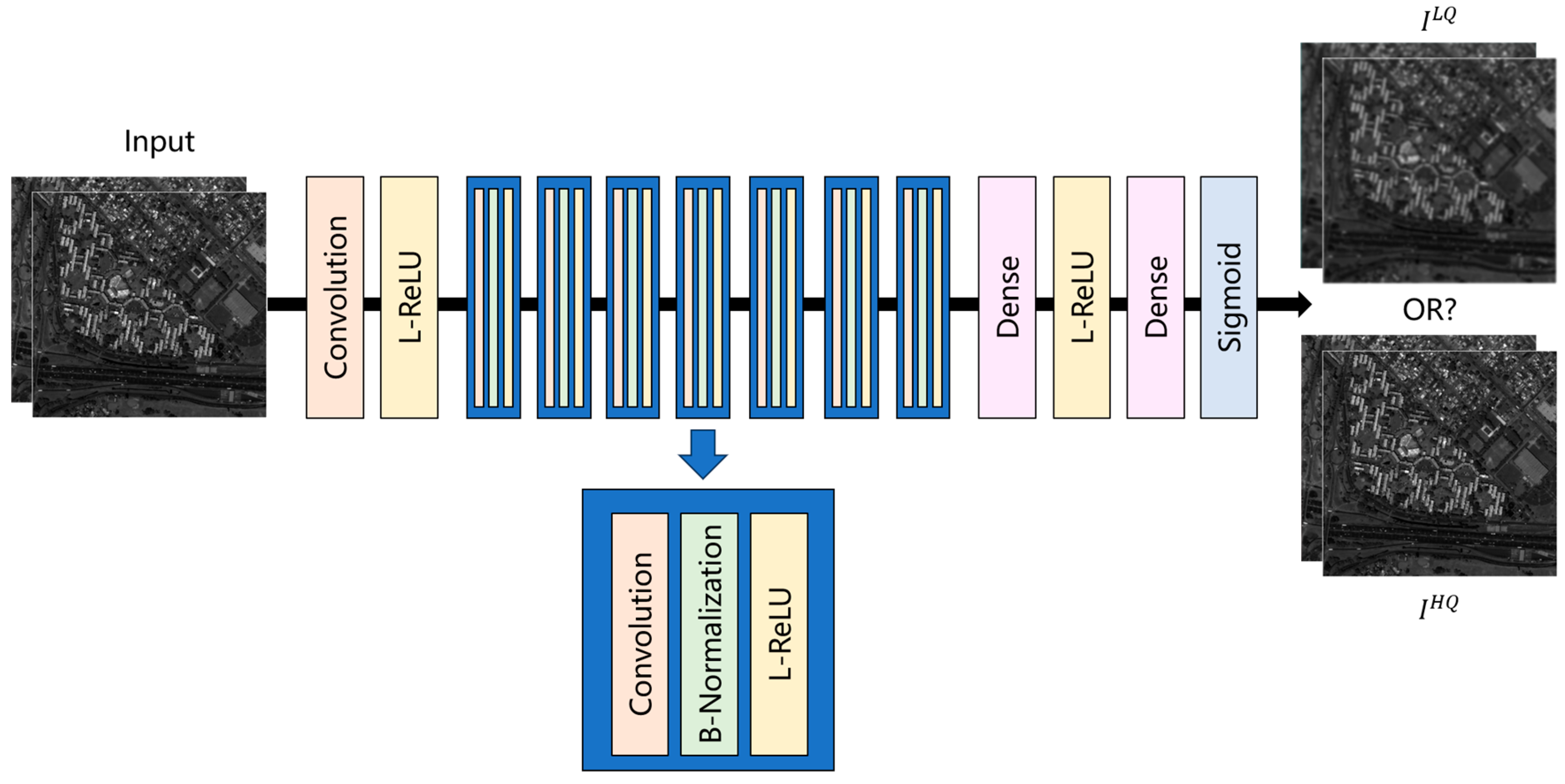
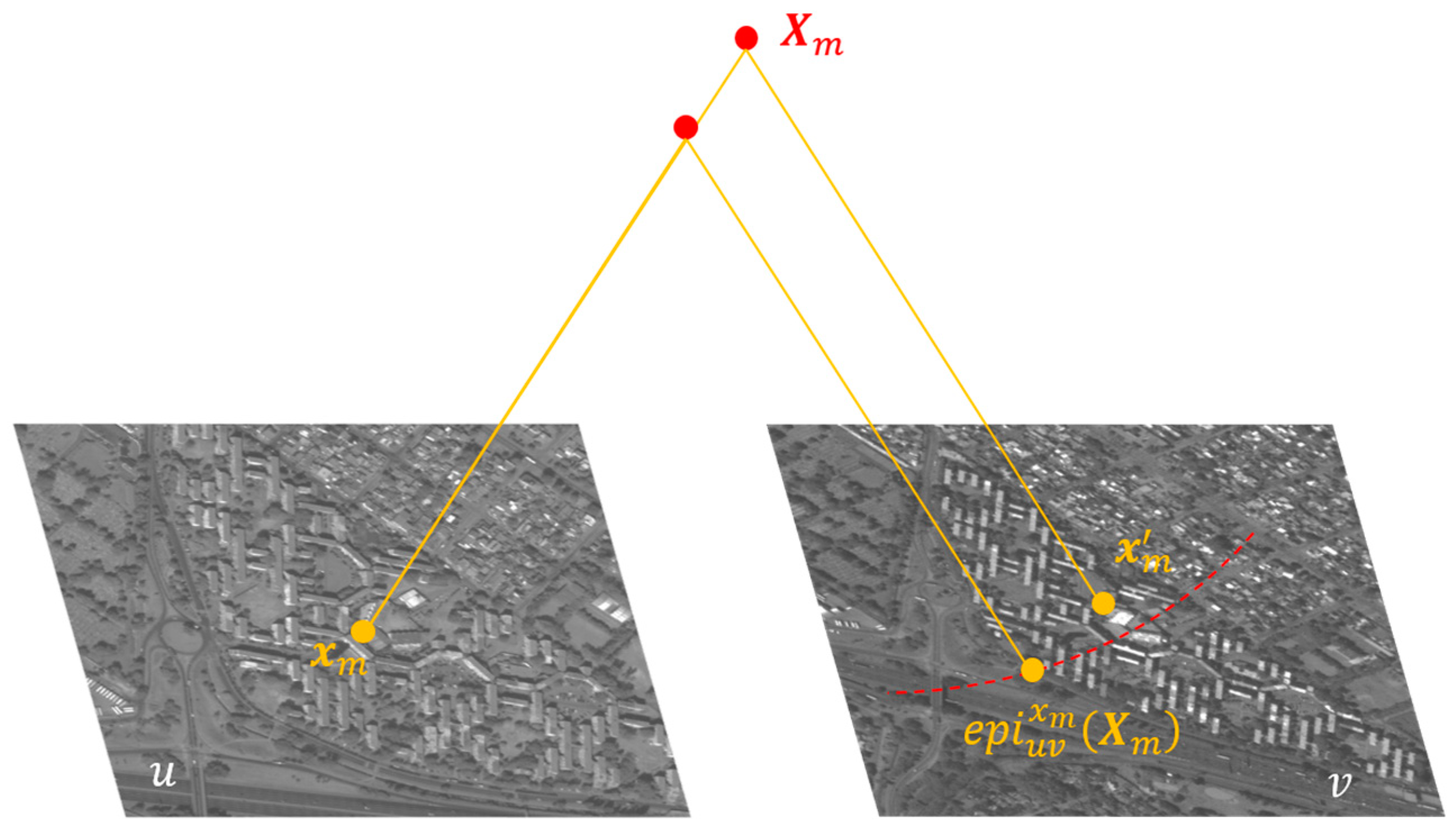
An Improved 3D Reconstruction Method for Satellite Images Based on Generative Adversarial Network Image Enhancement

Abstract
Share and Cite
Li, H.; Yin, J.; Jiao, L. An Improved 3D Reconstruction Method for Satellite Images Based on Generative Adversarial Network Image Enhancement. Appl. Sci. 2024, 14, 7177. https://doi.org/10.3390/app14167177
Li H, Yin J, Jiao L. An Improved 3D Reconstruction Method for Satellite Images Based on Generative Adversarial Network Image Enhancement. Applied Sciences. 2024; 14(16):7177. https://doi.org/10.3390/app14167177
Chicago/Turabian StyleLi, Henan, Junping Yin, and Liguo Jiao. 2024. "An Improved 3D Reconstruction Method for Satellite Images Based on Generative Adversarial Network Image Enhancement" Applied Sciences 14, no. 16: 7177. https://doi.org/10.3390/app14167177
APA StyleLi, H., Yin, J., & Jiao, L. (2024). An Improved 3D Reconstruction Method for Satellite Images Based on Generative Adversarial Network Image Enhancement. Applied Sciences, 14(16), 7177. https://doi.org/10.3390/app14167177