Cold-Water Coral Habitat Mapping: Trends and Developments in Acquisition and Processing Methods


Abstract
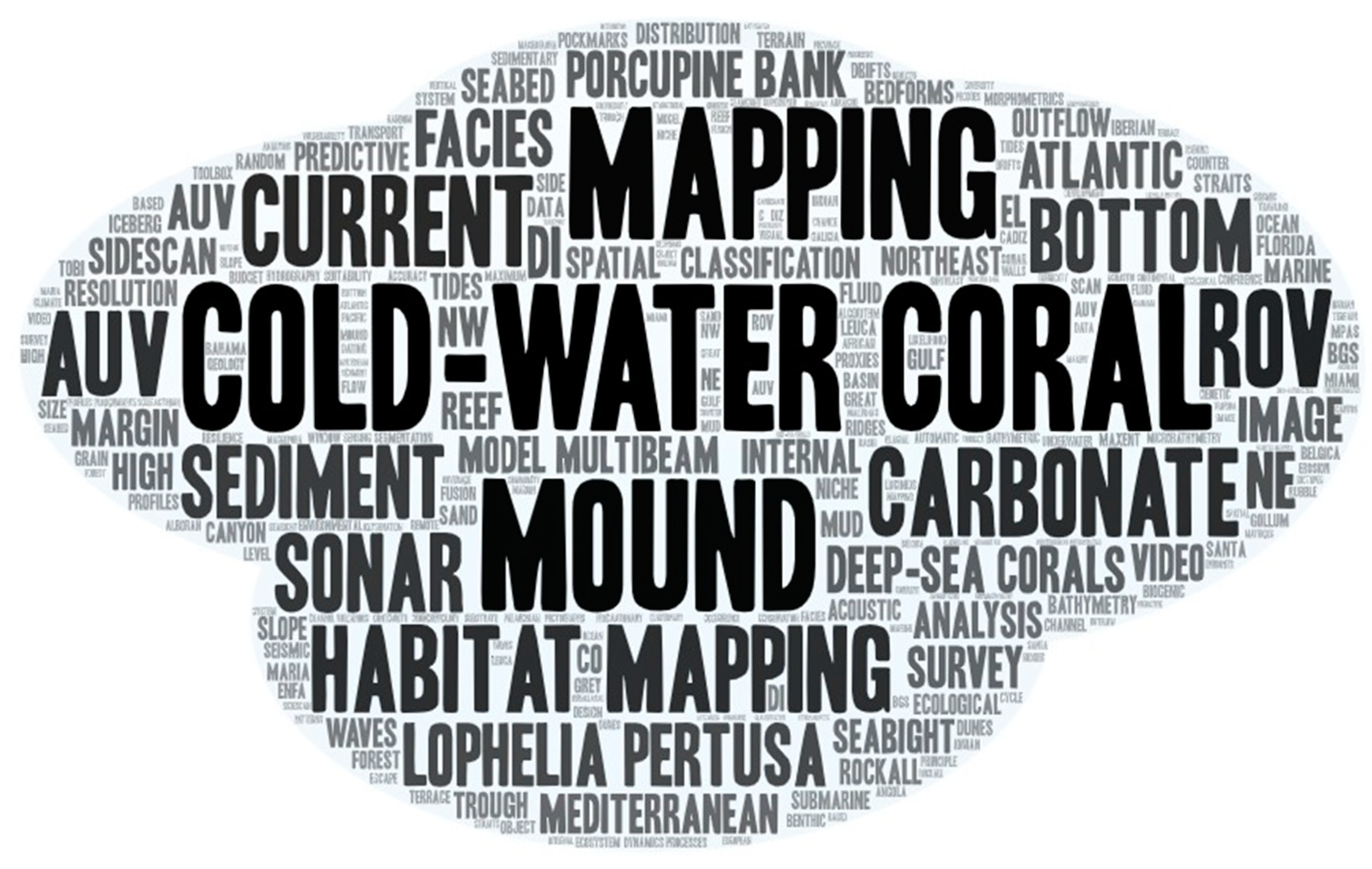
1. Introduction
2. Future Mapping Perspectives
3. Surveying Cold-Water Coral Habitats
4. Acquisition Methods
5. Processing Methods
6. Concluding Remarks
Author Contributions
Funding
Conflicts of Interest
References
- Mayer, L.; Jakobsson, M.; Allen, G.; Dorschel, B.; Falconer, R.; Ferrini, V.; Lamarche, G.; Snaith, H.; Weatherall, P. The Nippon Foundation—GEBCO Seabed 2030 Project: The Quest to See the World’s Oceans Completely Mapped by 2030. Geosciences 2018, 8, 63. [Google Scholar] [CrossRef]
- Danovaro, R.; Dell’Anno, A.; Pusceddu, A. Biodiversity response to climate change in a warm deep sea. Ecol. Lett. 2004, 7, 821–828. [Google Scholar] [CrossRef]
- Roberts, J.M.; Wheeler, A.J.; Cairns, S.; Freiwald, A. Cold-Water Corals: The Biology and Geology of Deep-Sea Coral Habitats; Cambridge University Press: Cambridge, UK, 2009. [Google Scholar]
- Freiwald, A. Ocean Margin Systems; Wefer, G., Billet, D., Hebbeln, D., Jorgensen, B.B., Schlüter, M., Van Weering, T.C., Eds.; Hanse Conference Report; Springer: Berlin/Heidelberg, Germany, 2002; pp. 365–385. [Google Scholar]
- Roberts, J.M.; Long, D.; Wilson, J.B.; Mortensen, P.B.; Gage, J.D. The cold-water coral Lophelia pertusa (Scleractinia) and enigmatic seabed mounds along the north-east Atlantic margin: Are they related? Mar. Pollut. Bull. 2003, 46, 7–20. [Google Scholar] [CrossRef]
- Addamo, A.M.; Vertino, A.; Stolarski, J.; García-Jiménez, R.; Taviani, M.; Machordom, A. Merging scleractinian genera: The overwhelming genetic similarity between solitary Desmophyllum and colonial Lophelia. BMC Evolut. Biol. 2016, 16, 108. [Google Scholar]
- Mienis, F.; Duineveld, G.C.A.; Davies, A.J.; Ross, S.W.; Seim, H.; Bane, J.; Van Weering, T.C.E. The influence of near-bed hydrodynamic conditions on cold-water corals in the Viosca Knoll area, Gulf of Mexico. Deep Sea Red. Part I Oceanogr. Res. Pap. 2012, 60, 32–45. [Google Scholar] [CrossRef]
- Mienis, F.; de Stigter, H.C.; de Haas, H.; van Weering, T.C.E. Near-bed particle deposition and resuspension in a cold-water coral mound area at the Southwest Rockall Trough margin, NE Atlantic. Deep Sea Res. Part I 2009, 56, 1026–1038. [Google Scholar] [CrossRef]
- Mienis, F.; de Stigter, H.C.; White, M.; Duineveld, G.; de Haas, H.; van Weering, T.C.E. Hydrodynamic controls on cold-water coral growth and carbonate-mound development at the SW and SE Rockall Trough Margin, NE Atlantic Ocean. Deep Sea Res. I 2007, 54, 1655–1674. [Google Scholar] [CrossRef]
- De Clippele, L.H.; Huvenne, V.A.; Orejas, C.; Lundälv, T.; Fox, A.; Hennige, S.J.; Roberts, J.M. The effect of local hydrodynamics on the spatial extent and morphology of cold-water coral habitats at Tisler Reef, Norway. Coral Reefs 2018, 37, 253–266. [Google Scholar] [CrossRef]
- Orejas, C.; Gori, A.; Rad-Menéndez, C.; Last, K.S.; Davies, A.J.; Beveridge, C.M.; Sadd, D.; Kiriakoulakis, K.; Witte, U.; Roberts, J.M. The effect of flow speed and food size on the capture efficiency and feeding behaviour of the cold-water coral Lophelia pertusa. J. Exp. Mar. Biol. Ecol. 2016, 481, 34–40. [Google Scholar] [CrossRef]
- Wilson, J.B. “Patch” development of the deep-water coral Lophelia pertusa (L.) on the Rockall bank. J. Mar. Biol. Assoc. UK 1979, 59, 165–177. [Google Scholar] [CrossRef]
- Thierens, M.; Titschack, J.; Dorschel, B.; Huvenne, V.A.; Wheeler, A.J.; Stuut, J.B.; O’donnell, R. The 2.6 Ma depositional sequence from the Challenger cold-water coral carbonate mound (IODP Exp. 307): Sediment contributors and hydrodynamic palaeo-environments. Mar. Geol. 2010, 271, 260–277. [Google Scholar] [CrossRef]
- Titschack, J.; Thierens, M.; Dorschel, B.; Schulbert, C.; Freiwald, A.; Kano, A.; Takashima, C.; Kawagoe, N.; Li, X.; Expedition, I.O.D.P. Carbonate budget of a cold-water coral mound (Challenger Mound, IODP Exp. 307). Mar. Geol. 2009, 259, 36–46. [Google Scholar] [CrossRef]
- Davies, J.S.; Guillaumont, B.; Tempera, F.; Vertino, A.; Beuck, L.; Ólafsdóttir, S.H.; Smith, C.J.; Fosså, J.H.; Van den Beld, I.M.J.; Savini, A.; et al. A new classification scheme of European cold-water coral habitats: Implications for ecosystem-based management of the deep sea. Deep Sea Res. Part II Top. Stud. Oceanogr. 2017, 145, 102–109. [Google Scholar] [CrossRef]
- Carlier, A.; Le Guilloux, E.; Olu, K.; Sarrazin, J.; Mastrototaro, F.; Taviani, M.; Clavier, J. Trophic relationships in a deep Mediterranean cold-water coral bank (Santa Maria di Leuca, Ionian Sea). Mar. Ecol. Progr. Ser. 2010, 397, 125–137. [Google Scholar] [CrossRef]
- van Oevelen, D.; Duineveld, G.; Lavaleye, M.S.S.; Mienis, F.; Soetaert, K.; Heip, C. The cold-water coral community as a hot spot for carbon cycling on continental margins: A food-web analysis from Rockall Bank (northeast Atlantic). Limnol. Oceanogr. 2009, 54, 1829–1844. [Google Scholar] [CrossRef]
- Duineveld, G.C.A.; Lavaleye, M.S.S.; Bergman, M.J.N.; de Stigter, H.C.; Mienis, F. Trophic structure of a cold-water coral mound community (Rockall Bank, NE Atlantic) in relation to the near-bottom particle supply and current regime. Bull. Mar. Sci. 2007, 81, 449–467. [Google Scholar]
- Roberts, J.M.; Wheeler, A.J.; Freiwald, A. Reefs of the Deep: The Biology and Geology of Cold-Water Coral Ecosystems. Science 2006, 312, 543–547. [Google Scholar] [CrossRef]
- Huvenne, V.A.I.; Bett, B.J.; Masson, D.G.; Le Bas, T.P.; Wheeler, A.J. Effectiveness of a deep-sea cold-water coral Marine Protected Area, following eight years of fisheries closure. Biol. Conserv. 2016, 200, 60–69. [Google Scholar] [CrossRef]
- UNEP World Conservation Monitoring Centre, and Census of Marine Life on Seamounts (Programme). Data Analysis Working Group. Seamounts, Deep-Sea Corals and Fisheries: Vulnerability of Deep-Sea Corals to Fishing on Seamounts Beyond Areas of National Jurisdiction; UNEP-WCMC: Cambridge, UK, 2006. [Google Scholar]
- Cordes, E.; Arnaud-Haond, S.; Bergstad, O.-A.; da Costa Falcão, A.P.; Freiwald, A.; Roberts, J.M.; Bernal, P. Cold-Water Corals. In The First Global Integrated Marine Assessment: World Ocean Assessment I; United Nations: New York, NY, USA, 2016. [Google Scholar]
- Wölfl, A.C.; Snaith, H.; Amirebrahimi, S.; Devey, C.W.; Dorschel, B.; Ferrini, V.; Huvenne, V.A.; Jakobsson, M.; Jencks, J.; Johnston, G.; et al. Seafloor Mapping—The Challenge of a Truly Global Ocean Bathymetry. Front. Mar. Sci. 2019, 6, 283. [Google Scholar] [CrossRef]
- De Oliveira Pires, D. The azooxanthellate coral fauna of Brazil. Bull. Mar. Sci. 2007, 81, 265–272. [Google Scholar]
- Kitahara, M.V. Species richness and distribution of azooxanthellate Scleractinia in Brazil. Bull. Mar. Sci. 2007, 81, 497–518. [Google Scholar]
- Le Guilloux, E.; Olu, K.; Bourillet, J.F.; Savoye, B.; Iglésias, S.P.; Sibuet, M. First observations of deep-sea coral reefs along the Angola margin. Deep Sea Res. Part II Top. Stud. Oceanogr. 2009, 56, 2394–2403. [Google Scholar] [CrossRef]
- Buhl-Mortensen, P. Coral reefs in the Southern Barents Sea: Habitat description and the effects of bottom fishing. Mar. Biol. Res. 2017, 13, 1027–1040. [Google Scholar] [CrossRef]
- Wells, J.W.; Hedgpeth, J.W. Treatise on Marine Ecology and Paleoecolog; Geological Society of America: Boulder, CO, USA, 1957; Volume 67V10. [Google Scholar]
- Grasmueck, M.; Eberli, G.P.; Viggiano, D.A.; Correa, T.; Rathwell, G.; Luo, J. Autonomous underwater vehicle (AUV) mapping reveals coral mound distribution, morphology, and oceanography in deep water of the Straits of Florida. Geophys. Res. Lett. 2006, 33, L23616. [Google Scholar] [CrossRef]
- Wheeler, A.J.; Beyer, A.; Freiwald, A.; De Haas, H.; Huvenne, V.A.I.; Kozachenko, M.; Olu-Le Roy, K.; Opderbecke, J. Morphology and environment of cold-water coral carbonate mounds on the NW European margin. Int. J. Earth Sci. 2007, 96, 37–56. [Google Scholar] [CrossRef]
- Guinan, J.; Brown, C.; Dolan, M.F.J.; Grehan, A.J. Ecological niche modelling of the distribution of cold-water coral habitat using underwater remote sensing data. Ecol. Inf. 2009, 4, 83–92. [Google Scholar] [CrossRef]
- Heindel, K.; Titschack, J.; Dorschel, B.; Huvenne, V.A.I.; Freiwald, A. The sediment composition and predictive mapping of facies on the Propeller Mound—A cold-water coral mound (Porcupine Seabight, NE Atlantic). Cont. Shelf Res. 2010, 30, 1814–1829. [Google Scholar] [CrossRef]
- Huvenne, V.A.; Tyler, P.A.; Masson, D.G.; Fisher, E.H.; Hauton, C.; Hühnerbach, V.; Le Bas, T.P.; Wolff, G.A. A picture on the wall: Innovative mapping reveals cold-water coral refuge in submarine canyon. PLoS ONE 2011, 6, e28755. [Google Scholar] [CrossRef]
- Huvenne, V.A.I.; Beyer, A.; de Haas, H.; Dekindt, K.; Henriet, J.-P.; Kozachenko, M. Cold-Water Corals and Ecosystems; André Freiwald, A., Murray Roberts, J., Eds.; Springer: Berlin/Heidelberg, Germany, 2005; pp. 535–569. [Google Scholar]
- Mortensen, P.B.; Hovland, M.T.; Fosså, J.H.; Furevik, D.M. Distribution, abundance and size of Lophelia pertusa coral reefs in mid-Norway in relation to seabed characteristics. J. Mar. Biol. Assoc. UK 2001, 81, 581–597. [Google Scholar] [CrossRef]
- Reed, J.K.; Weaver, D.C.; Pomponi, S.A. Habitat and fauna of deep-water Lophelia pertusa coral reefs off the southeastern U.S.: Blake plateau, Straits of Florida, and Gulf of Mexico. Bull. Mar. Sci. 2006, 78, 343–375. [Google Scholar]
- Savini, A.; Vertino, A.; Marchese, F.; Beuck, L.; Freiwald, A. Mapping cold-water coral habitats at different scales within the Northern Ionian Sea (Central Mediterranean): An assessment of coral coverage and associated vulnerability. PLoS ONE 2014, 9, e87108. [Google Scholar] [CrossRef] [PubMed]
- Savini, A.; Corselli, C. High-resolution bathymetry and acoustic geophysical data from Santa Maria di Leuca Cold Water Coral province (Northern Ionian Sea—Apulian continental slope). Deep Sea Res. Part II Top. Stud. Oceanogr. 2010, 57, 326–344. [Google Scholar] [CrossRef]
- Wheeler, A.; Bett, B.; Billett, D.; Masson, D. High resolution side-scan sonar mapping of deep-water coral mounds: Surface morphology and processes affecting growth. Eos Trans. Am. Geophys. Union 2000, 81, F638. [Google Scholar]
- Wienberg, C.; Beuck, L.; Heidkamp, S.; Hebbeln, D.; Freiwald, A.; Pfannkuche, O.; Monteys, X. Franken Mound: Facies and biocoenoses on a newly-discovered “carbonate mound” on the western Rockall Bank, NE Atlantic. Facies 2008, 54, 1–24. [Google Scholar] [CrossRef]
- Jarna, A.; Baeten, N.J.; Elvenes, S.; Bellec, V.K.; Thorsnes, T.; Diesing, M. Semi-Automatic Versus Manual Mapping of Cold-Water Coral Carbonate Mounds Located Offshore Norway. ISPRS Int. J. Geo Inf. 2019, 8, 40. [Google Scholar] [CrossRef]
- Lo Iacono, C.; Savini, A.; Huvenne, V.A.I.; Gràcia, E. Mediterranean Cold-Water Corals: Past, Present and Future: Understanding the Deep-Sea Realms of Coral; Orejas, C., Jiménez, C., Eds.; Springer International Publishing: Berlin/Heidelberg, Germany, 2019; pp. 157–171. [Google Scholar]
- Angeletti, L.; Bargain, A.; Campiani, E.; Foglini, F.; Grande, V.; Leidi, E. Mediterranean Cold-Water Corals: Past, Present and Future: Understanding the Deep-Sea Realms of Coral; Orejas, C., Jiménez, C., Eds.; Springer International Publishing: Berlin/Heidelberg, Germany, 2019; pp. 173–189. [Google Scholar]
- Bargain, A.; Foglini, F.; Pairaud, I.; Bonaldo, D.; Carniel, S.; Angeletti, L.; Taviani, M.; Rochette, S.; Fabri, M.C. Predictive habitat modeling in two Mediterranean canyons including hydrodynamic variables. Pogr. Oceanogr. 2018, 169, 151–168. [Google Scholar] [CrossRef]
- Bargain, A.; Marchese, F.; Savini, A.; Taviani, M.; Fabri, M.-C. Santa Maria di Leuca Province (Mediterranean Sea): Identification of Suitable Mounds for Cold-Water Coral Settlement Using Geomorphometric Proxies and Maxent Methods. Front. Mar. Sci. 2017, 4, 338. [Google Scholar] [CrossRef]
- Mata, D.; Muñoz, A.; Viscasillas, L.; Varas, D. Seafloor Geomorphology as Benthic Habitat, 2nd ed.; Harris, P.T., Baker, E., Eds.; Elsevier: Amsterdam, The Netherlands, 2020; pp. 721–734. [Google Scholar]
- Prampolini, M.; Angeletti, L.; Grande, V.; Taviani, M.; Foglini, F. Seafloor Geomorphology as Benthic Habitat, 2nd ed.; Harris, P.T., Baker, E., Eds.; Elsevier: Amsterdam, The Netherlands, 2020; pp. 793–810. [Google Scholar]
- Brown, C.J.; Smith, S.J.; Lawton, P.; Anderson, J.T. Benthic habitat mapping: A review of progress towards improved understanding of the spatial ecology of the seafloor using acoustic techniques. Estuar. Coast. Shelf Sci. 2011, 92, 502–520. [Google Scholar] [CrossRef]
- Anderson, J.T.; Van Holliday, D.; Kloser, R.; Reid, D.G.; Simard, Y. Acoustic seabed classification: Current practice and future directions. ICES J. Mar. Sci. 2008, 65, 1004–1011. [Google Scholar] [CrossRef]
- Brown, C.J.; Blondel, P. Developments in the application of multibeam sonar backscatter for seafloor habitat mapping. Appl. Acoust. 2009, 70, 1242–1247. [Google Scholar] [CrossRef]
- Le Bas, T.P.; Huvenne, V.A.I. Acquisition and processing of backscatter data for habitat mapping—Comparison of multibeam and sidescan systems. Appl. Acoust. 2009, 70, 1248–1257. [Google Scholar] [CrossRef]
- Pandian, P.K.; Ruscoe, J.P.; Shields, M.; Side, J.C.; Harris, R.E.; Kerr, S.A.; Bullen, C.R. Seabed habitat mapping techniques: An overview of the performance of various systems. Mediter. Mar. Sci. 2009, 10, 29–44. [Google Scholar] [CrossRef]
- Van Rein, H.; Brown, C.; Quinn, R.; Breen, J. A review of sublittoral monitoring methods in temperate waters: A focus on scale. Underw. Technol. 2009, 28, 99–113. [Google Scholar] [CrossRef]
- Freitas, R.; Ricardo, F.; Pereira, F.; Sampaio, L.; Carvalho, S.; Gaspar, M.; Quintino, V.; Rodrigues, A.M. Benthic habitat mapping: Concerns using a combined approach (acoustic, sediment and biological data). Estuar. Coast. Shelf Sci. 2011, 92, 598–606. [Google Scholar] [CrossRef]
- Beyer, A.; Schenke, H.W.; Klenke, M.; Niederjasper, F. High resolution bathymetry of the eastern slope of the Porcupine Seabight. Mar. Geol. 2003, 198, 27–54. [Google Scholar] [CrossRef]
- Hebbeln, D.; Wienberg, C.; Wintersteller, P.; Freiwald, A.; Becker, M.; Beuck, L.; Dullo, W.C.; Eberli, G.P.; Glogowski, S.; Matos, L.; et al. Environmental forcing of the Campeche cold-water coral province, southern Gulf of Mexico. Biogeosciences 2014, 11, 1799–1815. [Google Scholar] [CrossRef]
- De Clippele, L.H.; Gafeira, J.; Robert, K.; Hennige, S.; Lavaleye, M.S.; Duineveld, G.C.A.; Huvenne, V.A.; Roberts, J.M. Using novel acoustic and visual mapping tools to predict the small-scale spatial distribution of live biogenic reef framework in cold-water coral habitats. Coral Reefs 2017, 36, 255–268. [Google Scholar] [CrossRef]
- Roberts, J.M.; Brown, C.J.; Long, D.; Bates, C.R. Acoustic mapping using a multibeam echosounder reveals cold-water coral reefs and surrounding habitats. Coral Reefs 2005, 24, 654–669. [Google Scholar] [CrossRef]
- Angeletti, L.; Castellan, G.; Montagna, P.; Remia, A.; Taviani, M. The “Corsica Channel Cold-Water Coral Province” (Mediterranean Sea). Front. Mar. Sci. 2020, 7, 661. [Google Scholar] [CrossRef]
- Wienberg, C.; Titschack, J.; Freiwald, A.; Frank, N.; Lundälv, T.; Taviani, M.; Beuck, L.; Schröder-Ritzrau, A.; Krengel, T.; Hebbeln, D. The giant Mauritanian cold-water coral mound province: Oxygen control on coral mound formation. Quat. Sci. Rev. 2018, 185, 135–152. [Google Scholar] [CrossRef]
- Dorschel, B.; Wheeler, A.J.; Monteys, X.; Verbruggen, K. Atlas of the Deep-Water Seabed: Ireland; Springer: Berlin/Heidelberg, Germany, 2010. [Google Scholar]
- Wheeler, A.J.; Beck, T.; Thiede, J.; Klages, M.; Grehan, A.; Monteys, F.X. Cold-Water Corals and Ecosystems; Freiwald, A., Murray Roberts, J., Eds.; Springer: Berlin/Heidelberg, Germany, 2005; pp. 393–402. [Google Scholar]
- Huvenne, V.A.I.; Blondel, P.; Henriet, J.-P. Textural analyses of sidescan sonar imagery from two mound provinces in the Porcupine Seabight. Mar. Geol. 2002, 189, 323–341. [Google Scholar] [CrossRef]
- Dorschel, B.; Wheeler, A.J.; Huvenne, V.A.I.; de Haas, H. Cold-water coral mounds in an erosive environmental setting: TOBI side-scan sonar data and ROV video footage from the northwest Porcupine Bank, NE Atlantic. Mar. Geol. 2009, 264, 218–229. [Google Scholar] [CrossRef]
- Lim, A.; Huvenne, V.A.I.; Vertino, A.; Spezzaferri, S.; Wheeler, A.J. New insights on coral mound development from groundtruthed high-resolution ROV-mounted multibeam imaging. Mar. Geol. 2018, 403, 225–237. [Google Scholar] [CrossRef]
- Foubert, A.T.G.; Huvenne, V.A.I.; Wheeler, A.J.; Kozachenko, M.; Opderbecke, J.; Henriet, J.-P. The Moira Mounds, small cold-water coral mounds in the Porcupine Seabight, NE Atlantic: Part B—Evaluating the impact of sediment dynamics through high-resolution ROV-borne bathymetric mapping. Mar. Geol. 2011, 282, 65–78. [Google Scholar] [CrossRef]
- Purser, A.; Bergmann, M.; Lundälv, T.; Ontrup, J.; Nattkemper, T.W. Use of machine-learning algorithms for the automated detection of cold-water coral habitats: A pilot study. Mar. Ecol. Progr. Ser. 2009, 397, 241–251. [Google Scholar] [CrossRef]
- Appah, J.K.M.; Lim, A.; Harris, K.; O’Riordan, R.; O’Reilly, L.; Wheeler, A.J. Are Non-reef Habitats as Important to Benthic Diversity and Composition as Coral Reef and Rubble Habitats in Submarine Canyons? Analysis of Controls on Benthic Megafauna Distribution in the Porcupine Bank Canyon, NE Atlantic. Front. Mar. Sci. 2020, 7. [Google Scholar] [CrossRef]
- Vertino, A.; Savini, A.; Rosso, A.; Di Geronimo, I.; Mastrototaro, F.; Sanfilippo, R.; Gay, G.; Etiope, G. Benthic habitat characterization and distribution from two representative sites of the deep-water SML Coral Province (Mediterranean). Deep Sea Res. Part II 2010, 57, 380–396. [Google Scholar] [CrossRef]
- Dorschel, B.; Hebbeln, D.; Foubert, A.T.G.; White, M.; Wheeler, A.J. Hydrodynamics and cold-water coral facies distribution related to recent sedimentary processes at Galway Mound west of Ireland. Mar. Geol. 2007, 244, 184–195. [Google Scholar] [CrossRef]
- Dolan, M.F.J.; Grehan, A.J.; Guinan, J.C.; Brown, C. Modelling the local distribution of cold-water corals in relation to bathymetric variables: Adding spatial context to deep-sea video data. Deep Sea Res. I 2008, 55, 1564–1579. [Google Scholar] [CrossRef]
- Wheeler, A.J.; Kozachenko, M.; Henry, L.A.; Foubert, A.; De Haas, H.; Huvenne, V.A.I.; Masson, D.G.; Olu, K. The Moira Mounds, small cold-water coral banks in the Porcupine Seabight, NE Atlantic: Part A—An early stage growth phase for future coral carbonate mounds? Mar. Geol. 2011, 282, 53–64. [Google Scholar] [CrossRef]
- Lim, A.; Wheeler, A.J.; Arnaubec, A. High-resolution facies zonation within a cold-water coral mound: The case of the Piddington Mound, Porcupine Seabight, NE Atlantic. Mar. Geol. 2017, 390, 120–130. [Google Scholar] [CrossRef]
- Pizarro, O.; Friedman, A.; Bryson, M.; Williams, S.B.; Madin, J. A simple, fast, and repeatable survey method for underwater visual 3D benthic mapping and monitoring. Ecol. Evol. 2017, 7, 1770–1782. [Google Scholar] [CrossRef] [PubMed]
- Price, D.M.; Robert, K.; Callaway, A.; Lo lacono, C.; Hall, R.A.; Huvenne, V.A.I. Using 3D photogrammetry from ROV video to quantify cold-water coral reef structural complexity and investigate its influence on biodiversity and community assemblage. Coral Reefs 2019, 38, 1007–1021. [Google Scholar] [CrossRef]
- Robert, K.; Huvenne, V.A.; Georgiopoulou, A.; Jones, D.O.; Marsh, L.; Carter, G.D.; Chaumillon, L. New approaches to high-resolution mapping of marine vertical structures. Sci. Rep. 2017, 7, 9005. [Google Scholar] [CrossRef]
- Chitre, M.; Shahabudeen, S.; Stojanovic, M. Underwater acoustic communications and networking: Recent advances and future challenges. Mar. Technol. Soc. J. 2008, 42, 103–116. [Google Scholar] [CrossRef]
- Kinsey, J.C.; Eustice, R.M.; Whitcomb, L.L. IFAC Conference of Manoeuvering and Control of Marine Craft; IFAC: Lisbon, Portugal, 2006. [Google Scholar]
- Boolukos, C.M.; Lim, A.; O’Riordan, R.M.; Wheeler, A.J. Cold-water corals in decline—A temporal (4 year) species abundance and biodiversity appraisal of complete photomosaiced cold-water coral reef on the Irish Margin. Deep Sea Red. Part I Oceanogr. Res. Pap. 2019, 146, 44–54. [Google Scholar] [CrossRef]
- Lim, A.; Kane, A.; Arnaubec, A.; Wheeler, A.J. Seabed image acquisition and survey design for cold water coral mound characterisation. Mar. Geol. 2018, 395, 22–32. [Google Scholar] [CrossRef]
- Bennecke, S.; Kwasnitschka, T.; Metaxas, A.; Dullo, W.-C. In situ growth rates of deep-water octocorals determined from 3D photogrammetric reconstructions. Coral Reefs 2016, 35, 1227–1239. [Google Scholar] [CrossRef]
- Goodchild, M.F.; Haining, R.P. GIS and spatial data analysis: Converging perspectives. Pap. Reg. Sci. 2004, 83, 363–385. [Google Scholar] [CrossRef]
- Wheeler, A.J.; Kozachenko, M.; Beyer, A.; Foubert, A.T.G.; Huvenne, V.A.I.; Klages, M. Cold-Water Corals and Ecosystems; Freiwald, A., Murray Roberts, J., Eds.; Springer: Berlin/Heidelberg, Germany, 2005; pp. 533–564. [Google Scholar]
- Beyer, A.; Chakraborty, B.; Schenke, H.W. Seafloor classification of the mound and channel provinces of the Porcupine Seabight: An application of the multibeam angular backscatter data. Int. J. Earth Sci. 2007, 96, 11–20. [Google Scholar] [CrossRef]
- Davies, A.J.; Wisshak, M.; Orr, J.C.; Roberts, J.M. Predicting suitable habitat for the cold-water coral Lophelia pertusa (Scleractinia). Deep Sea Res. I 2008, 55, 1048–1062. [Google Scholar] [CrossRef]
- Smith Menandro, P.; Cardoso Bastos, A. Seabed Mapping: A Brief History from Meaningful Words. Geosciences 2020, 10, 273. [Google Scholar] [CrossRef]
- De Mol, B.; Van Rensbergen, P.; Pillen, S.; Van Herreweghe, K.; Van Rooij, D.; McDonnell, A.; Huvenne, V.A.I.; Ivanov, M.K.; Swennen, R.; Henriet, J.-P. Large deep-water coral banks in the Porcupine Basin, southwest of Ireland. Mar. Geol. 2002, 188, 193–231. [Google Scholar] [CrossRef]
- Freiwald, A.; Hühnerbach, V.; Lindberg, B.; Wilson, J.B.; Campbell, J. The Sula Reef Complex, Norwegian shelf. Facies 2002, 47, 179–200. [Google Scholar] [CrossRef]
- Masson, D.G.; Bett, B.J.; Billett, D.S.M.; Jacobs, C.L.; Wheeler, A.J.; Wynn, R.B. The origin of deep-water, coral-topped mounds in the northern Rockall Trough, Northeast Atlantic. Mar. Geol. 2003, 194, 159–180. [Google Scholar] [CrossRef]
- O’Reilly, B.M.; Readman, P.W.; Shannon, P.M.; Jacob, A.W.B. A model for the development of a carbonate mound population in the Rockall Trough based on deep-towed sidescan sonar data. Mar. Geol. 2003, 198, 55–66. [Google Scholar] [CrossRef]
- Kenyon, N.H.; Akhmetzhanov, A.M.; Wheeler, A.J.; van Weering, T.C.E.; de Haas, H.; Ivanov, M.K. Giant carbonate mounds in the southern Rockall Trough. Mar. Geol. 2003, 195, 3–50. [Google Scholar] [CrossRef]
- Akhmanov, G.G.; Premoli Silva, I.; Erba, E.; Cita, M.B. Sedimentary succession and evolution of the Mediterranean Ridge western sector as derived from lithology of mud breccia clasts. Mar. Geol. 2003, 195, 277–299. [Google Scholar] [CrossRef]
- Foubert, A.T.G.; Beck, T.; Wheeler, A.J.; Opderbecke, J.; Grehan, A.; Klages, M.; Thiede, J.; Henriet, J.-P. Polarstern ARK-XIX/3a shipboard party. In Deep-Water Corals and Ecosystems; Freiwald, A., Roberts, J.M., Eds.; Springer: Heidelberg, Germany, 2005; pp. 403–415. [Google Scholar]
- Mienis, F.; van Weering, T.C.E.; de Haas, H.; de Stigter, H.C.; Huvenne, V.A.I.; Wheeler, A.J. Carbonate mound development at the SW Rockall Trough margin based on high resolution TOBI and seismic recording. Mar. Geol. 2006, 233, 1–19. [Google Scholar] [CrossRef]
- De Mol, B.; Kozachenko, M.; Wheeler, A.J.; Alvares, H.; Henriet, J.-P.; Olu-Le Roy, K. Thérèse Mound: A case study of coral bank development in the Belgica Mound Province, Porcupine Seabight. Int. J. Earth Sci. 2007, 96, 103–120. [Google Scholar] [CrossRef]
- Wheeler, A.J.; Kozachenko, M.; Masson, D.G.; Huvenne, V.A.I. Influence of benthic sediment transport on cold-water coral bank morphology and growth: The example of the Darwin Mounds, north-east Atlantic. Sedimentology 2008, 55, 1875–1887. [Google Scholar] [CrossRef]
- Wienberg, C.; Hebbeln, D.; Fink, H.G.; Mienis, F.; Dorschel, B.; Vertino, A.; López Correa, M.; Freiwald, A. Scleractinian cold-water corals in the Gulf of Cádiz-first clues about their spatial and temporal distribution. Deep Sea Res. Part I Oceanogr. Res. Pap. 2009, 56, 1873–1893. [Google Scholar] [CrossRef]
- Guinan, J.; Grehan, A.J.; Dolan, M.F.J.; Brown, C. Quantifying relationships between video observations of cold-water coral cover and seafloor features in Rockall Trough, west of Ireland. Mar. Ecol. Prog. Ser. 2009, 375, 125–138. [Google Scholar] [CrossRef]
- Davies, A.J.; Duineveld, G.C.A.; van Weering, T.C.E.; Mienis, F.; Quattrini, A.M.; Seim, H.E.; Bane, J.M.; Ross, S.W. Short-term environmental variability in cold-water coral habitat at Viosca Knoll, Gulf of Mexico. Deep Sea Res. Part I Oceanogr. Res. Pap. 2010, 57, 199–212. [Google Scholar] [CrossRef]
- Coiras, E.; Iacono, C.L.; Gracia, E.; Danobeitia, J.; Sanz, J.L. Automatic Segmentation of Multi-Beam Data for Predictive Mapping of Benthic Habitats on the Chella Seamount (North-Eastern Alboran Sea, Western Mediterranean). IEEE J. Sel. Top. Appl. Earth Obs. Remote Sens. 2011, 4, 809–813. [Google Scholar] [CrossRef]
- Correa, T.B.S.; Eberli, G.P.; Grasmueck, M.; Reed, J.K.; Correa, A.M.S. Genesis and morphology of cold-water coral ridges in a unidirectional current regime. Mar. Geol. 2012, 326, 14–27. [Google Scholar] [CrossRef]
- Correa, T.B.S.; Grasmueck, M.; Eberli, G.P.; Reed, J.K.; Verwer, K.; Purkis, S.A.M. Variability of cold-water coral mounds in a high sediment input and tidal current regime, Straits of Florida. Sedimentology 2012, 59, 1278–1304. [Google Scholar] [CrossRef]
- Mazzini, A.; Akhmetzhanov, A.; Monteys, X.; Ivanov, M. The Porcupine Bank Canyon coral mounds: Oceanographic and topographic steering of deep-water carbonate mound development and associated phosphatic deposition. Geo Mar. Lett. 2012, 32, 205–225. [Google Scholar] [CrossRef]
- Harris, P.T.; Nichol, S.L.; Anderson, T.J.; Heap, A.D. Seafloor Geomorphology as Benthic Habitat: GeoHab Atlas of Seafloor Geomorphic Features and Benthic Habitats; Harris, P.T., Baker, E.K., Eds.; Elsevier: Amsterdam, The Netherlands, 2012; pp. 777–789. [Google Scholar]
- Muñoz, A.; Cristobo, J.; Rios, P.; Druet, M.; Polonio, V.; Uchupi, E.; Acosta, J. Sediment drifts and cold-water coral reefs in the Patagonian upper and middle continental slope. Mar. Petrol. Geol. 2012, 36, 70–82. [Google Scholar] [CrossRef]
- Wienberg, C.; Wintersteller, P.; Beuck, L.; Hebbeln, D. Coral Patch seamount (NE Atlantic)—A sedimentological and megafaunal reconnaissance based on video and hydroacoustic surveys. Biogeosciences 2013, 10, 3421–3443. [Google Scholar] [CrossRef]
- Mienis, F.; Duineveld, G.C.A.; Davies, A.J.; Lavaleye, M.M.S.; Ross, S.W.; Seim, H.; Bane, J.; van Haren, H.; Bergman, M.J.N.; de Haas, H.; et al. Cold-water coral growth under extreme environmental conditions, the Cape Lookout area, NW Atlantic. Biogeosciences 2014, 11, 2543–2560. [Google Scholar] [CrossRef]
- Brooke, S.; Ross, S.W. First observations of the cold-water coral Lophelia pertusa in mid-Atlantic canyons of the USA. Deep Sea Res. Part II Top. Stud. Oceanogr. 2014, 104, 245–251. [Google Scholar] [CrossRef]
- Lo Iacono, C.; Gràcia, E.; Ranero, C.R.; Emelianov, M.; Huvenne, V.A.I.; Bartolomé, R.; Booth-Rea, G.; Prades, J.; Ambroso, S.; Dominguez, C.; et al. The West Melilla cold water coral mounds, Eastern Alboran Sea: Morphological characterization and environmental context. Deep Sea Res. Part II Top. Stud. Oceanogr. 2014, 99, 316–326. [Google Scholar] [CrossRef]
- Neves, B.M.; Du Preez, C.; Edinger, E. Mapping coral and sponge habitats on a shelf-depth environment using multibeam sonar and ROV video observations: Learmonth Bank, northern British Columbia, Canada. Deep Sea Res. Part II Top. Stud. Oceanogr. 2014, 99, 169–183. [Google Scholar] [CrossRef]
- Somoza, L.; Ercilla, G.; Urgorri, V.; León, R.; Medialdea, T.; Paredes, M.; Gonzalez, F.J.; Nombela, M.A. Detection and mapping of cold-water coral mounds and living Lophelia reefs in the Galicia Bank, Atlantic NW Iberia margin. Mar. Geol. 2014, 349, 73–90. [Google Scholar] [CrossRef]
- Mackay, K.A.; Rowden, A.A.; Bostock, H.C.; Tracey, D.M. Revisiting Squires’ Coral Coppice, Campbell Plateau, New Zealand. N. Z. J. Mar. Freshwater Res. 2014, 48, 507–523. [Google Scholar] [CrossRef]
- Stewart, H.A.; Davies, J.S.; Guinan, J.; Howell, K.L. The Dangeard and Explorer canyons, South Western Approaches UK: Geology, sedimentology and newly discovered cold-water coral mini-mounds. Deep Sea Research Part II Top. Stud. Oceanogr. 2014, 104, 230–244. [Google Scholar] [CrossRef]
- Robert, K.; Jones, D.O.B.; Roberts, J.M.; Huvenne, V.A.I. Improving predictive mapping of deep-water habitats: Considering multiple model outputs and ensemble techniques. Deep Sea Res. Part I Oceanogr. Res. Pap. 2016, 113, 80–89. [Google Scholar] [CrossRef]
- Vandorpe, T.; Martins, I.; Vitorino, J.; Hebbeln, D.; García, M.; Van Rooij, D. Bottom currents and their influence on the sedimentation pattern in the El Arraiche mud volcano province, southern Gulf of Cadiz. Mar. Geol. 2016, 378, 114–126. [Google Scholar] [CrossRef]
- Ramos, A.; Sanz, J.L.; Ramil, F.; Agudo, L.M.; Presas-Navarro, C. Deep-Sea Ecosystems Off Mauritania: Research of Marine Biodiversity and Habitats in the Northwest African Margin; Ramos, A., Ramil, F., Sanz, J.L., Eds.; Springer: Dordrecht, The Netherlands, 2017; pp. 481–525. [Google Scholar]
- Reolid, J.; Reolid, M.; Betzler, C.; Lindhorst, S.; Wiesner, M.G.; Lahajnar, N. Upper Pleistocene cold-water corals from the Inner Sea of the Maldives: Taphonomy and environment. Facies 2017, 63, 8. [Google Scholar] [CrossRef]
- Collart, T.; Verreydt, W.; Hernández-Molina, F.J.; Llave, E.; León, R.; Gómez-Ballesteros, M.; Pons-Branchu, E.; Stewart, H.; Van Rooij, D. Sedimentary processes and cold-water coral mini-mounds at the Ferrol canyon head, NW Iberian margin. Pogr. Oceanogr. 2018, 169, 48–65. [Google Scholar] [CrossRef]
- Diesing, M.; Thorsnes, T. Mapping of Cold-Water Coral Carbonate Mounds Based on Geomorphometric Features: An Object-Based Approach. Geosciences 2018, 8, 34. [Google Scholar] [CrossRef]
- Conti, L.A.; Lim, A.; Wheeler, A.J. High resolution mapping of a cold water coral mound. Sci. Rep. 2019, 9, 1016. [Google Scholar] [CrossRef] [PubMed]
- Hebbeln, D.; Bender, M.; Gaide, S.; Titschack, J.; Vandorpe, T.; Van Rooij, D.; Wintersteller, P.; Wienberg, C. Thousands of cold-water coral mounds along the Moroccan Atlantic continental margin: Distribution and morphometry. Mar. Geol. 2019, 411, 51–61. [Google Scholar] [CrossRef]
- Lim, A.; Wheeler, A.J.; Price, D.M.; O’Reilly, L.; Harris, K.; Conti, L. Influence of benthic currents on cold-water coral habitats: A combined benthic monitoring and 3D photogrammetric investigation. Sci. Rep. 2020, 10, 19433. [Google Scholar] [CrossRef]
- Kenyon, N.H.; Ivanov, M.K.; Akhmetzhanov, A.M. IOC Technical Series 52; 178; UNESCO: Paris, France, 1998. [Google Scholar]
- Rezak, R.; Bright, T.J.; McGrail, D.W. Reefs and Banks of the Northwestern Gulf of Mexico: Their Geological, Biological, and Physical Dynamics; Wiley: Hoboken, NJ, USA, 1985. [Google Scholar]
- Hovland, M.; Thomsen, E. Cold-water corals—Are they hydrocarbon seep related? Mar. Geol. 1997, 137, 159–164. [Google Scholar] [CrossRef]
- Kocak, D.M.; Caimi, F.M. The Current Art of Underwater Imaging—With a Glimpse of the Past and Vision of the Future. Mar. Technol. Soc. J. 2005, 39, 5–26. [Google Scholar] [CrossRef]
- Hu, S.; Sprintall, J.; Guan, C.; McPhaden, M.J.; Wang, F.; Hu, D.; Cai, W. Deep-reaching acceleration of global mean ocean circulation over the past two decades. Sci. Adv. 2020, 6, eaax7727. [Google Scholar] [CrossRef]
- Diesing, M.; Mitchell, P.; Stephens, D. Image-based seabed classification: What can we learn from terrestrial remote sensing? ICES J. Mar. Sci. 2016, 73, 2425–2441. [Google Scholar] [CrossRef]
- Lucieer, V.; Roche, M.; Degrendele, K.; Malik, M.; Dolan, M.; Lamarche, G. User expectations for multibeam echo sounders backscatter strength data-looking back into the future. Mar. Geophys. Res. 2018, 39, 23–40. [Google Scholar] [CrossRef]
- Lamarche, G.; Lurton, X. Recommendations for improved and coherent acquisition and processing of backscatter data from seafloor-mapping sonars. Mar. Geophys. Res. 2018, 39, 5–22. [Google Scholar] [CrossRef]
- Hovland, M.; Risk, M. Do Norwegian deep-water coral reefs rely on seeping fluids? Mar. Geol. 2003, 198, 83–96. [Google Scholar] [CrossRef]
- Durden, J.M.; Bett, B.J.; Schoening, T.; Morris, K.J.; Nattkemper, T.W.; Ruhl, H.A. Comparison of image annotation data generated by multiple investigators for benthic ecology. Mar. Ecol. Progr. Ser. 2016, 552, 61–70. [Google Scholar] [CrossRef]
- Costello, M.J. Distinguishing marine habitat classification concepts for ecological data management. Mar. Ecol. Progr. Ser. 2009, 397, 253–268. [Google Scholar] [CrossRef]
- Masetti, G.; Mayer, L.A.; Ward, L.G. A bathymetry-and reflectivity-based approach for seafloor segmentation. Geosciences 2018, 8, 14. [Google Scholar] [CrossRef]
- Jasiewicz, J.; Stepinski, T.F. Geomorphons—A pattern recognition approach to classification and mapping of landforms. Geomorphology 2013, 182, 147–156. [Google Scholar] [CrossRef]
- ArcGIS Benthic Terrain Modeler: Collection of Tools Used with Bathymetric Data Sets to Examine the Deepwater Benthic Environment; Oregon State University, Davey Jones’ Locker Seafloor Mapping/Marine GIS Laboratory and NOAA Coastal Services Center: Corvallis, OR, USA, 2005.
- Lastras, G.; Canals, M.; Ballesteros, E.; Gili, J.-M.; Sanchez-Vidal, A. Cold-Water Corals and Anthropogenic Impacts in La Fonera Submarine Canyon Head, Northwestern Mediterranean Sea. PLoS ONE 2016, 11, e0155729. [Google Scholar] [CrossRef]
- Serrano, A.; González-Irusta, J.M.; Punzón, A.; García-Alegre, A.; Lourido, A.; Ríos, P.; Blanco, M.; Gómez-Ballesteros, M.; Druet, M.; Cristobo, J.; et al. Deep-sea benthic habitats modeling and mapping in a NE Atlantic seamount (Galicia Bank). Deep Sea Red. Part I Oceanogr. Res. Papers 2017, 126, 115–127. [Google Scholar] [CrossRef]
- Chen, G.; Weng, Q.; Hay, G.J.; He, Y. Geographic object-based image analysis (GEOBIA): Emerging trends and future opportunities. GISci. Remote Sens. 2018, 55, 159–182. [Google Scholar] [CrossRef]
- Lang, S.; Schöpfer, E.; Hölbling, D.; Blaschke, T.; Moeller, M.; Jekel, T. Use of Landscape Sciences for the Assessment of Environmental Security; Petrosillo, I., Müller, F., Jones, K.B., Zurlini, G., Krauze, K., Victorov, S., Li, B.L., Kepner, W.G., Eds.; Springer: Berlin/Heidelberg, Germany, 2008; pp. 93–105. [Google Scholar]
- Thessen, A.E. Adoption of Machine Learning Techniques in Ecology and Earth Science. One Ecosyst. 2016, 1, e8621. [Google Scholar] [CrossRef]
- Osterloff, J.; Nilssen, I.; Järnegren, J.; Van Engeland, T.; Buhl-Mortensen, P.; Nattkemper, T.W. Computer vision enables short- and long-term analysis of Lophelia pertusa polyp behaviour and colour from an underwater observatory. Sci. Rep. 2019, 9, 6578. [Google Scholar] [CrossRef] [PubMed]


| Article | Year | Journal | Video/Image | MBES | ROV MBES | Photogram | SSS | Place |
|---|---|---|---|---|---|---|---|---|
| Huvenne et al., 2002 [63] | 2002 | Marine Geology | 0 | 0 | 0 | 0 | 1 | NE Atlantic |
| De Mol., et al., 2002 [87] | 2002 | Marine Geology | 0 | 0 | 0 | 0 | 1 | NE Atlantic |
| Freiwald et al., 2002 [88] | 2002 | Facies | 1 | 0 | 0 | 0 | 1 | NE Atlantic |
| Masson et al., 2003 [89] | 2003 | Marine Geology | 1 | 0 | 0 | 0 | 1 | NE Atlantic |
| Beyer et al., 2003 [55] | 2003 | Marine Geology | 0 | 1 | 0 | 0 | 0 | NE Atlantic |
| O’Reilly et al., 2003 [90] | 2003 | Marine Geology | 0 | 0 | 0 | 0 | 1 | NE Atlantic |
| Kenyon et al., 2003 [91] | 2003 | Marine Geology | 1 | 0 | 0 | 0 | 1 | NE Atlantic |
| Akhmetzhanov et al., 2003 [92] | 2003 | in Mienert and Weaver eds. | 0 | 0 | 0 | 0 | 1 | NE Atlantic |
| Foubert et al., 2005 [93] | 2005 | in Freiwald and Roberts (eds) | 1 | 0 | 1 | 0 | 0 | NE Atlantic |
| Huvenne et al., 2005 [34] | 2005 | in Freiwald and Roberts (eds) | 1 | 0 | 0 | 0 | 1 | NE Atlantic |
| Roberts et al., 2005 [58] | 2005 | Coral Reefs | 1 | 1 | 0 | 0 | 0 | NE Atlantic |
| Wheeler et al., 2005 [62] | 2005 | in Freiwald and Roberts (eds) | 1 | 1 | 0 | 1 | 1 | NE Atlantic |
| Grasmueck et al., 2006 [29] | 2006 | Geophysical Research Letters | 0 | 0 | 1 | 0 | 0 | NW Atlantic |
| Mienis et al., 2006 [94] | 2006 | Marine Geology | 0 | 0 | 0 | 0 | 1 | NE Atlantic |
| Wheeler et al., 2007 [30] | 2007 | Int Journal of Earth Sciences | 1 | 1 | 0 | 0 | 1 | NE Atlantic |
| Dorschel et al., 2007 [70] | 2007 | Marine Geology | 1 | 0 | 0 | 0 | 1 | NE Atlantic |
| De Mol et al., 2007 [95] | 2007 | Int Journal of Earth Sciences | 1 | 1 | 0 | 0 | 1 | NE Atlantic |
| Dolan et al., 2008 [71] | 2008 | Deep Sea Research 1 | 1 | 0 | 1 | 0 | 0 | NE Atlantic |
| Wheeler et al., 2008 [96] | 2008 | Sedimentology | 0 | 0 | 0 | 0 | 1 | NE Atlantic |
| Dorschel et al., 2009 [64] | 2009 | Marine Geology | 1 | 0 | 0 | 0 | 1 | NE Atlantic |
| Wienberg et al., 2009 [97] | 2009 | Deep Sea Research 1 | 1 | 0 | 0 | 0 | 0 | NE Atlantic |
| Guilloux et al., 2009 [29] | 2009 | Deep Sea Research 2 | 1 | 1 | 0 | 0 | 1 | S Atlantic |
| Guinan et al., 2009 [98] | 2009 | Marine Ecology Press Series | 1 | 1 | 0 | 0 | 0 | NE Atlantic |
| Guinan et al., 2009 [31] | 2009 | Ecological Informatics | 1 | 1 | 0 | 0 | 0 | NE Atlantic |
| Heindel et al., 2010 [32] | 2010 | Continental Shelf Research | 1 | 1 | 0 | 0 | 0 | NE Atlantic |
| Savini et al., 2010 [38] | 2010 | Deep Sea Research 2 | 0 | 1 | 0 | 0 | 1 | Mediteranean |
| Vertino et al., 2010 [69] | 2010 | Deep Sea Research 2 | 1 | 1 | 0 | 1 | 1 | Mediteranean |
| Davies et al., 2010 [99] | 2010 | Deep Sea Research 1 | 1 | 1 | 0 | 0 | 0 | NW Atlantic |
| Wheeler et al., 2011 [72] | 2011 | Marine Geology | 1 | 0 | 0 | 1 | 1 | NE Atlantic |
| Foubert et al., 2011 [66] | 2011 | Marine Geology | 1 | 0 | 1 | 0 | 0 | NE Atlantic |
| Coiras et al., 2011 [100] | 2011 | IEEE Journal of Selected Topics in Applied Earth Observations and Remote Sensing | 1 | 1 | 0 | 0 | 0 | Mediteranean |
| Correa et al., 2012 [101] | 2012 | Marine Geology | 1 | 0 | 1 | 0 | 1 | NW Atlantic |
| Correa et al., 2012 [102] | 2012 | Sedimentology | 1 | 1 | 0 | 0 | 1 | NW Atlantic |
| Mazzini et al., 2012 [103] | 2012 | Geo-Marine Letters | 1 | 1 | 0 | 0 | 1 | NE Atlantic |
| Harris et al., 2012 [104] | 2012 | Seafloor Geomorphology | 1 | 1 | 0 | 0 | 0 | S Pacific |
| Munoz et al., 2012 [105] | 2012 | Marine and Petroleum Geology | 1 | 1 | 0 | 0 | 0 | S Atlantic |
| Wienberg ET AL., 2013 [106] | 2013 | Biogeosciences | 1 | 1 | 0 | 0 | 0 | NE Atlantic |
| Mienis et al., 2014 [107] | 2014 | Biogeosciences | 1 | 1 | 0 | 0 | 0 | NW Atlantic |
| Hebbeln et al., 2014 [56] | 2014 | Biogeosciences | 1 | 1 | 0 | 0 | 0 | NW Atlantic |
| Brooke et al., 2014 [108] | 2014 | Deep Sea Research 2 | 1 | 1 | 0 | 0 | 0 | NW Atlantic |
| Savini et al., 2014 [37] | 2014 | PLOS One | 1 | 1 | 0 | 0 | 1 | Mediteranean |
| Lo Iacono et al., 2014 [109] | 2014 | Deep Sea Research 2 | 0 | 1 | 0 | 0 | 0 | Mediteranean |
| Neves et al., 2014 [110] | 2014 | Deep Sea Research 2 | 1 | 1 | 0 | 0 | 0 | NW Atlantic |
| Somoza et al., 2014 [111] | 2014 | Marine Geology | 0 | 1 | 0 | 0 | 0 | NE Atlantic |
| Mackay et al., 2014 [112] | 2014 | New Zealand Journal of Marine and Freshwater Research | 1 | 1 | 0 | 0 | 0 | S Pacific |
| Stewart et al., 2014 [113] | 2014 | Deep Sea Research 2 | 1 | 1 | 0 | 0 | 0 | NE Atlantic |
| Robert et al., 2016 [114] | 2016 | Deep Sea Research 1 | 1 | 1 | 0 | 0 | 1 | NE Atlantic |
| Huvenne et al., 2016 [20] | 2016 | Biological Conservation | 1 | 0 | 0 | 0 | 1 | NE Atlantic |
| Vandthorpe et al., 2016 [115] | 2016 | Marine Geology | 0 | 1 | 0 | 0 | 0 | NE Atlantic |
| De Clippele et al., 2016 [57] | 2016 | Coral Reefs | 1 | 1 | 1 | 0 | 0 | NE Atlantic |
| Bargain et al., 2017 [45] | 2017 | Frontiers in Marine Science | 1 | 1 | 0 | 0 | 0 | Mediteranean |
| Lim et al., 2017 [73] | 2017 | Marine Geology | 1 | 0 | 1 | 1 | 0 | NE Atlantic |
| Robert et al., 2017 [76] | 2017 | Nature Sci Reports | 1 | 0 | 1 | 1 | 0 | NE Atlantic |
| Ramos et al., 2017 [116] | 2017 | in Ramos, Ramil and Sanz (eds) | 0 | 1 | 0 | 0 | 0 | NE Atlantic |
| Reolid et al., 2017 [117] | 2017 | Facies | 1 | 1 | 0 | 0 | 0 | Indian Ocean |
| Lim et al., 2018 [65] | 2018 | Marine Geology | 1 | 0 | 1 | 1 | 0 | NE Atlantic |
| Lim et al., 2018 [80] | 2018 | Marine Geology | 1 | 0 | 1 | 0 | 0 | NE Atlantic |
| Collart et al., 2018 [118] | 2018 | Progress in Oceanography | 1 | 1 | 0 | 0 | 0 | NE Atlantic |
| Diesing et al., 2018 [119] | 2018 | Marine Geomorphometry | 0 | 1 | 0 | 0 | 0 | NE Atlantic |
| Conti et al., 2019 [120] | 2019 | Nature Sci Reports | 1 | 0 | 1 | 1 | 0 | NE Atlantic |
| Hebbeln et al., 2019 [121] | 2019 | Marine Geology | 1 | 1 | 0 | 0 | 0 | NE Atlantic |
| Price et al., 2019 [75] | 2019 | Coral Reefs | 1 | 0 | 0 | 1 | 0 | NE Atlantic |
| Lim et al., 2020 [122] | 2020 | Nature Sci Reports | 1 | 1 | 0 | 1 | 0 | NE Atlantic |
Publisher’s Note: MDPI stays neutral with regard to jurisdictional claims in published maps and institutional affiliations. |
© 2020 by the authors. Licensee MDPI, Basel, Switzerland. This article is an open access article distributed under the terms and conditions of the Creative Commons Attribution (CC BY) license (http://creativecommons.org/licenses/by/4.0/).
Share and Cite
Lim, A.; Wheeler, A.J.; Conti, L. Cold-Water Coral Habitat Mapping: Trends and Developments in Acquisition and Processing Methods. Geosciences 2021, 11, 9. https://doi.org/10.3390/geosciences11010009
Lim A, Wheeler AJ, Conti L. Cold-Water Coral Habitat Mapping: Trends and Developments in Acquisition and Processing Methods. Geosciences. 2021; 11(1):9. https://doi.org/10.3390/geosciences11010009
Chicago/Turabian StyleLim, Aaron, Andrew J. Wheeler, and Luis Conti. 2021. "Cold-Water Coral Habitat Mapping: Trends and Developments in Acquisition and Processing Methods" Geosciences 11, no. 1: 9. https://doi.org/10.3390/geosciences11010009
APA StyleLim, A., Wheeler, A. J., & Conti, L. (2021). Cold-Water Coral Habitat Mapping: Trends and Developments in Acquisition and Processing Methods. Geosciences, 11(1), 9. https://doi.org/10.3390/geosciences11010009