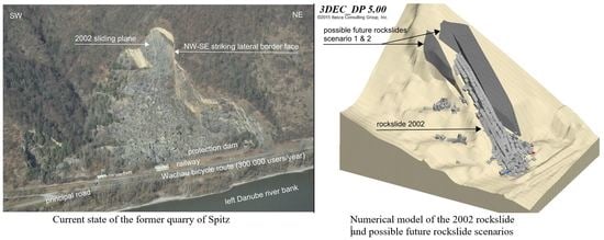
Risk Assessment of Rock Falls Released from the Former Quarry Near Spitz (Austria)
Abstract
1. Introduction
2. Geological Conditions
3. Rockslides Since 1961
3.1. Rockslide on 12 March 1961
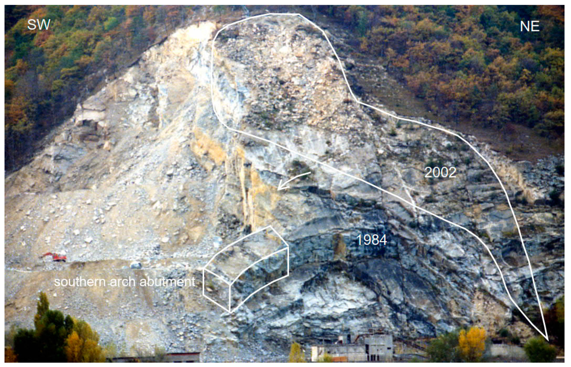
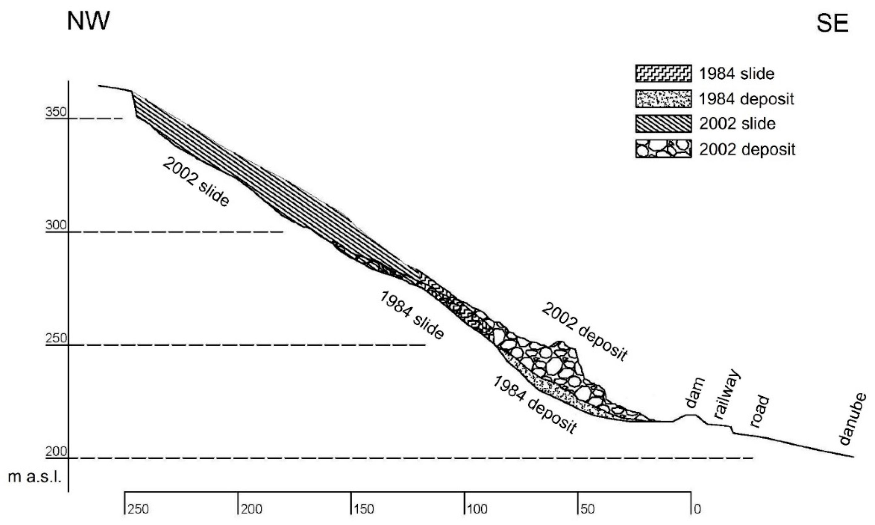
3.2. Rockslide on 4 October 1984
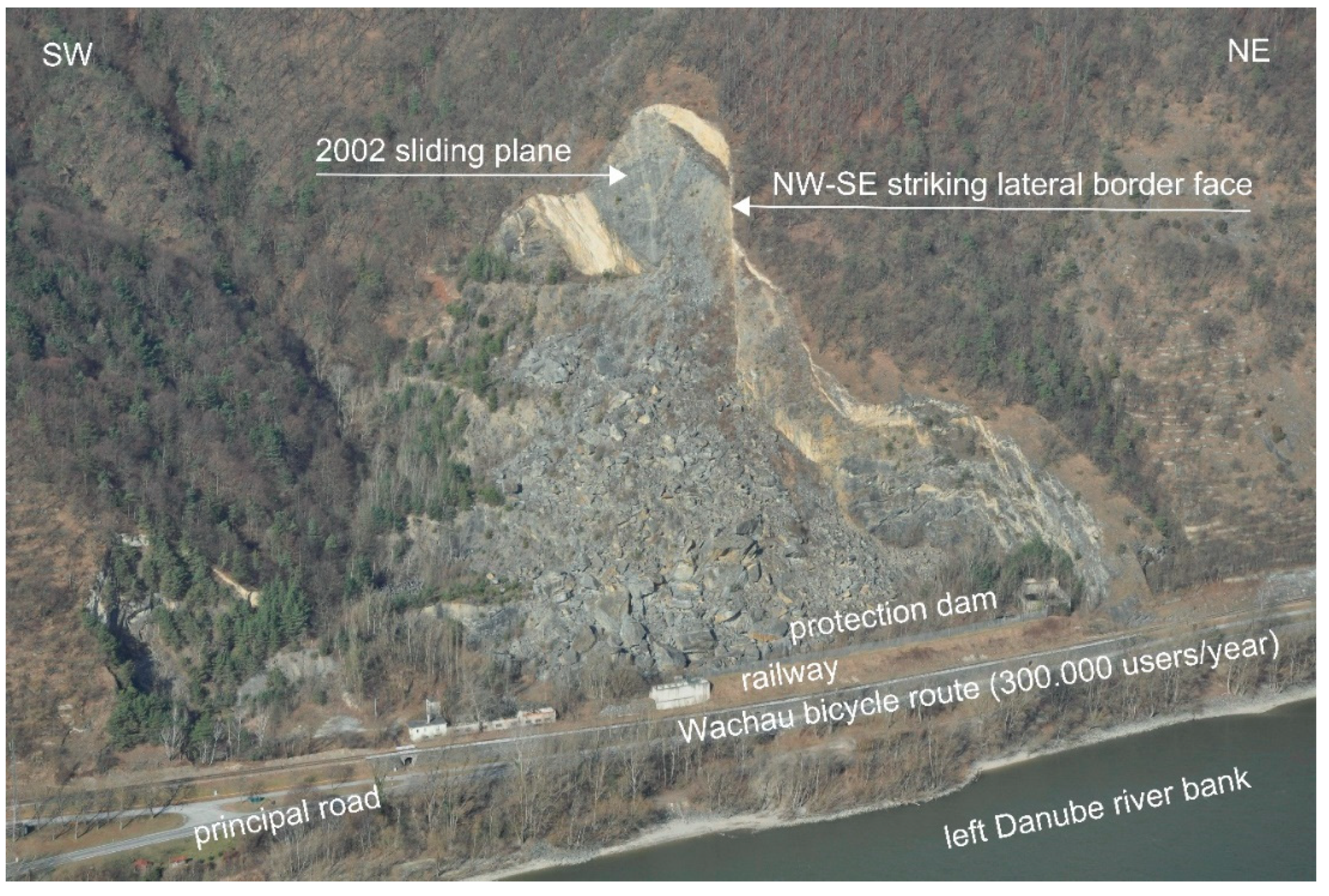
3.3. Rockslide on 11 October 2002
3.4. Rockslide on 16 April 2006
- 8000 cars/day (average daily traffic, ADT),
- 0.05 km endangered slope length (SL),
- 24 h per day
- 70 km/h posted speed limit (PSP) and
- The probability of a future rockslide of 1/1000 years (PR) (details see Section 6),
4. Precipitation Conditions
5. Influence of Earthquakes
6. Probability of Future Rockslides
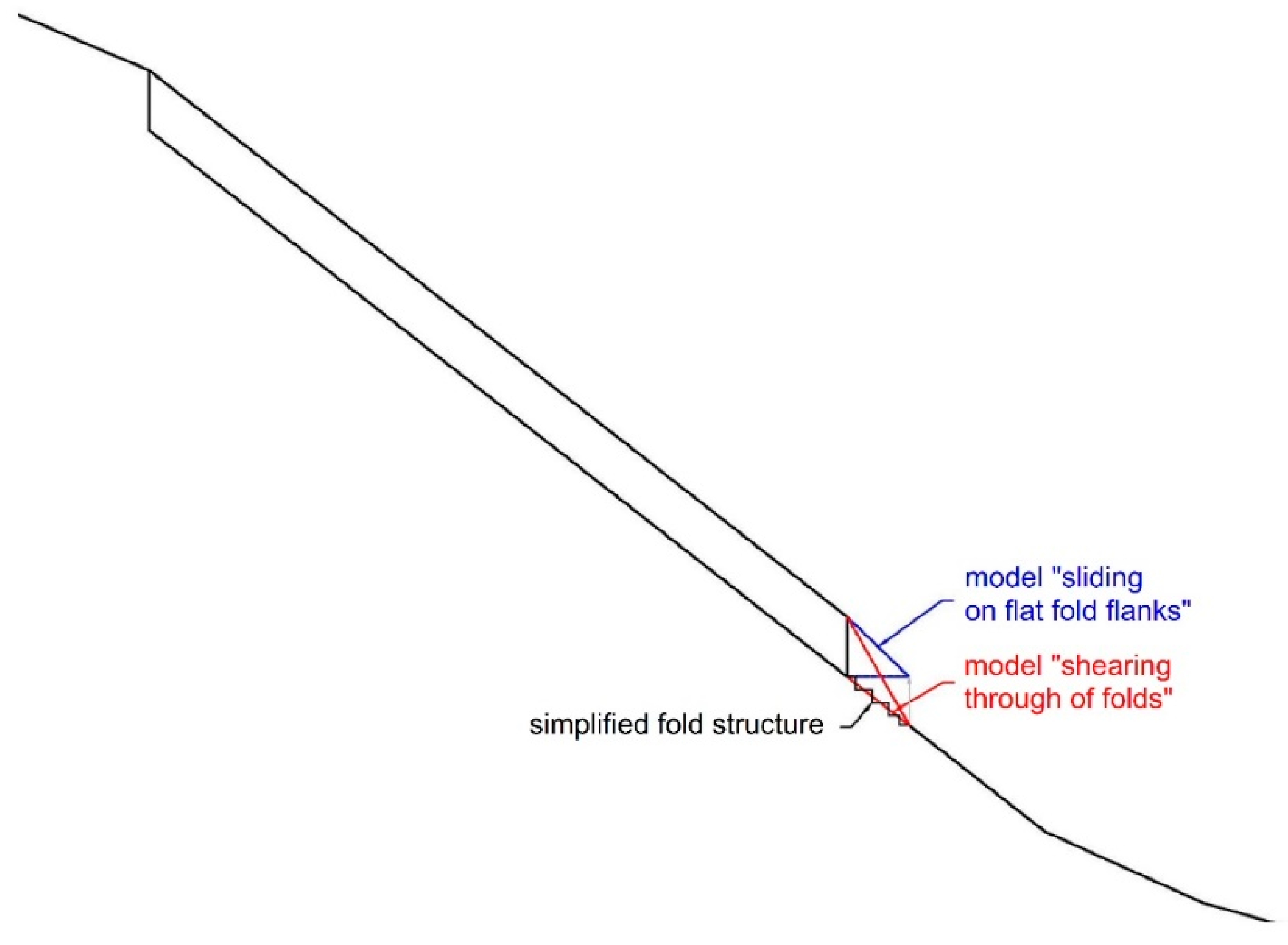
7. Possible Future Rock Detachments
8. Deposits of Runouts of Possible Future Rock Detachments
- Sliding of rock blocks on a discontinuity is simulated with sufficient precision, but
- Falling of rock blocks is not simulated precisely enough because of local damping.
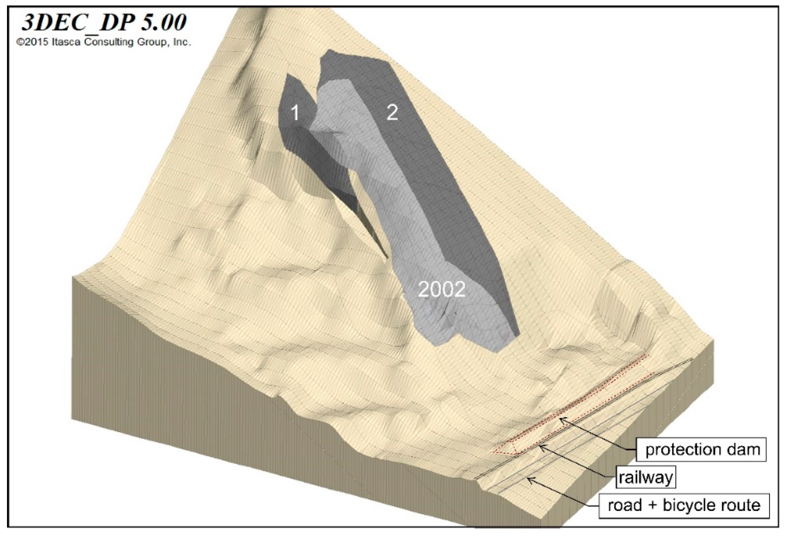
8.1. Simulation of Rockslide 2002
- A friction angle of 26°,
- A damping parameter of 0.35 and
- A joint normal and joint shear stiffness of 107 Pa/m
- A friction angle of 22°,
- A damping parameter of 0.35 and
- A joint normal stiffness of 107 Pa/m and joint shear stiffness of 106 Pa/m.
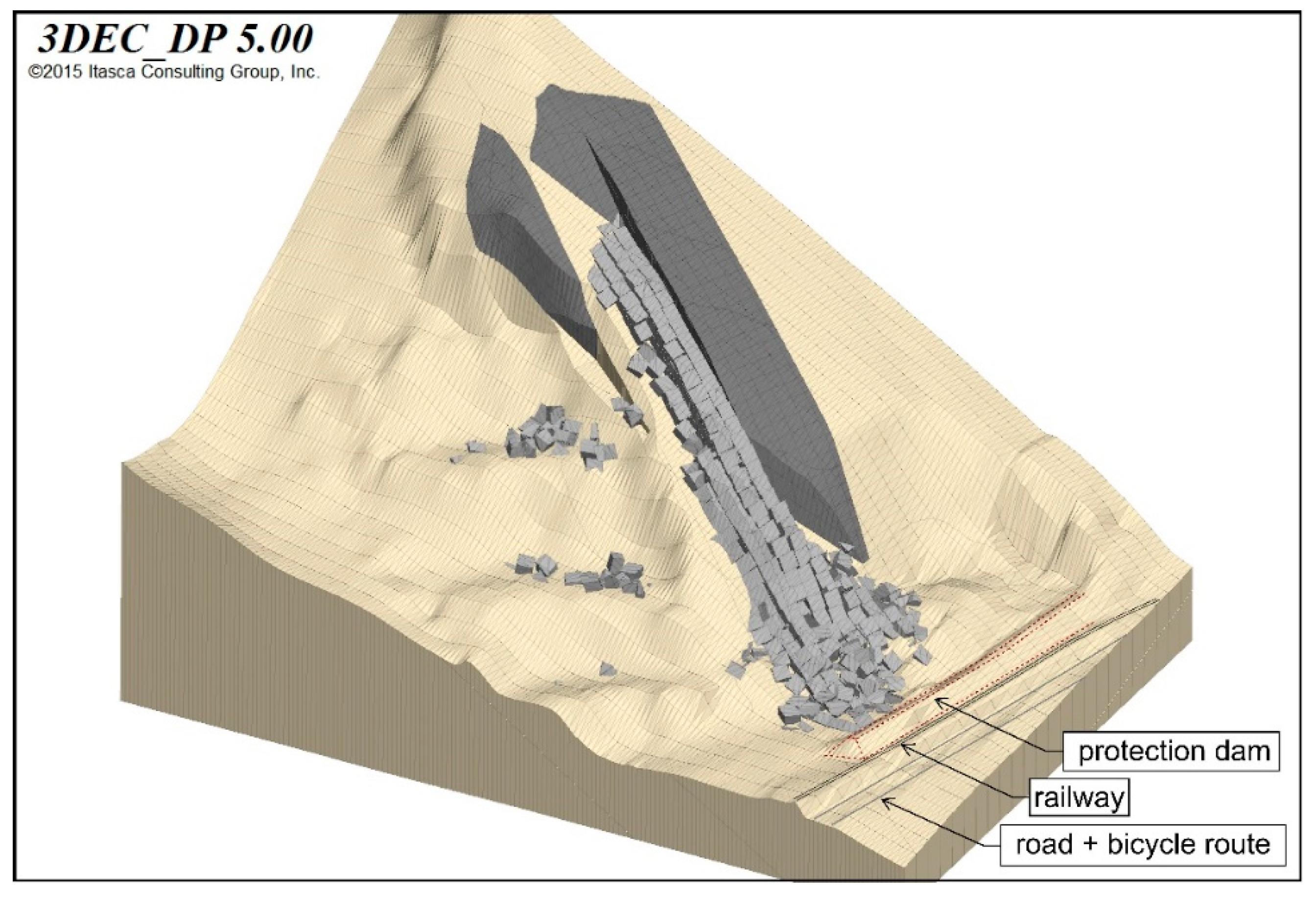
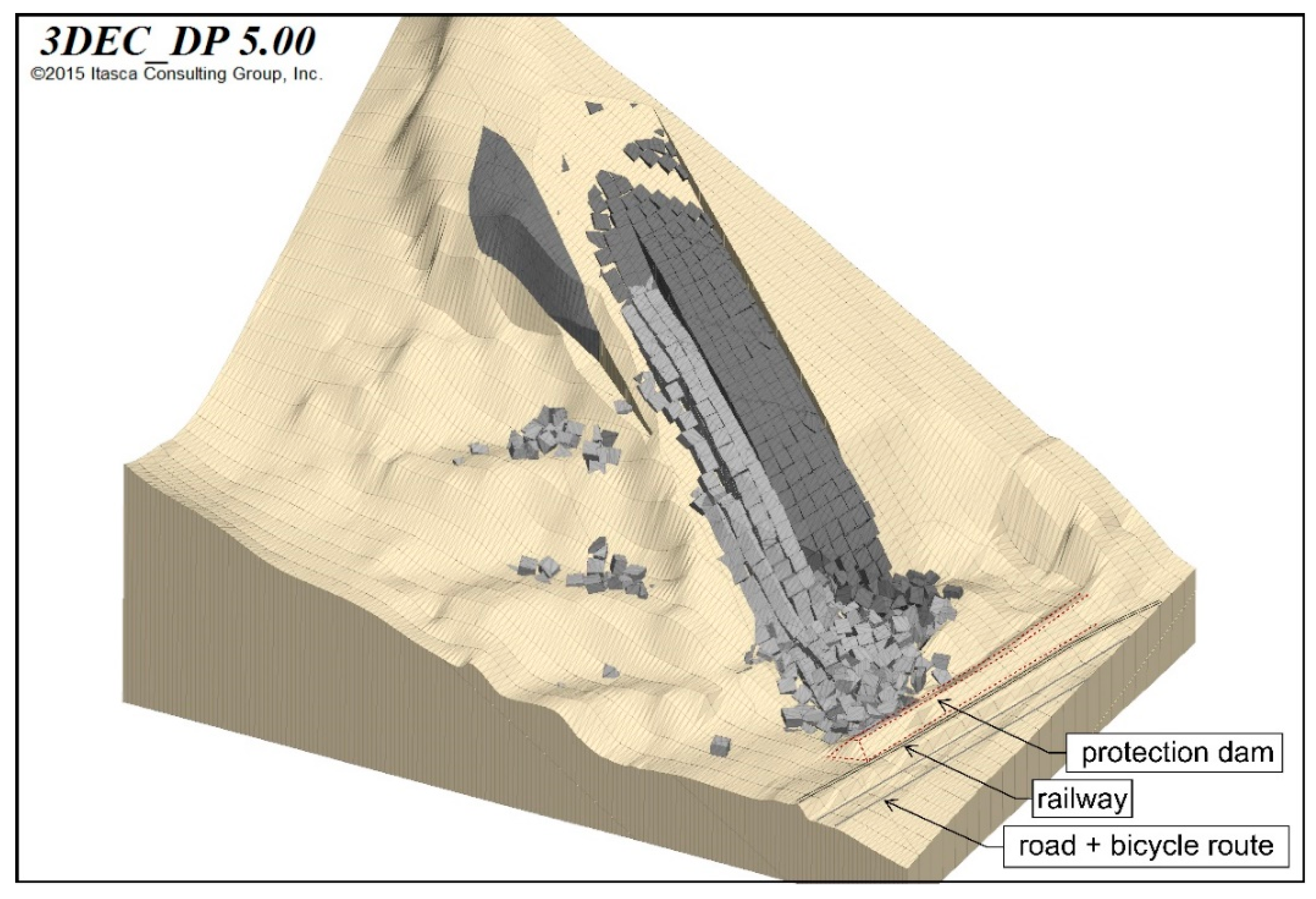
8.2. Simulation of the Runout of Scenario 1
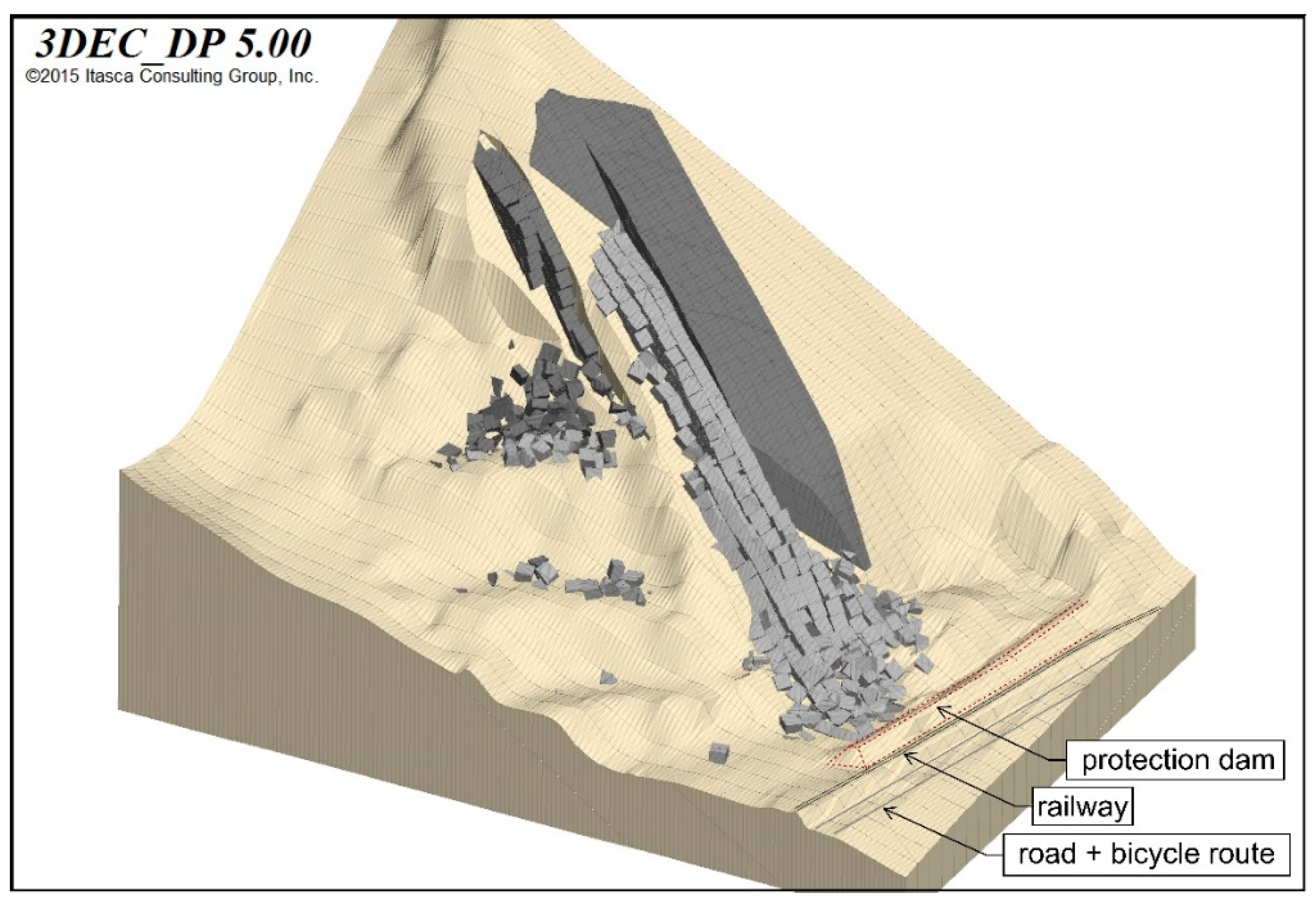
8.3. Simulation of Runout of Scenario 2
9. Assessment of the Risk
9.1. Damages
9.1.1. Direct Damage Caused by a Large Rockslide
9.1.2. Indirect Damages Caused by a Large Rockslide
- Social (e.g., fatalities, casualties, mental harm)
- Environmental (e.g., vegetation damage, impact on groundwater), and
- Economic (e.g., damages because of river impounding and of the blockade of traffic routes).
9.1.3. Possible Total Damage
9.2. Occurrence Probability
9.3. Risk
10. Concluding Remarks
Author Contributions
Funding
Acknowledgments
Conflicts of Interest
References
- Alpinfra. Rockfall Spitz a.d. Donau—Technical Report upon Studies of Alternatives to ÖBB Corporation; ÖBB: Vienna, Austria, 2006. (In German) [Google Scholar]
- Wagner, H. Remedial Design of the Quarry Fehringer in Spitz a.d. Donau. 2006; Unpublished work. (In German) [Google Scholar]
- Ferrari, F.; Giacomini, A.; Thoeni, K. Qualitative Rockfall Hazard Assessment: A Comprehensive Review of Current Practices. Rock Mech. Rock Eng. 2016, 49, 2865–2922. [Google Scholar] [CrossRef]
- Einstein, H.H. Landslide risk assessment procedure. In Proceedings of the 5th International Symposium on Landslides, Lausanne, Switzerland, 10–15 July 1988; Balkema: Rotterdam, The Netherland, 1988; Volume 2, pp. 1075–1090. [Google Scholar]
- Amatruda, G.; Bonnard, C.; Castelli, M.; Forlati, F.; Giacomelli, L.; Morelli, M.; Paro, L.; Piana, F.; Pirulli, M.; Polino, R.; et al. A key approach: The IMIRILAND project method. In Identification and Mitigation of Large Landslide Risks in Europe: IMIRILAND Project; Bonnard, C., Forlati, F., Scavia, C., Eds.; Balkema: Rotterdam, The Netherland, 2004; pp. 13–43. ISBN 9058095983. [Google Scholar]
- Corominas, J.; van Westen, C.; Frattini, P.; Cascini, L.; Malet, J.-P.; Fotopoulou, S.; Catani, F.; Van Den Eeckhaut, M.; Mavrouli, O.; Agliardi, F.; et al. Recommendations for the quantitative analysis of landslide risk. Bull. Eng. Geol. Environ. 2014, 73, 209–263. [Google Scholar] [CrossRef]
- Fell, R.; Corominas, J.; Bonnard, C.; Cascini, L.; Leroi, E.; Savage, W.Z. Guidelines for landslide susceptibility, hazard and risk zoning for land-use planning. Eng. Geol. 2008, 102, 99–111. [Google Scholar] [CrossRef]
- Gibson, W. Probabilistic methods for slope analysis and design. Aust. Geomech. J. 2011, 46, 29–39. [Google Scholar]
- ITASCA. 3DEC: 3-Dimensional Distinct Element Code. 2016. Available online: https://www.itascacg.com/software/3dec (accessed on 21 October 2020).
- 3GSM GmbH. Report ShapeMetrix3D. Former Quarry Spitz/Donau. 3D—Aerial Photo Documentation for a Geological Assessment. 2016. Available online: https://3gsm.at/produkte/shape-metrix/ (accessed on 21 October 2020). (In German).
- NOE Atlas. Available online: https://atlas.noe.gv.at/ (accessed on 15 July 2020).
- Schwenk, H. Mass movements in Lower Austria 1953–1990. Jb. Geol. B.-A. 1992, 135, 597–660. (In German) [Google Scholar]
- Pfahler, G.; (Government of Lower Austria, Department Hydrology and Geographical Information, St. Poelten, Austria). Letter to the Authors from 24 March 2016. Personal communication, 2016. (In German). [Google Scholar]
- Sommer GmbH. Electronic Fissurometer Data of the Quarry SPITZ an der Donau; Sommer GmbH: Koblach, Austria, 2017. (In German) [Google Scholar]
- Geodata GmbH. Monitoring Data of the Quarry Spitz an der Donau; Geodata GmbH: Leoben, Austria, 2017. (In German) [Google Scholar]
- Government of Lower Austria, Department Hydrology and Geographical Information. Precipitation Data Mühldorf bei Spitz; Government of Lower Austria, Department Hydrology and Geographical Information: St. Poelten, Austria, 2017. (In German)
- Lenhardt, W.; (Zentralanstalt für Meteorologie und Geodynamik (ZAMG), Vienna, Austria). Email from 4 April 2016. Personal communication, 2016. [Google Scholar]
- Blöschl, G.; Viglione, A. Determination of the annualities of 7-, 30-, 60- and 90-days precipitation sums Mühldorf bei Spitz. 2017; Unpublished Report. (In German) [Google Scholar]
- Fell, R. Human induced landslides. In Proceedings of the 12th International Symposium on Landslides, Naples, Italy, 12–19 June 2016; Volume I, pp. 171–199. [Google Scholar]
- Poisel, R.; Angerer, H.; Pöllinger, M.; Kalcher, T.; Kittl, H. Mechanics and velocity of the Lärchberg—Galgenwald landslide (Austria). Eng. Geol. 2009, 109, 57–66. [Google Scholar] [CrossRef]
- Austrian Society for Geomechanics. Protection Target Recommendation with Gravitational Natural Hazards in Austria; Austrian Society for Geomechanics: Salzburg, Austria, 2014. [Google Scholar]
- Protection Target Model; Eckhardt, A., Ed.; Nationale Plattform für Naturgefahren PLANAT: Bern, Switzerland, 2009. [Google Scholar]


| Date [dd.mm.yyyy] | Volume [m3] | Cause |
|---|---|---|
| 12.03.1961 | 70,000 | inappropriate excavation |
| 1975 | many blocks (estimated 1000 m3) | precipitation |
| 04.10.1984 | 10,000 | inappropriate excavation |
| 23.04.1996 | 100 | ? |
| 11.10.2002 | 60,000–85,000 | precipitation |
| 16.04.2006 | 2500–5000 | ? |
| 2012–2015 | several times some m3 | ? |
| Precipitation Event | Return Period | ||||
|---|---|---|---|---|---|
| Year | Duration [days] | Start [dd.mm.yyyy] | End [dd.mm.yyyy] | Sum [mm] | [Years] |
| 2002 | 7 | 6.8.2002 | 12.8.2002 | 256.8 | >1000 |
| 30 | 14.7.2002 | 12.8.2002 | 338.9 | 400 | |
| 60 | 3.7.2002 | 31.8.2002 | 398.0 | 80 | |
| 90 | 6.6.2002 | 3.9.2002 | 467.1 | 35 | |
| 2010 | 7 | 15.7.2010 | 21.7.2010 | 113.5 | 8 |
| 30 | 15.7.2010 | 13.8.2010 | 282.2 | 70 | |
| 60 | 12.6.2010 | 10.8.2010 | 327.9 | 17 | |
| 90 | 10.5.2010 | 7.8.2010 | 507.6 | 80 | |
Publisher’s Note: MDPI stays neutral with regard to jurisdictional claims in published maps and institutional affiliations. |
© 2020 by the authors. Licensee MDPI, Basel, Switzerland. This article is an open access article distributed under the terms and conditions of the Creative Commons Attribution (CC BY) license (http://creativecommons.org/licenses/by/4.0/).
Share and Cite
Poisel, R.; Hoedlmoser, N.; Grasemann, B. Risk Assessment of Rock Falls Released from the Former Quarry Near Spitz (Austria). Geosciences 2020, 10, 432. https://doi.org/10.3390/geosciences10110432
Poisel R, Hoedlmoser N, Grasemann B. Risk Assessment of Rock Falls Released from the Former Quarry Near Spitz (Austria). Geosciences. 2020; 10(11):432. https://doi.org/10.3390/geosciences10110432
Chicago/Turabian StylePoisel, Rainer, Nikolaus Hoedlmoser, and Bernhard Grasemann. 2020. "Risk Assessment of Rock Falls Released from the Former Quarry Near Spitz (Austria)" Geosciences 10, no. 11: 432. https://doi.org/10.3390/geosciences10110432
APA StylePoisel, R., Hoedlmoser, N., & Grasemann, B. (2020). Risk Assessment of Rock Falls Released from the Former Quarry Near Spitz (Austria). Geosciences, 10(11), 432. https://doi.org/10.3390/geosciences10110432


