Cultural Landscape Assessment: The Rural Architectural Heritage (13th–17th Centuries) in Mediterranean Valleys of Marina Alta, Spain

Abstract
:1. Research Aim
2. Introduction
2.1. Heritage and Cultural Landscape
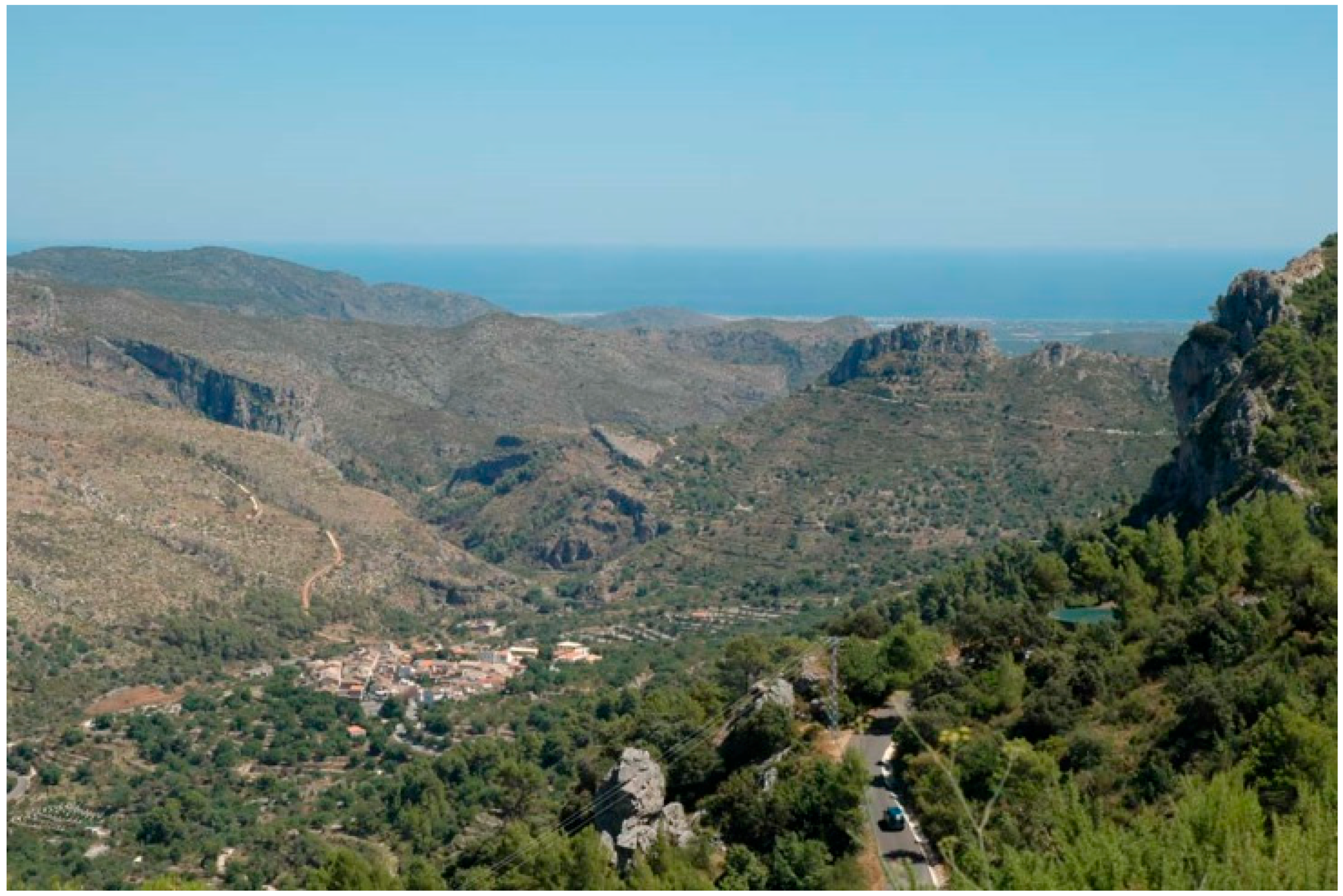
2.2. Geographical and Historic Context
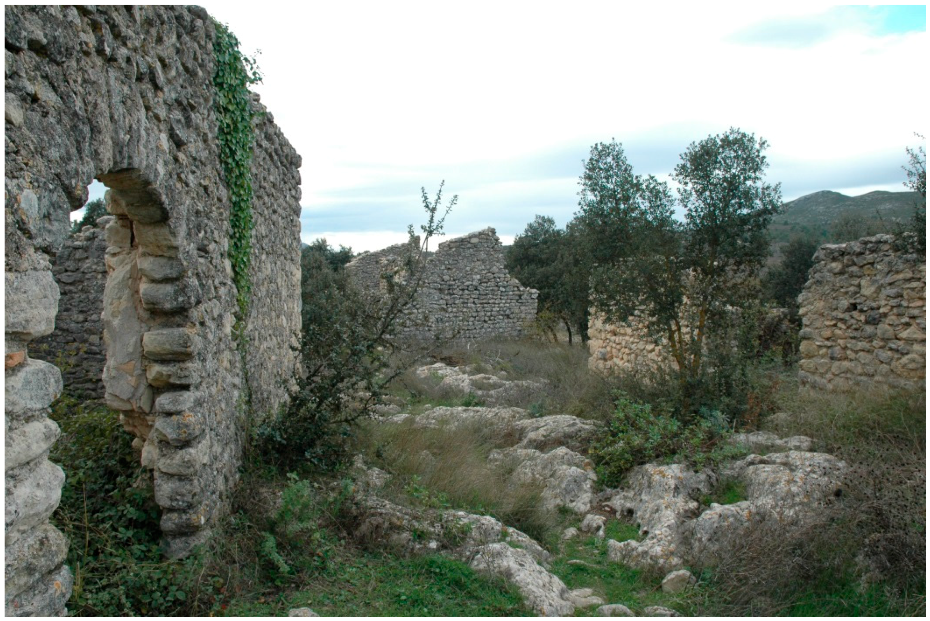
2.3. The Scattered Settlements
3. Research Method
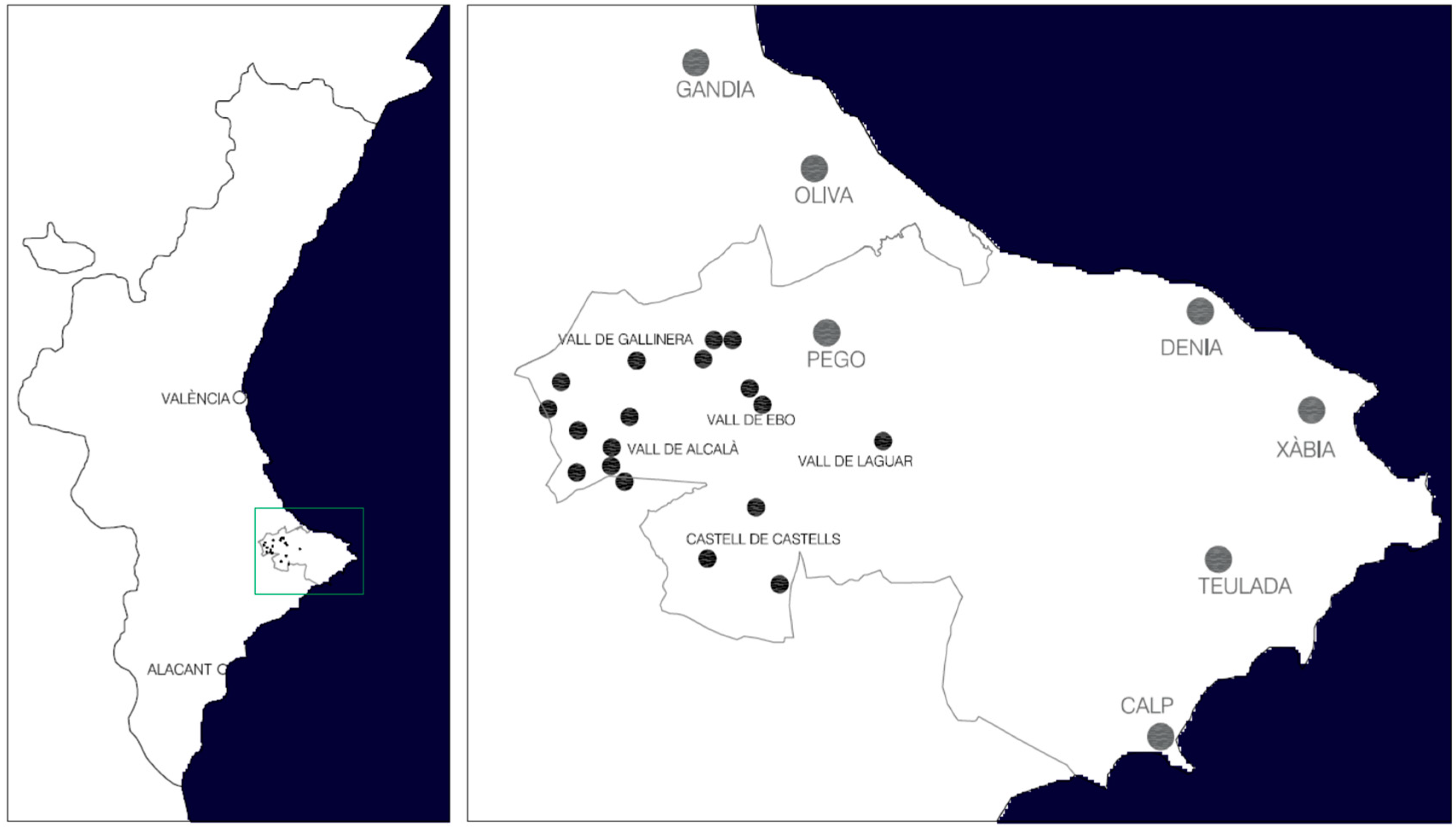
3.1. Definition of the Geographical Area
3.2. Historical Study
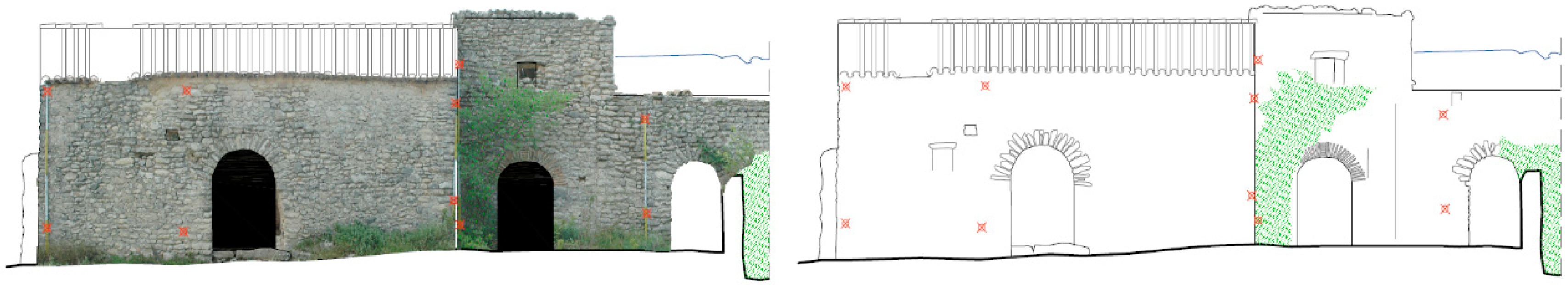
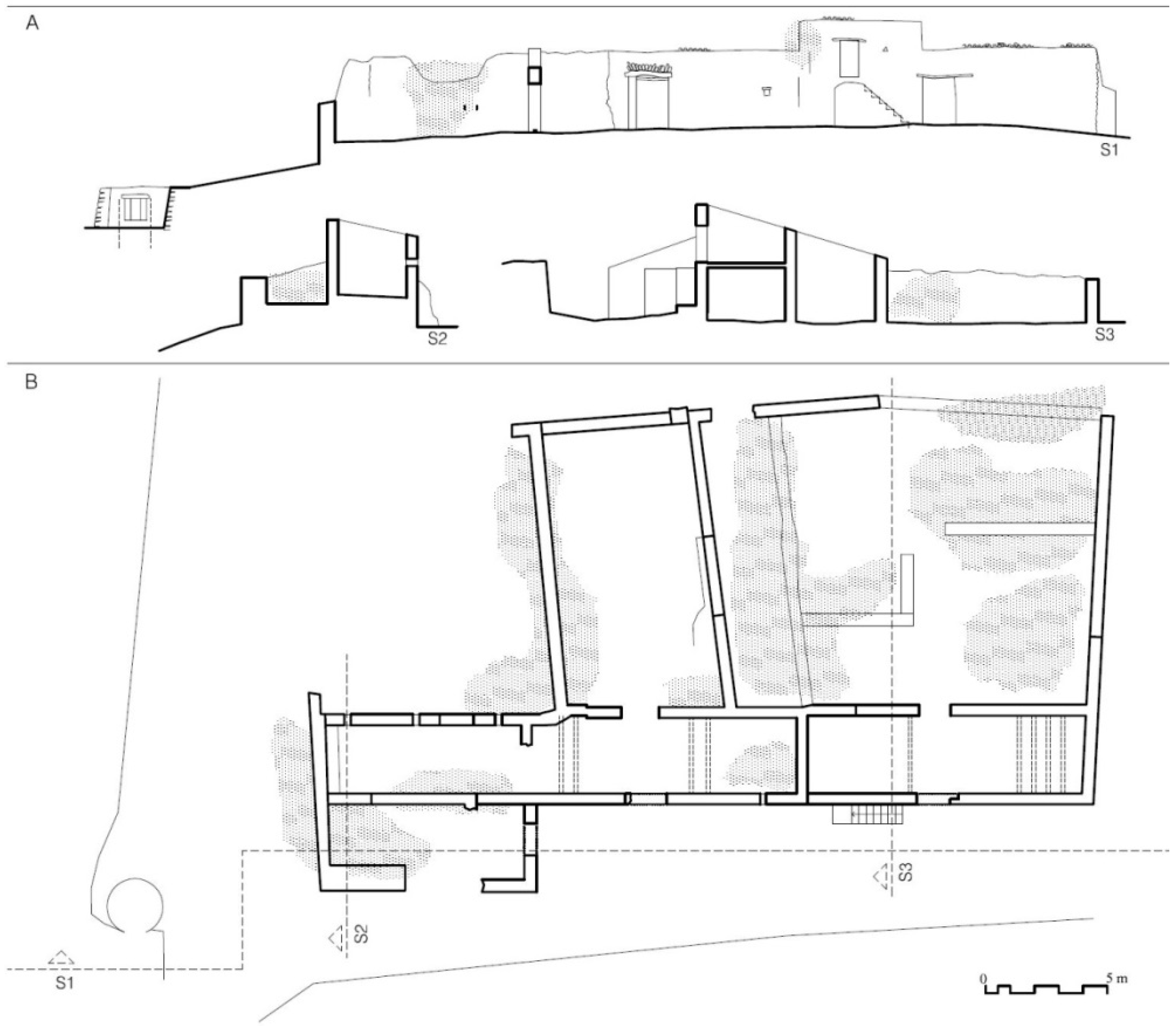
3.3. Architectural Survey
3.4. Specific Studies
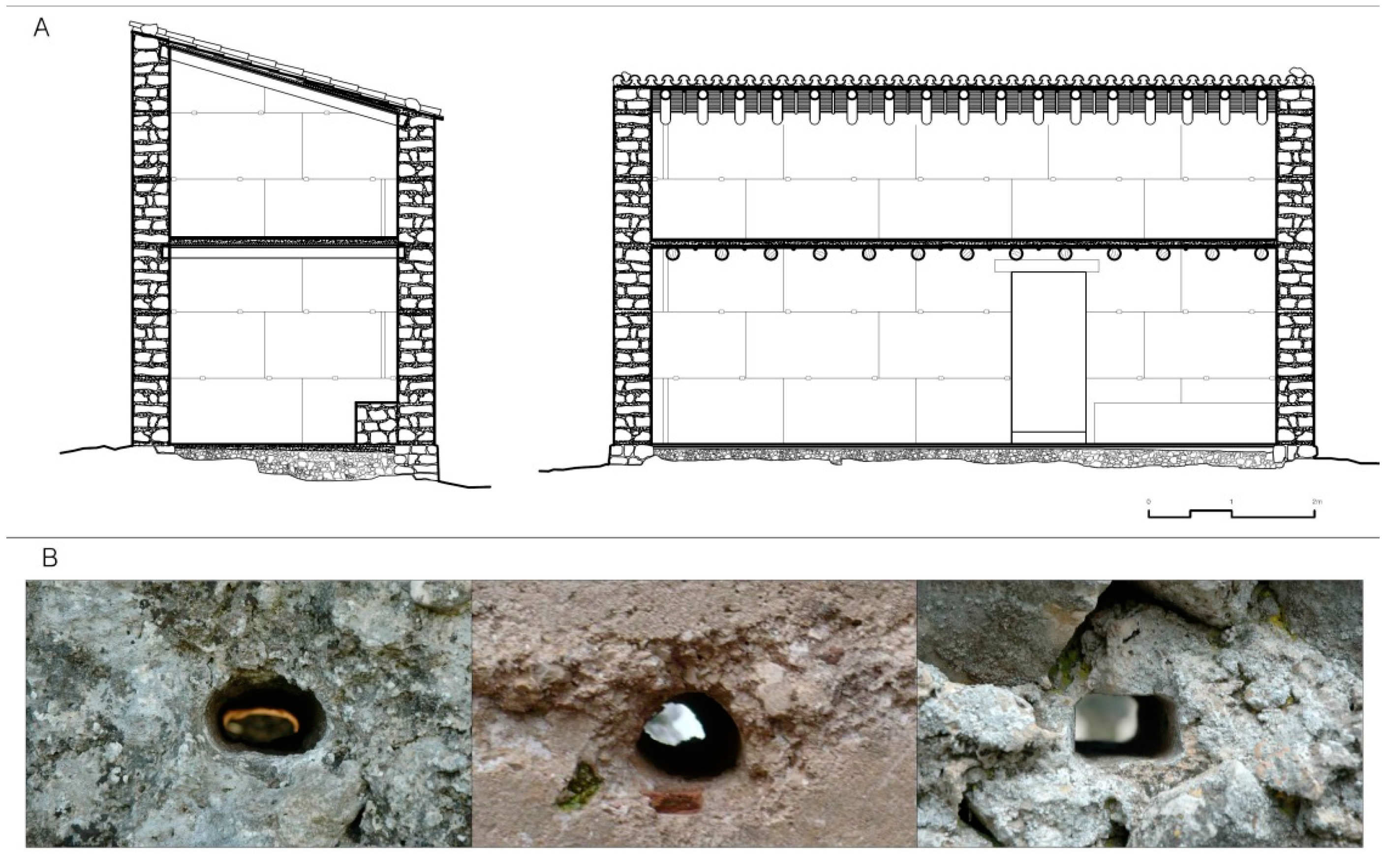
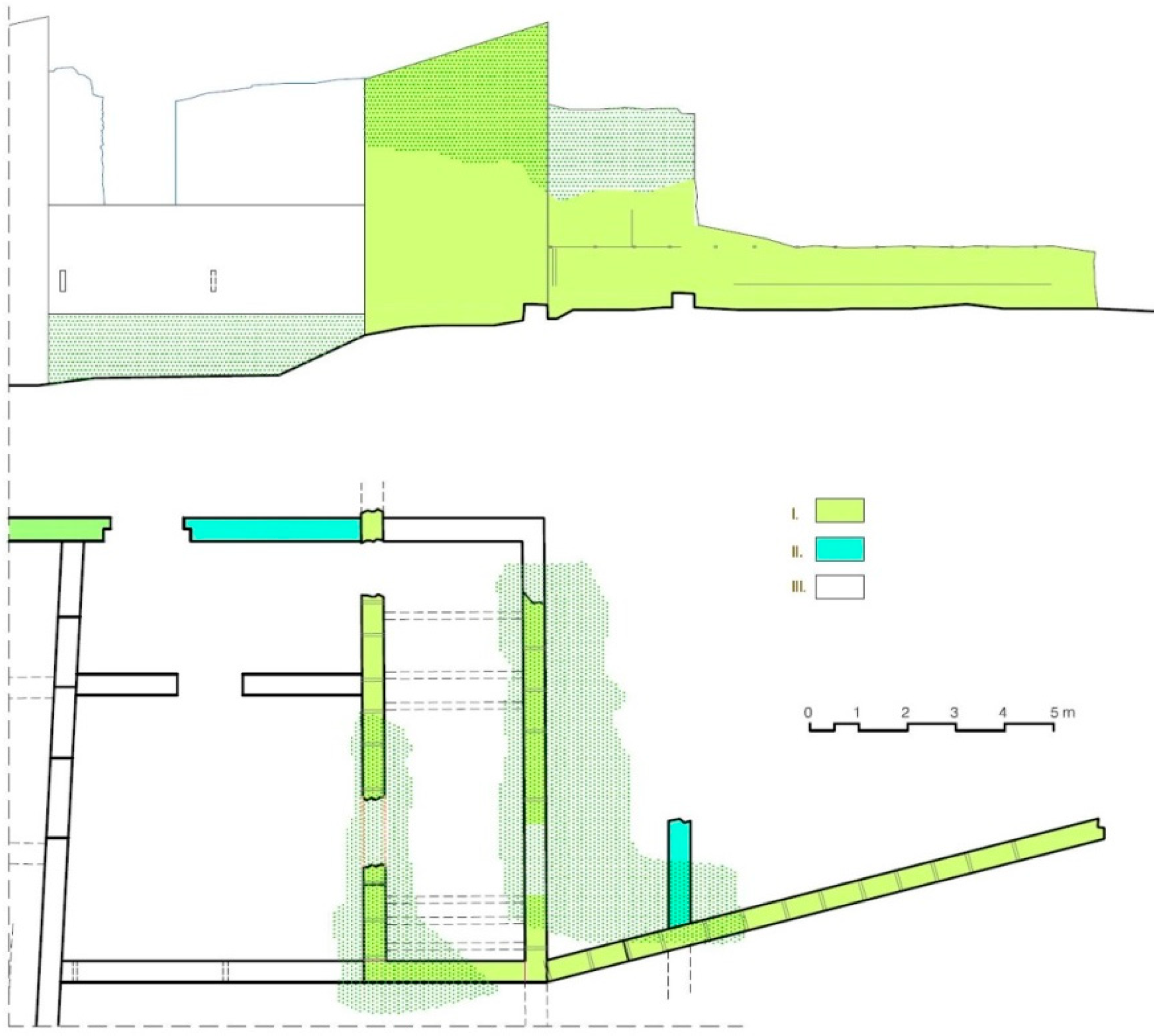
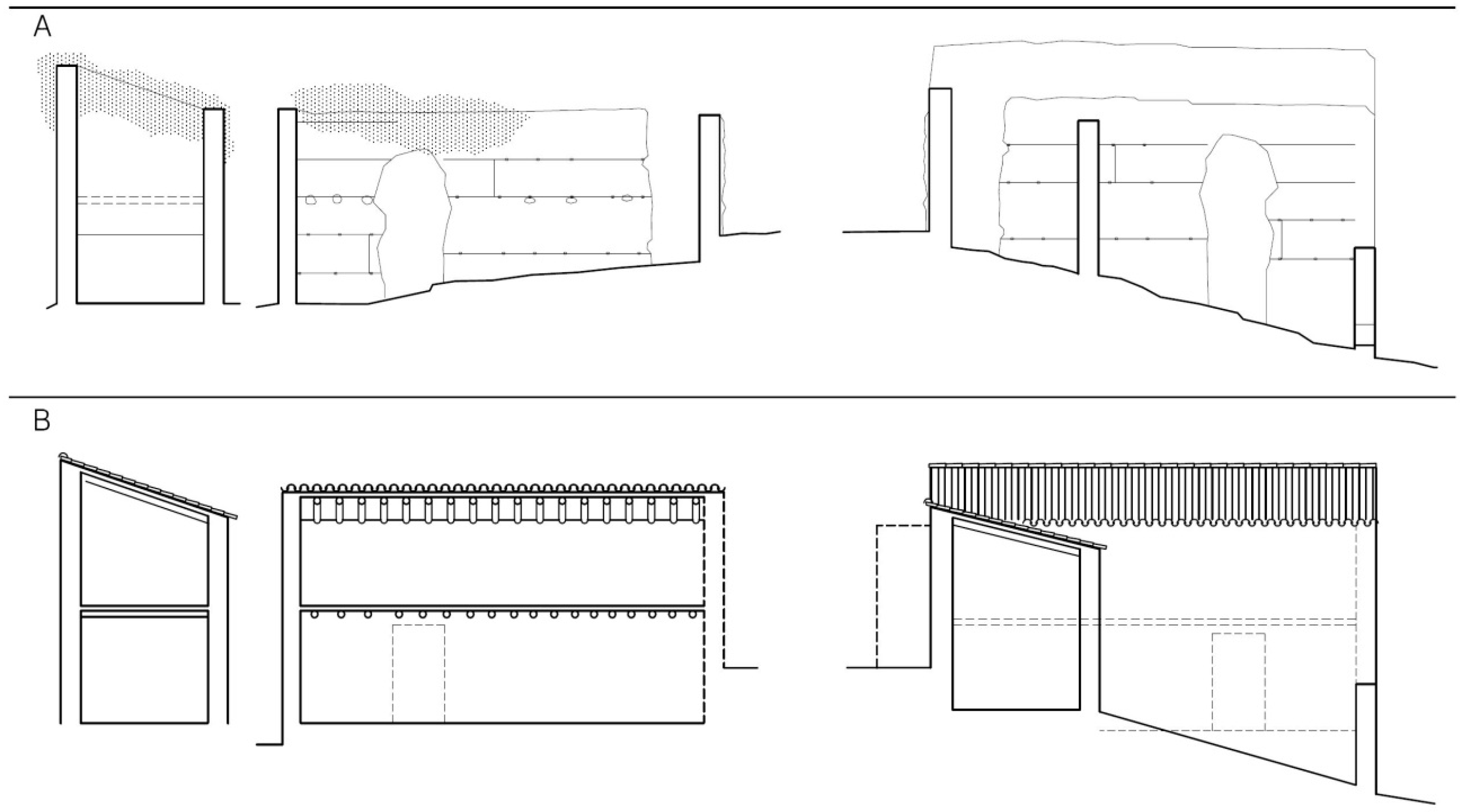
3.4.1. Construction Systems and Building Materials
3.4.2. Overlapping Phases
3.5. Catalogue
4. Results
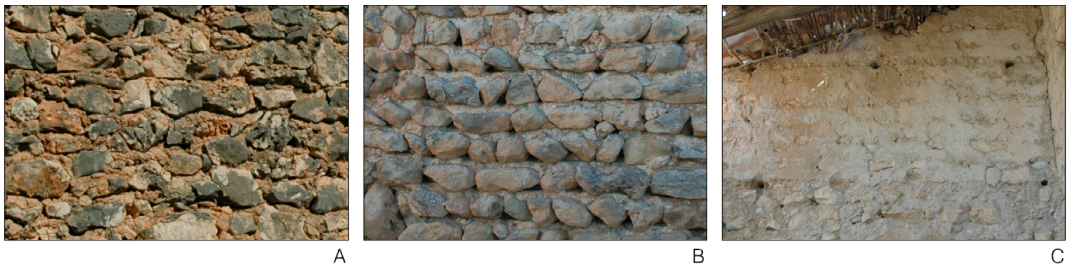
4.1. Wall Fabrics
4.2. Typology
4.3. Values
4.4. Proposals
5. Conclusions
Funding
Conflicts of Interest
References
- Convention Concerning the Protection of the World Cultural and Natural Heritage; The United Nations Educational, Scientific and Cultural Organization (UNESCO): Paris, France, 1972; Available online: https://whc.unesco.org/archive/convention-en.pdf (accessed on 20 October 2017).
- European Landscape Convention; Council of Europe: Florence, Italy, 2000; Available online: https://rm.coe.int/1680080621 (accessed on 20 October 2017).
- Operational Guidelines for the Implementation of the World Heritage Convention; The United Nations Educational, Scientific and Cultural Organization (UNESCO): Paris, France, 2017; Available online: https://whc.unesco.org/en/guidelines/ (accessed on 20 October 2017).
- The Florence Declaration on Heritage and Landscape as Human Values; ICOMOS: Florence, Italy, 2014; Available online: https://www.icomos.org/images/DOCUMENTS/Secretariat/2015/GA_2014_results/GA2014_Symposium_FlorenceDeclaration_EN_final_20150318.pdf (accessed on 10 January 2017).
- Declaration on the Spirit of Place; ICOMOS: Quebec, QC, Canada, 2008; Available online: https://whc.unesco.org/uploads/activities/documents/activity-646-2.pdf (accessed on 10 January 2017).
- Principles for the Conservation of Heritage Sites in China; ICOMOS: Beijing, China, 2015; Available online: http://openarchive.icomos.org/1650/ (accessed on 10 January 2017).
- Rock Art of the Mediterranean Basin on the Iberian Peninsula. UNESCO World Heritage List. 1998. Available online: https://whc.unesco.org/en/list/874 (accessed on 15 February 2018).
- Christie, N.; Beavitt, P.; Gisbert, J.A.; Seguí, J.; Gil, M.V. Ethnography and Archaeology in Upland Mediterranean Spain. Manolo’s World: Peopling the Recent Past in the Serra de L’Altmirant; University of Leicester: Leicester, UK, 2004; ISBN 0953891461. [Google Scholar]
- Muñoz, A.; Soler, R.; Soler, A. Proyecto URBACOST Corredor del Serpis; Generalitat Valenciana: Valencia, Spain, 2006; ISBN 9788448245870. [Google Scholar]
- Grau, I.; Segura, J.M.; Soler, A.; Soler, R.; Torró, J.; Vives, M. Estudio del Paisaje Cultural y Arquitectónico Mediterráneo; Universitat Politècnica de València: Valencia, Spain, 2016; ISBN 9788490484784. [Google Scholar]
- Vehbi, B.O.; Yuceer, H.; Hurol, Y. Rural carob warehouses in Cyprus: An assessment of architectural and structural characteristics. J. Archit. Conserv. 2016, 22, 18–47. [Google Scholar] [CrossRef]
- Ortiz-Cordero, R.; Hidalgo Hernandez, R.E. Multivariate study and proportion study for classification and dating of Islamic Al-Andalus’ minarets: A first approach. J. Cult. Herit. 2017, 24, 117–123. [Google Scholar] [CrossRef]
- Torró, J. The eastern regions of Al-Andalus before the conquest by Catalonia-Aragon: An overview. Catalan Hist. Rev. 2012, 5, 11–27. [Google Scholar] [CrossRef]
- Bazzana, A. Maisons d’Al-Andalus. Habitat Médiéval et Structures du Peuplement Dans l’Espagne Orientale; Casa de Velázquez: Madrid, Spain, 1992; ISBN 8486839300. [Google Scholar]
- Torró, J.; Ivars, J. La vivienda rural mudéjar y morisca en el sur del País Valenciano. In La Casa Hispano-Musulmana. Aportaciones de la Arqueología; Bermúdez, J., Bazzana, A., Eds.; Junta de Andalucía: Granada, Spain, 1990; pp. 73–97. ISBN 8486827051. [Google Scholar]
- Lapeyre, H. Geografía de la España Morisca; Universitat de València: Valencia, Spain, 2011; ISBN 9788492521753. [Google Scholar]
- Carta del Rilievo Architettonico; Castell Sant Angelo: Rome, Italy, 2000.
- Soler-Estrela, A. La Arquitectura de Los Despoblados Moriscos en Los Valles de la Marina Alta. Ph.D. Thesis, Universidad Politécnica de Valencia, Valencia, Spain, 2009. [Google Scholar]
- Convention for the Protection of the Architectural Heritage of Europe. Council of Europe, 1985. Available online: https://rm.coe.int/168007a087 (accessed on 14 March 2018).
- Vacca, G.; Fiorino, D.R.; Pili, D. A spatial Information System (SIS) for the Architectural and Cultural Heritage of Sardinia (Italy). Int. J. Geo-Inf. 2018, 7, 49. [Google Scholar] [CrossRef]
- Soler, A.; Soler, R.; Ortega Pérez, J.R. Restoration of the stone tapia of hsin al-Qala (Castell d’Alcalà de Gallinera), Alicante, Spain. In Rammed Earth Conservation; Mileto, C., Vegas, F., Cristini, V., Eds.; Taylor & Francis Group: London, UK, 2012; pp. 413–418. ISBN 9780415621250. [Google Scholar]
- The ICOMOS Charter on Cultural Routes; ICOMOS: Quebec, QC, Canada, 2008; Available online: https://www.icomos.org/images/DOCUMENTS/Charters/culturalroutes_e.pdf (accessed on 14 March 2018).
- Mitchell, N.; Rössler, M.; Tricaud, P.-M. World Heritage Cultural Landscapes: A Handbook for Conservation and Management; The United Nations Educational, Scientific and Cultural Organization (UNESCO): Paris, France, 2009; Available online: http://whc.unesco.org/documents/publi_wh_papers_26_en.pdf (accessed on 14 March 2018).
- Soler, A.; Soler, R.; Paredes, E. Architecture and Landscape in Sharq al–Andalus. The conservation of an Islamic Qarya. In Earthen Architecture: Past, Present and Future; Mileto, C., Vegas, F., Cristini, V., Eds.; Taylor & Francis Group: London, UK, 2015; pp. 351–356. ISBN 9781138027114. [Google Scholar]


© 2018 by the author. Licensee MDPI, Basel, Switzerland. This article is an open access article distributed under the terms and conditions of the Creative Commons Attribution (CC BY) license (http://creativecommons.org/licenses/by/4.0/).
Share and Cite
Soler-Estrela, A. Cultural Landscape Assessment: The Rural Architectural Heritage (13th–17th Centuries) in Mediterranean Valleys of Marina Alta, Spain. Buildings 2018, 8, 140. https://doi.org/10.3390/buildings8100140
Soler-Estrela A. Cultural Landscape Assessment: The Rural Architectural Heritage (13th–17th Centuries) in Mediterranean Valleys of Marina Alta, Spain. Buildings. 2018; 8(10):140. https://doi.org/10.3390/buildings8100140
Chicago/Turabian StyleSoler-Estrela, Alba. 2018. "Cultural Landscape Assessment: The Rural Architectural Heritage (13th–17th Centuries) in Mediterranean Valleys of Marina Alta, Spain" Buildings 8, no. 10: 140. https://doi.org/10.3390/buildings8100140
APA StyleSoler-Estrela, A. (2018). Cultural Landscape Assessment: The Rural Architectural Heritage (13th–17th Centuries) in Mediterranean Valleys of Marina Alta, Spain. Buildings, 8(10), 140. https://doi.org/10.3390/buildings8100140