Article

Development and Application of an AI-Based Automatic Identification System for Rural Road Distress and Maintenance Management

Zhejiang Highway Technicians College, Hangzhou 310023, China
*
Author to whom correspondence should be addressed.
Buildings 2025, 15(23), 4222; https://doi.org/10.3390/buildings15234222 (registering DOI)
Submission received: 21 May 2025 / Revised: 27 July 2025 / Accepted: 6 August 2025 / Published: 22 November 2025
(This article belongs to the Special Issue Advances in Road Pavements)

Abstract

With the continuous expansion of rural road construction and increasing management demands, traditional rural road inspection and maintenance models are becoming insufficient to meet current needs. The analysis of inspection results and the development of maintenance plans are often delayed. To address these challenges, this paper proposes a rural road distress sample recognition and annotation method based on machine vision techniques, and establishes a corresponding disease target identification sample database. The method is trained and validated using the U-Net algorithm, achieving an accuracy of 94.95%. Additionally, a lightweight detection system is developed to facilitate rural road surface disease target detection and automatic recognition. The self-developed automatic recognition system significantly enhances the accuracy and efficiency of pavement disease recognition. Furthermore, a management platform has been implemented to enable the dynamic management of rural road disease data and maintenance operations.

1. Introduction

Rural roads are an important part of the road network, serving as a vital infrastructure for the economic development of rural areas. They are also critical to promoting urban–rural integration and driving rural revitalization. Because of the expansion of rural road coverage and accessibility, the management philosophy of rural roads has gradually shifted from focusing on construction to a coordinated development of construction, management, maintenance, and operation. However, the traditional rural road maintenance management model remains outdated and cannot meet the actual development needs of rural road operations.
With the rapid development of big data and AI technologies, various lightweight and automated devices have been applied to technically assess the conditions of rural roads [1]. Some regions have improved their management systems by constructing mathematical models to address road maintenance planning and traffic congestion issues [2,3]. Previous studies have optimized multi-objective identification, prioritizing safety hazard factors while meeting maintenance planning requirements [4]. Through these technological advancements, efforts are being made to promote the digitalization of infrastructure, specialization in maintenance, modernization of management, operational efficiency, and high-quality service, thereby driving the digital transformation of rural roads.
The condition assessment of rural roads and the evaluation of infrastructure service conditions are fundamental tasks in road construction, maintenance, and management [5]. By utilizing more lightweight and automated inspection methods, not only can road engineering quality be effectively controlled, but it can also be integrated with smart management systems to enhance the scientific level of road asset management and maintenance decision-making, further achieving the goal of “every road must be maintained, and maintenance must be in place.”
In recent years, disease and defect detection methods have undergone significant technological advancements and innovations across various fields. In the area of concrete crack detection, Hu et al. [6] proposed a three-step algorithmic framework based on computer vision, which effectively identifies cracks on concrete surfaces even under complex background conditions. Hui et al. [7] applied the MobileNetV2 neural network for crack detection, significantly enhancing accuracy while enabling precise evaluation of crack widths in high-resolution images.
For bridge defect detection, Li et al. [8] developed a crack detection method incorporating geometric correction and calibration algorithms, addressing key challenges in UAV-based crack identification for bridge structures. An et al. [9] introduced an improved bridge deck defect detection algorithm based on YOLOv7-Tiny-DBB, which not only improved detection accuracy but also mitigated the issue of missed small-scale defects.
In terms of lightweight detection frameworks, Sheng et al. [10] proposed a maturity detection method for Hemerocallis citrina Baroni based on GCB YOLOv7, leveraging a lightweight neural network and attention mechanism to balance computational efficiency and detection precision. Jiang et al. [11] introduced MobiLiteNet, a lightweight deep learning model that significantly reduced computational overhead while delivering real-time, scalable, and accurate road hazard detection—supporting the advancement of intelligent transportation systems and infrastructure management.
Regarding road surface defect detection, France’s GERPHO system [12] utilizes photographic technology combined with vehicle positioning to synchronously capture images of road damage, setting a new benchmark in the field. Similarly, Japan’s Komatsu system [13] employs high-speed image acquisition with auxiliary lighting to collect high-resolution road surface damage data. The integration of digital imaging and computer vision technologies has given rise to rapid road surface inspection systems centered around digital cameras. The U.S. DHDV data collection vehicle [13] enables real-time, automated analysis through high-speed, multi-source data acquisition—marking a major step forward in automated road condition monitoring. These studies have provided successful performance for infrastructural disease and defect detection. However, an automatic identification system for rural road diseases and maintenance management is still rare. Despite the development and application of numerous pavement distress detection technologies, rural road environments pose significant challenges. Traditional detection systems are often large, expensive, and limited in both accuracy and processing speed, which hinders their effectiveness in supporting timely and cost-efficient rural road maintenance.
In this study, we aim to develop an AI-based, lightweight, low-cost, accurate, and efficient automatic identification system specifically designed for detecting rural road diseases and facilitating effective maintenance management. The primary objective is to integrate advanced machine learning and image processing techniques to improve the efficiency and accuracy of rural road condition assessments, which traditionally rely on manual inspections that are time-consuming and subjective. The study begins by detailing the overall design framework of the automatic identification system for rural road diseases. This includes an overview of the data acquisition process, system architecture, and the integration of AI modules with geographic information systems (GIS) and mobile platforms for real-time monitoring. Next, we introduce a robust rural road pavement distress automatic identification algorithm. This algorithm utilizes deep learning methods to analyze road surface images and classify various types of pavement distresses such as cracks, potholes, broken slabs, and so on. The methodology includes data preprocessing, model training, and performance evaluation, ensuring the system’s reliability across different rural environments and lighting conditions. Section 4 presents practical applications of the developed system in rural road maintenance and management. We demonstrate how the system supports decision-making by local authorities through automated reporting, prioritization of repairs, and maintenance scheduling based on severity levels and traffic patterns. Finally, Section 5 summarizes the key findings and contributions of the study. It highlights the effectiveness of the AI-based approach in reducing maintenance costs, improving road safety, and promoting sustainable infrastructure development in rural areas.

2. Design of the Automatic Identification System for Rural Road Diseases

2.1. System Architecture Design

The system architecture mainly consists of five layers: the Acquisition Layer, Network Layer, Data Layer, Application Layer, and Platform Layer, as shown in Figure 1.
The Acquisition Layer aims to achieve full coverage of automatic inspections for rural roads. It uses lightweight automated detection devices to real-time collect basic location information of the current vehicle (such as route code, route name, pile number, maintenance unit, etc.), as well as pavement and forward image data, ensuring efficient data collection at the grassroots level of rural roads.
The Network Layer takes into account the communication network conditions of rural roads. It uses industrial computers to self-check network status and automatically switches between transmission and storage modes based on current signal strength and network bandwidth, ensuring the integrity and continuity of underlying data.
The Data Layer utilizes artificial intelligence algorithms to analyze and classify the underlying data, establishing a multidimensional database that includes the basic information database, distress information database, road environment database, inspection information database, geographic information database, and maintenance information database.
The Application Layer is the core of the intelligent management and maintenance system for rural roads. It integrates and analyzes multidimensional data to build corresponding functionalities that meet the practical needs of rural road maintenance and management. It mainly includes data analysis, result evaluation, and decision support.
The Platform Layer logically connects various data modules within the system and displays and operates them on the Web and mobile apps in the form of image models, reports, and other formats.

2.2. Design of Lightweight Intelligent Inspection Hardware System

The lightweight intelligent inspection hardware system is an integrated hardware solution comprising a high-definition camera, a multi-mode geolocation positioning module, a central control panel, a 4G/5G network module, and an edge intelligence all-in-one unit. The system is magnetically mounted for easy installation and removal.
Each set of the lightweight intelligent inspection hardware system includes one high-definition industrial camera; one edge intelligence all-in-one unit (consisting of one industrial computer, one 4G/5G transmission module, one GPS positioning module, and four antennas); one data acquisition and control display unit; and several power connection and data cables. The system configuration and device technical specifications are shown in Figure 2 and Table 1.

3. Automatic Identification Algorithm for Rural Road Pavement Distress

3.1. Typical Types of Rural Road Pavement Distress

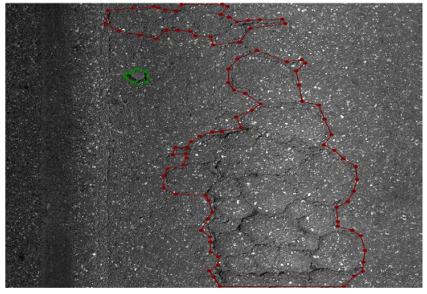
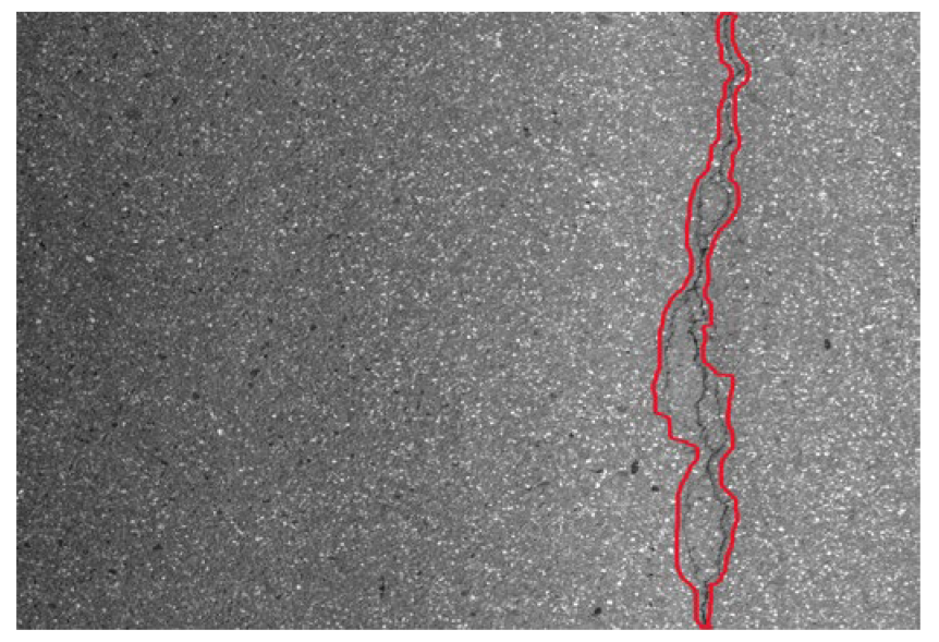
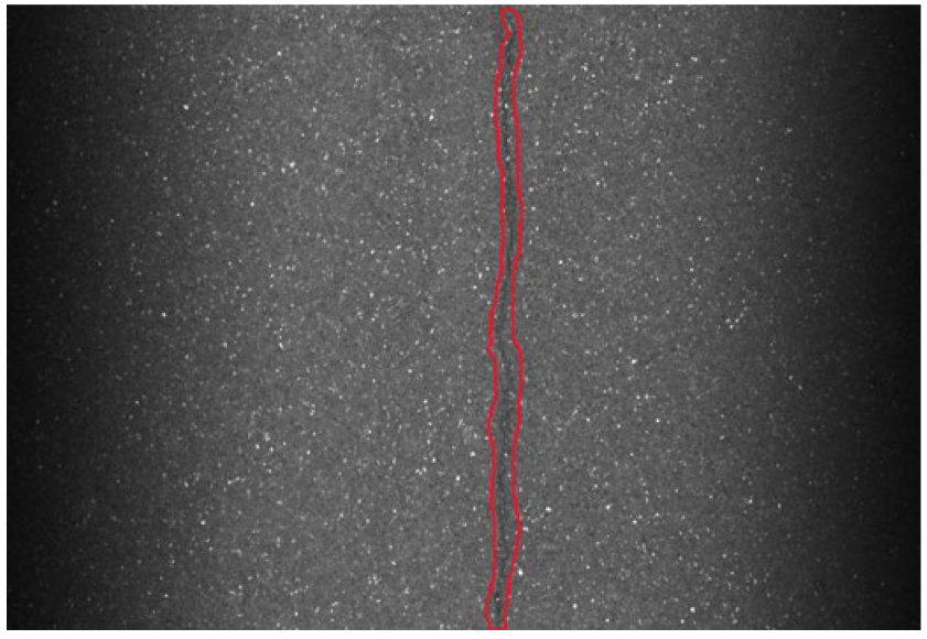
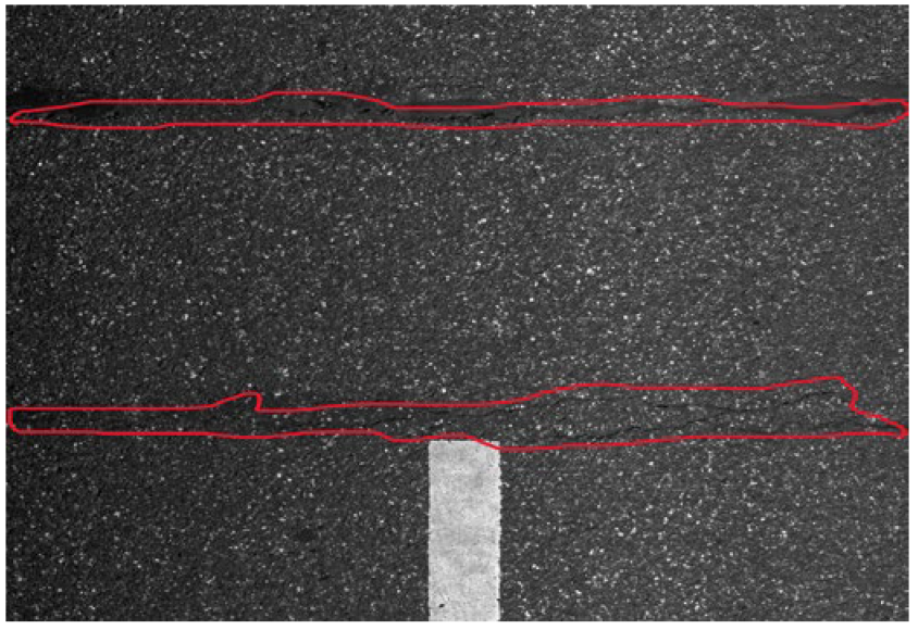
The classification of pavement distresses on rural roads differs from that of standard trunk roads. The detection environment of regular trunk roads is favorable, and the identification of distress types is relatively accurate, whereas the detection environment of rural roads is complex, making it difficult to distinguish between different types of distress. Common pavement distress types frequently observed on rural roads include transverse cracks, longitudinal cracks, alligator cracking, and potholes for asphalt pavements, while cement concrete pavements typically exhibit cracks, broken slabs, and potholes. For the purpose of automatic identification of pavement distresses on rural roads, accurate segmentation of the damaged areas is essential. By statistically analyzing the extent of pavement damage, relevant evaluation indices can be derived. To enhance the precision in quantifying the affected areas, this study categorizes typical rural pavement distresses into two groups: length-based and area-based. Transverse cracks, longitudinal cracks, and general cracks are classified as length-based distresses, whereas alligator cracking, broken slabs, and potholes fall under area-based distresses.

3.2. Distress Sample Annotation Method

High-quality road distress samples serve as the foundation for developing effective algorithmic recognition models, and the choice of annotation method significantly influences the subsequent training and performance of deep learning models. At present, pavement distress annotation primarily relies on manual labeling. In addition to mastering the operation of annotation software, annotators must possess relevant expertise in road inspection to accurately identify various types of pavement diseases.
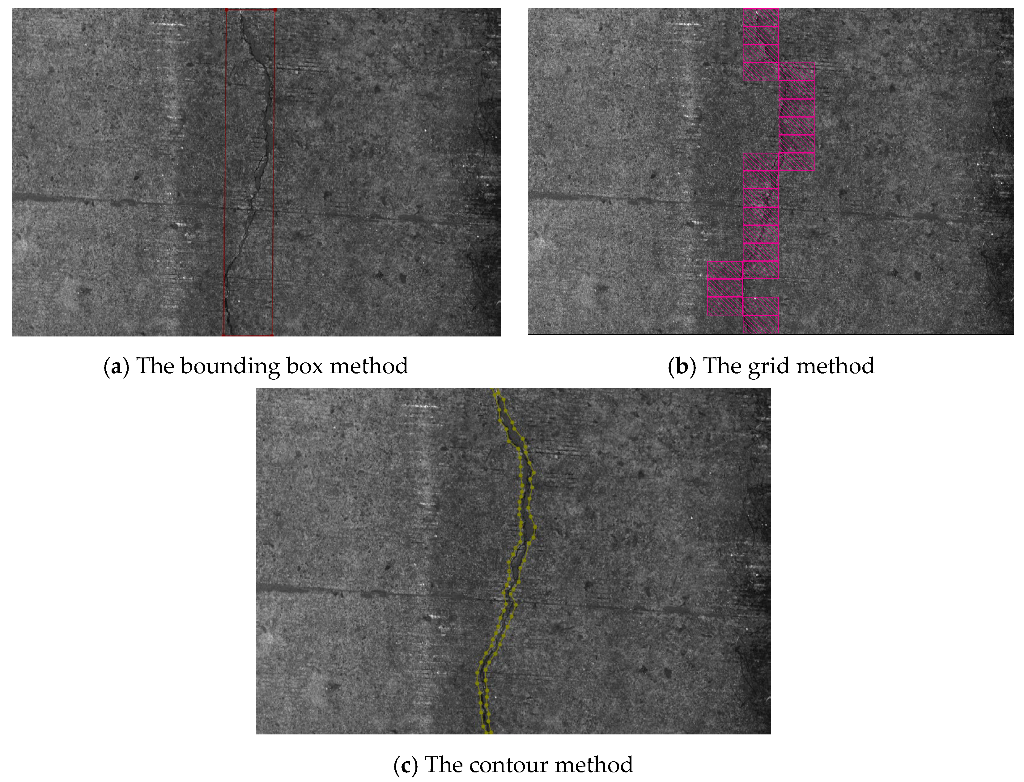
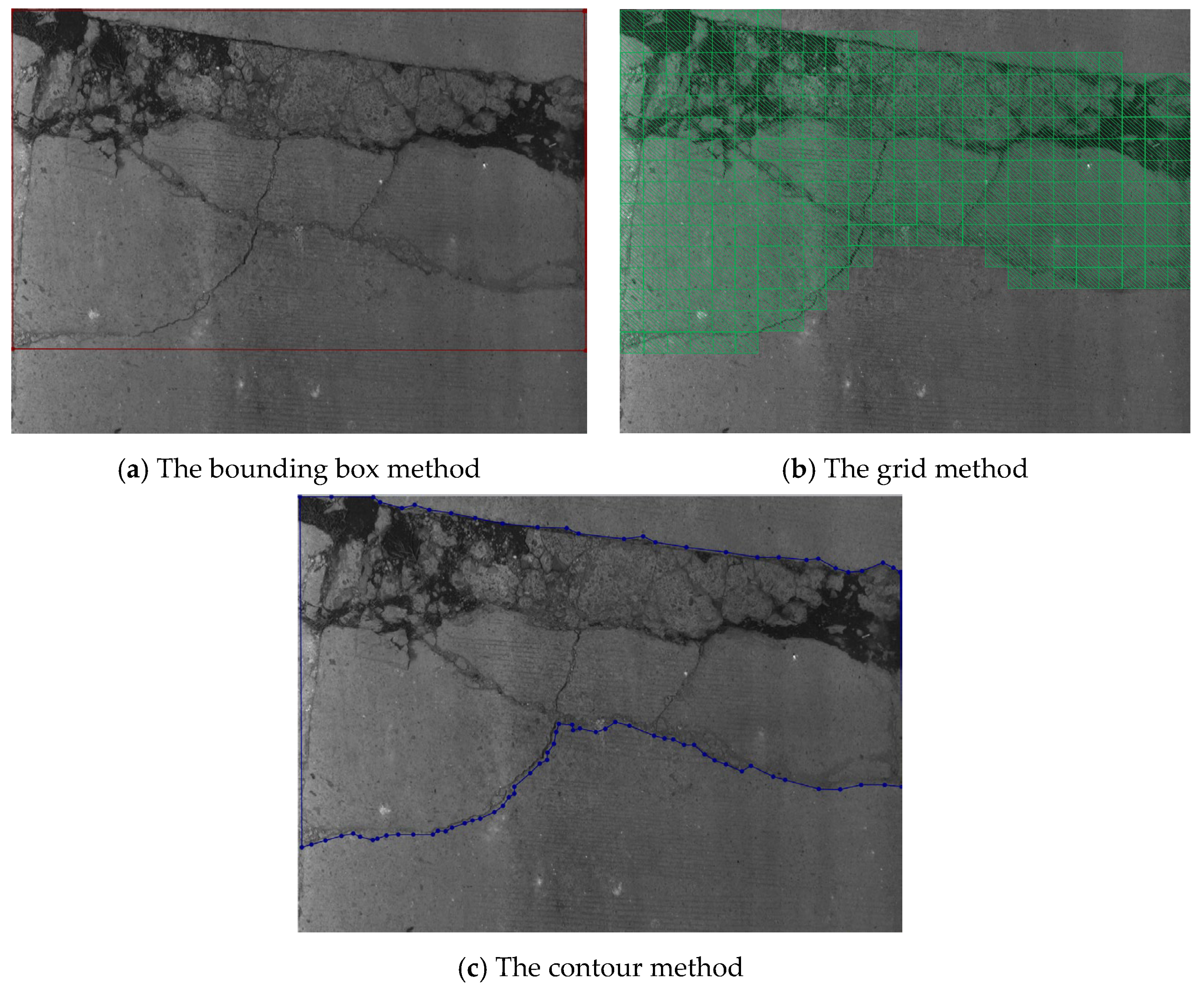
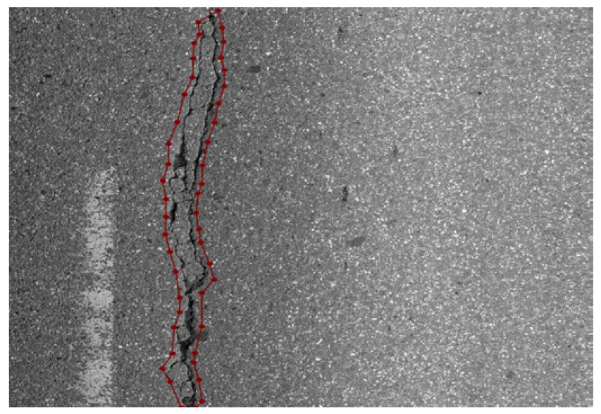
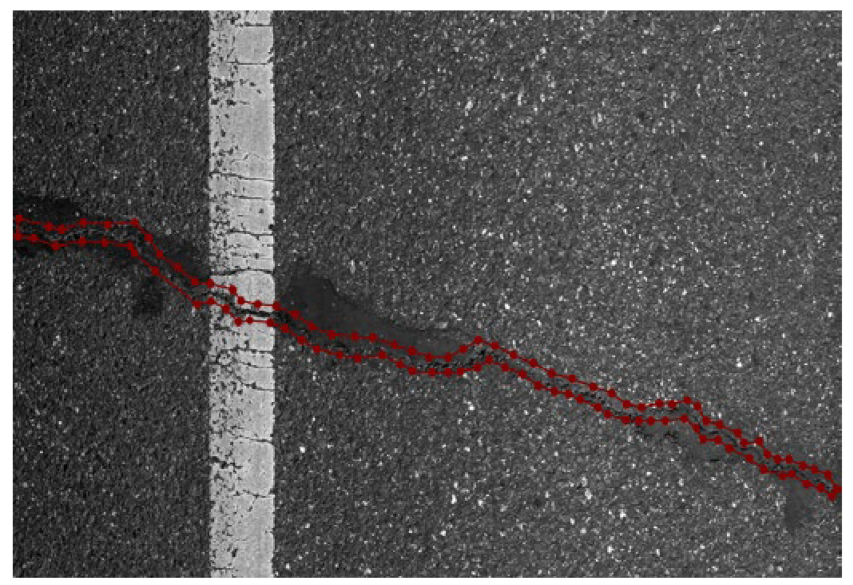
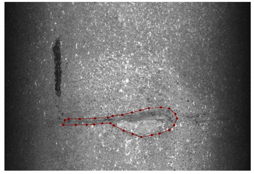
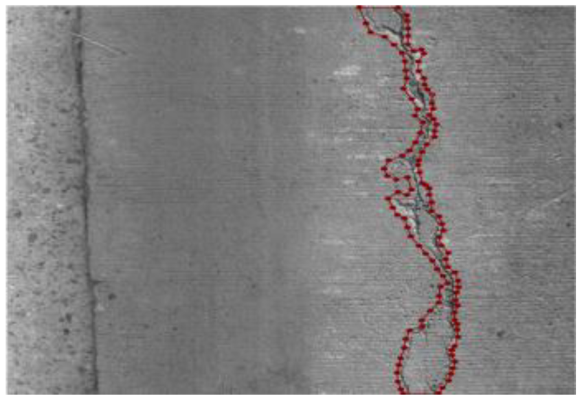
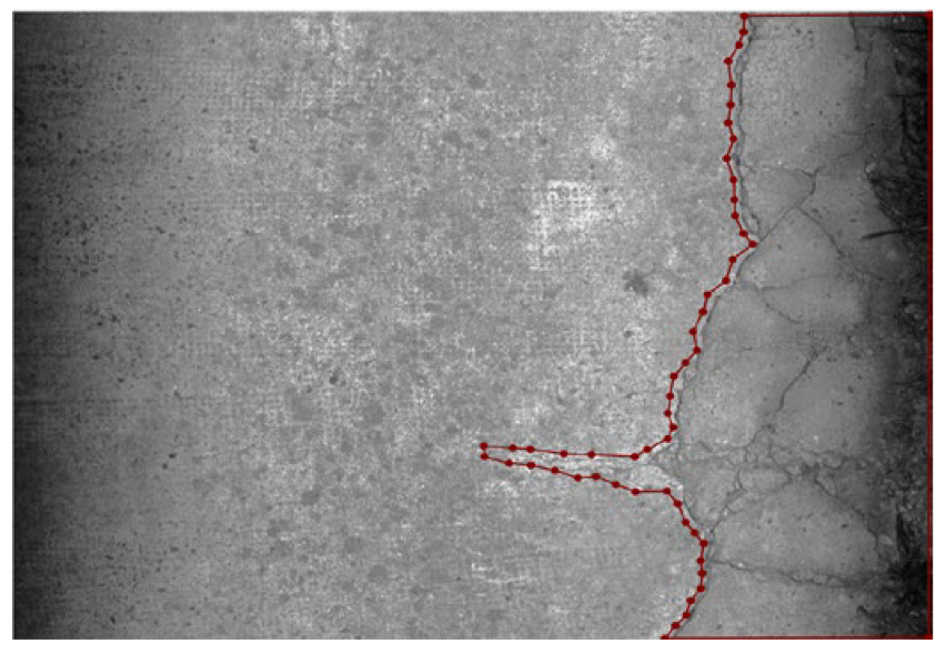
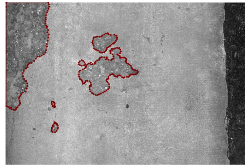
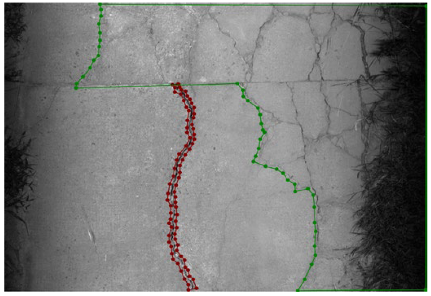
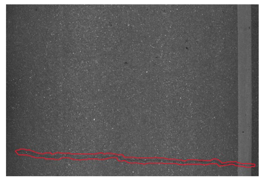
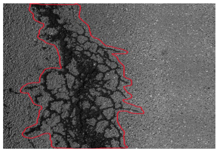
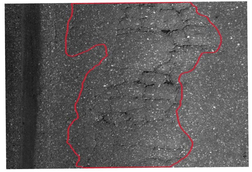
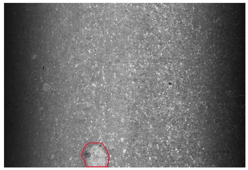
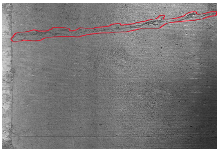
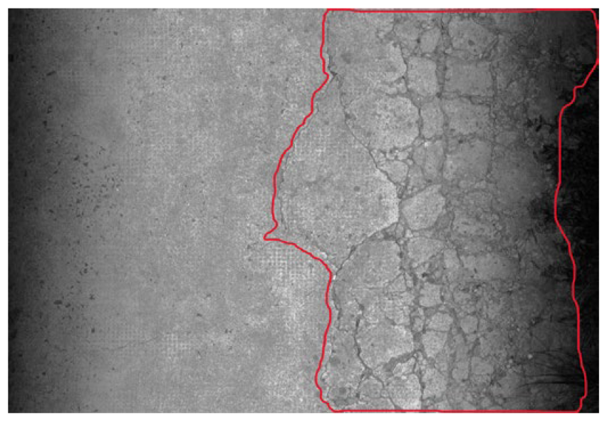
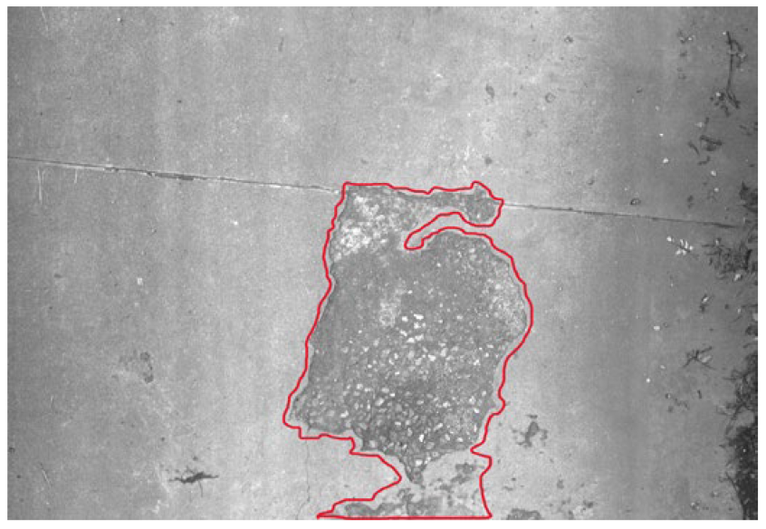
Currently, manual annotation methods mainly include the bounding box method, grid method, and contour method, as illustrated in Figure 3 and Figure 4. The bounding box method involves drawing an external rectangular box tangential to the edges of the pavement distress to estimate the affected area. The grid method divides pavement image data using 0.1 × 0.1 m grid lines, determines whether each grid cell falls within the diseased area, and calculates the number of affected grid cells to measure the distress area. The contour method involves tracing the actual edges of the pavement distress to form a closed shape, and the area enclosed by the traced contour is used to quantify the distress extent.

3.3. Typical Detection and Identification Process of Rural Road Diseases

The automatic detection and identification system for road diseases in this paper is based on a disease segmentation algorithm, conducting research on the identification of typical diseases in rural roads. The main recognition process is divided into the following three steps:
Step 1: Random samples are taken from rural road pavement image data in different regions, with varying technical levels and pavement types in Zhejiang Province. The images are annotated for disease identification to build a typical rural road disease sample dataset.
Step 2: Optimizations are made based on the U-Net to construct the disease type localization and accurate segmentation of disease areas.
Step 3: The deep learning algorithm model is tested to evaluate the recognition performance of typical rural road pavement diseases in the test database.

3.3.1. Establishing a Sample Database of Typical Rural Road Distress

Image data of rural road surfaces in various regions of Zhejiang Province, including Hangzhou, Ningbo, Shaoxing, Quzhou, Taizhou, Lishui, and Jinhua, were collected using lightweight equipment. Distressed images were randomly selected from roads with different technical grades and pavement types to construct a typical rural road distress sample dataset. The asphalt pavement dataset primarily includes longitudinal cracks, transverse cracks, alligator cracking, and potholes, while the cement pavement dataset includes cracks, shattered slabs, and potholes. These distress types were used as the basis for annotation. To ensure the quality of the distress sample data annotation, preprocessing steps were carried out on the raw image data, which included noise reduction, resizing, and adjustments to brightness and contrast.
In this study, the U-Net, an advanced architecture derived from the Fully Convolutional Network (FCN), is employed. It features a symmetric encoder–decoder structure with extensive skip connections, which effectively preserve spatial information and improve segmentation accuracy. The U-Net disease detection algorithm presented in this study classifies asphalt pavement cracks into transverse and longitudinal cracks. The specific classification criterion involves calculating the crack angle based on the long edge of the minimum bounding rectangle and defining the angle range: cracks with angles between 0° and 45° are classified as transverse cracks, while those with angles between 45° and 90° are classified as longitudinal cracks.
As shown in Figure 5a, the lengths of the long and short edges of the bounding rectangle are first determined (with d1 representing the long edge and d2 representing the short edge). Then, the angle between the long edge and the horizontal axis (x) is calculated. Two angles, α1 and α2, are obtained, and the smaller angle, which is ≤90°, is selected (as shown in the figure, if α1 is less than 90°, this value is chosen). Figure 5b provides an example from a rural road image. The minimum bounding rectangle of the measured pavement crack has an angle of 27°, measured using a protractor, indicating it is a transverse crack.
The annotation method for the typical rural road distress samples is the “contour method,” which requires that sample image data be clear and unobstructed. Images that are blurred or difficult to interpret for crack type classification should be excluded. The rural road typical distress sample database includes 1487 images of asphalt transverse cracks, 3654 images of asphalt longitudinal cracks, 2951 images of asphalt alligator cracks, 817 images of asphalt potholes, 6755 images of cement cracks, 4875 images of cement shattered slabs, and 1812 images of cement potholes, as shown in Figure 6. Table 2 presents the feature list of the typical rural road distress samples, which serves as the standard for annotation and provides a foundation for the development of automated distress recognition algorithms.

3.3.2. Construction of a Typical Rural Road Disease Identification Algorithm

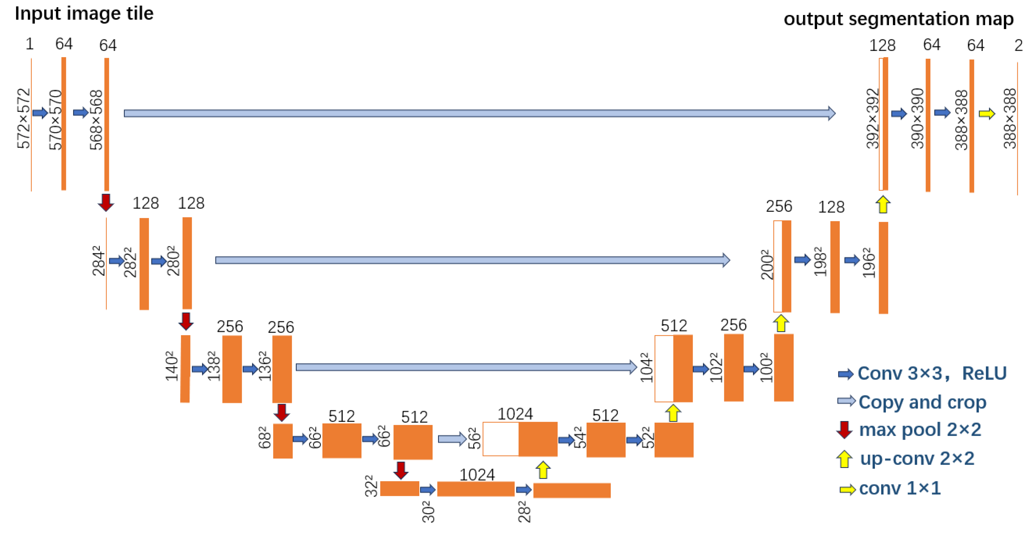
In this study, the U-Net, an advanced architecture derived from the Fully Convolutional Network (FCN), is employed. It features a symmetric encoder–decoder structure with extensive skip connections, which effectively preserve spatial information and improve segmentation accuracy. The U-Net consists of two concatenated paths: the contracting path and the expanding path. The contracting path is designed to extract image features, compressing the image into a feature map that represents these features. The expanding path is responsible for precise localization, decoding the extracted features into a segmented prediction image that matches the original image size.
Unlike the FCN, U-Net retains a large number of feature channels during the upsampling process, allowing more information to be retained and flow into the final reconstructed segmentation image. To minimize information loss in the contracting path, feature maps of the same size from both the contracting and expanding paths are concatenated, followed by convolution and upsampling. This process integrates more information, thereby enhancing the accuracy of image segmentation. The U-Net network structure is illustrated in Figure 7.

3.3.3. Recognition Results Under Different Annotation Methods

A deep learning-based U-Net algorithm model was used to evaluate the recognition performance of typical rural road distresses through metrics such as accuracy, false detection rate, and missed detection rate. Using lightweight inspection equipment, rural roads within the Hangzhou area were surveyed, resulting in the selection and classification of 28,000 test samples across 7 typical types of rural road distress. Experimental parameters are provided in Table 3. The recognition results are shown in Table 4, and examples of recognition images are presented in Table 5.
The statistical results indicate that the U-Net algorithm trained using the contour method outperforms both the grid method and the bounding box method in terms of accuracy, false detection rate, and missed detection rate. The contour method achieves the best performance, with an average accuracy of 94.95%, an average false detection rate of 5.93%, and an average missed detection rate of 2.79%, as shown in Table 4.

3.3.4. Comparison of Automatic Distress Recognition Models for Different Pavement Types

To further validate the accuracy and efficiency of the proposed model, a comparative experiment using different automatic recognition models was conducted to evaluate algorithm performance. The most representative models selected for comparison were the YOLO v3 and Faster R-CNN automatic recognition models.
The test data consisted of approximately 10 km of rural road surface images collected using lightweight inspection equipment in Tonglu District, Hangzhou. For seven types of typical pavement distresses, three recognition models—U-Net-based model, YOLO v3 [14], and Faster R-CNN [15]—were applied to the same dataset for performance comparison, as shown in Table 6.
The statistical results indicate that the proposed U-Net-based model outperformed the other models in terms of accuracy, false detection rate, and missed detection rate across all distress types.

4. Application for Rural Road Maintenance and Management

Based on an automatic identification algorithm developed for rural road distresses, a rural road disease management system that enables dynamic management of rural road maintenance operations is developed. Its key functions related to the above automatic identification algorithm are outlined below:
(1)
Data validation
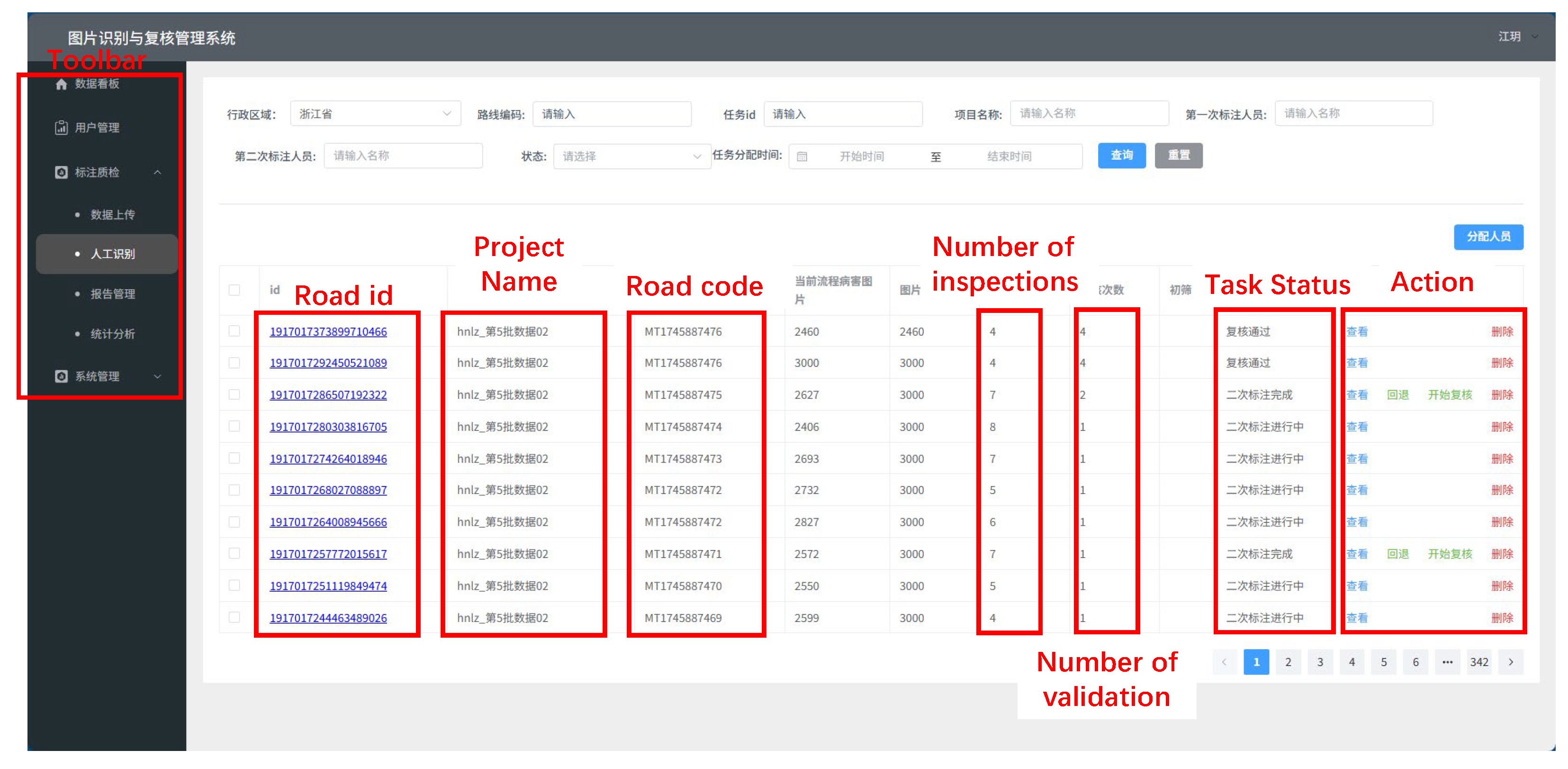
The inspection management platform enables the review of completed image recognition data, allowing the identification and filtering of inaccurate results (see Figure 8). Through the system’s editing functions, technical personnel can modify or delete distress annotations to ensure the accuracy and reliability of the recognition outcomes.
(2)
Rural road distress database
Through the inspection management platform, verified recognition results are categorized and stored, laying a solid foundation for future iterations and upgrades of the distress recognition algorithm, while also supporting historical distress query requirements for inspection projects.
(3)
Maintenance Work Orders
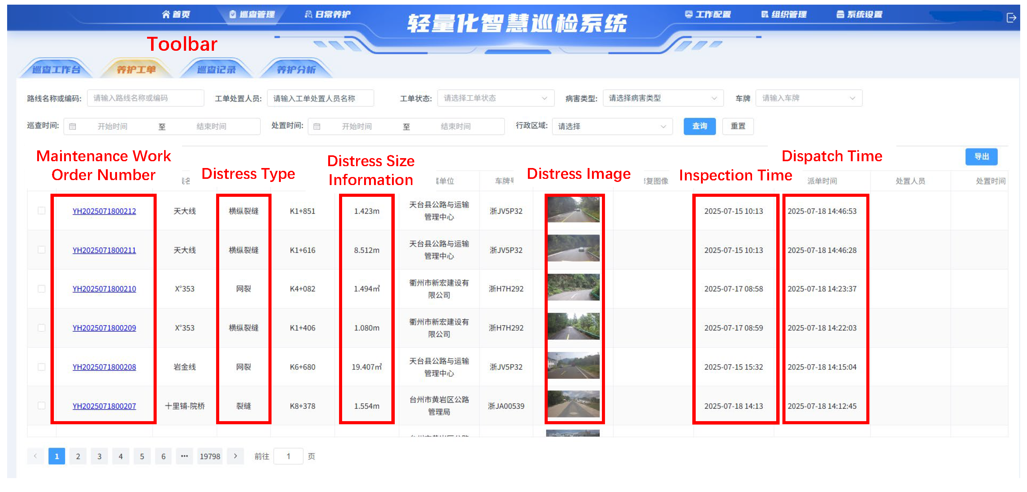
The inspection management platform enables rapid identification of rural road surface distress. Based on the identified distress types, maintenance work orders, as shown in Figure 9, are generated in real time, significantly reducing the time span between distress detection and maintenance dispatch, and greatly improving the efficiency of rural road maintenance.
(4)
Data Reports
According to the recognition results from the inspection management platform, data reports in Excel Format, as shown in Figure 10, on rural road surface distresses are automatically generated. The reports provide detailed information, including distress locations, affected areas, and distress types, serving as a foundation for subsequent maintenance analysis.

5. Conclusions

This study addresses the detection needs of rural road diseases by designing an automatic recognition system based on a disease segmentation algorithm. The main novelty lies in the creation of a typical rural road disease sample database covering different regions, technical grades, and pavement types in Zhejiang Province. Additionally, a pavement disease recognition network is optimized and built based on the U-Net algorithm. By comparing the model training results of three annotation strategies, the optimal annotation method is determined. The results show that the U-Net algorithm trained using the contour annotation method achieves the best performance, with an accuracy of 94.95%, a false detection rate of 5.93%, and a missed detection rate of 2.79%, significantly outperforming the grid and bounding box methods. The system has completed initial deployment and debugging, enabling efficient data processing for lightweight detection devices. Under controlled testing conditions, the system demonstrates excellent performance, effectively addressing the challenges faced by traditional equipment in rural road detection. It provides technical support for low-cost and precise maintenance, showcasing its vast potential for future practical applications.

Author Contributions

Conceptualization, L.C. and H.Z.; methodology, H.Z. and D.L.; software, D.L. and Y.L.; validation, Y.L. and J.L.; formal analysis, J.L. and K.F.; data collection, K.F. and J.L.; writing—original draft preparation, L.C.; writing—review and editing, H.Z.; project administration, L.C.; funding acquisition, D.L. and H.Z. All authors have read and agreed to the published version of the manuscript.

Funding

This work was supported by Zhejiang Provincial Department of Transportation Science and Technology Program Project (No. 2024018).

Data Availability Statement

Dataset available on request from the authors.

Conflicts of Interest

The authors declare no conflicts of interest.

References

  1. Zhu, J.; Wu, Y.; Ma, T. Multi-Object Detection for Daily Road Maintenance Inspection with UAV Based on Improved YOLOv8. IEEE Trans. Intell. Transp. Syst. 2024, 25, 16548–16560. [Google Scholar] [CrossRef]
  2. Mathew, B.S.; Isaac, K.P. Optimisation of Maintenance Strategy for Rural Road Network Using Genetic Algorithm. Int. J. Pavement Eng. 2014, 15, 352–360. [Google Scholar] [CrossRef]
  3. Shan, F.; Li, H.; Wang, Z.; Jin, M.; Chen, D. Optimizing Rural Highway Maintenance Scheme with Mathematical Programming. Appl. Sci. 2024, 14, 8253. [Google Scholar] [CrossRef]
  4. Pasindu, H.; Ranawaka, R.; Sandamal, R.; Dias, T. Incorporating Road Safety into Rural Road Network Pavement Management. Int. J. Pavement Eng. 2021, 23, 4306–4319. [Google Scholar] [CrossRef]
  5. Yang, G.; Wang, H.; Pan, Y.; Li, L. Research on Application of the Rural Road Performance Assessment Method in Jiangsu Province. Road Mater. Pavement Des. 2017, 18 (Suppl. 3), 76–87. [Google Scholar] [CrossRef]
  6. Hu, Y.; Chen, N.; Hou, Y.; Lin, X.; Jing, B.; Liu, P. Lightweight Deep Learning for Real-Time Road Distress Detection on Mobile Devices. Nat. Commun. 2025, 16, 4212. [Google Scholar] [CrossRef] [PubMed]
  7. Hui, L.; Ibrahim, A.; Hindi, R. Computer Vision-Based Concrete Crack Identification Using MobileNetV2 Neural Network and Adaptive Thresholding. Infrastructures 2025, 10, 42. [Google Scholar] [CrossRef]
  8. Li, J.; Li, X.; Liu, K.; Yao, Z. Crack Identification for Bridge Structures Using an Unmanned Aerial Vehicle (UAV) Incorporating Image Geometric Correction. Buildings 2022, 12, 1869. [Google Scholar] [CrossRef]
  9. An, H.; Fan, Y.; Jiao, Z.; Liu, M. Research on Improved Bridge Surface Disease Detection Algorithm Based on YOLOv7-Tiny-DBB. Appl. Sci. 2025, 15, 3626. [Google Scholar] [CrossRef]
  10. Sheng, B.; Wu, L.; Zhang, N. A Maturity Detection Method for Hemerocallis Citrina Baroni Based on Lightweight and Attention Mechanism. Appl. Sci. 2023, 13, 12043. [Google Scholar] [CrossRef]
  11. Jiang, M.; Gielen, G.; Deng, B.; Zhu, X. A Fast Learning Algorithm for Time-Delay Neural Networks. Inf. Sci. 2002, 148, 27–39. [Google Scholar] [CrossRef]
  12. Kim, J.Y. Development of New Automated Crack Measurement Algorithm Using Laser Images of Pavement Surface. Master’s Thesis, The University of Iowa, Iowa City, IA, USA, 2008. [Google Scholar]
  13. Wang, K.C.P.; Gong, W.-G. Real-Time Automated Survey System of Pavement Cracking in Parallel Environment. J. Infrastruct. Syst. 2005, 11, 154–164. [Google Scholar] [CrossRef]
  14. Redmon, J.; Farhadi, A. YOLOv3: An Incremental Improvement. arXiv 2018. [Google Scholar] [CrossRef]
  15. Ren, S.; He, K.; Girshick, R.; Sun, J. Faster R-CNN: Towards Real-Time Object Detection with Region Proposal Networks. IEEE Trans. Pattern Anal. Mach. Intell. 2017, 39, 1137–1149. [Google Scholar] [CrossRef] [PubMed]
Figure 1. System architecture design.
Buildings 15 04222 g001
Figure 2. Composition of the lightweight intelligent inspection hardware system.
Buildings 15 04222 g002
Figure 3. Annotated examples of length-based distress samples.
Buildings 15 04222 g003
Figure 4. Annotated examples of area-based distress samples.
Buildings 15 04222 g004
Figure 5. Example of the bounding rectangle to determine the orientation of the crack.
Buildings 15 04222 g005
Figure 6. Sample images from the database.
Buildings 15 04222 g006
Figure 7. U-Net network structure.
Buildings 15 04222 g007
Figure 8. Data validation module.
Buildings 15 04222 g008
Figure 9. Maintenance work orders.
Buildings 15 04222 g009
Figure 10. Data report in Excel format (in Chinese).
Buildings 15 04222 g010
Table 1. Technical Specifications.
ItemDescription
CPU11th Gen Inter(R) Core(TM) I5-1135G7@2.49GHZ
RAM/ROM8 GB-DDR3L 1600 MHz
Operation SystemWindows 11 Professional Edition 22H2
Hard DriveSamsung SSD 870 EVO 500GB
Ethernet Port4× Intel® i211 Gigabit Ethernet Ports; supports PoE (Power over Ethernet); compliant with IEEE 802.3af; supports Wake-on-LAN/PXE boot
COM Port4× RS232/RS485, switchable via jumper caps; COM1–COM4 support digital capacitive isolation
Wireless Communication1× External SIM card slot connected to M.2 B-key slot, supports 4G/5G wireless networking
GPSGPS + BDS + SBAS + QZSS hybrid positioning with <2 m positioning error and <0.1 m/s velocity error; output frequency: 10 Hz
CameraTriangular magnetic base; 2560 × 1440 resolution; autofocus; strong light suppression; backlight enhancement; Frame rate: 50 Hz, 25 fps
Power Connection Connects to vehicle power supply
Power Supply Voltage24 V, 5 A
Operating Temperature−20 to +70 °C
Waterproof RatingIP67-rated waterproof
Antenna Type4× High-gain magnetic metal rod antennas
Antenna Height230 mm ± 3 mm
Device Installation MethodThe GPS module and camera are magnetically mounted; the industrial computer is fixed in an enclosed housing
Table 2. Feature table of typical rural road distress.
Annotated ImagesTypeFeature
Buildings 15 04222 i001Longitudinal cracks in asphalt pavementsThe cracks are generally parallel to the driving direction, with the angle α1 clearly falling between 45° and 90°. The annotation even includes fine cracks, with markings along the outer edge of the crack.
Buildings 15 04222 i002Transverse cracks in asphalt pavementsThe cracks are generally perpendicular to the driving direction, with the angle α1 clearly falling between 0° and 45°. If the crack is within a strip repair area, the boundary between the repair and the crack should be identified. Markings are made along the outer edge of the crack.
Buildings 15 04222 i003Alligator cracking in asphalt pavementsAlligator cracking on asphalt pavement shall be defined as a grid-shaped pattern formed by intersecting longitudinal and transverse cracks. Annotations must capture the fine internal cracking within the network, with delineation traced along the outermost boundary of the cracking zone.
Buildings 15 04222 i004Pothole in asphalt pavementsPotholes are localized surface depressions resulting from the disintegration and loss of aggregate in asphalt pavement. Markings should be made along the outer edge of the pothole.
Buildings 15 04222 i005Cracks in concrete pavementsThe cracks are longitudinal, transverse, or diagonal cracks on the cement pavements. The annotation should include fine cracks, marked along the outer edge of the crack.
Buildings 15 04222 i006Broken Slab in concrete pavementsThe fractured slab refers to the cement pavement slab with through cracks penetrating the surface layer, and the slab is divided into three or more pieces by the cracks. The annotation should include fine cracks within the range of the through cracks, marked along the outer edge of the fractured slab.
Buildings 15 04222 i007Pothole in concrete pavementsPotholes refer to localized depressions or damage on the cement pavement. The annotation should determine whether the potholes are independent. Independent potholes should be marked along their outer edges separately.
Buildings 15 04222 i008Combined pavement distresses 1If independent cracks outside the fractured slab area are observed in the pavement image, they should be annotated according to the type of defect. When other defects appear within the fractured slab, only the fractured slab should be marked.
Buildings 15 04222 i009Combined pavement distresses 2If independent potholes outside the extent of the alligator cracking are observed in the pavement image, they should be annotated according to the type of defect. When other defects appear within the alligator cracking area, only the alligator cracking should be marked.
Table 3. Experimental parameters.
Experimental ParametersContent
Dataset ProportionTraining:Validation = 8:2
Model ParametersBatch Size: 8, Learning Rate: 0.0001, Optimizer: SGD, Number of Epochs: 100, Loss Function: CrossEntropyLoss
Table 4. Recognition results for different annotation methods.
Annotation MethodRoad TypeDistress TypeSample ImagesAccuracyFalse DetectionMissed DetectionAccuracy (%)False Detection Rate (%)Missed Detection Rate (%)
Bounding box method Asphalt pavementLongitudinal cracks400037921238594.79%4.07%2.87%
Transverse cracks400037801229994.49%5.12%4.20%
Alligator cracking300028471381594.89%9.52%1.16%
Potholes300027102335890.32%10.65%2.87%
Concrete pavementsCracks800076942238396.18%4.26%1.64%
Broken Slab300028271254894.23%10.05%4.07%
Potholes300028365111294.55%3.39%7.14%
Average94.20%6.72%3.42%
Grid method Asphalt pavementLongitudinal cracks400038091137895.22%3.75%2.61%
Transverse cracks400037901169494.75%4.89%3.97%
Alligator cracking300028591301295.29%8.93%0.87%
Potholes300027262245090.86%10.23%2.50%
Concrete pavementsCracks800077042168096.30%4.14%1.57%
Broken Slab300028411184194.69%9.45%3.53%
Potholes300028514310695.04%2.84%6.72%
Average94.59%6.32%3.11%
Contour methodAsphalt pavementLongitudinal cracks400038211077295.53%3.53%2.40%
Transverse cracks400038041108695.10%4.60%3.63%
Alligator cracking30002869124795.63%8.50%0.52%
Potholes300027412164391.37%9.85%2.13%
Concrete pavementsCracks800077132117696.41%4.03%1.49%
Broken Slab300028531093895.10%8.67%3.20%
Potholes30002866369895.53%2.36%6.18%
Average94.95%5.93%2.79%
Table 5. Image of typical defect identification in rural roads.
Road TypeDistress TypeDefect Identification
Example Image 1
Defect Identification
Example Image 2
Asphalt pavementsLongitudinal cracksBuildings 15 04222 i010Buildings 15 04222 i011
Transverse cracksBuildings 15 04222 i012Buildings 15 04222 i013
Alligator crackingBuildings 15 04222 i014Buildings 15 04222 i015
PotholesBuildings 15 04222 i016Buildings 15 04222 i017
Concrete pavementsCracksBuildings 15 04222 i018Buildings 15 04222 i019
Broken SlabBuildings 15 04222 i020Buildings 15 04222 i021
PotholesBuildings 15 04222 i022Buildings 15 04222 i023
Table 6. Comparison of evaluation metrics for different recognition models.
ModelEvaluation Metrics
Accuracy RateFalse Detection RateMissed Detection Rate
YOLO v3 90.36%6.74%2.9%
Fastr R-CNN 93.86%4.74%1.4%
Unet 95.04%3.67%1.29%
Disclaimer/Publisher’s Note: The statements, opinions and data contained in all publications are solely those of the individual author(s) and contributor(s) and not of MDPI and/or the editor(s). MDPI and/or the editor(s) disclaim responsibility for any injury to people or property resulting from any ideas, methods, instructions or products referred to in the content.