Article

Intent-Driven Hybrid Semantic–Spatial Retrieval–Augmented Generation for Intelligent Prospecting with GIS Visualization


1
Center for Earth Environment & Earth Resources, Sun Yat-sen University, Zhuhai 510275, China
2
School of Earth Sciences and Engineering, Sun Yat-sen University, Zhuhai 519000, China
3
Guangdong Provincial Key Laboratory of Geological Processes and Mineral Resource Exploration, Zhuhai 519085, China
4
Joint Research Institute for Deep-Time Digital Earth and Intelligent Prediction, Sun Yat-sen University, Shenzhen 510000, China
*
Authors to whom correspondence should be addressed.
Minerals 2026, 16(8), 802; https://doi.org/10.3390/min16080802
Submission received: 5 June 2026 / Revised: 29 July 2026 / Accepted: 31 July 2026 / Published: 2 August 2026
(This article belongs to the Topic Big Data and AI for Geoscience)

Abstract

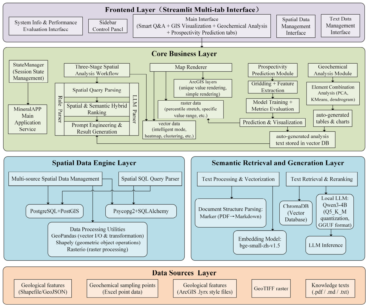
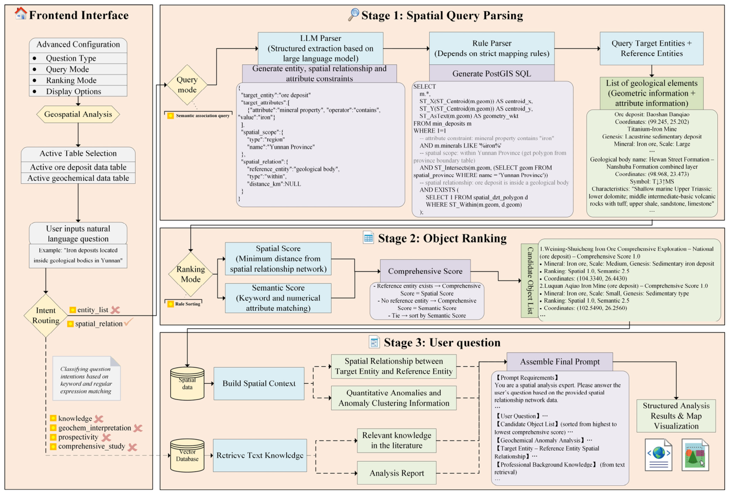
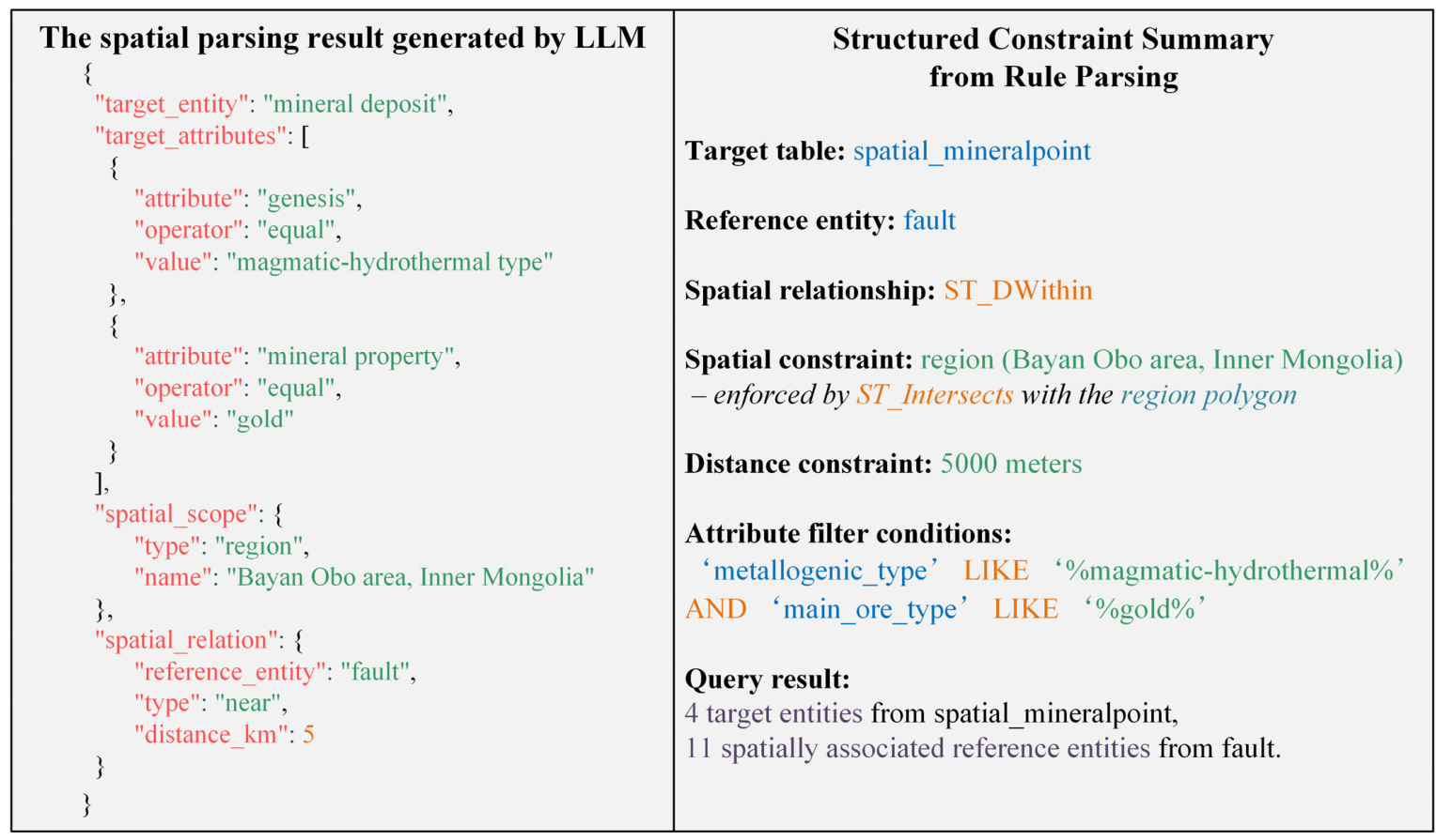
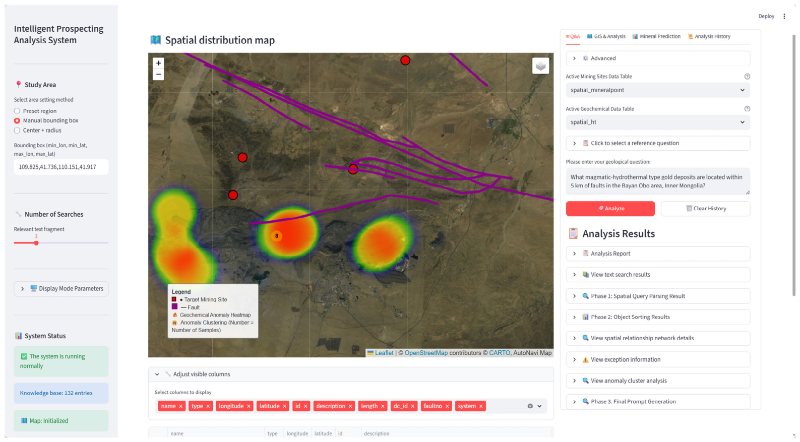
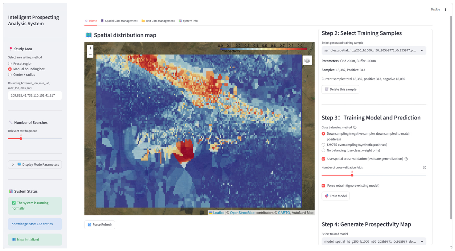
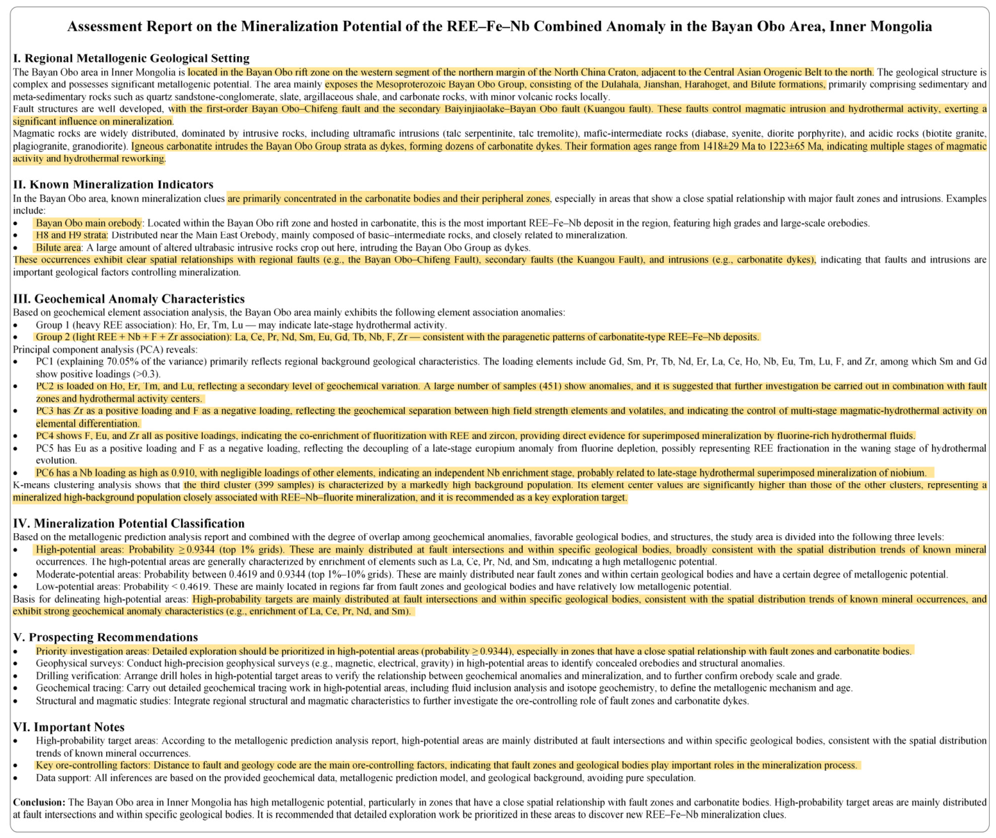
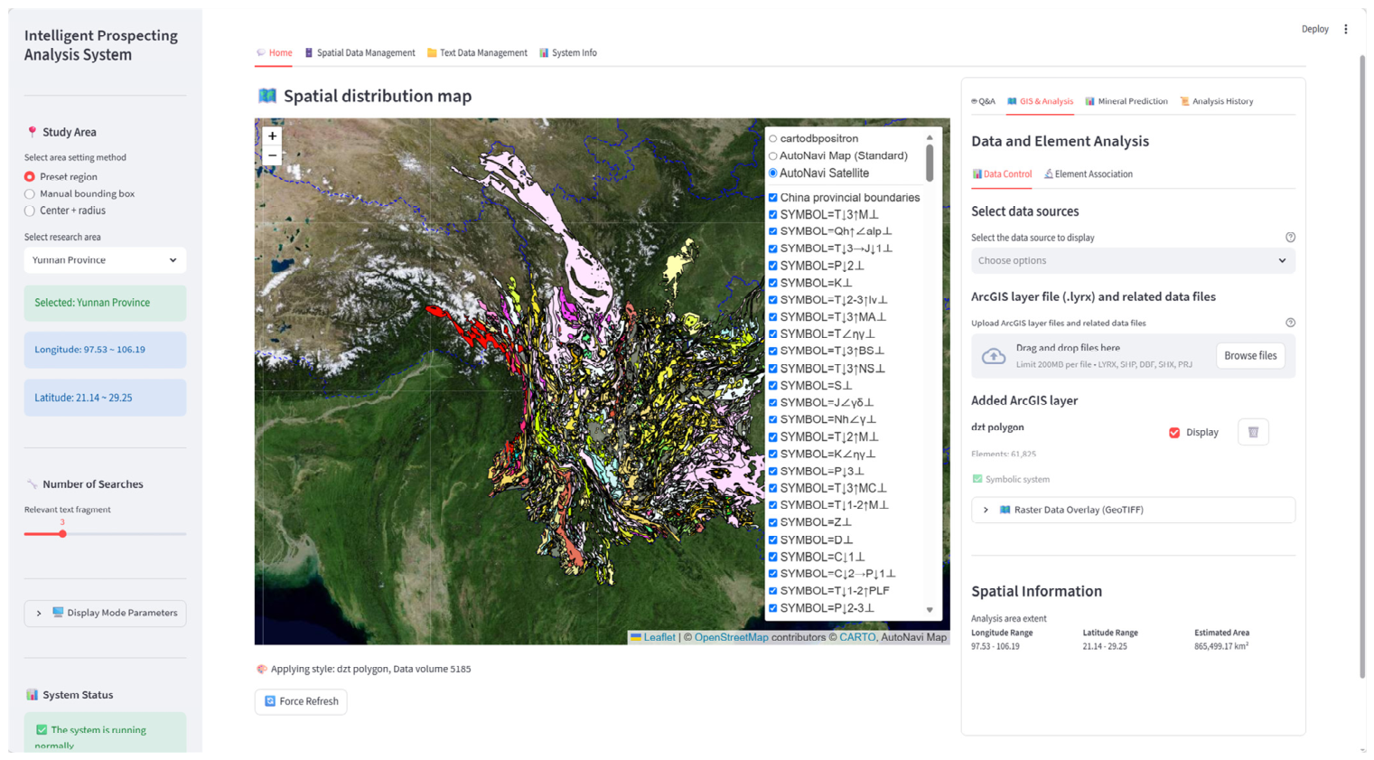
To address the difficulty of synergizing multi-source spatial data with geological text and the limited spatial reasoning of large language models (LLMs), this paper proposes an intention-driven hybrid semantic–spatial retrieval–augmented generation (RAG) method and a corresponding GIS visualization system. The method uses intent routing to direct queries to spatial parsing or text retrieval, extracts target entities, attribute constraints, and spatial relations from natural language via an LLM, and dynamically generates parameterized PostGIS (PostgreSQL Spatial Extension) queries through a rule-based parser, achieving deep coupling of semantic understanding and spatial computation. A spatial proximity verification module computes the minimum distances between target and reference entities, producing a verifiable target-reference list that provides precise spatial support for answers. The system implements a multi-source dynamic data management mechanism supporting unified heterogeneous data import, ArcGIS layer style parsing, adaptive point visualization, and user-defined mappings from data tables to geological entity types. It further integrates prospectivity prediction, geochemical association analysis, and intelligent QA into an end-to-end interactive GIS environment. Experimental results show that semantic filtering raises Precision@5 (Precision at rank 5) from 0.171 to 0.829, rule-based ranking improves NDCG@5 (Normalized Discounted Cumulative Gain at rank 5) by about 16%, and the spatial proximity verification module increases the spatial citation rate (distance coverage ratio) from 24.2% to 47.8% when computed over the 17 spatial-relation queries for which distance citations are applicable. Adding textual knowledge further boosts answer relevance to 0.863 while maintaining a comparable spatial citation rate (47.2% vs. 47.8%). To mitigate potential self-preference bias in the LLM-as-Judge setup, an independent evaluation using DeepSeek-V4-Flash was conducted, yielding high inter-evaluator agreement (Pearson r = 0.951 for faithfulness, 0.988 for relevance). These results suggest the method’s potential for query understanding, ranking optimization, and spatial interpretability, while also highlighting the need for larger-scale benchmarks and blinded expert evaluation.
Keywords: spatial data augmentation; intelligent prospecting; large language model; retrieval-augmented generation; GIS visualization; spatial query parsing; spatial proximity verification module; geochemical analysis spatial data augmentation; intelligent prospecting; large language model; retrieval-augmented generation; GIS visualization; spatial query parsing; spatial proximity verification module; geochemical analysis