Article

Quantifying Evapotranspiration and Environmental Factors in the Abandoned Saline Farmland Using Landsat Archives

1
State Key Laboratory of Water Resources and Hydropower Engineering Sciences, Wuhan University, Wuhan 430072, China
2
Division of Soil and Water Management, Department of Earth and Environmental Sciences, KU Leuven, 3001 Leuven, Belgium
3
Department of Biogeochemical Integration, Max Planck Institute for Biogeochemistry, 07745 Jena, Germany
4
School of Humanities and Law, Northeastern University, Shenyang 110169, China
*
Authors to whom correspondence should be addressed.
Land 2025, 14(2), 283; https://doi.org/10.3390/land14020283
Submission received: 26 November 2024 / Revised: 22 January 2025 / Accepted: 27 January 2025 / Published: 30 January 2025
(This article belongs to the Special Issue Salinity Monitoring and Modelling at Different Scales: 2nd Edition)

Abstract

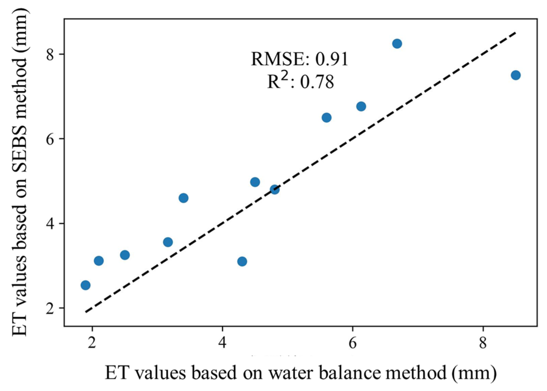
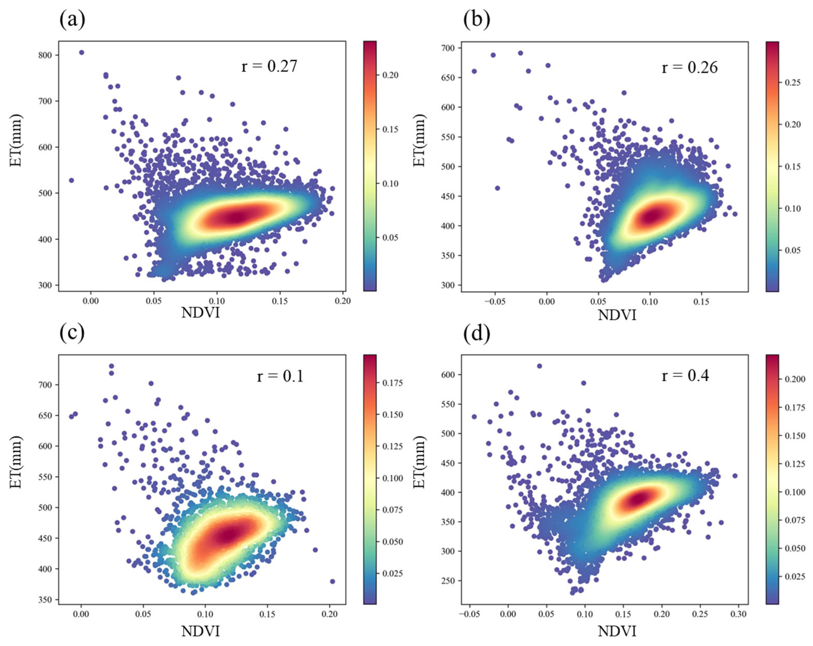
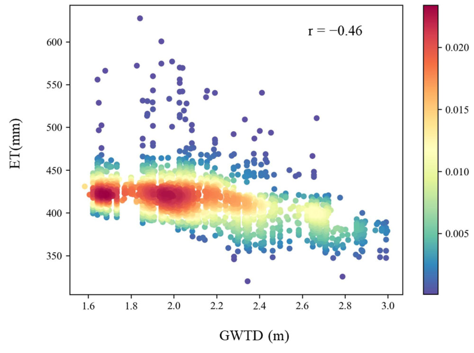
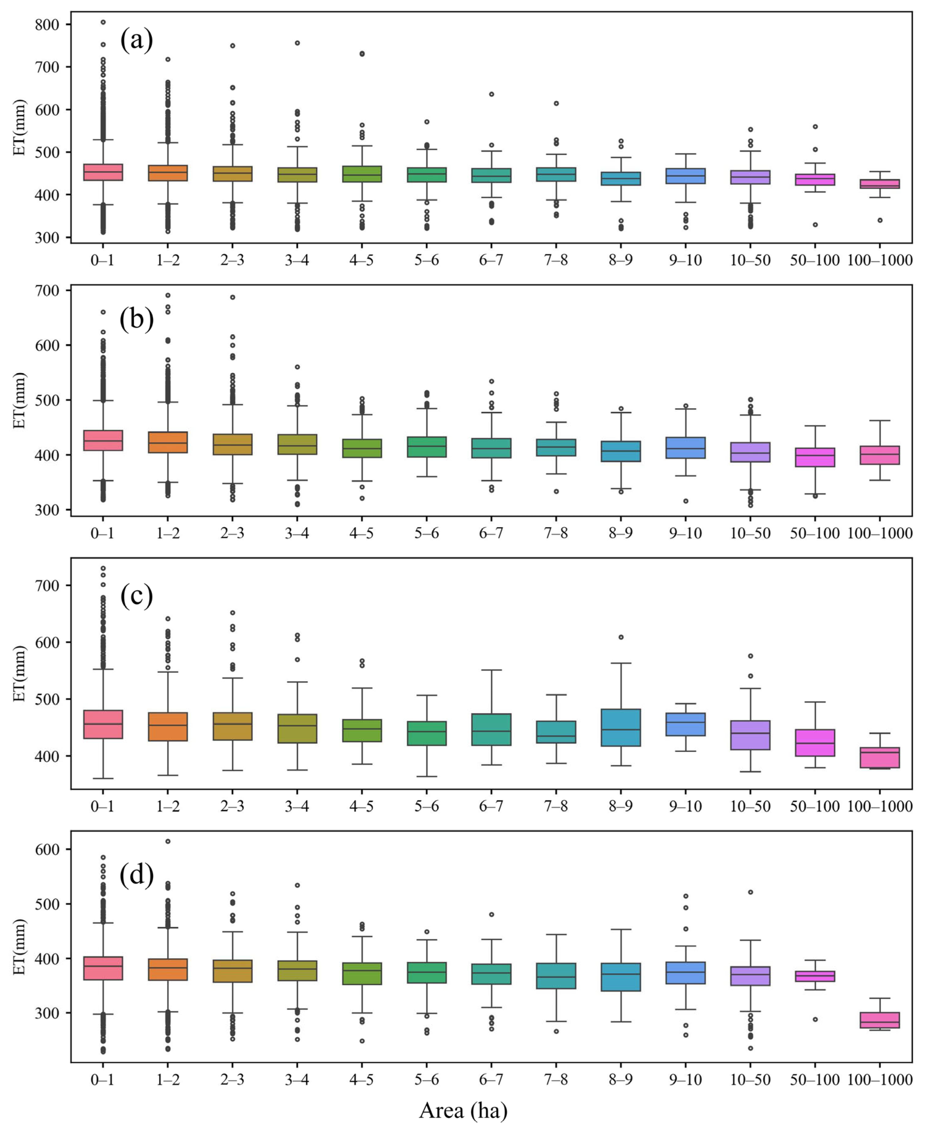
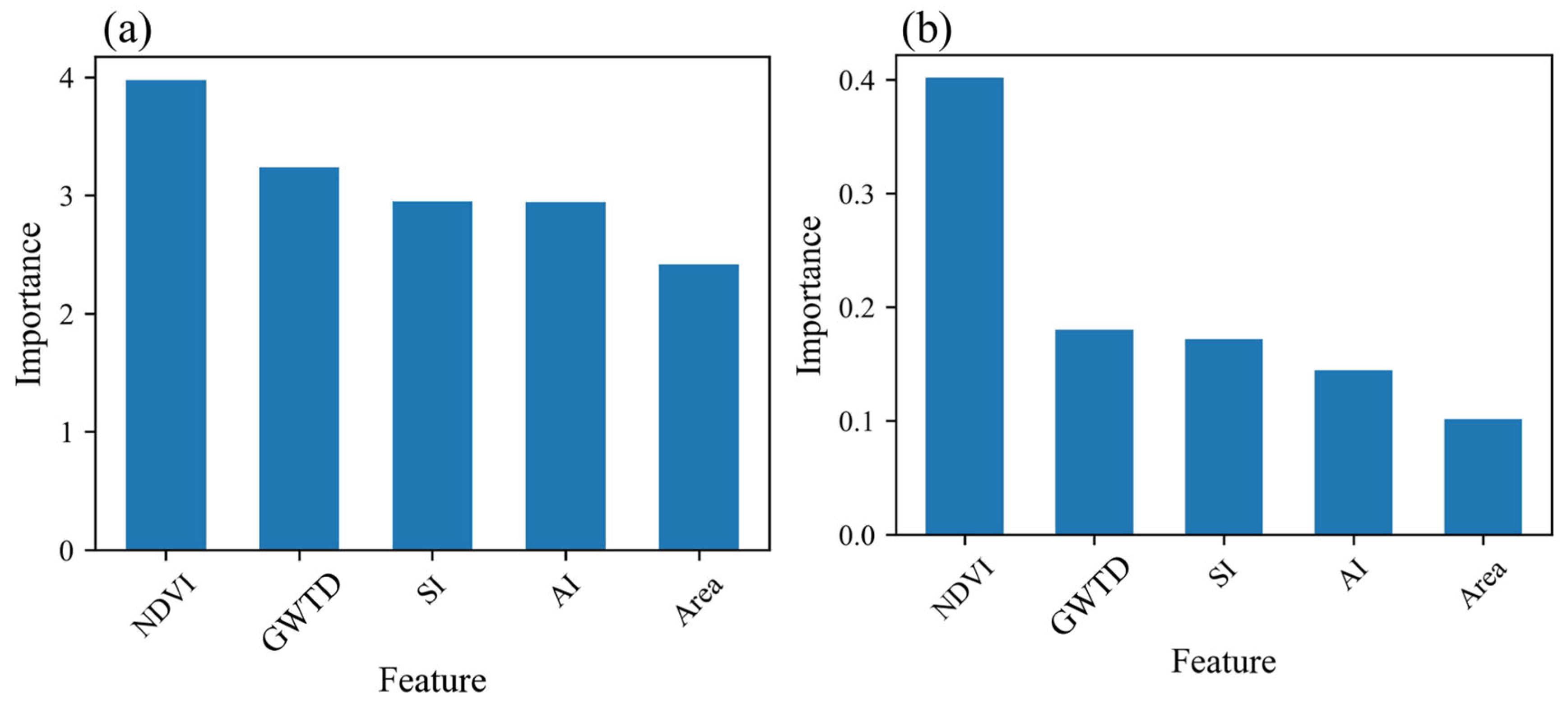
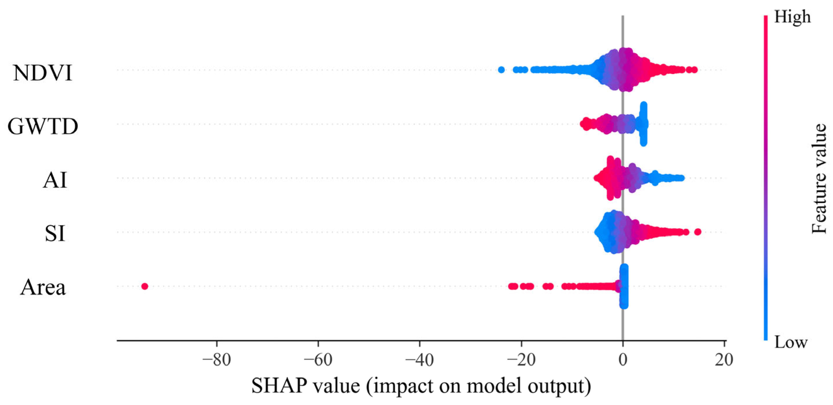
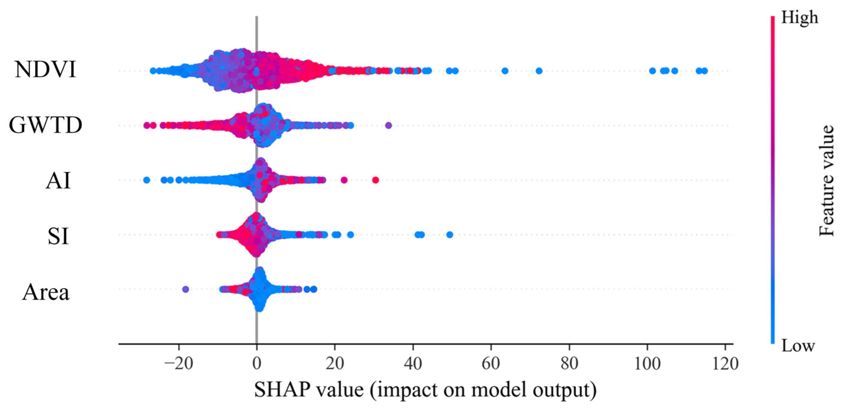
This study investigates the complex interaction of biophysical and meteorological factors that drive evapotranspiration (ET) in saline environments. Leveraging a total of 182 cloud-free Landsat 5/8 time-series data from 1988 to 2019, we employed the Surface Energy Balance System (SEBS) model to quantify ET and investigate its relationships with soil salinity, vegetation cover, groundwater depth, and landscape metrics. We validated the predicted ET at two experimental sites using ET observation calculated by a water balance model. The result shows an R2 of 0.78 and RMSE of 0.91 mm for the SEBS predicted ET, indicating high accuracy of the ET estimation. We detected abandoned saline farmland patches across Hetao and extracted the normalized difference vegetation index (NDVI), salinization index (SI), and the predicted ET for analysis. The results indicate that ET is negatively correlated with SI with a Pearson correlation coefficient (r) up to −0.7, while ET is positively correlated with NDVI (r = 0.4). In addition, we designed a control-variable experiment in the Yichang subdistrict to investigate the effects of groundwater depth, land aggregation index, soil salinity index, and the area of abandoned saline farmland patches on ET. The results indicate that increased NDVI could significantly enhance ET, while smaller saline farmland patches exhibited greater sensitivity to groundwater recharge, with higher averaged ET than larger patches. Moreover, we analyzed factor importance using Lasso regression and Random Forest (RF) regression. The result shows that the ranking of the importance of the features is consistent for both methods and for all the features, with NDVI being the most important (with an RF importance score of 0.4), followed by groundwater table depth (GWTD), and the influence of the surface area of abandoned saline farmland being the weakest. We found that smaller patches of abandoned saline farmland were more sensitive to changes in groundwater levels induced by nearby irrigation, affecting their averaged ET more dynamically than larger patches. Decreasing patch size over time indicates ongoing changes in land management and ecological conditions. This study, through a multifactor analysis of ET in abandoned saline farmland and its intrinsic factors, provides a reference for evaluating the dry drainage efficiency of abandoned saline farmland in a dry drainage system.
Keywords: evapotranspiration; abandoned saline farmland; Hetao Irrigation District; Landsat; soil salinity; vegetation cover; aggregation index; dry drainage system evapotranspiration; abandoned saline farmland; Hetao Irrigation District; Landsat; soil salinity; vegetation cover; aggregation index; dry drainage system