Review

Global Open Data Remote Sensing Satellite Missions for Land Monitoring and Conservation: A Review


by
Dorijan Radočaj
1,*,
Jasmina Obhođaš
2,
Mladen Jurišić
1 and
Mateo Gašparović
3
1
Faculty of Agrobiotechnical Sciences Osijek, Josip Juraj Strossmayer University of Osijek, Vladimira Preloga 1, 31000 Osijek, Croatia
2
Ruđer Bošković Institute, Bijenička 54, 10000 Zagreb, Croatia
3
Faculty of Geodesy, University of Zagreb, Kačićeva 26, 10000 Zagreb, Croatia
*
Author to whom correspondence should be addressed.
Land 2020, 9(11), 402; https://doi.org/10.3390/land9110402
Submission received: 9 October 2020 / Revised: 21 October 2020 / Accepted: 22 October 2020 / Published: 23 October 2020

Abstract

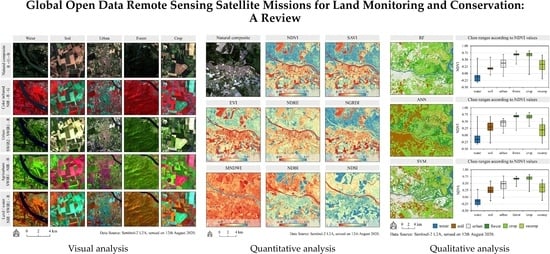
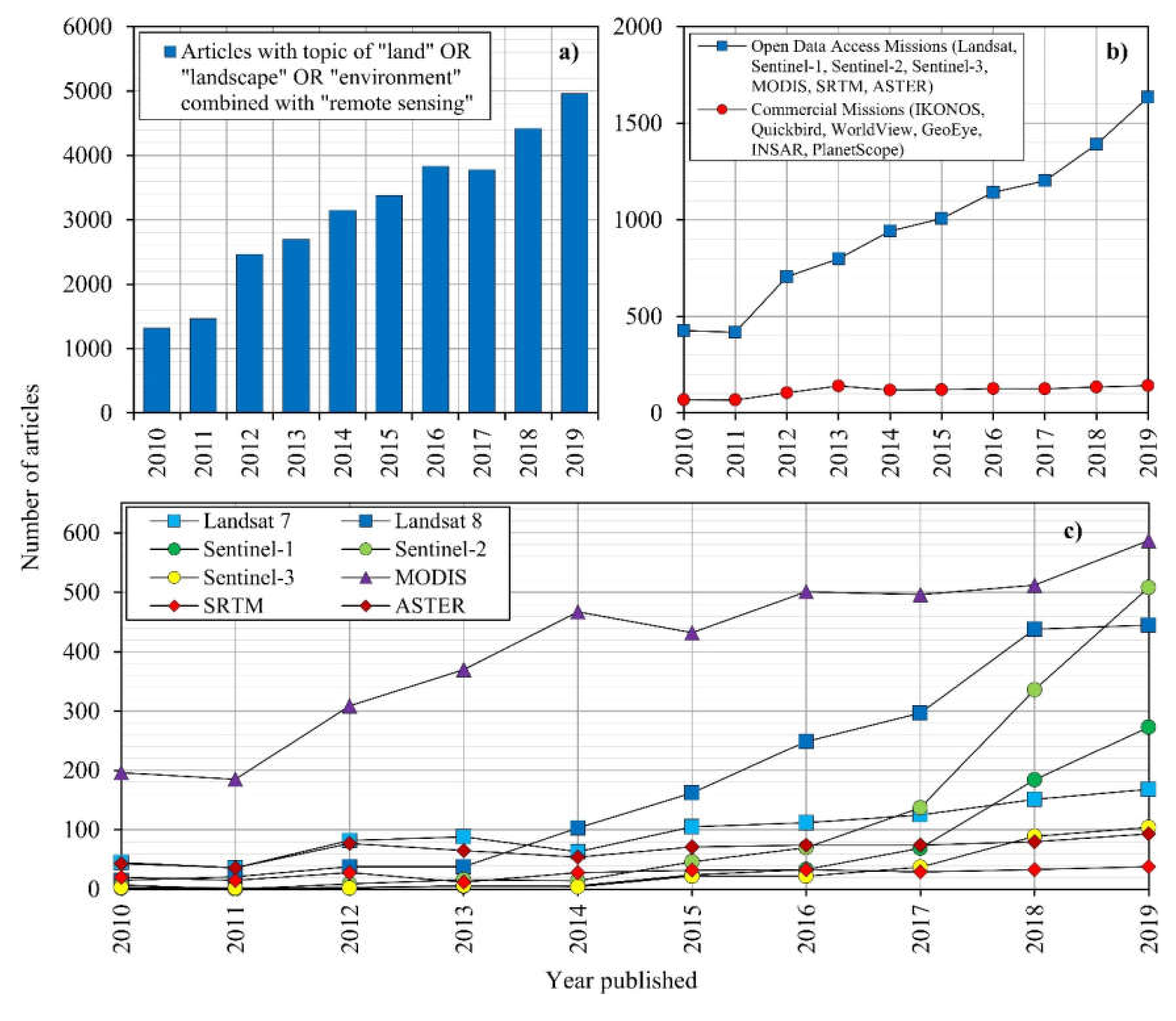
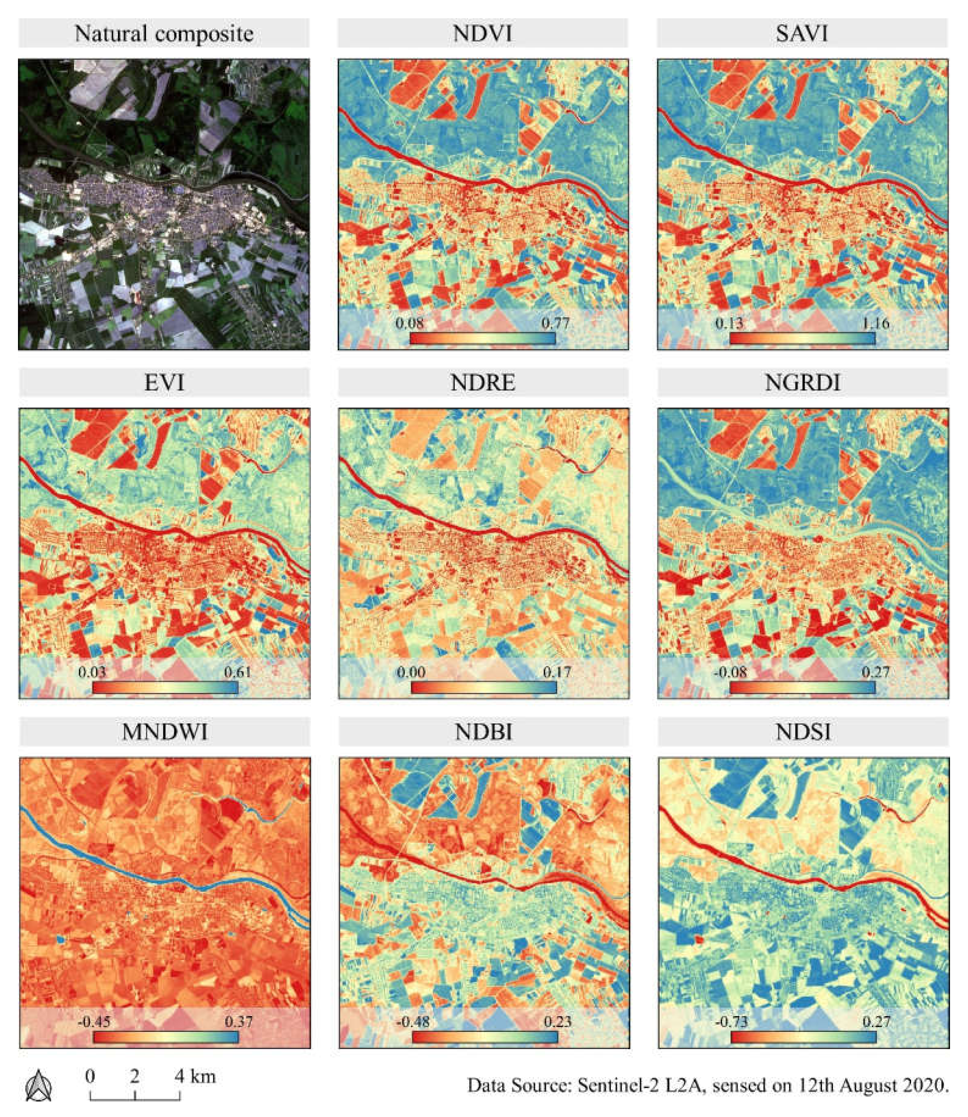
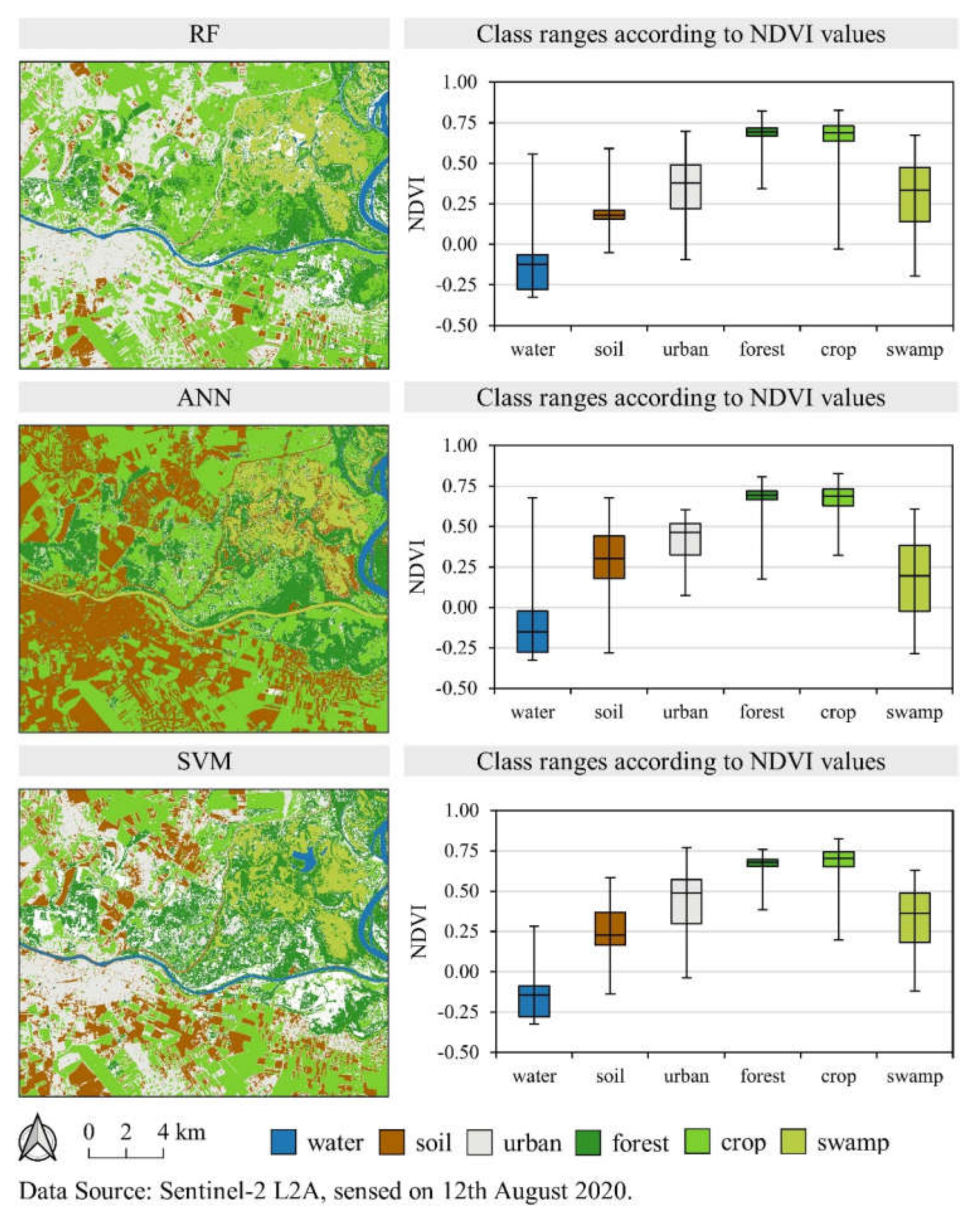
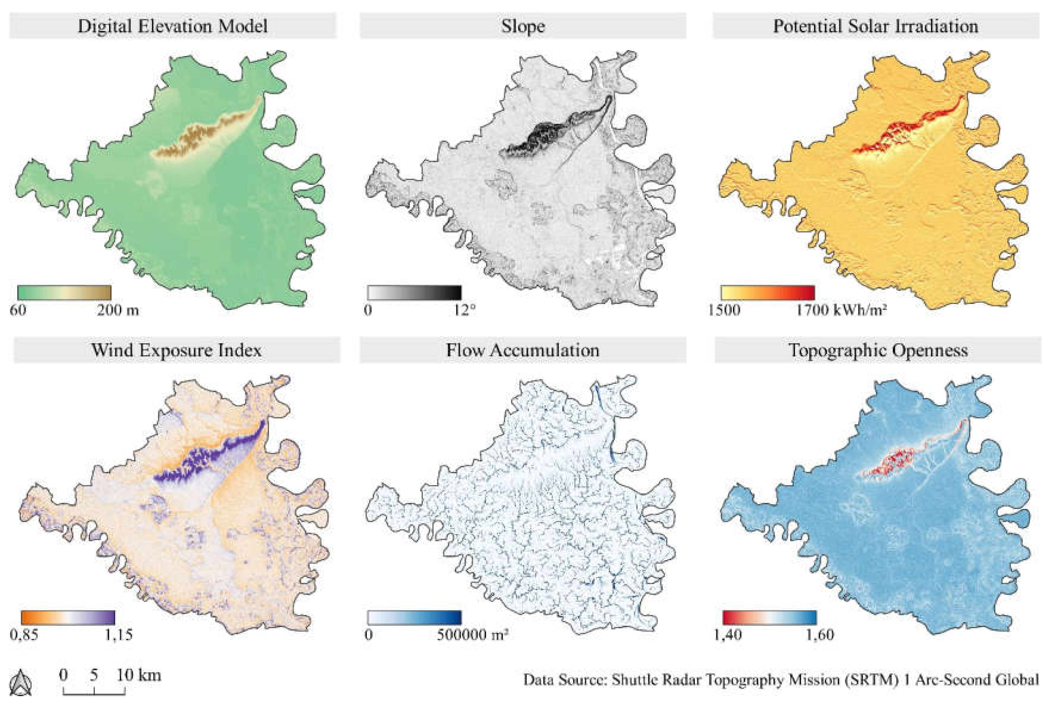
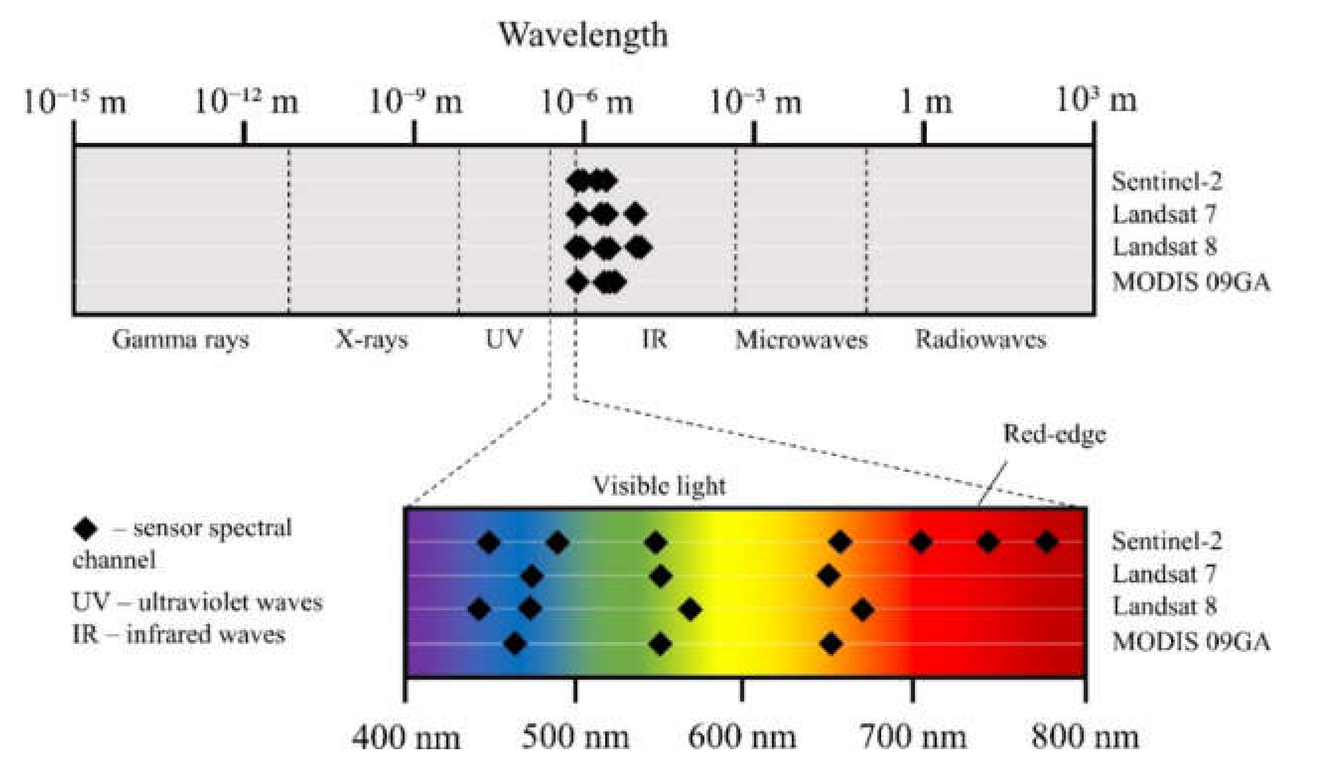
The application of global open data remote sensing satellite missions in land monitoring and conservation studies is in the state of rapid growth, ensuring an observation with high spatial and spectral resolution over large areas. The purpose of this study was to provide a review of the most important global open data remote sensing satellite missions, current state-of-the-art processing methods and applications in land monitoring and conservation studies. Multispectral (Landsat, Sentinel-2, and MODIS), radar (Sentinel-1), and digital elevation model missions (SRTM, ASTER) were analyzed, as the most often used global open data satellite missions, according to the number of scientific research articles published in Web of Science database. Processing methods of these missions’ data consisting of image preprocessing, spectral indices, image classification methods, and modelling of terrain topographic parameters were analyzed and demonstrated. Possibilities of their application in land cover, land suitability, vegetation monitoring, and natural disaster management were evaluated, having high potential in broad use worldwide. Availability of free and complementary satellite missions, as well as the open-source software, ensures the basis of effective and sustainable land use management, with the prerequisite of the more extensive knowledge and expertise gathering at a global scale.
Keywords: multispectral; Sentinel-2; Landsat 8; MODIS; synthetic aperture radar; Sentinel-1; digital elevation model; SRTM; machine learning; spectral index multispectral; Sentinel-2; Landsat 8; MODIS; synthetic aperture radar; Sentinel-1; digital elevation model; SRTM; machine learning; spectral index
Graphical Abstract