Article

Identification and Driving Factor Analysis of Non-Grain Conversion of Cultivated Land in Qian’an City Using High-Resolution Remote Sensing Images


1
College of Resources and Environment, Hebei Agricultural University, Baoding 071001, China
2
College of Land and Resources, Hebei Agricultural University, Baoding 071001, China
3
Hebei Engineering Research Center for Agricultural Remote Sensing Applications, Baoding 071001, China
4
Research Center for Rural Culture and Rural Governance, Hebei Agricultural University, Baoding 071001, China
*
Author to whom correspondence should be addressed.
Land 2026, 15(8), 1376; https://doi.org/10.3390/land15081376
Submission received: 18 June 2026 / Revised: 28 July 2026 / Accepted: 30 July 2026 / Published: 31 July 2026

Abstract

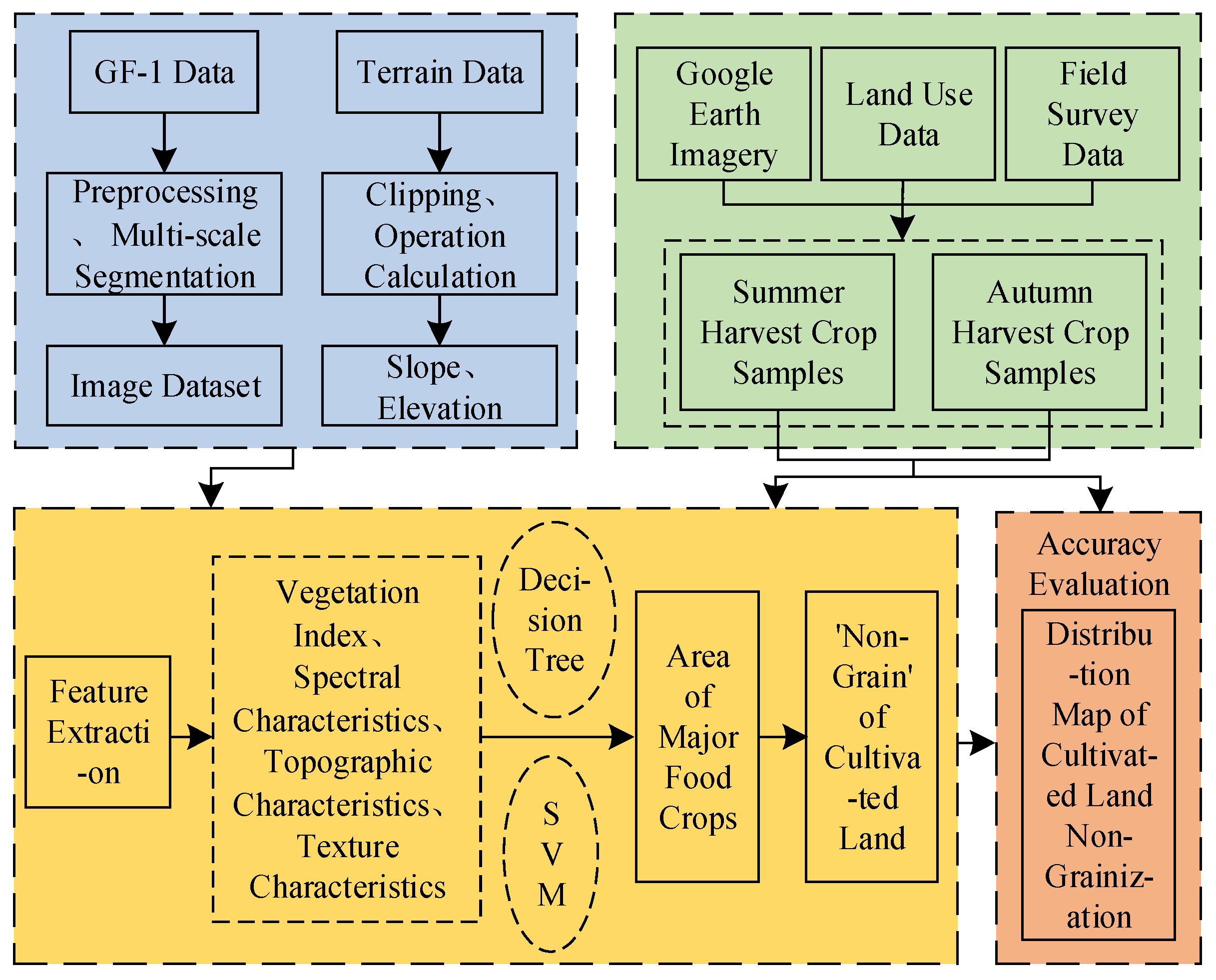
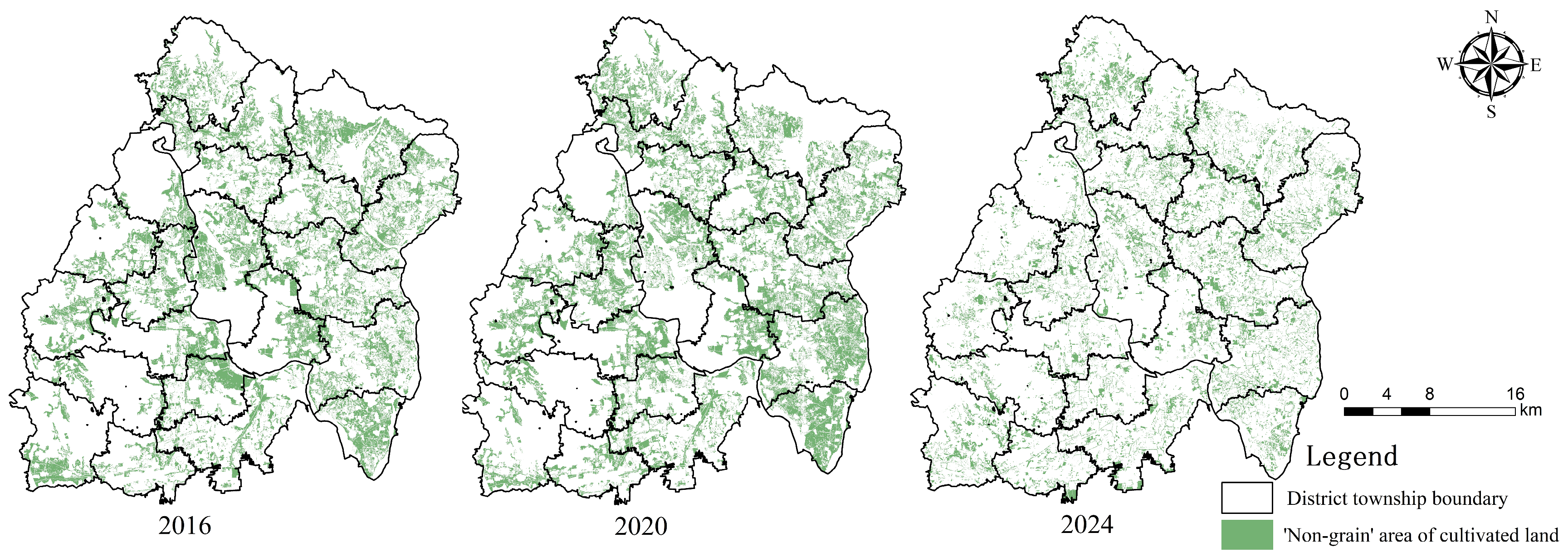
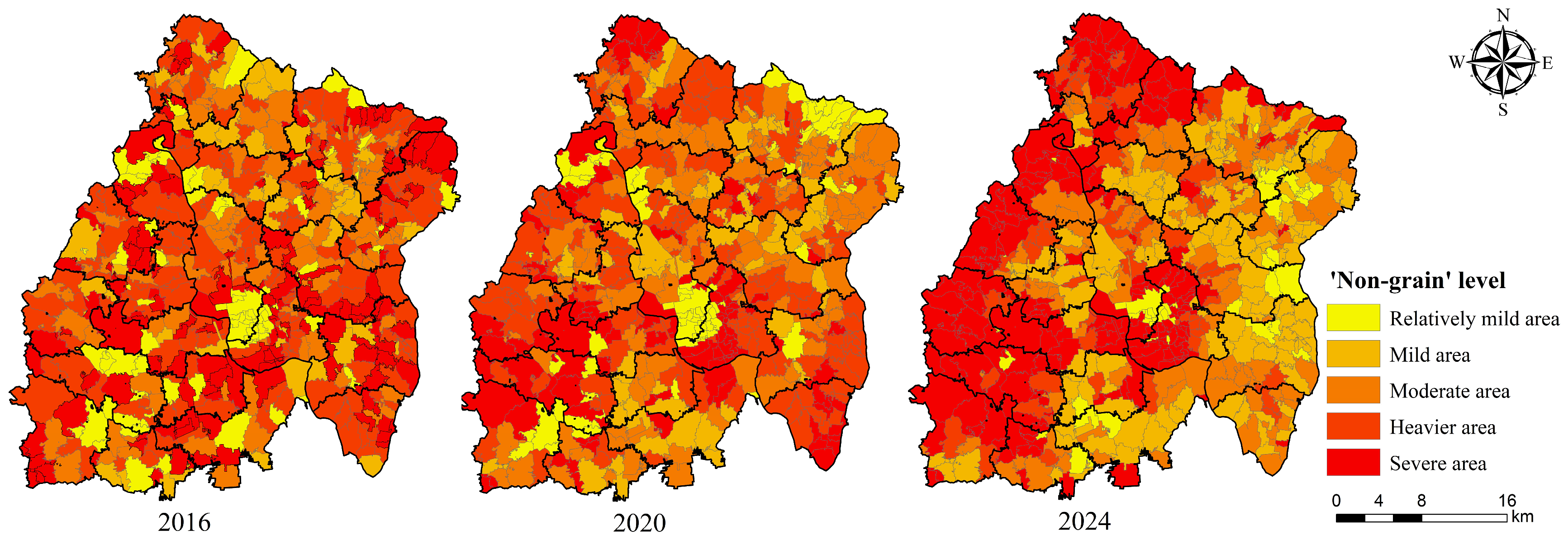
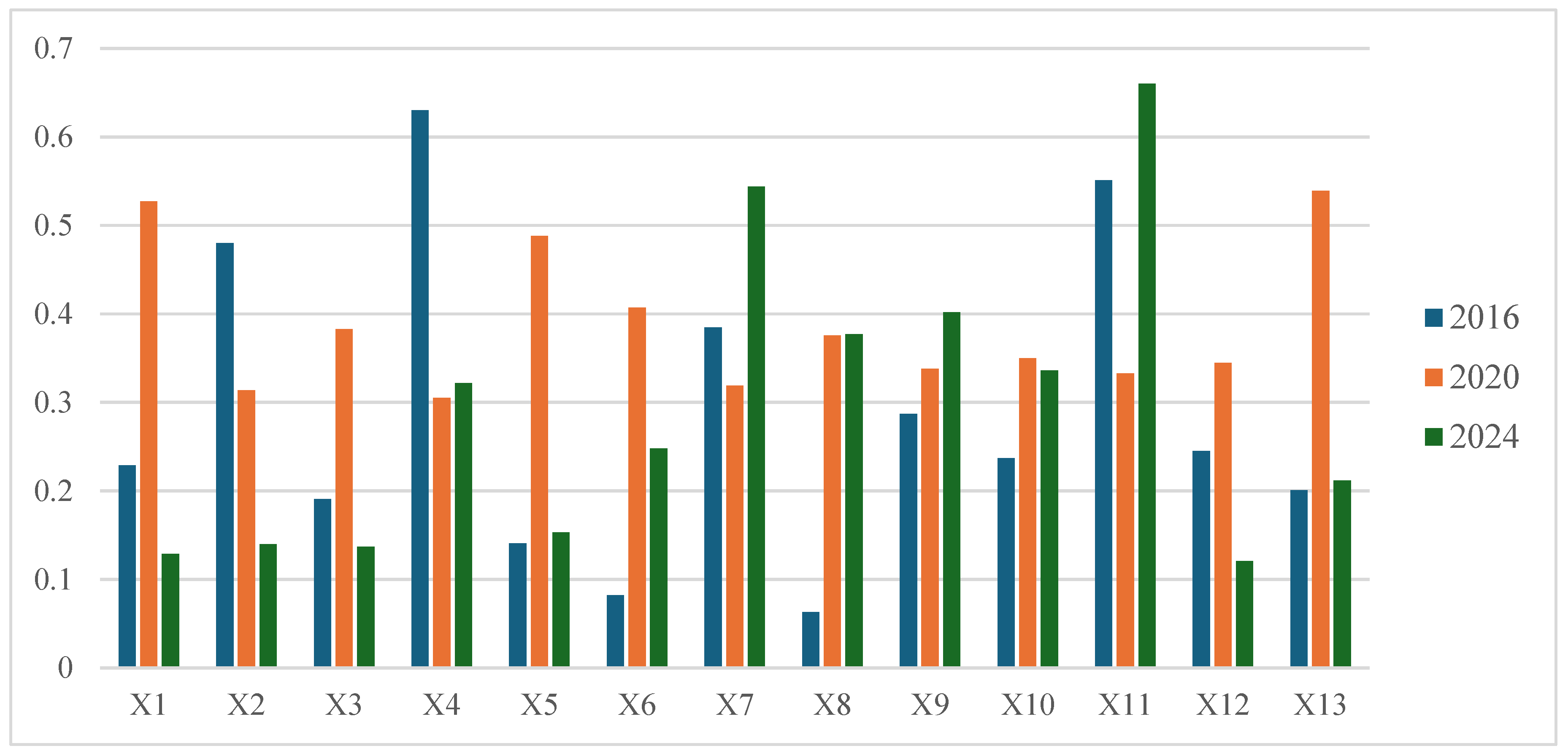
Global food security remains under severe strain, and the conversion of cultivated land to non-grain uses poses a significant threat to the stability of food production capacity. Driven by mineral development and urbanization, the risk of non-grain conversion in resource-based counties has increased. This study selected Qian’an City as the study area to accurately identify the spatiotemporal evolution characteristics of non-grain production at the county scale. GF-1 satellite (China Centre for Resources Satellite Data and Application, Beijing, China) imagery from 2016, 2020, and 2024 was employed, integrated with a vegetation index, multi-scale segmentation, and a decision tree model. Non-grain conversion rate measurement, spatial trend surface analysis, and kernel density estimation were then applied for analysis. The results were as follows. (1) The high-precision identification system for the non-grain conversion of cultivated land accurately distinguished grain crops from non-grain land uses, achieving an overall accuracy of over 91%. (2) The process of non-grain conversion of cultivated land in Qian’an City showed significant stage characteristics. The non-grain conversion area first increased and then decreased, with the non-grain rate fluctuating from 49.38 to 53.48% before declining to 46.62%. (3) The driving mechanism exhibited a phased evolution: from natural economy-led, to policy-driven strong intervention, and finally to market location-led. In 2016, the terrain undulation (q = 0.63) and GDP (q = 0.551) were dominant. In 2020, the proportion of ecological protection red line area (q = 0.539) took the lead. By 2024, GDP (q = 0.66) and the distance from the main road (q = 0.544) were dominant. This reflected the coupling effect of market and location within the policy baseline and interpreted the dynamic evolution of cultivated land use management. The spatial and temporal evolution characteristics of non-grain conversion for cultivated land were quantitatively revealed. The findings provide a scientific basis and decision support for regional cultivated land protection, food security, and optimal allocation of land resources.
Keywords: non-grain conversion of cultivated land; high-resolution remote sensing image; decision tree classification; driving factors; Qian’an City non-grain conversion of cultivated land; high-resolution remote sensing image; decision tree classification; driving factors; Qian’an City