Article

Segmentation Performance and Mapping of Dunes in Multi-Source Remote Sensing Images Using Deep Learning

1
College of Geography and Remote Sensing Sciences, Xinjiang University, Urumqi 830046, China
2
Xinjiang Key Laboratory of Oasis Ecology, Xinjiang University, Urumqi 830046, China
3
Xinjiang Institute of Ecology and Geography Chinese Academy of Sciences, Urumqi 830011, China
4
Changji Geological Brigade, Geological Bureau of Xinjiang Uygur Autonomous Region, Changji 831100, China
*
Author to whom correspondence should be addressed.
Land 2025, 14(4), 713; https://doi.org/10.3390/land14040713
Submission received: 15 February 2025 / Revised: 16 March 2025 / Accepted: 25 March 2025 / Published: 26 March 2025
(This article belongs to the Section Land Innovations – Data and Machine Learning)

Abstract

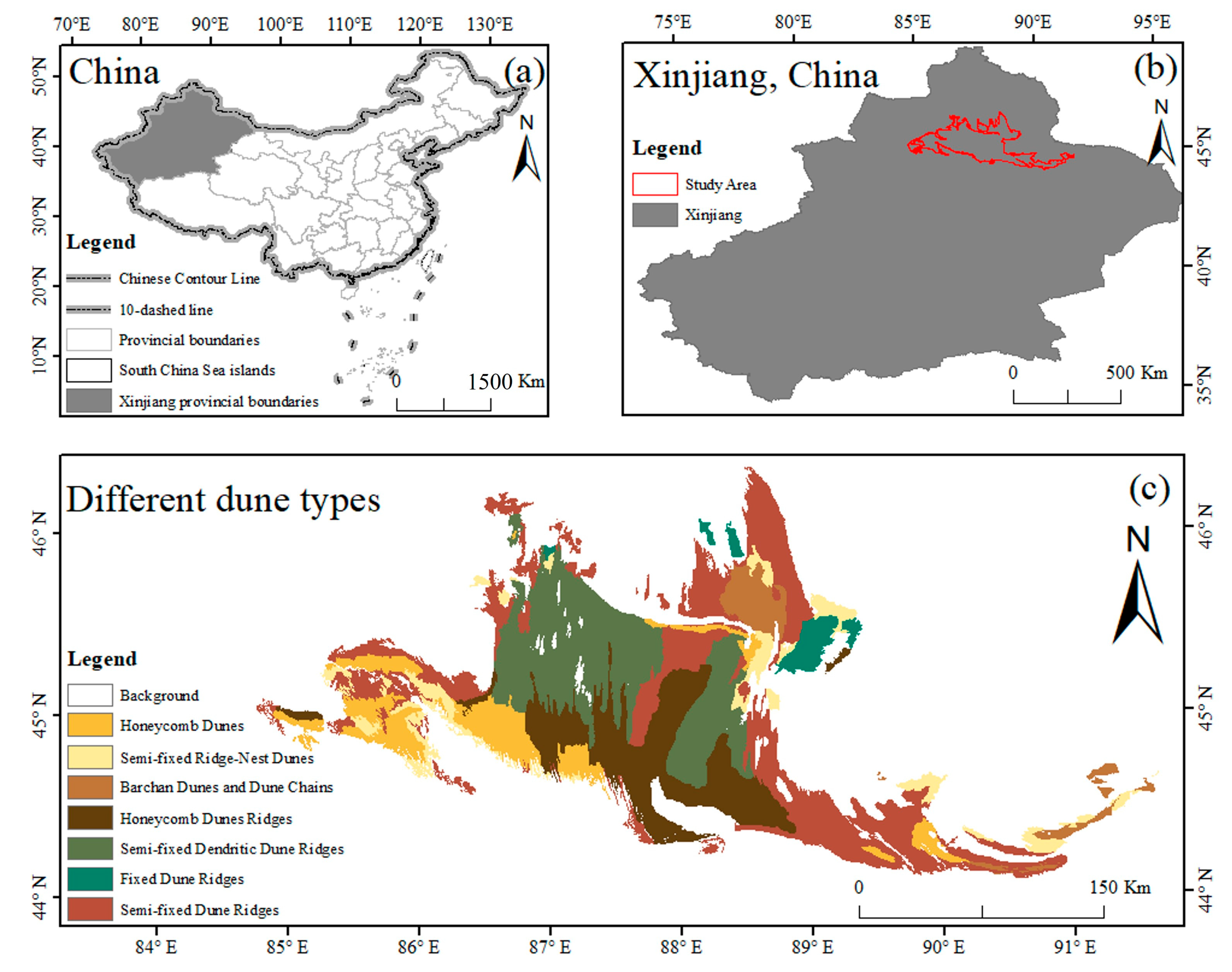
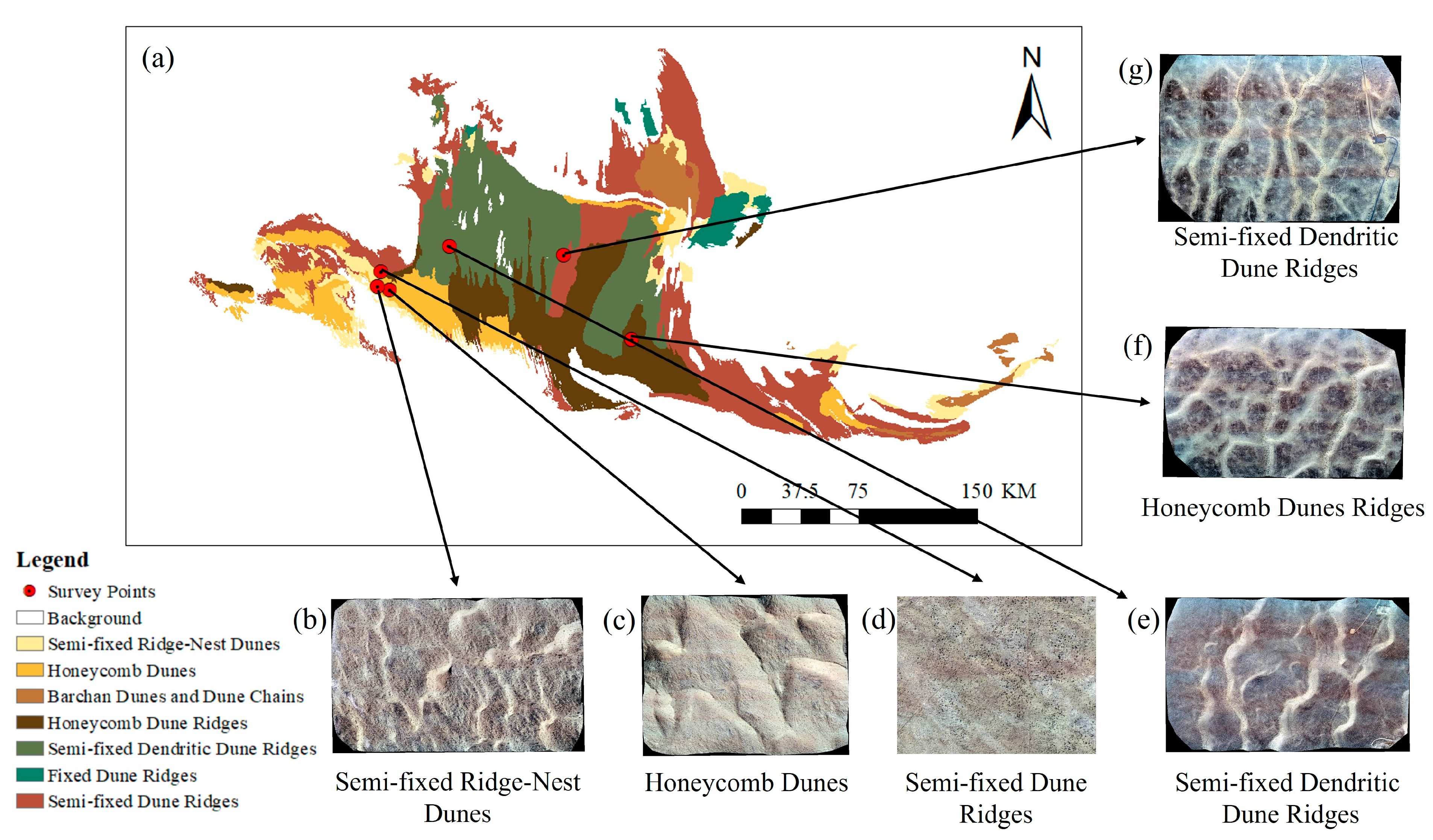
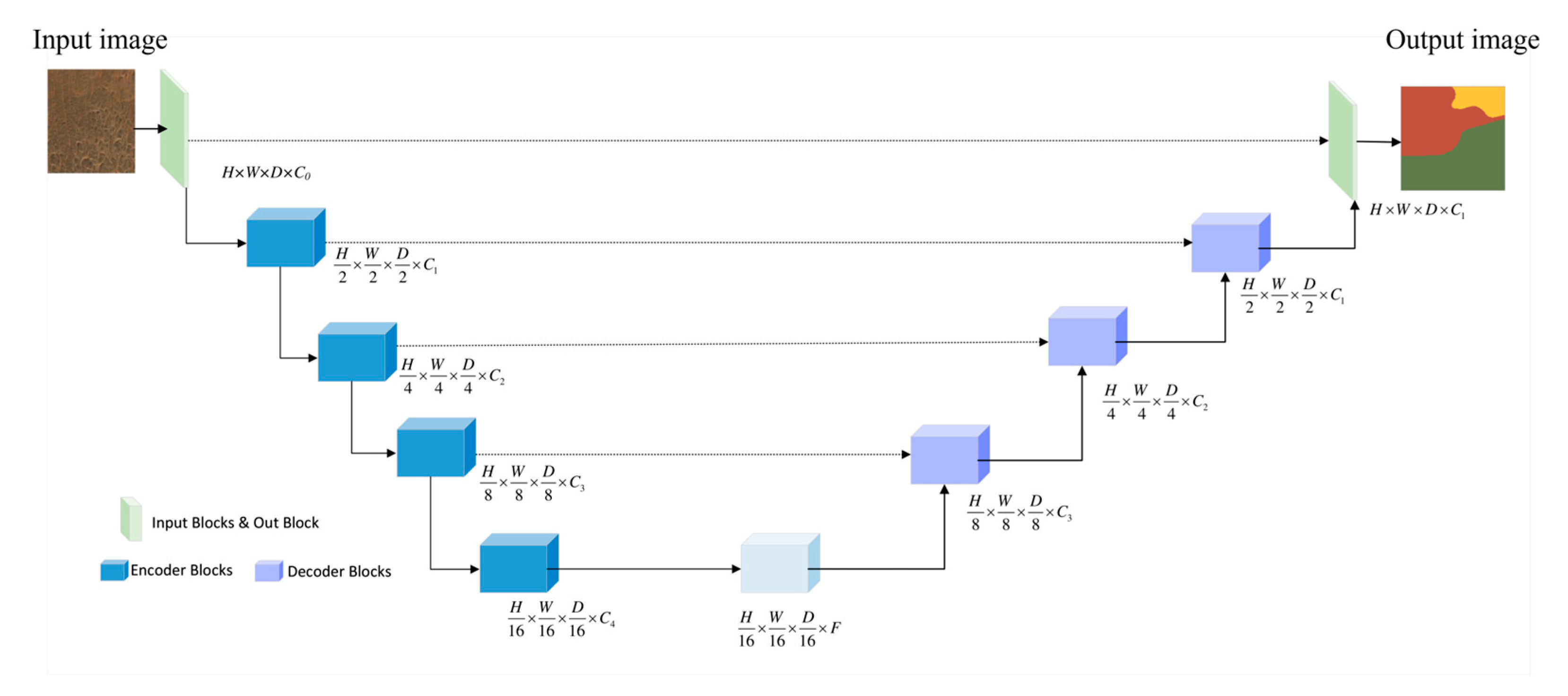
Dunes are key geomorphological features in aeolian environments, and their automated mapping is essential for ecological management and sandstorm disaster early warning in desert regions. However, the diversity and complexity of the dune morphology present significant challenges when using traditional classification methods, particularly in feature extraction, model parameter optimization, and large-scale mapping. This study focuses on the Gurbantünggüt Desert in China, utilizing the Google Earth Engine (GEE) cloud platform alongside multi-source remote sensing data from Landsat-8 (30 m) and Sentinel-2 (10 m). By integrating three deep learning models—DeepLab v3, U-Net, and U-Net++—this research evaluates the impact of the batch size, image resolution, and model structure on the dune segmentation performance, ultimately producing a high-precision dune type map. The results indicate that (1) the batch size significantly affects model optimization. Increasing the batch size from 4 to 12 improves the overall accuracy (OA) from 69.65% to 84.34% for Landsat-8 and from 89.19% to 92.03% for Sentinel-2. Increasing the batch size further to 16 results in a slower OA improvement, with Landsat-8 reaching OA of 86.63% and Sentinel-2 reaching OA of 92.32%, suggesting that gradient optimization approaches saturation. (2) The higher resolution of Sentinel-2 greatly enhances the ability to capture finer details, with the segmentation accuracy (OA: 92.45%) being 5.82% higher than that of Landsat-8 (OA: 86.63%). (3) The U-Net model performs best on Sentinel-2 images (OA: 92.45%, F1: 90.45%), improving the accuracy by 0.13% compared to DeepLab v3, and provides more accurate boundary delineation. However, DeepLab v3 demonstrates greater adaptability to low-resolution images. This study presents a dune segmentation approach that integrates multi-source data and model optimization, offering a framework for the dynamic monitoring and fine-scale mapping of the desert’s geomorphology.
Keywords: dune mapping; dune type classification; multi-source remote sensing imagery; deep learning; U-Net; geomorphological mapping dune mapping; dune type classification; multi-source remote sensing imagery; deep learning; U-Net; geomorphological mapping