Article

Spatiotemporal Dynamics and Driving Forces of Ecological Environment Quality in Coastal Cities: A Remote Sensing and Land Use Perspective in Changle District, Fuzhou


by
Tianxiang Long
1,2,3,
Zhuhui Bai
4,* and
Bohong Zheng
5
1
College of Architecture and Urban Planning, Hunan City University, Yiyang 413000, China
2
Key Laboratory of Urban Planning Information Technology of Hunan Provincial Universities, Yiyang 413000, China
3
Key Laboratory of Digital Urban and Rural Spatial Planning of Hunan Province, Yiyang 413000, China
4
College of Architecture, Inner Mongolia University of Technology, Huhehot 010051, China
5
School of Architecture and Art, Central South University, Changsha 410083, China
*
Author to whom correspondence should be addressed.
Land 2024, 13(9), 1393; https://doi.org/10.3390/land13091393
Submission received: 11 August 2024 / Accepted: 23 August 2024 / Published: 29 August 2024
(This article belongs to the Special Issue Urban Ecosystem Services: 5th Edition)

Abstract

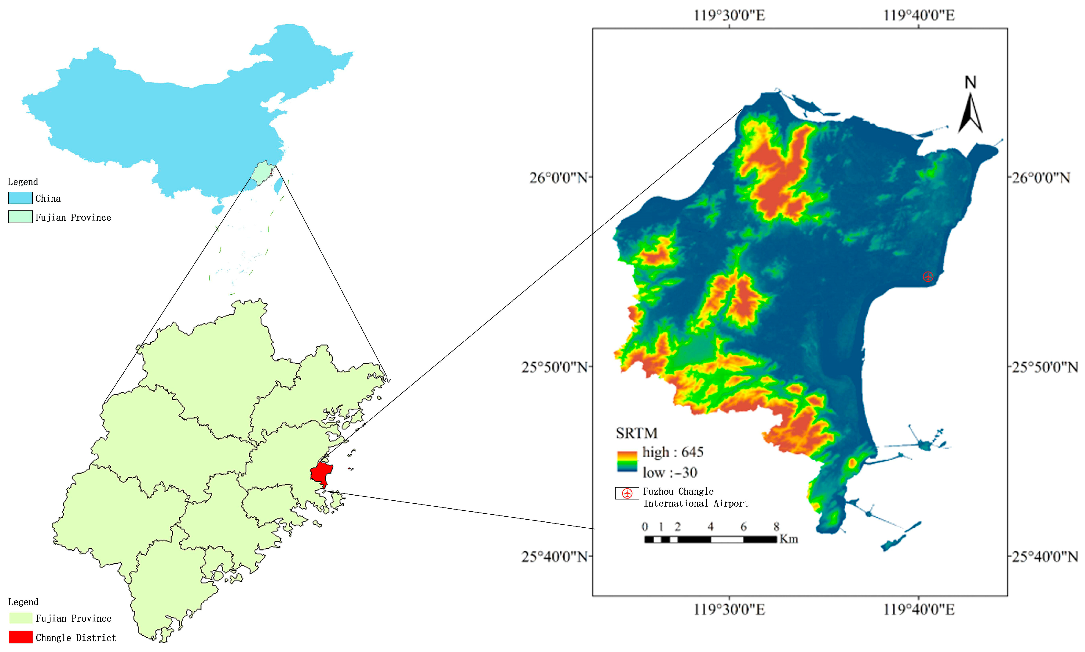
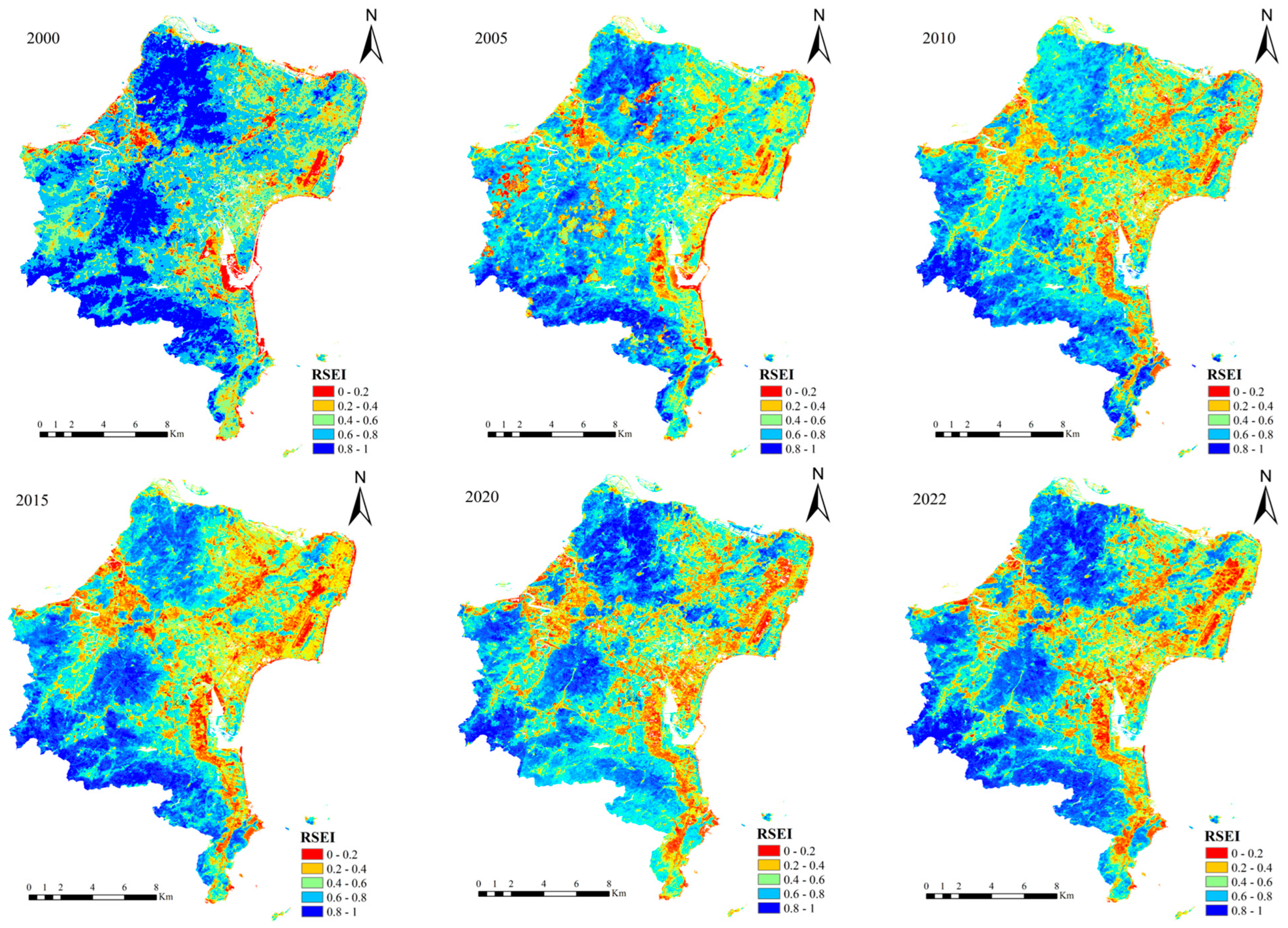
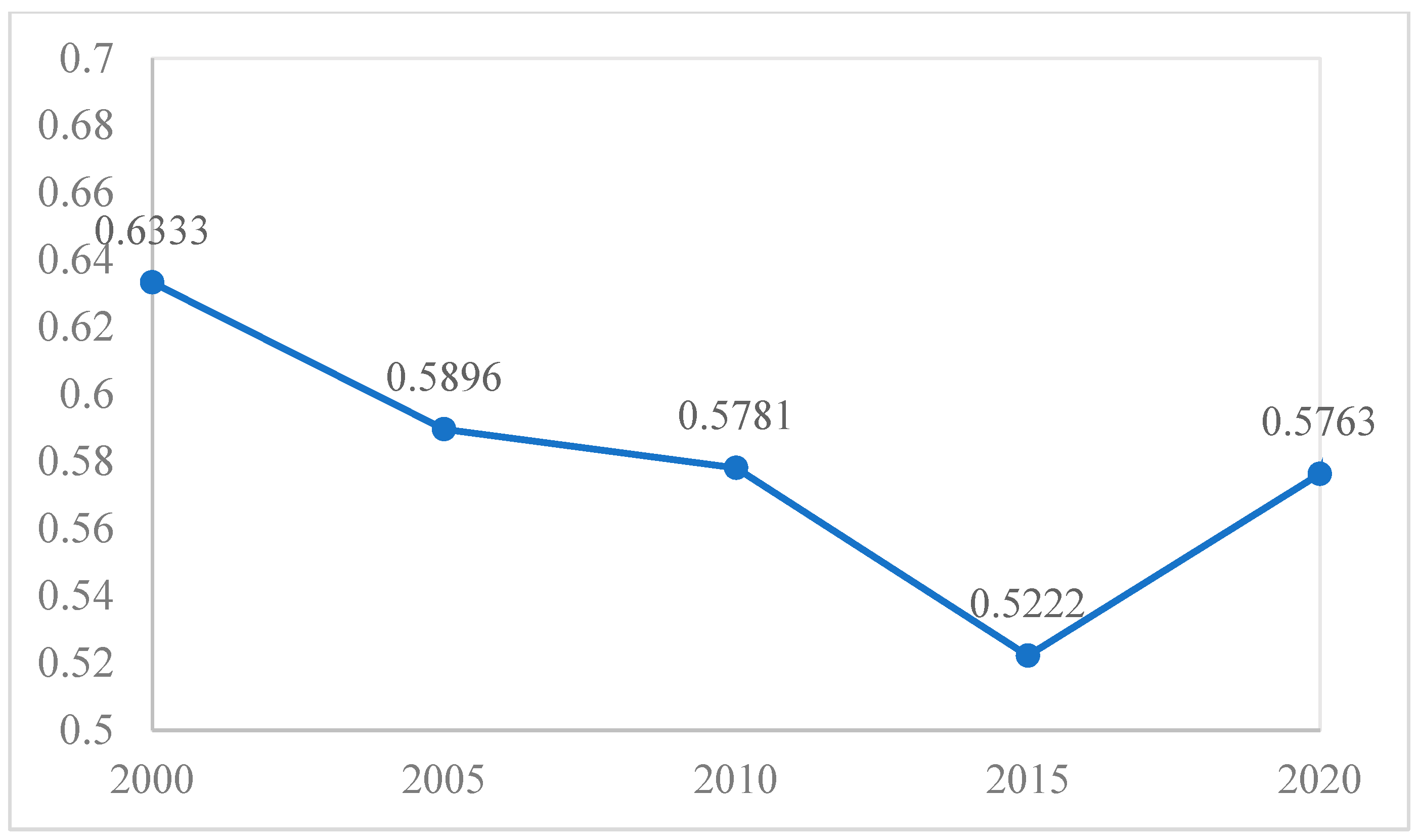
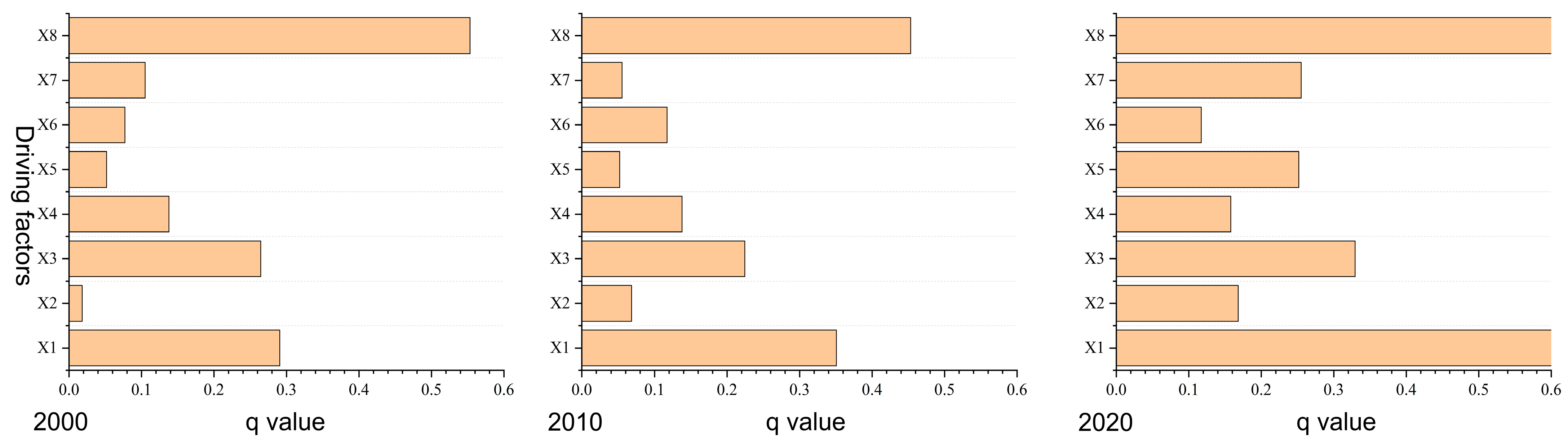
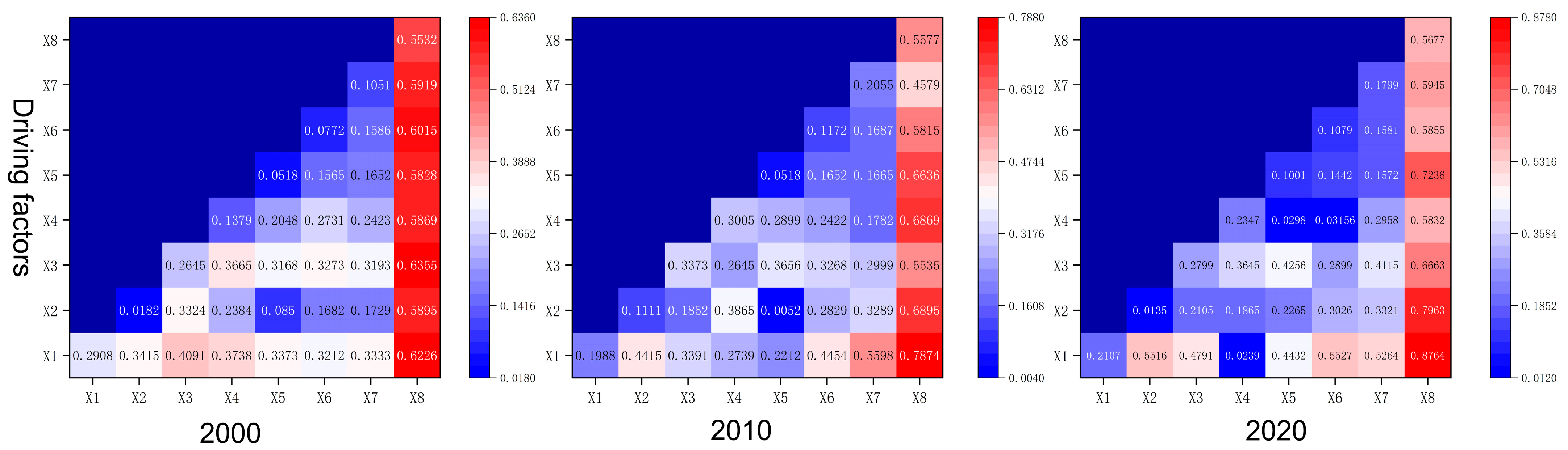
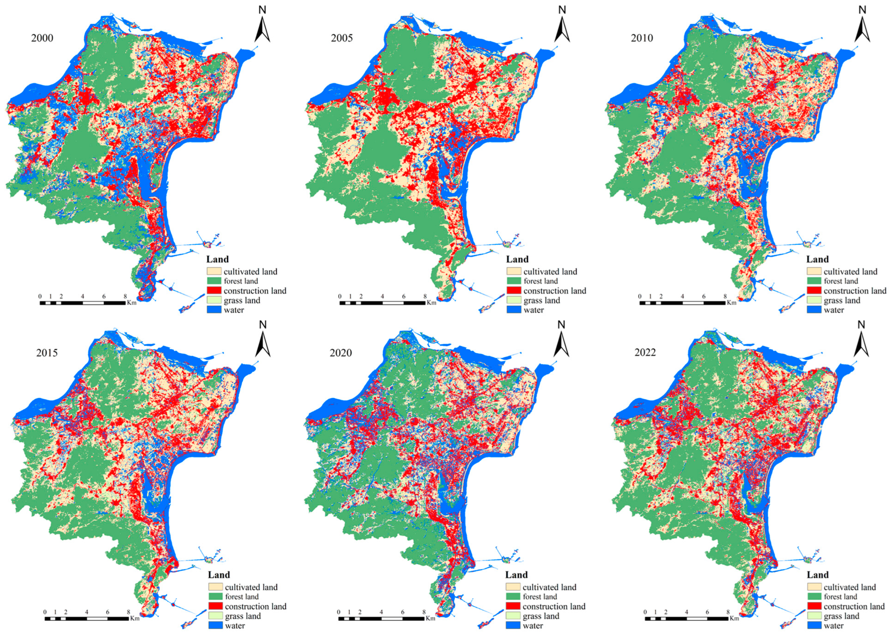
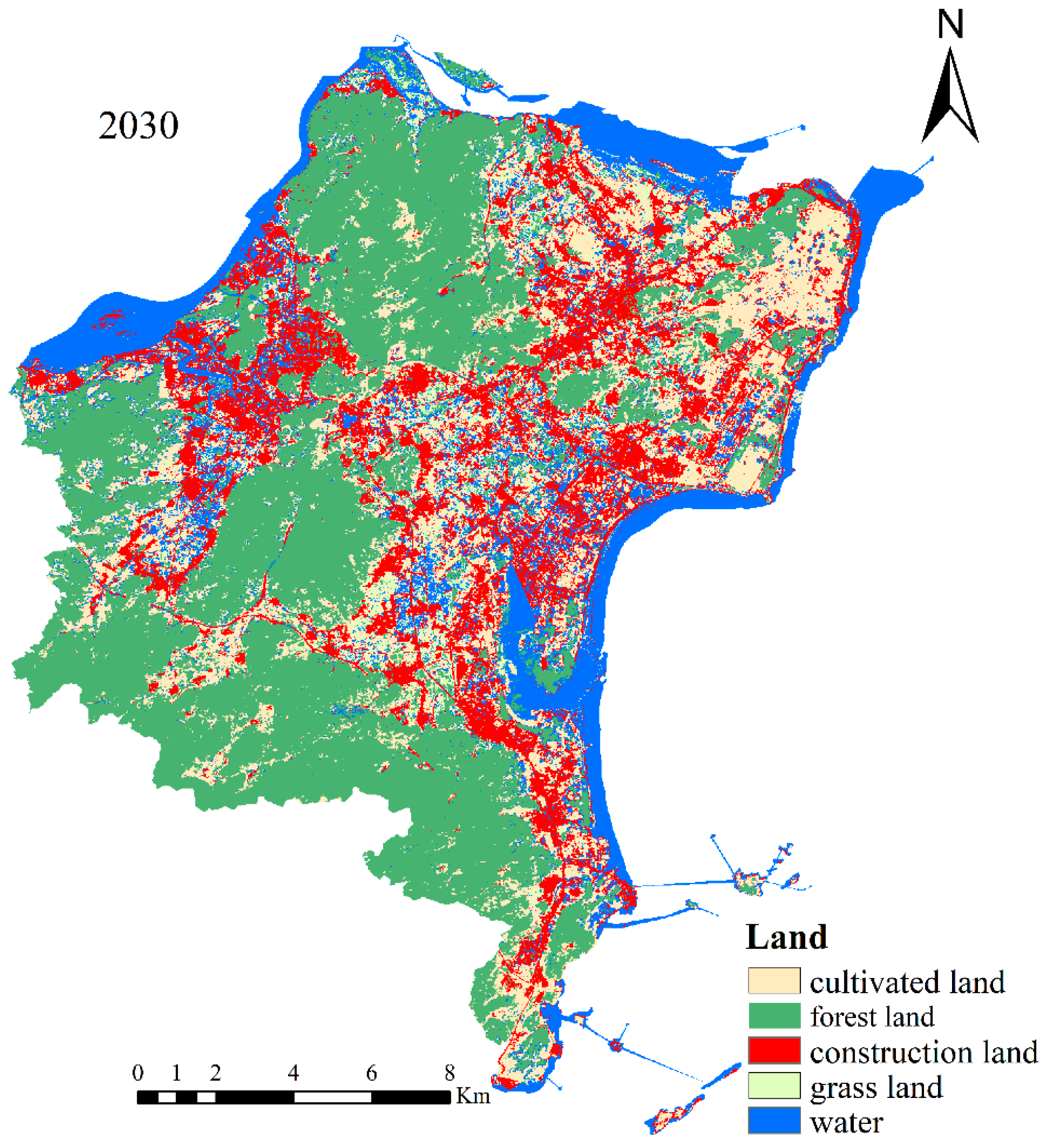
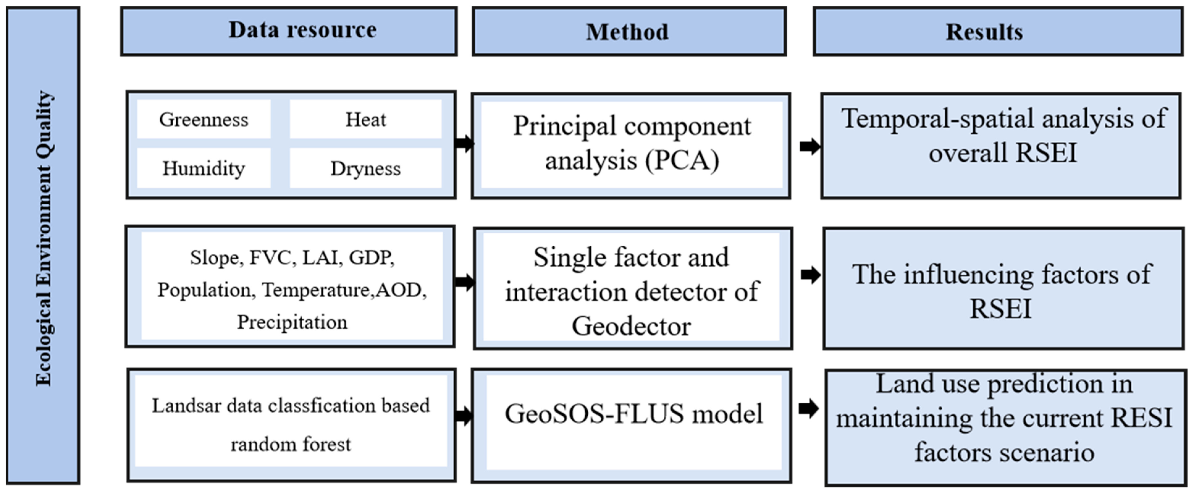
In the face of persistent global environmental challenges, evaluating ecological environment quality and understanding its driving forces are crucial for maintaining the ecological balance and achieving sustainable development. Based on a case study of Changle District in Fuzhou, China, this research employed the Remote Sensing Ecological Index (RSEI) method to comprehensively assess ecological environment quality and analyze the impact of various driving factors from 2000 to 2020. Based on the GeoSOS-FLUS model, this study simulated and predicted land use classifications if maintaining the RSEI factors. The results reveal an overall improvement in the southern and southwestern regions, while the northwest and eastern areas face localized degradation. The RSEI index increased from 0.6333 in 2000 to 0.6625 in 2022, indicating significant ecological shifts over the years. The key driving factors identified include vegetation coverage, leaf area index, and aerosol levels. Industrial emissions and transportation activities notably affect air quality, while land use changes, particularly the expansion of construction land, play a critical role in altering ecological conditions. If maintaining the current RESI factors without any improvement, Changle District will experience continued urbanization and development, leading to an increase in built-up areas to 32.93% by 2030 at the expense of grasslands. This study offers valuable insights for policymakers and environmental managers to formulate targeted strategies aimed at reducing industrial and traffic emissions, optimizing land use planning, and enhancing ecological sustainability. The methodology and findings provide a robust framework for similar assessments in other rapidly urbanizing regions, contributing to the broader discourse on sustainable land use and ecological conservation. By advancing the understanding of ecological environment quality and its driving forces, this research supports the development of informed environmental protection and sustainable development strategies for coastal regions in developing countries globally.
Keywords: risk-screening environmental indicators; land use classification; driving force analysis; Geodetector; Changle District risk-screening environmental indicators; land use classification; driving force analysis; Geodetector; Changle District