Article

Optimizing Crowdsourced Land Use and Land Cover Data Collection: A Two-Stage Approach
1
School of Mathematics and Statistics, University of Canterbury, Christchurch 8041, New Zealand
2
International Institute for Applied Systems Analysis (IIASA), 2361 Laxenburg, Austria
3
Te Pūnaha Matatini, New Zealand Centre of Research Excellence, Auckland 1010, New Zealand
*
Author to whom correspondence should be addressed.
These authors contributed equally to this work.
Land 2022, 11(7), 958; https://doi.org/10.3390/land11070958
Submission received: 12 May 2022 / Revised: 12 June 2022 / Accepted: 14 June 2022 / Published: 21 June 2022

Abstract

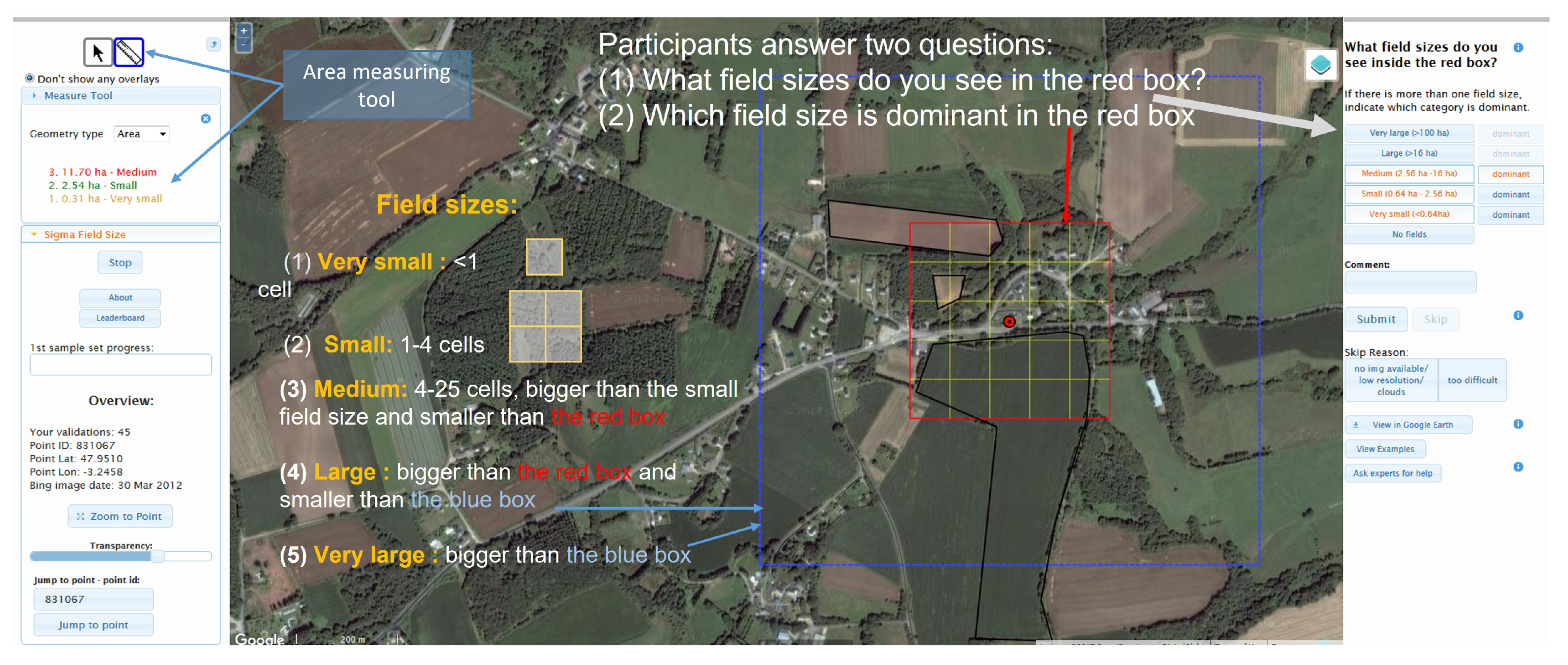
Citizen science has become an increasingly popular approach to scientific data collection, where classification tasks involving visual interpretation of images is one prominent area of application, e.g., to support the production of land cover and land-use maps. Achieving a minimum accuracy in these classification tasks at a minimum cost is the subject of this study. A Bayesian approach provides an intuitive and reasonably straightforward solution to achieve this objective. However, its application requires additional information, such as the relative frequency of the classes and the accuracy of each user. While the former is often available, the latter requires additional data collection. In this paper, we present a two-stage approach to gathering this additional information. We demonstrate its application using a hypothetical two-class example and then apply it to an actual crowdsourced dataset with five classes, which was taken from a previous Geo-Wiki crowdsourcing campaign on identifying the size of agricultural fields from very high-resolution satellite imagery. We also attach the R code for the implementation of the newly presented approach.
Keywords: citizen science; crowdsourcing; classification task; visual interpretation; earth observation; satellite imagery; Bayesian; cost optimization; Geo-Wiki; field size citizen science; crowdsourcing; classification task; visual interpretation; earth observation; satellite imagery; Bayesian; cost optimization; Geo-Wiki; field size