Next Article in Journal
Correction: AbdElgalil et al. Unraveling the Influence of Water and Nitrogen Management on Quinoa (Chenopodium quinoa Willd.) Agronomic and Yield Traits. Water 2023, 15, 1296
Next Article in Special Issue
Multivariate Analysis and Hydrogeochemical Evolution of Groundwater in a Geologically Controlled Aquifer System: A Case Study in North Central Province, Sri Lanka
Previous Article in Journal
Probabilistic Forecasting of Peak Discharges Using L-Moments and Multi-Parameter Statistical Models
Previous Article in Special Issue
Spatiotemporal Evolution and Driving Factors of Groundwater in Beijing Sub-Center
 
 
Correction published on 24 July 2025, see Water 2025, 17(15), 2206.
Article

Groundwater Potential Mapping in Semi-Arid Areas Using Integrated Remote Sensing, GIS, and Geostatistics Techniques


1
Mining and Petroleum Engineering Department, Faculty of Engineering-Qena, Al-Azhar University, Qena 83513, Egypt
2
Mining and Petroleum Engineering Department, Faculty of Engineering, Al-Azhar University, Cairo 11651, Egypt
3
Department of Civil Engineering, College of Engineering, Qassim University, Buraidah 51452, Saudi Arabia
4
Mining and Metallurgical Engineering Department, Assiut University, Assiut 71515, Egypt
5
Mining Engineering Department, King Abdulaziz University, Jeddah 21589, Saudi Arabia
6
Department of Geology, Tanta University, Tanta 31527, Egypt
7
Department of Mineralogy and Geology, University of Debrecen, 4032 Debrecen, Hungary
*
Authors to whom correspondence should be addressed.
Water 2025, 17(13), 1909; https://doi.org/10.3390/w17131909
Submission received: 23 April 2025 / Revised: 27 May 2025 / Accepted: 27 May 2025 / Published: 27 June 2025 / Corrected: 24 July 2025

Abstract

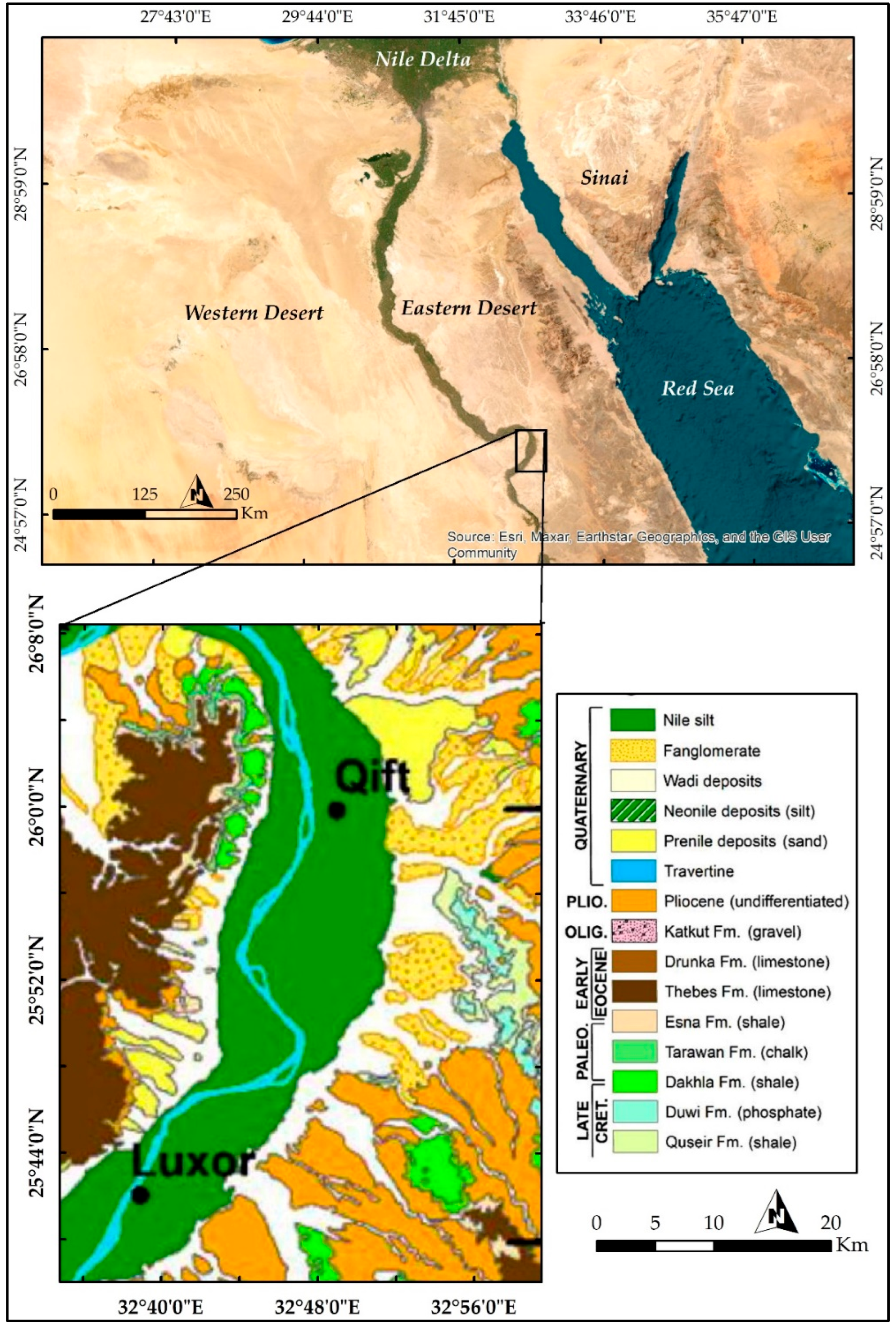
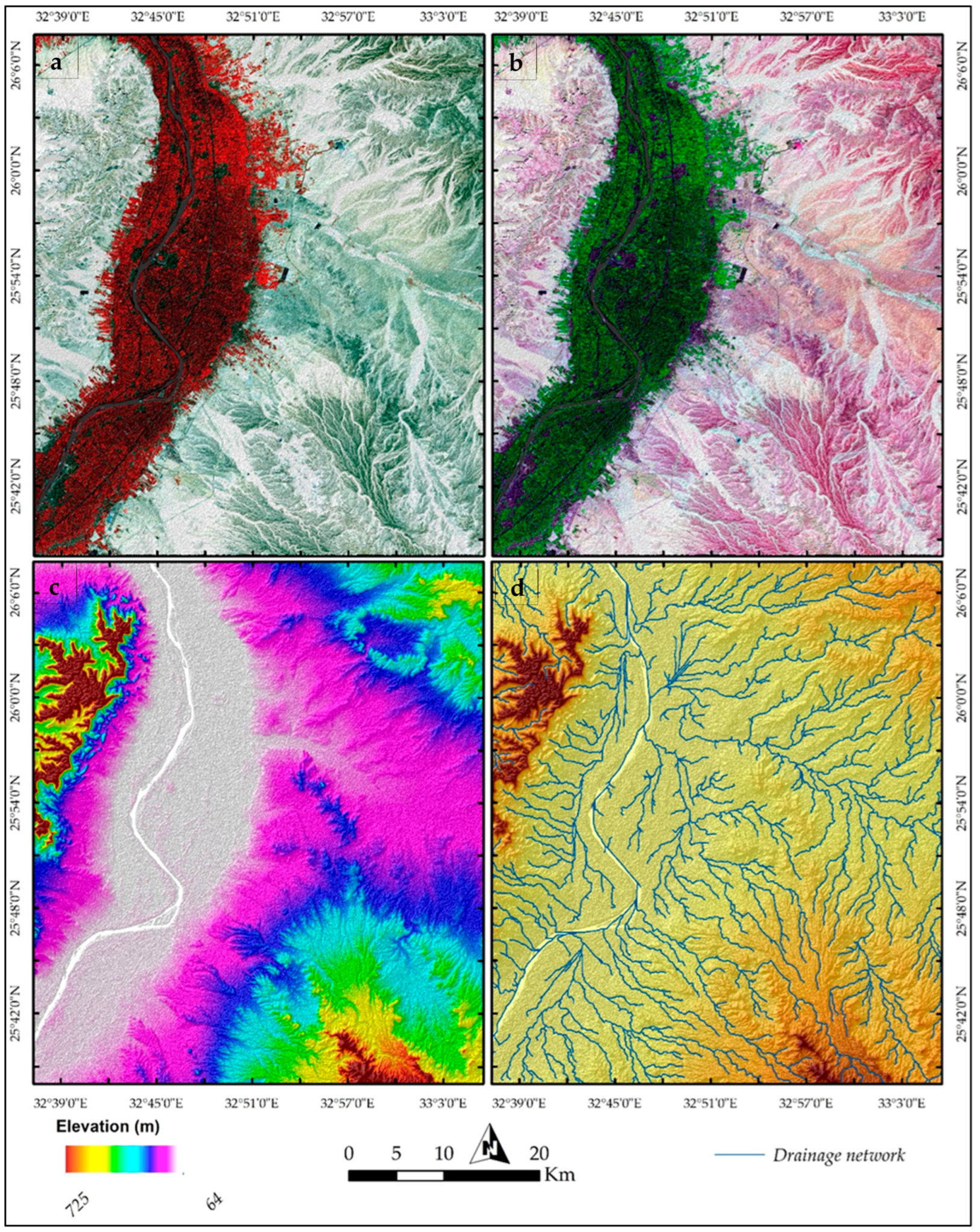
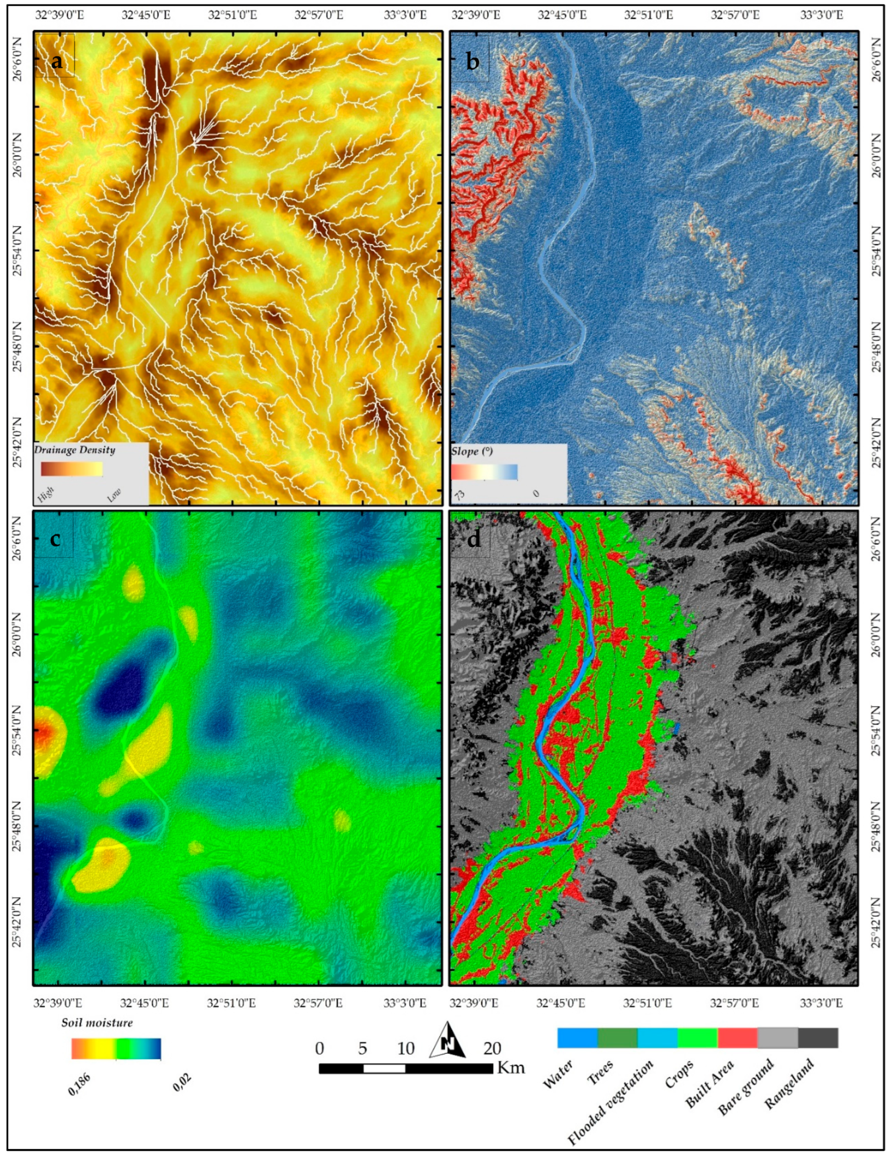
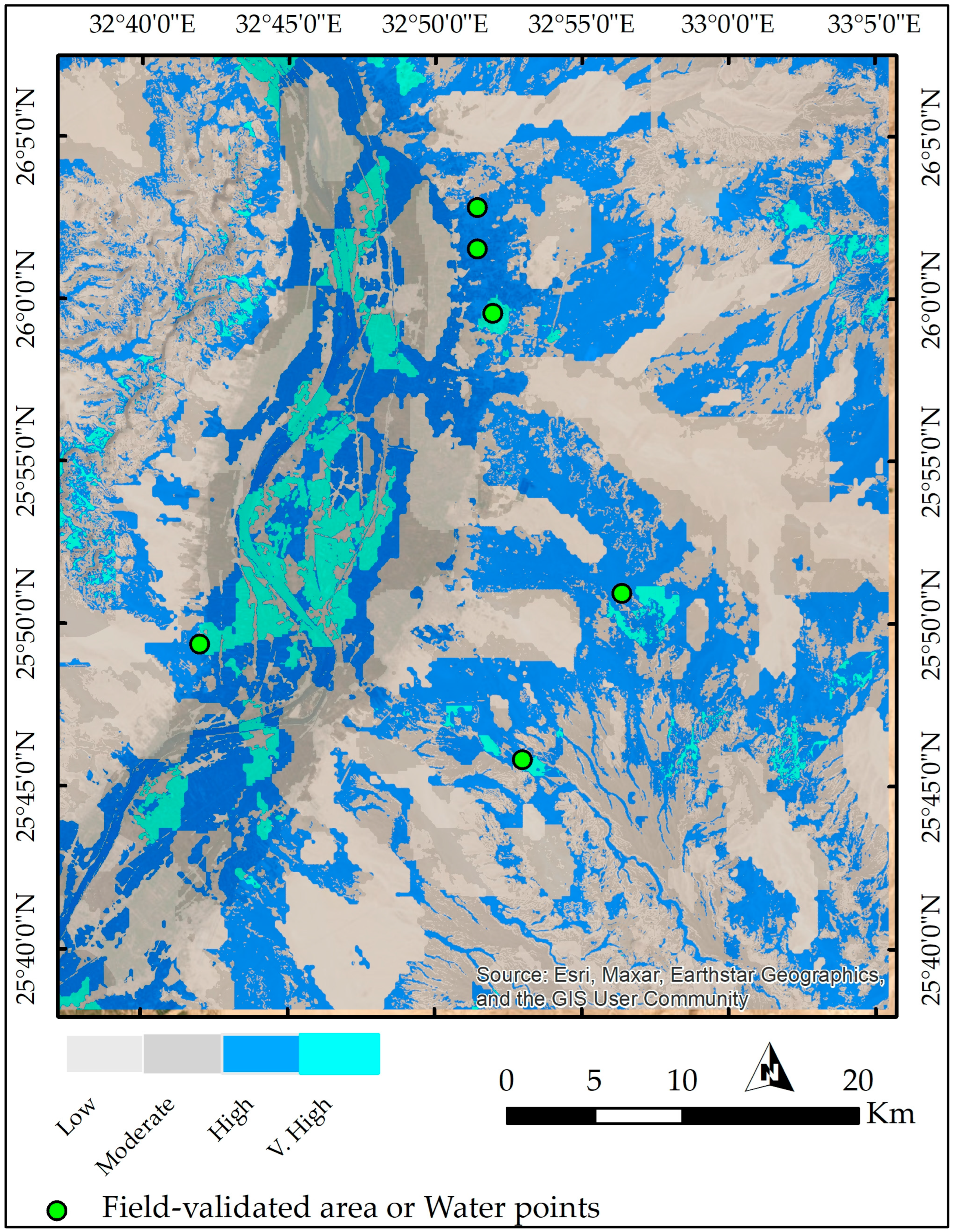
Groundwater serves as a vital resource for sustainable water supply, particularly in semi-arid regions where surface water availability is limited. This study explores groundwater potential zones in the East Desert, Qift–Qena, Egypt, using a multidisciplinary approach that integrates remote sensing (RS), geographic information systems (GIS), geostatistics, and field validation with water wells to develop a comprehensive groundwater potential mapping framework. Sentinel-2 imagery, ALOS PALSAR DEM, and SMAP datasets were utilized to derive critical thematic layers, including land use/land cover, vegetation indices, soil moisture, drainage density, slope, and elevation. The results of the groundwater potentiality map of the study area from RS reveal four distinct zones: low, moderate, high, and very high. The analysis indicates a notable spatial variability in groundwater potential, with “high” (34.1%) and “low” (33.8%) potential zones dominating the landscape, while “very high” potential areas (4.8%) are relatively scarce. The limited extent of “very high” potential zones, predominantly concentrated along the Nile River valley, underscores the river’s critical role as the primary source of groundwater recharge. Moderate potential zones include places where infiltration is possible but limited, such as gently sloping terrain or regions with slightly broken rock structures, and they account for 27.3%. These layers were combined with geostatistical analysis of data from 310 groundwater wells, which provided information on static water level (SWL) and total dissolved solids (TDS). GIS was employed to assign weights to the thematic layers based on their influence on groundwater recharge and facilitated the spatial integration and visualization of the results. Geostatistical interpolation methods ensured the reliable mapping of subsurface parameters. The assessment utilizing pre-existing well data revealed a significant concordance between the delineated potential zones and the actual availability of groundwater resources. The findings of this study could significantly improve groundwater management in semi-arid/arid zones, offering a strategic response to water scarcity challenges.
Keywords: groundwater; semi-arid regions; remote sensing; GIS; sustainability groundwater; semi-arid regions; remote sensing; GIS; sustainability