Abstract
Securing water resources is a complicated issue in Kazakhstan. Only 36% of Kazakhstan’s rural population has access to a centralized water supply and 57.3% use groundwater accessed by wells and boreholes. The groundwater quality must be monitored to minimize health risks. The aim of this project is to investigate the groundwater quality in the Zhambyl region of Kazakhstan. Groundwater depletion, pollution, waterlogging, and salinization are all widespread in Kazakhstan. Previously, 500 self-flowing and, within this project, 204 wells were investigated in southern Kazakhstan, the Zhambyl region. The field works and data processing was carried out in three phases: first, a fieldwork survey of existing water wells; the second phase, field work with more detailed hydrogeological investigations, including measurements of flow rates, pH, temperature, and electrical conductivity of water samples; the third phase, processing, and analysis of field data samples in chemical laboratories. Kazakhstan’s requirements for drinking water are much lower than the requirements in the EU. Less than 30% of Kazakhstan’s population has access to safe water and about 50% of the population consumes drinking water that does not meet international standards of salinity, hardness, or bacteriological levels.
Keywords:
groundwater; artesian well; Zhambyl region; Kazakhstan; Central Asia; health risk; water standards 1. Introduction
Water is one of the most essential components in the existence of the biosphere and is an indispensable element in the productive and economic activities of human society. Among the world’s most pressing problems at present are the protection, conservation, and rational use of water resources [1]. More than 2.2 billion people suffer from the lack of clean drinking water according to the UN [2]. The sustainability of water resources and water availability are complicated issues in Kazakhstan [3]. The country depends upon its neighboring Central Asian (CA) countries for transboundary waters carried by rivers. Kazakhstan is situated downstream of most CA river basins [4,5,6,7,8,9]. Negotiating and regulating transboundary waters is complicated and contentious in CA, similar to many regions in the world. Hydropolitics affects around 40% of the world’s population [10] and requires systematic studies of conflict and cooperation in transboundary water basins, which are difficult issues in CA. Water sustainability and water security are vital priorities for Kazakhstan [11,12,13]. Due to the complexities of surface water resources, groundwater is becoming the main source for personal, agricultural, and industrial use. Intensive extraction of groundwater and minerals is leading to many anthropogenic distortions to the environment. The continued shrinking of the Aral and Balkhash Lakes is accompanied by drying, salinization, and desertification of the deltas of the Syr Darya and Ili Rivers. Deep degradation of the ecosystem and the deterioration of surface and groundwater resources are widespread in Kazakhstan. The human health risks induced by using polluted groundwater, especially with heavy metals in Kazakhstan, are becoming a big issue similar to many developing countries [14]. A non-threshold model to estimate the carcinogenic risk of nitrate-nitrite in drinking water was applied in the neighboring countries, in Iran, on a regional scale [15]. Human distraction from nature, with the construction of different dams, results in sedimentation and pollutant increases, as was investigated in the man-made lake: Sabalan Dam Reservoir, Iran [16]. The alarming carcinogenic and non-carcinogenic risk of heavy metals has been shown in the Sabalan dam reservoir, Northwest of Iran [17].
The aim of this project is to investigate the current status of groundwater wells and to examine the quality of water for future use and water sustainability in the Zhambyl region. Combinations of fieldwork surveys and water sampling with geographic information system (GIS) mapping were applied. GIS-based tools are widely employed to create a digital geographic database for investigation and visualization mapping, and prediction analysis for groundwater–surface water interactions, to support decision-makers [18,19]. Anthropogenic activities and man-made impacts on the environment require proper investigations. For sustainable solutions recommendations, proper fieldwork with easy tracking and understandable GIS mappings are very important project work activities [20,21,22]. The results of this case study will be used for further investigations, modeling with prediction analysis to support local decision-makers in developing sustainable groundwater resource programs.
2. Materials and Methods
2.1. Study Area Description
The Zhambyl region is located in southern Kazakhstan with a central point of 44° N 72° E (Figure 1, Figure 2 and Figure 3). The region is characterized by a warm continental climate and has an average annual precipitation of 200 to 3500 mm [23]. Until 2021, the surface water from the Chu-Talas River basins was the main water source for the Zhambyl region. However, after a devastating drought in 2021 caused a severe shortage of surface water, groundwater must be utilized more extensively. This groundwater is used for local human consumption and for agricultural and industrial purposes in the Zhambyl region [24,25].
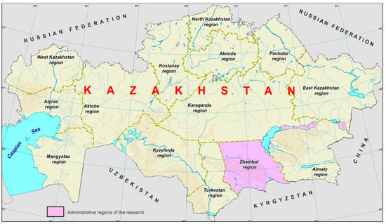
Figure 1.
The location of the Zhambyl region, Kazakhstan is shown in purple.
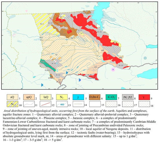
Figure 2.
The hydrogeological map of the Zhambyl region, Kazakhstan. Areal distribution of hydrogeological units, occurring first from the surface of the earth. Aquifers and complexes, aquifer fracture zones.
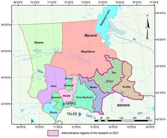
Figure 3.
The study’s field-data-collected areas in oblique lines, in Merke, Shu, and Korday districts in the Zhambyl region, Kazakhstan.
Expedition surveys of hydrogeological (self-flowing and non-self-flowing) wells with an assessment of the sanitary-ecological and technical condition of water points covered the territories of the Merke, Shu, and Korday districts of the Zhambyl region (Figure 2 and Figure 3). In the process of route research for each water point, groundwater levels were measured in the absence of self-spill, flow rates were estimated using a 10 L bucket and a stopwatch, geographic coordinates were determined using a GPS navigator, and, as a result, a table was created for a general description of hydrogeological wells according to Merke, Shu, and Korday districts (Table 1).

Table 1.
Summary of field survey in Merke, Shu, and Korday districts in the Zhambyl region (2021).
The survey was carried out in spring and autumn in two stages. At each survey of hydrogeological wells, the flow rates, temperatures, and pH of the water were measured. The pH was measured with a temperature meter and the pH of the water. Next, water samples were taken for laboratory research. Water sampling was carried out on our own and in clean new plastic bottles of 5 L and 1 L. Five-liter samples were taken for sanitary and epidemiological rules and norms, and liter samples were for reduced chemical analysis of water and radiological analysis of water.
In previous studies, archival data were processed before the fieldwork survey to investigate the groundwater wells and shallow and deep aquifers. The shallow aquifers are within the alluvial and alluvial–proluvial Quaternary deposits (Figure 2). The thickness of the shallow aquifers can be up to 100 m. The flow rates of wells, which have been drilled in shallow aquifers, range from 5 to 60 L/s. The deep aquifers are within the Cretaceous, Paleogene, and Neogene deposits (Figure 3). The thicknesses of the deep aquifers are between 100 and 900 m [26]. Our field works and data processing was carried out in three phases:
- (I)
- The first phase lasting 30 days consisted of the fieldwork surveys of existing water wells in the Merke, Shu, and Korday districts in the Zhambyl region (Figure 2). The fieldwork surveys were concentrated on the inventory of wells, including
- -
- Wells coordinates, latitude, longitude, and elevation recording with Global Positioning System (GPS);
- -
- Wells flow rates measurements;
- -
- In situ parameters, temperature, pH, electrical conductivity (EC), and water tables were measured as MSL.
- (II)
- During the second phase, the field survey works were expanded:
- -
- More hydrogeological investigations were provided with measurements continuation of the wells flow rates, pH, temperature, and electrical conductivity;
- -
- Well water samples were collected for laboratory analyses.
The fieldwork was completed in 25 days for the second phase. The flow rate of artesian wells varied from 0.1 to 40 L/s. Water levels in wells were at a depth of 0.1 to 10 m. The type of water extraction technologies was investigated. In some wells, submersible pumps have been installed to extract groundwater for consumption and drinking water supply.
- (III)
- During the third phase, the collected field data samples were processed and analyzed. During field surveys in the study area in Merke, Shu, and Korday districts of the Zhambyl region, several hundred hydrogeological wells were identified, of which more than half were artesian wells (Table 1, Figure 4). In most wells, groundwater was without the well-spring. Submersible pumps are installed in some wells. In a third of the wells, the wells are clogged with stones. Clogged wells need to be cleaned using an airlift method or new wells need to be drilled. The survey showed that 90% of artesian wells are within the Merke district in the Zhambyl region.
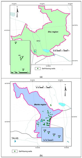
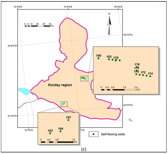 Figure 4. Hydrological wells are located in the Shu, Merke, and Korday districts within the Zhambyl region, Kazakhstan: (a) Hydrogeological and artesian wells are located in the Shu district; (b) Hydrogeological and artesian wells are located in the Merke district; (c) Hydrogeological and artesian wells are located in the Korday district.
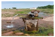
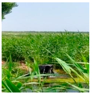
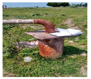
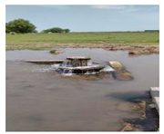
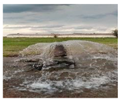
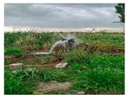
Many wells were used unsustainably with the permanent spouting of water (Figure 5). The related classification maps were prepared with well types descriptions, including the database of spouting wells and artesian aquifers in Merke, Shu, and Korday districts in the Zhambyl region study area (Table 2). Further investigation with analysis, water depletion modeling, and decision-makers policies are required. Recommendations for management decisions will be reasonable with the creation of a geo-information-analytical subsystem of resources of artesian water in the Merke, Shu, and Korday districts in the Zhambyl region. The integrated information-analytical systems with connected numerical mathematical modeling will be helpful to set up the next phrases [27]. The collected and processed field data, containing hydrogeological properties, groundwater source location, and groundwater quality (major ions, nutrients, heavy metals, and trace elements), are stored in the database and can be used by regional decision-makers and further scientific works.
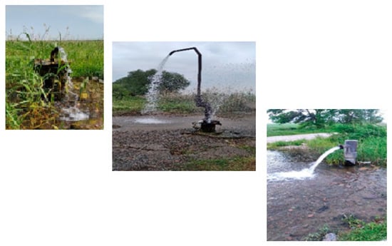
Figure 5.
Spouting wells in the research area from 25 May 2021.

Table 2.
Example description of hydrogeological wells in the research regions dated 20 August 2021.
2.2. Sampling and Data Preparation
2.2.1. Laboratory Analysis
The laboratory analysis was provided for the collected field samples based on the SSRK R 51592-2003 method [28]. The pH, electrical conductivity, and dry residue were provided by the Mettler-Toledo liquid analyzer. Na and K cations were measured on a flame photometer PFP-7. Ca, Mg, NH4, SO4, Cl, P, F, NO3, and NO2 were determined on the capillary electrophoresis apparatus Capel 105 M. Reagents CTA-OH, DEA, tartaric acid, hydrochloric acid, and sodium hydroxide were used to prepare electrolytes. The standards were used to build scales and sample preparation in the membrane filter filtration. All processed samples were measured in a centrifuge for about 5 min for all specified components. The results are presented in mg/dm3 units.
Halogens were measured on the capillary electrophoresis apparatus Capel 105 M. Boron (Si) and silicon (Si, SiO2) were determined on the KFK-2 apparatus [29]. To determine them, we built a scale and the optical density was used to calculate the sample and the scale. The boron (Si) results are presented in mg/L units. The silicon (SiO2) results are presented in mg/dm3 units. The silicon (SiO2) results are presented in mg/dm3 units.
Metals were determined on the ICPE-9820 emission spectrometer. Samples were concentrated with nitric acid (NO3) and filtered with measurements. The scale and samples were determined by the width, height, and peaks. Heavy metals were measured on an Agilent AA 140 Atomic Absorption Spectrophotometer.
Petroleum elements and phenols were determined on a “Fluorat-02-NM” fluorescent-photometric liquid analyzer, with the addition of the hexane reagent.
Pesticides were determined on a gas chromatography-mass spectrometer. Hexane was mixed with samples. The mixed liquids of 0.1 mL were sprayed through a microsyringe. The peaks, height, width, and area were measured. The results are presented in mg/dm3 units.
Alpha and Beta Activities Measurements
The alpha and beta activities were measured by using the Alpha-Beta radiometer UMF-2000 methodology [30]. The measurement is determined by the given ratio calculations. The lower limit for alpha activity is 0.02 Bq and that for beta activity is 0.1 Bq with an expanded uncertainty value of 60% for P = 0.95. The upper limit for alpha activity is 1000 Bq and that for beta activity is 3000 Bq with an expanded uncertainty value of 20% for P = 0.95. The Alpha-Beta radiometer UMF-2000 with a control source allows the measurement of the activities of countable samples up to 40 mm in diameter with simultaneous measurement of alpha activity and beta activity. The laboratory analytical scales of the VLR-200 type according to SS 19491-74 range from 0 to 200 g, and a basic measurement error of 0.5 mg was also used for the sample measurements. For the calibration, the following characteristics were applied: sensitivity to alpha radiation for different masses of the counting sample ; sensitivity to beta radiation α for different masses of the counting sample ; coefficient of account transfer from the alpha channel to the beta channel, K, for different masses of the counting sample. The recommended weight range for counting samples for calibration is 100–600 mg. The method is based on the concentration of radionuclides from the volume of an aqueous sample by evaporation to a dry residue, measuring the count rate of alpha and beta radiation of the obtained residue using a radiometer, and comparing it with the count rate from the reference sample with certified activity values and calculating the total alpha and beta activity samples.
Calculation of the alpha and beta activity of the counting sample for the alpha channel A, Bq, and α is carried out by the Formulas (1) and (2):
and that for the beta channel A, Bq, is according to the formula:
where <Nα> is the score for the alpha channel; <Nβ> accounts for the beta channel; Effα and Effβ are sensitivities to alpha and beta radiation, respectively, for β of a given mass of a countable sample; Ktr is the coefficient of transfer of the alpha count to the beta channel for a given mass of the counting sample.
3. Results and Discussion
3.1. Groundwater Chemistry
South Kazakhstan, in comparison, is similar to other neighboring countries in regional scalers such as “Iran’s Groundwater Hydrochemistry”; most of the groundwater does not meet the requirements for drinking use [31].
The South Kazakhstan, Zhambyl region, field samples’ chemical analyses are presented in Table 3. Groundwater pH was slightly alkaline with values from 7.5 to 9.5 (average value of 7.95). Groundwater temperatures in wells range from 10 to 32 °C.

Table 3.
Field samples’ chemical summary results in Merke, Shu, and Korday districts in the Zhambyl region, Kazakhstan, with drinking water standards comparison [32,33].
The fluorine F values are higher in comparison to the allowed water drinking standards. Only the standard fluorine rate in water is harmless to the human body. Both fluorine excess and deficiency are equally harmful. An excess of fluorine in water negatively affects the body, which may cause diseases such as thyroid disorders, nerve impulses, cardiovascular diseases, inflammation of the nasopharynx and digestive tract, hearing loss, and a decrease in immunity. Fluorosis disease may occur with changes in bone tissue issues. From the water, fluorides are carried throughout the body, settling on the teeth and bones. Then, fluorides accumulate in the bones, causing deformations. An increased level of fluoride in water causes infertility, osteoporosis, cancer, and Alzheimer’s disease [34]. The silicon (Si) values are twice as high as the allowed water drinking standards. Crystalline silica may affect the immune system, causing mycobacterial infections (tuberculous and nontuberculous) and fungal diseases [35]. Tuberculosis rates are very high in Kazakhstan, one of the highest rates in the world [36]. The tuberculosis rates are more than >216/100,000, in comparison to the EU with less than <13/100 000 population [37]. The arsenic (As) values are two-five times higher in comparison to the allowed water drinking standards. Arsenic is naturally present at high levels in Kazakhstan’s groundwater. Arsenic is a highly toxic element. Contaminated water with arsenic used for drinking, food preparation, and irrigation causes health problems, including cancer, skin lesions, cardiovascular disease, diabetes, negative impacts on cognitive development, young adult deaths, lung disease, heart attacks, and kidney failure. Arsenic causes adverse pregnancy outcomes and infant mortality [38].
A Piper diagram consists of two trigonograms projected onto a rhombus and allows for determining the type of water. Two triangles are filled first (a triangle carrying cations and the other anions) and then a rhombus. The left triangle demonstrates the composition of cations, and the right one is for anions. The values in the triangle are calculated as follows: percentages of Mg2+, Ca2+, and Na+ + K+ cations—according to Formulas (3)–(5):
Major ion concentrations of samples were plotted in a Piper diagram to delineate the hydrochemically paramount groundwater types in Merke, Shu, and Korday districts in the Zhambyl region (Figure 6) [39]. In most groundwater samples, the dominant cations were Na+ > Ca2+ > Mg2+ > K+, whereas the dominant anions were HCO3− > SO42− > Cl−.
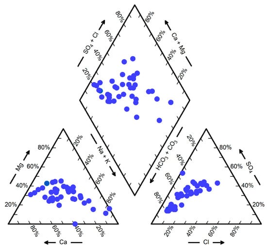
Figure 6.
Piper plot depicting the chemical compositions of groundwater from in Merke, Shu, and Korday districts in the Zhambyl region.
The intersection of points of values of cations and anions of samples in a rhombus determines their type. The construction of the Piper diagram showed that the dominant component type in the groundwater is Na-HCO3, followed by Ca-HCO3, as it is presented in the Piper diagram. The results of major ions meet national requirements for domestic and drinking water [40].
The groundwater radioactivity was analyzed on four groundwater samples that were collected from the Merke district. The temperature of the groundwater samples ranged from 30.1 °C to 31 °C. The results indicate that the water meets the requirements of radiation safety (Table 4).

Table 4.
Results of water samples for radiation safety research from 23 August 2021, with drinking water standards comparison [41,42].
The alpha activity values are approximately twice higher from the allowed water drinking standards. Alpha particles can be very harmful if alpha emitters are swallowed and enter the body from the drinking water. The alpha particles may damage living tissue cells and deoxyribonucleic acid (DNA) [43]. Lower doses of radiation may cause cancer or other health problems. The initial preliminary effect of radiation may be without any appearance for many years but will cause many issues later in life [44,45,46].
The mineralization, or TDS (Total dissolved solids), the ratio of various components by the location of hydrogeological wells is presented in Figure 7.
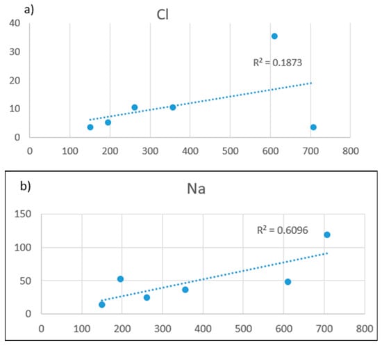
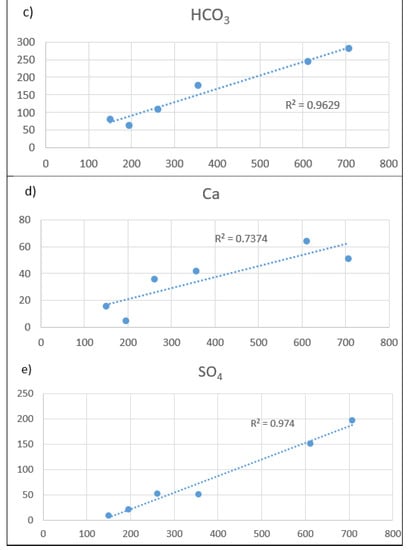
Figure 7.
The mineralization or TDS (Total dissolved solid) on the X axis, and major ions on the Y axis in water wells in Merke, Shu, and Korday districts in the Zhambyl region: (a) TDS-Cl; (b) TDS-Na; (c) TDS-HCO3; (d) TDS-Ca; (e) TDS-SO4.
In Merken, Shui, and Kordai districts of the Zhambyl region (Figure 7), the mineralization level TDS -Ca is R2 = 0.7374, TDS-HCO3 is R2 = 0.9629, and TDS-SO4 is R2 = 0.974. This pattern may indicate differences in contributions from the Aral Lake, more salts, or the deposition and washout of marine aerosols. In addition, intensive agricultural activity in the area may be the cause of this apparent anomaly associated with the weathering of silicate volcanic, with the release of alkali and alkaline earth metals and the production of alkali. The mineralization TDS and Cl (R2 = 0.1873) are low, which may indicate a reduced influence of water–rock interaction processes.
Water Quality Index (WQI) reveals the degree that reflects the combined influence of several water quality parameters. The WQI is important for the determination of the suitability of groundwater for potable use. The WQI assessment is an effective method for assessing water quality and may be useful for future groundwater monitoring. It is also an easy way to present groundwater quality results. The calculated WQI, water type, and percentage of different types of water in the Merken, Shui, and Kordai districts of the Zhambyl region are presented in Table 5.

Table 5.
Correlation coefficient ranges and interpretation.
For 80% of the selected wells, the groundwater quality in the Merken, Shu and Korday districts of the Zhambyl region satisfies the Kazakhstan sanitary norm for the potable use. The intensive use of groundwater, as well as the increase in mining, has led to many anthropogenic distortions of the environment. The expansion of groundwater use and extraction requires proper management. Only 36% of the rural population of Kazakhstan has access to a centralized water supply, and 57.3% use groundwater from wells [47]. Groundwater quality needs to be monitored to minimize health risks.
3.2. Data and Database
Data accumulation in geoinformation-analytical subsystem formats implies the creation of a semantic and graphic database structure, tables and layer structures, data input and digitization, and conversion of available data from the document base. The created semantic database of hydrogeological and self-flowing wells in the districts of Merke, Shu, and Korday contains all the accumulative information on the studied self-flowing wells, such as areas, location, the chemical composition of water, mineralization, total water hardness, temperature, and water flow rate in self-flowing wells (Figure 8, Figure 9 and Figure 10).
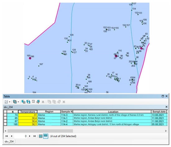
Figure 8.
A sampling of surveyed wells with temperatures above 30 degrees.
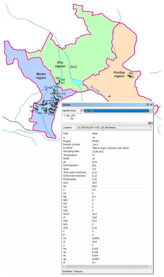
Figure 9.
Attributive data associated with surveyed wells.
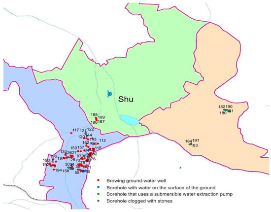
Figure 10.
Map of artesian wells.
Evaluation of the data contained in graphical and semantic databases is conducted for reliability, completeness, and consistency and includes formal data verification, expert data verification, data correction, and addition. The solution to practical problems of hydrogeology assumes the creation of thematic maps and cartographic models. In order to create thematic maps, the necessary information is selected, data classification and calculations are made, maps are drawn, and the results are analyzed (Figure 8).
Recommendations were prepared by analyzing the primary and processed data, to improve monitoring, improve sustainability, and set up the proper control system of the groundwater resources, including protection from pollution and depletion. The field survey was localized with mapping and classification of the spouting wells with high flow rates, which will be reasonable to use more efficiently. In total, three main spouting wells areas were identified, which are located in the Merke district, Zhambyl region (Figure 8, Figure 9 and Figure 10).
The first site contains seven spouting wells within the Andasbatyr rural area of the Merke district. The flow rate of the wells is from 5 to 40 L/s, they are located in one area, and the distance from the outermost wells is approximately 400 m. The wells are located north of the village Kyzylkistak from 1 to 1.4 km.
The second site contains six spouting wells within the Andasbatyr rural area of Merke district and one spouting well in the Zhanatogan rural area. The flow rate of these wells is from 10 to 20 L/s, they are located in one area, and the distance from the outermost wells is approximately 300 m.
The third site contains nine spouting wells, which are located on the territory of the “Merke stud plant” Joint-Stock Company (JSC) of the Akerman rural area of the Merke district. The flow rates of the wells are from 1 to 40 L/s, they are located in one area, and the distance from the outermost wells is 200 m. Thus, most high-spouting wells are located in the Merke district of the Zhambyl region. The capacity of 37 spouting wells in Merke district is 0.536 m3/s, which is 6.5% of the calculated value of the annual replenishment of groundwater resources. During the summer vegetation period, the total volume of groundwater, brought out to the surface by 37 spouting wells, is estimated at 6.947 mln. m3. Taking into account the average water use norm of the district—4515 m3/ha, at the number of irrigations for the whole vegetation period of 7 at the expense of 37 spouting wells, there is the possibility to provide irrigation of agricultural crops at the additional area of 220 ha. The sprinkler irrigation technologies are becoming popular in the Zhambyl region, which is more rational compared to the surface canal irrigation system [48]. Other technologies such as drip subsoil irrigation are subject to further investigation and development. Further investigation and sustainable program adaptations are required, including expertise from other countries, such as Australia and Canada, to adapt to Kazakhstan. In Australia, the Great Artesian Basin Well Restoration Program (1989–1999) was developed and implemented with efficient use of groundwater, and sustainable Managed Aquifer Recharge technologies, which require further learning and adaptation for Kazakhstan [49,50].
The local people consume the water from wells as it is, without additional purifications and processing. It is typical in many regions of Kazakhstan to drink well water without proper chemical analysis. The groundwater quality investigation by this study meets most Kazakhstan national requirements for drinking water and the results indicate that the water meets Kazakhstan’s requirements of radiation safety. At the same time, the established standards for drinking water by Kazakhstan’s national authorities differ in comparison with the WHO/EU drinking water standards. Drinking water quality requirements are much higher in the WHO/EU, in comparison to Kazakhstan. For example, for chromium, the difference is 10 times: 0.5 mg/L in Kazakhstan and 0.05 mg/L in EU; for cyanide, the difference is 7 times: 0.035 mg/L in Kazakhstan and 0.005 mg/L in EU; for nitrite, the difference is 6 times: 3.0 mg/L in Kazakhstan and 0.5 mg/L in the EU; for arsenic, the difference is 5 times: 0.05 mg/L in Kazakhstan and 0.01 mg/L in EU; for lead, the difference is 3 times: 0.03 mg/L in Kazakhstan and 0.01 mg/L in EU. The human body consists of up to 70% of water and many illnesses are related to water quality. Less than 30% of the Kazakhstan population has access to safe water and sanitation [51,52]. About 50% of the population uses drinking water that does not meet the international standards of salinity, hardness, and bacteriological standards [53]. Kazakhstan’s infant mortality rate is 6 times higher in comparison to the EU; Kazakhstan has 17.9 and the EU has 3.1 deaths per 1000 live births [54,55]. Water quality, including groundwater, with human risk analysis, requires further investigations in Kazakhstan. Standards for drinking water need further revision in Kazakhstan.
4. Conclusions
Kazakhstan has difficulties with surface-groundwater resources. The threat of water scarcity and inefficient management of water resources can become a major challenge to the sustainable socioeconomic development of Kazakhstan. Depletion of surface water and complexities with the transboundary water resources intensifies groundwater extraction and usage. Groundwater is becoming polluted due to mining extraction activities and intensive pesticide and chemical usage in irrigation. Economic activities, industry, and agriculture water usage are depleted with inefficient over-exploitation of groundwater resources. Our project work in Merke, Shu, and Korday districts in the Zhambyl region shows that the groundwater resource extraction, depletion, overuse, waterlogging, and salinization of soils are expanding. The previous studies, which tracked the 500 self-flowing wells in the southern Kazakhstan region, also showed similar issues. Many water infrastructure facilities are out of order and currently require major repairs and full restoration. The number of self-flowing pressure wells has decreased, and most of them are not suitable for use. Further proper surface–groundwater interaction studies and modeling are required for the improvement of water management. This project investigation showed that almost all spouting wells used by the local population in Merke, Shu, and Korday districts in the Zhambyl region for various needs do not have special water use permits. Subject to the issuance of permits for special water use, wells will be reasonable to implement. Spouting wells with warm water is of special interest, and it is necessary to estimate their therapeutic and health-improving potential. The fountain operation of three wells with a total capacity of 2.94 thousand cubic meters per day could be used for many applications. At the same time, additional proper investigations, including the radiation radon level, are required. Previous studies have shown that the natural sources of radiation of the Kazakh population are about 80%, including 50% from radon. The radon soil concentration in some Kazakhstan areas reaches 300,000 Bq/m3, which exceeds the maximum permissible concentration by 60 times. Further investigation, with modeling, policy, and proper water management practice, is required with the further targeted activities. This case study presented an investigation of the current status of underground water use with existing issues. The results of this project will be useful for further science investigations and modeling with prediction analysis and can support local decision-makers to develop sustainable groundwater resources in Merke, Shu, and Korday districts in the Zhambyl region, Kazakhstan. Similar issues could exist in many regions worldwide, especially in developing countries, and this investigation will be applicable for comparison studies.
Author Contributions
D.A. collected and analyzed the data; S.T. traveled to the field and collected data on self-flowing wells; Y.M. supervised the development and further introduction of the work; L.T. and O.M. with the help of received and collected materials formed and developed GIS modeling; J.S., M.A. and A.Z. analyzed the data, conducted the literature search in English, modified the figures and tables, and prepared the final manuscript. All authors have read and agreed to the published version of the manuscript.
Funding
This research is funded with the support of the Committee of Science of the Ministry of Education and Science of the Republic of Kazakhstan (grant No. IRN AR09260877). The term of the grant is 2021–2023.
Data Availability Statement
The groundwater field data presented in this study were collected with Kazakhstan’s local authorities’ approvals and are available on request from the corresponding author.
Conflicts of Interest
The authors declare no conflict of interest.
References
- Farah Water Resources of Kazakhstan; Handbook; Galym: Almaty, Kazakhstan, 2002; p. 595. (In Russian)
- Jawadi, H.; Sagin, J.; Snow, D. A detailed assessment of groundwater quality in the Kabul basin, Afghanistan, and suitability for future development. Water 2020, 12, 2890. [Google Scholar] [CrossRef]
- UN. Available online: www.un.org/ru/global-issues/water (accessed on 15 September 2022).
- Yapiyev, V.; Sagintayev, Z.; Inglezakis, V.J.; Samarkhanov, K.; Verhoef, A. Essentials of Endorheic Basins and Lakes: A review in the context of current and future water resource management and mitigation activities in central Asia. Water 2017, 9, 798. [Google Scholar] [CrossRef]
- Salikova, N.; Rodrigo-Ilarri, J.; Alimova, K.; Rodrigo-Clavero, M.-E. Analysis of the water quality of the ishim river within the Akmola Region (Kazakhstan) using hydrochemical indicators. Water 2021, 13, 1243. [Google Scholar] [CrossRef]
- Sagin, J.; Adenova, D.; Tolepbayeva, A.; Poryadin, V. Underground water resources in Kazakhstan. Int. J. Environ. Stud. 2017, 74, 386–398. [Google Scholar] [CrossRef]
- Mirlas, V.; Makyzhanova, A.; Kulagin, V.; Kuldeev, E.; Anker, Y. An integrated aquifer management approach for the aridification-affected agricultural area, Shengeldy-Kazakhstan. Water 2021, 13, 2357. [Google Scholar] [CrossRef]
- Abdullaev, I.; Rakhmatullaev, S. Transformation of water management in Central Asia: From State-centric, a hydraulic mission to socio-political control. Environ. Earth Sci. 2013, 73, 849–861. [Google Scholar] [CrossRef]
- Hydrogeology of the USSR. South Kazakhstan. Moscow Subsoil 1970, 36, 473. (In Russian)
- Shahbazbegian, M.; Noori, R. Hydropolitical system archetypes: Feedback structures, physical environments, unintended behaviors, and a diagnostic checklist. Hydrology 2022, 9, 207. [Google Scholar] [CrossRef]
- Mukhamedjanov, M.A.; Arystanbaev, Y.Y. Underground waters of arid regions of Kazakhstan and their use under conditions of climate change and growth of water consumption. In Proceedings of the International Conference Water resources of Central Asia and their use, Almaty, Kazakhstan, 22–23 September 2016; Volume 1, pp. 122–126. (In Russian). [Google Scholar]
- Absametov, M.K.; Adenova, D.K.; Nusupova, A.B. Assessment of the impact of anthropogenic factors water resources of Kazakhstan. Ser. Geol. Tech. Sci. 2019, 1, 248–254. [Google Scholar] [CrossRef]
- Muratkhanov, D.; Rakhmetov, I.; Rakhimov, T. Recommendations on prevention, remediation, and mitigation of climate change negative effects on groundwater in Kazakhstan. In Proceedings of the 20th International Multidisciplinary Scientific Geo Conference & EXPO SGEM, Albena, Bulgaria, 18–24 August 2020; pp. 707–714. [Google Scholar] [CrossRef]
- Gogu, R.; Carabin, G.; Hallet, V.; Peters, V.; Dassargues, A. GIS-based hydrogeochemical databases, and groundwater modeling. Hydrogeol. J. 2001, 9, 555–569. [Google Scholar] [CrossRef]
- Guney, M.; Akimzhanova, Z.; Kumisbek, A.; Beisova, K.; Kismelyeva, S.; Satayeva, A.; Inglezakis, V.; Karaca, F. Mercury (Hg) contaminated sites in Kazakhstan: Review of current cases and site remediation responses. Int. J. Environ. Res. Public Health 2020, 17, 8936. [Google Scholar] [CrossRef]
- Noori, R.; Farahani, F.; Jun, C.; Aradpour, S.; Bateni, S.M.; Ghazban, F.; Hosseinzadeh, M.; Maghrebi, M.; Naseh, M.R.V.; Abolfathi, S. A non-threshold model to estimate carcinogenic risk of nitrate-nitrite in drinking water. J. Clean. Prod. 2022, 363, 132432. [Google Scholar] [CrossRef]
- Aradpour, S.; Noori, R.; Tang, Q.; Bhattarai, R.; Hooshyaripor, F.; Hosseinzadeh, M.; Haghighi, A.T.; Klöve, B. Metal contamination assessment in the water column and surface sediments of a warm monomictic man-made lake: Sabalan Dam Reservoir, Iran. Hydrol. Res. 2020, 51, 799–814. [Google Scholar] [CrossRef]
- Aradpour, S.; Noori, R.; Naseh, M.R.V.; Hosseinzadeh, M.; Safavi, S.; Ghahraman-Rozegar, F.; Maghrebi, M. Alarming carcinogenic and non-carcinogenic risk of heavy metals in Sabalan dam reservoir, Northwest of Iran. Environ. Pollut. Bioavailab. 2021, 33, 278–291. [Google Scholar] [CrossRef]
- Comunian, A.; Renard, P. Introducing wwhypda: A world-wide collaborative hydrogeological parameters database. Hydrogeol. J. 2008, 17, 481–489. [Google Scholar] [CrossRef]
- Ostrovsky, V.N. Groundwater Formation in Arid Areas of Kazakhstan; Sydykov, Zh.S., Sosedov, I.S., Eds.; Leningrad, USSR, Gidrometeoizdat: 1976; pp. 5–227. (In Russian). Available online: https://search.rsl.ru/ru/record/01006977637?ysclid=ld3g3vzfhu433384748 (accessed on 25 December 2022).
- Sydykov, Z.S.; Jakelov, A.K.; Jabasov, M.H. Underground Waters of Kazakhstan. Resources, Use and Protection Problems; Almaty, Kazakhstan, 1999; p. 11. Hardcopy monography (In Russian). Available online: https://reliefweb.int/report/kazakhstan/kazakhstan-killings-excessive-use-force-almaty (accessed on 25 December 2022).
- Medeu, A.R.; Malkovsky, I.M.; Toleubaeva, L.S.; Iskakov, N.A. Water Security of the REPUBLIC of Kazakhstan: Problems of Sustainable Water Supply; Almaty, Kazakhstan 2015; p. 582. (In Russian). Available online: https://ingeo.kz/?p=5127 (accessed on 25 December 2022).
- Republic of Kazakhstan Ministry of Investment and Development Committee for Roads. Environmental and Social Impact Assessment. 2015. Available online: https://www.ebrd.com/documents/environment/47229-esia-r.pdf (accessed on 25 December 2022).
- Dzhakelov, A.K. Formation of Groundwater of Chu-Sarysu Artesian Basin; Almaty, Kazakhstan. 1993, p. 240. (In Russian). Available online: https://search.rsl.ru/ru/record/01000594988?ysclid=ld3gpmwsw9702117854 (accessed on 25 December 2022).
- Smolyar, V.A.; Burov, B.V.; Mustafaev, S.T. Groundwater resources of the Republic of Kazakhstan. Water Resources of Kazakhstan: Assessment, Forecast, Management; Almaty, Kazakhstan. 2011, 8, p. 588. (In Russian).
- Veselov, V.V. Hydrogeological Zoning and Regional Assessment of Groundwater Resources of Kazakhstan: (Analysis of Research Results for 1961–2002), Almaty, Kazakhstan. 2002, p. 438. (In Russian). Available online: https://studwood.net/1288876/geografiya/spisok_ispolzovannyh_istochnikov?ysclid=ld3gwz0w9g195383365 (accessed on 25 December 2022).
- Murtazin, E.; Miroshnichenko, O.; Trushel, L. Description of the informational system of groundwater resources and reserves of Kazakhstan. In Proceedings of the 19th International Multidisciplinary Scientific Geo Conference & EXPO SGEM, Albena, Bulgaria, 30 June–6 July 2019; pp. 137–144. [Google Scholar]
- On Approval of the Rules for Sampling Moved (Transported) Objects and Biological Material. Available online: https:adilet.zan.kz/rus/docs/V1500011618 (accessed on 25 December 2022).
- Design and Operation of a Concentration Photoelectric Colorimeter (KFC-2). Available online: https:studfile.net/preview/4614227/page:8/ (accessed on 25 December 2022).
- Method for Determining the Total Specific Alpha Activity of Radionuclides. Available online: https:files.stroyinf.ru/Data2/1/4293785/4293785580.pdf?ysclid=lcrif05gt5205152543 (accessed on 25 December 2022).
- WHO/EU Drinking Water Standards Comparative Table. Available online: https://www.lenntech.com/who-eu-water-standards.htm (accessed on 10 September 2022).
- Murtazin, Y.; Adenova, D.; Tazhiyev, S. Assessment of the potential of self-discharging hydrogeological wells for sustainable development of rural areas of Zhambyl region. Ser. Geol. Tech. Sci. 2022, 5, 143–155. [Google Scholar] [CrossRef]
- Gumbatova, R.M. Effect of fluorine on the human body. Probl. Mod. Sci. Education. 2021, 2, 43–45. (In Russian) [Google Scholar]
- Chemical Properties Of Silicon, Health Effects Of Silicon, Environmental Effects of Silicon. Available online: https://www.lenntech.com/periodic/elements/si.htm#ixzz7mWr7NyYu (accessed on 12 May 2022).
- Terlikbayeva, A.; Hermosilla, S.; Galea, S.; Schluger, N.; Yegeubayeva, S.; Abildayev, T.; Muminov, T.; Akiyanova, F.; Bartkowiak, L.; Zhumadilov, Z.; et al. Tuberculosis in Kazakhstan: Analysis of risk determinants in national surveillance data. BMC Infect. Dis. 2012, 12, 262. [Google Scholar] [CrossRef]
- Maghrebi, M.; Noori, R.; Partani, S.; Araghi, A.; Barati, R.; Farnoush, H.; Haghighi, A.T. Iran’s Groundwater Hydrochemistry. Earth Space Sci. 2021, 8, e2021EA001793. [Google Scholar] [CrossRef]
- Walls, T.; Shingadia, D. The epidemiology of tuberculosis in Europe. Arch. Dis. Child. 2007, 92, 726–729. [Google Scholar] [CrossRef] [PubMed]
- WHO. Arsenic—World Health Organization. Fact Sheets. Available online: https://www.who.int/news-room/fact-sheets/detail/arsenic (accessed on 22 December 2022).
- Piper, A.M. A graphic procedure in the geochemical interpretation of water analyses. Eos Trans. Am. Geophys. Union 1944, 25, 914–928. [Google Scholar] [CrossRef]
- Kazakhstan Government. Drinking Water General Requirements for the Organization and Methods of Quality Control; ST RK GOST R 51232. In Proceedings of the Committee for Standardization, Metrology and Certification, Astana, Kazakhstan. 2003. (In Russian). Available online: https://waterservice.kz/downloads/rd/gst7.pdf?ysclid=ld3fpwacho899490449 (accessed on 22 December 2022).
- Order of the Chairman of the Committee for Water Resources of the Ministry of Agriculture of the Republic of Kazakhstan dated 9 November 2016 No. Registered with the Ministry of Justice of the Republic of Kazakhstan on 13 December 2016 No. 14513 Unified Classification System for Water Quality in Water Bodies. Available online: https://adilet.zan.kz/rus/docs/V070004735 (accessed on 12 May 2022).
- Li, X.; Wang, S.; Lou, H.; Pan, J.; Dong, Q.; Zheng, Y.; Chen, L. Simultaneous determination of gross alpha/beta activities in water by liquid scintillation counting and its applications in environmental monitoring. Sci. Rep. 2022, 12, 8281. [Google Scholar] [CrossRef]
- Bonotto, D.M. Gross alpha/beta radioactivity and radiation dose in thermal and non-thermal spas groundwaters. Heliyon 2019, 5, e01563. [Google Scholar] [CrossRef] [PubMed]
- Information and Analytical Review of Parliamentary Hearings on the Topic: Water Security of Kazakhstan: State, Problems, and Recommendations. Available online: https:senate.parlam.kz/storage/536c3d72c4494ae687e43510c22c78f1.pdf?ysclid=lcrjw39uy1260006563 (accessed on 25 December 2022).
- EPA. United States Environmental Protection Agency. Radiation Basics. Available online: https://www.epa.gov/radiation/radiation-basics (accessed on 7 May 2022).
- Radiation Health Basics. Available online: https://www.co.monmouth.nj.us/documents/118/RADIATION%20HEALTH%20BASICS.pdf (accessed on 10 May 2022).
- Gross Alpha Radiation, Uranium, and Radium in Drinking Water. Available online: https://www.healthvermont.gov/health-environment/drinking-water/radioactive-elements (accessed on 10 May 2022).
- Dzhumagulov, A.A.; Nikolaenko, A.Y.; Mirkhashimov, I.K.H. Water Quality Standards and Norms in the RK, Almaty. 2009, 44. Available online: https://carececo.org/publications/Standarty_i_nromy_kachestva_vod_v_Respublike_Kazakhstan.pdf (accessed on 5 October 2022).
- Non-Renewable Groundwater Resources. Foster, S.; and Loucks, D.P., Eds.; A Guidebook on Socially-Sustainable Management for Water-Policy Makers; IHP-VI, Series on Groundwater No. UNESCO. Paris, France. 2006, p. 97. Available online: https://www.un-igrac.org/sites/default/files/resources/files/GWMATE%20Books%20-%20Non-renewable%20grounwater%20resources.pdf (accessed on 5 October 2022).
- Fensham, R.; Laffineur, B. Response of spring wetlands to restored aquifer pressure in the Great Artesian Basin, Australia. J. Hydrol. 2022, 612, 128152. [Google Scholar] [CrossRef]
- Nurmadiyeva, G.T.; Zhetpisbaev, B.A. Impact of the ecosystem on human health in the industrially developed regions of Kazakhstan. Lit. Review. Sci. Health 2018, 4, 107–132. (In Russian) [Google Scholar]
- Nurmanova, Z.A. The issue of providing drinking water to the population of the regions of the Republic of Kazakhstan. Bull. KazNMU 2012, 1, 421–423. [Google Scholar]
- Toguzbayeva, K.K.; Myrzakhmetova, S.K.; Zhunistayev, D.D.; Niyazbekova, L.S.; Zhakhanov, A.Z.; Seiduanova, L.B.; Sailybekova, A.K.; Shayakhmetov, S.S.; Kaldybai, A.U.; Seitakhmetova, M.B.; et al. Hygienic assessment of the impact of the quality of household and drinking water supply on the health of the rural population of the Almaty region. Bull. KazNMU 2014, 3, 33–38. (In Russian) [Google Scholar]
- Pozdnyakova, A.P.; Taizhanova, D.Z.; Guseinova, Z.K.; Turemuratova, D.T.; Ashirbekov, G.K.; Adilgireyuly, Z. Screening of the health status of the population in the territories, approaching the district of the «Proton-m» accident in 2013, and in the comparison area—Aiteke bi. Med. Ecol. 2018, 1, 47–52. [Google Scholar]
- Healthcare in Kazakhstan: Problems and Solutions. Available online: https://borgenproject.org/tag/healthcare-in-kazakhstan/ (accessed on 10 September 2022).
Disclaimer/Publisher’s Note: The statements, opinions and data contained in all publications are solely those of the individual author(s) and contributor(s) and not of MDPI and/or the editor(s). MDPI and/or the editor(s) disclaim responsibility for any injury to people or property resulting from any ideas, methods, instructions or products referred to in the content. |
© 2023 by the authors. Licensee MDPI, Basel, Switzerland. This article is an open access article distributed under the terms and conditions of the Creative Commons Attribution (CC BY) license (https://creativecommons.org/licenses/by/4.0/).
