


Abstract
Karst regions are commonly characterized by highly interwoven bare rock–bare soil–vegetation mosaics, strong coupling between surface and subsurface processes, and pronounced geomorphic fragmentation. Conventional land cover classification systems, which are primarily organized around land use patterns or generic ecological types, are often unable to accurately represent these key surface components and their roles in ecological processes. From the perspective of reconstructing classification semantics, this study proposes a Natural-Attribute-Based Karst Land Cover Classification framework (NALCC). The framework takes bare rock, bare soil, vegetation, water bodies, and impervious surfaces as primary classes, and further develops a hierarchical system consisting of subclasses, attribute labels, hierarchical coding, multi-scale organization, and parameter mapping with ecosystem service models. Compared with conventional land cover classification systems, the innovation of this framework lies not in increasing the number of categories, but in reconstructing the semantic organization of classification units, so that land cover classification can move beyond surface-type description toward the expression of process-sensitive information. The classification objective of NALCC is not to develop a universal land cover classification system, but to establish a process-oriented classification framework for ecosystem service monitoring, rocky desertification diagnosis, and governance zoning in karst regions, which can directly represent key surface components and their ecological-process significance. However, its regional transferability and mapping performance still need to be further validated through case studies in representative areas.
1. Introduction
Land cover classification is an important foundation for ecological process analysis, ecosystem service assessment, and regional governance decision-making [1,2,3,4]. For karst mountainous regions, whether classification units can accurately represent key surface components such as bare rock, bare soil, vegetation, water bodies, and impervious surfaces directly affects the reliability of rocky desertification diagnosis, water conservation assessment, soil retention analysis, and ecological restoration zoning.
Karst regions are globally recognized as highly heterogeneous and highly sensitive surface systems, widely distributed in Southwest China, Southeast Asia, the Balkan Peninsula, and North America [5,6]. As one of the world’s three major concentrated karst regions, Southwest China is characterized by typical geomorphic units such as peak-cluster depressions, peak-forest valleys, and karst plateaus. Controlled by intense dissolution of carbonate rocks, this region generally exhibits high bedrock exposure, shallow and discontinuous soils, close surface–subsurface hydrological connections, and pronounced ecological vulnerability [7,8]. Rocky desertification is the most representative degradation process in karst areas. Its essence lies in the mutually reinforcing chain of vegetation destruction, soil loss, and increasing bedrock exposure, which in turn leads to soil erosion, habitat fragmentation, and ecosystem service degradation [9,10,11]. Previous studies have shown that bedrock exposure, vegetation cover, and soil thickness are key state variables controlling ecosystem stability and restoration potential in karst regions [12,13].
However, mainstream land cover classification systems have primarily been developed for land use statistics, global mapping, or generic ecological type identification. Whether Anderson’s system, FAO LCCS, IGBP, MODIS Land Cover, GlobeLand30, Dynamic World, or ESA WorldCover, these frameworks all exhibit good generality and comparability at global or regional scales [14,15,16,17]. Yet in karst regions, they commonly suffer from a mismatch between classification semantics and surface processes: bare rock is often merged into “bare land” or “unused land”; soil lacks independent representation; vegetation classes emphasize community form rather than restoration stage and its relationship with rock–soil background; and impervious surfaces fail to adequately express their special impacts on karst hydrological processes and ecological stability [18,19,20]. As a result, although existing classification results can support general mapping and statistics, they are inadequate for directly supporting rocky desertification diagnosis, water conservation assessment, soil retention analysis, and ecological restoration monitoring.
Advances in remote sensing have improved the identification of land cover in karst regions to some extent. In recent years, multi-source remote sensing, machine learning, and deep learning have been widely applied to bare rock extraction, rocky desertification grading, and vegetation restoration assessment [21,22]. Nevertheless, the strong rock–soil–vegetation mosaic, severe surface fragmentation, mixed pixels [23], and shadow effects in karst environments still lead to persistent confusion among key categories such as bare rock versus built-up areas and thin soil versus sparse vegetation [24]. This indicates that the key issue in karst land cover research is no longer merely how to improve classification accuracy, but how to ensure that classification semantics correspond to key surface components and their ecological-process significance, namely the indicative, controlling, and responsive relationships of different surface components to key karst processes. For example, bare rock exposure directly indicates the degree of rocky desertification and the status of soil loss; bare soil reflects soil-layer preservation and erosion sensitivity; vegetation cover is closely related to ecological restoration and soil conservation; water bodies reflect surface–subsurface hydrological regulation processes; and impervious surfaces represent the disturbance of human activities to infiltration, runoff, and habitat connectivity. If the classification units themselves cannot express controlling variables such as bare rock exposure, soil-layer continuity, vegetation restoration stage, and surface hardening intensity, subsequent ecosystem service assessment and governance analysis will still need to rely on supplementary indicators for compensation, thereby limiting the interpretability and traceability of the classification results themselves.
Based on this, this study proposes a Natural-Attribute-Based Karst Land Cover Classification framework, namely NALCC. The core objective of this framework is not to develop a universal land cover classification system, nor to propose a new remote sensing classification algorithm, but to reconstruct the correspondence between land cover classification units, key surface components, and ecological processes for ecosystem service monitoring, rocky desertification diagnosis, and governance zoning in karst regions. The specific objectives are to: (1) identify the semantic mismatches in conventional land cover classification systems when representing key karst components such as bare rock, bare soil, vegetation, water bodies, and impervious surfaces; (2) construct a hierarchical NALCC classification system oriented toward ecological processes and ecosystem service monitoring, including primary classes, subclasses, attribute labels, hierarchical coding, and multi-scale conversion rules; and (3) clarify the potential application pathways of NALCC in rocky desertification diagnosis, ecosystem service model parameterization, and governance zoning, and propose a scheme for future empirical validation in representative areas.
2. Theoretical Basis of Karst Land Cover Classification
2.1. Fragile Karst Ecosystems and Complex Surface Structure
Understanding the basic characteristics of fragile karst ecosystems and complex surface structures is a prerequisite for constructing a land cover classification framework suitable for karst regions. The essential structural feature of karst surfaces can be summarized as a thin-soil, fragmented ecosystem controlled by soluble rock masses. Dissolution of carbonate rocks leads to the development of karst fissures and underground conduit systems, resulting in strong coupling between surface runoff and groundwater recharge [25]. At the same time, soil formation rates are low, soil distribution is spatially discontinuous, and vegetation habitats are highly differentiated at the microtopographic scale [26,27].
The ecological pattern of karst surfaces is commonly controlled by four major factors (Figure 1): (1) rock exposure, which directly reflects bedrock outcrop and soil loss and serves as a key indicator for rocky desertification diagnosis [28]; (2) soil depth/continuity, which determines water storage and rooting space, thereby influencing vegetation maintenance and restoration thresholds [29]; (3) vegetation cover and structure, which affect surface roughness, evapotranspiration, interception, and erosion control and are commonly represented by remote sensing variables such as NDVI and LAI [30,31]; and (4) topographic relief/roughness, which determines radiation conditions, soil erosion potential, and water redistribution, serving as the topographic basis of spatial heterogeneity in karst regions [29,32].
Figure 1.
Examples of field survey sites and corresponding remote sensing images. Each image pair consists of a field photograph and its corresponding remote sensing image, illustrating different land cover types and landscape patterns in karst regions. The field survey was conducted on 20 April 2025. Red circles indicate the camera shooting locations, and the photographs were taken from the front passenger seat of the vehicle.
Karst mountain ecosystems exhibit the following characteristics:
- (1)
- Highly heterogeneous surface cover. Vegetation, soil, and rock are interwoven or discontinuously distributed in karst regions, forming a rock–soil–vegetation mosaic pattern [23] (Figure 2) with extremely high spatial heterogeneity [33]. Even at small spatial scales, bare rock, soil patches, and vegetation communities may alternate frequently [34,35], posing great challenges to land cover classification.Figure 2. Rock-soil-vegetation mosaic pattern (photographed on 11 August 2024).
- (2)
- Dominance of rocky desertification processes. Rocky desertification is the most severe ecological problem in karst regions. Its core manifestation is increasing bedrock exposure and soil degradation (Table 1). In essence, it is a chain degradation process of vegetation reduction–soil loss–bedrock exposure. Therefore, the quantitative relationships and spatial patterns among bare rock, soil, and vegetation constitute the core basis for diagnosing rocky desertification status [36,37,38].Table 1. Remote sensing identification characteristics of different levels of karst rocky desertification (KRD) [23].
- (3)
- Distinctive combinations of ecosystem services. Ecosystem service supply in karst regions is unique: water conservation mainly depends on soil storage and the regulation capacity of underground river systems [39]; soil retention is closely related to vegetation cover and bedrock exposure [40,41]; and biodiversity maintenance is reflected in highly heterogeneous habitats and endemic species distributions [42]. Compared with plains, trade-offs and synergies among ecosystem services in karst ecosystems are more complex. For example, vegetation restoration may reduce water yield, while soil retention and carbon storage may conflict spatially.
Therefore, karst land cover classification oriented toward ecosystem service monitoring should not remain limited to the identification of generic types such as forest, grassland, cropland, and built-up land. Instead, it should treat rock exposure, soil-layer preservation, vegetation restoration, water-body persistence, and surface hardening intensity as core classification semantics that can be explicitly represented, mapped, and parameterized.
2.2. Suitability Problems of Existing Land Cover Classification Systems in Karst Regions
Land cover classification is fundamental to geography, ecology, and remote sensing research [43,44,45]. Widely used systems, including IGBP, MODIS global land cover products, FAO LCCS, GLC_FCS30, Dynamic World, and ESA WorldCover, are mostly based on plant functional types or land use categories and show strong generality at global and regional scales [46,47,48]. However, in highly heterogeneous mountain areas, especially karst regions, they still suffer from overly coarse semantics and insufficient representation of key surface components [16,17,49,50,51]. The key challenge in land cover classification research has shifted from whether classification is possible to whether classification semantics can correctly represent natural attributes and ecological processes. Based on the above mismatch between classification semantics and karst surface processes, the inadequacy of existing land cover classification systems for karst regions can be further summarized in the following four aspects:
- (1)
- Inadequate representation of bare rock. Mainstream systems often merge bare rock into bare land or unused land, alongside bare soil and sandy land [52,53,54,55], weakening its ecological significance as a core indicator of rocky desertification, a key interface of hydrological processes, and the basis of special habitats. Previous studies have shown that karst bare rock has distinctive remote sensing responses and should be identified as an independent class [56,57].
- (2)
- Lack of independent representation of soil. Traditional systems usually embed soil under forest, grassland, or cropland [58]. However, soils in karst regions are shallow, fragmented, and often spatially separated from vegetation. Their thickness, continuity, and retention capacity directly determine vegetation restoration potential and hydrological regulation functions [59,60]. If soil cannot be independently represented, early degradation processes and restoration baseline conditions cannot be accurately identified. Methodological studies have demonstrated that bare soil can be extracted as an independent endmember from remote sensing imagery [61,62].
- (3)
- Disconnection between vegetation classification and karst ecological processes. Existing systems usually classify vegetation by structural forms such as forest, shrubland, and grassland, emphasizing community types rather than restoration stages and their spatial relationships with bare rock and soil. Karst ecological restoration focuses more on cover change, successional sequences, and rock–soil background conditions [63,64,65]. Therefore, traditional vegetation categories alone are insufficient for revealing the effectiveness of rocky desertification control and ecological functional differences.
- (4)
- Inadequate expression of impervious surfaces and their relationship with natural surfaces. Impervious surfaces in karst regions not only represent construction activities but also alter infiltration, runoff, and underground river recharge processes, amplifying ecological instability [66,67]. If treated merely as general built-up land, their special disturbance effects on the coupled surface–subsurface karst system cannot be fully expressed.
Scholars have increasingly emphasized that management-oriented categories such as cropland, forestland, grassland, and built-up land do not necessarily correspond one-to-one with ecological process variables, and that classification semantics must be adjusted according to regional physical geographical contexts [68,69,70]. In karst mountainous regions, bare rock, thin soil, sparse vegetation, seasonal water bodies, and impervious surfaces together constitute a typical natural surface continuum. However, conventional LULC classification systems compress these key components into a few coarse categories, resulting in insufficient explanatory power for processes such as rocky desertification, water conservation, soil retention, and thermal environments [71,72].
These issues indicate that the limitation of conventional land cover classification systems in karst regions is not simply an insufficient number of categories, but rather a disconnection between classification semantics and ecological process variables (Table 2). For ecosystem service monitoring, bare rock proportion affects soil retention and habitat quality; bare soil continuity influences erosion sensitivity and restoration potential; vegetation cover affects carbon storage, water conservation, and soil retention; water-body persistence influences water resource supply and ecological corridors; and impervious surface intensity affects infiltration blockage, runoff reorganization, and ecological risk. Therefore, karst land cover classification needs to shift from the expression of “land use types” toward the expression of “ecological process variables”.
Table 2.
Mapping relationships between NALCC and mainstream land cover systems and their semantic loss.
2.3. Classification Semantic Requirements for Ecosystem Service Monitoring
Ecosystem service assessment is an important application of land cover studies. International research has evolved from early value accounting to service classification, process simulation, and policy applications, forming a theoretical foundation represented by Costanza et al. and the Millennium Ecosystem Assessment, and achieving spatialized and scenario-based analysis under the promotion of models such as InVEST [73,74,75]. In karst regions, research has also shifted from single-value assessment to analyses of multiple services—such as water conservation, soil retention, habitat quality, and carbon sequestration—as well as their synergies, trade-offs, and functional zoning [11,76,77,78].
However, most studies still use traditional LULC as the basic input for ecosystem service models, and then apply corrections using bedrock exposure, vegetation cover, topographic factors, or rocky desertification indices [79,80]. Although this improves assessment accuracy, it does not fundamentally solve the mismatch between classification semantics and ecological processes. In karst regions, bedrock exposure, soil continuity, vegetation structure, and surface hardening intensity are the key variables controlling runoff production, erosion, habitat quality, and service trade-offs [81]. If classification systems cannot directly express these components, ecosystem service assessment will continue to rely on supplementary indicators, thereby limiting both interpretability and traceability.
Current related studies are increasingly shifting toward scale effects, threshold responses, and GeoAI integration [82,83,84], yet the theoretical basis of karst land cover classification still clearly lags behind. The classification objective of NALCC should be directly oriented toward ecosystem service monitoring and governance applications (Table 3). On the one hand, by independently representing bare rock, bare soil, vegetation, water bodies, and impervious surfaces, NALCC provides surface units that are more consistent with process mechanisms for rocky desertification diagnosis and ecosystem service assessment. On the other hand, through attribute labels and parameter mapping, classification results can be further transformed into model parameters or correction factors required for water conservation, soil retention, habitat quality, ecological risk assessment, and restoration-priority identification.
Table 3.
Correspondence between NALCC Primary Classes, Karst Ecological Processes, and Ecosystem Service Monitoring Objectives.
3. Design of the NALCC Framework
3.1. Rationale and Design Principles
3.1.1. Basis for Framework Construction
- (1)
- Essential characteristics of karst ecosystems. The uniqueness of karst ecosystems lies in their carbonate-rock material basis, their distinct dual surface–subsurface structure, and the coupled processes of dissolution and erosion, which distinguish them from non-karst ecosystems in hydrological cycling, soil formation, ecological restoration, and environmental vulnerability. From a systems perspective, karst ecosystems can be summarized by four basic elements: bedrock, soil, vegetation, and water. Bedrock constitutes the geological basis; soil is the key medium for material cycling and plant growth; vegetation is the biological component and the primary carrier of ecosystem functions; and water is the key dynamic medium linking surface and subsurface processes [6,10]. Therefore, taking bedrock, soil, vegetation, and water as major independent types from the perspective of natural attributes is a necessary choice for representing the essential characteristics of karst ecosystems.
- (2)
- Core indicators of rocky desertification diagnosis. Rocky desertification is essentially a process in which system balance is disrupted, leading to soil loss, vegetation degradation, and increased bedrock exposure. Therefore, taking bedrock, soil, vegetation, and water as core types of the karst natural ecosystem has clear ecological and geomorphological justification [85]. In addition, rocky desertification diagnosis commonly focuses on indicators such as bedrock exposure rate, vegetation cover, and soil cover conditions. Thus, bare rock, soil, and vegetation must possess relatively independent and measurable attributes to support rocky desertification grading, degradation recognition, and restoration effectiveness evaluation [21,86,87].
- (3)
- Functional units for ecosystem service assessment. From the perspective of ecosystem services, vegetation mainly relates to biomass production, carbon sequestration, and climate regulation; soil and water bodies mainly support water conservation, soil retention, nutrient cycling, and water supply; and bare rock, although not a high-supply service unit, is closely associated with rapid infiltration, groundwater recharge, and maintenance of special habitats in karst regions, and thus still has important hydrological and ecological significance [76]. In addition, impervious surfaces represent human replacement, occupation, and disturbance of natural ecosystems and should therefore be identified as independent types in the classification system [88].
- (4)
- Technical feasibility of remote sensing classification. From the perspective of remote sensing classification feasibility, previous studies have shown that optical imagery, SAR, DEM, and multi-temporal data are complementary in terms of spectral, textural, structural, topographic, and moisture-related information. Such complementarity can effectively improve the discrimination of easily confused categories in complex mountainous and karst regions, including bare rock, bare soil, low-cover vegetation, impervious surfaces, and water bodies [86,89,90]. In addition, studies based on fully polarimetric SAR have also achieved the classification of water bodies, forestland, grassland, cropland, built-up land, and bare rock in karst regions [91]. These findings indicate that the five-class system of “bare rock–soil–vegetation–water body–impervious surface” has a sound basis for remote sensing identification.
3.1.2. Basic Principles of Classification
- (1)
- Goal-oriented principle. The classification objective of NALCC is to support ecosystem service monitoring, rocky desertification diagnosis, and governance zoning in karst regions, rather than to replace all general-purpose land cover classification systems. Therefore, the design of classification units should prioritize their indicative capacity for key ecological processes, their recognizability in remote sensing mapping, and their ability to support the parameterization of ecosystem service models.
- (2)
- Principle of prioritizing natural attributes. Classification should be based primarily on the material composition, cover state, and structural characteristics of surface cover, highlighting the natural attributes of karst surfaces while reducing interference from land use and management attributes, so as to ensure semantic stability and cross-period comparability.
- (3)
- Principle of process relevance. Classification units should correspond to key ecological processes in karst regions, especially rocky desertification evolution, hydrological regulation, soil erosion, and ecological restoration. The quantitative relationships, spatial configurations, and transformation pathways among bare rock, bare soil, and vegetation provide important evidence for characterizing surface degradation and restoration.
- (4)
- Principle of functional integrity. Each type should have relatively consistent ecological functional attributes, so that classification results can not only reflect differences in surface cover but also support analyses of water conservation, soil retention, carbon sequestration, and ecological disturbance, as well as ecosystem service assessment.
- (5)
- Principle of scale adaptability. The classification framework should accommodate different spatial scales and application needs. At the macro-regional scale (1:100,000–1:250,000), basic types such as bare rock, bare soil, vegetation, water body, and impervious surface can be used; at the meso-landscape scale (1:10,000–1:50,000), secondary types may be further distinguished; and at the micro-plot scale (<1:10,000), type–cover composite classes can be formed by combining cover levels. Subclasses and attribute labels at meso- and micro-scales help express complex patches, transition zones, and heterogeneous features and facilitate cross-scale linkage and conversion.
- (6)
- Principle of remote sensing operability. Each class should have relatively stable and distinguishable remote sensing responses that can be identified through spectral, textural, morphological, temporal, and topographic information, while balancing theoretical soundness with practical mapping feasibility.
3.1.3. Formal Representation of the NALCC Framework
To enhance the scientific rigor, reproducibility, and model connectivity of the NALCC framework, this study further formalizes it as a hierarchical semantic mapping framework from spatial observation units to primary classes, subclasses, and process-oriented attribute labels. Let denote the karst study area, and let ui represent the i-th spatial observation unit within the study area.
For any spatial unit ui, its remote sensing and environmental features can be expressed as:
where ri denotes spectral features, ti denotes textural and morphological features, mi denotes multi-temporal or phenological features, pi denotes topographic, slope-position, and geological background constraints, and zi denotes auxiliary variables such as soil, lithology, road networks, nighttime lights, or field survey samples.
The primary class set of NALCC can be defined as:
where B, S, V, W, and I represent bare rock, bare soil, vegetation, water body, and impervious surface, respectively. The NALCC classification process can be expressed as a semantic mapping from observation features to primary classes:
where ci represents the NALCC primary class corresponding to spatial unit ui. Furthermore, for each primary class, subclasses can be divided according to structural differences and process-related attributes, and attribute labels can be attached accordingly. Therefore, the complete NALCC semantic label of spatial unit ui can be expressed as:
where di represents the subclass, and ai represents the attribute-label vector, such as bare-rock exposure degree, lithology, bare-soil thickness, vegetation coverage, phenology, water persistence, and disturbance intensity. Correspondingly, the NALCC code can be expressed as:
This expression indicates that NALCC is not merely a surface-type naming system, but a hierarchical semantic representation framework composed of “primary class–subclass–attribute label”.
In cross-scale applications, fine-scale classification results can be aggregated into coarse-scale units according to area proportions. Suppose that a coarse-scale spatial unit RRR is composed of several fine-scale units ui. The area proportion of type c within R can be expressed as:
where A(ui) denotes the area of the fine-scale unit, A(R) denotes the area of the coarse-scale unit, and I(⋅) is an indicator function. This formula is used to ensure area conservation and semantic consistency when NALCC is converted across different scales.
In addition, the linkage between NALCC and ecosystem service models can be simplified as:
where θm,i denotes the parameter vector required by ecosystem service model m for spatial unit ui, and Φm represents the mapping relationship from NALCC semantic labels and auxiliary environmental variables to model parameters. Through this expression, NALCC can establish an interpretable and traceable connection among remote sensing classification units, ecological process variables, and model parameters.
3.2. Definitions and Diagnostic Indicators of Primary Classes
Primary classes are used to represent the most basic and process-sensitive surface components in karst regions and constitute the core semantic units of the NALCC framework (Table 4). Their delineation follows the principles of prioritizing natural attributes, clear process relevance, and remote sensing recognizability, emphasizing consistency among material composition, cover state, spatial setting, and remote sensing response. The identification of primary classes does not rely on a single spectral threshold; rather, it integrates material composition, vegetation/rock cover proportion, textural structure, topographic background, and temporal variation. To avoid ambiguity between pedological soil and remotely sensed surface soil, the term bare soil is adopted at the primary-class level to refer specifically to surfaces dominated by exposed soil.
Table 4.
Remote sensing identification characteristics of NALCC primary classes.
- (1)
- Bare rock (Code: B)
Bare rock refers to surface types dominated by directly exposed bedrock, with very limited soil cover and low cover of higher vegetation, including rocky hills, stone buds, and severely rocky-desertified areas. Its essential characteristic is the dominance of rock at the surface, typically with vegetation cover below 10%, while soil is scattered in rock crevices or small depressions. Bare rock is often distributed on steep slopes, ridges, and the margins of peak-cluster landforms where erosion is strong, and thus exhibits strong topographic sensitivity. In remote sensing imagery, it commonly shows relatively high reflectance in the visible and near-infrared bands, stable shortwave infrared responses, rough textures, and predominantly surface scattering in radar imagery. Bare rock is the core diagnostic variable of rocky desertification, and its area proportion, connectivity, and patch morphology directly reflect surface erosion intensity, runoff potential, and karst habitat characteristics.
- (2)
- Bare soil (Code: S)
Bare soil refers to surface types dominated by exposed mineral soil, with low vegetation cover and no obvious bedrock exposure, including naturally bare ground, cultivated disturbed soil, abandoned farmland, and temporarily exposed engineering ground. Its main characteristic is continuous or semi-continuous soil distribution at the surface, usually with rock exposure below 10% and vegetation cover below 10%. Bare soil surfaces are loose and relatively uniform in texture and are more sensitive to changes in moisture and organic matter. Their spectral responses vary markedly with season and wetness, and shortwave infrared bands are particularly important for identification. In radar imagery, bare soil generally shows weak surface scattering. Bare soil is a critical but often overlooked intermediary variable in karst ecological restoration, and its spatial distribution reflects soil preservation conditions, restoration potential, and soil erosion risk.
- (3)
- Vegetation (Code: V)
Vegetation refers to surface types dominated by live plants, including forests, shrublands, grasslands, agricultural vegetation, and orchards. The basic criterion is vegetation cover of no less than 10%, accompanied by relatively stable green-vegetation spectral responses or clear seasonal phenological variation. In remote sensing imagery, vegetation typically shows strong absorption in the red band, high reflectance in the near-infrared band, canopy-structure-controlled textures, and volume scattering in radar imagery. Unlike traditional vegetation classification, the vegetation primary class in NALCC does not prioritize floristic composition in the phytosociological sense; instead, it emphasizes vegetation as the principal agent of ecological restoration, an erosion-protection layer, and the carrier of ecosystem service supply in karst regions. Its cover, structure, and temporal variation are directly related to rocky desertification reversal, water conservation, and soil retention.
- (4)
- Water body (Code: W)
Water bodies refer to surface areas dominated by liquid water, including rivers, lakes, reservoirs, and ponds. Their basic characteristics are continuous water surfaces, relatively clear boundaries, and very low reflectance in the near-infrared and shortwave infrared bands; in radar imagery they usually appear as low backscatter targets. Water bodies in karst regions also exhibit marked seasonal fluctuation and surface–subsurface conversion characteristics. Therefore, their identification should not rely solely on spectral information, but should also integrate topography, morphology, and temporal dynamics. Water bodies are not only important components of regional water resources and ecological corridors, but also key elements for understanding spatial differences in hydrological regulation and ecosystem services in karst regions.
- (5)
- Impervious surface (Code: I)
Impervious surfaces refer to areas covered by artificial materials such as concrete, asphalt, brick, stone, and metal, with substantially reduced permeability, including buildings, roads, squares, industrial and mining land, and other hardened surfaces. Their typical characteristics include regular geometric shapes, clear boundaries, and strong spatial organization. In high-resolution imagery they often appear as regular patches or linear structures, while in radar imagery they may show strong backscatter or double-bounce reflections. Because some artificial materials are spectrally similar to bare rock, impervious surfaces often need to be identified with the help of shape, texture, road networks, and nighttime lights. In karst environments, impervious surfaces not only represent construction activities themselves, but also indicate blocked infiltration, runoff reorganization, habitat fragmentation, and enhanced ecological risk.
3.3. Secondary Indicator System and Observation Pathways
To characterize stable differences in morphology, functional attributes, and spatial organization within the same primary class, NALCC divides secondary indicators into two levels: subclasses and attribute labels. The former emphasizes mutual exclusivity, relatively clear boundaries, and remote-sensing mappability, whereas the latter supplement continuous or semi-continuous characteristics such as exposure degree, thickness, cover, phenology, hydrological persistence, lithology, and disturbance status.
Subclasses mainly reflect stable structural and functional differences on karst surfaces. Specifically, the bare rock class is divided into continuous bare rock, mosaic bare rock, and debris-covered bare rock; the bare soil class into continuous bare soil, patchy bare soil, and disturbed bare soil; the vegetation class into woody vegetation, shrub vegetation, herbaceous vegetation, and agricultural vegetation; the water-body class into linear water bodies, areal natural water bodies, and artificial water bodies; and the impervious-surface class into built-up surfaces, transportation surfaces, industrial/mining surfaces, and mining-disturbed surfaces. This design captures the fragmentation and transitional nature of karst surfaces while also expressing the ecological significance of different types.
By contrast, bare-rock exposure degree and lithology, bare-soil thickness and soil type, vegetation cover and phenology, water-body persistence, and impervious-surface functional attributes are more appropriately represented as attribute labels attached to subclasses. This design maintains the simplicity and mutual exclusivity of the classification system while strengthening its ability to express key process variables.
In terms of observation pathways, the extraction of secondary indicators follows a hierarchical strategy of primary-class identification, subclass refinement, and attribute supplementation (Table 5). Bare rock and bare soil are mainly identified using multispectral data, shortwave infrared bands, texture, and DEM information; vegetation subclasses rely more on time-series vegetation indices, structural texture, and height information; water bodies require the combined use of water indices, low SAR backscatter, morphological analysis, and multi-temporal statistics; and impervious surfaces depend on high-resolution imagery, object morphology, road-network structure, POI/OSM data, and nighttime lights. Attributes such as lithology, soil type, and soil thickness can be obtained jointly from geological maps, soil maps, field samples, and machine-learning-based spatial extrapolation.
Table 5.
Secondary indicator system of NALCC and its data acquisition pathways.
3.4. Classification Coding System
To enable standardized expression, cross-scale conversion, and multi-scenario sharing of NALCC results, this study constructs a hierarchical coding system. Following the principles of clear hierarchy, stable semantics, and easy extensibility, the system adopts a combined structure of primary-class code–subclass code–attribute code to represent surface primary classes, structural subclasses, and process-oriented supplementary attributes, thereby retaining stable class identity while accommodating continuous or semi-continuous information such as cover, thickness, phenology, disturbance status, and hydrological persistence (Figure 3).
Figure 3.
Hierarchical coding system of NALCC.
The NALCC code adopts a 3–8 character hierarchical combination format: primary-class code–subclass code–attribute code 1–attribute code 2. The primary-class code corresponds to the primary indicator type, namely B (bare rock), S (bare soil), V (vegetation), W (water body), and I (impervious surface). The subclass code represents the secondary subclass: bare rock includes B1 continuous bare rock, B2 mosaic bare rock, and B3 debris-covered bare rock; bare soil includes S1 continuous bare soil, S2 patchy bare soil, and S3 disturbed bare soil; vegetation includes V1 woody vegetation, V2 shrub vegetation, V3 herbaceous vegetation, and V4 agricultural vegetation; water bodies include W1 linear water body, W2 areal natural water body, and W3 artificial water body; impervious surfaces include I1 built-up surface, I2 transportation surface, I3 industrial/mining surface, and I4 mining-disturbed surface.
Attribute codes are used to express key supplementary attributes of different primary classes and do not need to be fully consistent across classes. For bare rock, exposure degree and lithology may be added, such as H/M/L for high, medium, and low exposure, and LS/DO/OT for limestone, dolomite, and other lithologies. For bare soil, thickness, soil type, or disturbance status may be added, such as D/M/T for deep, medium, and thin soil layers; CL/YL/RL for calcareous soil, yellow soil, and red soil; and CU/EN/AB for cultivated disturbance, engineering disturbance, and abandoned disturbance. For vegetation, cover and phenology labels may be added, such as H/M/L for high, medium, and low cover, and EV/DE/DR for evergreen, deciduous, and dry/dormant. Water bodies may use P/S to distinguish perennial and seasonal types. Impervious surfaces may be assigned function or disturbance-intensity labels, such as RS/TR/IN/MI for residential, transport, industrial, and mining functions, and H/M/L for high, medium, and low disturbance.
According to these rules, combinations such as B1-H-LS (continuous bare rock–high exposure–limestone), S3-T-CU (disturbed bare soil–thin layer–cultivated disturbance), V1-H-EV (woody vegetation–high cover–evergreen), W2-P (areal natural water body–perennial), and I4-MI-H (mining-disturbed surface–mining function–high disturbance) can be generated. From a formal perspective, NALCC coding can be regarded as a mapping from semantic labels to standardized codes. For spatial unit ui, its complete semantic label is:
where ci denotes the primary class, di denotes the subclass, and ai denotes the attribute-label vector. Accordingly, its code can be simplified as:
This expression clarifies the hierarchical relationship among primary classes, subclasses, and attribute labels, enabling the coding system to maintain semantic stability while selectively retaining or aggregating information at different levels according to mapping scale and application objectives.
The coding system has three main advantages. First, it clearly distinguishes type from attribute, avoiding the parallel placement of state variables such as cover, thickness, and phenology with entity types such as forest, grassland, and reservoir at the same hierarchical level. Second, it facilitates aggregation and conversion across scales—for example, B1-H-LS can be aggregated into B1 and then into B. Third, it supports database organization, remote sensing mapping, and model parameter mapping. In scale conversion, only the primary-class code may be retained at the macro-regional scale; both primary-class and subclass codes may be retained at the meso-landscape scale; and attribute labels may be further added at the micro-plot scale. The overall rule is that attributes aggregate into subclasses, and subclasses aggregate into primary classes, thereby ensuring reversibility and area conservation.
3.5. Multi-Scale Organization and Conversion Rules
Land cover remote sensing classification is strongly scale-dependent. The level of detail in class delineation, the minimum mapping unit, and the organization of auxiliary information should differ across scales. Based on karst landscape studies and general experience in remote sensing mapping, the NALCC framework can be organized into the following scale hierarchies:
- (1)
- Macro-regional scale (1:250,000–1:1,000,000)
This level is suitable for cross-provincial or cross-basin macro-scale studies, such as overall pattern analysis and large-scale rocky desertification monitoring in the Southwest China karst region. The five primary classes—bare rock, bare soil, vegetation, water body, and impervious surface—are used, and the minimum mapping unit may range from 25 to 100 ha, corresponding roughly to Landsat- and MODIS-scale resolutions. Data sources mainly include medium-resolution remote sensing imagery such as Landsat, Sentinel-2, and MODIS, supplemented by existing land cover products.
- (2)
- Meso-landscape scale (1:50,000–1:100,000)
This level is suitable for county-scale, protected-area, or watershed studies, such as ecosystem service assessment, ecological redline delineation, and rocky desertification control planning. A primary + secondary classification system is recommended, with a minimum mapping unit of about 1–4 ha, corresponding roughly to SPOT or GF-1 imagery. High-resolution remote sensing imagery serves as the main data source, combined with thematic data such as topographic and geological maps.
- (3)
- Micro-plot scale (1:10,000–1:25,000)
This level is suitable for detailed studies in typical plots or ecological restoration demonstration areas, such as monitoring of rocky desertification control effectiveness, biodiversity habitat assessment, and ecological engineering benefit evaluation. Secondary classification or type–cover composite classification may be adopted, with a minimum mapping unit of approximately 400–2500 m2, corresponding roughly to UAV and GF-2 imagery. Data sources mainly include UAV and high-resolution remote sensing imagery, combined with ground surveys and plot observations.
- (4)
- Cross-scale conversion rules
NALCC exhibits clear scale adaptability. At the macro-regional scale, classification should emphasize the simplicity and consistency of primary classes and mainly serve regional pattern analysis, overall rocky desertification monitoring, and cross-regional comparison. At the meso-landscape scale, secondary subclasses can be introduced to enhance the expression of landscape structural differences, functional differentiation, and transition zones. At the micro-plot scale, attribute labels may be superimposed to refine cover, thickness, disturbance status, and persistence, thereby better representing local heterogeneity on karst surfaces.
To ensure linkage among results at different scales, NALCC establishes both top-down and bottom-up conversion rules. Primary classes at the macro scale can serve as prior constraints and the basic framework for meso- and micro-scale classification, while subclasses and attribute labels at finer scales can be progressively aggregated into primary classes. During conversion, the principles of class consistency, boundary coordination, and area conservation should be followed to avoid semantic distortion or information discontinuity caused by scale changes.
In scale conversion, the aggregation of fine-scale results into coarse-scale units can be expressed using an area-weighted approach. For a coarse-scale unit R, the area proportion of type c can be expressed as:
This formula is used to express the area composition of different types within a coarse-scale unit, thereby ensuring area conservation and semantic consistency during the conversion among micro-plot, meso-landscape, and macro-regional scales.
3.6. Parameter Linkages with Ecosystem Service Models
NALCC not only reconstructs the semantics of karst land cover classification, but also provides a more process-consistent input interface for ecosystem service assessment. Unlike the traditional practice of taking LULC types directly as model inputs and then correcting them with bedrock exposure, topographic factors, or rocky desertification indices, NALCC emphasizes mapping primary classes, subclasses, and attribute labels hierarchically onto ecosystem service model parameters, thereby establishing a more direct correspondence among classification units, process variables, and model parameters.
At the level of linkage, the connection between NALCC and ecosystem service models includes two aspects. The first is class mapping, i.e., converting bare rock, bare soil, vegetation, water body, and impervious surface, together with their subclasses, into the basic land classes required by the model. The second is parameter mapping, i.e., using attribute labels such as exposure degree, thickness, cover, phenology, hydrological persistence, and disturbance intensity to modify parameters related to water yield, erosion, habitat quality, and ecological risk. The former answers the question of what land classes should be input, whereas the latter addresses what parameter values should be assigned under karst conditions.
Thus, the application objective of NALCC is to provide a process-consistent parameterization entry point for ecosystem service monitoring. For example, bare rock exposure can be used to adjust degradation intensity in soil retention and habitat quality assessments; bare soil thickness and continuity can reflect erosion sensitivity and restoration potential; vegetation cover and phenology can support carbon storage, water conservation, and soil retention models; and impervious surface function and disturbance intensity can be used to identify ecological risks and governance pressures. Through this “type–attribute–parameter” transformation mechanism, NALCC can serve as a basic semantic framework linking remote sensing mapping, ecosystem service assessment, and governance zoning.
The linkage between NALCC and ecosystem service models can be further summarized as a parameter-mapping relationship:
where Li denotes the NALCC semantic label of spatial unit ui, zi denotes auxiliary environmental variables such as topography, lithology, soil, hydrology, climate, or human activities, and θm,i denotes the parameter vector required by ecosystem service model m for spatial unit ui. This expression indicates that NALCC not only provides land cover categories, but can also provide parameterized inputs for models related to water conservation, soil retention, habitat quality, ecological risk, and restoration-priority identification through a “category–attribute–parameter” transformation mechanism.
4. Discussion
4.1. Contributions of NALCC Relative to Existing Classification Systems
Traditional classification systems usually organize categories around land use patterns, vegetation functional types, or generic ecological types. They are suitable for macro-scale mapping and statistical comparison, but in karst mountainous regions they tend to compress components with different ecological-process significance, such as bare rock, bare soil, sparse vegetation, and artificially hardened surfaces, into coarse categories such as “bare land,” “sparse vegetation,” or “built-up land.” In contrast, NALCC is based on natural attributes and process sensitivity. It emphasizes the correspondence between classification units and key processes such as rocky desertification evolution, hydrological regulation, soil retention, ecological restoration, and human disturbance, thereby shifting land cover classification from “surface-type naming” toward “process-sensitive information organization.”
Specifically, NALCC places bare rock, bare soil, vegetation, water bodies, and impervious surfaces as primary classes. This design is not a simple subdivision of conventional categories, but rather highlights the independent representational value of key karst surface components. Bare rock is directly associated with rocky desertification intensity, rapid infiltration, and the maintenance of special habitats; bare soil reflects soil-layer preservation, erosion sensitivity, and the baseline for vegetation restoration; vegetation corresponds to ecological restoration, soil retention, and carbon sequestration functions; water bodies represent surface–subsurface hydrological regulation and water resource supply; and impervious surfaces reflect the disturbance of human activities to infiltration, runoff reorganization, and habitat connectivity. By placing these key components at the primary classification level, NALCC improves the explicit representation of key state variables in karst regions.
Furthermore, through the hierarchical structure and coding system of “primary class–subclass–attribute label,” NALCC links surface components, state attributes, and ecological functions across different scales. At the macro scale, the five primary classes can serve as the basis for regional mapping, ecological monitoring, and pattern comparison. At meso- and micro-scales, subclasses and attribute labels can further express process variables such as bare rock exposure, bare soil thickness, vegetation cover, water-body persistence, and impervious surface disturbance intensity. Therefore, NALCC is not only a classification naming system, but also a basemap language for ecosystem service monitoring and governance zoning, providing spatial representations with stronger process interpretability for governance units such as rocky desertification restoration zones, ecological buffer zones, mining restoration zones, and water conservation zones.
4.2. Interpretive Power of NALCC for Diagnosing Key Karst Processes
A key contribution of NALCC is that it places the most process-sensitive surface components of the karst critical zone at the primary-class level, enabling classification results to directly support rocky desertification diagnosis, restoration potential identification, and ecological risk interpretation. Traditional LULC systems and global land cover products emphasize land use attributes or generic ecological types and often compress bare rock, bare soil, and impervious surface into coarse categories such as bare land, built-up area, or sparse vegetation, so that classification results, although useful for mapping and statistics, are difficult to transform directly into process-analysis units.
By contrast, NALCC reconstructs classification semantics around bare rock, bare soil, vegetation, water body, and impervious surface. Bare rock can directly indicate rocky desertification intensity and rapid runoff potential; bare soil reflects soil preservation and erosion sensitivity; and vegetation reveals restoration stages and ecological functional differences. More importantly, NALCC can transform land-cover pattern changes into traceable ecological evolution pathways. Based on the five primary classes, together with subclasses and attribute labels, a bare rock–bare soil–vegetation transition matrix can be built to identify pathways such as rocky-desertification expansion, restoration advancement, and stagnation, and to relate these pathways to factors such as slope, lithology, precipitation, cover, and disturbance intensity. In addition, once impervious surface is treated as a primary class, its expansion and internal differences can more clearly reflect the impacts of settlement development, road cutting, and industrial/mining exploitation on blocked infiltration, runoff reorganization, habitat fragmentation, and thermal-environment change; likewise, water bodies and their persistence labels help reveal fluctuations in surface water supply and hydrological regulation capacity.
Specifically, the transition relationships among “bare rock–bare soil–vegetation” can be used to characterize degradation and restoration processes on karst surfaces. When vegetation is converted into bare soil or bare rock, it usually indicates vegetation degradation, soil-layer fragmentation, and the expansion of rocky desertification. When bare soil is gradually covered by vegetation and the connectivity of bare rock patches decreases, it suggests the advancement of ecological restoration and the enhancement of soil retention function. When bare rock, bare soil, and low-cover vegetation remain in a mosaic state over a long period without a clear transition direction, it may reflect restoration stagnation or ecological threshold constraints. By overlaying this transition pathway with factors such as slope, lithology, precipitation, soil-layer thickness, vegetation cover, and human disturbance intensity, NALCC can further reveal the dominant mechanisms controlling degradation, restoration, and stable maintenance of karst landscapes.
4.3. Value of NALCC for Ecosystem Service Assessment and Governance Zoning
The value of NALCC in ecosystem service assessment and governance zoning is mainly reflected in its ability to provide a more direct parameterized interface for process models and governance analysis. Existing ecosystem service assessments often rely on conventional LULC layers and then apply corrections using bare rock proportion, topographic factors, vegetation cover, or rocky desertification indices. This indicates that traditional classification results themselves are often insufficient to serve as direct inputs for process parameters. In contrast, NALCC uses hierarchical mapping of primary classes, subclasses, and attribute labels to allow variables such as bare rock exposure, bare soil thickness and continuity, vegetation cover, water-body persistence, and surface hardening intensity to directly enter ecosystem service models and governance assessment frameworks. This enhances the process consistency of model inputs and the traceability of result interpretation.
In governance applications, NALCC can provide diagnostic indicators that are more closely aligned with management problems for different governance units, such as rocky desertification restoration zones, ecological buffer zones, mining restoration zones, and water conservation zones. For example, in rocky desertification landscape restoration zones, monitoring can focus on decreases in bare rock proportion, recovery of bare soil thickness, and increases in vegetation cover. In mining and construction disturbance zones, changes in impervious surface expansion, mining-disturbed surfaces, and vegetation restoration transitions can be tracked. In water conservation zones, attention can be paid to seasonal water-body fluctuations, shoreline disturbance, and surrounding vegetation configuration.
In ecosystem service assessment, different NALCC types and attribute labels can correspond to different model inputs or correction factors. Bare rock classes can be used in rocky desertification diagnosis, soil retention assessment, and habitat quality evaluation, with exposure degree, connectivity, and patch fragmentation serving as correction factors for degradation intensity or ecological resistance. Bare soil classes can support soil retention and restoration potential assessment, with thickness, continuity, and disturbance status used to characterize erosion sensitivity and restoration baseline conditions. Vegetation classes can be incorporated into carbon storage, water conservation, soil retention, and habitat quality models, with cover, structure, and phenological attributes serving as parameters of ecological functional intensity. Water body classes can support water conservation and water resource supply assessment, with persistence, area change, and connectivity serving as indicators of hydrological regulation capacity. Impervious surface classes can be used in ecological risk, habitat fragmentation, and governance pressure assessments, with functional type, expansion intensity, and disturbance level serving as correction factors for human activity pressure. Through this “type–attribute–parameter” transformation relationship, NALCC can convert remote sensing classification results into process variables required for ecosystem service monitoring and governance zoning.
4.4. Applicability, Validation Pathways, and Limitations of NALCC
This study is positioned as research on classification semantic reconstruction and framework development, rather than as a validation study of a remote sensing classification algorithm or the production of a regional land cover mapping product. Therefore, this study does not take classification accuracy in a single region as its main evaluation objective. Instead, it focuses on proposing a classification semantic system oriented toward karst ecosystem service monitoring and governance zoning. Nevertheless, application case validation remains highly important for examining the operability and regional applicability of NALCC. Considering that sample design in representative areas, multi-source data processing, and accuracy assessment require systematic experimental support, this study regards them as key tasks for future research and proposes specific validation pathways in this section.
Future validation can be carried out in the following aspects: (1) selecting typical geomorphic units, such as peak-cluster depressions, peak-forest valleys, karst plateaus, and gorge-type karst areas, as experimental regions, and constructing a reference sample database covering bare rock, bare soil, vegetation, water bodies, and impervious surfaces; (2) integrating high-resolution optical imagery, Sentinel-2, Landsat, SAR, DEM, geological maps, soil maps, and field survey samples to conduct NALCC-based classification and mapping experiments; (3) comparing NALCC with IGBP, ESA WorldCover, Dynamic World, GLC_FCS30, and conventional land use classification systems, and evaluating classification performance using metrics such as overall accuracy, F1-score, user’s accuracy, producer’s accuracy, confusion matrix, quantity disagreement, and spatial allocation disagreement; and (4) inputting different classification results into models for rocky desertification diagnosis, soil retention, water conservation, habitat quality, and ecological risk assessment, and comparing their differences in terms of process interpretability and the traceability of model parameters.
Karst surfaces are highly fragmented, and broad transition zones exist among bare rock, thin soil, low-cover vegetation, and impervious surfaces. Shadow effects, mixed pixels, and spectral confusion caused by “same object with different spectra” and “different objects with similar spectra” may still affect classification accuracy. Some attribute labels, such as soil-layer thickness, lithological differences, and disturbance intensity, are also difficult to retrieve reliably using only single-date remote sensing imagery. Therefore, the regional transferability of NALCC, the reliability of its attribute labels, and its added value for ecosystem service models still need to be further examined using empirical data in future research.
4.5. Prospects for the Application of NALCC
NALCC is expected to support tasks such as rocky desertification monitoring, ecological restoration diagnosis, protected-area assessment, mine restoration, thermal-environment studies, and territorial ecological governance. Its potential advantages are twofold: first, classification results more closely reflect the actual coexisting surface structure of rock, soil, vegetation, water, and impervious surfaces in karst mountain regions; second, semantic linkages between classification units and process variables or governance indicators are more direct, facilitating the embedding of remote-sensing mapping results into rocky desertification diagnosis, ecosystem service assessment, and governance-effect evaluation. Compared with traditional LULC layers, NALCC places greater emphasis on key surface components and their state differences, and can therefore provide more targeted base maps for restoration-potential identification, ecological-risk assessment, and restoration-priority ranking. The significance of NALCC lies not only in revising classification nomenclature, but also in transforming land cover outputs into process-sensitive and governance-oriented spatial information units, thereby providing a more extensible framework for integrated monitoring–assessment–governance studies in karst regions.
5. Conclusions
This study addresses the longstanding problem of semantic mismatch in land cover classification in karst mountain regions by proposing the natural-attribute-based NALCC framework. Compared with traditional classification systems centered on land use or generic ecological types, NALCC elevates bare rock, bare soil, vegetation, water body, and impervious surface to the primary-class level, enabling classification units to correspond more directly to key process needs such as rocky desertification diagnosis, hydrological regulation, ecosystem service assessment, and human-disturbance identification. Its core contribution lies not in increasing the number of categories, but in reconstructing the semantic organization of karst land cover so that classification results shift from surface-type description toward process-sensitive information representation. This study further formalizes the NALCC framework in a concise manner through feature vectors, classification mapping, semantic labels, hierarchical coding, scale aggregation, and parameter mapping. This formal representation enhances the reproducibility, extensibility, and model interoperability of NALCC, making it not only a land cover classification system for karst regions, but also a semantic representation framework that links remote sensing mapping, ecological process interpretation, and governance-oriented decision analysis. Based on the above analysis, the main conclusions of this study can be summarized in the following three aspects.
- (1)
- This study establishes a complete system composed of primary classes, subclasses, attribute labels, scale hierarchies, coding rules, and parameter-linkage relationships. The hierarchical design of primary class–subclass–attribute label helps balance classification consistency with the expression of karst surface heterogeneity; the coding system improves operability in cross-scale conversion, database organization, and remote sensing mapping; and the parameter-linkage design provides a more process-consistent interface for introducing classification results into process models such as InVEST.
- (2)
- NALCC improves the interpretive power of key karst process diagnosis. By separating bare rock, bare soil, and vegetation from traditional coarse categories, the resulting classification can more directly characterize rocky desertification intensity, soil preservation conditions, restoration stages, water-body persistence, and the disturbance effects of impervious surfaces, and can further support transition-path analysis among bare rock, bare soil, and vegetation. Karst land cover classification therefore moves beyond static mapping toward support for degradation–restoration process identification, ecological risk interpretation, and governance-effect assessment.
- (3)
- NALCC is currently still a classification semantic framework that requires further examination. Its regional transferability, mapping performance, and added value for models still need to be tested through mapping experiments in representative areas, multi-region comparisons, parameter sensitivity analysis, and ecological response validation. Future studies can integrate multi-source remote sensing, topographic constraints, temporal information, and field samples to further evaluate its actual improvements in classification accuracy, process interpretability, and governance applicability, thereby providing a more robust foundational representation for integrated monitoring–assessment–governance research in karst mountainous regions.
Author Contributions
All authors contributed to the manuscript. Conceptualization, D.H.; methodology, D.H.; software, H.L. and Y.L. (Yi Li); validation, D.H.; formal analysis, C.H.; data curation, D.H.; writing—original draft preparation, D.H.; writing—review and editing, D.H., visualization, Y.L. (Ya Li), Y.L. (Ying Luo) and Y.Y.; supervision, Z.Z.; project administration, Z.Z.; funding acquisition, D.H. All authors have read and agreed to the published version of the manuscript.
Funding
This research was funded by the Guizhou Provincial Key Technology R&D Program (Qiankehe [2023] General No. 211), Guizhou Provincial Key Laboratory Construction Project (Qian Ke He Ping Tai [2025] 014), and the Supported by Guizhou Provincial 2025 Central Government—Guided Local Science and Technology Development Fund Project (Qian Ke He Zhong Yin Di [2025] 031).
Institutional Review Board Statement
Not applicable.
Data Availability Statement
Dataset available on request from the corresponding author.
Conflicts of Interest
The authors declare no conflicts of interest.
References
- Turner, B.L.; Lambin, E.F.; Reenberg, A. The emergence of land change science for global environmental change and sustainability. Proc. Natl. Acad. Sci. USA 2007, 104, 20666–20671. [Google Scholar] [CrossRef] [Scilit] [PubMed]
- Foley, J.A.; DeFries, R.; Asner, G.P.; Barford, C.; Bonan, G.; Carpenter, S.R.; Chapin, F.S.; Coe, M.T.; Daily, G.C.; Gibbs, H.K. Global consequences of land use. Science 2005, 309, 570–574. [Google Scholar] [CrossRef] [Scilit] [PubMed]
- Lambin, E.F.; Turner, B.L.; Geist, H.J.; Agbola, S.B.; Angelsen, A.; Bruce, J.W.; Coomes, O.T.; Dirzo, R.; Fischer, G.; Folke, C. The causes of land-use and land-cover change: Moving beyond the myths. Glob. Environ. Change 2001, 11, 261–269. [Google Scholar] [CrossRef] [Scilit]
- Verburg, P.H.; Crossman, N.; Ellis, E.C.; Heinimann, A.; Hostert, P.; Mertz, O.; Nagendra, H.; Sikor, T.; Erb, K.-H.; Golubiewski, N. Land system science and sustainable development of the earth system: A global land project perspective. Anthropocene 2015, 12, 29–41. [Google Scholar] [CrossRef] [Scilit]
- Ford, D.; Williams, P.D. Karst Hydrogeology and Geomorphology; John Wiley & Sons: Hoboken, NJ, USA, 2007. [Google Scholar]
- Hartmann, A.; Mudarra, M.; Andreo, B.; Marín, A.; Wagener, T.; Lange, J. Modeling spatiotemporal impacts of hydroclimatic extremes on groundwater recharge at a Mediterranean karst aquifer. Water Resour. Res. 2014, 50, 6507–6521. [Google Scholar] [CrossRef] [Scilit]
- Wang, S.J.; Liu, Q.M.; Zhang, D.F. Karst rocky desertification in southwestern China: Geomorphology, landuse, impact and rehabilitation. Land Degrad. Dev. 2004, 15, 115–121. [Google Scholar] [CrossRef] [Scilit]
- Zhang, J.; Dai, M.; Wang, L.; Zeng, C.; Su, W. The challenge and future of rocky desertification control in karst areas in southwest China. Solid Earth 2016, 7, 83–91. [Google Scholar] [CrossRef] [Scilit]
- Wang, S.; Li, Y.; Li, R. Karst rocky desertification: Formation background, evolution and comprehensive taming. Quat. Sci. 2003, 23, 657–666. [Google Scholar]
- Jiang, Z.; Lian, Y.; Qin, X. Rocky desertification in Southwest China: Impacts, causes, and restoration. Earth-Sci. Rev. 2014, 132, 1–12. [Google Scholar] [CrossRef] [Scilit]
- Bai, Y.; Han, H.; Jian, Y. Review of ecosystem services in karst rocky desertification controls: Status, challenges, and future directions. Trop. Ecol. 2025, 66, 404–421. [Google Scholar] [CrossRef] [Scilit]
- Wang, K.; Han, L.; Liao, J. Threshold analysis of the key factors of rocky desertification evolution in the typical karst region of China. All Earth 2025, 37, 1–14. [Google Scholar] [CrossRef] [Scilit]
- Liu, H.; Dai, J.; Xu, C.; Peng, J.; Wu, X.; Wang, H. Bedrock-associated belowground and aboveground interactions and their implications for vegetation restoration in the karst critical zone of subtropical Southwest China. Prog. Phys. Geogr. Earth Environ. 2021, 45, 7–19. [Google Scholar] [CrossRef] [Scilit]
- Anderson, J.R. A Land Use and Land Cover Classification System for Use with Remote Sensor Data; US Government Printing Office: Washington, DC, USA, 1976; Volume 964.
- Di Gregorio, A. Land Cover Classification System: Classification Concepts and User Manual: LCCS; Food & Agriculture Organization: Rome, Italy, 2005; Volume 8. [Google Scholar]
- Brown, C.F.; Brumby, S.P.; Guzder-Williams, B.; Birch, T.; Hyde, S.B.; Mazzariello, J.; Czerwinski, W.; Pasquarella, V.J.; Haertel, R.; Ilyushchenko, S. Dynamic World, Near real-time global 10 m land use land cover mapping. Sci. Data 2022, 9, 251. [Google Scholar] [CrossRef] [Scilit]
- Xu, P.; Tsendbazar, N.-E.; Herold, M.; De Bruin, S.; Koopmans, M.; Birch, T.; Carter, S.; Fritz, S.; Lesiv, M.; Mazur, E. Comparative validation of recent 10 m-resolution global land cover maps. Remote Sens. Environ. 2024, 311, 114316. [Google Scholar] [CrossRef] [Scilit]
- Li, Y.; Wang, S.; Peng, T.; Zhao, G.; Dai, B. Hydrological characteristics and available water storage of typical karst soil in SW China under different soil–rock structures. Geoderma 2023, 438, 116633. [Google Scholar] [CrossRef] [Scilit]
- Hu, G.; Zhang, Z.; Wu, H.; Li, L. Factors influencing the distribution of woody plants in tropical karst hills, south China. PeerJ 2023, 11, e16331. [Google Scholar] [CrossRef] [Scilit] [PubMed]
- Yang, X.; Guan, X.; Jiang, Z. Bedrock type mediates the response of vegetation activity to seasonal precipitation in the karst forest. Sustainability 2024, 16, 1281. [Google Scholar] [CrossRef] [Scilit]
- Qi, X.; Zhang, C.; Wang, K. Comparing remote sensing methods for monitoring karst rocky desertification at sub-pixel scales in a highly heterogeneous karst region. Sci. Rep. 2019, 9, 13368. [Google Scholar] [CrossRef] [Scilit]
- Jiang, M.; Lin, Y. Parameter comparison for linear spectral unmixing in field hyperspectral sampling of rocky desertification. In Proceedings of the Multispectral, Hyperspectral, and Ultraspectral Remote Sensing Technology, Techniques, and Applications VII, Honolulu, HI, USA, 24–26 September 2018; SPIE: Bellingham, WA, USA, 2018; pp. 180–188. [Google Scholar]
- Huang, D.; Zhou, Z.; Zhang, Z.; Dai, Q.; Lu, H.; Li, Y.; Huang, Y. Land Use/Land Cover Remote Sensing Classification in Complex Subtropical Karst Environments: Challenges, Methodological Review, and Research Frontiers. Appl. Sci. 2025, 15, 9641. [Google Scholar] [CrossRef] [Scilit]
- Xiong, Y.; Yue, Y.; Wang, K. Comparative Study of Indicator Extraction for Assessment of Karst Rocky Desertification Based on Hyperion and ASTER Images. Bull. Soil Water Conserv. 2014, 33, 186–190. [Google Scholar]
- Hao, H.; Hao, X.; Chen, M.; Li, X.; Cao, X.; Zha, X.; Zhang, R.; Wu, P.; Li, X.; Li, Q. Towards better understanding of intermittent pollution mechanism of seasonal karst spring by combining hydrogeology, hydrogeochemistry, and REEs indication. J. Hydrol. 2025, 662, 133873. [Google Scholar] [CrossRef] [Scilit]
- Jiang, X.; Zhou, H.; Zhao, W.; Cui, Y.; Hou, Y.; Zhou, T.; Hu, F.; Wu, P. The Impact of Microhabitat and Microtopography on the Photosynthetic Characteristics of Typical Karst Forest Plants in Guizhou, China. Forests 2025, 16, 532. [Google Scholar] [CrossRef] [Scilit]
- Qian, Q.; Wang, S.; Bai, X.; Zhou, D.; Tian, Y.; Li, Q.; Wu, L.; Xiao, J.; Zeng, C.; Chen, F. Assessment of soil erosion in karst critical zone based on soil loss tolerance and source-sink theory of positive and negative terrains. ACTA Geogr. Sin. 2018, 73, 2135–2149. [Google Scholar]
- Li, N.; Gan, F.; Dong, X.; Li, J.; Zhang, S.; Li, T. Investigation and applications of rocky desertification based on GF-5 hyperspectral data. Remote Sens. Nat. Resour. 2023, 35, 230–235. [Google Scholar]
- Wang, S.; Yan, Y.; Zhao, Y.; Fu, Z.; Chen, H. Co-evolution among soil thickness, epikarst weathering degree, and runoff characteristics on a subtropical karst hillslope. J. Hydrol. 2024, 628, 130499. [Google Scholar] [CrossRef] [Scilit]
- Xizhi, W.; Chunying, G.; Zhaoxiong, L.; Quanzhou, G. Regime of vegetation coverage in Lianjiang watershed in North Guangdong karst mountain. Carsologica Sin. 2010, 29, 425–433. [Google Scholar]
- Liu, P.; Pei, J.; Guo, H.; Tian, H.; Fang, H.; Wang, L. Evaluating the accuracy and spatial agreement of five global land cover datasets in the ecologically vulnerable south China Karst. Remote Sens. 2022, 14, 3090. [Google Scholar] [CrossRef] [Scilit]
- Wang, Y.; Cai, Y.; Pan, M. Relationship Between Soil Erosion and Topographic Characters in Wujiang River Basin of Guizhou Province. Bull. Soil Water Conserv. 2013, 33, 7–12. [Google Scholar]
- Li, K.; Zhang, M.; Li, Y.; Xing, X.; Fan, S.; Dong, L. Dynamics of fractional vegetation coverage and vegetation spatial pattern in natural restoration process of rocky desertification in Yunnan Shilin Geopark. Chin. J. Ecol. 2025, 44, 1626. [Google Scholar]
- Shu, J.; Zhang, X.; Ye, H.; Wu, X.; Ning, X.; Zhang, Y.; Cai, Y. Evolutionary characteristics of rocky desertification land in the karst areas of the Beipanjiang River Basin. Carsologica Sin. 2025, 44, 722–733. [Google Scholar]
- Chen, Y.; Fang, S.; Mo, J.; Liu, Z. Characteristic of Typical Vegetation Growth in Karst Area based on Ground-based Visible Images. Remote Sens. Technol. Appl. 2023, 38, 518–526. [Google Scholar]
- Li, Y.-b.; Shao, J.-a.; Yang, H.; Bai, X.-y. The relations between land use and karst rocky desertification in a typical karst area, China. Environ. Geol. 2009, 57, 621–627. [Google Scholar] [CrossRef] [Scilit]
- Yue, Y.; Wang, K.; Zhang, B.; Jiao, Q.; Liu, B.; Zhang, M. Remote sensing of fractional cover of vegetation and exposed bedrock for karst rocky desertification assessment. Procedia Environ. Sci. 2012, 13, 847–853. [Google Scholar] [CrossRef] [Scilit]
- Li, S.; Dong, Y.; Wang, J. Re-discussion on the concept and classification of rocky desertification. Carsologica Sin. 2007, 26, 279–284. [Google Scholar]
- Zhou, L.; Peng, T.; Wang, S. Characteristics and Ecological Functions of Water Conservation in Karst Regions of Southwest China. J. Soil Water Conserv. 2025, 39, 1–14. [Google Scholar]
- Chen, M.; Gao, J.-y.; Chen, H.-l.; Jing, J.; Li, R. Elevation, bedrock exposure, land use, interbedded limestone and clastic rock, and vegetation coverage dominate the spatiotemporal variability of soil erosion in karst basin. J. Mt. Sci. 2023, 20, 2519–2535. [Google Scholar] [CrossRef] [Scilit]
- He, M.; Zhang, Y.; Gao, J.; Wu, Q.; Li, R. Synergistic Evolution and Interaction of Soil Erosion and RockyDesertification in Karst Area. J. Soil Water Conserv. 2023, 37, 140–150. [Google Scholar]
- Tu, C.; Luo, W.; Chen, Y.; Wu, Z.; Hu, Z.; Liu, S.; Ma, Q.; Qin, L. Zoning management of karst landscape resources in Guilin based on ecosystem sensitivity and service function. Geol. China 2024, 51, 1839–1854. [Google Scholar]
- Sharma, R.; Pritipadmaja; Ahmad, Z.; Garg, R.D. Improving Land Cover Mapping in Riverine Environments with Machine Learning and Spectral Indices. ISPRS Ann. Photogramm. Remote Sens. Spat. Inf. Sci. 2025, 813–820. [Google Scholar] [CrossRef] [Scilit]
- Campos, J.C.; Liz, A.V.; Patkó, L.; Abdulkarem, A.; Van Essen, L.; El-Bana, M.; Al-Ansari, A.; Al-Attas, O.; Brito, J.C. An optimised land-use land-cover classification approach for general application in deserts and arid regions. Sci. Remote Sens. 2025, 12, 100334. [Google Scholar] [CrossRef] [Scilit]
- Jocea, A.F.; Liviu, P.; Lucian, N.; Dan, R. Sentinel-2 Land Cover Classification: State-of-the-Art Methods and the Reality of Operational Deployment—A Systematic Review. Sustainability 2025, 17, 10324. [Google Scholar] [CrossRef] [Scilit]
- Liang, D.; Zuo, Y.; Huang, L.; Zhao, J.; Teng, L.; Yang, F. Evaluation of the consistency of MODIS Land Cover Product (MCD12Q1) based on Chinese 30 m GlobeLand30 datasets: A case study in Anhui Province, China. ISPRS Int. J. Geo-Inf. 2015, 4, 2519–2541. [Google Scholar] [CrossRef] [Scilit]
- Bachantourian, M.; Chaleplis, K.; Gemitzi, A.; Kalabokidis, K.; Palaiologou, P.; Vasilakos, C. Evaluation of MODIS, climate change initiative, and CORINE land cover products based on a ground truth dataset in a Mediterranean landscape. Land 2022, 11, 1453. [Google Scholar] [CrossRef] [Scilit]
- Li, P.; Wang, Y.; Wang, C.; Tian, L.; Lin, M.; Xu, S.; Zhu, C. A Comparison of Recent Global Time-Series Land Cover Products. Remote Sens. 2025, 17, 1417. [Google Scholar] [CrossRef] [Scilit]
- Friedl, M.A.; Sulla-Menashe, D.; Tan, B.; Schneider, A.; Ramankutty, N.; Sibley, A.; Huang, X. MODIS Collection 5 global land cover: Algorithm refinements and characterization of new datasets. Remote Sens. Environ. 2010, 114, 168–182. [Google Scholar] [CrossRef] [Scilit]
- Gong, P.; Wang, J.; Yu, L.; Zhao, Y.; Zhao, Y.; Liang, L.; Niu, Z.; Huang, X.; Fu, H.; Liu, S. Finer resolution observation and monitoring of global land cover: First mapping results with Landsat TM and ETM+ data. Int. J. Remote Sens. 2013, 34, 2607–2654. [Google Scholar] [CrossRef] [Scilit]
- Zhang, X.; Liu, L.; Chen, X.; Gao, Y.; Xie, S.; Mi, J. GLC_FCS30: Global land-cover product with fine classification system at 30 m using time-series Landsat imagery. Earth Syst. Sci. Data 2021, 13, 2753–2776. [Google Scholar] [CrossRef] [Scilit]
- Gebrehiwot, G.H.; Bekitie, K.T.; Yohannes, H.; Anose, F.A.; Gebremichael, H.B. Time series land use/land cover mapping and change detection to support policies on sustainable environmental and economic management. Environ. Syst. Res. 2024, 13, 33. [Google Scholar] [CrossRef] [Scilit]
- Ghafoor, G.Z.; Sharif, F.; Shahid, M.G.; Shahzad, L.; Rasheed, R.; Khan, A.U.H. Assessing the impact of land use land cover change on regulatory ecosystem services of subtropical scrub forest, Soan Valley Pakistan. Sci. Rep. 2022, 12, 10052. [Google Scholar] [CrossRef] [Scilit]
- Tateishi, R.; Uriyangqai, B.; Al-Bilbisi, H.; Ghar, M.A.; Tsend-Ayush, J.; Kobayashi, T.; Kasimu, A.; Hoan, N.T.; Shalaby, A.; Alsaaideh, B. Production of global land cover data–GLCNMO. Int. J. Digit. Earth 2011, 4, 22–49. [Google Scholar] [CrossRef] [Scilit]
- Karra, K.; Kontgis, C.; Statman-Weil, Z.; Mazzariello, J.C.; Mathis, M.; Brumby, S.P. Global land use/land cover with Sentinel 2 and deep learning. In Proceedings of the 2021 IEEE International Geoscience and Remote Sensing Symposium IGARSS, Brussels, Belgium, 11–16 July 2021; pp. 4704–4707. [Google Scholar]
- Shu, T.; Xiong, K.; Chen, L. Change of land use and landscape pattern under rocky desertification control. Southwest China J. Agric. Sci. 2022, 35, 446–452. [Google Scholar]
- Gao, J.; Xiong, K. Correlation of Karst Rock Desertification and Land Use Patterns in Different Geomorphologic Environment. Bull. Soil Water Conserv. 2014, 34, 97–101. [Google Scholar]
- Wan, J.; Cai, Y. Applying linear spectral unmixing approach to the research of land cover change in Karst area: A case in Guanling County of Guizhou Province. Geogr. Res. 2003, 22, 439–446. [Google Scholar]
- Qiu, J.G. Study on LUCC and Its Ecological Effects in Karst Area: The Case of Mudu River Basin, Chongqing Municipality. Master’s Thesis, Southwest University, Chongqing, China, 2010. Available online: https://kns.cnki.net/kcms2/article/abstract?v=ZO6hV6rGk-Ywgvu7S2IrYBn9BrZwCzDXaqQjH7KMzAfNF1fRpXmIgANzB4IINqFDRHRDOkWtByB_HeO4O9rSxsdeVaq7fjH4nm2Ibvs3Lndb36kY189cWeO1KMvR3O4IQ5leIhoQ7velnpvqR1XlZrtt-vuprhOEPodE5NsMFVKGsCbO6wQFnA==&uniplatform=NZKPT&language=CHS (accessed on 20 February 2026).
- Li, S.; Zhao, X.; Pu, J.; Wang, Q.; Miao, P.; Tan, K. Territorial space function quality evaluation and coupling coordination analysis in typical karst areas of Southwest China: A case study of Guangnan county. J. Nat. Resour. 2021, 36, 2350–2367. [Google Scholar] [CrossRef] [Scilit]
- Ou, R.; Sui-hua, L.; Jie, L.; Hai-tao, H. Rocky desertification information extraction in karst terrain complex area based on endmember variable. Spectrosc. Spectr. Anal. 2022, 42, 2269–2277. [Google Scholar]
- Alevkayalı, Ç.; Yayla, O.; Atayeter, Y. Monitoring and classification of karst rocky desertification with Landsat 8 OLI images using spectral indices, multi-endmember spectral mixture analysis and support vector machine. Int. J. Eng. Geosci. 2023, 8, 277–289. [Google Scholar] [CrossRef] [Scilit]
- Zhou, Q.; Luo, Y.; Shi, C.; Li, Y. Hydrological effects of vegetation restoration in karst areas research: Progress and challenges. Trans. Earth Environ. Sustain. 2023, 1, 177–204. [Google Scholar] [CrossRef] [Scilit]
- Wu, J.; Gong, X.; Shu, Y. Effects of vegetation restoration in karst areas on soil nitrogen mineralisation. PeerJ 2024, 12, e18582. [Google Scholar] [CrossRef] [Scilit]
- Tan, S.; Zhang, Z.; Zhou, L.; Li, Y.; Lu, S.; Tang, C.; Yu, L. Natural vegetation restoration promotes soil quality improvement in rocky desertification areas of southwestern China. Plant Soil 2025, 1–19. [CrossRef] [Scilit]
- Zhang, J.; Chen, H.; Nie, Y.; Fu, Z.; Lian, J.; Wang, F.; Luo, Z.-D.; Wang, K. Research progress on structure and hydrological processes in the karst critical zone of southwest China. Chin. J. Appl. Ecol./Yingyong Shengtai Xuebao 2024, 35, 985. [Google Scholar]
- Xu, J.; Fan, D.; Wang, F.; Zhao, X.; Ma, W.; Duan, J. Assessing the spatiotemporal characteristics and driving factors of habitat quality in sustainable development demonstration zones: A case study of Guilin City, China. Front. Environ. Sci. 2025, 13, 1545221. [Google Scholar] [CrossRef] [Scilit]
- Ouyang, Z.; Wang, X.; Miao, H. A primary study on Chinese terrestrial ecosystem services and their ecological-economic values. Acta Ecol. Sin. 1999, 19, 607–613. [Google Scholar]
- Fu, B.; Yu, D. Trade-off analyses and synthetic integrated method of multiple ecosystem services. Resour. Sci. 2016, 38, 1–9. [Google Scholar]
- Cao, Q.; Zhang, X.; Ma, H.; Wu, J. Review of landscape ecological risk and an assessment framework based on ecological services: ESRISK. Acta Geogr. Sin. 2018, 73, 843–855. [Google Scholar]
- Gao, J.; Du, F.; Zuo, L.; Jiang, Y. Integrating ecosystem services and rocky desertification into identification of karst ecological security pattern. Landsc. Ecol. 2021, 36, 2113–2133. [Google Scholar] [CrossRef] [Scilit]
- Gao, J.; Zuo, L.; Liu, W. Environmental determinants impacting the spatial heterogeneity of karst ecosystem services in Southwest China. Land Degrad. Dev. 2021, 32, 1718–1731. [Google Scholar] [CrossRef] [Scilit]
- Costanza, R.; d’Arge, R.; De Groot, R.; Farber, S.; Grasso, M.; Hannon, B.; Limburg, K.; Naeem, S.; O’neill, R.V.; Paruelo, J. The value of the world’s ecosystem services and natural capital. Nature 1997, 387, 253–260. [Google Scholar] [CrossRef] [Scilit]
- Nelson, E.; Mendoza, G.; Regetz, J.; Polasky, S.; Tallis, H.; Cameron, D.; Chan, K.M.; Daily, G.C.; Goldstein, J.; Kareiva, P.M. Modeling multiple ecosystem services, biodiversity conservation, commodity production, and tradeoffs at landscape scales. Front. Ecol. Environ. 2009, 7, 4–11. [Google Scholar] [CrossRef] [Scilit]
- Qi, X.; Li, Q.; Yue, Y.; Liao, C.; Zhai, L.; Zhang, X.; Wang, K.; Zhang, C.; Zhang, M.; Xiong, Y. Rural–urban migration and conservation drive the ecosystem services improvement in China karst: A case study of HuanJiang County, Guangxi. Remote Sens. 2021, 13, 566. [Google Scholar] [CrossRef] [Scilit]
- Goldscheider, N. A holistic approach to groundwater protection and ecosystem services in karst terrains. Carbonates Evaporites 2019, 34, 1241–1249. [Google Scholar] [CrossRef] [Scilit]
- Wang, K.; Zhang, C.; Chen, H.; Yue, Y.; Zhang, W.; Zhang, M.; Qi, X.; Fu, Z. Karst landscapes of China: Patterns, ecosystem processes and services. Landsc. Ecol. 2019, 34, 2743–2763. [Google Scholar] [CrossRef] [Scilit]
- D’Ettorre, U.S.; Liso, I.S.; Parise, M. Desertification in karst areas: A review. Earth-Sci. Rev. 2024, 253, 104786. [Google Scholar] [CrossRef] [Scilit]
- Wang, X.; Zhang, X.; Feng, X.; Liu, S.; Yin, L.; Chen, Y. Trade-offs and synergies of ecosystem services in karst area of China driven by grain-for-green Program. Chin. Geogr. Sci. 2020, 30, 101–114. [Google Scholar] [CrossRef] [Scilit]
- Zeng, C.; Zhang, G.; Li, T.; He, B.; Zhang, D. Spatial-Temporal heterogeneity of ecosystem service value driven by Nature-Human Activity-Policy in a representative fragile karst trough valley, SW China. Land 2024, 13, 256. [Google Scholar] [CrossRef] [Scilit]
- Wenfang, L.; Xiaodong, R.; Yiling, L.; Xiaonian, W.; Jie, X. The impact of land use change on ecosystem service value in karst mountain area. J. Environ. Eng. Technol. 2023, 13, 368–376. [Google Scholar]
- Zhao, M.; Zhou, Q.; Luo, Y.; Li, Y.; Wang, Y.; Yuan, E. Threshold effects between ecosystem services and natural and social drivers in karst landscapes. Land 2024, 13, 691. [Google Scholar] [CrossRef] [Scilit]
- Dai, Q.; Zhou, Z.; Huang, D.; Yang, Y.; Lu, H.; Li, Y. Response of land cover to multi-scale spatial effects in complex karst mountainous areas. Geocarto Int. 2025, 40, 2513520. [Google Scholar] [CrossRef] [Scilit]
- Wang, J.; Xu, C. Geodetector Principle and prospective. ACTA Geogr. Sin. 2017, 72, 116–134. [Google Scholar]
- Zhang, X.; Shang, K.; Cen, Y.; Shuai, T.; Sun, Y. Estimating ecological indicators of karst rocky desertification by linear spectral unmixing method. Int. J. Appl. Earth Obs. Geoinf. 2014, 31, 86–94. [Google Scholar] [CrossRef] [Scilit]
- Li, Y.; Sun, B.; Gao, Z.; Su, W.; Wang, B.; Yan, Z.; Gao, T. Extraction of rocky desertification information in karst area by using different multispectral sensor data and multiple endmember spectral mixture analysis method. Front. Environ. Sci. 2022, 10, 996708. [Google Scholar] [CrossRef] [Scilit]
- Bi, X.; Yao, Y.; Wang, Z.; Li, C.; Cao, D.; Wen, L.; Jing, L.; Sun, B. Improving monitoring Karst rocky desertification using high-frequency Landsat observations: A generalized framework and its application to a typical karst region in southeast China. Catena 2024, 241, 108045. [Google Scholar] [CrossRef] [Scilit]
- Yang, H.; Li, S.; Chen, J.; Zhang, X.; Xu, S. The standardization and harmonization of land cover classification systems towards harmonized datasets: A review. ISPRS Int. J. Geo-Inf. 2017, 6, 154. [Google Scholar] [CrossRef] [Scilit]
- De Luca, G.; MN Silva, J.; Di Fazio, S.; Modica, G. Integrated use of Sentinel-1 and Sentinel-2 data and open-source machine learning algorithms for land cover mapping in a Mediterranean region. Eur. J. Remote Sens. 2022, 55, 52–70. [Google Scholar] [CrossRef] [Scilit]
- Hu, B.; Xu, Y.; Huang, X.; Cheng, Q.; Ding, Q.; Bai, L.; Li, Y. Improving urban land cover classification with combined use of sentinel-2 and sentinel-1 imagery. ISPRS Int. J. Geo-Inf. 2021, 10, 533. [Google Scholar] [CrossRef] [Scilit]
- Su, C.; Hu, J.; Ou, W.; Cao, Y. Land type classification of full polarization SAR data using SPAN and NDVI in Karst Areas, China. Trans. Chin. Soc. Agric. Eng. 2020, 36, 265–272. [Google Scholar] [CrossRef]
- Cai, J.; Yu, W.; Fang, Q.; Zi, R.; Fang, F.; Zhao, L. Extraction of rocky desertification information in the karst area based on the red-NIR-SWIR spectral feature space. Remote Sens. 2023, 15, 3056. [Google Scholar] [CrossRef] [Scilit]
- Chen, Q.; Fu, H.; Li, X.; Qin, X.; Yan, L. Classification of Karst rocky desertification levels in Jinsha county using a feature space method based on SDGSAT-1 multispectral data. Remote Sens. 2024, 16, 4786. [Google Scholar] [CrossRef] [Scilit]
- Wang, Y.; Tang, X.; Huang, Y.; Yang, J.; Lu, J. Identification and factor analysis of rocky desertification severity levels in large-scale karst areas based on deep learning image segmentation. Ecol. Indic. 2024, 167, 112565. [Google Scholar] [CrossRef] [Scilit]
- Han, Z.; Tian, Q.; Tian, J.; Zhao, T.; Xu, C.; Zhou, Q. Estimation of fractional cover based on NDVI-VISI response space using visible-near infrared satellite imagery. Int. J. Appl. Earth Obs. Geoinf. 2025, 137, 104432. [Google Scholar] [CrossRef] [Scilit]
- Collins, L.; Guindon, L.; Lloyd, C.; Taylor, S.; White, S. Fractional cover mapping of wildland-urban interface fuels using Landsat, Sentinel 1 and PALSAR imagery. Remote Sens. Environ. 2024, 308, 114189. [Google Scholar] [CrossRef] [Scilit]
- Rehman, A.U.; Zhang, L.; Sajjad, M.M.; Raziq, A. Multi-temporal Sentinel-1 and Sentinel-2 data for orchards discrimination in Khairpur District, Pakistan using spectral separability analysis and machine learning classification. Remote Sens. 2024, 16, 686. [Google Scholar] [CrossRef] [Scilit]
- Zhang, G.; Roslan, S.N.A.B.; Wang, C.; Quan, L. Research on land cover classification of multi-source remote sensing data based on improved U-net network. Sci. Rep. 2023, 13, 16275. [Google Scholar] [CrossRef] [Scilit] [PubMed]
- Su, Z.; Xiang, L.; Steffen, H.; Jia, L.; Deng, F.; Wang, W.; Hu, K.; Guo, J.; Nong, A.; Cui, H. A new and robust index for water body extraction from Sentinel-2 imagery. Remote Sens. 2024, 16, 2749. [Google Scholar] [CrossRef] [Scilit]
- Wu, Y.; Pan, J. Detecting changes in impervious surfaces using multi-sensor satellite imagery and machine learning methodology in a metropolitan area. Remote Sens. 2023, 15, 5387. [Google Scholar] [CrossRef] [Scilit]
- Shao, Z.; Cheng, T.; Fu, H.; Li, D.; Huang, X. Emerging issues in mapping urban impervious surfaces using high-resolution remote sensing images. Remote Sens. 2023, 15, 2562. [Google Scholar] [CrossRef] [Scilit]
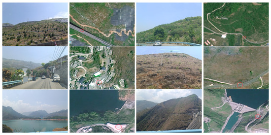
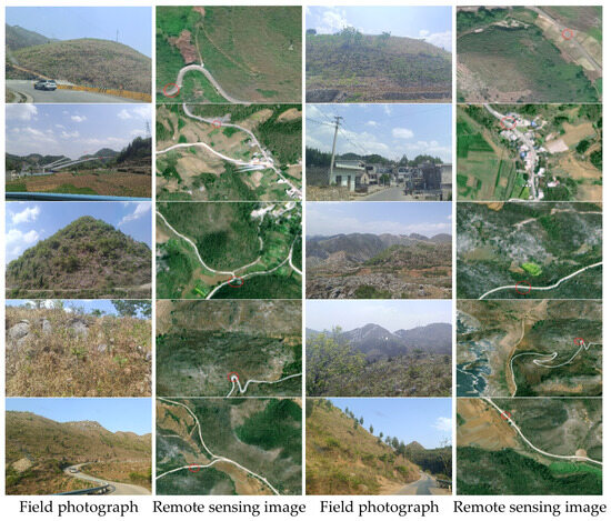
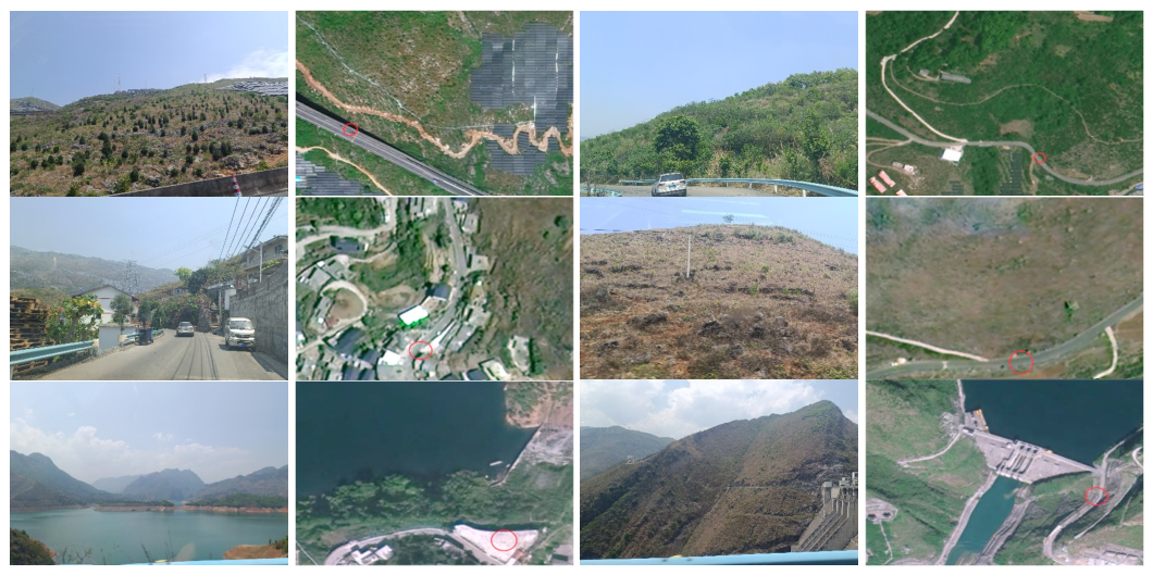
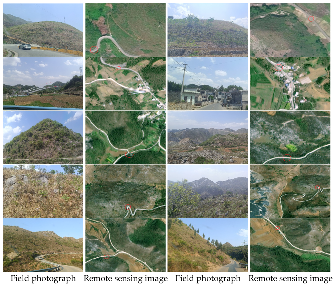
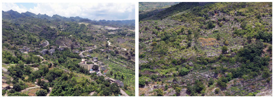
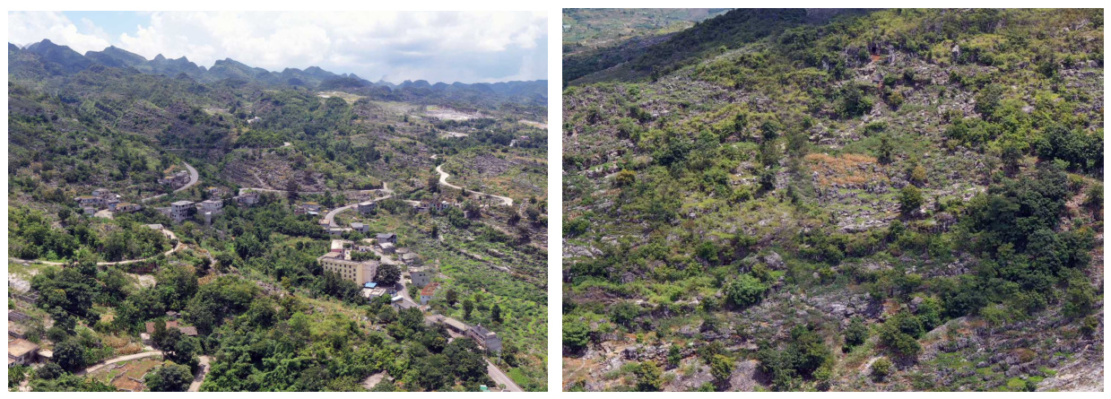
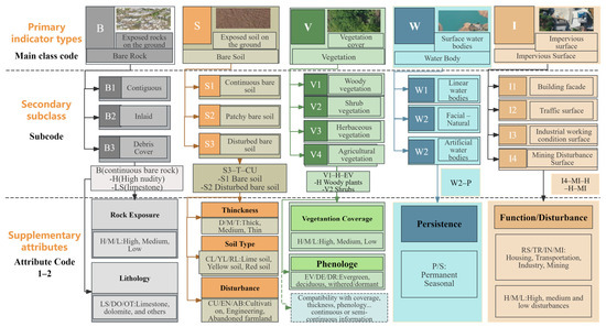
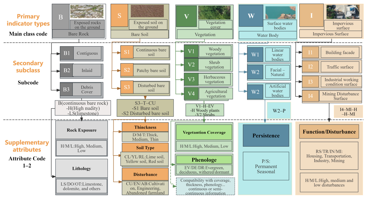

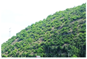
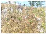
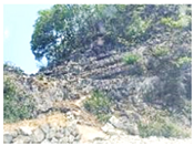
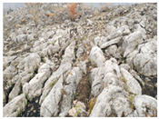
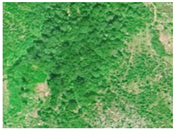
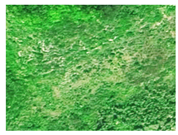
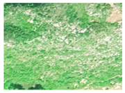
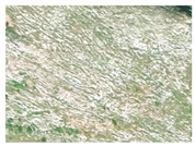
Disclaimer/Publisher’s Note: The statements, opinions and data contained in all publications are solely those of the individual author(s) and contributor(s) and not of MDPI and/or the editor(s). MDPI and/or the editor(s) disclaim responsibility for any injury to people or property resulting from any ideas, methods, instructions or products referred to in the content. |
© 2026 by the authors. Licensee MDPI, Basel, Switzerland. This article is an open access article distributed under the terms and conditions of the Creative Commons Attribution (CC BY) license.