Review

Using Remote Sensing and an Unmanned Aerial System for Weed Management in Agricultural Crops: A Review

by
Muhammad Huzaifah Mohd Roslim
1,*,
Abdul Shukor Juraimi
2,
Nik Norasma Che’Ya
3,
Nursyazyla Sulaiman
3,
Muhammad Noor Hazwan Abd Manaf
2,
Zaid Ramli
2 and
Mst. Motmainna
2
1
Department of Crop Science, Faculty of Agricultural Science and Forestry, Universiti Putra Malaysia Bintulu Campus, Bintulu 97000, Sarawak, Malaysia
2
Department of Crop Science, Faculty of Agriculture, Universiti Putra Malaysia, Serdang 43400, Selangor, Malaysia
3
Department of Agriculture Technology, Faculty of Agriculture, Universiti Putra Malaysia, Serdang 43400, Selangor, Malaysia
*
Author to whom correspondence should be addressed.
Agronomy 2021, 11(9), 1809; https://doi.org/10.3390/agronomy11091809
Submission received: 16 June 2021 / Revised: 23 July 2021 / Accepted: 26 July 2021 / Published: 8 September 2021
(This article belongs to the Special Issue Application of Sensors for Mechanical Weed Control)

Abstract

:
Weeds are unwanted plants that can reduce crop yields by competing for water, nutrients, light, space, and carbon dioxide, which need to be controlled to meet future food production requirements. The integration of drones, artificial intelligence, and various sensors, which include hyperspectral, multi-spectral, and RGB (red-green-blue), ensure the possibility of a better outcome in managing weed problems. Most of the major or minor challenges caused by weed infestation can be faced by implementing remote sensing systems in various agricultural tasks. It is a multi-disciplinary science that includes spectroscopy, optics, computer, photography, satellite launching, electronics, communication, and several other fields. Future challenges, including food security, sustainability, supply and demand, climate change, and herbicide resistance, can also be overcome by those technologies based on machine learning approaches. This review provides an overview of the potential and practical use of unmanned aerial vehicle and remote sensing techniques in weed management practices and discusses how they overcome future challenges.

1. Introduction

Weeds are unwanted plants that can reduce crop yields by competing for water, nutrients, light, space, and carbon dioxide, the primary sources of which are from the soil seed bank [1,2,3]. This problem can be controlled by weed management, which is essential for agricultural production, and it is necessary to meet the requirement of future food production [4]. Several methods for controlling weed problems include manual weeding, conventional herbicides, mechanical and machines, sustainable strategies, and artificial intelligence.
In conventional agricultural environments worldwide, herbicides will continue to be crucial components of weed control, especially in developed countries [5,6]. These chemical weed control techniques have been more successful than mechanical methods to decrease weed densities and biomass [1]. However, herbicides have many adverse impacts, particularly with the significant issue of herbicide resistance in weeds, although they are cost-effective and provide versatility [3,5].
Furthermore, sustainable strategies for managing weeds using natural and biological approaches are essential for conserving ecosystems and biodiversity [5,7]. An example of the biological method of controlling weeds is using cover crops that can compete with weeds for light, water, and nutrients or release allelopathic exudates [8,9,10]. Meanwhile, pyroligneous acid is an example of a natural, readily biodegradable product that can inhibit weeds’ seed germination [11].
Moreover, the use of machine learning and geospatial technologies is increasingly advanced in weed control practices [6]. The integration of robotics, artificial intelligence (AI), and various sensors ensure the possibility of a better outcome by implementing various agricultural tasks, including weed detection and removal [12,13]. This method utilises the unmanned ground vehicle (UGV) and unmanned aerial vehicle (UAV), which can minimise labour and increase quality food production [13]. Figure 1 shows an example of a sprayer UAV for pesticide application.
Combining multiple techniques in the integrated weed management (IWM) strategy is a step toward reducing problems related to conventional approaches, such as herbicide resistance [5,15]. UAV photography helps to better categorise results in early-season agronomic conditions where crop and weed seedlings have similar spectral signatures [16]. Precision farming approaches can efficiently manage weed problems while minimising operating expenses and environmental damage by detecting weeds early in the season as a first and crucial stage [17,18]. This review aims to overview precise weed control using the most advanced sensors available on the market.

2. Application of UAV and Remote Sensing Technique for Weed Management in Agricultural Crops

Crop or weed mapping is one of the efficient approaches to be taken in managing agricultural crops. Weed population displays spatial variation within the crop type; thus, mapping weed infestations in annual crop results in implications for site-specific herbicide applications and designing different management strategies, and analyzing weed ecology itself [19]. Du et al. [20] opined that precision agriculture assimilates several technological appliances, which incorporate variable rate technology (VRT), remote sensing, global positioning systems (GPS), and geographical information systems (GIS). Remotely sensed data could be utilised hugely in agricultural sector applications at a wide range of scales, from the micro level towards the global survey of internationally significant crops [21]. Remote sensing methods, such as thermal infrared (IR) sensors and light detection and ranging (LiDAR) technology, attained astonishing results in measuring vegetation canopy temperatures and heights in order to evaluate the biomass, chlorophyll, and nitrogen (N) contents at a discrete time [22,23,24]. Additionally, remote sensing has been broadly employed to detect and map weeds in the agricultural sector [25,26,27,28].
According to Aggarwal [29], Remote Sensing Systems is a multi-disciplinary science that includes a combination of several fields, such as spectroscopy, optics, computers, photography, satellite launching, electronics, and communication. The successful operation of remote sensing requires several stages, such as (1) emission of electromagnetic radiation (EMR) provided by sun or self-emission, (2) transmission of energy from source to earth surface, (3) interaction of EMR with the earth’s surface, in the form of reflection and emission, (4) transmission of energy from the surface to sensor, and lastly (5) the output provided by the sensor. Remote sensing data encloses various forms, from ground-based sensors launched on tractors or other tools, to aerial imaging systems on data collected from satellite platforms. Shaw [30] stated that detecting subtle changes in vegetation characteristics makes remote sensing an appealing piece of equipment to detect weed infestations and determine the size and location of weed patches in agronomics production systems. Smith and Blackshaw [19] explained that in remote sensing imagery, the digital reflectance value for each pixel is the consequence of integrating spectral contributions from each scene of the element, i.e., for weed mapping the scene component of weed and crop species, soil, and shadow.

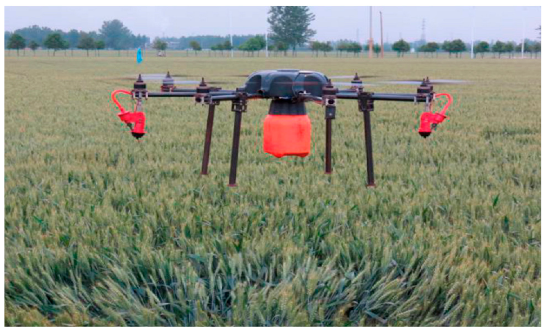
2.1. UAV in Agriculture

New agricultural techniques aim at making production more effective by applying inputs and machinery precisely [31]. The use of emerging technology in agriculture, such as drones, provides the ability to face many major or minor challenges; irrigation, crop monitoring, soil, and field analysis are the main application of drones in agriculture [32].
In recent years, drone technology has rapidly advanced. Due to lower-priced consumer drones’ enhanced flight efficiency, drone application research is commonly performed in agriculture for various purposes. Drone-based remote sensing helps us observe crop biomass, pest damage, and high-spatial-resolution weed conditions frequently [33]. The drone offers an efficient method for such an operation by reducing the operational time by at least one-third of traditional operations [34]. In addition, the use of drones is also increasing in agricultural insurance and field evaluation, including forensics for insurance claims [35].
Drones can be classified into certain parts: hyperspectral, thermal-spectral, or multi-spectral sensors. Therefore, it becomes easier to determine an irrigation plan. Additionally, drones are often used to determine the quality of crops by scanning them using near-infrared and visible light [36]. During times of low commodity prices, many farmers diversify with the addition of cattle or swine operations. Drones are a solid choice for tracking overhead herds, monitoring the amount and extent of animals’ activity in one field. Due to the human eye’s inability to see in the dark, they are beneficial for night-time surveillance [37].
Hyperspectral, multi-spectral, or thermal sensor drones can determine which parts of a field are dry or need improvement [32]. The drones provide accurate details about ground reality, with more explicit photos as they are closer to the ground [36]. Various plowing techniques can be differentiated with the help of an RGB-D sensor linked to the drone. In order to distinguish between the plowing regions, two separate algorithms are used [38].
In North West Selangor, both fertilising and spraying activities accounted for about 63.42% of the overall cost expenditure; 36.78% in fertilisation and 26.64% in spraying. Thus, reducing operating costs for both programs will promise Malaysia’s paddy farmers a better average cost [39]. The operator has to deal with hazardous chemicals and repeated exposure, and the spraying process is the most dangerous operation. The drone spraying system has been implemented as an alternative. The drone has been designed to fly at a low altitude of several meters, and the spraying effect can be controlled in the active field [34].
The use of drones for crop quality enhancement can be carried out by detecting the loopholes beforehand, which could increase their protection. The crops could be properly managed using specialised cameras attached to the drones to detect water scarcity and harmful pests [40]. This approach uses available data from the satellite and the drone. It helps differentiate between a sparse and a dense area. This method works with a region’s picture statistic and helps minimise the operation of drones [41].

Weed Mapping and Management

Weed mapping is one of the most popular applications of UAVs in precision agriculture. Site-specific weed management (SSWM) is utilised in precision farming methods. SSWM refers to applying herbicides in a spatially variable manner rather than in a uniform manner across the entire field. Due to the fact that weed plants typically spread through only a few spots of the field, the field is divided into management zones, with each zone receiving a customised management plan, as described above. In order to achieve this, an accurate weed cover map for precise herbicide spraying is required. UAVs can collect images and data from the entire field to create a precise weed cover map that shows where chemicals are needed: (a) most; (b) least; or (c) not at all applying them.
Weed patch maps for herbaceous crops have proven challenging to obtain using remote sensing techniques due to the spectral and appearance similarities between weeds and crops during their early development stages [42]. In order to resolve these similarities, image analysis methods based only on pixel information must be extended. It is possible to overcome the limitations of pixel-based methods by incorporating new information into the analysis routine using object-based image analysis (OBIA). OBIA creates ‘objects’ by grouping adjacent pixels with homogeneous spectral values, then combines them spectrally, topologically, and contextually to improve the precision of the image classification [43]. According to Wu et al. [44], the position of vegetation objects in the crop row structure is critical for accurate weed detection for herbicide prescription maps in wide row crops such as maize. Other barriers in early season weed mapping involve ultra-high spatial resolution imaging and the need for a timely post-emergency control in a short period of time. Unmanned aerial vehicles (UAVs) can now provide the spatial and temporal resolution required for early season weed mapping. In addition to taking ultra-high spatial resolution photographs (pixels of a few millimetres or centimetres), a UAV can also monitor small individual plants or patches, which was previously impossible [45]. They also provide tremendous flexibility in the programming of flights because of the reduced time required to plan, initiate, and carry out a flight. A radio control pilot, a ground station operator, and a visual observer were used to secure the UAV [46]. The radio control pilot manually launches and lands the UAV and activates the flight path. The ground station operator controls UAV position, flying altitude, flight speed, battery level, radio control signal quality, and wind speed. The visual observer looks for possible collision dangers with other air traffic. Mink et al. [47] presented a site-specific herbicide application utilising UAV imagery, concluding that the presented aerial imagery calculation approach can detect weed presence or absence in row crops. Small unmanned aerial systems (UAS) demonstrate that they are reasonably simple to integrate into weed studies and have significant potential for site-specific weed management [48].

2.2. Red-Green-Blue (RGB) Camera in Weed Management

Digital images are made of pixels with a mixture of red-green-blue (RGB) colour channels [49], also known as a visual spectrum. A consumer-grade RGB camera can be used to detect and classify the various type of weeds based on the red-green-blue colours and depth information of the flower, fruit, branch, and trunk [50]. Other plant traits, such as plant size, leaf count, cotyledons and real leaf shape, colour, surface, and position, can also be detected by the RGB sensor [51].
RGB cameras, which are commonly used, especially in weed detection, are generally available to the local market, and the cost is low compared to other sensors [52]. The RGB methodology also has a low maintenance cost and requires little training to master the techniques for taking the photographs and analysing the images [53]. Moreover, RGB sensors can be integrated with a UAV (unmanned aerial vehicle) to conduct various agriculture tasks, including field mapping, plant stress identification, and biomass estimation [54].
RGB sensors are handy for precision agriculture [54]. Issues related to crops’ health and vigour can also be identified using combination data of RGB-D and IR (infrared), which can be used to predict and prevent future action [50]. The nitrogen balance index (NBI), which measures chlorophyll’s ratio to polyphenols, is one of the indices used in nitrogen deficiency detection [55].
Instead of plant monitoring, the RGB sensor can improve indoor applications, such as fruit classification according to size, shape, and colour [50]. Besides crop production, the RGB sensor can also be applied in precision livestock farming for in vivo animal phenotyping [50]. Two environments, at a greenhouse and actual field conditions, can capture the RGB images to increase the diversity of certain crop species diversity or plant organs [56].
The depth reading of each pixel of an RGB image helps strengthen the classification strategies by increasing the acquired data’s accuracy and performance [50]. Kinect sensors can identify plants’ phenotypes, including plant geometry, leaf parameters, and fruit volume, and can be used to monitor plant growth [50]. A 3D model of a plant or even an entire planting area can be obtained by estimating the distance and height of crops by using the Kinect sensor and GPS (Global Positioning System) receiver, which can be used in management strategies [50].
The RGB images can train convolutional neural networks to distinguish weeds and crops based on a computer vision method that uses artificial intelligence [56]. An algorithm needs to be implemented to detect and classify on a frame of RGB-D data [42]. Vegetation indices, point clouds, machine learning models, and statistical methods are typical instruments to help in this data processing from an RGB sensor [54].
However, the RGB camera used in weed detection should follow the experts’ guidelines to avoid errors because the sensor is sensitive to lighting conditions [50]. RGB sensors only work best for relatively wide colour or shape disparity between plant types, such as weeds and crops, and it only offers minimal spectral information using three significant bands [57]. RGB values’ quality deteriorates with decreasing light level, especially after it becomes dark in outdoor conditions, but artificial lighting can illuminate the scene [50].

2.3. Multispectral Remote Sensing Imagery for Agricultural Purpose

Evolution in precision agriculture farming technology, e.g., GPS, GIS, and variable rate equipment, comes with the tools required to apply information from multi-spectral images to management problems [58]. According to Chang et al. [59], in multi-spectral image processing with only tens of discrete spectral bands in use, the spectral information anticipated by a multi-spectral image pixel is generally very limited compared to that provided by a hyperspectral image pixel. Mapasyst [60] stated that multi-spectral imagery is generated by sensors that measure reflected energy within several specific sections or recognised as bands of the electromagnetic spectrum. An example of the multi-spectral imagery is the Landsat-8 satellite image which produces images with the following bands, and each band possess a spatial resolution of 30 m, except bands 8, 10, and 11 (Table 1). Band 8 has a spatial resolution of 15 m, while Band 10 and 11 have a spatial resolution of 100 m [61]. Chang and Bai [62] stated that the latest Landsat 8, which launched in 2013, includes a two-sensor payload, i.e., Operational Land Imager (OLI) and the Thermal InfraRed Sensor (TIRS).
A study by Franke and Menz [63] identified multi-spectral remote sensing potential in analysing multi-temporal crop diseases using three high resolutions of remote sensing imagery to execute a spatio-temporal analysis of the impaction dynamic. This study showed multi-spectral remote sensing data for recognition of infections yielded positive results, indicating the suitability of these methods for disease detection in late occurrences and at high infection rates. Du et al. [20] evaluated the establishment of airborne multi-spectral techniques for examining tree health problems in a citrus grove that can be integrated with variable rate technology (VRT) for obligatory pesticide application and environmental modelling for assessment of pollution restriction. The study showed that multi-spectral imagery was used for anomaly detection and a spectral linear unmixing-based approach with site-specific agriculture was used to quantify stress severity and detect prior infection. It was mentioned by Mink et al. [64] that airborne multi-spectral imaging evaluation delivers more detailed and comprehensive information than data acquired in field trials visually.
Research performed by Deng et al. [23] employed a narrowband Mini-MCA6 multi-spectral camera and a sunshine-sensor-equipped broadband Sequoia multi-spectral camera set up on a multirotor-UAV to collect multi-spectral imagery and soil–plant analysis development (SPAD) values of maize. This study proved that different multi-spectral cameras achieved nonnegligible differences in numerous sides, i.e., data collection, product applicability, and accuracy. Furthermore, specific applications will be implemented according to appropriate sensor and data processing techniques. However, the multi-spectral satellite imagery possessed gaps between the collected spectral band’s disparity to hyperspectral data, which occupied lots of contiguous bands [65]. The moderate spatial and spectral resolution of Landsat images and other remote sensors could be successful if the habitat circumstances were more homogenous, the infested area was large, and the chosen species had distinct phenology or visual characteristics [66,67,68].

2.4. Hyperspectral Remote Sensing Imagery for the Agricultural Sector

Hyperspectral imaging has indicated tremendous innovation over the past few years. Chang et al. [59] stated that target detection and classification, as the vital chores in hyperspectral imaging due to high-resolution and -interest targets, differ from multi-spectral imagery. According to Qian [69], space-borne hyperspectral imaging has appeared as a new generation of remote sensing satellites due to its extended capacity to obtain hundreds of contiguous and narrow bands for each pixel in the scene. Borengasser et al. [65] mentioned that hyperspectral data bandwidth usually ranges from 1 to 15 nanometers, dissimilar to multi-spectral data, consisting of bands ranging from 50 to 120 nanometers. The platform utilised for hyperspectral image acquisition is space-borne or airborne, as shown in Table 2 below. Qian [69] stated that hyperspectral sensors include spectral and spatial information of the scene and generate a data cube for each scene. There are three approaches to obtaining hyperspectral data: (i) dispersive elements-based approach, (ii) spectral filters-based approach, and (iii) snapshot hyperspectral imaging.
A review on hyperspectral remote sensing for tracking plant invasions performed by He et al. [67] shows that spectral information anticipated by hyperspectral sensors can detect invaders from a species-level crosswise range of community and ecosystem types, which effectively provides a baseline of invasive species dispersal for future observation and control efforts. They also opined that information about the spatial distribution of invasive species could help land managers arrange long-term constructive conservation plans to protect and sustain the natural ecosystems. Okamoto and Lee [70] carried out a study to assemble an image processing method for detecting green citrus fruit within individual trees. Hyperspectral images of three different green citrus fruits were obtained using a hyperspectral camera of 369–1042 nm, and the technique used was pixel discrimination and fruit object identification. The results show that pixel identification tests with a relatively high detection rate (70–85%) and detection of green fruit at an earlier growth stage could be carried out using hyperspectral imaging.
Suzuki et al. [71] conducted a study on image segmentation between crop and weed in a soybean field for weed detection using hyperspectral remote sensing, showing a high degree of accuracy (99.9%) for discrimination between soil and plant. This study used a hyperspectral camera (ImSpector V10: Specim Ltd., Oulu, Finland) with a spectral wavelength range of 360 to 1010 nm and spectral resolution of 10 nm. Okamoto et al. [72] studied plant classification for weed detection using hyperspectral imaging with wavelet analysis. The authors obtained hyperspectral images with 240 wavebands for spectral information and compared three different plant classification methods, i.e., Euclidean distance, discriminant analysis, and wavelet coefficient. The results show that the wavelet coefficient was more practical for weed detection; furthermore, the validation result indicates that the developed classification technique has a future practical use.

3. Future Challenge and Overcome through Modern Technologies

3.1. Food Security

The world population reached 7.55 billion in 2017 and is expected to reach 9.5 billion by 2050 [73]. Food security will become a significant issue when the world population is increased, and it is putting pressure both on available cultivable land and yields required. One way to meet the growing national food security demands is to reduce the existing food production system gaps.
The challenges faced at this time in the agricultural sector are to produce more food from less land area through more efficient use of natural resources with minimal impact on the environment. The amount of cultivated area in 2015 was virtually the same as in 1965, with no rapid increase expected in the future [73]. FAO estimated that food production must increase up to 70% to meet food demands, and the main challenge is to increase the yield per hectare of arable land. The losses in yield production caused by pests, including weeds, have been a significant issue, and many studies have been carried out to resolve these problems [74,75,76,77,78]. Weed problems cannot be separated from the agricultural sector. That is why weed management needs to be emphasised to increase agricultural productivity while also guaranteeing food security and safety.
Since the spread of the Green Revolution, South Asia has made a quantum leap. It is currently the second most excellent rice-growing region globally, with 41 percent of arable land in rice production; only India and Pakistan are entirely independent, whereas Sri Lanka, Bangladesh, and Nepal are not self-sufficient and dependent on exports from other regions [79]. Malaysia’s stance on food security is translated mainly into achieving self-sufficient rice production at about 65–70% of the local consumption [80,81]. There are many obstacles to achieving self-sufficiency in rice production, such as unpredictable weather conditions. Research carried out by Vaghefi et al. [81] on the impact of climate change on food security in Malaysia using the Decision Support System for Agrotechnological Transfer (DSSAT) model shows that increases in temperature and rainfall pattern can be expected to reduce the rice yield by 12% and 31.3%, respectively, until the year 2030. Additionally, a problem faced by rice farmers around the world today is weedy rice (Oryza sativa f. spontanea Roshev.). Weedy rice infestations are recognised as a significant constraint in rice production worldwide, reducing harvests by up to 30% to 50% in the United States alone [82].
Weedy rice is a paddy species that quickly falls to the ground before it can be harvested, leading to the loss of crops. It was first detected at the Integrated Agricultural Development Area (IADA) of Selangor in 1988. According to the survey performed by the Department of Agriculture (DOA) on rice fields in 2016, a total of 1088 paddy fields covering 6435 hectares in Selangor, Perlis, Johor, Negeri Sembilan, and Pahang were found to be weedy rice. However, the incidence of weedy rice in the area was affected at different levels. Of the total area surveyed, 700 hectares experienced a severe incidence of between 41–50%, resulting in farmers’ losses and an almost 90% loss of the total yield in the highly infested area [83]. Around RM 70,000 losses were reported because of the weedy rice at Kangar, with a total area of 33 hectares, and if the weedy rice is not controlled, it will increase the losses and burden to the farmers [84]. Thus, this situation can be controlled by using AI technology, where the technology can detect the weedy rice at the early stage and control it using integrated weed management.

3.2. Sustainable Agriculture

Sustainable agriculture is a farming system that protects the environment, maintains the yield for future use, and integrates the social and economic. Most agriculture uses chemical input that will harm the environment in the long term. It is good to control the chemicals used to prevent soil degradation and decrease soil fertility. Therefore, organic farming is one of the options to reduce the use of chemical-based input. Organic farming improves soil health and animal, human, and societal health related to sustainable agriculture [85]. On the other hand, organic farming produces more healthy and adequate nutrients for the products because of no contamination with any chemical-based treatments for pest, disease, and weed control [85]. The rules regarding the use of chemical input needed to investigate sustainable agriculture are secure.
Small groups of farmers are practising organic farming due to the cost and limitations of the labour. However, sustainable agriculture can be implemented by using different types of practices such as cover crops [86], integrated farming [87], crop rotation [88], and integrated pest management (IPM) [3,89]. All these methods are suitable for weed control without the use of any chemical-based treatments. For example, by using integrated farming, weeds can control the cattle in the plantation. How farmers want to practice agriculture to sustain and improve future generations depends on their society. The economic, technological, and environmental elements depend on social institutions, such as social capital, the conceptual, and the empirical [90]. Thus, agriculture can be dependent on the social institution as a growth engine and centre of society [90].
The adoption of advanced technology indicates that low-tech approaches increase the yield, and finally, can improve food security as a basis for sustainable agriculture [91]. Smallholders can use the technology for ecological risk analysis and generate income to increase the nation’s economy [91]. The products from agriculture will affect the economic outcomes by using technology in sustainable agriculture and food supply–demand [92]. Thus, AI’s role is vital in operation control, machine monitoring, data sharing, model prediction, data analysis, and storage to achieve sustainable agriculture [93].

3.3. Food Supply Demand

The food supply will depend on the agricultural practices during the previous year, and based on the archive data, a scientist can predict whether the food supply is sufficient for the population. How can agriculture be ensured to fulfil the demand for food? According to Davis et al. [94], the environmental burden can be investigated to reduce demand. For example, footprints for water, nitrogen, carbon, and land to quantitatively evaluate resource demands and greenhouse gas (GHG) emissions of future agriculture will prevent the supply’s limitation by changing the staple food for the population.
These can be reduced by modifying the food consumption patterns, improvements in resource use, and emissions relative to an affluence-based diet. It can shift resource savings, and the historical demand will change and improve [94]. For example, dietary changes will improve the environment’s burden by integrating the economic, nutritional, and environmental factors, leading to resource savings across a suite of environmental impacts [94]. Artificial intelligence is suited to integrate all aspects in one comprehensive system in the model to trace any food shortage in the future.

3.4. Herbicide Resistance in Weeds

Herbicide Resistance in Weeds is one of the challenges in agriculture produces. Almost half of the agriculture operations are to control weeds and avoid any resistance. Herbicide Resistance Weed is a weed growing in a larger area even though the herbicides are already applied to the area, becoming resistant [95]. The incidence of weed species’ resistance to synthetic auxin herbicides (SAHs) is relatively low considering their long-term global application, and it is essential to understand the context and mechanisms of SAH resistance [96]. Thus, herbicide-resistant weed management (HRWM) is practiced by many growers to prevent weed resistance.
According to Beckie and Harker [97], there are ten top HRWM, such as maintaining a database for an invaluable reference guide, strategic tillage, field- and site-specific weed management, weed sanitation, combination non-target-site-resistance, herbicide site-of-action rotation, herbicide mixtures, pre- and post-herbicide application scouting and survey, competitive crops and practices that promote competitiveness, and crop diversity. Crop diversity is the best practice and reduces the number of weed populations [97]. For example, planting crops as mixtures between dicots and monocots, winter and spring, or cool and warm season reduces weed competition and reduces weed resistance. Kniss [88] also suggested that crop diversity, crop rotation, and tillage can prevent weed distribution and weed resistance.
There are significant changes in using herbicides for most countries when using genetically engineered (GE) herbicide-resistant plants, as happens in the United States. Many farmers argue that GE will cause herbicide-resistant weeds known as super weeds but based on the International Survey of Herbicide-Resistant Weeds and the USDA, herbicide diversity in cotton and soybean was reduced using the GE herbicide-resistant varieties [88].
Starting in 1998, the evolution of new glyphosate-resistant weed species has increased in the U.S., but the number of all herbicide sites (SOAs) decreased in 2005 [88]. However, to ensure weed resistance in lower cases, it is vital to maintain or increase herbicide diversity and practice different planting such as crop rotation and tillage, proven to reduce the weed resistance [88]. Identification of weed patches using uncrewed aerial vehicles (UAVs) can aid in integrated weed management (IWM), decreasing both selection pressure on herbicide-resistant weeds and chemicals spread in the environment [98]. Thus, AI can help farmers control weeds by early detection and avoid any weed resistance in the future [99]. The AI can detect or differentiate weeds in the crop at an early stage, and it can prevent weed infestation in the area. Remote sensing detection approaches for herbicide-resistant weeds are listed in Table 3.

3.5. Climate Change

The earth’s temperature becoming higher, increased carbon dioxide in the atmosphere, and inconsistent moisture changes for plants are the three main components of climate change [107], which is a challenge in weed management in agriculture practice. Climate change is a serious matter, and it may change the natural phenological traits of plants and weeds, which is proved when new species are found as alien species. For example, in Aotearoa, New Zealand, new weeds have been found as part of the massive pool of new weeds under climate change [108].
It took a long time to see the impact, but from now on, precautions need to be taken before it is too late. In the last ten years, the weather has strongly changed compared to the last 20 years. This is because of the rapid shift of the usual climate into a new pattern. Thus, this pattern can be investigated to prevent any outbreaks of weed distribution. Additionally, herbicide application, climate conditions, limited soil moisture, and high temperature are the factors that affect how modern crops can survive by using breeding improvement. However, for the weed species, they can survive in those conditions. Thus, farmers need to take fast action for weed control technology, such as weed management in evolutionary biology [107]. Furthermore, the youngest generations need to be alert to the climate’s effect on weeds from time-to-time. The new weeds will compete with the existing plants and cooperation is required between farm managers, researchers, and local people to improve the weed problem [108,109].
The impact from the sea and under-sea tectonic movement of the earth will affect many factors, such as natural disasters, population density, soil properties, and topography. All these factors will impact the agricultural production and ecosystem in the country [110]. The main factors to affect agriculture are high temperature and water deficit (drought). Thus, drought will influence rice and weedy rice growth aspects, such as plant height [111]. Small unmanned aerial vehicles (UAVs) with various sensors have been introduced for in situ air quality monitoring. They can provide new approaches and research opportunities in air pollution and emission monitoring and study atmospheric trends such as climate change while ensuring urban and industrial air safety. However, the involvement of AI in the agricultural sector is still quite negligible due to the higher cost of the equipment and requires training before being implemented in the selected crop field (this situation focuses more on common farmers in rural/isolated areas with low income). Generally said, AI practice in the agricultural sector (especially in Malaysia) is probably still in the initial level and it is predicted that technological enhancement in AI will be an efficient mainstream approach to revolutionised agriculture for the related stakeholder in this important industry, as well as supporting the main agriculture precision pillars (utilising the correct approach, at the right place, at the right time, and in the right quantity).

4. Conclusions

This paper analysed the potential of employing the current and advanced technologies of artificial intelligence (AI) towards the agricultural sector, with a focus on weed management. Agriculture is one of the core sectors affecting the sustainability of the economy, as it contributes a primary element in the long-term prospects of economic extension and structural alteration. Farmers must confront several uncertainties such as unachievable crop production, climate change, pest and weed problems in crops, degradation of soil, and others. However, advanced technology in production, information, transportation, etc., has indisputably triggered new trends in agriculture, as artificial intelligence (AI) has been implemented in the agriculture sector apace with advanced computing technologies. Artificial intelligence (AI), i.e., drones and remote sensing UAVs in agriculture management, has emerged as being powerful, precise, cost-effective, and sustainable, as well as important to ensure the agricultural sector’s longevity in meeting demand and supply for food production. The utilisation of unmanned aerial vehicles (UAVs) and machine learning algorithms can increase weed management sustainability by accurately identifying weed patches in cultivated fields. UAVs can help with integrated weed management (IWM) by identifying weed patches and lowering selection pressure against herbicide-resistant weeds and herbicide diffusion in the environment. AI technology implementation in agriculture is quite convenient where it could overwhelm labour scarcity issues and reduce human intervention in handling chemical herbicides (e.g., usage of fertiliser sprayer drone), and it is predicted that technological enhancement of AI will be an efficient mainstream approach to revolutionise agriculture for the related stakeholder in this important industry, as well as supporting the main agricultural precision pillars (implementation of the right approach, at the right place, at the right time, and in the right quantity).

Author Contributions

Conceptualisation, M.H.M.R. and A.S.J.; methodology, N.N.C.; software, N.S.; validation, M.N.H.A.M., Z.R. and M.M.; formal analysis, M.H.M.R.; investigation, A.S.J. and N.N.C.; resources, A.S.J., N.N.C. and M.H.M.R.; data curation, M.H.M.R.; writing—original draft preparation, M.H.M.R.; writing—review and editing, N.S., M.N.H.A.M., Z.R. and M.M.; supervision, A.S.J. All authors have read and agreed to the published version of the manuscript.

Funding

This research was funded by Research Project entitled “Pest and Disease Monitoring Using Artificial Intelligent for Risk Management of Rice Under Climate Change” under the Long-Term Research Grant Scheme (LRGS), Ministry of Higher Education, Malaysia (LRGS/1/2019/UPM//2; vote number: 5545002).

Institutional Review Board Statement

Not applicable.

Informed Consent Statement

Not applicable.

Data Availability Statement

Not applicable.

Acknowledgments

The authors are grateful to the Research Project entitled “Pest and Disease Monitoring Using Artificial Intelligent for Risk Management of Rice Under Climate Change” under the Long-Term Research Grant Scheme (LRGS), Ministry of Higher Education, Malaysia (LRGS/1/2019/UPM//2; vote number: 5545002). The authors also sincerely acknowledge the University Putra Malaysia for providing facilities.

Conflicts of Interest

The authors declare no conflict of interest.

References

  1. Barba, P.; Sawicka, B.; Marczak, B.K.; Pszczółkowski, P. Effect of Mechanical and Herbicide Treatments on Weed Densities and Biomass in Two Potato Cultivars. Agriculture 2020, 10, 455. [Google Scholar] [CrossRef]
  2. Mahé, I.; Cordeau, S.; Bohan, D.A.; Derrouch, D.; Dessaint, F.; Millot, D.; Chauvel, B. Soil seedbank: Old methods for new challenges in agroecology? Ann. Appl. Biol. 2020, 178, 23–38. [Google Scholar] [CrossRef]
  3. Hasan, M.; Ahmad-Hamdani, M.S.; Rosli, A.M.; Hamdan, H. Bioherbicides: An Eco-Friendly Tool for Sustainable Weed Management. Plants 2021, 10, 1212. [Google Scholar] [CrossRef] [PubMed]
  4. Westwood, J.H.; Charudattan, R.; Duke, S.O.; Fennimore, S.A.; Marrone, P.; Slaughter, D.C.; Swanton, C.; Zollinger, R. Weed Management in 2050: Perspectives on the Future of Weed Science. Weed Sci. 2018, 66, 275–285. [Google Scholar] [CrossRef] [Green Version]
  5. MacLaren, C.; Storkey, J.; Menegat, A.; Metcalfe, H.; Dehnen-Schmutz, K. An ecological future for weed science to sustain crop production and the environment. A review. Agron. Sustain. Dev. 2020, 40, 24. [Google Scholar] [CrossRef]
  6. Oliveira, M.C.; Osipitan, O.A.; Begcy, K.; Werle, R. Cover crops, hormones and herbicides: Priming an integrated weed management strategy. Plant Sci. 2020, 301, 110550. [Google Scholar] [CrossRef] [PubMed]
  7. Motmainna, M.; Juraimi, A.S.; Uddin, M.K.; Asib, N.B.; Islam, A.K.M.M.; Hasan, M. Assessment of allelopathic compounds to develop new natural herbicides: A review. Allelopath. J. 2021, 52, 19–38. [Google Scholar] [CrossRef]
  8. Adetunji, A.T.; Ncube, B.; Mulidzi, R.; Lewu, F.B. Management impact and benefit of cover crops on soil quality: A review. Soil Till. Res. 2020, 204, 104717. [Google Scholar] [CrossRef]
  9. Motmainna, M.; Juraimi, A.S.; Uddin, M.K.; Asib, N.B.; Islam, A.K.M.M.; Hasan, M. Allelopathic potential of Malaysian invasive weed species on Weedy rice (Oryza sativa f. spontanea Roshev). Allelopath. J. 2021, 53, 53–68. [Google Scholar] [CrossRef]
  10. Motmainna, M.; Juraimi, A.S.; Uddin, M.; Asib, N.B.; Islam, A.K.M.M.; Hasan, M. Bioherbicidal Properties of Parthenium hysterophorus, Cleome rutidosperma and Borreria alata Extracts on Selected Crop and Weed Species. Agronomy 2021, 11, 643. [Google Scholar] [CrossRef]
  11. Hagner, M.; Lindqvist, B.; Vepsäläinen, J.; Samorì, C.; Keskinen, R.; Rasa, K.; Hyvönen, T. Potential of pyrolysis liquids to control the environmental weed Heracleum mantegazzianum. Environ. Technol. Innov. 2020, 20, 101154. [Google Scholar] [CrossRef]
  12. BK, I.A.; Prakash, A.; Prakash, A. An Approach for Digital Farming using Mobile Robot. In Proceedings of the Second International Conference on Inventive Research in Computing Applications (ICIRCA), Coimbatore, India, 15–17 July 2020; pp. 580–585. [Google Scholar]
  13. Bini, D.; Pamela, D.; Prince, S. Machine Vision and Machine Learning for Intelligent Agrobots: A review, ICDCS 2020–2020. In Proceedings of the 5th International Conference on Devices, Circuits and Systems, Coimbatore, India, 5–6 March 2020; pp. 12–16. [Google Scholar]
  14. Wang, G.; Lan, Y.; Yuan, H.; Qi, H.; Chen, P.; Ouyang, F.; Han, Y. Comparison of spray deposition, control efficacy on wheat aphids and working efficiency in the wheat field of the unmanned aerial vehicle with boom sprayer and two conventional knapsack sprayers. Appl. Sci. 2019, 9, 218. [Google Scholar] [CrossRef] [Green Version]
  15. Hu, K.; Coleman, G.; Zeng, S.; Wang, Z.; Walsh, M. Graph weeds net: A graph-based deep learning method for weed recognition. Comput. Electron. Agric. 2020, 174, 105520. [Google Scholar] [CrossRef]
  16. De Castro, A.; Torres-Sánchez, J.; Peña, J.; Jiménez-Brenes, F.; Csillik, O.; López-Granados, F. An Automatic Random Forest-OBIA Algorithm for Early Weed Mapping between and within Crop Rows Using UAV Imagery. Remote Sens. 2018, 10, 285. [Google Scholar] [CrossRef] [Green Version]
  17. Chlingaryan, A.; Sukkarieh, S.; Whelan, B. Machine learning approaches for crop yield prediction and nitrogen status estimation in precision agriculture: A review. Comput. Electron. Agric. 2018, 151, 61–69. [Google Scholar] [CrossRef]
  18. Torres-Sánchez, J.; López-Granados, F.; Peña, J.M. An automatic object-based method for optimal thresholding in UAV images: Application for vegetation detection in herbaceous crops. Comput. Electron. Agric. 2015, 114, 43–52. [Google Scholar] [CrossRef]
  19. Smith, A.M.; Blackshaw, R.E. Weed–Crop Discrimination Using Remote Sensing: A Detached Leaf Experiment. Weed Technol. 2003, 17, 811–820. [Google Scholar] [CrossRef]
  20. Du, Q.; Chang, N.B.; Yang, C.; Srilakshmi, K.R. Combination of multi-spectral remote sensing, variable rate technology and environmental modeling for citrus pest management. J. Environ. Manag. 2008, 86, 14–26. [Google Scholar] [CrossRef] [PubMed]
  21. Steven, M.D.; Clark, J.A. Application of Remote Sensing in Agriculture; Elsevier: Amsterdam, The Netherlands, 2013. [Google Scholar] [CrossRef] [Green Version]
  22. Berni, J.A.; Zarco-Tejada, P.J.; Suarez, L.; Fereres, E. Thermal and narrowband multispectral remote sensing for vegetation monitoring from an unmanned aerial vehicle. IEEE Trans. Geosci. Remote Sens. 2009, 47, 722–738. [Google Scholar] [CrossRef] [Green Version]
  23. Deng, L.; Mao, Z.; Li, X.; Hu, Z.; Duan, F.; Yan, Y. UAV-based multi-spectral remote sensing for precision agriculture: A comparison between different cameras. ISPRS J. Photogramm. Remote Sens. 2018, 146, 124–136. [Google Scholar] [CrossRef]
  24. Maimaitijiang, M.; Ghulam, A.; Sidike, P.; Hartling, S.; Maimaitiyiming, M.; Peterson, K.; Shavers, E.; Fishman, J.; Peterson, J.; Kadam, S. Unmanned Aerial System (UAS)-based phenotyping of soybean using multi-sensor data fusion and extreme learning machine. ISPRS J. Photogramm. Remote Sens. 2017, 134, 43–58. [Google Scholar] [CrossRef]
  25. Lamb, D.W.; Brown, R.B. Remote-sensing and mapping of weeds in crops. J. Agric. Eng. Res. 2001, 78, 117–125. [Google Scholar] [CrossRef]
  26. Moran, M.S.; Inoue, Y.; Barnes, E.M. Opportunities and limitations for image-based remote sensing in precision crop management. Remote Sens. Environ. 1997, 61, 319–346. [Google Scholar] [CrossRef]
  27. Thorp, K.R.; Tian, L.F. A review on remote sensing of weeds in agriculture. Precis. Agric. 2004, 5, 477–508. [Google Scholar] [CrossRef]
  28. Zwiggelaar, R. A review of spectral properties of plants and their potential use for crop/weed discrimination in row-crops. Crop Prot. 1998, 17, 189–206. [Google Scholar] [CrossRef]
  29. Aggarwal, S. Principles of Remote Sensing. In Satellite Remote Sensing and GIS Applications in Agricultural Meteorology, Dehra Dun; World Meteorological Organization: Geneva, Switzerland, 2004; pp. 23–38. [Google Scholar]
  30. Shaw, D.R. Translation of remote sensing data into weed management decisions. Weed Sci. 2005, 53, 264–273. [Google Scholar] [CrossRef]
  31. Burwood-Taylor, L. The Next Generation of Drone Technologies for Agriculture. AgFunderNews Website. Available online: https://agfundernews.com/the-next-generation-of-drone-technologies-for-agriculture.html (accessed on 14 March 2018).
  32. Ahirwar, S.; Swarnkar, R.; Bhukya, S.; Namwade, G. Application of Drone in Agriculture. Int. J. Curr. Microbiol. Appl. Sci. 2019, 8, 2500–2505. [Google Scholar] [CrossRef]
  33. Iwasaki, K.; Torita, H.; Abe, T.; Uraike, T.; Touze, M.; Fukuchi, M.; Sato, H.; Iijima, T.; Imaoka, K.; Igawa, H. Spatial pattern of windbreak effects on maize growth evaluated by an unmanned aerial vehicle in Hokkaido, northern Japan. Agrofor. Syst. 2019, 93, 1133–1145. [Google Scholar] [CrossRef]
  34. Suhaizi, M.A.; Azmi, Y.; Norida, M.; Saiful, A.M. Evaluation of the Spraying Dispersion and Uniformity Using Drone in Rice Field Application. In Proceedings of the MSAE Conference, Serdang, Malaysia, 7–8 February 2018. [Google Scholar]
  35. Wadke, R. Insurers Deploy Drones to Check Claims by Farmers. Agri Business Website, 2018. Available online: https://www.thehindubusinessline.com/economy/agri-business/insurers-deploy-drones-to-check-claims-by-farmers/article9583909.ece (accessed on 27 May 2021).
  36. Saha, A.K.; Saha, J.; Ray, R.; Sircar, S.; Dutta, S.; Chattopadhyay, S.P.; Saha, H.N. IOT-based drone for improvement of crop quality in agricultural field. In Proceedings of the IEEE 8th Annual Computing and Communication Workshop and Conference, C.C.W.C., Las Vegas, NV, USA, 8–10 January 2018; pp. 612–615. [Google Scholar]
  37. Veroustraete, F. The Rise of the Drones in Agriculture. EC Agric. 2015, 2, 325–327. [Google Scholar]
  38. Muazu, A.; Yahya, A.; Ishak, W.I.W.; Khairunniza-Bejo, S. Energy audit for sustainable wetland paddy cultivation in Malaysia. Energy 2015, 87, 182–191. [Google Scholar] [CrossRef]
  39. Tripicchio, P.; Satler, M.; Dabisias, G.; Ruffaldi, E.; Avizzano, C.A. Towards Smart Farming and Sustainable Agriculture with Drones. In Proceedings of the International Conference on Intelligent Environments, Prague, Czech Republic, 15–17 July 2015; pp. 140–143. [Google Scholar]
  40. Reinecke, M.; Prinsloo, T. The influence of drone monitoring on crop health and harvest size. In Proceedings of the 1st International Conference on Next Generation Computing Applications, NextComp, Moka, Mauritius, 19–21 July 2017; pp. 5–10. [Google Scholar]
  41. Murugan, D.; Garg, A.; Singh, D. Development of an Adaptive Approach for Precision Agriculture Monitoring with Drone and Satellite Data. IEEE J. Sel. Top. Appl. Earth Obs. Remote. Sens. 2017, 10, 5322–5328. [Google Scholar] [CrossRef]
  42. López-Granados, F. Weed detection for site-specific weed management: Mapping and real-time approaches. Weed Res. 2011, 51, 1–11. [Google Scholar] [CrossRef] [Green Version]
  43. Blaschke, T. Object based image analysis for remote sensing. ISPRS J. Photogramm. Remote Ses. 2010, 65, 2–16. [Google Scholar] [CrossRef] [Green Version]
  44. Wu, Z.; Chen, Y.; Zhao, B.; Kang, X.; Ding, Y. Review of Weed Detection Methods Based on Computer Vision. Sensors 2021, 21, 3647. [Google Scholar] [CrossRef]
  45. Xiang, H.; Tian, L. Development of a low-cost agricultural remote sensing system based on an autonomous unmanned aerial vehicle (UAV). Biosyst. Eng. 2011, 108, 174–190. [Google Scholar] [CrossRef]
  46. Torres-Sánchez, J.; López-Granados, F.; De Castro, A.; Peña-Barragán, J. Configuration and Specifications of an Unmanned Aerial Vehicle (UAV) for Early Site SpecificWeed Management. PLoS ONE 2013, 8, e58210. [Google Scholar] [CrossRef] [Green Version]
  47. Mink, R.; Dutta, A.; Peteinatos, G.; Sökefeld, M.; Engels, J.; Hahn, M.; Gerhards, R. Multi-temporal site-specific weed control of Cirsium arvense (L.) Scop. and Rumex crispus L. in maize and sugar beet using Unmanned Aerial Vehicle based mapping. Agriculture 2018, 8, 65. [Google Scholar] [CrossRef] [Green Version]
  48. Rasmussen, J.; Nielsen, J.; Garcia-Ruiz, F.; Christensen, S.; Streibig, J.C. Potential uses of small unmanned aircraft systems (UAS) in weed research. Weed Res. 2013, 53, 242–248. [Google Scholar] [CrossRef]
  49. Prey, L.; von Bloh, M.; Schmidhalter, U. Evaluating RGB imaging and multi-spectral active and hyperspectral passive sensing for assessing early plant vigor in winter wheat. Sensors 2018, 18, 2931. [Google Scholar] [CrossRef] [Green Version]
  50. Rosell-Polo, J.R.; Cheeinx, F.A.; Gregorio, E.; Andújar, D.; Puigdomènech, L.; Masip, J.; Escolà, A. Advances in Structured Light Sensors Applications in Precision Agriculture and Livestock Farming. Adv. Agron. 2015, 133, 71–112. [Google Scholar]
  51. Madsen, S.L.; Mathiassen, S.K.; Dyrmann, M.; Laursen, M.S.; Paz, L.C.; Jørgensen, R.N. Open plant phenotype database of common weeds in Denmark. Remote Sens. 2020, 12, 10–12. [Google Scholar]
  52. Gašparović, M.; Zrinjski, M.; Barković, Đ.; Radočaj, D. An automatic method for weed mapping in oat fields based on UAV imagery. Comput. Electron. Agric. 2020, 173, 105385. [Google Scholar] [CrossRef]
  53. Baresel, J.P.; Rischbeck, P.; Hu, Y.; Kipp, S.; Hu, Y.; Barmeier, G.; Mistele, B. Use of a digital camera as alternative method for non-destructive detection of the leaf chlorophyll content and the nitrogen nutrition status in wheat. Comput. Electron. Agric. 2017, 140, 25–33. [Google Scholar] [CrossRef]
  54. Hassler, S.C.; Baysal-Gurel, F. Unmanned aircraft system (UAS) technology and applications in agriculture. Agronomy 2019, 9, 618. [Google Scholar] [CrossRef] [Green Version]
  55. Li, J.; Zhang, F.; Qian, X.; Zhu, Y.; Shen, G. Quantification of rice canopy nitrogen balance index with digital imagery from unmanned aerial vehicle. Remote Sens. Lett. 2015, 6, 183–189. [Google Scholar] [CrossRef]
  56. Sudars, K.; Jasko, J.; Namatevs, I.; Ozola, L.; Badaukis, N. Dataset of annotated food crops and weed images for robotic computer vision control. Data Brief 2020, 31, 105833. [Google Scholar] [CrossRef]
  57. Zhang, Y.; Gao, J.; Cen, H.; Lu, Y.; Yu, X.; He, Y.; Pieters, J.G. Automated spectral feature extraction from hyperspectral images to differentiate weedy rice and barnyard grass from a rice crop. Comput. Electron. Agric. 2019, 159, 42–49. [Google Scholar] [CrossRef]
  58. Barnes, E.M.; Moran, M.S.; Pinter, P.J.; Clarke, T.R. Multi-spectral Remote Sensing and Site-Specific Agriculture: Examples of Current Technology and Future Possibilities. In Proceedings of the 3rd International Conference on Precision Agriculture, Minneapolis, MN, USA, 23–26 June 1996; pp. 845–854. [Google Scholar]
  59. Chang, N.B.; Vannah, B.; Jeffrey Yang, Y. Comparative sensor fusion between hyperspectral and multi-spectral satellite sensors for monitoring microcystin distribution in lake erie. IEEE J. Sel. Top. Appl. Earth Obs. Remote Sens. 2014, 7, 2426–2442. [Google Scholar] [CrossRef]
  60. Mapasyst. What Is the Difference between Multi-Spectral & Hyperspectral Imagery? Geospatial Technology Website. Available online: https://mapasyst.extension.org/what-is-the-difference-between-multispectral-and-hyperspectral-imagery/ (accessed on 21 May 2021).
  61. Nelson, S.A.C.; Khorram, S. Image Processing and Data Analysis with ERDAS IMAGINE. Taylor & Francis Group, Ed.; CRC Press: Boca Raton, FL, USA, 2019. [Google Scholar]
  62. Chang, N.B.; Bai, K. Multisensor Data Fusion and Machine Learning for Environmental Remote Sensing; CRC Press: Boca Raton, FL, USA, 2018. [Google Scholar]
  63. Franke, J.; Menz, G. Multi-temporal wheat disease detection by multi-spectral remote sensing. Precis. Agric. 2007, 8, 161–172. [Google Scholar] [CrossRef]
  64. Mink, R.; Linn, A.I.; Santel, H.J.; Gerhards, R. Sensor-based evaluation of maize (Zea mays) and weed response to post-emergence herbicide applications of Isoxaflutole and Cyprosulfamide applied as crop seed treatment or herbicide mixing partner. Pest Manag. Sci. 2020, 76, 1856–1865. [Google Scholar] [CrossRef]
  65. Borengasser, M.; Hungate, W.S.; Watkins, R. Hyperspectral Remote Sensing: Principles and Applications; CRC Press: Boca Raton, FL, USA, 2007. [Google Scholar]
  66. Groeneveld, D.P.; Watson, R.P. Near-infrared discrimination of leafless saltcedar in wintertime Landsat TM. Int. J. Remote Sens. 2008, 29, 3577–3588. [Google Scholar] [CrossRef]
  67. He, K.S.; Rocchini, D.; Neteler, M.; Nagendra, H. Benefits of hyperspectral remote sensing for tracking plant invasions. Divers Distrib. 2011, 17, 381–392. [Google Scholar] [CrossRef]
  68. Wilfong, B.N.; Gorchov, D.L.; Henry, M.C. Detecting an Invasive Shrub in Deciduous Forest Understories Using Remote Sensing. Weed Sci. 2009, 57, 512–520. [Google Scholar] [CrossRef]
  69. Qian, S.E. Hyperspectral Satellites and System Design; CRC Press: Boca Raton, FL, USA, 2020. [Google Scholar]
  70. Okamoto, H.; Lee, W.S. Green citrus detection using hyperspectral imaging. Comput. Electron. Agric. 2009, 66, 201–208. [Google Scholar] [CrossRef]
  71. Suzuki, Y.; Okamoto, H.; Kataoka, T. Image Segmentation between Crop and Weed using Hyperspectral Imaging for Weed Detection in Soybean Field. Environ. Control Biol. 2008, 46, 163–173. [Google Scholar] [CrossRef] [Green Version]
  72. Okamoto, H.; Murata, T.; Kataoka, T.; Hata, S.I. Plant classification for weed detection using hyperspectral imaging with wavelet analysis: Research paper. Weed Biol. Manag. 2007, 7, 31–37. [Google Scholar] [CrossRef]
  73. Nishimoto, R. Global trends in the crop protection industry. J. Pestic. Sci. 2019, 44, 141–147. [Google Scholar] [CrossRef] [PubMed] [Green Version]
  74. Ahmed, F.; Rafii, M.Y.; Ismail, M.R.; Juraimi, A.S.; Rahim, H.A.; Latif, M.A.; Hasan, M.M.; Tanweer, F.A. The addition of submergence-tolerant Sub1 gene into high yielding MR219 rice variety and analysis of its BC2F3 population in terms of yield and yield contributing characters to select advance lines as a variety. Biotechnol. Biotechnol. Equip. 2016, 30, 853–863. [Google Scholar] [CrossRef] [Green Version]
  75. Aslani, F.; Juraimi, A.S.; Ahmad-Hamdani, M.S.; Hashemi, F.S.G.; Alam, M.A.; Hakim, M.A.; Uddin, M.K. Effects of Tinospora tuberculata leaf methanol extract on seedling growth of rice and associated weed species in hydroponic culture. J. Integr. Agric. 2016, 15, 1521–1531. [Google Scholar] [CrossRef]
  76. Jalil, M.A.; Juraimi, A.S.; Yusop, M.R.; Uddin, M.K.; Hakim, M.A. Introgression of root trait genes for drought tolerance to a Malaysian rice variety by marker-assisted backcross breeding. Int. J. Agric. Biol. 2018, 20, 119–126. [Google Scholar]
  77. Take-tsaba, A.I.; Bin Juraimi, A.S.; Bin Yusop, M.R.; Othman, R.B.; Singh, A. Weed Competitiveness of some Aerobic Rice Genotypes. Int. J. Agric. Biol. 2018, 20, 583–593. [Google Scholar] [CrossRef]
  78. Motmainna, M.; Juraimi, A.S.; Uddin, M.K.; Asib, N.B.; Islam, A.K.M.M.; Ahmad-Hamdani, M.S.; Berahim, Z.; Hasan, M. Physiological and Biochemical Responses of Ageratum conyzoides, Oryza sativa f. spontanea (Weedy Rice) and Cyperus iria to Parthenium hysterophorus Methanol Extract. Plants 2021, 10, 1205. [Google Scholar] [CrossRef]
  79. Ghose, B.; Sarker, S.; Kpoghomou, M.A.; Gao, H.; Jun, L.; Yin, D.; Ghosh, S. Self-sufficiency in rice and food security: A South Asian perspective. Agric. Food Sec. 2013, 2, 10. [Google Scholar]
  80. Rahim, F.H.A.; Abidin, N.Z.; Hawari, N.N. Analyzing the impact of price subsidy on rice self-sufficiency level in Malaysia: A preliminary finding. AIP Conf. Proc. 2017, 1905, 801–806. [Google Scholar]
  81. Vaghefi, N.; Shamsudin, M.N.; Radam, A.; Rahim, K.A. Impact of climate change on food security in Malaysia: Economic and policy adjustments for rice industry. J. Integr. Environ. Sci. 2016, 13, 19–35. [Google Scholar] [CrossRef]
  82. Shivrain, V.K.; Burgos, N.R.; Gealy, D.R.; Smith, K.L.; Scott, R.C.; Mauromoustakos, A.; Black, H. Red Rice (Oryza sativa) Emergence Characteristics and Influence on Rice Yield at Different Planting Dates. Weed Sci. 2009, 57, 94–102. [Google Scholar] [CrossRef]
  83. Bzour, M.I.; Zuki, F.M.; Mispan, M.S. Introduction of Imidazolinone Herbicide and Clearfield® Rice between Weedy Rice Control Efficiency and Environmental Concerns (Residues/Resistance): A Review. Environ. Rev. 2017, 26, 181–198. [Google Scholar] [CrossRef]
  84. Rahman, A.A.D. Dugaan. Harian Metro website. Available online: https://www.hmetro.com.my/mutakhir/2018/01/304201/dugaan (accessed on 21 May 2021).
  85. Seufert, V.; Ramankutty, N.; Mayerhofer, T. What is this thing called organic?—How organic farming is codified in regulations. Food Policy 2017, 68, 10–20. [Google Scholar] [CrossRef] [Green Version]
  86. Basche, A.D.; Roesch-McNally, G.E. Research topics to scale up cover crop use: Reflections from innovative Iowa farmers. J. Soil Water Conserv. 2017, 72, 59A–63A. [Google Scholar] [CrossRef] [Green Version]
  87. Sengar, R.S.; Singh, A. Eco-Friendly Agro-Biological Techniques for Enhancing Crop Productivity; Springer: Berlin, Germany, 2018; pp. 1–282. [Google Scholar]
  88. Kniss, A.R. Genetically Engineered Herbicide-Resistant Crops and Herbicide-Resistant Weed Evolution in the United States. Weed Sci. 2018, 66, 260–273. [Google Scholar] [CrossRef] [Green Version]
  89. Gross, J.; Gündermann, G. Advances in Insect Control and Resistance Management; Springer: Berlin, Germany, 2016; pp. 1–339. [Google Scholar]
  90. Heryanto, M.A.; Kurnia, G.; Perdana, T.; Ginanjar, T. Integrating Bioresources and Advanced Technology for Sustainable Development. In Proceedings of the 6 International Symposium for Sustainable Humanosphere Humanosphere Science School, Bogor, Indonesia, 15–16 November 2016; pp. 109–116, Research Center for Biomaterials—LIPI. [Google Scholar]
  91. Sarker, M.N.I.; Wu, M.; Alam, G.M.M.; Islam, M.S. Role of climate smart agriculture in promoting sustainable agriculture: A systematic literature review. Int. J. Agric. Resour. Gov. Ecol. 2019, 15, 323–337. [Google Scholar]
  92. Szparaga, A.; Kuboń, M.; Kocira, S.; Czerwińska, E.; Pawłowska, A.; Hara, P.; Kobus, Z.; Kwaśniewski, D. Towards sustainable agriculture-agronomic and economic effects of biostimulant use in common bean cultivation. Sustainability 2019, 11, 4575. [Google Scholar] [CrossRef] [Green Version]
  93. Alreshidi, E. Smart Sustainable Agriculture (SSA) solution underpinned by Internet of Things (IoT) and Artificial Intelligence (AI). Int. J. Adv. Comput. Sci. Appl. 2019, 10, 93–102. [Google Scholar] [CrossRef]
  94. Davis, K.F.; Gephart, J.A.; Emery, K.A.; Leach, A.M.; Galloway, J.N.; D’Odorico, P. Meeting future food demand with current agricultural resources. Glob. Environ. Chang. 2016, 39, 125–132. [Google Scholar] [CrossRef]
  95. Jussaume, J.; Ervin, D. Understanding Weed Resistance as a Wicked Problem to Improve Weed Management Decisions. Weed Sci. 2016, 64, 559–569. [Google Scholar] [CrossRef]
  96. Busi, R.; Goggin, D.E.; Heap, I.M.; Horak, M.J.; Jugulam, M.; Masters, R.A.; Napier, R.M.; Riar, D.S.; Satchivi, N.M.; Torra, J.; et al. Weed resistance to synthetic auxin herbicides. Pest Manag. Sci. 2018, 74, 2265–2276. [Google Scholar] [CrossRef] [PubMed]
  97. Beckie, H.J.; Harker, K.N. Our top 10 herbicide-resistant weed management practices. Pest Manag. Sci. 2017, 73, 1045–1052. [Google Scholar] [CrossRef]
  98. López-Granados, F.; Torres-Sánchez, J.; Serrano-Pérez, A.; de Castro, A.I.; Mesas-Carrascosa, F.J.; Pena, J.M. Early season weed mapping in sunflower using UAV technology: Variability of herbicide treatment maps against weed thresholds. Precis. Agric. 2016, 17, 183–199. [Google Scholar] [CrossRef]
  99. Esposito, M.; Crimaldi, M.; Cirillo, V.; Sarghini, F.; Maggio, A. Drone and sensor technology for sustainable weed management: A review. Chem. Biol. Technol. Agric. 2021, 8, 1–11. [Google Scholar] [CrossRef]
  100. Nugent, P.W.; Shaw, J.A.; Jha, P.; Scherrer, B.; Donelick, A.; Kumar, V. Discrimination of herbicide-resistant kochia with hyperspectral imaging. J. Appl. Remote Sens. 2018, 12, 1. [Google Scholar] [CrossRef] [Green Version]
  101. Scherrer, B.; Sheppard, J.; Jha, P.; Shaw, J.A. Hyperspectral imaging and neural networks to classify herbicide-resistant weeds. J. Appl. Remote Sens. 2019, 13, 1. [Google Scholar] [CrossRef]
  102. Singh, V.; Dou, T.; Krimmer, M.; Singh, S.; Humpal, D.; Payne, W.Z.; Sanchez, L.; Voronine, D.V.; Prosvirin, A.; Scully, M.; et al. Raman Spectroscopy Can Distinguish Glyphosate-Susceptible and -Resistant Palmer Amaranth (Amaranthus palmeri). Front. Plant Sci. 2021, 12, 657963. [Google Scholar] [CrossRef] [PubMed]
  103. Lee, M.A.; Huang, Y.; Nandula, V.K.; Reddy, K.N. Differentiating glyphosate-resistant and glyphosate-sensitive Italian ryegrass using hyperspectral imagery. Sens. Agric. Food Qual. Saf. VI 2014, 9108, 91080B. [Google Scholar]
  104. Reddy, K.N.; Huang, Y.; Lee, M.A.; Nandula, V.K.; Fletcher, R.S.; Thomson, S.J.; Zhao, F. Glyphosate-resistant and glyphosate-susceptible Palmer amaranth (Amaranthus palmeri S. Wats.): Hyperspectral reflectance properties of plants and potential for classification. Pest Manag. Sci. 2014, 70, 1910–1917. [Google Scholar] [CrossRef]
  105. Shirzadifar, A.; Bajwa, S.; Nowatzki, J.; Shojaeiarani, J. Development of spectral indices for identifying glyphosate-resistant weeds. Comput. Electron. Agric. 2020, 170, 105276. [Google Scholar] [CrossRef]
  106. Shirzadifar, A.; Bajwa, S.; Nowatzki, J.; Bazrafkan, A. Field identification of weed species and glyphosate-resistant weeds using high resolution imagery in early growing season. Biosyst. Eng. 2020, 200, 200–214. [Google Scholar] [CrossRef]
  107. Chauhan, B.S. Grand Challenges in Weed Management. Front. Agron. 2020, 1, 3. [Google Scholar] [CrossRef]
  108. Sheppard, C.S.; Burns, B.R.; Stanley, M.C. Future-proofing weed management for the effects of climate change: Is New Zealand underestimating the risk of increased plant invasions? N. Z. J. Ecol. 2016, 40, 398–405. [Google Scholar] [CrossRef] [Green Version]
  109. Hasan, M.; Mokhtar, A.S.; Rosli, A.M.; Hamdan, H.; Motmainna, M.; Ahmad-Hamdani, M.S. Weed Control Efficacy and Crop-Weed Selectivity of a New Bioherbicide WeedLock. Agronomy 2021, 11, 1488. [Google Scholar] [CrossRef]
  110. Sen, H.S. Coastal ecosystems: Risk factors for development and threats due to climate change. In Soil Salinity Management in Agriculture; Apple Academic Press: Cambridge, MA, USA, 2017; pp. 63–95. [Google Scholar]
  111. Piveta, L.B.; Roma-Burgos, N.; Noldin, J.A.; Viana, V.E.; de Oliveira, C.; Lamego, F.P.; de Avila, L.A. Molecular and physiological responses of rice and weedy rice to heat and drought stress. Agriculture 2021, 11, 9. [Google Scholar] [CrossRef]
Figure 1. Image of an unmanned aerial vehicle (retrieved from Wang et al. [14]).
Agronomy 11 01809 g001
Table 1. Comparison of corresponding band properties of Landsat 8 OLI and TIRS images [60].
Landsat 8 BandsWavelength (um)Resolution (m)
Band 1—Ultra Blue0.435–0.45130
Band 2—Blue0.452–0.51230
Band 3—Green0.533–0.599030
Band 4—Red0.636–0.67330
Band 5—Near Infrared (NIR)0.851–0.87930
Band 6—Shortwave Infrared (SWIR) 11.566–1.65130
Band 7—Shortwave Infrared (SWIR) 22.107–2.29430
Band 8—Panchromatic0.503–0.67615
Band 9—Cirrus1.363–1.38430
Band 10—Thermal Infrared (TIRS) 110.60–11.19100
Band 11—Thermal Infrared (TIRS) 211.50–12.51100
Table 2. Type of platform for hyperspectral image acquisition [65].
Spaceborne (Satellite Sensor)Airborne (Fixed-Wing/Airplane)
Landsat, Ikonos, Quickbird, ASTER (Advanced Spaceborne Thermal Emission and Reflection Radiometer), HyperionAISA, AVIRIS (Airborne Visual and Infra-Red Imaging Spectrometer), CASI, HyMAP
Table 3. Spectral sensors for herbicide-resistant weed detection.
WeedHerbicideSensorAccuracy (%)References
KochiaDicamba, glyphosateHyperspectral camera
(Resonon Pika IIg)
67.0–80.0Nugent et al. [100]
Kochia, marestail, lambsquartersDicamba, glyphosateHyperspectral camera
(Resonon Pika L)
77.0–90.0
25.0–79.0 (Drone)
Scherrer et al. [101]
Palmer amaranthGlyphosateRaman spectroscopy
(Resolve Agilent)
71.9–84.7Singh et al. [102]
Italian ryegrassGlyphosateHyperspectral camera
(Resonon Pika II)
75.0–80.0Lee et al. [103]
Palmer amaranthGlyphosateHyperspectral camera
(Resonon Pika II)
94.0–96.0Reddy et al. [104]
Kochia, ragweed, waterhempGlyphosateHyperspectral camera
(USB2000 Vis/NIR)
96.0–100.0Shirzadifar et al. [105]
Kochia, ragweed, waterhempGlyphosateMultispectral camera (Quad sensor, Sentera),
Thermal camera (Infrared Camera Inc.)
88.0–92.0 (Drone)Shirzadifar et al. [106]
Publisher’s Note: MDPI stays neutral with regard to jurisdictional claims in published maps and institutional affiliations.

