Landsat-Based Trend Analysis of Lake Dynamics across Northern Permafrost Regions
Abstract
:1. Introduction
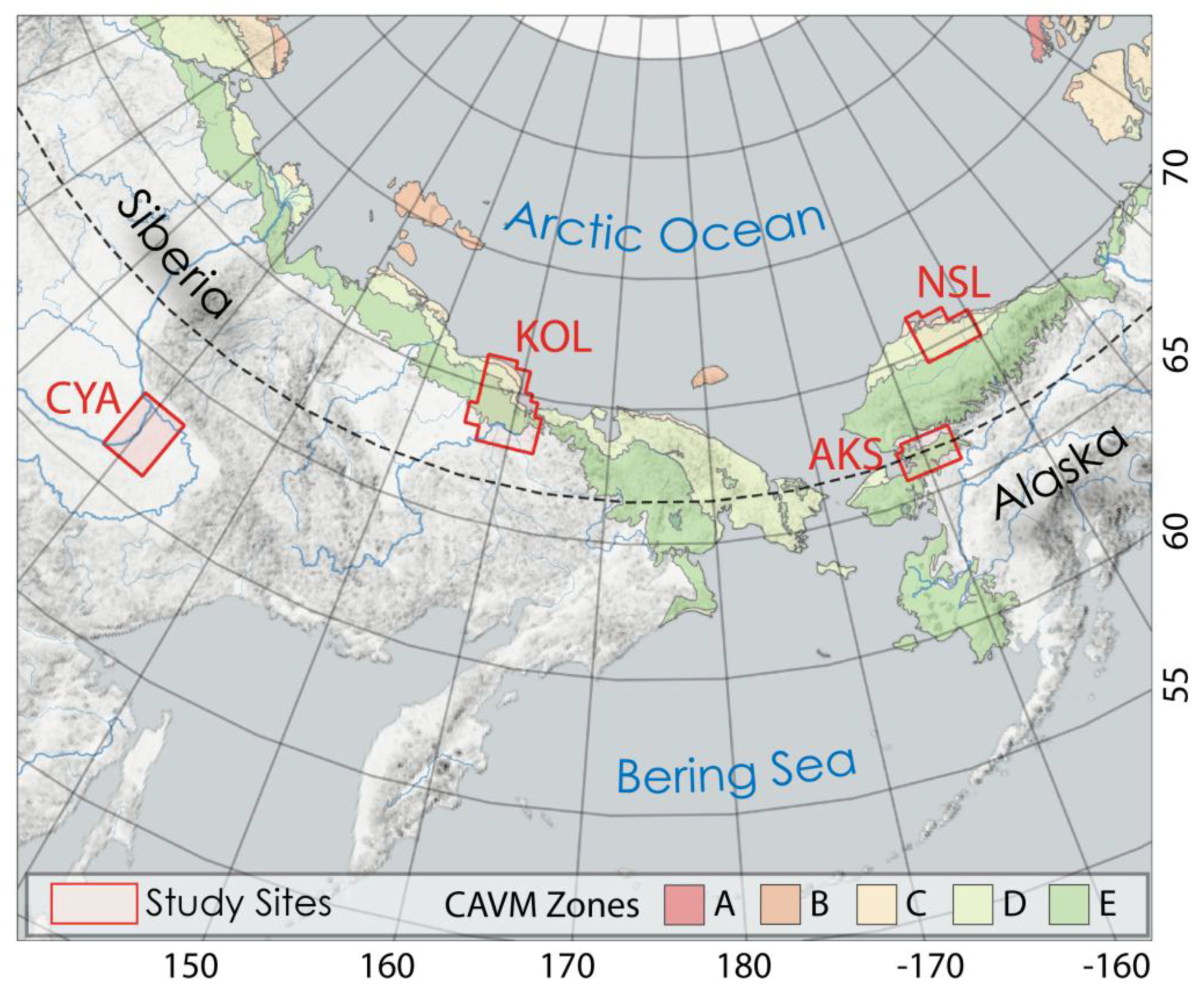
2. Study Sites
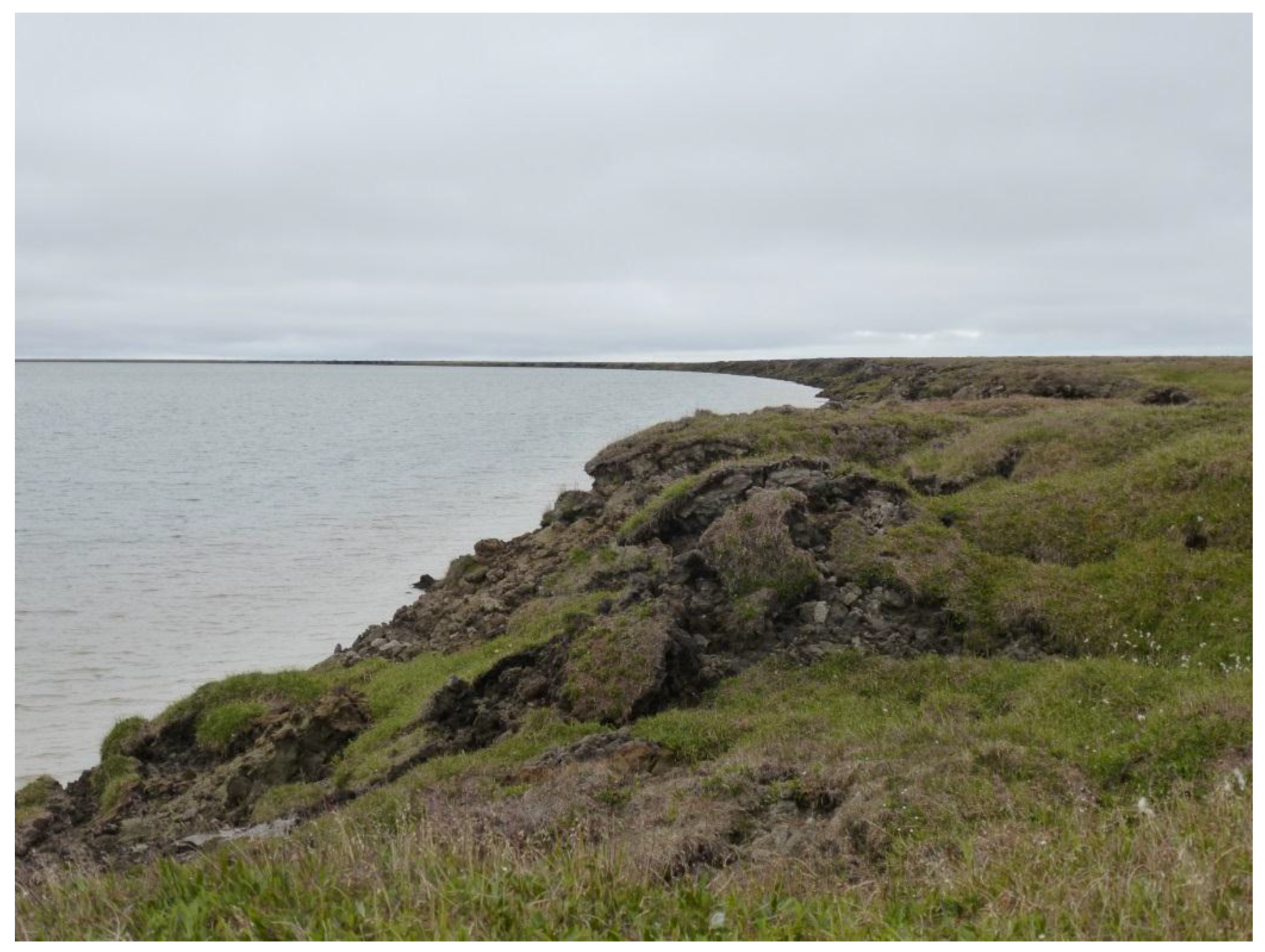
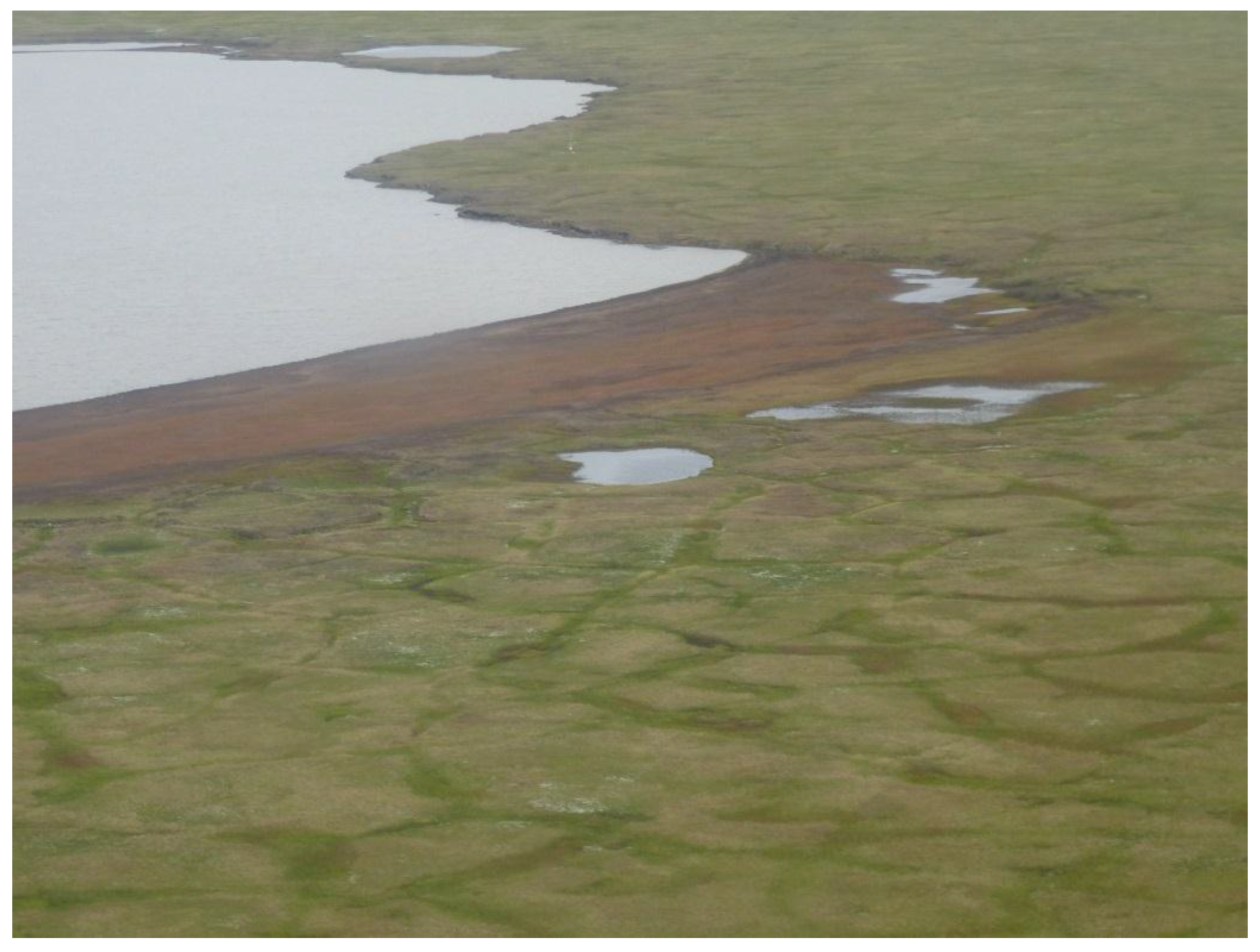
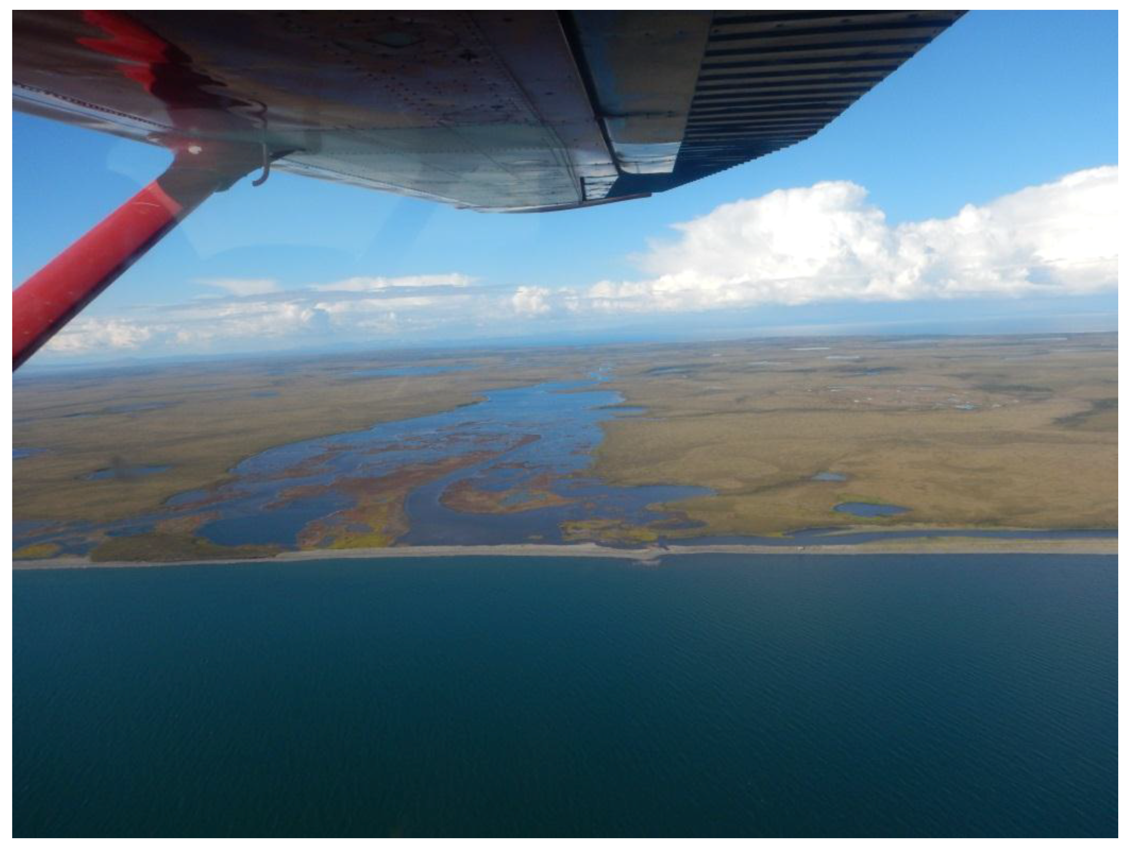
2.1. Alaska North Slope (NSL)
2.2. Alaska Kobuk-Selawik Lowlands (AKS)
2.3. Central Yakutia (CYA)
2.4. Kolyma Lowland (KOL)
3. Data and Methods
3.1. Data and Trend Analysis
3.2. Pixel-Based Machine-Learning Classification
3.2.1. Training Sampling
3.2.2. Classification Method Details
3.3. Object-Based Image Analysis
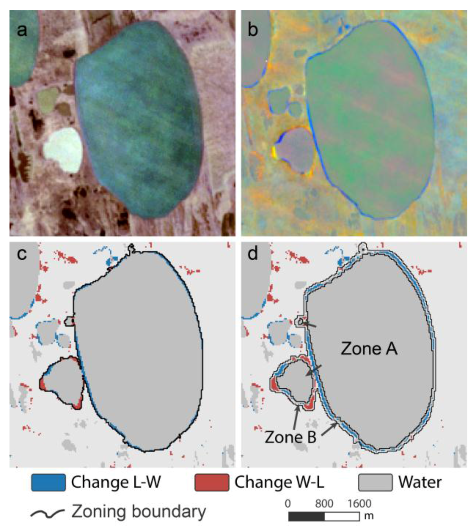
3.3.1. Lake Object Creation
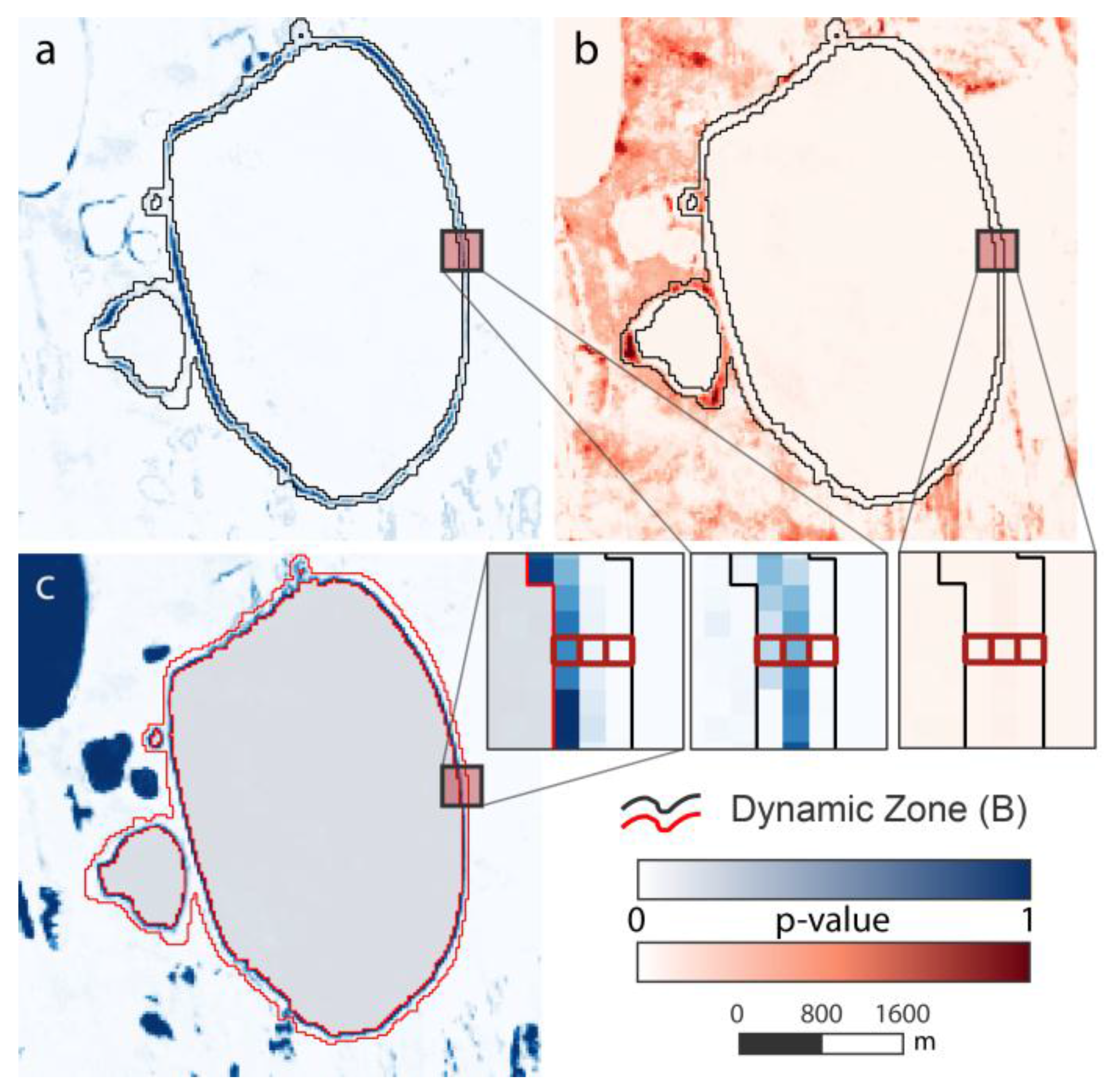
3.3.2. Lake Change Calculation
3.4. Data Quality and Post-Processing
3.5. Calculation of Lake Change Statistics
4. Results
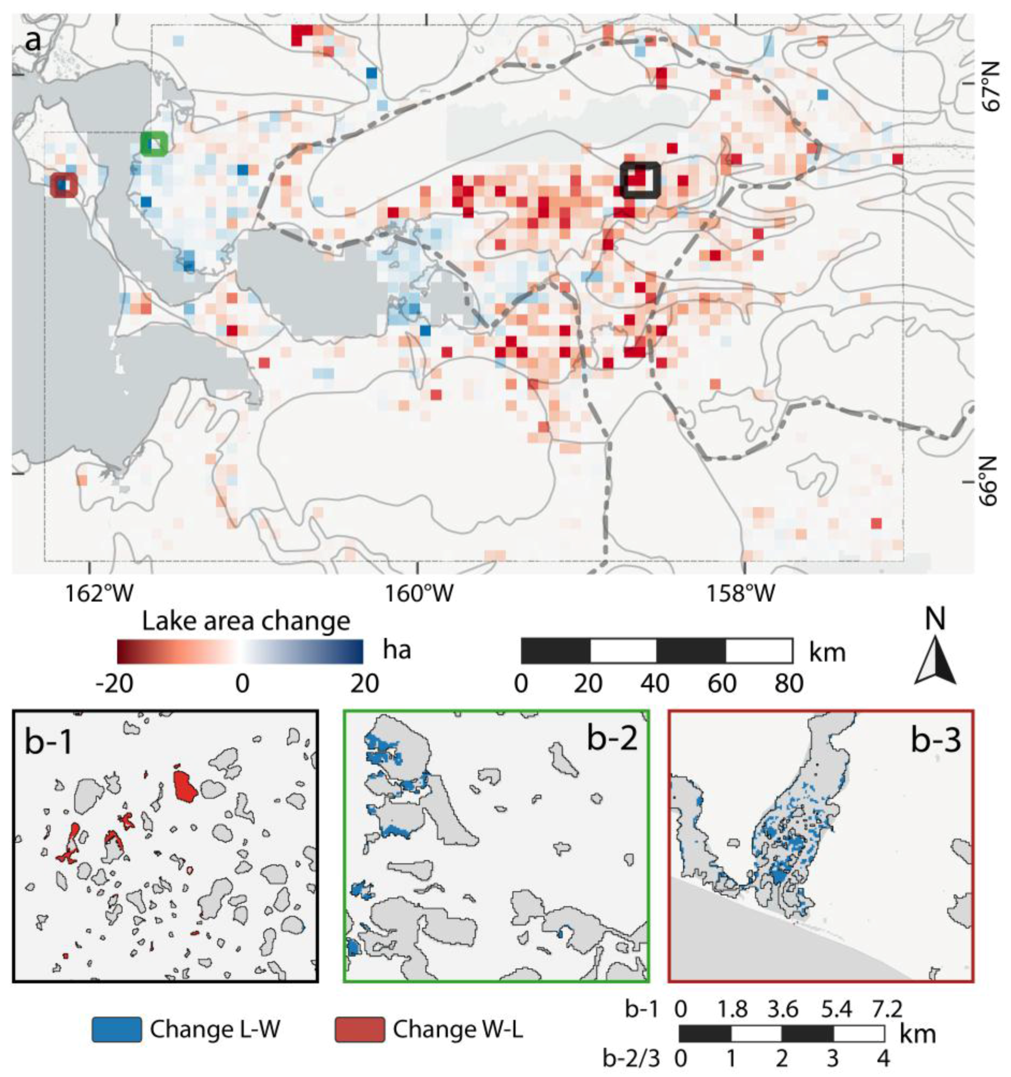
4.1. NSL (Alaska North Slope)
4.2. AKS (Alaska Kobuk-Selawik Lowlands)
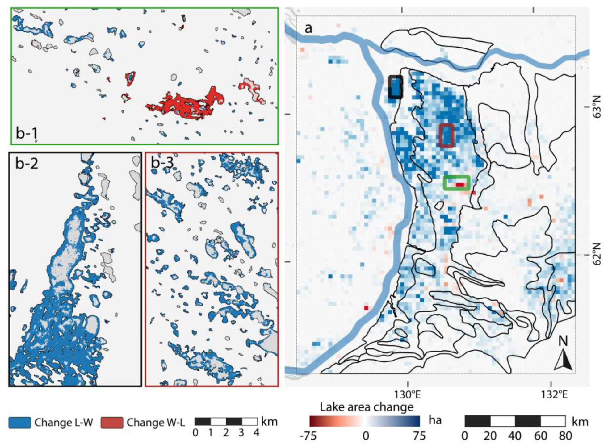
4.3. CYA (Central Yakutia)
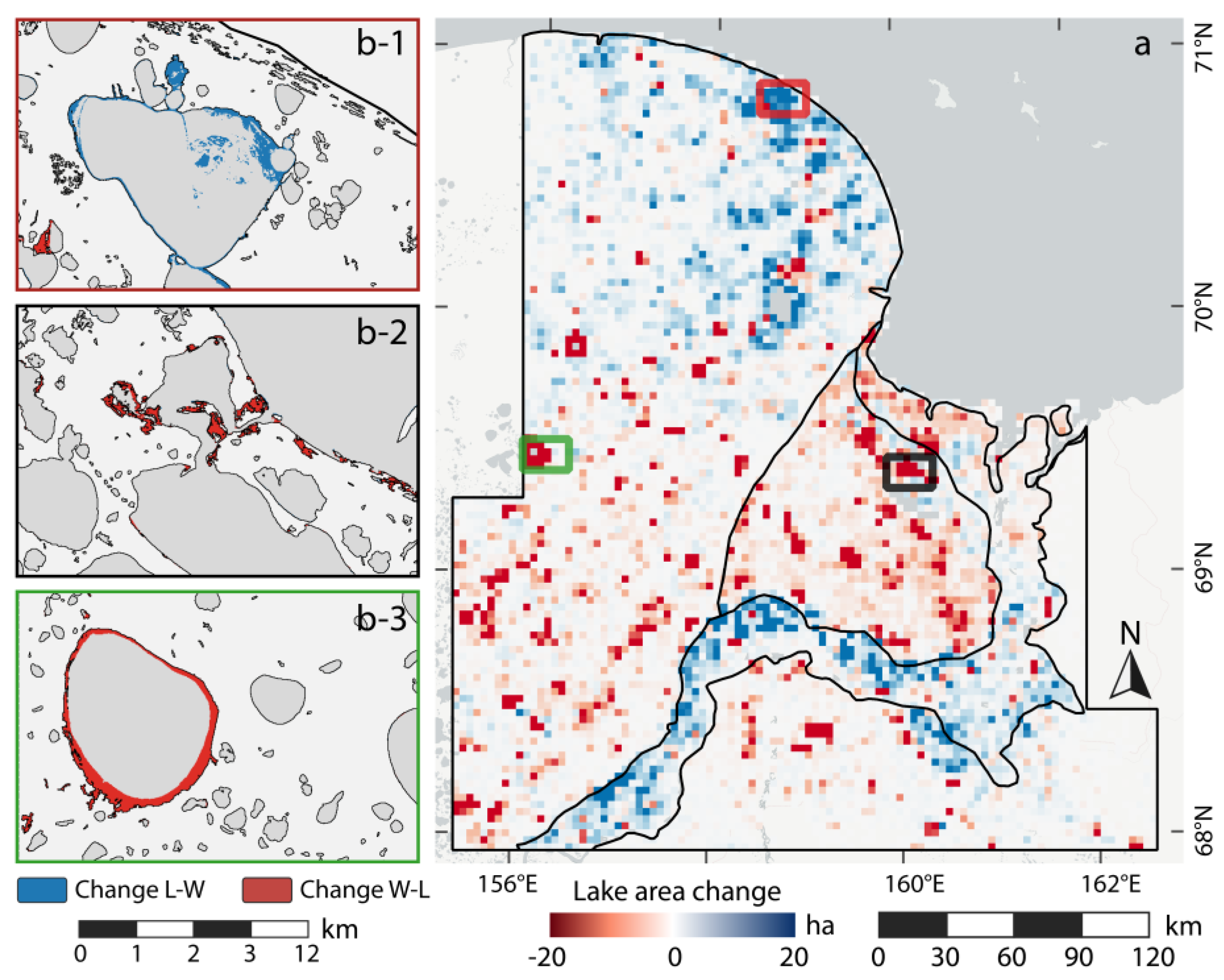
4.4. KOL (Kolyma Lowland)
5. Discussion
5.1. Data Analysis
5.2. Comparison of Sites and Prior Studies
6. Conclusions
Supplementary Materials
Acknowledgments
Author Contributions
Conflicts of Interest
Appendix A


References
- Lehner, B.; Döll, P. Development and validation of a global database of lakes, reservoirs and wetlands. J. Hydrol. 2004, 296, 1–22. [Google Scholar] [CrossRef]
- Smith, L.C.; Sheng, Y.; MacDonald, G.M. A first pan-Arctic assessment of the influence of glaciation, permafrost, topography and peatlands on northern hemisphere lake distribution. Permafr. Periglac. Process. 2007, 18, 201–208. [Google Scholar] [CrossRef]
- Grosse, G.; Jones, B.; Arp, C. Thermokarst Lakes, Drainage, and Drained Basins; Elsevier: Amsterdam, The Netherlands, 2013. [Google Scholar]
- Muster, S.; Roth, K.; Langer, M.; Lange, S.; Aleina, F.C.; Bartsch, A.; Morgenstern, A.; Grosse, G.; Jones, B.; Sannel, A.B.K.; et al. PeRL: A Circum-Arctic Permafrost Region Pond and Lake Database. Earth Syst. Sci. Data 2017, 9, 317–348. [Google Scholar] [CrossRef]
- Jorgenson, M.T.; Shur, Y. Evolution of lakes and basins in northern Alaska and discussion of the thaw lake cycle. J. Geophys. Res. Earth Surf. 2007, 112. [Google Scholar] [CrossRef]
- Jones, B.M.; Arp, C.D.; Whitman, M.S.; Nigro, D.; Nitze, I.; Beaver, J.; Gädeke, A.; Zuck, C.; Liljedahl, A.; Daanen, R.; et al. A lake-centric geospatial database to guide research and inform management decisions in an Arctic watershed in northern Alaska experiencing climate and land-use changes. Ambio 2017, 1–18. [Google Scholar] [CrossRef] [PubMed]
- Anthony, K.W.; Daanen, R.; Anthony, P.; von Deimling, T.S.; Ping, C.-L.; Chanton, J.P.; Grosse, G. Methane emissions proportional to permafrost carbon thawed in Arctic lakes since the 1950s. Nat. Geosci. 2016, 9, 679–682. [Google Scholar] [CrossRef]
- Langer, M.; Westermann, S.; Boike, J.; Kirillin, G.; Grosse, G.; Peng, S.; Krinner, G. Rapid degradation of permafrost underneath waterbodies in tundra landscapes-towards a representation of thermokarst in land surface models. J. Geophys. Res. Earth Surf. 2016. [Google Scholar] [CrossRef]
- Olefeldt, D.; Goswami, S.; Grosse, G.; Hayes, D.; Hugelius, G.; Kuhry, P.; McGuire, A.D.; Romanovsky, V.E.; Sannel, A.B.K.; Schuur, E.A.G.; et al. Circumpolar distribution and carbon storage of thermokarst landscapes. Nat. Commun. 2016, 7. [Google Scholar] [CrossRef] [PubMed]
- Boike, J.; Georgi, C.; Kirilin, G.; Muster, S.; Abramova, K.; Fedorova, I.; Chetverova, A.; Grigoriev, M.; Bornemann, N.; Langer, M. Thermal processes of thermokarst lakes in the continuous permafrost zone of northern Siberia--observations and modeling (Lena River Delta, Siberia). Biogeosciences 2015, 12, 5941–5965. [Google Scholar] [CrossRef]
- Arp, C.D.; Jones, B.M.; Schmutz, J.A.; Urban, F.E.; Jorgenson, M.T. Two mechanisms of aquatic and terrestrial habitat change along an Alaskan Arctic coastline. Polar Biol. 2010, 33, 1629–1640. [Google Scholar] [CrossRef]
- Lantz, T.C.; Turner, K.W. Changes in lake area in response to thermokarst processes and climate in Old Crow Flats, Yukon. J. Geophys. Res. Biogeosci. 2015, 120, 513–524. [Google Scholar] [CrossRef]
- Jorgenson, M.T.; Shur, Y.L.; Pullman, E.R. Abrupt increase in permafrost degradation in Arctic Alaska. Geophys. Res. Lett. 2006, 33. [Google Scholar] [CrossRef]
- Jones, B.M.; Grosse, G.; Arp, C.D.; Jones, M.C.; Anthony, W.A.K.M.; Romanovsky, V.E. Modern thermokarst lake dynamics in the continuous permafrost zone, northern Seward Peninsula, Alaska. J. Geophys. Res. Biogeosci. 2011, 116. [Google Scholar] [CrossRef]
- Jones, B.M.; Arp, C.D. Observing a catastrophic thermokarst lake drainage in northern Alaska. Permafr. Periglac. Process. 2015, 26, 119–128. [Google Scholar] [CrossRef]
- Arp, C.D.; Jones, B.M.; Urban, F.E.; Grosse, G. Hydrogeomorphic processes of thermokarst lakes with grounded-ice and floating-ice regimes on the Arctic coastal plain, Alaska. Hydrol. Proce. 2011, 25, 2422–2438. [Google Scholar] [CrossRef]
- Liljedahl, A.K.; Boike, J.; Daanen, R.P.; Fedorov, A.N.; Frost, G.V.; Grosse, G.; Hinzman, L.D.; Iijma, Y.; Jorgenson, J.C.; Matveyeva, N.; et al. Pan-Arctic ice-wedge degradation in warming permafrost and its influence on tundra hydrology. Nat. Geosci. 2016, 9, 312–318. [Google Scholar] [CrossRef]
- Lindgren, P.R.; Grosse, G.; Romanovsky, V.E.; Farquharson, L.M. Landsat-based lake distribution and changes in western Alaska permafrost regions between 1972 and 2014. Int. Conf. Permafr. 2016. [Google Scholar] [CrossRef]
- Carroll, M.L.; Townshend, J.R.; DiMiceli, C.M.; Noojipady, P.; Sohlberg, R.A. A new global raster water mask at 250 m resolution. Int. J. Digit. Earth 2009, 2, 291–308. [Google Scholar] [CrossRef]
- Donchyts, G.; Baart, F.; Winsemius, H.; Gorelick, N.; Kwadijk, J.; van de Giesen, N. Earthś surface water change over the past 30 years. Nat. Climate Chang. 2016, 6, 810–813. [Google Scholar] [CrossRef]
- Pekel, J.-F.; Cottam, A.; Gorelick, N.; Belward, A.S. High-resolution mapping of global surface water and its long-term changes. Nature 2016, 540, 418–422. [Google Scholar] [CrossRef] [PubMed]
- Paltan, H.; Dash, J.; Edwards, M. A refined mapping of Arctic lakes using Landsat imagery. Int. J. Remote Sens. 2015, 36, 5970–5982. [Google Scholar] [CrossRef]
- Muster, S.; Heim, B.; Abnizova, A.; Boike, J. Water Body Distributions Across Scales: A Remote Sensing Based Comparison of Three Arctic Tundra Wetlands. Remote Sens. 2013, 5, 1498–1523. [Google Scholar] [CrossRef]
- Zhang, T.; Barry, R.G.; Knowles, K.; Heginbottom, J.A.; Brown, J. Statistics and characteristics of permafrost and ground-ice distribution in the Northern Hemisphere. Polar Geogr. 2008, 31, 47–68. [Google Scholar] [CrossRef]
- Karlsson, J.M.; Lyon, S.W.; Destouni, G. Temporal Behavior of Lake Size-Distribution in a Thawing Permafrost Landscape in Northwestern Siberia. Remote Sens. 2014, 6, 621–636. [Google Scholar] [CrossRef]
- Smith, L.C.; Sheng, Y.; MacDonald, G.M.; Hinzman, L.D. Disappearing arctic lakes. Science 2005, 308, 1429. [Google Scholar] [CrossRef] [PubMed]
- Olthof, I.; Fraser, R.H.; Schmitt, C. Landsat-based mapping of thermokarst lake dynamics on the Tuktoyaktuk Coastal Plain, Northwest Territories, Canada since 1985. Remote Sens. Environ. 2015, 168, 194–204. [Google Scholar] [CrossRef]
- Riordan, B.; Verbyla, D.; McGuire, A.D. Shrinking ponds in subarctic Alaska based on 1950–2002 remotely sensed images. J. Geophys. Res. Biogeosci. 2006, 111. [Google Scholar] [CrossRef]
- Roach, J.K.; Griffith, B.; Verbyla, D. Landscape influences on climate-related lake shrinkage at high latitudes. Global Chang. Biol. 2013, 19, 2276–2284. [Google Scholar] [CrossRef] [PubMed]
- Kravtsova, V.I.; Tarasenko, T.V. The Dynamics of thermokarst lakes under climate change since 1950. Cent. Yakutia Kriosf. Zeml. 2011, 15, 31–42. [Google Scholar]
- Hinkel, K.M.; Jones, B.M.; Eisner, W.R.; Cuomo, C.J.; Beck, R.A.; Frohn, R. Methods to assess natural and anthropogenic thaw lake drainage on the western Arctic coastal plain of northern Alaska. J. Geophys. Res. Earth Surf. 2007, 112. [Google Scholar] [CrossRef]
- Plug, L.J.; Walls, C.; Scott, B.M. Tundra lake changes from 1978 to 2001 on the Tuktoyaktuk Peninsula, western Canadian Arctic. Geophys. Res. Lett. 2008, 35. [Google Scholar] [CrossRef]
- Walter, K.M.; Zimov, S.A.; Chanton, J.P.; Verbyla, D.; Chapin, F.S.I.I.I. Methane bubbling from Siberian thaw lakes as a positive feedback to climate warming. Nature 2006, 443, 71–75. [Google Scholar] [CrossRef] [PubMed]
- Boike, J.; Grau, T.; Heim, B.; Günther, F.; Langer, M.; Muster, S.; Gouttevin, I.; Lange, S. Satellite-derived changes in the permafrost landscape of central Yakutia, 2000–2011: Wetting, drying, and fires. Global Planet. Chang. 2016, 139, 116–127. [Google Scholar] [CrossRef]
- Labrecque, S.; Lacelle, D.; Duguay, C.R.; Lauriol, B.; Hawkings, J. Contemporary (1951–2001) evolution of lakes in the Old Crow Basin, Northern Yukon, Canada: Remote sensing, numerical modeling, and stable isotope analysis. Arctic 2009, 62, 225–238. [Google Scholar] [CrossRef]
- Elsakov, V.; Marushchak, I. The inter-Year changes of thermokarst lakes on North-East part of European Russia (in Russian). Issled. Zeml. iz Kosm. 2011, 5, 45–57. [Google Scholar]
- Kravtsova, V.; Radionova, T. Variations in size and number of thermokarst lakes in different permafrost regions: Spaceborne evidence. Earth's Cryosphere 2016, 1, 75–81. [Google Scholar]
- Jepsen, S.M.; Voss, C.I.; Walvoord, M.A.; Minsley, B.J.; Rover, J. Linkages between lake shrinkage/expansion and sublacustrine permafrost distribution determined from remote sensing of interior Alaska, USA. Geophys. Res. Lett. 2013, 40, 882–887. [Google Scholar] [CrossRef]
- Yoshikawa, K.; Hinzman, L.D. Shrinking thermokarst ponds and groundwater dynamics in discontinuous permafrost near Council, Alaska. Permafr. Periglac. Process. 2003, 14, 151–160. [Google Scholar] [CrossRef]
- Andresen, C.G.; Lougheed, V.L. Disappearing Arctic tundra ponds: Fine-scale analysis of surface hydrology in drained thaw lake basins over a 65 year period (1948--2013). J. Geophys. Res. Biogeosci. 2015, 120, 466–479. [Google Scholar] [CrossRef]
- Sannel, A.B.K.; Brown, I.A. High-resolution remote sensing identification of thermokarst lake dynamics in a subarctic peat plateau complex. Can. J. Remote Sens. 2010, 36, S26–S40. [Google Scholar] [CrossRef]
- Necsoiu, M.; Dinwiddie, C.L.; Walter, G.R.; Larsen, A.; Stothoff, S.A. Multi-temporal image analysis of historical aerial photographs and recent satellite imagery reveals evolution of water body surface area and polygonal terrain morphology in Kobuk Valley National Park, Alaska. Environ. Res. Lett. 2013, 8, 025007. [Google Scholar] [CrossRef]
- Ulrich, M.; Matthes, H.; Schirrmeister, L.; Schütze, J.; Park, H.; Iijima, Y.; Fedorov, A.N. Differences in behavior and distribution of permafrost-related lakes in Central Yakutia and their response to climatic drivers. Water Res. Res. 2017, 53, 1167–1188. [Google Scholar] [CrossRef]
- Tarasenko, T.V. Interannual variations in the areas of thermokarst lakes in Central Yakutia. Water Res. 2013, 40, 111–119. [Google Scholar] [CrossRef]
- Hansen, M.C.; Potapov, P.V.; Moore, R.; Hancher, M.; Turubanova, S.A.; Tyukavina, A.; Thau, D.; Stehman, S.V.; Goetz, S.J.; Loveland, T.R.; et al. High-resolution global maps of 21st-century forest cover change. Science 2013, 342, 850–853. [Google Scholar] [CrossRef] [PubMed]
- Wulder, M.A.; White, J.C.; Loveland, T.R.; Woodcock, C.E.; Belward, A.S.; Cohen, W.B.; Fosnight, E.A.; Shaw, J.; Masek, J.G.; Roy, D.P. The global Landsat archive: Status, consolidation, and direction. Remote Sens. Environ. 2016, 185, 271–283. [Google Scholar] [CrossRef]
- Fraser, R.H.; Olthof, I.; Kokelj, S.V.; Lantz, T.C.; Lacelle, D.; Brooker, A.; Wolfe, S.; Schwarz, S. Detecting Landscape Changes in High Latitude Environments Using Landsat Trend Analysis: 1. Visualization. Remote Sens. 2014, 6, 11533–11557. [Google Scholar] [CrossRef]
- Brooker, A.; Fraser, R.H.; Olthof, I.; Kokelj, S.V.; Lacelle, D. Mapping the activity and evolution of retrogressive thaw slumps by tasselled cap trend analysis of a Landsat satellite image stack. Permafr. Periglac. Process. 2014. [Google Scholar] [CrossRef]
- Nitze, I.; Grosse, G. Detection of landscape dynamics in the Arctic Lena Delta with temporally dense Landsat time-series stacks. Remote Sens. Environ. 2016, 181, 27–41. [Google Scholar] [CrossRef]
- Ju, J.; Masek, J.G. The vegetation greenness trend in Canada and US Alaska from 1984–2012 Landsat data. Remote Sens. Environ. 2016, 176, 1–16. [Google Scholar] [CrossRef]
- Walker, D.A.; Raynolds, M.K.; Daniëls, F.J.A.; Einarsson, E.; Elvebakk, A.; Gould, W.A.; Katenin, A.E.; Kholod, S.S.; Markon, C.J.; Melnikov, E.S.; et al. The circumpolar Arctic vegetation map. J. Veg. Sci. 2005, 16, 267–282. [Google Scholar] [CrossRef]
- Hinkel, K.M.; Sheng, Y.; Lenters, J.D.; Lyons, E.A.; Beck, R.A.; Eisner, W.R.; Wang, J. Thermokarst Lakes on the Arctic Coastal Plain of Alaska: Geomorphic Controls on Bathymetry. Permafr. Periglac. Process 2012, 23, 218–230. [Google Scholar] [CrossRef]
- Jorgenson, M.T.; Yoshikawa, K.; Kanevskiy, M.; Shur, Y.; Romanovsky, V.; Marchenko, S.; Grosse, G.; Brown, J.; Jones, B. Permafrost characteristics of Alaska. In Proceedings of the Ninth International Conference on Permafrost, Fairbanks, AK, USA, 29 June–3 July 2008. [Google Scholar]
- Hinkel, K.M.; Frohn, R.C.; Nelson, F.E.; Eisner, W.R.; Beck, R.A. Morphometric and spatial analysis of thaw lakes and drained thaw lake basins in the western Arctic Coastal Plain, Alaska. Permafr. Periglac. Process. 2005, 16, 327–341. [Google Scholar] [CrossRef]
- NOAA. Climate Data Online: 1981–2010 Normals, 2017. Available online: https://www.ncdc.noaa.gov/cdo-web/datatools/normals (accessed on 2 May 2017).
- Farquharson, L.M.; Mann, D.H.; Grosse, G.; Jones, B.M.; Romanovsky, V.E. Spatial distribution of thermokarst terrain in Arctic Alaska. Geomorphology 2016, 273, 116–133. [Google Scholar] [CrossRef]
- Lenz, J.; Jones, B.M.; Wetterich, S.; Tjallingii, R.; Fritz, M.; Arp, C.D.; Rudaya, N.; Grosse, G. Impacts of shore expansion and catchment characteristics on lacustrine thermokarst records in permafrost lowlands, Alaska Arctic Coastal Plain. Arktos 2016, 2, 25. [Google Scholar] [CrossRef]
- Sellman, P.V.; Brown, J.; Lewellen, R.I.; McKim, H.; Merry, C. The Classification and Geomor-Phic Implications of Thaw Lakes of the Arctic Coastal Plain, Alaska; U.S. Department of Defense, Department of the Army; Corps of Engineers, Cold Regions Research and Engineering Laboratory: Washington, DC, USA, 1975.
- Jones, B.M.; Arp, C.D.; Hinkel, K.M.; Beck, R.A.; Schmutz, J.A.; Winston, B. Arctic lake physical processes and regimes with implications for winter water availability and management in the National Petroleum Reserve Alaska. Environ. Manag. 2009, 43, 1071–1084. [Google Scholar] [CrossRef] [PubMed]
- Kanevskiy, M.; Shur, Y.; Jorgenson, M.T.; Ping, C.-L.; Michaelson, G.J.; Fortier, D.; Stephani, E.; Dillon, M.; Tumskoy, V. Ground ice in the upper permafrost of the Beaufort Sea coast of Alaska. Cold Reg. Sci. Technol. 2013, 85, 56–70. [Google Scholar] [CrossRef]
- Schirrmeister, L.; Froese, D.; Tumskoy, V.; Grosse, G.; Wetterich, S. Yedoma: Late Pleistocene ice-rich syngenetic permafrost of Beringia. In Encyclopedia of Quaternary Science, 2nd ed.; Elsevier: Amsterdam, The Netherlands, 2013; pp. 542–552. [Google Scholar]
- Raynolds, M.K.; Walker, D.A.; Ambrosius, K.J.; Brown, J.; Everett, K.R.; Kanevskiy, M.; Kofinas, G.P.; Romanovsky, V.E.; Shur, Y.; Webber, P.J. Cumulative geoecological effects of 62 years of infrastructure and climate change in ice-rich permafrost landscapes, Prudhoe Bay Oilfield, Alaska. Global Chang. Biol. 2014, 20, 1211–1224. [Google Scholar] [CrossRef] [PubMed]
- Larsen, A.S.; O'Donnell, J.A.; Schmidt, J.H.; Kristenson, H.J.; Swanson, D.K. Physical and chemical characteristics of lakes across heterogeneous landscapes in arctic and subarctic Alaska. J. Geophys. Res. Biogeosci. 2017. [Google Scholar] [CrossRef]
- Cable, W.L.; Romanovsky, V.E.; Jorgenson, M.T. Scaling-up permafrost thermal measurements in western Alaska using an ecotype approach. Cryosphere 2016, 10, 2517. [Google Scholar] [CrossRef]
- Jorgenson, M.T.; Roth, J.E.; Miller, P.F.; Macander, M.J.; Duffy, M.S.; Pullman, E.R.; Attanas, L.B.; Wells, A.F.; Talbot, S. An Ecological Land Survey and Landcover Map of the Selawik National Wildlife Refuge; ABR, Inc.: Fairbanks, AK, USA, 2009. [Google Scholar]
- Ivanov, M.S. Cryogenic Structure of Quaternary Deposits of the Lena-Aldan-Depression; Nauka: Novosibirsk, Russia, 1984. [Google Scholar]
- Fedorov, A.N.; Ivanova, R.N.; Park, H.; Hiyama, T.; Iijima, Y. Recent air temperature changes in the permafrost landscapes of northeastern Eurasia. Polar Sci. 2014, 8, 114–128. [Google Scholar] [CrossRef]
- Yang, D.; Kane, D.L.; Hinzman, L.D.; Zhang, X.; Zhang, T.; Ye, H. Siberian Lena River hydrologic regime and recent change. J. Geophys. Res. Atmos. 2002, 107, 14. [Google Scholar] [CrossRef]
- Soloviev, P.A. Cryolithozone of the Northern Part of the Leno-Amga Interfluve; Publishing House of the USSR Acadamy of Sciences: Moscow, Russia, 1959. [Google Scholar]
- Fedorov, A.N.; Gavriliev, P.P.; Konstantinov, P.Y.; Hiyama, T.; Iijima, Y.; Iwahana, G. Estimating the water balance of a thermokarst lake in the middle of the Lena River basin, eastern Siberia. Ecohydrology 2014, 7, 188–196. [Google Scholar] [CrossRef]
- Crate, S.; Ulrich, M.; Habeck, J.; Desyatkin, A.; Desyatkin, R.; Fedorov, A.; Hiyama, T.; Iijima, Y.; Ksenofontov, S.; Mészáros, C.; et al. Permafrost livelihoods: A transdisciplinary analysis of thermokarst-based systems of indigenous land use. Anthropocene 2017. [Google Scholar] [CrossRef]
- Kaplina, T. History of permafrost in Northern Yakutia. In History of the Development of Perennial Frozen Deposits in Eurasia; Nauka: Moscow, Russia, 1981; pp. 153–181. [Google Scholar]
- Ershov, E. Geocryology of the USSR; East Siberia and Far East: Moscow, Russia, 1989. [Google Scholar]
- Shmelev, D.; Veremeeva, A.; Kraev, G.; Kholodov, A.; Spencer, R.G.M.; Walker, W.S.; Rivkina, E. Estimation and Sensitivity of Carbon Storage in Permafrost of North-Eastern Yakutia. Permafr. Periglac. Process. 2017. [Google Scholar] [CrossRef]
- Veremeeva, A.A.; Glushkova, N.V. Formation of relief in the regions of Ice complex deposits distribution: Remote sensing and GIS studies in the Kolyma lowland tundra. Earth's Cryosphere 2016, 1, 14–24. [Google Scholar]
- Spector, V. Quaternary Deposits of the Coastal Lowland (Khallerchin Tundra); The Cenozoic of East Yakutia, Yakut Branch of the Siberian Department of the USSR Academy of Sciences: Yakutsk, USSR, 1980; pp. 87–97. [Google Scholar]
- Zhu, Z.; Wang, S.; Woodcock, C.E. Improvement and expansion of the Fmask algorithm: Cloud, cloud shadow, and snow detection for Landsats 4–7, 8, and Sentinel 2 images. Remote Sens. Environ. 2015, 159, 269–277. [Google Scholar] [CrossRef]
- Olthof, I.; Fraser, R.H. Detecting Landscape Changes in High Latitude Environments Using Landsat Trend Analysis: 2. Classification. Remote Sens. 2014, 6, 11558–11578. [Google Scholar] [CrossRef]
- Sen, P.K. Estimates of the regression coefficient based on Kendallś tau. J. Am. Stat. Assoc. 1968, 63, 1379–1389. [Google Scholar] [CrossRef]
- Theil, H. A rank-invariant method of linear and polynomial regression analysis. In Henri Theil’s Contributions to Economics and Econometrics; Springer: Berlin, Germany, 1992; pp. 345–381. [Google Scholar]
- Rover, J.; Ji, L.; Wylie, B.K.; Tieszen, L.L. Establishing water body areal extent trends in interior Alaska from multi-temporal Landsat data. Remote Sens. Lett. 2012, 3, 595–604. [Google Scholar] [CrossRef]
- Raynolds, M.K.; Walker, D.A. Increased wetness confounds Landsat-derived NDVI trends in the central Alaska North Slope region, 1985–2011. Environ. Res. Lett. 2016, 11, 085004. [Google Scholar] [CrossRef]
- Kennedy, R.E.; Yang, Z.; Cohen, W.B. Detecting trends in forest disturbance and recovery using yearly Landsat time series: 1. LandTrendr—Temporal segmentation algorithms. Remote Sens. Environ. 2010, 114, 2897–2910. [Google Scholar] [CrossRef]
- Breiman, L. Random Forests. Mach. Learn. 2001, 45, 5–32. [Google Scholar] [CrossRef]
- Nitze, I.; Barrett, B.; Cawkwell, F. Temporal optimisation of image acquisition for land cover classification with Random Forest and MODIS time-series. Int. J. Appl. Earth Obs. Geoinf. 2015, 34, 136–146. [Google Scholar] [CrossRef]
- Barrett, B.; Nitze, I.; Green, S.; Cawkwell, F. Assessment of multi-temporal, multi-sensor radar and ancillary spatial data for grasslands monitoring in Ireland using machine learning approaches. Remote Sens. Environ. 2014, 152, 109–124. [Google Scholar] [CrossRef]
- Belgiu, M.; Drăgut, L. Random forest in remote sensing: A review of applications and future directions. ISPRS J. Photogramm. Remote Sens. 2016, 114, 24–31. [Google Scholar] [CrossRef]
- Nitze, I.; Schulthess, U.; Asche, H. Comparison of machine learning algorithms random forest, artificial neural network and support vector machine to maximum likelihood for supervised crop type classification. In Proceedings of the 4th GEOBIA, Rio de Janeiro, Brazil, 7–9 May 2012; pp. 7–9. [Google Scholar]
- Santoro, M.; Strozzi, T. Circumpolar digital elevation models >55 N with links to geotiff images. PANGAEA 2012. [Google Scholar] [CrossRef]
- Desyatkin, R. Soil Formation in Thermokarst Depression—Alases of Cryolithozone; Nauka: Novosibirsk, Russia, 2008. [Google Scholar]
- Chen, M.; Rowland, J.C.; Wilson, C.J.; Altmann, G.L.; Brumby, S.P. The importance of natural variability in lake areas on the detection of permafrost degradation: A case study in the Yukon Flats, Alaska. Permafr. Periglac. Process. 2013, 24, 224–240. [Google Scholar] [CrossRef]
- Veremeeva, A.; Gubin, S. Modern tundra landscapes of the Kolyma Lowland and their evolution in the Holocene. Permafr. Periglac. Process. 2009, 20, 399–406. [Google Scholar] [CrossRef]
- Iijima, Y.; Fedorov, A.N.; Park, H.; Suzuki, K.; Yabuki, H.; Maximov, T.C.; Ohata, T. Abrupt increases in soil temperatures following increased precipitation in a permafrost region, central Lena River basin, Russia. Permafr. Periglac. Process. 2010, 21, 30–41. [Google Scholar] [CrossRef]
- Nitze, I.; Grosse, G.; Jones, B.M.; Arp, C.D.; Ulrich, M.; Fedorov, A.; Veremeeva, A. Landsat-based trend analysis of lake dynamics across northern permafrost regions, supplementary material. PANGAEA 2017. [Google Scholar] [CrossRef]



| Class Name | Class ID | Number of Training Samples | Examples of Observed Land Cover or Changes |
|---|---|---|---|
| Stable water | S-W | 148 | Lakes, sea water, river |
| Stable land | S-L | 270 | Tundra, forest, bare ground |
| Change water to land | C-WL | 193 | Lake drainage (water to bare ground, water to vegetation), river channel migration |
| Change land to water | C-LW | 84 | Thermokarst lake expansion, riverbank erosion, coastal erosion |
| Multi-Spectral Index | Trend Metric |
|---|---|
| TC Brightness | Slope |
| TC Greenness | Intercept |
| TC Wetness | Lower CI |
| NDVI | Upper CI |
| NDWI | CI Range |
| NDMI |
| Example Pixel | S-W | S-L | C-LW | C-WL | ||||
|---|---|---|---|---|---|---|---|---|
| p-Value | m² | p-Value | m² | p-Value | m² | p-Value | m² | |
| px-West | 0.705 | 634.5 | 0.005 | 4.5 | 0.29 | 261 | 0 | 0 |
| px-Central | 0.065 | 58.5 | 0.39 | 351 | 0.51 | 459 | 0.035 | 31.5 |
| px-East | 0 | 0 | 1 | 900 | 0 | 0 | 0 | 0 |
| Σ | 0.77 | 693 | 1.395 | 1255.5 | 0.8 | 720 | 0.035 | 31.5 |
| Attribute | Unit | NSL | AKS | CYA | KOL |
|---|---|---|---|---|---|
| Total land area | km² | 31,715 | 31,135 | 56,700 | 73,339 |
| Number of lake objects | # | 19,922 | 9771 | 13,254 | 38,838 |
| Net lake area change | % | −0.69 | −2.82 | 48.48 | −0.51 |
| Net lake area change | ha | −3849.25 | −2806.63 | 45,288.11 | −6083.14 |
| Lake area 1999 | ha | 555,478.54 | 99,398.59 | 93,417.39 | 1,197,262.70 |
| Lake area 2014 | ha | 551,629.28 | 96,591.97 | 138,705.50 | 1,191,179.56 |
| Lake area gain | ha | 3936.53 | 2024.47 | 50,115.75 | 21,826.55 |
| Lake area loss | ha | 7785.78 | 4831.10 | 4827.64 | 27,909.69 |
| Mean lake size 1999 | ha | 27.88 | 10.17 | 7.05 | 30.83 |
| Mean lake size 2014 | ha | 27.69 | 9.89 | 10.47 | 30.67 |
| Median lake size 1999 | ha | 3.91 | 3.23 | 2.28 | 5.58 |
| Median lake size 2014 | ha | 3.84 | 3.01 | 3.56 | 5.59 |
| Max lake size 1999 | ha | 84,847.11 | 2384.02 | 1828.07 | 22,445.77 |
| Max lake size 2014 | ha | 84,732.23 | 2427.16 | 5008.44 | 22,448.93 |
| Lakes with strong growth | # | 4 | 16 | 1720 | 64 |
| Lakes with strong loss | # | 43 | 394 | 183 | 205 |
| Stable water >95% | # | 12,736 | 5547 | 2076 | 23,515 |
| Change <1 ha, % lakes | % | 96.61 | 88.77 | 56.35 | 90.24 |
© 2017 by the authors. Licensee MDPI, Basel, Switzerland. This article is an open access article distributed under the terms and conditions of the Creative Commons Attribution (CC BY) license (http://creativecommons.org/licenses/by/4.0/).
Share and Cite
Nitze, I.; Grosse, G.; Jones, B.M.; Arp, C.D.; Ulrich, M.; Fedorov, A.; Veremeeva, A. Landsat-Based Trend Analysis of Lake Dynamics across Northern Permafrost Regions. Remote Sens. 2017, 9, 640. https://doi.org/10.3390/rs9070640
Nitze I, Grosse G, Jones BM, Arp CD, Ulrich M, Fedorov A, Veremeeva A. Landsat-Based Trend Analysis of Lake Dynamics across Northern Permafrost Regions. Remote Sensing. 2017; 9(7):640. https://doi.org/10.3390/rs9070640
Chicago/Turabian StyleNitze, Ingmar, Guido Grosse, Benjamin M. Jones, Christopher D. Arp, Mathias Ulrich, Alexander Fedorov, and Alexandra Veremeeva. 2017. "Landsat-Based Trend Analysis of Lake Dynamics across Northern Permafrost Regions" Remote Sensing 9, no. 7: 640. https://doi.org/10.3390/rs9070640
APA StyleNitze, I., Grosse, G., Jones, B. M., Arp, C. D., Ulrich, M., Fedorov, A., & Veremeeva, A. (2017). Landsat-Based Trend Analysis of Lake Dynamics across Northern Permafrost Regions. Remote Sensing, 9(7), 640. https://doi.org/10.3390/rs9070640


