Article

A Study on Radar–Gauge Rainfall Data Merging and Its Impact on Flood Simulation
1
PowerChina Zhongnan Engineering Corporation Limited, Changsha 410014, China
2
State Key Laboratory of Hydraulic Engineering Intelligent Construction and Operation, Tianjin University, Tianjin 300350, China
*
Author to whom correspondence should be addressed.
Remote Sens. 2026, 18(15), 2587; https://doi.org/10.3390/rs18152587
Submission received: 29 June 2026 / Revised: 31 July 2026 / Accepted: 1 August 2026 / Published: 4 August 2026
(This article belongs to the Section Remote Sensing in Geology, Geomorphology and Hydrology)

Abstract

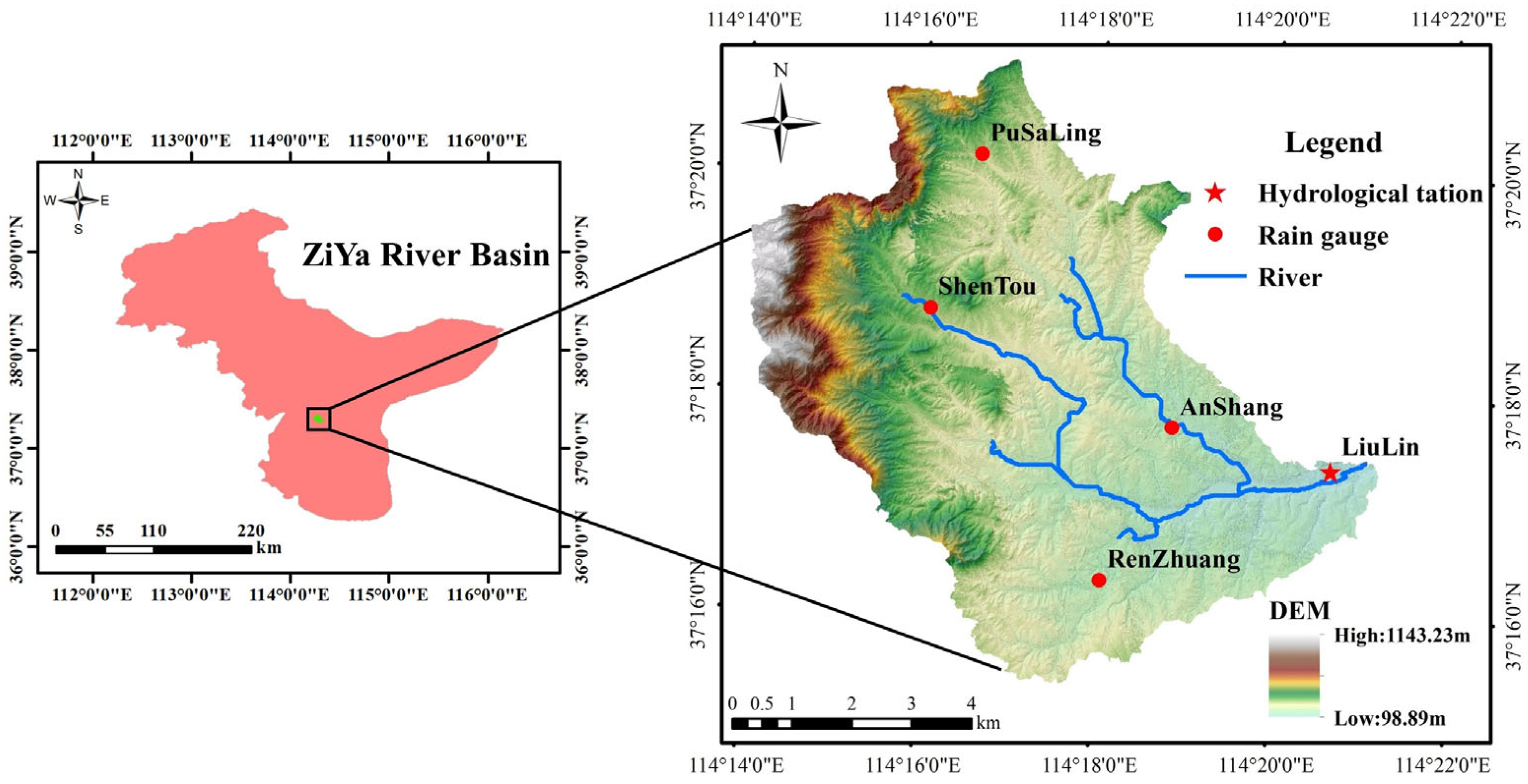
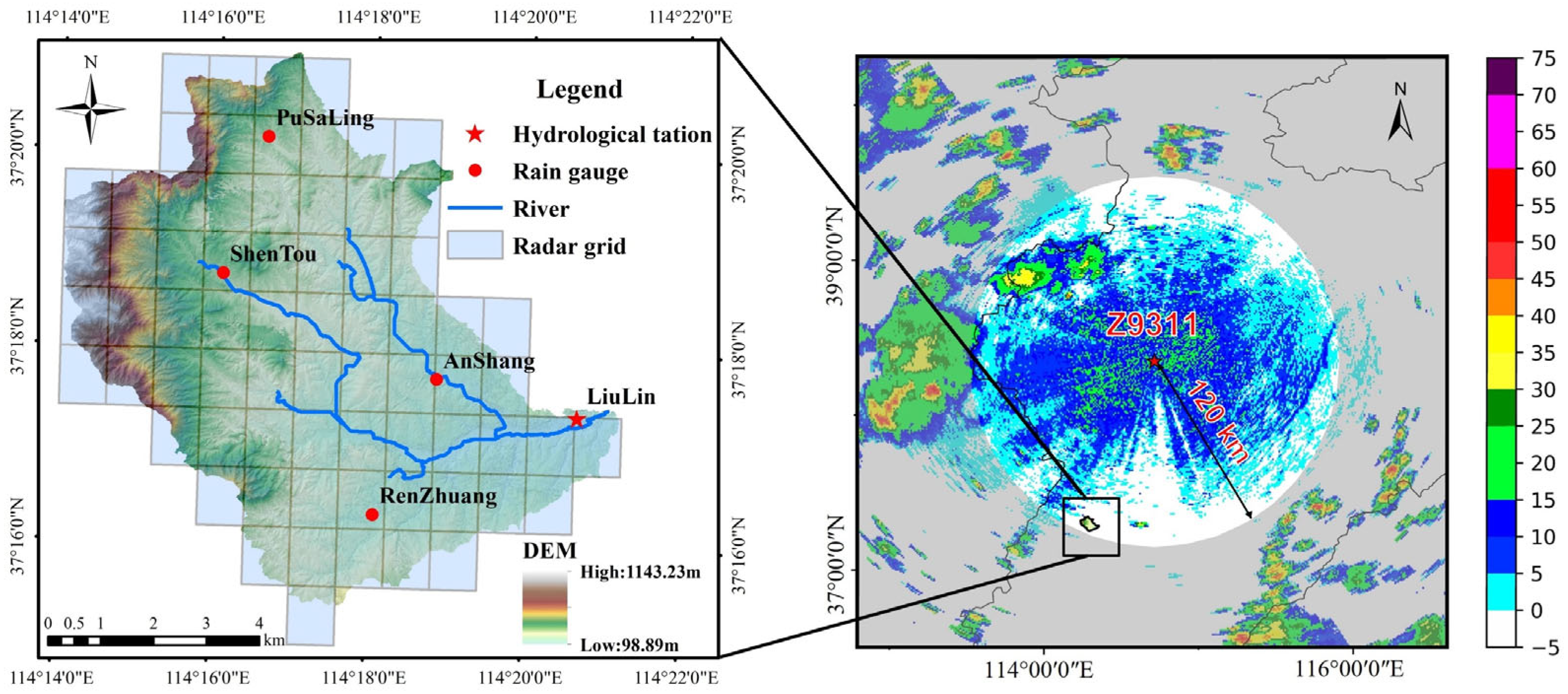
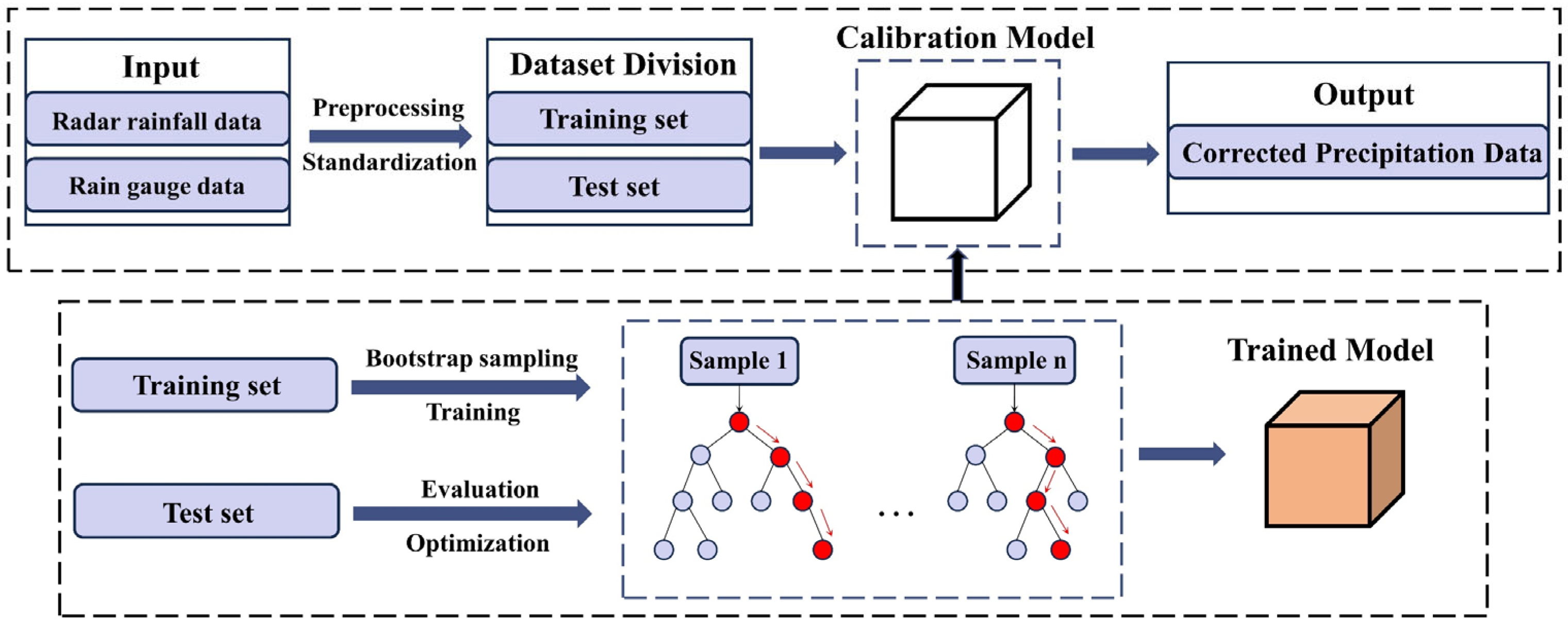
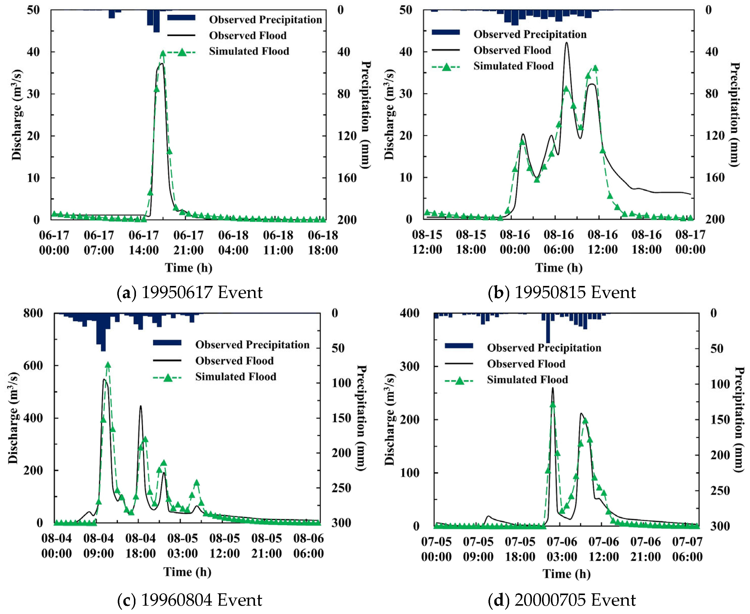
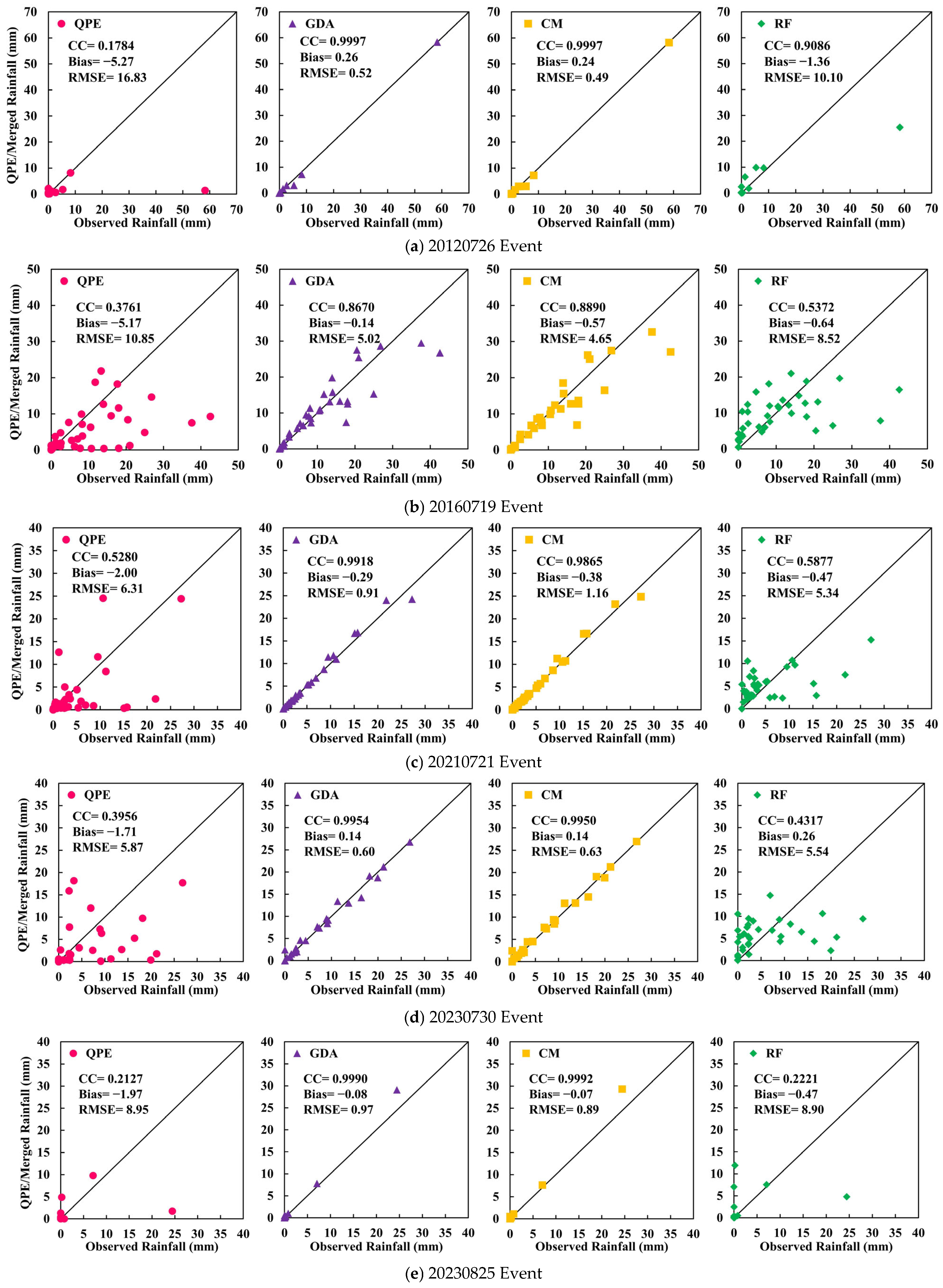
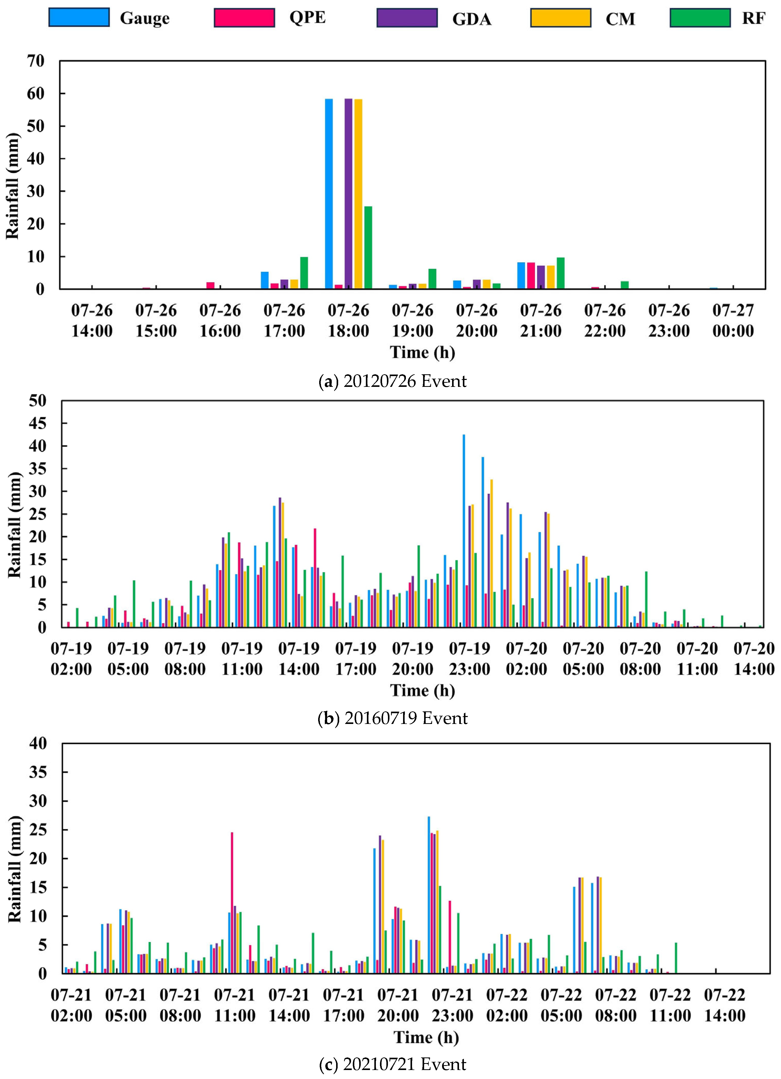
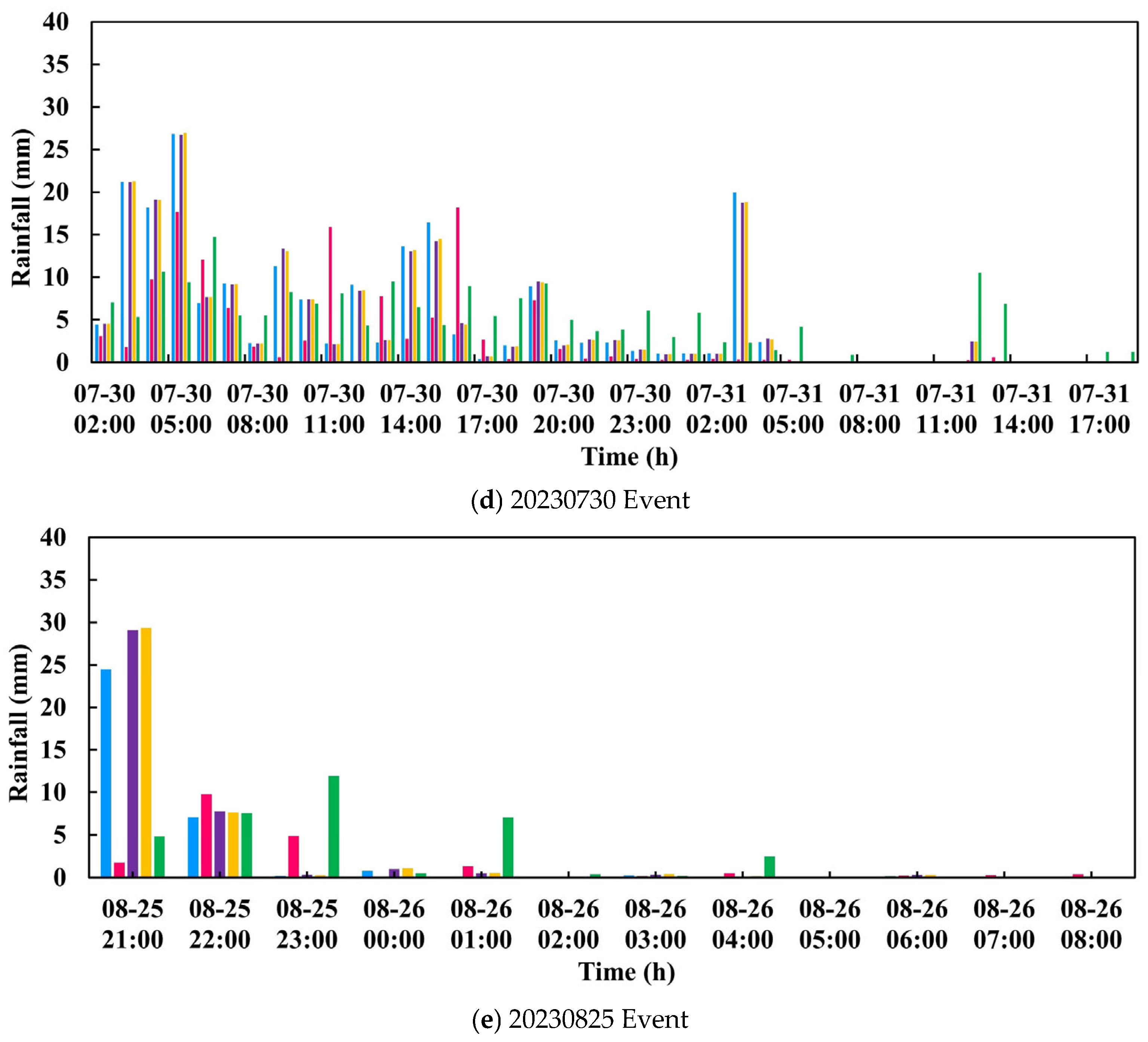
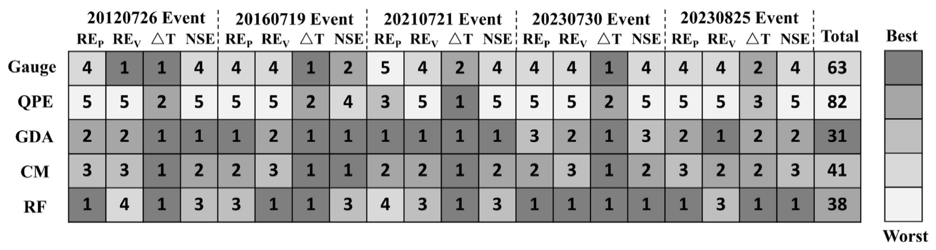
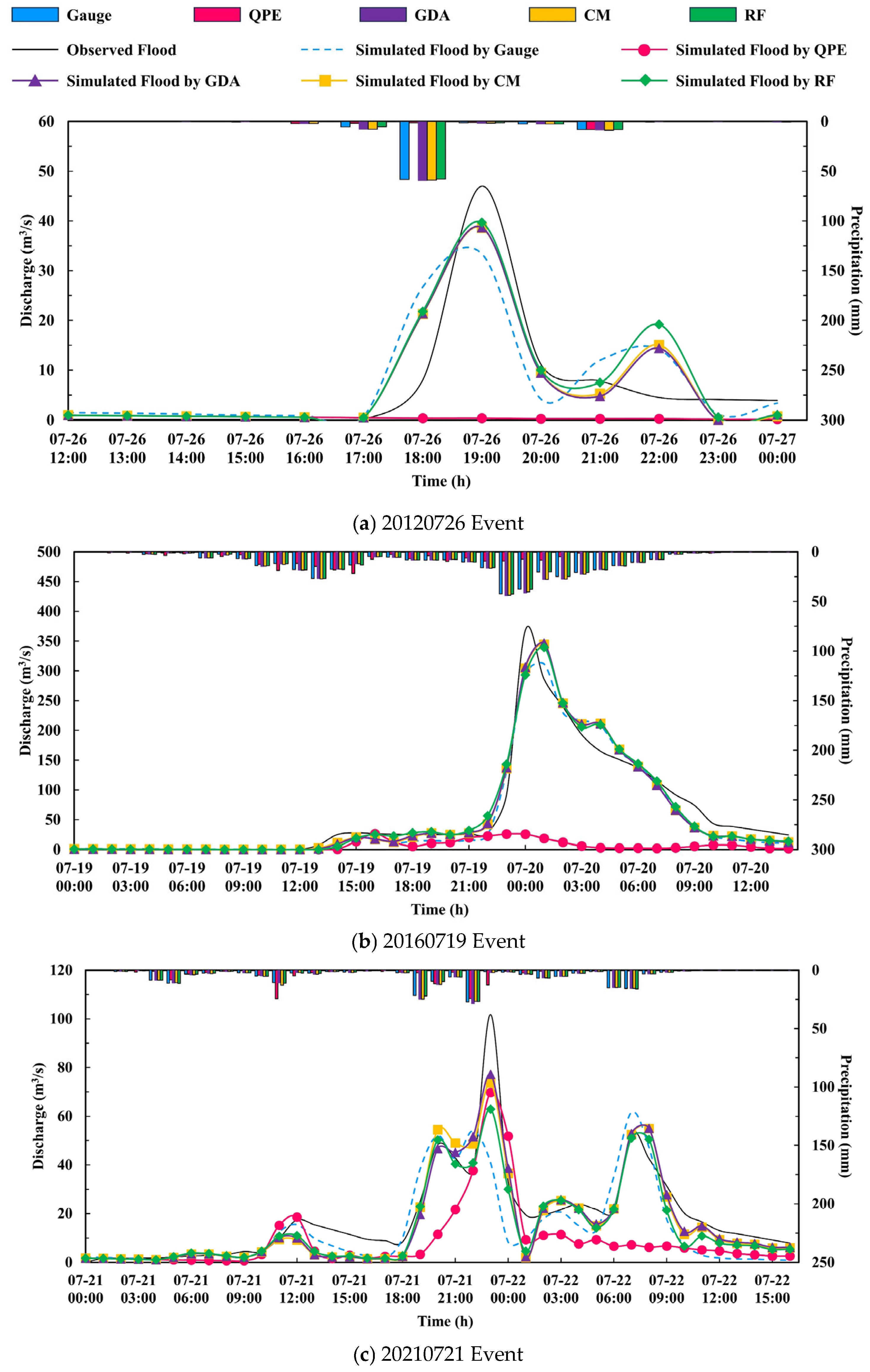
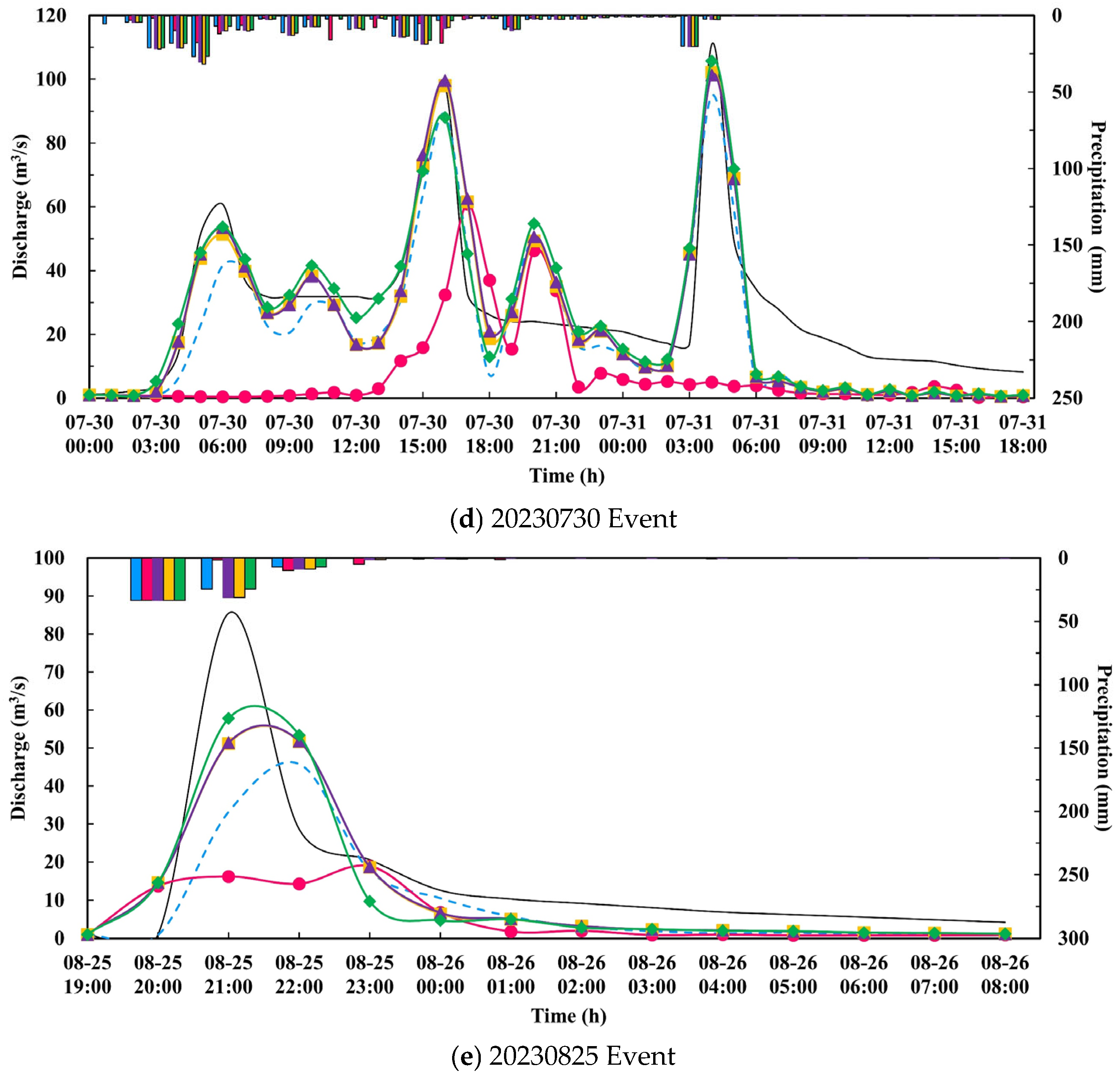
Accurate rainfall input is critical for reliable flood simulation, particularly in semi-arid watersheds with pronounced spatiotemporal precipitation heterogeneity. This study developed a radar–gauge rainfall fusion framework to improve HEC-HMS (Hydrologic Engineering Center–Hydrologic Modeling System) model performance in the Liulin experimental watershed, Xingtai City, Hebei Province. Radar quantitative precipitation estimation (QPE) was generated via a dynamically optimized Z-I relationship, then fused with gauge observations using three methods—Geographical Differential Analysis (GDA), Conditional Merging (CM), and Random Forest (RF). The fused products drove a calibrated HEC-HMS model, evaluated over five representative flood events. All three methods corrected radar QPE underestimation. Under independent cross-validation, GDA and CM achieved comparable point-scale accuracy (CC ≈ 0.81, RMSE ≈ 5.7 mm), while RF showed lower generalization (CC ≈ 0.48, RMSE ≈ 8.7 mm) due to overfitting. In flood simulations, GDA performed most robustly, followed by RF and CM, all surpassing single-source inputs. Notably, CM’s higher statistical accuracy did not translate into better flood performance, indicating that optimal statistical fidelity does not guarantee optimal hydrological results. Peak discharge deviations persisted for short-duration intense storms and long-duration uneven rainfall events. This study confirms that radar–gauge fusion enhances rainfall input quality and provides a reliable approach for improving flood forecasting.
Keywords: radar–gauge data fusion; geographical differential analysis; conditional merging; random forest; dynamically optimized Z-I relationship; HEC-HMS model radar–gauge data fusion; geographical differential analysis; conditional merging; random forest; dynamically optimized Z-I relationship; HEC-HMS model