Article

Sentinel-1 SAR and Temporal Lag Soil Moisture Estimation at Instrumented Field Sites: A Stacked Ensemble Approach

College of Geoexploration Science and Technology, Jilin University, Changchun 130026, China
*
Author to whom correspondence should be addressed.
Remote Sens. 2026, 18(15), 2483; https://doi.org/10.3390/rs18152483
Submission received: 19 June 2026 / Revised: 18 July 2026 / Accepted: 23 July 2026 / Published: 30 July 2026

Abstract

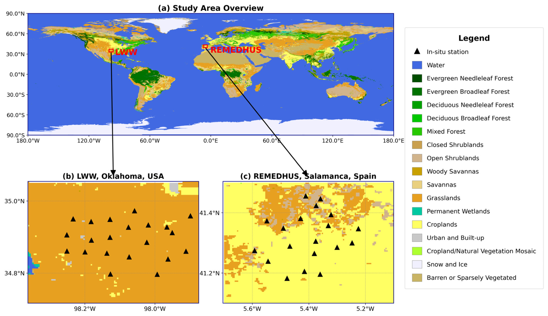
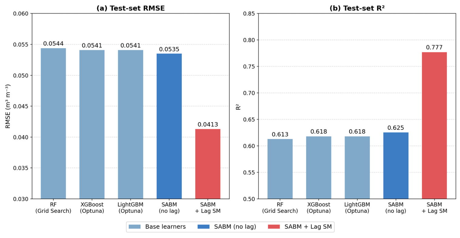
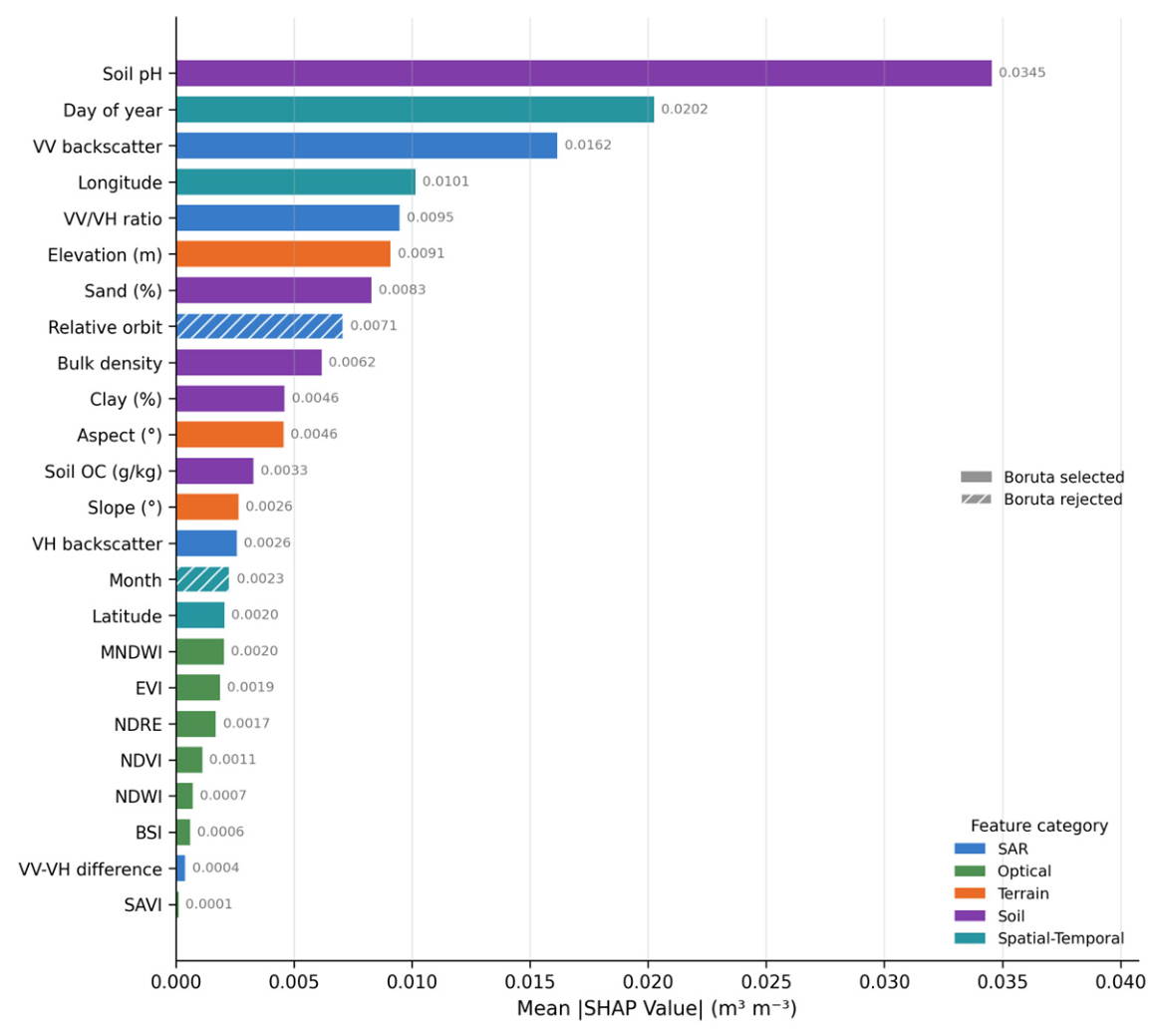
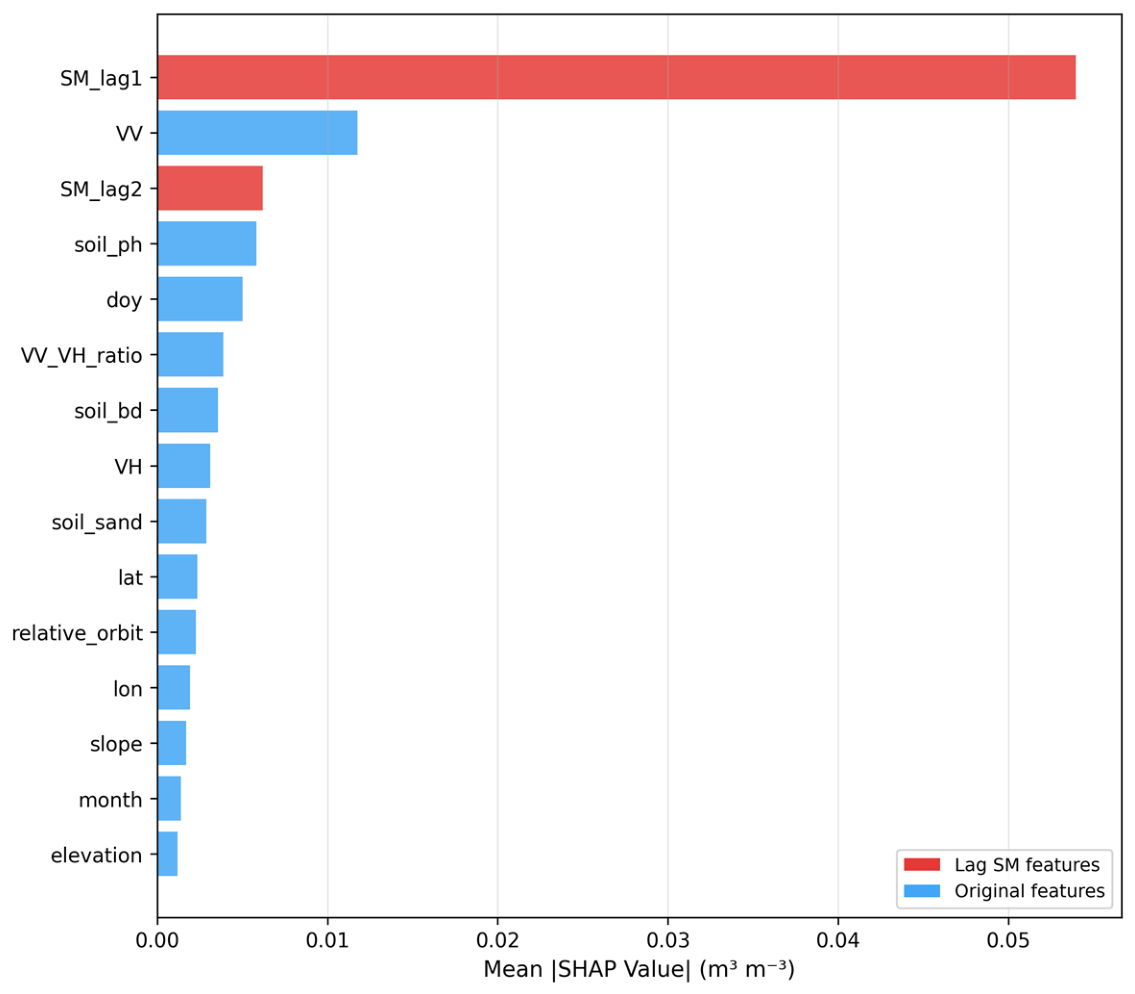
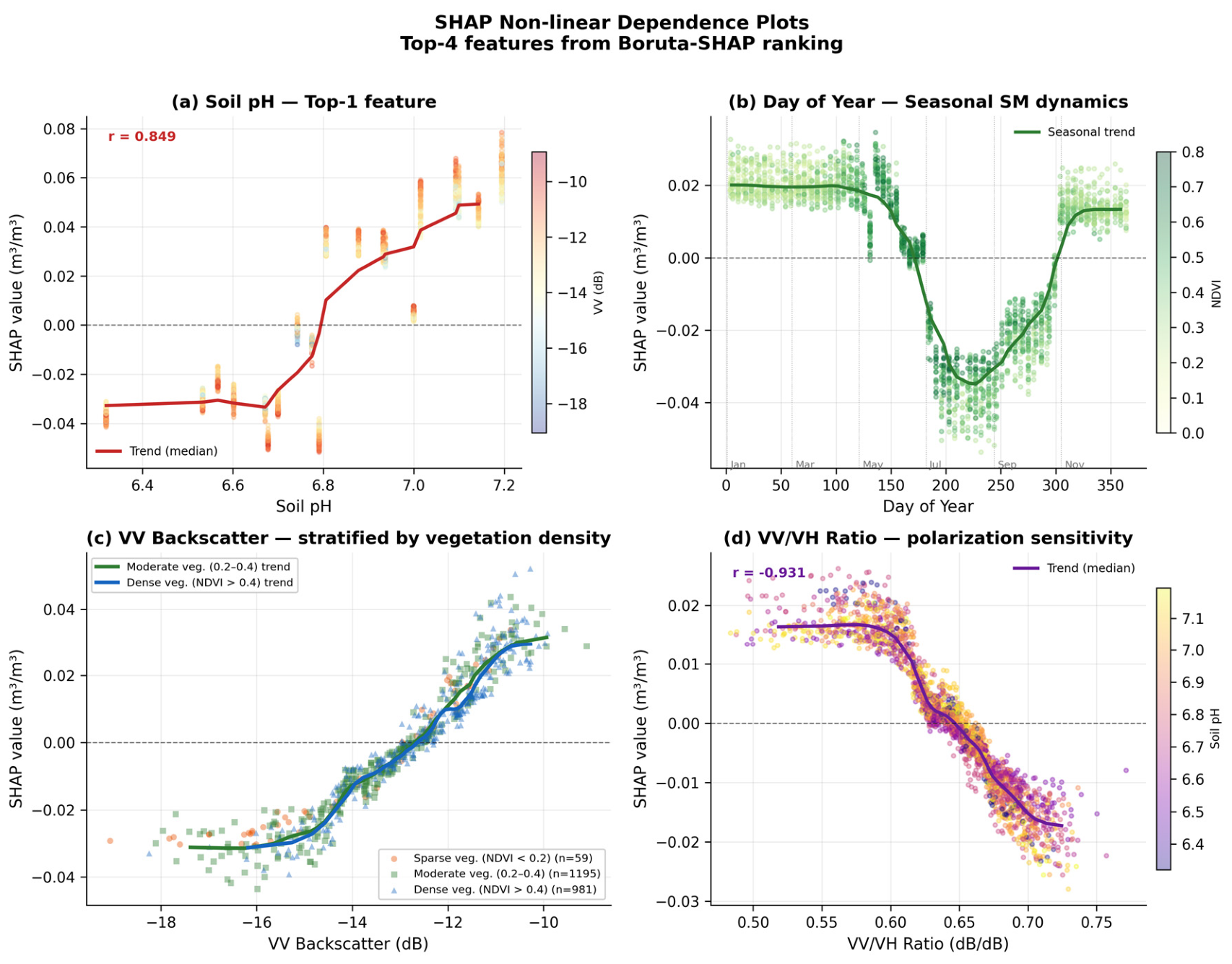
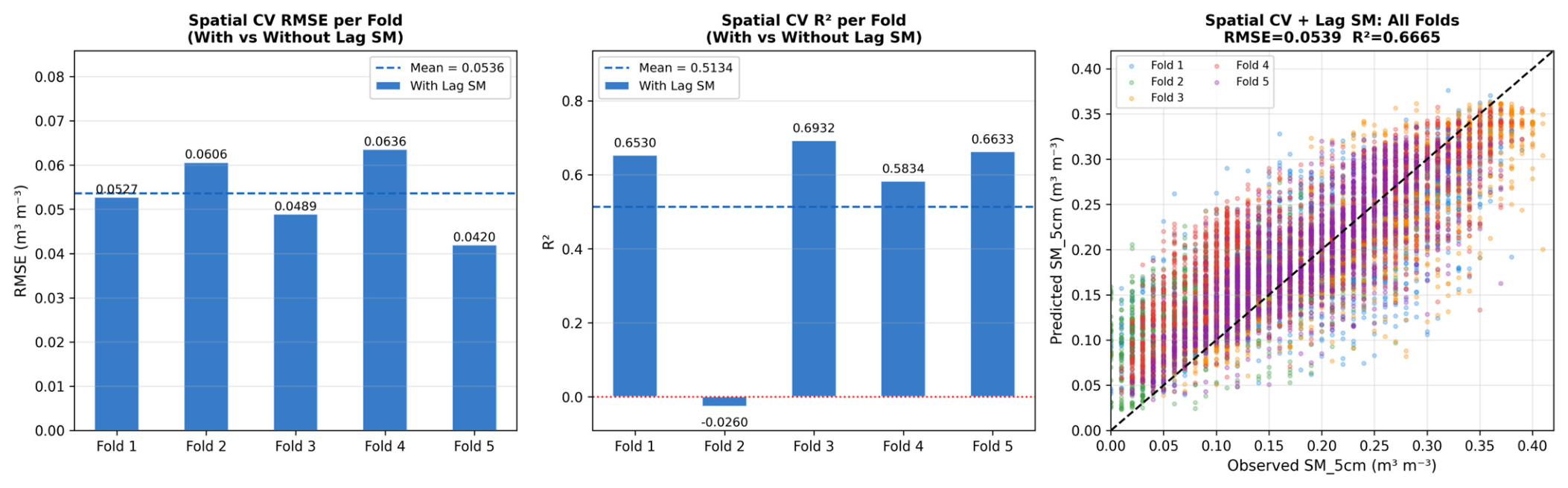
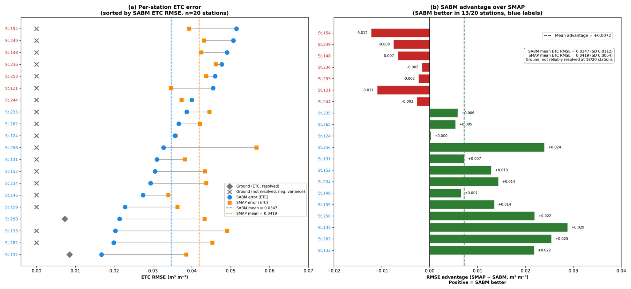
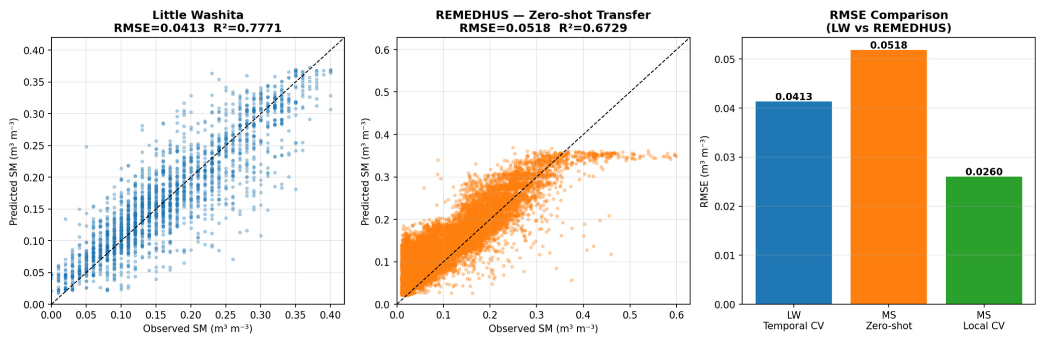
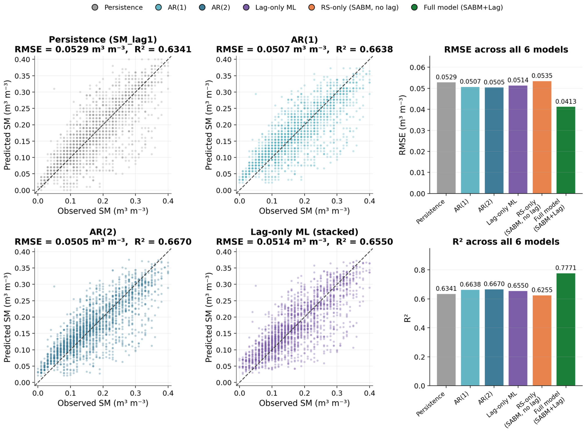
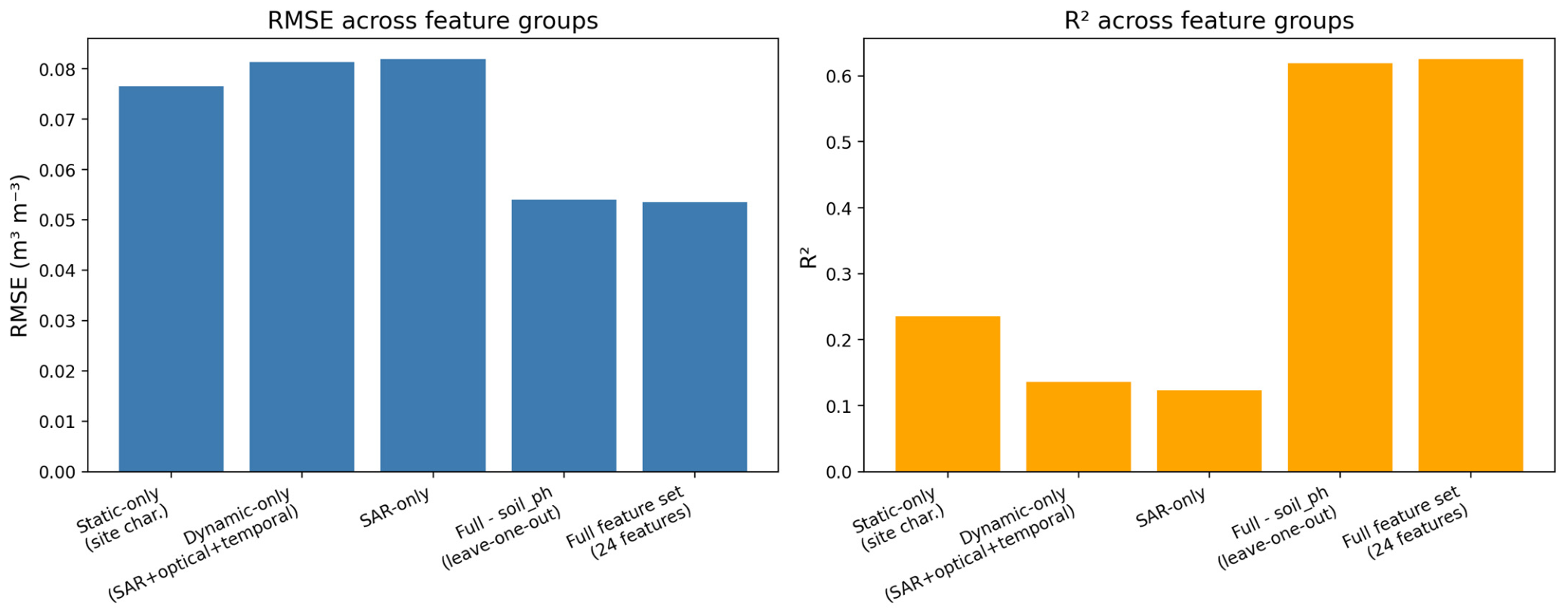
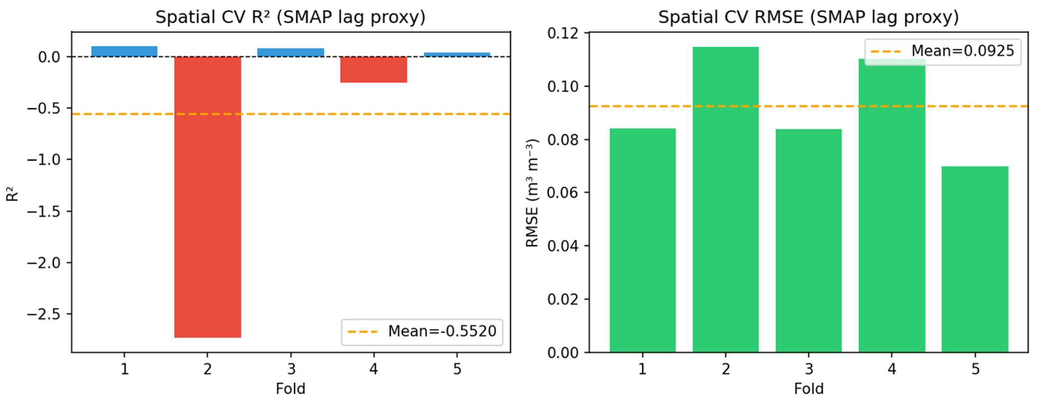
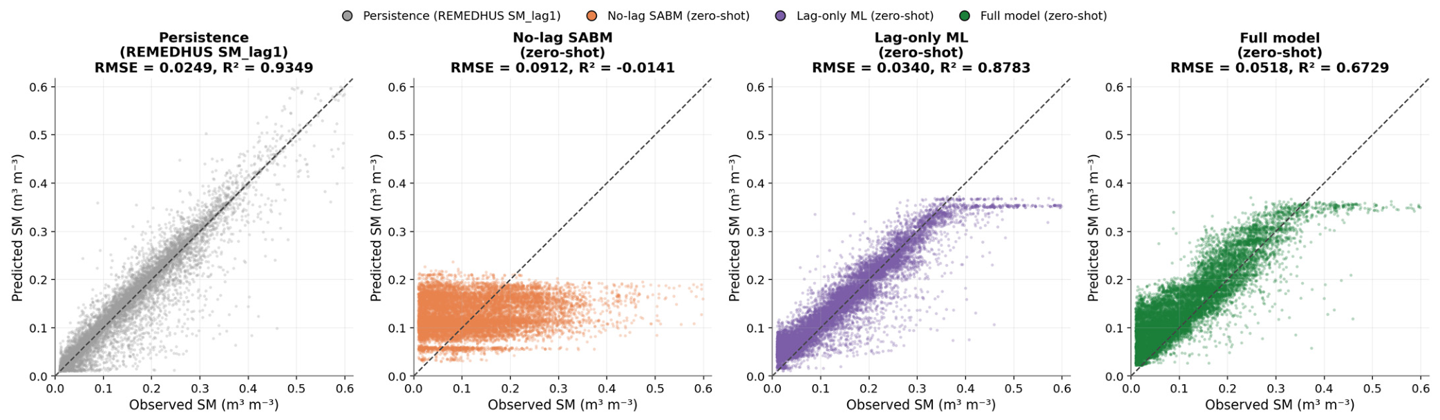
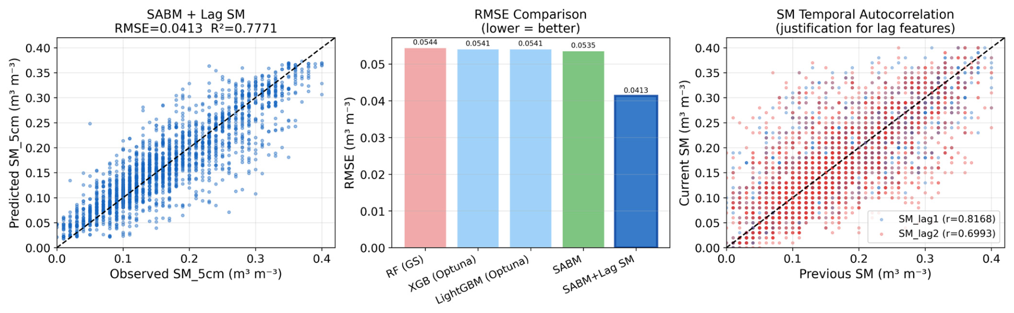
Field-scale soil moisture (SM) estimation from Sentinel-1 C-band SAR alone is challenged by vegetation, roughness, and spatial heterogeneity. This study proposes a Stacked Additive Boosting-based Model (SABM) that combines Sentinel-1 SAR, Sentinel-2 optical, and ancillary geophysical features with temporal lag SM features (SMlag1, SMlag2) derived from a station’s own antecedent in situ record, exploiting SM persistence at 12-day Sentinel-1 repeat intervals; the framework is accordingly intended for instrumented sites with historical SM observations rather than as a satellite-only retrieval method for ungauged locations. Validated at Little Washita Watershed, Oklahoma, USA (21 stations, 2016–2023), lag features improved temporal hold-out validation from R2 = 0.6255, RMSE = 0.0535 m3 m−3 to R2 = 0.7771, RMSE = 0.0413 m3 m−3 (23% RMSE reduction) and improved accuracy at held-out, instrumented stations from mean R2 = −0.6024 to R2 = 0.5134 across five station-level hold-out folds. Extended Triple Collocation indicated lower point-scale error for SABM (ETC RMSE = 0.0347 m3 m−3) than SMAP L3 Enhanced (0.0419 m3 m−3) at 13 of 20 stations at a nominal ~900× finer native pixel resolution (10 m Sentinel-1 pixel spacing vs. ~9 km SMAP footprint), though the effective support scale of the extracted features is coarser due to spatial averaging of the input features, and the ground reference’s own error term could not be reliably resolved at most stations, a limitation attributable to SABM’s use of antecedent ground observations as predictors. With cross-site transfer to REMEDHUS, Spain yielded R2 = 0.6729 without retraining, though this accuracy was attributable primarily to SM persistence rather than transferred SAR/optical relationships. Boruta–SHAP identified soil pH as the top-ranked predictor by SHAP importance, though follow-up ablation indicates that this ranking substantially reflects a replaceable, station-identity-correlated proxy rather than an indispensable physical driver; SHAP dependence patterns for seasonal forcing, vegetation density, and SAR polarisation ratio were physically coherent. These findings demonstrate that temporal lag features substantially enhance retrieval accuracy at instrumented, model-unseen stations, providing a robust and interpretable framework for operational field-scale SM monitoring at sites with antecedent soil moisture records.
Keywords: Little Washita; REMEDHUS; Extended Triple Collocation; SHAP; cross-site generalization; soil moisture Little Washita; REMEDHUS; Extended Triple Collocation; SHAP; cross-site generalization; soil moisture