Article

A Multi-Method Approach to the Analysis of Trends and Cyclical Variability in Sea Level Along the Southern Baltic Coast


Department of Geoinformation and Cartography, Institute of Geodesy and Civil Engineering, University of Warmia and Mazury in Olsztyn, Oczapowskiego St. 2, 10-719 Olsztyn, Poland
*
Author to whom correspondence should be addressed.
Remote Sens. 2026, 18(14), 2398; https://doi.org/10.3390/rs18142398
Submission received: 3 June 2026 / Revised: 16 July 2026 / Accepted: 17 July 2026 / Published: 19 July 2026

Abstract

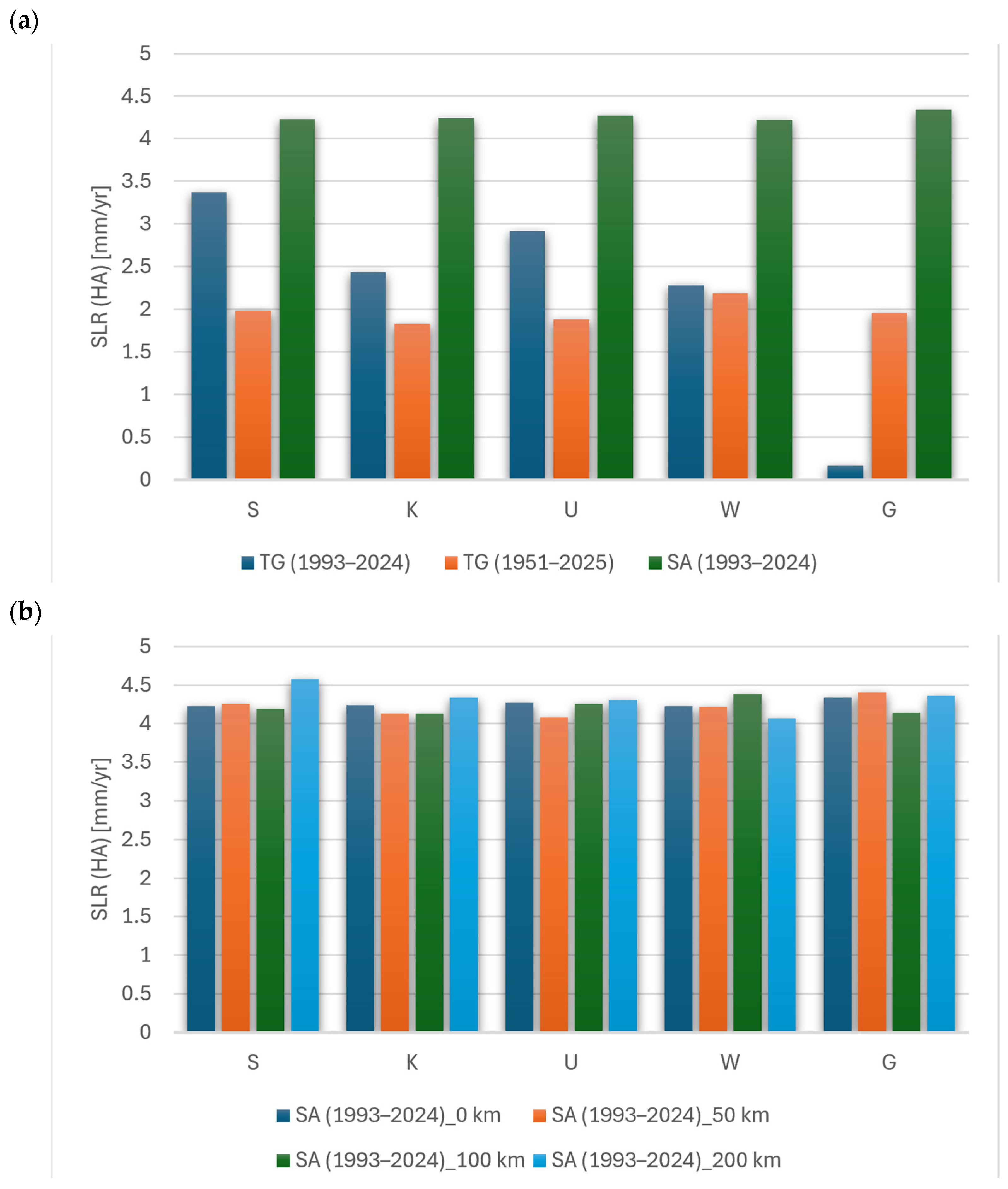
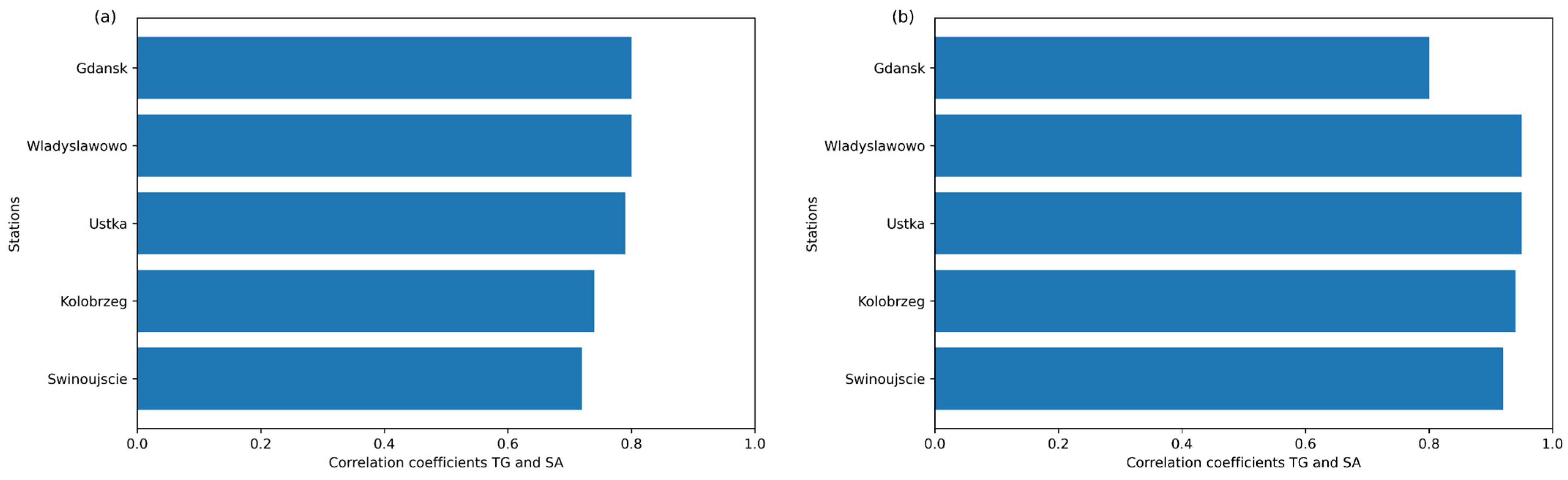
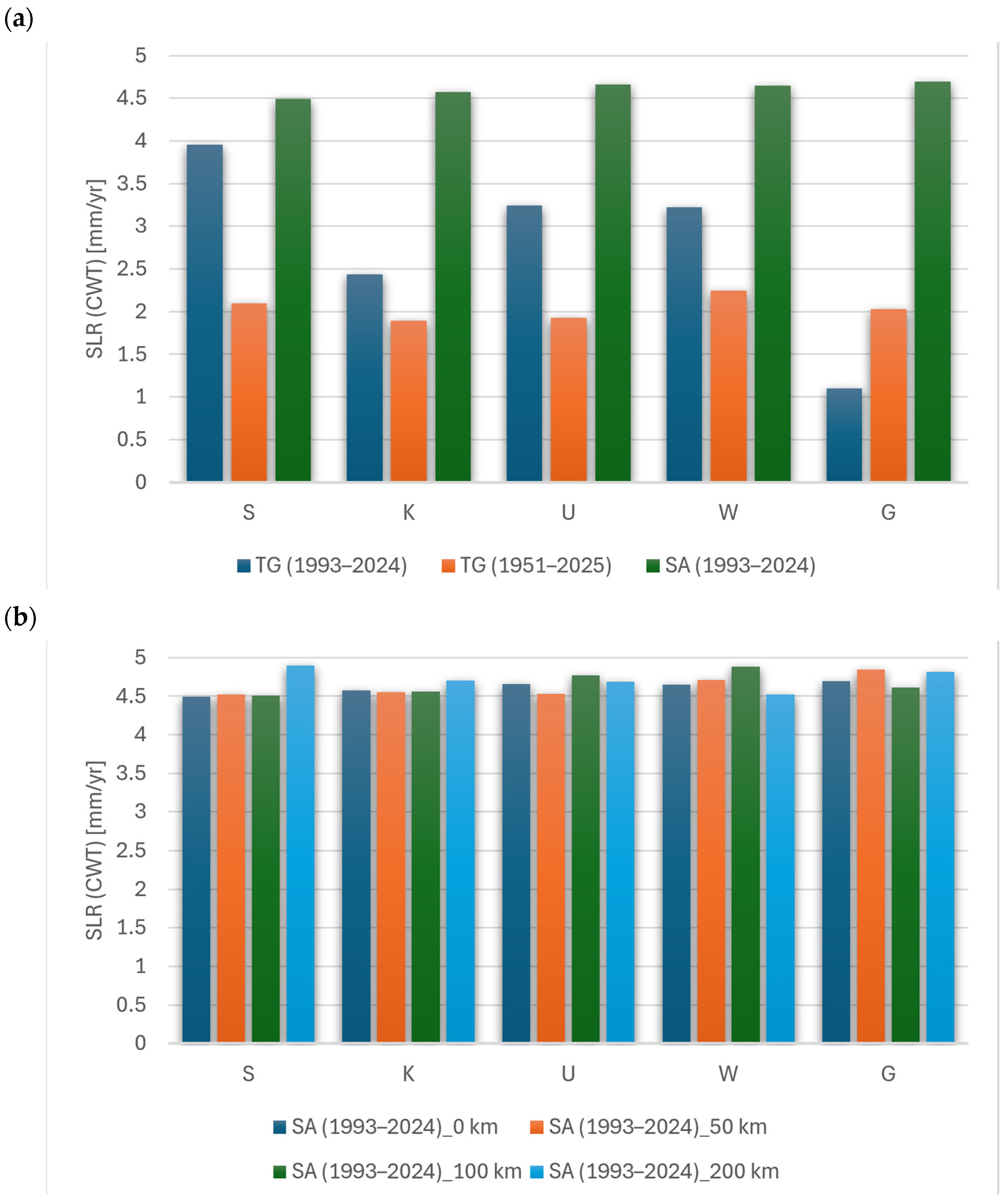
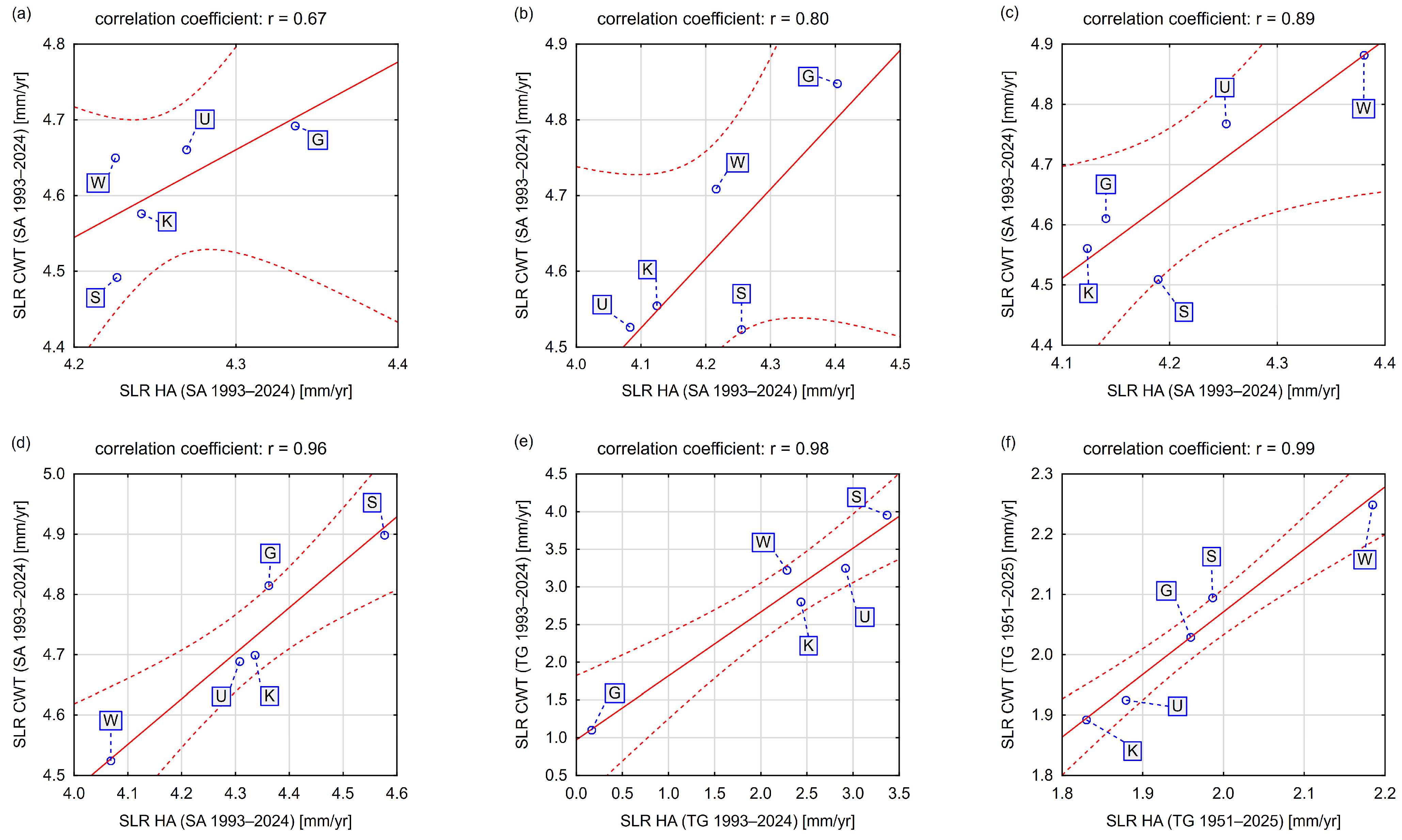
The aim of this study was to estimate trends and multiscale variability in sea level along the southern coast of the Baltic Sea based on tide gauge and altimetry data, using Harmonic Analysis (HA) and Continuous Wavelet Transform (CWT). Particular consideration was given to the influence of time series length, data type, seafloor depth and distance from the coastline on the stability and consistency of the estimated trends and amplitudes. The results indicated that, for coastal stations, trends derived from tide gauge data averaged 2.2 mm/yr for the 1993–2024 period and 2.0 mm/yr for the 1951–2025 series, with lower estimation errors for series with an extended time range of data. Satellite altimetry data indicated a higher rate of sea level rise, averaging 4.3 mm/yr, and higher spatial consistency, particularly at virtual stations away from the coast. As the distance from the coastline increased, a more stable trend and a decrease in the influence of local hydrodynamic processes were observed. A comparison of methods demonstrated that Harmonic Analysis significantly improves the consistency of trends derived from altimetry and tide gauge data compared to classical linear regression—the correlation coefficient increased from 0.72–0.80 to 0.92–0.95. CWT confirmed the reliability of these results, while also allowing the identification of temporal modulation in cycle amplitudes and periods of increased signal nonstationarity. The results confirm that a correct interpretation of sea level changes requires that we take both long-term trends and natural variability across various timescales into account. The proposed approach provides a universal tool for analyzing nonstationary environmental signals. It can support risk assessment in coastal zones and the development of adaptation strategies in the context of climate change.
Keywords: satellite altimetry; tide gauge; Baltic Sea; seafloor depth; sea level rise; seasonality; vertical land movement satellite altimetry; tide gauge; Baltic Sea; seafloor depth; sea level rise; seasonality; vertical land movement